17th Century Collectibles and Curiosities

to
806
1,132
152
1,292
91
3
2
1
1
1
4,460
6,705
13,475
2,696
3,503
4,685
3,093
511
300
605
748
484
902
880
906
662
592
1,055
121
116
40
33
353
80
65
54
51
1,292
1,292
1,292
63
12
11
11
6
Period: 17th Century
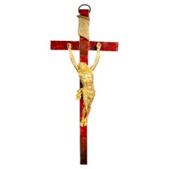
Large Cross With Christ In Gilt Bronze From The 17th Century
Located in Madrid, ES
Large Cross With Christ In Gilt Bronze From The 17th Century IMPORTANT 17th C. CROSS TO CHRIST IN FINELY CHISELLED GOLD BRONZE FRENCH SCHOOL OF THE...
Category

Antique 17th Century Collectibles and Curiosities

Materials

Bronze

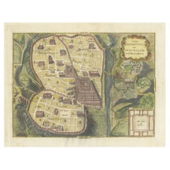
The Antient City of Jerusalem and Places Adjacent, Hand-Colored Map, 1699
Located in Langweer, NL
Title: "1699 Hand-Colored Bird's-Eye Plan of Jerusalem with Ancient and Biblical Landmarks" This beautifully hand-colored, imaginary bird's-eye plan of Jerusalem, published in 1699,...
Category

Antique 17th Century Collectibles and Curiosities

Materials

Paper

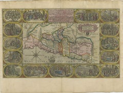
1625 Petrus Plancius / Cloppenburg Map of the Holy Land with Biblical Vignettes
Located in Langweer, NL
1625 Petrus Plancius / Johannes Cloppenburg Map of the Holy Land with Biblical Vignettes This exquisite 1625 map by Petrus Plancius and Johannes Cloppenburg represents the Holy Lan...
Category

Antique 17th Century Collectibles and Curiosities

Materials

Paper

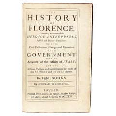
The Works of the Famous Nicolas Machiavelli - SECOND EDITION - 1695
Located in Hillsborough, NJ
AUTHOR: MACHIAVELLI, Nicolas TITLE: The Works of the Famous Nicolas Machiavel, Citizen and Secretary of Florence. Written originaIly [sic] in Italian, and from thence newly and fait...
Category

British Antique 17th Century Collectibles and Curiosities

Materials

Leather

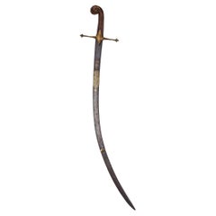
A Jawhar Sword With Calligraphy, By Asad Allah, Period Of Shah Abbas
Located in London, GB
A beautiful Persian sword crafted by Asad Allah in the 17th century during the reign of Shah Abbas. translate: Victory from God and conquest is near, an...
Category

Asian Antique 17th Century Collectibles and Curiosities

Materials

Steel

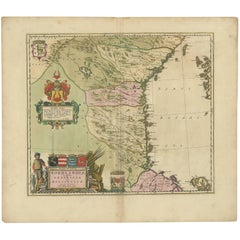
Antique Map of Central Sweden by J. Blaeu, 1662
Located in Langweer, NL
A striking, rare map with a cartouche dedicated to Gabriel Bengtsson Oxenstierna. Published by J. Bleau, Amsterdam, 1662. Contemporary coloring.
Category

Antique 17th Century Collectibles and Curiosities

Materials

Paper

Large Antique Map of France by De Wit, c.1680
Located in Langweer, NL
Antique map titled 'Accuratissima Galliae Tabula vulgo Royaume de France'. Detailed map of France. Shows provinces, cities, rivers etc. Artists and Engravers: Frederick de Wit (1...
Category

Antique 17th Century Collectibles and Curiosities

Materials

Paper

Original Antique Map of the Northern Baltic Region
Located in Langweer, NL
Title: "Livonia: Antique Map of the Northern Baltic Region" Description: This antique map, titled "Livonia," is a detailed representation of the northern Baltic region. Centered on ...
Category

Antique 17th Century Collectibles and Curiosities

Materials

Paper

Antique Map of Sri Lanka with an unusual five-sided shape, circa 1606
Located in Langweer, NL
Antique map titled 'Ins. Ceilan quae incolis Tenarisin dicitur'. This exquisite, early map of Sri Lanka is shown with an unusual five-sided shape. North is oriented to the left by an...
Category

Antique 17th Century Collectibles and Curiosities

Materials

Paper

An Original Antique Mid-17th Century Blaeu Map of Styria in Southeastern Austria
Located in Langweer, NL
This is an antique map of Styria (referred to as “Stiria” or “Steyrmarck”), published by the renowned Dutch cartographer Willem Janszoon Blaeu (often simply “Blaeu”). The first editi...
Category

Antique 17th Century Collectibles and Curiosities

Materials

Paper

Spanish 17/ 18th Century Hand Carved Group of Baroque Winged Angel Heads
Located in Buisson, FR
Beautiful Hand carved group of winged angelheads. Wonderful traces of paint are visible and the wood has a gorgeous natural patina due to its high age Spain, circa 1650-1750 Weathere...
Category

Spanish Baroque Antique 17th Century Collectibles and Curiosities

Materials

Wood

Antique Print of Cairo in Egypt, 1698
Located in Langweer, NL
Untitled antique print with two views of Cairo, Egypt. 78: Palace of Sultan Gori. 79. Tower and aqueduct. This print originates from 'Reizen van Cornelis de Bruyn, door de vermaardst...
Category

Antique 17th Century Collectibles and Curiosities

Materials

Paper

Mapping the Heart of France: Willem Blaeu's 17th Century Île-de-France, ca.1650
Located in Langweer, NL
This original antique map titled "Le Gouvernement de l'Isle de France" represents the Île-de-France region, which historically was one of the provinces of France and contained the ci...
Category

Antique 17th Century Collectibles and Curiosities

Materials

Paper

Antique Map of the Holy Land, with vignette of the Garden of Eden
Located in Langweer, NL
Antique map titled 'Hondius his Map of Paradise'. Beautiful map of the region bounded by the Holy Land. Syria, Mesopotamia, Chaldea and part of Arabia. W...
Category

Antique 17th Century Collectibles and Curiosities

Materials

Paper

Large 1693 Maritime Map of Irish Sea, West Coasts of Ireland, England, Scotland
Located in Langweer, NL
This is a historical sea chart titled "Carte Generale des Costes d'Irlande, et des Costes Occidentales d'Angleterre avec une Partie de celles d'Ecosse," which translates to "General Map of the Coasts of Ireland and the Western Coasts of England with a Part of Scotland." The map was first published in 1693 in the atlas "La Neptune Francois," created by Jaillot and published by Pieter Mortier in Amsterdam. This initiative was started by the French minister Colbert to improve maritime navigation. Details of the Map: 1. **Geographical Coverage:** - The map primarily focuses on the Irish coast. - It also includes the west coast of England and Wales. - Parts of the west coast of Scotland are also depicted. 2. **Inset Map:** - There is a detailed inset map showing the area around Chester and the course of the River Dee. 3. **Features:** - **Depth Soundings:** The Irish Sea is detailed with depth soundings to assist in navigation. - **Coastal Towns and Islands:** Numerous coastal towns, islands, and geographical features are indicated. - **Rhumb Lines:** The map includes extensive rhumb lines, which are lines used by navigators to plot a straight-line course. - **Key:** There is a key describing the quality of the terrain along the coast, important for navigators to understand the nature of the coastal landscape. 4. **Labels and Annotations:** - **Coastal Settlements:** Ports, forts, and villages along the coast are labeled. - **Geographical Features:** Islands and other significant features are marked. 5. **Artistic and Practical Elements:** - The map is printed on thick paper and is hand-colored, reflecting contemporary coloring techniques. - Detailed lines and soundings are included to help ships navigate around the numerous small islands and narrow inlets safely. 6. **Historical Context:** - The map was part of a significant French maritime project aimed at improving navigation and charting European waters more accurately. - It reflects the high level of cartographic skill and knowledge of the late 17th century. This map would have been a valuable tool for mariners of the time, providing them with crucial information about the coastal features, depth soundings, and safe passage routes around the complex coastlines of Ireland, England, and Scotland. About the Makers and the Atlas **1. Alexis-Hubert Jaillot (1632-1712):** - **Background:** Jaillot was a prominent French cartographer and publisher in the 17th century. He was known for his detailed and accurate maps and atlases. - **Work:** He collaborated with other notable cartographers of his time and played a key role in improving and publishing detailed maps. Jaillot's work was characterized by its precision and artistic quality. - **Contribution:** He was instrumental in the creation of "La Neptune Francois," a maritime atlas aimed at improving French naval navigation. **2. Pieter Mortier (1661-1711):** - **Background:** Mortier was a Dutch engraver, publisher, and mapmaker based in Amsterdam. He was well-known for his high-quality prints and maps. - **Work:** Mortier published several important atlases and maps, often collaborating with other cartographers and engravers. His work was recognized for its detailed craftsmanship and accuracy. - **Contribution:** Mortier published "La Neptune Francois" in Amsterdam, making significant contributions to maritime navigation by providing highly detailed sea charts. About the Atlas "La Neptune Francois": **1. Purpose:** - The atlas was created as part of an initiative led by Jean-Baptiste Colbert, the French minister of finance under King Louis XIV. The goal was to enhance the accuracy and availability of maritime charts for French naval and commercial vessels. - "La Neptune Francois" was designed to be a comprehensive and detailed reference for navigators, covering various European waters with a focus on the French coast and adjacent regions. **2. Content:** - The atlas includes a series of sea charts, each providing detailed information on coastal regions, depth soundings, rhumb lines, and other navigational aids. - The maps were printed on high-quality paper and hand-colored, reflecting the artistic standards of the time. **3. Historical Significance:** - "La Neptune Francois" was a landmark in the history of cartography, representing a significant advancement in the accuracy and detail of maritime maps...
Category

Antique 17th Century Collectibles and Curiosities

Materials

Paper

Antique Map of Northern Germany, Including Schleswig-Holstein and Hamburg
Located in Langweer, NL
Antique map titled 'Basse Partie de la Basse Saxe ou sont les Duchés de Sleswick, Holsace, Meckelenbourg et Lauvenbourg (..)'. Original old map of northern Germany, including Schlesw...
Category

Antique 17th Century Collectibles and Curiosities

Materials

Paper

Antique Print of the Royal Flagship of the English Fleet by P. Mortier, c.1693
Located in Langweer, NL
Antique print titled 'Vaisseau Royal de l'Angleterre, Konincklyke Schip van Engeland'. Beautiful hand-coloured engraving of the Royal Flagship of the English Fleet. Originally publis...
Category

Antique 17th Century Collectibles and Curiosities

Materials

Paper

Charles II Carved Crest Of The Arms Of Westminster School
Located in Essex, MA
A large crest with shell and scroll carved frame enclosing an azure ground with gilded coat of arms featuring a cross with four birds over lions and fleur de lis and Tudor roses. Onl...
Category

English Baroque Antique 17th Century Collectibles and Curiosities

Materials

Wood, Giltwood

Antique Map of the Province of Navarre with the City of Pamplona, Spain
Located in Langweer, NL
Antique map titled 'Royaume de Navarre (..)'. Decorative map of the province Navarre (Spanish: Navarra) in Northern Spain centered on the city of Pamplona. Published by N. Sanson, 16...
Category

Antique 17th Century Collectibles and Curiosities

Materials

Paper

Canterbury Cathedral: First Edition, The Antiquities Of Canterbury By Somner
Located in Kent, Dover
An extremely rare first edition: William Somner, The antiquities of Canterbury. Or a survey of that ancient citie, with the suburbs, and cathedrall. Containing principally matters of...
Category

English Antique 17th Century Collectibles and Curiosities

Materials

Leather, Paper

Antique Map of the Region of Mansfeld, Saxony-Anhalt, Germany
Located in Langweer, NL
Antique map titled 'Mansfeldiae Comitatus Descriptio'. Original antique map of the region of Mansfeld, Saxony-Anhalt, Germany. Shows the area between Halle a. d. Saale, Aschersleben,...
Category

Antique 17th Century Collectibles and Curiosities

Materials

Paper

1684 Mallet Map of Amazon River & Kingdom of Amazons – Hand Colored, Miniature
Located in Langweer, NL
This map, titled 'Royaume des Amazones', was created by Alain Manesson Mallet and published in 1684 in a German edition of *Beschreibung des Gantzen Welt-Kreisses*, a renowned work d...
Category

Antique 17th Century Collectibles and Curiosities

Materials

Paper

Circa 1686 Daniel Stoopendaal Map: Biblical Sites from Paradise to Canaan
Located in Langweer, NL
Circa 1686 Daniel Stoopendaal Map: Biblical Sites from Paradise to Canaan This circa 1686 hand-colored map by Daniel Stoopendaal, titled "De Gelegentheyt van 't Paradys en 't Landt Canaan," beautifully illustrates the Middle East, extending from the Mediterranean to the Persian Gulf. The map features numerous Biblical locations, such as the Garden of Eden, the wanderings of the Children of Israel, and the story of Jonas and the whale. It is adorned with elaborate decorations, including a banner-style title cartouche and four corner vignettes depicting scenes from Genesis: Paradise, the creation of Adam and Eve, Eve offering the apple, and their expulsion from Eden. The bottom center showcases a dramatic portrayal of Noah's Ark. Measuring 18.3 inches wide by 11.9 inches high, this first state map includes Dutch text on the reverse and is in good condition, with a crisp impression, light toning along the centerfold, and a small chip in the bottom margin. Keywords: - Daniel Stoopendaal map - Biblical map - Garden of Eden - Land of Canaan - Middle East historical map - Noah's Ark map - Adam and Eve - 17th-century Bible...
Category

Antique 17th Century Collectibles and Curiosities

Materials

Paper

Antique Map of Warwickshire by Speed, c.1614
Located in Langweer, NL
Antique map titled 'The Counti of Warwick (..)'. Map of Warwickshire, England. Includes inset town plans of Warwick and Coventry. This map originates from 'Theatre of Great Britaine'...
Category

Antique 17th Century Collectibles and Curiosities

Materials

Paper

Saint or Virgin to dress. Wood, metal. Spanish school, 17th century.
Located in Madrid, ES
Saint or Virgin to dress. Wood, metal. Spanish school, 17th century. It has faults. The female figure stands (with her right leg forward) on a small polygonal base. Made of partial...
Category

Spanish Baroque Antique 17th Century Collectibles and Curiosities

Materials

Metal, Other

17th Century Lantern Alarm Clock by Johannes Quelch, Oxford
Located in Oxfordshire, United Kingdom
An English 17th century lantern clock made of brass and iron, circa 1665-1670. The clock consists of going and striking trains, as well as a...
Category

British Baroque Antique 17th Century Collectibles and Curiosities

Materials

Brass

Antique Map of West Africa, focused on the Congo and Angola
Located in Langweer, NL
Original antique map titled 'Regna Congo et Angola'. Decorative 17th Century English map of a portion of West Africa, focused on the Congo and Angola. The map is centered on the Zair...
Category

Antique 17th Century Collectibles and Curiosities

Materials

Paper

Large 1695 Hand-Colored Engraved Map of Gascony (Gascogna), France
Located in Langweer, NL
This map, created by Giacomo Cantelli da Vignola in 1695, represents the "General Government of Guyenne and Gascony" in southwest France. Cantelli da Vignola was a renowned Italian c...
Category

Antique 17th Century Collectibles and Curiosities

Materials

Paper

1687 Engraved View of Rhodes by O. Dapper – Hand-Colored Island of Rhodus
Located in Langweer, NL
1687 Engraved View of Rhodes by O. Dapper – Hand-Colored Island of Rhodus This original antique print is a beautifully detailed copper engraving titled "Het Eylant Rhodus" (The Isla...
Category

Antique 17th Century Collectibles and Curiosities

Materials

Paper

17th Century Brass Alms Plate
Located in San Francisco, CA
A 17th century or earlier brass alms dish or alms plate.
Category

European Antique 17th Century Collectibles and Curiosities

Materials

Brass

Leeuwarden Friesland City View – Antique Engraving by Jollain, c.1670
Located in Langweer, NL
Antique Bird’s Eye View of Leeuwarden, Friesland, by Jollain, circa 1670 This rare and decorative antique engraving presents a panoramic bird’s eye view of the fortified city of Lee...
Category

French Antique 17th Century Collectibles and Curiosities

Materials

Paper

1663 Blaeu's Engraved Map of Frankfurt with Decorative Coats of Arms
Located in Langweer, NL
This map, titled "Novam Hanc Territorii Francofurtensis Tabulam," is an exquisite hand-colored engraved map from around 1663, created by the renowned cartographers J. and C. Blaeu of...
Category

Antique 17th Century Collectibles and Curiosities

Materials

Paper

French 17th Century Weathered Carved Oak Christ Fragment
Located in Buisson, FR
Very nice carved oak Christ figure with a strong expression. Beautiful weathered , France circa 1600-1700. Weathered, and losses. Measurement with the base
Category

French Antique 17th Century Collectibles and Curiosities

Materials

Oak

Frisia Occidentalis, A Rare Antique Engraving of Friesland, The Netherlands
Located in Langweer, NL
Antique map titled 'Frisia Occidentalis.' - A very decorative map of the Dutch province Friesland, also showing the Wadden islands Terschelling and Ameland. With coats of arms of the...
Category

Antique 17th Century Collectibles and Curiosities

Materials

Paper

Antique Map of the Burgundy Region by Mallet, c.1683
Located in Langweer, NL
Antique map titled 'Royaume de Bourgogne sous la seconde Race des Roys de France'. Detailed miniature map of the Burgundy region, France. Originates from Mallet's 'Description de l'U...
Category

Antique 17th Century Collectibles and Curiosities

Materials

Paper

Antique Map of Persia with Dedication Cartouche
Located in Langweer, NL
Antique map titled 'Persia sive Sophorum Regnum'. Original old map of Persia. The map extends from the Eastern Mediteranian to Tacalistan and the Indus River and the Dalanguer Mounta...
Category

Antique 17th Century Collectibles and Curiosities

Materials

Paper

Antique Map of North Africa by Ortelius, c.1600
Located in Langweer, NL
Antique map titled 'Barbariae et Biledulgerid nova descriptio'. Old map of coastal North Africa and the Mediterranean. The map extends from Morocco and the Sahara to Libya and sh...
Category

Antique 17th Century Collectibles and Curiosities

Materials

Paper

Coast of Northumberland, England, Incl the Holy & Farne Islands, Etc, 1693
Located in Langweer, NL
Antique map titled 'Holy Island, Staples and Barwick.' A map of the coast of Northumberland, England. This map includes Holy Island, Buckton, Sunderland and the Farne Islands. Th...
Category

Antique 17th Century Collectibles and Curiosities

Materials

Paper

The Workes of our Ancient and Learned English Poet, Geffrey Chaucer
Located in Middletown, NY
Chaucer, Geoffrey The Workes of our Ancient and Learned English Poet, Geffrey Chaucer, Newly Printed London: Adam Islip, 1602. Second Edition. Folio, 13 x 8 3/4 inches (328 x 223 ...
Category

English Antique 17th Century Collectibles and Curiosities

Materials

Gold Leaf

Devotional plaque, Saint Benedict of Nursia. Bronze. Spanish School, 17th c
Located in Madrid, ES
Devotional plaque, Saint Benedict of Nursia. Bronze. Spanish School, 17th century. Rectangular bronze devotional plaque with a ring at the top, a molded frame, and a relief figurat...
Category

Spanish Baroque Antique 17th Century Collectibles and Curiosities

Materials

Bronze

Original Antique Map of Friesland in Decorative Hand-Colouring, 1600
Located in Langweer, NL
Antique map titled 'Frisiae antiquissima trans rhenu provinc et adiacentium regionum nova et exacta descriptio'. Original antique map of the province of Friesland, the Netherlands. T...
Category

Antique 17th Century Collectibles and Curiosities

Materials

Paper

Description of the city of Delft, by Dirck can Bleyswijck - ILLUSTRATED, 1667
Located in Middletown, NY
A very good copy of Bleyswijck famous description of the history, topography, institutions, and commercial life of Delft in the 17th Century. The plates are exquisite depiction's of ...
Category

Dutch Antique 17th Century Collectibles and Curiosities

Materials

Gold Leaf

Old Map of the Mughal Empire, Persia in the West to Lake Chimay etc., ca.1685
Located in Langweer, NL
Antique map titled 'L'Empire du Grand Mogol'. Old map of India and Central Asia. The map extends from Persia in the West to Lake Chimay and the Bay of Bengal...
Category

Antique 17th Century Collectibles and Curiosities

Materials

Paper

17th Century Dutch Bronze pharmacy Mortar, dated 1632
Located in Bilzen, BE
17th century Dutch bronze mortar, dated 1632 and with border text "lof God van al anno 1632". Height 12.5 cm, Diameter 14 cm
Category

Dutch Renaissance Antique 17th Century Collectibles and Curiosities

Materials

Bronze

Antique Map of Peru in South America by Blaeu, circa 1645
Located in Langweer, NL
Antique map titled 'Peru'. Original antique map of Peru. With cartouche, compass rose, ships and two sea-monsters. Published by W. Blaeu, circa 1645.
Category

Antique 17th Century Collectibles and Curiosities

Materials

Paper

17th Century Spanish Carved Polychrome and Painted Bust of Christ on Stand
Located in Dallas, TX
Make a statement on your mantel, enfilade or tabletop with this antique "Haute Epoque" carved santo figure. Created in Spain, circa 1680, the bust is set ...
Category

Spanish Antique 17th Century Collectibles and Curiosities

Materials

Gesso, Walnut

Antique Map of the Saxony Region 'Germany' by F. de Wit, circa 1680
Located in Langweer, NL
A detailed map of a region in eastern Germany. Cartouches depict coat of arms surrounded by cherubs. The map is fully engraved with towns, political boundaries, rivers and forests. P...
Category

Dutch Antique 17th Century Collectibles and Curiosities

Materials

Paper

Rare and Early Map of the Seventeen Provinces, Published in circa 1640
Located in Langweer, NL
Antique map titled 'Carte Generale des Dixsept Provinces des Pais Bas'. Rare and Early map of the Seventeen Provinces. The Seventeen Provinces were the Imperial states of the Habsbur...
Category

Antique 17th Century Collectibles and Curiosities

Materials

Paper

Original Antique Sea Chart of the Northern Part of Hispaniola, Western Cuba
Located in Langweer, NL
Antique map titled 'Pas kaart van de Noord Kust van Espaniola (..)'. Beautiful sea chart of the northern part of Hispaniola, western Cuba. The map includes the Turks & Caicos Islands and southern part of the Bahamas. Shows Guanahami or S. Salvador. Guanahani is an island in the Bahamas that was the first land in the New World sighted and visited by Christopher Columbus' first voyage, on October 12, 1492. It is not known precisely which island it was, and several theories have been put forth by historians. Guanahani is the native Taíno name; Columbus called it San Salvador. Originates from 'De Nieuwe Groote Lightende Zee-Fakkel'. Published by J. van Keulen, circa 1684. The Van Keulens were a family of chartmakers and publishers. The firm, In de Gekroonde Lootsman (In the Crowned Pilot), was founded in 1678 by Johannes van Keulen (1654-1715). Van Keulen originally registered his business as a vendor of books and instruments (specifically cross-staffs). In 1680, however, he gained a privilege from the States of Holland and West Friesland for the publication of pilot guides and sea atlases. In that year, van Keulen released his Zee-Atlas (Sea Atlas), which secured him a name in the competitive maritime publishing market. In 1681, he published the first volume of Nieuwe Lichtende Zee-Fakkel (New Shining Sea Torch). This would be the first of an eventual five volumes originally published between 1680 and 1684. A sixth volume was added in 1753. The Zee-Fakkel won van Keulen lasting fame. The atlas had charts compiled by Claes Jansz Vooght and artwork from Jan Luyken...
Category

Antique 17th Century Collectibles and Curiosities

Materials

Paper

Antique Map of the North Pole by V.M. Coronelli, circa 1692
Located in Langweer, NL
Globe gore by Vincenzo Maria Coronelli shows the North Pole with the coasts of Canada, Greenland, Scandinavia and Siberia, and is decorated with pictorial scenes of bear, seal and wh...
Category

Antique 17th Century Collectibles and Curiosities

Materials

Paper

17th Century Sterling Silver Reliquary with Intact Wax Seal
Located in Madrid, ES
A rare and sacred 17th-century sterling silver reliquary, exquisitely crafted and preserving relics of multiple unidentified saints. This devotional object reflects the spiritual int...
Category

Antique 17th Century Collectibles and Curiosities

Materials

Silver

Antique Map of Roermond & Duchy of Guelders by Sanson – Hand-Colored, c.1667
Located in Langweer, NL
Antique map of Roermond and the Duchy of Guelders with rich detail, c.1667 This beautifully hand-colored 17th-century map presents the region of Roermond and the broader Duchy of Gu...
Category

French Antique 17th Century Collectibles and Curiosities

Materials

Paper

Antique Map of Coevorden in the Netherlands, 1691
Located in Langweer, NL
Plate 'Covorden.' (Plan of the fortified city of Coevorden, The Netherlands.) This attractive original old antique print / plate originates from: 'Ausführliche und grundrichtige Besc...
Category

Antique 17th Century Collectibles and Curiosities

Materials

Paper

Antique Print of Alexandria in Egypt, 1698
Located in Langweer, NL
Antique print with two views of Alexandria, Egypt. This print originates from 'Reizen van Cornelis de Bruyn, door de vermaardste deelen van Klein Asia, de eylanden Scio, Rhodus, Cypr...
Category

Antique 17th Century Collectibles and Curiosities

Materials

Paper

1685 Alain Manesson Mallet Map of Hokkaido (Lesso) in Northern Japan
Located in Langweer, NL
Title: 1685 Alain Manesson Mallet Map of Hokkaido, Iesso, and Company’s Land Description: This engraved seventeenth-century map, titled Terre de Iesso, was published in 1685 as pa...
Category

Antique 17th Century Collectibles and Curiosities

Materials

Paper

Antique Copper Engraving of the City of Kuchin in China, 1668
Located in Langweer, NL
Antique print China titled 'Kuching'. Old print depicting a view on the Chinese city of Kuching or Kuchin (Gui Jiang, Kuei Chiang), near the river Gui (Guei). This area is close ...
Category

Antique 17th Century Collectibles and Curiosities

Materials

Paper

Rare 17th Century South American Shrine
Located in Rio De Janeiro, BR
Rare 17th Century Cedar Shrine. Straight box with padded doors. Interior with decorative arch in the shape of a portal. Dimensions in centimeters: 52cm W x 26,50 cm D x 71 cm H. Th...
Category

Brazilian Baroque Antique 17th Century Collectibles and Curiosities

Materials

Cedar

Antique Map of Belgium and Northern France by F. de Wit, circa 1680
Located in Langweer, NL
Antique map titled 'Belgii Regii Accuratissima Tabula Pluribus Locis Recens Emen'. Large map of Belgium and Northern France. Published by F. de Wit, circa 1680.
Category

Antique 17th Century Collectibles and Curiosities

Materials

Paper

Antique Map of Japan and Korea by Sanson, 'c.1690'
Located in Langweer, NL
Antique map titled 'Les Iles du Iapon (..)'. Original antique map, with beautiful (later) hand coloring, of Japan and the Island of Corey (Korea). Uncommon edition, with '234' at top...
Category

Antique 17th Century Collectibles and Curiosities

Materials

Paper

Antique Print of Hanseatic City of Lübeck in Northern Germany by Merian, c.1650
Located in Langweer, NL
Antique print titled 'Lubecca, Lübeck'. A bird's eye view of Lubeck, the northern German city in Schleswig-Holstein. This print originates from 'Topographia Saxoniae Inferioris'. Ar...
Category

Antique 17th Century Collectibles and Curiosities

Materials

Paper

Read More

Medal-Worthy Memorabilia from Epic Past Olympic Games

Get into the games! These items celebrate the events, athletes, host countries and sporting spirit.

Ahoy! You’ve Never Seen a Collection of Sailor Art and Kitsch Quite Like This

French trendsetter and serial collector Daniel Rozensztroch tells us about his obsession with objects related to seafaring men.

Pamela Shamshiri Shares the Secrets behind Her First-Ever Book and Its Effortlessly Cool Interiors

The sought-after designer worked with the team at Hoffman Creative to produce a monograph that beautifully showcases some of Studio Shamshiri's most inspiring projects.

Moroccan Artworks and Objects Take Center Stage in an Extraordinary Villa in Tangier

Italian writer and collector Umberto Pasti opens the doors to his remarkable cave of wonders in North Africa.

Montecito Has Drawn Royalty and Celebrities, and These Homes Are Proof of Its Allure

Hollywood A-listers, ex-pat aristocrats and art collectors and style setters of all stripes appreciate the allure of the coastal California hamlet — much on our minds after recent winter floods.

Whaam! Blam! Pow! — a New Book on Pop Art Packs a Punch

Publishing house Assouline and writer Julie Belcove have teamed up to trace the history of the genre, from Roy Lichtenstein, Andy Warhol and Yayoi Kusama to Mickalene Thomas and Jeff Koons.

The Sparkling Legacy of Tiffany & Co. Explained, One Jewel at a Time

A gorgeous new book celebrates — and memorializes — the iconic jeweler’s rich heritage.

What Makes a Gem-Encrusted Chess Set Worth $4 Million?

The world’s most opulent chess set, weighing in at 513 carats, is literally fit for a king and queen.
Recently Viewed

View All