17th Century Collectibles and Curiosities

to
819
1,096
150
1,254
85
3
1
1
1
4,372
6,576
13,270
2,710
3,496
4,589
3,008
518
314
589
736
463
893
863
890
653
566
1,029
119
110
35
29
297
61
54
48
43
1,254
1,254
1,254
63
12
11
11
6
Period: 17th Century
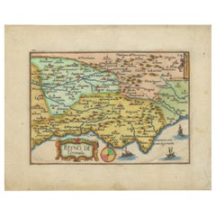
Map of Le Maine by H. Hondius, 1633, Hand-Colored, Decorative and Historic
Located in Langweer, NL
Map of Le Maine by H. Hondius, 1633, Hand-Colored, Decorative and Historic This rare and beautifully executed antique map titled 'Le Maine' was published in 1633 by Henricus Hondius...
Category

Antique 17th Century Collectibles and Curiosities

Materials

Paper

Devotional Pendant, Saint James the Great, Bronze, Spain, 17th Century
Located in Madrid, ES
Devotional medal, Santiago Apóstol. Ormolu, 17th century. Openwork devotional medal with the image of Santiago Apóstol in the center, on a pedestal and holding a staff and a book, surrounded by a crown of leaves knotted with two loops above and below. Copies similar to the present one are found in the Museum of Pilgrimages in Santiago de Compostela...
Category

Spanish Baroque Antique 17th Century Collectibles and Curiosities

Materials

Bronze

Antique Exceptional Judaica Stirrups with Star of David Ottoman Empire
Located in Doha, QA
An outstanding 17th century pair of brass,copper and silver inlay Stirrups with David’s Star -each stirrup has two stars hand hammered from lef...
Category

Turkish Antique 17th Century Collectibles and Curiosities

Materials

Silver, Brass, Copper

Antique Map of the Region of Oldenburg, Germany
Located in Langweer, NL
Antique map titled 'Oldenburg Comitatus'. Detailed old map of Oldenburg, Germany. The map also shows Bremen and the Jade Bight. Published by W. Blaeu, circa 1640. Willem Jansz. Blaeu...
Category

Antique 17th Century Collectibles and Curiosities

Materials

Paper

18th Century Polish Brass Hanukkah Lamp
Located in New York, NY
The backplate is cast and featuring a deer in the center surrounded by open scrollwork. The side panels fitted with two servant lights, fronted by a row of eight oil fonts. Scholars theorize that these Polish Chanukah lamps that bear two servant lights (as opposed to the singular servant light normally found on a Hanukkah Lamp...
Category

Polish Antique 17th Century Collectibles and Curiosities

Materials

Brass

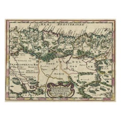
Copper-Engraved Map Showing the Algerian Coast of North Africa, Published 1683
Located in Langweer, NL
Antique map titled 'Partie de Barbarie, ou est le Royaume d'Alger (..)'. Copper-engraved map showing the Algerian coast of North Africa. Published 1683. Artists and Engravers:...
Category

Antique 17th Century Collectibles and Curiosities

Materials

Paper

Original Antique 17th-Century Map of Shaangxi (Xensi) Province, China – by Blaeu
Located in Langweer, NL
Antique 17th-Century Map of Shaangxi Province, China – "Xensi" by Blaeu, Featuring Decorative Cartouches Description: This exquisite 17th-century map of Shaangxi Province, historically known as Xensi Province, is an exceptional work by Johannes Blaeu, one of the most celebrated mapmakers of the Dutch Golden Age. Originally published in Blaeu's groundbreaking 'Novus Atlas Sinensis', this map is a masterful blend of geography and artistry. Blaeu's atlas was created in collaboration with Martino Martini, a Jesuit missionary whose insights into China provided European audiences with unprecedented geographical accuracy. The map meticulously charts Shaangxi's mountains, rivers, mines, cities, and towns, with names rendered in Latin. It also features a detailed section of the Great Wall of China, a symbol of the region's historical significance. The artistry of this map is further enhanced by its elaborate cartouches. At the top, a Chinese warrior is beautifully illustrated, while the lower-left corner displays a deer, possibly a reference to the elusive Pere David deer...
Category

Antique 17th Century Collectibles and Curiosities

Materials

Paper

1616 Petrus Bertius Map of Arakan and Pegu in Southeast Asia
Located in Langweer, NL
Title: 1616 Petrus Bertius Map of Arakan and Pegu in Southeast Asia Description: This early seventeenth-century map, titled Descriptio Arachan et Pegu, was published in 1616 by P...
Category

Antique 17th Century Collectibles and Curiosities

Materials

Paper

Collection of Dutch miniature dollhouse pewter, 17th - 18th century
Located in Delft, NL
Collection of Dutch miniature dollhouse pewter, 17th - 18th century A collection of 4 pieces of antique miniature pewter from the periods 17th century and 18th century A porringer ...
Category

Dutch Antique 17th Century Collectibles and Curiosities

Materials

Pewter

Italia Antiqua Philippo Cluvero – 1603 Hondius Map of Ancient Italy, Handcolored
Located in Langweer, NL
Italia Antiqua Philippo Cluvero – 1603 Hondius Map of Ancient Italy with Hand Color This stunning early 17th-century map, *Italia Antiqua Philippo Cluvero Borusso Designatore*, wa...
Category

Antique 17th Century Collectibles and Curiosities

Materials

Paper

Antique Map of the Course of the Rhine River by Blaeu, circa 1640
Located in Langweer, NL
Antique map titled 'Rhenus Fluviorum Europae celeberrimus, cum Mosa, Mosella, et reliquis, in illum se exonerantibus, fluminibus'. Beautiful map of the course of the Rhine River...
Category

Antique 17th Century Collectibles and Curiosities

Materials

Paper

Hand-Colored 17th-Century Map of Orléanais in France by Frederik De Wit c. 1688
Located in Langweer, NL
Title: Hand-Colored 17th-Century Map of Orléanais by Frederik De Wit c. 1688 Description: This beautifully crafted map, "Gouvernement General du Pays Orléanois," illustrates the Orl...
Category

Antique 17th Century Collectibles and Curiosities

Materials

Paper

Rare Copper Engraving of Female with Five Breasts Lactating onto Others, 1686
Located in Langweer, NL
Antique print titled 'Painting'. Rare antique print showing painters and various figures including: a female figure holding palette and brushes in centre, with another female figur...
Category

Antique 17th Century Collectibles and Curiosities

Materials

Paper

17th Century, Spanish Giltwood Baroque Altarpiece with Angel Head
Located in Buisson, FR
Stunning and complete unique early Baroque altarpiece with beautiful and very rich carved and gilded decor, Spain, circa 1650 Weathered, small losses, old repairs and adjustments o...
Category

Spanish Baroque Antique 17th Century Collectibles and Curiosities

Materials

Wood

Johannes Janssonius' 17th-Century Map of the Duchy of Bremen in Germany
Located in Langweer, NL
The map titled "Ducatus olim Episcopatus Bremensis et ostiorum Albis et Visurgis Fluviorum novissima Descriptio" by Johannes Janssonius provides a rich historical and geographical il...
Category

Antique 17th Century Collectibles and Curiosities

Materials

Paper

Original Engraving of Japanese Musicians Playing Native Music Instruments, 1669
Located in Langweer, NL
Antique print, titled: 'Japansche kamerspeelders.' - ('Japanese musicians'). Four chamber musicians are playing on native instruments outside. Arnol...
Category

Antique 17th Century Collectibles and Curiosities

Materials

Paper

Old Map of Prussia, Embellished with a Large Cartouche and Compass Rose, ca.1680
Located in Langweer, NL
Antique map titled 'Prussiae nova Tabula'. Later edition of Blaeu's map of Prussia, embellished with a large cartouche and compass rose. Prussia was a historically prominent Germ...
Category

Antique 17th Century Collectibles and Curiosities

Materials

Paper

Cross of Caravaca 17th Century
Located in Madrid, ES
Cross of caravaca XVII century. Very beautiful cross of caravaca made in bronze. 17th Century. Measurements: 15x6 cm. Good condition.
Category

Italian Gothic Antique 17th Century Collectibles and Curiosities

Materials

Bronze

William & Mary Rare Pewter Trefid Spoon with Portraits, Circa 1690
Located in Bishop's Stortford, Hertfordshire
Very rare William and Mary pewter trefid spoon the handle molded in relief with portraits and dating from around 1690. The spoon has an elongated rounded ...
Category

English William and Mary Antique 17th Century Collectibles and Curiosities

Materials

Pewter

Old Map of Ancient Times covering Egypt Towards Arabia and India to Java, c.1660
Located in Langweer, NL
Description: Antique map titled 'Erythraei Sive Rubri Maris Periplus olim ab arriano descriptus nunc vero ab abrah ortelio ex eodem delineatus'. Map of the Indian Ocean, or Erythraea...
Category

Antique 17th Century Collectibles and Curiosities

Materials

Paper

Travel Haltar
Located in San Cristobal de Las Casas, Chiapas
Travel altar with eight paintings depicting Saint Augustine, the Immaculate Virgin, Saint Anthony with a child, Saint Louis Gonzalez in Santo Domingo, the...
Category

Mexican American Colonial Antique 17th Century Collectibles and Curiosities

Materials

Wood

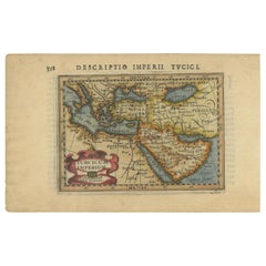
Antique Map of North Africa showing Egypt, Mauritania and Africa Minor, 1672
Located in Langweer, NL
Antique map titled 'Africa Minor, Mauritania , Aegyptus.' Charming miniature map of North Africa, showing Egypt, Mauritania and Africa Minor. This map originates from the pocket atla...
Category

Antique 17th Century Collectibles and Curiosities

Materials

Paper

Antique Map of Madagascar by N. Sanson, circa 1680
Located in Langweer, NL
Antique map titled 'Isle de Madagascar ou de St. Laurens. Tiree de Sanutu &c'. Antique map of Madagascar, first published by Sanson in 1657. Sanson n...
Category

Antique 17th Century Collectibles and Curiosities

Materials

Paper

Rare Original Handcolored Miniature Map of Malaysia and Singapore, 1600
Located in Langweer, NL
Very handsome original old coloured copper engraving of Malaysia and Singapore, with parts of Sumatra, inc the island of Bangka and Bintam. Title of the map 'Description Malacca'. On...
Category

Antique 17th Century Collectibles and Curiosities

Materials

Paper

Antique Plan of Fort Mardyck Mardijk, France by S. Beaulieu, 1649
Located in Langweer, NL
Plan of Fort Mardyck (Fort Mardijk) and surroundings by Sébastian de Pontault Beaulieu. Mardyck is a former commune in the Nord department in northern France. It is an associated com...
Category

Antique 17th Century Collectibles and Curiosities

Materials

Paper

Antique Map of Pannonia and Illyria by Cluver, 1685
Located in Langweer, NL
Antique map titled 'Pannonia et Illyricum.' Charming miniature map of Pannonia and Illyria, from the pocket atlas 'Introductionis in Universam Geographiam tam Veterem quam novam .. A...
Category

Antique 17th Century Collectibles and Curiosities

Materials

Paper

1654 Nicolas Sanson Map of Southern India and Southeast Asia
Located in Langweer, NL
1654 Nicolas Sanson Map of Southern India and Southeast Asia - Partie Meridionale de L'Inde This 1654 map by Nicolas Sanson, titled "Partie Meridionale de L'Inde en deux Presqu'Is...
Category

Antique 17th Century Collectibles and Curiosities

Materials

Paper

1621 Ptolemy & Magini Map of Taprobana (Sumatra) with Elephant Inset
Located in Langweer, NL
Title: 1620 Ptolemy and Magini Map of Taprobana (Sumatra) with Elephant Inset, Italian Edition Description: This rare and beautifully hand-colored 1620 map engraving, Tavola Duode...
Category

Antique 17th Century Collectibles and Curiosities

Materials

Paper

Thraciae Veteris Typus – 1618 Ortelius Map of Ancient Thrace with Hand Color
Located in Langweer, NL
Thraciae Veteris Typus – 1618 Ortelius Map of Ancient Thrace with Hand Color This striking early 17th-century map, Thraciae Veteris Typus, was published in 1618 by Abraham Orteliu...
Category

Antique 17th Century Collectibles and Curiosities

Materials

Paper

Antique Map of Piedmonte and Savoie 'Italy' by N. Visscher, circa 1683
Located in Langweer, NL
Antique map titled 'Regiae Celsitudinis Sabaudicae Status consistens in Sabaudiae ac Montisferrati Ducatus, Pedemontii Principatum (..). This map originates from 'Atlas Minor Sive Ge...
Category

Antique 17th Century Collectibles and Curiosities

Materials

Paper

Territorium Francofurtens – Moses Pitt’s 17th-Century Map of Frankfurt
Located in Langweer, NL
Title: Territorium Francofurtens – Moses Pitt’s 17th-Century Map of Frankfurt Description: This rare 17th-century map, titled Territorium Francofurtens, was published by Moses ...
Category

Antique 17th Century Collectibles and Curiosities

Materials

Paper

Grand Map of Europe by Frederick de Wit, Circa 1690: A Baroque Era Masterpiece.
Located in Langweer, NL
This is an attractive historical map of Europe created by Frederick de Wit, published around 1690. Here's a detailed description of the map and additional context about its creation:...
Category

Antique 17th Century Collectibles and Curiosities

Materials

Paper

Map Holy Promise Land Canaan Richard Palmer Richard Blome 1687 Joseph Moxon
Located in BUNGAY, SUFFOLK
Canaan comonly called the Holy Land or the Land of Promise, being the Possesion of the Israelites & travelled through by Our Lord & Saviour Iesus Christ and his Apostles. Engraven by Richard Palmer for Richard Blome. 1687 Blome, Richard, 1641-1705. London. 283 x 452 mm. Copperplate. Probably from an English Bible...
Category

British Baroque Antique 17th Century Collectibles and Curiosities

Materials

Paper

Rare Hand-Colored Map of of the Wine Region Burgundy in France by De Wit, c.1688
Located in Langweer, NL
Title: New Description of the Duchy of Burgundy - Frederik De Wit c. 1688 Description: This exquisite map of the Duchy of Burgundy, published after 1688, is a fascinating example of...
Category

Antique 17th Century Collectibles and Curiosities

Materials

Paper

Antique Map of the Burgundy Region by Mallet, c.1683
Located in Langweer, NL
Antique map titled 'Cercle de Bourgogne'. Detailed miniature map of the Burgundy region, France. Also shows the Netherlands and Belgium. Originates from Mallet's 'Description de l'Un...
Category

Antique 17th Century Collectibles and Curiosities

Materials

Paper

17th Century Pair of Carved and Gilded Wooden Mensulae with Birds
Located in Marbella, ES
17th century pair of carved and gilded wooden mensulae with birds.
Category

Spanish Antique 17th Century Collectibles and Curiosities

Materials

Wood

1690 Frederick de Wit Sea Chart of Hudson Bay, Baffin Bay and Greenland
Located in Langweer, NL
Title: c. 1690 Frederick de Wit Sea Chart of Hudson Bay, Baffin Bay, and Greenland - Engraved by Romeyn de Hooghe This striking sea chart by Frederick de Wit, titled "Septemtrionali...
Category

Antique 17th Century Collectibles and Curiosities

Materials

Paper

Old Map Focusing on the Wine Region of Metz, the Moselle Region of France, 1657
Located in Langweer, NL
Antique map of France titled 'Territorium Metense'. Old map focusing on the wine region surrounding Metz, in the Moselle region of France. This map originates from 'Atlas Novus, ...
Category

Antique 17th Century Collectibles and Curiosities

Materials

Paper

17th Century Spanish Talavera Pharmacy Jar in Blue Glazed Ceramic
Located in Marbella, ES
17th Century Spanish Talavera pharmacy jar in blue glazed ceramic.
Category

Spanish Antique 17th Century Collectibles and Curiosities

Materials

Ceramic

Circa 1659 Johannes Blaeu Map: Ducatus Silesiae Ligniciensis, Legnica Region
Located in Langweer, NL
Circa 1659 Johannes Blaeu Map: Ducatus Silesiae Ligniciensis, Legnica Region This hand-colored map from circa 1659 by Johannes Blaeu, titled "Ducatus Silesiae Ligniciensis," depicts the region centered around Legnica (Lignitz) in southwestern Poland. It extends to include the cities of Lublin, Jawor, and Lwówek Śląski. The map features decorative elements such as a title cartouche adorned with a putto, garlands of fruit, and birds, and a distance scale cartouche that includes a hunter with his dogs. This map is dedicated to Georgius Rodulfus, the Duke of Silesia, by Ionas Scultetus, reflecting the map's historical context and noble patronage. It includes Spanish text on the verso, indicating publication between 1659 and 1672. Measuring 20.9 inches wide by 16.3 inches high, the map is in excellent condition with a sharp impression, full contemporary color, and a large watermark of the god Atlas. Minor details include a bit of printer's ink residue at the right and slight marginal soiling. Keywords: - Johannes Blaeu map - Silesia historical map - Legnica (Lignitz) map - 17th-century Poland map...
Category

Antique 17th Century Collectibles and Curiosities

Materials

Paper

CAMDEN - The Historie of the Life & Death of Mary Stuart - SECOND EDITION - 1636
Located in Hillsborough, NJ
AUTHOR: CAMDEN, William. TITLE: The Historie of the Life and Death of Mary Stuart Queene of Scotland. PUBLISHER: London: by John Haviland, and are to be sold by William Sheares, 1...
Category

British Antique 17th Century Collectibles and Curiosities

Materials

Leather

Map of the Provence in Southern France, Original Old Engraving by De Wit c. 1688
Located in Langweer, NL
Title: Provence Map - Hand-Colored 17th-Century Engraving by Frederik De Wit c. 1688 Description: This captivating map, "Gouvernement de Provence," depicts the Provence region of so...
Category

Antique 17th Century Collectibles and Curiosities

Materials

Paper

17th-Century Map of the Latin Patriarchate of Jerusalem by Melchior Tavernier
Located in Langweer, NL
Title: 17th-Century Map of the Latin Patriarchate of Jerusalem by Melchior Tavernier Description: This rare 17th-century map by Melchior Tavernier illustrates the geographical ext...
Category

Antique 17th Century Collectibles and Curiosities

Materials

Paper

Original 17th-Century Antique Map of Fujian (Fokien) Province, China – by Blaeu
Located in Langweer, NL
17th-Century Antique Map of Fujian Province, China – "Fokien" by Blaeu, with Decorative Cartouches Description: This stunning 17th-century map of Fujian Province, historically ref...
Category

Antique 17th Century Collectibles and Curiosities

Materials

Paper

Original Antique 17th-Century Map of Shanxi (Xansi) Province, China – by Blaeu
Located in Langweer, NL
Antique 17th-Century Map of Shanxi Province, China – "Xansi" by Blaeu, with Artistic Cartouches Description: This beautifully engraved map of Shanxi Province, historically referred to as "Xansi," was created by Johannes Blaeu in 1655 as part of his renowned *Novus Atlas Sinensis*. This atlas was the first comprehensive Western collection focused on Chinese geography, produced with the guidance of Jesuit missionary Martino Martini. Blaeu’s attention to detail and artistic flair are evident in this representation of Shanxi, highlighting mountains, rivers, cities, towns, and key geographic features. The Great Wall of China, an iconic landmark, is also depicted. The map includes decorative cartouches that enhance its aesthetic appeal. The upper-left corner features the map's title framed in an ornate design, while the lower-right corner showcases a seated figure in traditional Chinese attire alongside a small globe, symbolizing the merging of European cartographic expertise and Chinese knowledge. Each city and geographic feature is labeled in Latin, making it a fascinating historical artifact of cross-cultural exploration. This map was crafted using the copperplate engraving technique, prized for its ability to produce fine, precise details. It is further embellished with hand-coloring, which brings the landscape and decorative elements to life. Blaeu’s maps are highly regarded for their accuracy, artistry, and historical significance, making this piece a valuable collectible. Shanxi Province, historically referred to as "Xansi," is renowned for its historical significance, natural landscapes, and rich cultural heritage. The region has been a crucial center of Chinese history and culture for centuries. Its name, meaning "West of the Mountains," refers to its location west of the Taihang Mountains. Shanxi has long been known for its coal resources, which have made it an important economic hub in modern times. Important places in Shanxi include Pingyao, a UNESCO World Heritage Site known for its well-preserved ancient city walls and traditional Chinese architecture. The Yungang Grottoes, near Datong, are another UNESCO site, famous for their intricate Buddhist carvings and statues. Mount Wutai, one of China’s Four Sacred Buddhist Mountains, is a significant religious site that attracts pilgrims and tourists alike. Taiyuan, the provincial capital, is known for its historical sites, including the Jinci Temple. Shanxi is also known for its role in the early development of Chinese banking, particularly during the Ming and Qing Dynasties. Keywords include antique map of Shanxi, Xansi map, Pingyao, Yungang Grottoes, Mount Wutai, 17th-century China map...
Category

Antique 17th Century Collectibles and Curiosities

Materials

Paper

Rare 17th-Century Map of Dauphiné in Southeastern France by F. De Wit, ca.1688
Located in Langweer, NL
Title: Rare Hand-Colored 17th-Century Map of Dauphiné by Frederik De Wit c. 1688 Description: This captivating 17th-century map of Dauphiné, titled "Nova et Accurata Delphinatus Vul...
Category

Antique 17th Century Collectibles and Curiosities

Materials

Paper

Original Antique Map of the Road from Marlborough to Huntspil
Located in Langweer, NL
Antique map titled 'The Continuation of the Road from London to Bristol (..)'. A strip map of the continuation of the road from London to Bristol, this particular sheet showing the r...
Category

Antique 17th Century Collectibles and Curiosities

Materials

Paper

Antique Map of Sri Lanka with an unusual five-sided shape, circa 1606
Located in Langweer, NL
Antique map titled 'Ins. Ceilan quae incolis Tenarisin dicitur'. This exquisite, early map of Sri Lanka is shown with an unusual five-sided shape. North is oriented to the left by an...
Category

Antique 17th Century Collectibles and Curiosities

Materials

Paper

Circa 1659 Willem Blaeu Map: Southwestern Switzerland with Geneva & Lakes
Located in Langweer, NL
Circa 1659 Willem Blaeu Map: Southwestern Switzerland with Geneva & Lakes This detailed map from circa 1659 by Willem Blaeu, titled "Das Wiflispurgergow," highlights the southwestern region of Switzerland. It features significant landmarks such as Geneva, Lake Geneva (Lacus Lemannus), Lake Neuchatel, Lake Biel, Bern, Freiburg, and Lake Thuner. Based on the work of Gerard Mercator, this map is published with Spanish text on the verso, dating from the period between 1659 and 1672. Measuring 19.9 inches wide by 15.1 inches high, the map is rendered in full contemporary color on a bright sheet that bears a large watermark of the god Atlas. The condition is excellent, with a sharp impression, short centerfold separations at the top and bottom margins, and an archivally repaired tear in the right margin. Keywords: - Willem Blaeu map - Gerard Mercator - 17th-century Switzerland map...
Category

Antique 17th Century Collectibles and Curiosities

Materials

Paper

Antique Map of the West African Coast and the Cape Verde Islands, c.1680
Located in Langweer, NL
Antique map Africa titled 'Isles du Cap Verd Coste et Pays des Negres'. Antique map of the coast of Africa and the Cape Verde islands. Artists and...
Category

Antique 17th Century Collectibles and Curiosities

Materials

Paper

Original 17th-Century Antique Map of Henan (Honan) Province, China – by Blaeu
Located in Langweer, NL
17th-Century Antique Map of Henan Province, China – "Honan" by Blaeu, with Detailed Cartography and Artistic Cartouches Description: This exceptional 17th-century map of Henan Province, historically referred to as "Honan," was created by Johannes Blaeu and published in 1655 as part of the *Novus Atlas Sinensis*. Henan, located in central China, is known as the cradle of Chinese...
Category

Antique 17th Century Collectibles and Curiosities

Materials

Paper

Original Antique Map of the Area of Bremen and Lower Saxony
Located in Langweer, NL
Antique map titled 'Ducatus olim Episcopatus Bremensis et ostiorum Albis et Visurgis Fluviorum novissima Descriptio'. Original old map of the area of ??Bremen and Lower Saxony. Uncom...
Category

Antique 17th Century Collectibles and Curiosities

Materials

Paper

Antique Map of Paraguay by A. Montanus, circa 1671
Located in Langweer, NL
Antique map titled 'Paraquaria Vulgo Paraguay Cum adjacentibus'. Antique map extending from Rio de Janiero to the Rio de la Plata basin. The map include...
Category

Antique 17th Century Collectibles and Curiosities

Materials

Paper

Old Map of the Bourbonnais Region of France, ca.1630
Located in Langweer, NL
Antique map titled 'Bourbonois - Borbonium Ducatus'. Old map of the Bourbonnais region of France. Bourbonnais was a historic province in the centre of France that corresponds to ...
Category

Antique 17th Century Collectibles and Curiosities

Materials

Paper

Rare Hand-Colored Map of Champagne and Brie, France, by Frederik De Wit c. 1688
Located in Langweer, NL
Title: Rare Hand-Colored Map of Champagne and Brie by Frederik De Wit c. 1688 Description: This exquisite 17th-century map, "Champagne et Brie," beau...
Category

Antique 17th Century Collectibles and Curiosities

Materials

Paper

Rhine Splendor: Antique Map of the Lower Rhine Region, circa 1680
Located in Langweer, NL
The antique map titled 'Novissima et Accuratissima Archiepiscopatus et Electoratus Coloniensis Ducatuum Iuliancensis et Montensis et Meursiae Comitatus' is a handsome and detailed ma...
Category

Antique 17th Century Collectibles and Curiosities

Materials

Paper

Road Map Britannia 1675/6 No 5 Road London to Barwick, London Stilton Grey Frame
Located in BUNGAY, SUFFOLK
John Ogilby (British 1600-1676) cosmographer and geographick printer to Charles II. A road map from Britannia, 1675/6. No 5, The road from London to Barwick: London to Stilton In a grey painted and gilded frame. In a remarkable life John Ogilby pursued, several careers, each ending in misfortune, and yet he always emerged undeterred, to carry on. His modern reputation is based on his final career, started in his sixty-sixth year, as a publisher of maps and geographical accounts. Ogilby was born outside Dundee, in 1600, the son of a Scottish gentleman. While he was still a child, the family moved to London. When the elder Ogilby was imprisoned for debt, the young John invested his savings in a lottery, won a minor prize, and settled his father's debts. Unfortunately, not enough money was left to secure John a good apprenticeship; instead, he was apprenticed to a dance master. Ogilby was soon dancing in masques at court but, one day, while executing a particularly ambitious leap, he landed badly. The accident left him with a permanent limp, and ended his dancing career. However, he had come to the attention of Thomas Wentworth, later Earl of Strafford, Charles I's most senior minister. Ever one to exploit his contacts, Ogilby became a dance instructor in Strafford's household. When Strafford was sent to Ireland, Ogilby accompanied him as Deputy-Master of the Kings Revels, and then Master of Revels. In Dublin, he built the New Theatre, in St. Werburgh Street, which prospered at first, but the Irish Rebellion, in 1641, cost Ogilby his fortune, which he estimated at £2,000, and almost his life. After brief service as a soldier, he returned to England, survived shipwreck on the way, and arrived back penniless. On his return, Ogilby turned his attention to the Latin classics, as a translator and publisher. His first faltering attempt, in 1649, was a translation of the works of Virgil, but after his marriage to a wealthy widow the same year, his publishing activities received a considerable boost. One means by which Ogilby financed these volumes was by subscription, securing advance payments from his patrons, in return for including their name and coats-of-arms on the plates of illustrations. Another approach was to secure a patron, preferably in the court circle. Ogilby's first patron was Strafford, who found out too late that all leading ministers are dispensable when Charles I assented to his execution in 1641. As he re-established himself, Ogilby sought a new patron, the King himself. In 1661, Ogilby was approached to write poetry for Charles II's coronation procession; he later published 'The Relation of His Majesties Entertainment Passing Through the City of London', and a much enlarged edition the following year, which included a Fine set of plates depicting the procession. Royal favour was bestowed in 1674 when John Ogilby received the title of 'His Majesty's Cosmographer and Geographick Printer' with a salary of £13.6s.8d per annum. In 1665, Ogilby left London to avoid the Plague then ravaging the capital. The following year, in the Great Fire of London, Ogilby claimed that he lost his entire stock of books valued at some £3,000, as well as his shop and house, leaving him worth just £5. As he sought to restore his fortunes, Ogilby was already looking in new directions. The initial opportunity he seized on was the reconstruction of London's burnt-out centre. He secured appointment as a "sworn viewer", whose duty was to establish the property boundaries as they existed before the Fire. Ogilby was assisted in the project by his step-grandson, William Morgan, and by a number of professional surveyors. The result was an outstanding plan of London, on a scale of 100 feet to an inch, on 20 sheets, although it was not printed until after Ogilby's death. Ogilby then turned his attention to publishing geographical descriptions of the wider-world. In 1667, he issued 'An Embassy from the East India Company of the United Provinces to the Grand Tartar Cham, Emperor of China.' Buoyed by the response to this volume, Ogilby conceived an ambitious project, a multi-volume description of the world. The volumes were joint collaborations, in conjunction with the Dutch publisher Jacob van Meurs. 'Africa', published in 1670, was the least original of the three, both in terms of the text, maps and illustrations. In a similar vein, he issued the 'Atlas Japannensis' (1670), the 'Atlas Chinensis' (1671), and 'Asia' (1673). In 1671, Ogilby published the 'America', translated from Arnold Montanus' Dutch text. The 'America' is certainly the most original, and most important, of Ogilby's various geographical volumes, and its influence and popularity was immediate. With its completion, Ogilby turned to a project nearer his heart, the description of Britain. Ogilby originally intended to devote one volume to Britain, but as the project evolved, he became more ambitious, as revealed in a prospectus issued in about 1672: "This having oblig'd our Author to take new Measures ... to compleat within the space of two Years a Work ... considering the Actual survey of the Kingdom, the Delineation and Dimensuration of the Roads, the Prospects and Ground plots of Cities, with other Ornamentals ... into six fair volumes. The Four first comprehending the historical and geographical description of England, with the County-Maps truly and actually survey'd. ... The fifth containing an Ichnographical and Historical Description of all the Principal Road-ways in England and Wales, in two hundred copper sculptures, after a new and exquisite method. The sixth containing a New and Accurate Description of the famous City of London, with the perfect Ichnography thereof ..." In the proposals, Ogilby emphasised the scale of the undertaking; no-one before him had attempted such a vast project. He estimated the total costs would be £20,000, a staggering amount. The cost of the complete set of six volumes was to be £34. At that time, Wenceslas Hollar...
Category

British Charles II Antique 17th Century Collectibles and Curiosities

Materials

Paper

Very Rare Antique Print of the Kings Celebrations in Pegu, Myanmar, 1682
Located in Langweer, NL
Plate: 'Konings feesten tot Pegu.' (Kings celebrations in Pegu.) On this plate: 1. The King. 2. And the Queen, sprinkling water on each other. 3. Their children. 4. Officers. 5. ...
Category

Antique 17th Century Collectibles and Curiosities

Materials

Paper

Read More

Medal-Worthy Memorabilia from Epic Past Olympic Games

Get into the games! These items celebrate the events, athletes, host countries and sporting spirit.

Ahoy! You’ve Never Seen a Collection of Sailor Art and Kitsch Quite Like This

French trendsetter and serial collector Daniel Rozensztroch tells us about his obsession with objects related to seafaring men.

Pamela Shamshiri Shares the Secrets behind Her First-Ever Book and Its Effortlessly Cool Interiors

The sought-after designer worked with the team at Hoffman Creative to produce a monograph that beautifully showcases some of Studio Shamshiri's most inspiring projects.

Moroccan Artworks and Objects Take Center Stage in an Extraordinary Villa in Tangier

Italian writer and collector Umberto Pasti opens the doors to his remarkable cave of wonders in North Africa.

Montecito Has Drawn Royalty and Celebrities, and These Homes Are Proof of Its Allure

Hollywood A-listers, ex-pat aristocrats and art collectors and style setters of all stripes appreciate the allure of the coastal California hamlet — much on our minds after recent winter floods.

Whaam! Blam! Pow! — a New Book on Pop Art Packs a Punch

Publishing house Assouline and writer Julie Belcove have teamed up to trace the history of the genre, from Roy Lichtenstein, Andy Warhol and Yayoi Kusama to Mickalene Thomas and Jeff Koons.

The Sparkling Legacy of Tiffany & Co. Explained, One Jewel at a Time

A gorgeous new book celebrates — and memorializes — the iconic jeweler’s rich heritage.

What Makes a Gem-Encrusted Chess Set Worth $4 Million?

The world’s most opulent chess set, weighing in at 513 carats, is literally fit for a king and queen.
Recently Viewed

View All