17th Century Collectibles and Curiosities

to
819
1,096
150
1,254
85
3
1
1
1
4,372
6,576
13,270
2,710
3,496
4,589
3,008
518
314
589
736
463
893
863
890
653
566
1,029
119
110
35
29
297
61
54
48
43
1,254
1,254
1,254
63
12
11
11
6
Period: 17th Century
Oil on copper, 17th century. “Saint Mary of Egypt, Penitent“
Located in Madrid, ES
Oil on Copper — "Saint Mary of Egypt, Penitent," Spanish or Flemish School, 17th Century A captivating oil on copper painting depicting Saint Mary of Egypt, dating from the 17th cen...
Category

European Baroque Antique 17th Century Collectibles and Curiosities

Materials

Copper

Antique Detailed Map of Jerusalem in Israël with Extensive Key and Scale, 1698
Located in Langweer, NL
Antique map titled 'Jerusalem.' Plan of the ancient city of Jerusalem. With extensive key and scale. Source unknown, to be determined. Artists and Engravers: Made by 'Cornelis de...
Category

Antique 17th Century Collectibles and Curiosities

Materials

Paper

Antique Map of Morocco Showing Towns of Marakesh, Taradant and Fez, 1636
Located in Langweer, NL
Antique map titled 'Fezzae et Marocchi regna Africae Celeberrima'. Map of Morocco, showing large fortified towns of Marakesh, Taradante and Fez, towns, mountains, rivers, lakes, etc....
Category

Antique 17th Century Collectibles and Curiosities

Materials

Paper

17th Century Early Baroque Flemish Wood Carved Religious Figural Group
Located in Vero Beach, FL
This rare 17th century panel, carved in high relief, is museum quality and without doubt the work of an important Flemish master carver. It represents the biblical scene of Mary and Joseph in Bethlehem for the census. Multiple figures surround the center in a well balanced setting. Rich, deep color and great patina, which developed over about 400 years, make this piece of art exceptional. The panel is mounted on a later dusty rose velvet backing. Condition: Small part of backdrop on right is missing. Joseph’s left hand is missing. Measurements: Image size - 8 ½” W x 12 ¼” H x 2” D Back panel - 10 ¼” W x 14” H x ½” D Entire piece - 10 ¼” W x 14” H x 2 ½” D Weight: 2 lbs. 8 oz.  
Category

Belgian Baroque Antique 17th Century Collectibles and Curiosities

Materials

Wood

Palermo – 1620 Braun & Hogenberg Bird’s-Eye Map of Palermo, Sicily
Located in Langweer, NL
Palermo – 1620 Braun & Hogenberg Bird’s-Eye Map of Palermo, Sicily This beautifully detailed bird’s-eye view of Palermo, Sicily, was created by Georg Braun and Frans Hogenberg aro...
Category

Antique 17th Century Collectibles and Curiosities

Materials

Paper

Original Antique Sea Chart of the Northern Part of Hispaniola, Western Cuba
Located in Langweer, NL
Antique map titled 'Pas kaart van de Noord Kust van Espaniola (..)'. Beautiful sea chart of the northern part of Hispaniola, western Cuba. The map includes the Turks & Caicos Islands and southern part of the Bahamas. Shows Guanahami or S. Salvador. Guanahani is an island in the Bahamas that was the first land in the New World sighted and visited by Christopher Columbus' first voyage, on October 12, 1492. It is not known precisely which island it was, and several theories have been put forth by historians. Guanahani is the native Taíno name; Columbus called it San Salvador. Originates from 'De Nieuwe Groote Lightende Zee-Fakkel'. Published by J. van Keulen, circa 1684. The Van Keulens were a family of chartmakers and publishers. The firm, In de Gekroonde Lootsman (In the Crowned Pilot), was founded in 1678 by Johannes van Keulen (1654-1715). Van Keulen originally registered his business as a vendor of books and instruments (specifically cross-staffs). In 1680, however, he gained a privilege from the States of Holland and West Friesland for the publication of pilot guides and sea atlases. In that year, van Keulen released his Zee-Atlas (Sea Atlas), which secured him a name in the competitive maritime publishing market. In 1681, he published the first volume of Nieuwe Lichtende Zee-Fakkel (New Shining Sea Torch). This would be the first of an eventual five volumes originally published between 1680 and 1684. A sixth volume was added in 1753. The Zee-Fakkel won van Keulen lasting fame. The atlas had charts compiled by Claes Jansz Vooght and artwork from Jan Luyken...
Category

Antique 17th Century Collectibles and Curiosities

Materials

Paper

Virgin Mary (dress-up). Wood, etc. Spanish school, 17th century and later.
Located in Madrid, ES
Virgin of Dress. Carved and polychrome wood, etc. Spanish school, 17th century; later clothing. Has damage. Polychrome wood carving of the type of dress or dress that has a series ...
Category

Spanish Baroque Antique 17th Century Collectibles and Curiosities

Materials

Other

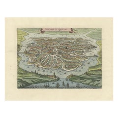
Antique Bird's-Eye View of Hangzhou (China) by Matthäus Merian, 1638
Located in Langweer, NL
This is an exquisite antique bird's-eye view map of Hangzhou, historically referred to as "Xuntien or Quinzay," from the first edition of Matthäus Merian's publication in 1638. This ...
Category

Antique 17th Century Collectibles and Curiosities

Materials

Paper

An ivory dyptich sundial, Germany, 17th century.
Located in Milan, IT
Ivory diptych sundial for latitude 48 degrees with vertical and horizontal dials, pin gnomon for Italian hours and lunar volvelle. Compass needle and glass cover. On the plain back ...
Category

German Antique 17th Century Collectibles and Curiosities

Materials

Ivory

1667 Melchior Tavernier Map of the Patriarchate of Constantinople – Black Sea, G
Located in Langweer, NL
This 1667 map titled "Patriarchatus Constantinopolitani Geographica Descriptio" was crafted by renowned French cartographer Melchior Tavernier, who was a prominent map engraver during the 17th century. This rare and historically significant map focuses on the territories under the ecclesiastical jurisdiction of the Patriarchate of Constantinople, one of the most important centers of the Eastern Orthodox Church. It covers regions around the Black Sea (Pontus Euxinus), parts of Greece, and adjacent areas in Asia Minor and the Balkans, which were historically vital during the Byzantine and Ottoman Empires. The map is filled with ancient place names, making it a valuable resource for both historical and cartographic enthusiasts. Key Features: - Antique ecclesiastical map illustrating the influence of the Orthodox Patriarchate of Constantinople in the 17th century. - Features beautifully detailed ancient coastlines, rivers, and terrains, providing a comprehensive geographical view of the region. - Rich with historic place names - like Byzantium, Nicomedia, Nicaea, Cyzicus, Bithynia, Pontus, Macedonia, and Thrace - that date back to the classical era, offering insights into the ancient geography of the eastern Mediterranean. - A finely engraved strapwork cartouche in the lower right corner with Baroque-style decoration, featuring two putti (cherubic figures) – a hallmark of 17th-century map art. - The map extends to include the Mediterranean Sea (Mare Mediterraneum) to the south and the Black Sea to the north, highlighting its ecclesiastical and geopolitical significance. - Original hand coloring may still be present, enhancing the decorative appeal for collectors of antique maps. This rare map offers a unique perspective on the religious influence and historical geography of the Eastern Mediterranean during the late 17th century. It would appeal to collectors interested in: - **Byzantine history** - **Ottoman Empire** - **Eastern Orthodox Church** - **Antique cartography...
Category

Antique 17th Century Collectibles and Curiosities

Materials

Paper

Le moyen de parvenir by François Béroalde de Verville, (1556-1626)
Located in Middletown, NY
Le moyen de parvenir; oeuvre contenant la raison de tout ce qui a esté, est & sera : avec démonstrations certaines et nécessaires, selon la rencontre des effects de vertu . n.d. (ci...
Category

French Antique 17th Century Collectibles and Curiosities

Materials

Gold Leaf

The Workes of our Ancient and Learned English Poet, Geffrey Chaucer
Located in Middletown, NY
Chaucer, Geoffrey The Workes of our Ancient and Learned English Poet, Geffrey Chaucer, Newly Printed London: Adam Islip, 1602. Second Edition. Folio, 13 x 8 3/4 inches (328 x 223 ...
Category

English Antique 17th Century Collectibles and Curiosities

Materials

Gold Leaf

Seminal guide to the East and West Indies, with 42 coloured maps and plates
Located in ZWIJNDRECHT, NL
Seminal guide to the East and West Indies, with 42 double-page and folding plates, including 6 maps, all engravings beautifully coloured by a contemporary hand LINSCHOTEN, Jan Huygh...
Category

Dutch Dutch Colonial Antique 17th Century Collectibles and Curiosities

Materials

Paper

1601 Miniature Map of Southeast Asia & Nova Guinea by Ortelius, Vrients Edition
Located in Langweer, NL
This miniature map of the East Indies and Nova Guinea was created by Abraham Ortelius and published in 1601 as part of the "Epitome" by Giovanni Battista Vrients. It is a finely hand...
Category

Antique 17th Century Collectibles and Curiosities

Materials

Paper

The Antient City of Jerusalem and Places Adjacent, Hand-Colored Map, 1699
Located in Langweer, NL
Title: "1699 Hand-Colored Bird's-Eye Plan of Jerusalem with Ancient and Biblical Landmarks" This beautifully hand-colored, imaginary bird's-eye plan of Jerusalem, published in 1699,...
Category

Antique 17th Century Collectibles and Curiosities

Materials

Paper

Antique Map of the City of Workum by Blaeu, 1649
Located in Langweer, NL
Antique map titled 'Worckum'. Old map of the city of Workum, Friesland. Originates from J. Blaeu's 'Town Book'. Artists and Engravers: Joan Blaeu (23 September 1596 - 28 May 1673...
Category

Antique 17th Century Collectibles and Curiosities

Materials

Paper

Antique 17th Century Map of the Islands Near Ceylon or Sri Lanka, 1672
Located in Langweer, NL
Antique map titled 'Eyland Ceylon.' Map of the islands near Ceylon or Sri Lanka. Dutch text on verso. Source unknown, to be determined. Artists and Engravers: Philip Baldaeus (1632-...
Category

Antique 17th Century Collectibles and Curiosities

Materials

Paper

Antique Map of the Course of the Elbe River by Janssonius, c.1650
Located in Langweer, NL
Antique map titled 'Nobilis Flubius Albis (..)'. Old map of the course of the Elbe river, large inset view of the city of Hamburg. Source unknown, to be determined. Artists and En...
Category

Antique 17th Century Collectibles and Curiosities

Materials

Paper

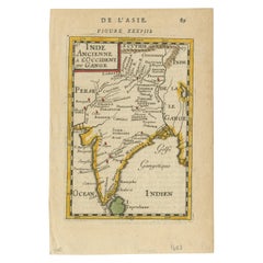
Old Map of the Mughal Empire, Persia in the West to Lake Chimay etc., ca.1685
Located in Langweer, NL
Antique map titled 'L'Empire du Grand Mogol'. Old map of India and Central Asia. The map extends from Persia in the West to Lake Chimay and the Bay of Bengal...
Category

Antique 17th Century Collectibles and Curiosities

Materials

Paper

Gorgeous Antique World Map by the Dutch Mapmaker Visscher, published circa 1679
Located in Langweer, NL
Antique map titled 'Novissima Totius Terrarum Orbis Tabula, Auctore Nicolao Visscher'. Gorgeous example of Nicholas Visscher's World map, which appeared...
Category

Antique 17th Century Collectibles and Curiosities

Materials

Paper

French 17th Century Weathered Carved Oak Christ Fragment
Located in Buisson, FR
Very nice carved oak Christ figure with a strong expression. Beautiful weathered , France circa 1600-1700. Weathered, and losses. Measurement with the base
Category

French Antique 17th Century Collectibles and Curiosities

Materials

Oak

Antique Continental Renaissance Church Lavabo
Located in Forney, TX
A magnificent medieval Renaissance period architectural holy water font lavabo. Born in a Christian church in Continental Europe during the middle ages, likely Italian 16th or 17th century, exquisitely hand-crafted by a highly skilled artisan, with exceptional craftsmanship, ornate and finely detailed, the rare and one of a kind forged bronze and brass upper presenting with gothic shaped palm frond back, domed lid with tall finial decorated in relief, the fountain reservoir is decorated with central mounted Star of Bethlehem four pointed pentagram star embellishment as well as other applied ormolu adornments, a narrow elongated spigot with valve dispenses the holy water below. A later gilt brass stoop catches the water, the nicely styled, demilune shaped wall mounted antique...
Category

European Renaissance Antique 17th Century Collectibles and Curiosities

Materials

Brass, Bronze, Ormolu

Gilt bronze pax board, Pietà. 16th-17th centuries, after Michelangelo Buonarroti
Located in Madrid, ES
Peacekeeper, Mercy. Golden bronze. Possibly Rome, last third of the 16th century-first quarter of the 17th century, following the model of Michelangelo Buonarroti. Gilded bronze pla...
Category

European Renaissance Antique 17th Century Collectibles and Curiosities

Materials

Other, Bronze

Antique Map of China and Korea incl Formosa and Hainan, by Janssonius, ca.1650
Located in Langweer, NL
Antique map titled 'Imperii Sinarum Nova Descriptio'. Beautiful map of China and Korea, much detail troughout the map. Including the Islands of Formosa (Taiwan) and Hainan. The Great...
Category

Antique 17th Century Collectibles and Curiosities

Materials

Paper

Bibliothecæ Alexandrinæ icones symbolicæ / elogiis illustratæ, by C. Giarda
Located in Middletown, NY
DISTINGUISHED PEDIGREE: from the libraries of Robert Hoe and John Barrymore. Elegantly illustrated and bound copy with a famed pedigree that spans from Robert Hoe—the businessman, collector, and founding member of the Grolier Club in 1884— to "The Lamberts" (probably purchased in the epic Hoe library auction of 1911-1912), who gifted it to the colorful and famous actor John Barrymore. Their bookplates adorn the inside covers, will your bookplate be next? Giarda, Cristoforo Bibliothecæ Alexandrinæ icones symbolicæ … elogiis illustratæ Milan: Giovanni Battista Bidelli, 1628. 4to, 9 5/8 x 7 inches (244 x 178 mm); (xii) + 140 pp, not including plates and inscriptions. Engraved architectural title with Saints Peter and Alexander by Cesare Bassano, 16 copperplates of female figures; woodcut dropcaps and tailpieces throughout. Later (circa 1890) red levant morocco binding by R. Petit (signed in gilt on front turn-in) with triple gilt frames on boards, raised bands, gilt title and decorative motifs in compartments; inner dentelles, marbled endpapers, professionally rebacked preserving original richly gilt backstrip in compartments; title and preliminaries stained, occasional spotting or light soiling and a few small light ink stains to covers. [Praz p.349] Provenance: Robert Hoe (blue morocco book label...
Category

French Antique 17th Century Collectibles and Curiosities

Materials

Gold Leaf

Antique Miniature Portrait on Bone with Fitted Case 14-Karat Yellow Gold Brooch
Located in Hamilton, Ontario
Dating from the late 17th century and done in the Federalist style, this finely detailed and well executed hand painted miniature portrait on bone of a period nobleman can be worn as...
Category

American Federal Antique 17th Century Collectibles and Curiosities

Materials

Gold

JESUS CHRIST CRUCIFIED Indo-Portuguese Sculpture from the 17th Century
Located in Madrid, ES
JESUS CHRIST CRUCIFIED Sinhalese-Portuguese sculpture, from the 17th century in ivor... The figure is represented dead wearing cendal draped around the waist. With cross in exotic w...
Category

Portuguese Baroque Antique 17th Century Collectibles and Curiosities

Materials

Wood

Edo-period Green-Laced Samurai Suit
Located in New Orleans, LA
This exceptional Moegi Odoshi Nimai-Dou Gusoku (Green Laced Armour), crafted in the 17th century, exemplifies the pinnacle of Edo-period samurai armor design and craftsmanship. Made ...
Category

Japanese Edo Antique 17th Century Collectibles and Curiosities

Materials

Copper, Iron

Large Cross With Christ In Gilt Bronze From The 17th Century
Located in Madrid, ES
Large Cross With Christ In Gilt Bronze From The 17th Century IMPORTANT 17th C. CROSS TO CHRIST IN FINELY CHISELLED GOLD BRONZE FRENCH SCHOOL OF THE...
Category

Antique 17th Century Collectibles and Curiosities

Materials

Bronze

17th Century Italian Holy Water Stoop
Located in Nijlen, BE
This beautiful duo of holy water vessels come from an Italian church. A unique set that has been used over time. One has slightly more pale discoloration than the other. They are ...
Category

Italian Baroque Antique 17th Century Collectibles and Curiosities

Materials

Marble

Antique Map of the City of Kampen by Guicciardini, 1613
Located in Langweer, NL
Antique map titled 'Urbis Campensis (..)'. Plan of the city of Kampen, the Netherlands. This map originates from the 1613 edition of 'Discrittione di tutti i Paesi Bassi', by L. Guic...
Category

Antique 17th Century Collectibles and Curiosities

Materials

Paper

Antique Map of the City of Gorinchem by Merian, 1659
Located in Langweer, NL
Antique map titled 'Gorckum'. This print depicts the city of Gorinchem (or Gorcum/Gorkum, The Netherlands). This print originates from 'Topographia Germaniae Inferioris (..)' by C. M...
Category

Antique 17th Century Collectibles and Curiosities

Materials

Paper

JESUS CHRIST CRUCIFIED Indo-Portuguese sculpture from the 17th Century
Located in Madrid, ES
JESUS CHRIST CRUCIFIED Indo-Portuguese sculpture, 17th Century on Ivor.... Wooden cross with ivory plaque. Defects and faults. Height: (christ) 26 cm.; Height: (total) 63 cm good con...
Category

Portuguese Baroque Antique 17th Century Collectibles and Curiosities

Materials

Wood

Large 1693 Maritime Map of Irish Sea, West Coasts of Ireland, England, Scotland
Located in Langweer, NL
This is a historical sea chart titled "Carte Generale des Costes d'Irlande, et des Costes Occidentales d'Angleterre avec une Partie de celles d'Ecosse," which translates to "General Map of the Coasts of Ireland and the Western Coasts of England with a Part of Scotland." The map was first published in 1693 in the atlas "La Neptune Francois," created by Jaillot and published by Pieter Mortier in Amsterdam. This initiative was started by the French minister Colbert to improve maritime navigation. Details of the Map: 1. **Geographical Coverage:** - The map primarily focuses on the Irish coast. - It also includes the west coast of England and Wales. - Parts of the west coast of Scotland are also depicted. 2. **Inset Map:** - There is a detailed inset map showing the area around Chester and the course of the River Dee. 3. **Features:** - **Depth Soundings:** The Irish Sea is detailed with depth soundings to assist in navigation. - **Coastal Towns and Islands:** Numerous coastal towns, islands, and geographical features are indicated. - **Rhumb Lines:** The map includes extensive rhumb lines, which are lines used by navigators to plot a straight-line course. - **Key:** There is a key describing the quality of the terrain along the coast, important for navigators to understand the nature of the coastal landscape. 4. **Labels and Annotations:** - **Coastal Settlements:** Ports, forts, and villages along the coast are labeled. - **Geographical Features:** Islands and other significant features are marked. 5. **Artistic and Practical Elements:** - The map is printed on thick paper and is hand-colored, reflecting contemporary coloring techniques. - Detailed lines and soundings are included to help ships navigate around the numerous small islands and narrow inlets safely. 6. **Historical Context:** - The map was part of a significant French maritime project aimed at improving navigation and charting European waters more accurately. - It reflects the high level of cartographic skill and knowledge of the late 17th century. This map would have been a valuable tool for mariners of the time, providing them with crucial information about the coastal features, depth soundings, and safe passage routes around the complex coastlines of Ireland, England, and Scotland. About the Makers and the Atlas **1. Alexis-Hubert Jaillot (1632-1712):** - **Background:** Jaillot was a prominent French cartographer and publisher in the 17th century. He was known for his detailed and accurate maps and atlases. - **Work:** He collaborated with other notable cartographers of his time and played a key role in improving and publishing detailed maps. Jaillot's work was characterized by its precision and artistic quality. - **Contribution:** He was instrumental in the creation of "La Neptune Francois," a maritime atlas aimed at improving French naval navigation. **2. Pieter Mortier (1661-1711):** - **Background:** Mortier was a Dutch engraver, publisher, and mapmaker based in Amsterdam. He was well-known for his high-quality prints and maps. - **Work:** Mortier published several important atlases and maps, often collaborating with other cartographers and engravers. His work was recognized for its detailed craftsmanship and accuracy. - **Contribution:** Mortier published "La Neptune Francois" in Amsterdam, making significant contributions to maritime navigation by providing highly detailed sea charts. About the Atlas "La Neptune Francois": **1. Purpose:** - The atlas was created as part of an initiative led by Jean-Baptiste Colbert, the French minister of finance under King Louis XIV. The goal was to enhance the accuracy and availability of maritime charts for French naval and commercial vessels. - "La Neptune Francois" was designed to be a comprehensive and detailed reference for navigators, covering various European waters with a focus on the French coast and adjacent regions. **2. Content:** - The atlas includes a series of sea charts, each providing detailed information on coastal regions, depth soundings, rhumb lines, and other navigational aids. - The maps were printed on high-quality paper and hand-colored, reflecting the artistic standards of the time. **3. Historical Significance:** - "La Neptune Francois" was a landmark in the history of cartography, representing a significant advancement in the accuracy and detail of maritime maps...
Category

Antique 17th Century Collectibles and Curiosities

Materials

Paper

Italian Parchment Map of the City of Pisa Dated, 1640
By Matthäus Merian the Elder
Located in Florence, Tuscany
An antique map of the Tuscan city of Pisa engraved for The 'Itinerarium Italiæ Nov-antiquæ' by Matthäus Merian the Elder and printed in 1640....
Category

Italian Antique 17th Century Collectibles and Curiosities

Materials

Paper

Antique Miniature Map of the Roman Province of Illyricum 'Dalmatia'
Located in Langweer, NL
Antique miniature map titled 'Illyricum'. Original small map of Illyricum. The Roman province of Illyricum stretched from the Drilon River (the Drin, in...
Category

Antique 17th Century Collectibles and Curiosities

Materials

Paper

Original 17th-Century Antique Map of Nanjing Province, China – by Blaeu
Located in Langweer, NL
Title: 17th-Century Antique Map of Nanjing Province, China – "Nanking sive Kiangnan" by Blaeu, with Decorative Details Description: This captivating 17th-century map of Nanjing Pr...
Category

Antique 17th Century Collectibles and Curiosities

Materials

Paper

Gilt Bronze Plaque of Saint Sebastian — 17th Century
Located in Madrid, ES
Gilt Bronze Devotional Plaque of Saint Sebastian — Spanish, Early 17th Century An exceptional gilt bronze devotional plaque depicting Saint Sebastian, created in Spain during the ea...
Category

Baroque Antique 17th Century Collectibles and Curiosities

Materials

Bronze

BARCLAY. An Apology for the True Christian Divinity - 1678 - 1ST ED IN ENGLISH
Located in Hillsborough, NJ
AUTHOR: BARCLAY, Robert. TITLE: An Apology for the True Christian Divinity, as the Same Is Held Forth, and Preached by the People, Called, in Scorn, Quakers. PUBLISHER: [Aberdeen(...
Category

British Antique 17th Century Collectibles and Curiosities

Materials

Leather

17th Century Dutch Book, Oost-Indien, 1694
Located in Delft, NL
17th Century Dutch Book, Oost-Indien, 1694 by Frikius, Hesse and Schweitzer, Simon de Vries Dutch translation by Simon de Vries of the accounts of three Ge...
Category

Dutch Antique 17th Century Collectibles and Curiosities

Materials

Paper

1684 Mallet Map of Amazon River & Kingdom of Amazons – Hand Colored, Miniature
Located in Langweer, NL
This map, titled 'Royaume des Amazones', was created by Alain Manesson Mallet and published in 1684 in a German edition of *Beschreibung des Gantzen Welt-Kreisses*, a renowned work d...
Category

Antique 17th Century Collectibles and Curiosities

Materials

Paper

Original Antique Hand-colored World Map with or without Frame, '1696'
Located in Langweer, NL
Antique world map titled 'Mappe-Monde dressee sur les Observations de Mrs. de l'Academie Royale des Sciences (..)'. Beautiful original antique world map...
Category

Antique 17th Century Collectibles and Curiosities

Materials

Paper

17th Century Nautical Chart of Skagerrak and Øresund by Johannes van Keulen
Located in Langweer, NL
This map titled *Pascaret van Schager-Rack de Bælt en de Sondt* was created by the prominent Dutch cartographer Johannes van Keulen and published in Amsterd...
Category

Antique 17th Century Collectibles and Curiosities

Materials

Paper

Antique Map of Venezuela by Montanus, 1671
Located in Langweer, NL
Antique map titled 'Venezuela cum parte Australi Novae Andalusiae'. The map extends from Coquibocoa to the Orinoque River, centered on Bariquicemento and Cape de Curiacao. Large cart...
Category

English Antique 17th Century Collectibles and Curiosities

Materials

Paper

1640 Map of North Africa Nova Barbariae Descriptio or The Barbarian Coast
Located in Langweer, NL
1640 Antique Map of North Africa 'Nova Barbariae Descriptio' by Johannes Janssonius This antique map titled Nova Barbariae Descriptio*, published by Johannes Janssonius around 1640,...
Category

Antique 17th Century Collectibles and Curiosities

Materials

Paper

Dutch Conquest of Rio Grande, Brazil (1633) Under Prince Frederick Hendrick
Located in Langweer, NL
The image is an engraving titled “VEROVERINGE VAN RIO GRANDE IN BRASIL ANNO 1633.” This historical print depicts the Dutch conquest of Rio Grande in Brazil, known today as Natal, dur...
Category

Antique 17th Century Collectibles and Curiosities

Materials

Paper

Antique Map of the City of Zwolle by Guicciardini, 1613
Located in Langweer, NL
Antique map titled 'Swolla'. Map of the city of Zwolle, the Netherlands. This map originates from the 1613 edition of 'Discrittione di tutti i Paesi Bassi', by L. Guicciardini, publi...
Category

Antique 17th Century Collectibles and Curiosities

Materials

Paper

Antique Map of Germany from a 17th Century Pocket Atlas, 1685
Located in Langweer, NL
Antique map titled 'Nova Totius Germaniae descriptio.' Miniature map of Germany, from the pocket atlas 'Introductionis in Universam Geographiam tam Veterem...
Category

Antique 17th Century Collectibles and Curiosities

Materials

Paper

Antique Map of Southern Germany and Switzerland by Cluver, 1685
Located in Langweer, NL
"Antique map titled 'Vindeliciae et Norici conterminarunque terrarum antiqua descriptio.' Miniature map of south Germany and Switzerland in Celtic times, From the pocket atlas 'Intro...
Category

Antique 17th Century Collectibles and Curiosities

Materials

Paper

17th Century Virgin of the Assumption Painting Oil on Canvas
Located in Milan, IT
17th century Virgin of the Assumption Oil on canvas, 93 x 81 cm Frame, 110 x 97 cm The present Assumption of the Virgin welcomes an innova...
Category

Italian Antique 17th Century Collectibles and Curiosities

Materials

Canvas

Rare Hand-Colored Map of Lorraine and Barrois, France by Frederik De Wit c. 1688
Located in Langweer, NL
Title: Rare Hand-Colored Map of Lorraine and Barrois by Frederik De Wit c. 1688 Description: This remarkable 17th-century map, titled "Generalis Lotharingiae Ducatus," offers a deta...
Category

Antique 17th Century Collectibles and Curiosities

Materials

Paper

1600s-1700s Eastern Ball Headed Club
Located in Coeur d'Alene, ID
Eastern ball headed club of walnut burl with panther effigy over ball. High polished use. Scalloped handle at base. Original drops missing. The panthe...
Category

American Native American Antique 17th Century Collectibles and Curiosities

Materials

Wood

Antique Map of Northern Germany, Including Schleswig-Holstein and Hamburg
Located in Langweer, NL
Antique map titled 'Basse Partie de la Basse Saxe ou sont les Duchés de Sleswick, Holsace, Meckelenbourg et Lauvenbourg (..)'. Original old map of northern Germany, including Schlesw...
Category

Antique 17th Century Collectibles and Curiosities

Materials

Paper

1767 D’Anville Map of the Holy Land: Ancient Divisions and Biblical Geography
Located in Langweer, NL
Ancient Map of Palestine or the Holy Land by D'Anville (1767) This detailed map, created by the renowned French cartographer Jean Baptiste Bourguignon d'Anville in 1767, depicts the...
Category

Antique 17th Century Collectibles and Curiosities

Materials

Paper

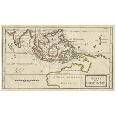
Map of The East Indies with the Route of Capt. William Dampier's Voyage, 1698
Located in Langweer, NL
Antique map titled 'Kaart van Oost Indie'. Old map of the East Indies. It shows the routes of Captain William Dampier's voyage throughout the regio...
Category

Antique 17th Century Collectibles and Curiosities

Materials

Paper

Antique Map of Persia with Dedication Cartouche
Located in Langweer, NL
Antique map titled 'Persia sive Sophorum Regnum'. Original old map of Persia. The map extends from the Eastern Mediteranian to Tacalistan and the Indus River and the Dalanguer Mounta...
Category

Antique 17th Century Collectibles and Curiosities

Materials

Paper

Circa 1691 Frederick de Wit Map: Middle East with Arabia, Persia & More
Located in Langweer, NL
Circa 1691 Frederick de Wit Map: Middle East with Arabia, Persia & More This exquisite hand-colored map, circa 1691, by Frederick de Wit, illustrates the Middle East, spanning from Turkey and Egypt to Afghanistan, with a detailed representation of the Arabian Peninsula. The map's detailing in Arabia is based on Nicolas Sanson's influential 1654 map, which was one of the most accurate and detailed depictions of the region up to the mid-seventeenth century. The decorative title cartouche is richly adorned with images of exotic figures, animals, and a merchant ship, symbolizing the region's historical trade importance. Additionally, a mapmaker is shown working with traditional tools, adding a touch of authenticity to the cartographic art. This is the fourth state of the map, published between 1691 and 1696. The map measures 21.8 inches in width by 18.5 inches in height, featuring a sharp impression, with minimal staining and a carefully repaired centerfold separation at the bottom. Keywords: - Middle East historical map - Frederick de Wit map - 17th century maps - Arabian Peninsula map - Persia (Iran) map - Turkey and Egypt map...
Category

Antique 17th Century Collectibles and Curiosities

Materials

Paper

17th Century Brass Alms Plate
Located in San Francisco, CA
A 17th century or earlier brass alms dish or alms plate.
Category

European Antique 17th Century Collectibles and Curiosities

Materials

Brass

17th Century Polychrome Wooden Niche with Angels and Pilasters
Located in Marbella, ES
17th century Polychrome wooden Niche with Angels and Pilasters.
Category

Spanish Antique 17th Century Collectibles and Curiosities

Materials

Wood

Mapping the Heart of France: Willem Blaeu's 17th Century Île-de-France, ca.1650
Located in Langweer, NL
This original antique map titled "Le Gouvernement de l'Isle de France" represents the Île-de-France region, which historically was one of the provinces of France and contained the ci...
Category

Antique 17th Century Collectibles and Curiosities

Materials

Paper

Antique Map of Greece by Allard (c.1698)
Located in Langweer, NL
Antique map titled 'Hellas seu Graecia Universa' Detailed map of Greece, with Crete, the Aegean Islands, and part of Turkey. With two cartouches, compass rose and scale. Carolus Alla...
Category

Antique 17th Century Collectibles and Curiosities

Materials

Paper

Antique Map of Zeeland, The Netherlands, by Jaillot, 1693
Located in Langweer, NL
Antique map titled 'Le Comte de Zeelande (..).' Detailed map of the province of Zeeland, The Netherlands. Details shown include fortified towns, roads, sandbanks and marshlands. Base...
Category

Antique 17th Century Collectibles and Curiosities

Materials

Paper

Antique Map of Stavoren, Bolsward and Hindeloopen by Merian, c.1650
Located in Langweer, NL
Antique map titled 'Stavera, Bolzvardia, Hindelopia'. Three maps on one sheet depicting Stavoren, Bolsward and Hindeloopen (Friesland, The Netherlands). With German legend. Artists a...
Category

Antique 17th Century Collectibles and Curiosities

Materials

Paper

CROSS OF CARAVACA 17th CENTURY
Located in Madrid, ES
CROSS OF CARAVACA XVII CENTURY BEAUTIFUL CARAVACA CROSS FROM THE 17TH CENTURY IN BRONZE. MEASURES: 12.5X5.5 CM. IN GOOD CONDITION good condition
Category

Italian Gothic Antique 17th Century Collectibles and Curiosities

Materials

Bronze

Description of the city of Delft, by Dirck can Bleyswijck - ILLUSTRATED, 1667
Located in Middletown, NY
A very good copy of Bleyswijck famous description of the history, topography, institutions, and commercial life of Delft in the 17th Century. The plates are exquisite depiction's of ...
Category

Dutch Antique 17th Century Collectibles and Curiosities

Materials

Gold Leaf

Antique Map of North Africa by Ortelius, c.1600
Located in Langweer, NL
Antique map titled 'Barbariae et Biledulgerid nova descriptio'. Old map of coastal North Africa and the Mediterranean. The map extends from Morocco and the Sahara to Libya and sh...
Category

Antique 17th Century Collectibles and Curiosities

Materials

Paper

Antique Map of the North Pole by V.M. Coronelli, circa 1692
Located in Langweer, NL
Globe gore by Vincenzo Maria Coronelli shows the North Pole with the coasts of Canada, Greenland, Scandinavia and Siberia, and is decorated with pictorial scenes of bear, seal and wh...
Category

Antique 17th Century Collectibles and Curiosities

Materials

Paper

Antique Map of Celtic Europe by Cluver, 1678
Located in Langweer, NL
Antique map Europe titled 'Europam sive Celticam Veterem'. Rare map of Celtic Europe. Made after A. Ortelius, originates from 'Introductionis in uni...
Category

Antique 17th Century Collectibles and Curiosities

Materials

Paper

Antique Map of Warwickshire in England by Speed, c.1614
Located in Langweer, NL
Antique map titled 'The Counti of Warwick the Shire Towne and Citie of Coventre described'. Map of Warwickshire, England. Includes inset town plans of Warwic...
Category

Antique 17th Century Collectibles and Curiosities

Materials

Paper

17th Century Old Master Oil Painting Saint Bernard of Clairvaux, Spanish School
Located in Vero Beach, FL
17th century old master oil painting of Saint Bernard of Clairvaux. Spanish school. Dramatic expression and perfect use of chiaroscuro, the art of light and shadow effects, makes th...
Category

Spanish Baroque Antique 17th Century Collectibles and Curiosities

Materials

Canvas

17thC faux marble altar
Located in Livorno, IT
Wooden altar of late 17thC richly decorated. Polychrome faux marble lacquer, embellished with carvings depicting putti with typical aesthetic characteristics of 17th-century Baroque....
Category

Italian Baroque Antique 17th Century Collectibles and Curiosities

Materials

Wood, Hardwood, Walnut

Rare 1681 Map of Batavia: Detailed Dutch Colonial Era Cartography, 1681
Located in Langweer, NL
The map of Batavia (modern-day Jakarta) from 1681, attributed to Frederick de Wit holds significant historical importance for several reasons: Historical Context 1. Colonial Era: This map dates back to the Dutch colonial era when Batavia served as the administrative and commercial hub of the Dutch East India Company (VOC). The VOC was a powerful trading entity that played a crucial role in the global spice trade and colonization in Southeast Asia. 2. Strategic Importance: Batavia was strategically located on the northwestern coast of Java, providing the Dutch with a critical base for their maritime operations. The city became the center of Dutch political and military control in the region. Cartographic Significance 1. Detailed Urban Layout: The map meticulously details the layout of Batavia, including its fortifications, canals, streets, and significant buildings. This level of detail provides insights into the urban planning and architectural styles of the period. 2. Military Engineering: The fortifications shown on the map illustrate the advanced military engineering techniques used by the Dutch to protect their valuable colony. The walls, bastions, and moats indicate the strategic considerations taken to defend against potential invasions. 3. Maritime Activity: The depiction of ships in the harbor highlights Batavia's role as a major maritime center. The VOC's fleets were essential for trade routes connecting Europe, Africa, and Asia, making Batavia a crucial node in global commerce. Artistic and Cultural Value 1. Artistic Elements: The decorative elements, such as the lion holding a shield and the intricate cartouches, reflect the artistic trends of Dutch Golden Age cartography. These embellishments were not only informative but also served to display the cartographer's skill and the map's prestige. 2. Cultural Exchange: Maps like this one provide evidence of cultural exchange between the Dutch and the indigenous populations of Java. The blending of Dutch and local influences can be seen in various aspects of the map and the architecture of the city. Rarity and Preservation 1. Rarity: Maps from the 17th century, especially those in good condition, are relatively rare and highly valued by collectors and historians. Each map provides a unique snapshot of historical geography and urban development. 2. Preservation of History: This map serves as a historical document, preserving knowledge about Batavia's cityscape, infrastructure, and colonial governance. It helps historians and scholars understand the socio-economic and political dynamics of the period. Conclusion The map of Batavia from 1681 is special due to its detailed depiction of one of the most important colonial cities in Southeast Asia during the Dutch Golden Age. It reflects the strategic, economic, and cultural significance of Batavia, serving as a valuable resource for understanding the history of Dutch colonialism and its global impact. The map's artistry and precision make it an important artifact in the history of cartography. --------------- The map is an original and historical map of Batavia (present-day Jakarta) on the island of Java, dated 1681. There are several details to consider when evaluating its origins and possible authorship: 1. **Style and Detail**: The intricate details and style are reminiscent of maps created by Frederick de Wit, a prominent Dutch cartographer and engraver of the 17th century. He was known for his detailed city maps and sea charts. 2. **Lack of Signature**: The absence of "F. de Wit, Excudit" could indicate either an omission or a different engraver. However, it is essential to note that some maps from that period were reproduced or copied by other engravers and cartographers. This was not uncommon, as map-making was a collaborative effort, and copies of popular maps were frequently made. 3. **Map Characteristics**: - The depiction of ships and the detailed fortifications are typical of Dutch cartography in the late 17th century. - The decorative elements, such as the lion holding a shield, are also characteristic of Dutch map engravers. 4. **Other Possible Engravers**: While Frederick de Wit is a strong candidate, other notable Dutch engravers from that period include Joan Blaeu and Willem Janszoon Blaeu. They also produced highly detailed maps and could potentially be the creators or inspirers of this map. To determine the precise authorship, you might consider: - **Comparing** this map with other confirmed works of Frederick de Wit and his contemporaries to identify stylistic similarities and differences. - **Historical Records**: Consulting historical records or publications related to Dutch cartography in the 17th century might provide more context or even direct references to this particular map. If you have access to additional details or higher-resolution images of specific sections, it might help further pinpoint the map's origin and authorship. ------------- Frederick de Wit (1629–1706) was a prominent Dutch cartographer, engraver, and publisher known for his detailed and decorative maps, atlases, and globes. He played a significant role in the Dutch Golden Age of cartography, contributing to the wealth of geographic knowledge and artistic achievement during this period. Here are key aspects of his life and work: ### Biography - **Early Life**: Frederick de Wit was born in Gouda, Netherlands, in 1629. Little is known about his early years, but he moved to Amsterdam, the epicenter of Dutch cartography, in the mid-17th century. - **Career Beginnings**: De Wit began his career as an engraver and publisher, initially producing maps that were reissues of earlier works by other cartographers, such as Joan Blaeu and Willem Janszoon Blaeu. ### Contributions to Cartography - **Mapmaking**: De Wit was known for his meticulous attention to detail and artistic flair. He produced a wide range of maps, including world maps, regional maps, city plans, and maritime charts...
Category

Antique 17th Century Collectibles and Curiosities

Materials

Paper

Caravaggesque Oil on Copper "Flagellation of Christ" Baroque Sicilian, 17th Cent
Located in Milano, IT
Splendid 17th-century Italian painting by unknown artist, but certainly a follower of Caravaggio, relying on style and drawing. The painting has a very beautiful gilded wooden frame, with a subtle greek with spheres and an overlying rectangular frame with sinuous flowers on each corner, very elegant and beautiful. The painting depicts one of the most depicted religious scenes ever, the scourging of Christ, and is entirely done in oil on copper. The scourging of Jesus is an episode narrated in the Gospels (Mk15:15-16; Mt27:26-27; Lk23:16-26; Jn19:1-17[1]). Scourging is a flogging, particularly bloody, by means of sticks, rods or cat-o-nine-tails, the latter instrument consisting, in the Roman typology, of a short stick to which were secured several strings ending in metal claws, leads and bone splinters that caused tremendous lacerations and fractures to the tortured person. Chains are used in this scene, both to immobilize Jesus Christ and to flog him, as we can see in the upper right hand of the scourger. According to some personal research, it turned out that the actual scourging of Christ was mostly depicted at the column, while this Christ is on the ground, so presumably Christ here is scourged during the Way of the Cross at one of those stages where he fell. The painting has a very dark coloring, which is why this painting is believed to faithfully follow Caravaggio's style of dry, authoritarian brushstrokes. The painting shows a figure agonizing on the ground that continues to receive beatings and floggings of all kinds, representing Christ; his face is crucified in a loquacious expression of pain, he turns his eyes to heaven as if to invoke God, but at the same time those same eyes admonish the wickedness and arrogance inherent in humanity. Christ has one hand resting on the ground in the act of holding himself, while the other takes a completely unnatural stance against the barren ground. His body appears hardened to wanting to parry the blows, his legs are curled up on his knees as he takes kicks from the soldier above him. Christ is depicted pinned down from the neck with a very large and strong black iron bolt held by the other soldier. The soldier on the right in the foreground wears a one-shoulder tunic with an orange tunic and blue pants. On his feet he wears gray shoes, at his waist he has a belt with an iron helmet...
Category

Italian Baroque Antique 17th Century Collectibles and Curiosities

Materials

Copper

Read More

Medal-Worthy Memorabilia from Epic Past Olympic Games

Get into the games! These items celebrate the events, athletes, host countries and sporting spirit.

Ahoy! You’ve Never Seen a Collection of Sailor Art and Kitsch Quite Like This

French trendsetter and serial collector Daniel Rozensztroch tells us about his obsession with objects related to seafaring men.

Pamela Shamshiri Shares the Secrets behind Her First-Ever Book and Its Effortlessly Cool Interiors

The sought-after designer worked with the team at Hoffman Creative to produce a monograph that beautifully showcases some of Studio Shamshiri's most inspiring projects.

Moroccan Artworks and Objects Take Center Stage in an Extraordinary Villa in Tangier

Italian writer and collector Umberto Pasti opens the doors to his remarkable cave of wonders in North Africa.

Montecito Has Drawn Royalty and Celebrities, and These Homes Are Proof of Its Allure

Hollywood A-listers, ex-pat aristocrats and art collectors and style setters of all stripes appreciate the allure of the coastal California hamlet — much on our minds after recent winter floods.

Whaam! Blam! Pow! — a New Book on Pop Art Packs a Punch

Publishing house Assouline and writer Julie Belcove have teamed up to trace the history of the genre, from Roy Lichtenstein, Andy Warhol and Yayoi Kusama to Mickalene Thomas and Jeff Koons.

The Sparkling Legacy of Tiffany & Co. Explained, One Jewel at a Time

A gorgeous new book celebrates — and memorializes — the iconic jeweler’s rich heritage.

What Makes a Gem-Encrusted Chess Set Worth $4 Million?

The world’s most opulent chess set, weighing in at 513 carats, is literally fit for a king and queen.
Recently Viewed

View All