17th Century Collectibles and Curiosities

to
806
1,132
152
1,292
91
3
2
1
1
1
4,460
6,705
13,475
2,696
3,503
4,685
3,093
511
300
605
748
484
902
880
906
662
592
1,055
121
116
40
33
353
80
65
54
51
1,292
1,292
1,292
63
12
11
11
6
Period: 17th Century
Antique Map of Silesia centered on Glogau
Located in Langweer, NL
Antique map titled 'Ducatus Silesiae Glogani vera delineatio'. This decorative map shows the Odra River valley based on the Silesian cartographer, Jonas Scultetus. The map is oriente...
Category

Antique 17th Century Collectibles and Curiosities

Materials

Paper

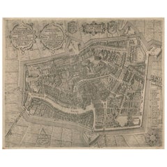
Rare Antique Map of Leeuwarden, Friesland, The Netherlands, by P. Bast, 1603
By P. Bast
Located in Langweer, NL
Very rare plan of Leeuwarden, Friesland, The Netherlands. With several cartouches and coat of arms. With a legend and compass rose at bottom right. Made by 'Pieter Bast' after the su...
Category

Antique 17th Century Collectibles and Curiosities

Materials

Paper

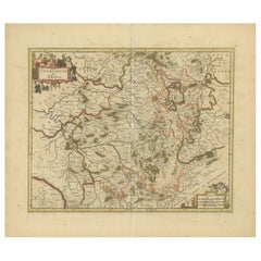
Rare Hand-Colored Map of Champagne and Brie, France, by Frederik De Wit c. 1688
Located in Langweer, NL
Title: Rare Hand-Colored Map of Champagne and Brie by Frederik De Wit c. 1688 Description: This exquisite 17th-century map, "Champagne et Brie," beau...
Category

Antique 17th Century Collectibles and Curiosities

Materials

Paper

Decorative Original Antique Map of Normandy, France
Located in Langweer, NL
Original antique map titled 'Ducato D'Normandie Scala di Miglia d'Italia'. Very decorative map of Normandy, with a fine title cartouche featuring Leda ...
Category

Italian Antique 17th Century Collectibles and Curiosities

Materials

Paper

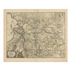
Antique Map of Overijssel by Visscher, c.1652
Located in Langweer, NL
Antique map titled 'Transisalania provincia vulgo Over-yssel'. Original antique map of the province of Overijssel, the Netherlands. Published by N. Visscher after N. ten Have, circa ...
Category

Antique 17th Century Collectibles and Curiosities

Materials

Paper

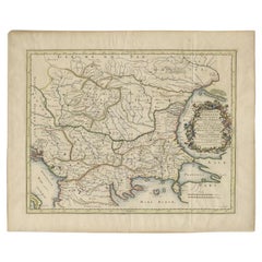
Antique Map of the Region Around the Baltic Sea by Cordier, c.1670
Located in Langweer, NL
Antique map titled 'Illyricum Orientis: In quo Partes II Moesia et Thracia'. Engraved map of the area west of the Baltic Sea, present day Bulgaria, Romania, and Turkey. The map is ba...
Category

Antique 17th Century Collectibles and Curiosities

Materials

Paper

Antique Map of the Region of Hauts-de-France by Hondius, circa 1630
Located in Langweer, NL
Antique map titled 'Description du Gouvernement de la Cappelle'. Old map of the region of Hauts-de-France including the cities of Vervins, Marle, Cappelle and others. This map origin...
Category

Antique 17th Century Collectibles and Curiosities

Materials

Paper

Antique Map of Asia and the East Indies and Korea as a Peninsula, ca.1660
Located in Langweer, NL
Antique map titled 'Asiae nova delineatio'. Decorative map of Asia and the East Indies. The map shows Korea as a peninsula. In China the Great Wall is depicted, as well as a long str...
Category

Antique 17th Century Collectibles and Curiosities

Materials

Paper

Old Engraving of The Catching of Horses on Jafnapatnam, Ceylon 'Sri Lanka', 1672
Located in Langweer, NL
Antique print, titled: 'Paardevangst op Jafnapatnam' - This plate shows the catching of horses on Jafnapatnam. The province of Jaffna , and specially the fort at Jaffnapatnam were th...
Category

Antique 17th Century Collectibles and Curiosities

Materials

Paper

Antique Portrait of Ivan IV The Terrible, 1st Csar of All Russia, 1615
Located in Langweer, NL
Antique portrait titled 'Basilius Magnus (..)'. Portrait of Ivan IV (1530-84, 'the Terrible'). This print originates from 'Tooneel der keyseren ende coningen van christenryck sedert den onderganck van het Griecks keyserdom vervatende hare beeltnissen afcomsten ende voornaemste daden (..)'. Ivan IV Vasilyevich (Russian: ???´? ????´??????; 25 August 1530 – 28 March [O.S. 18 March] 1584),[2] commonly known in English as Ivan the Terrible...
Category

Antique 17th Century Collectibles and Curiosities

Materials

Paper

Map of Zurich and Basel Region by Mercator, Uncolored Engraving c.1600
Located in Langweer, NL
Map of Zurich and Basel Region by Mercator, Uncolored Engraving c.1600 This original uncolored copperplate engraving, titled *Zurichgow et Basiliensis Provincia*, was created by the...
Category

Antique 17th Century Collectibles and Curiosities

Materials

Paper

Antique Map of Madagascar by Mariette 'c.1670'
Located in Langweer, NL
Antique map titled 'Isle Dauphine communement nommée par les Europeens Madagascar, et St. Laurens (..)'. Original large-scale antique map of Madagascar...
Category

Antique 17th Century Collectibles and Curiosities

Materials

Paper

Antique Map of Macedonia by the Famous Mapmaker Blaeu, c.1650
Located in Langweer, NL
Antique map titled 'Macedonia, Epirus et Achaia'. Ornated with a nice allegoric cartouche, one ship and a milage scale. Macedonia is shown in the centre of the map. With many detai...
Category

Antique 17th Century Collectibles and Curiosities

Materials

Paper

Christ On The Cross, Crucifix In Wood And Red Tortoiseshell
Located in Honnelles, WHT
Christ on the cross, Wooden and red tortoiseshell crucifix, silver, Antwerp hallmarks Dimensions of the Christ : 19 x 14,5 cm
Category

European Louis XIII Antique 17th Century Collectibles and Curiosities

Materials

Sterling Silver

Antique Map of Northeastern Spain by Mercator, 1634
Located in Langweer, NL
Antique map titled 'Biscaia, Guipiscoa, Navarra et Asturias de Santillana'. Charming map of Northeastern Spain with the areas of Pamplona and Valladolid. This map originates from 'At...
Category

Antique 17th Century Collectibles and Curiosities

Materials

Paper

Rare Print of the Siege of Doornik Between the English and French Armies, c.1680
Located in Langweer, NL
Antique print of the Siege of Doornik (Tournai) in 1581, during the Eighty Years' War. This print most likely originates from an edition of 'Histoire de la guerre de Flandre' by F. S...
Category

Antique 17th Century Collectibles and Curiosities

Materials

Paper

Antique Map of Bavaria, Bayern, with original Hand Coloring
Located in Langweer, NL
Antique map titled 'Bavariae Circulus atq Electoratus tam cum Adiacentibus quam insertis Regionibus'. Original old map of Bavaria, Bayern, Germany. The map stretches south to Innsbru...
Category

Antique 17th Century Collectibles and Curiosities

Materials

Paper

Antique Map of the Islands Near Batavia, Capital of the Dutch East Indies, 1682
Located in Langweer, NL
Antique map titled 'Caerte van de Eylanden voor Batavia.' Map of the islands near Batavia, Indonesia. With scale, compass rose, cartouche and ships on the sea. Sheet with engraving...
Category

Antique 17th Century Collectibles and Curiosities

Materials

Paper

Antique Map of Bavaria with many details, Germany
Located in Langweer, NL
Antique map titled 'Bavariae Circulus atq Electoratus tam cum Adiacentibus quam insertis Regionibus (..)'. Dutch map of Bavaria, showing the many cities, towns, and other features of...
Category

Antique 17th Century Collectibles and Curiosities

Materials

Paper

1654 Nicolas Sanson Map of Southern India and Southeast Asia
Located in Langweer, NL
1654 Nicolas Sanson Map of Southern India and Southeast Asia - Partie Meridionale de L'Inde This 1654 map by Nicolas Sanson, titled "Partie Meridionale de L'Inde en deux Presqu'Is...
Category

Antique 17th Century Collectibles and Curiosities

Materials

Paper

Antique Map of the Dutch Province of Gelderland with Zutphen as Capital, C.1650
Located in Langweer, NL
Antique map titled 'Ducatus Gelriae pars Tertia quae est comitatus Zutphaniensis'. Old map of the province of Gelderland, the Netherlands. The city of Zutphen can be found in the mid...
Category

Antique 17th Century Collectibles and Curiosities

Materials

Paper

Shakespeare. The London Prodigal - FOURTH FOLIO - 1685 - page 217-218
Located in Hillsborough, NJ
AUTHOR: SHAKESPEARE, William. TITLE: The Works of William Shakespeare. (The London Prodigal) - page 217-218. PUBLISHER: London: Printed for H. Herringman, E. Brewster and R. Bentley, 1685. DESCRIPTION: THE FOURTH FOLIO. 217-218p., correctly-incorrectly numbered, 1 leaf extracted from the fourth folio, 13-3/4" x 9", good margins. CONDITION: A VERY GOOD leaf...
Category

British Antique 17th Century Collectibles and Curiosities

Materials

Paper

Antique Lithography Map, Oxfordshire, English, Framed Cartography, Robert Morden
Located in Hele, Devon, GB
This is an antique lithography map of Oxfordshire. An English, framed atlas engraving of cartographic interest by Robert Morden, dating to the late 17th century and later. Superb l...
Category

British William and Mary Antique 17th Century Collectibles and Curiosities

Materials

Paper

Antique Map of the Spice Islands 'Moluccas', Indonesia by W. Blaeu, circa 1640
Located in Langweer, NL
Antique map titled 'Moluccae Insulae Celeberrimae'. Highly decorative antique map of the Spice Islands (Moluccas) published by W. Blaeu (circa 1640). This map features a large inset ...
Category

Antique 17th Century Collectibles and Curiosities

Materials

Paper

Antique Map of the City of Rotterdam by Guicciardini, C.1600
Located in Langweer, NL
Antique map titled 'Rotterdam'. Bird's eye view plan of Rotterdam in the province of Zuid-Holland, The Netherlands, Holland. This map originates from one of the editions of 'Discritt...
Category

Antique 17th Century Collectibles and Curiosities

Materials

Paper

Early Woodcut Map of the Rhine River Region in Germany and Holland, circa 1628
Located in Langweer, NL
Early Woodcut Map of the Rhine River Region, "Die Dritte Tafel des Rheinstroms," ca. 16th Century This early woodcut map, titled "Die Dritte Tafel des Rheinstroms Innhaltend das Nid...
Category

Antique 17th Century Collectibles and Curiosities

Materials

Paper

17th Century English Carved Oak Corbel “the Green Man”
Located in Vero Beach, FL
17th Century English carved oak corbel “The Green Man”. Rare antique decorative architectural ornament of the enigmatic Green Man. Images and carvings ca...
Category

English Renaissance Antique 17th Century Collectibles and Curiosities

Materials

Oak

COTTON, Charles, The Wonders of The Peake, 1681, FIRST EDITION
Located in Hillsborough, NJ
AUTHOR: COTTON, Charles. TITLE: The Wonders of The Peake. PUBLISHER: London: for Joanna Brome, 1681. DESCRIPTION: FIRST EDITION. 1 vol., 6-7/8" x 4-1/2", [ii]86pp., complete, bound in contemporary full speckled calf, covers ruled in blind. CONDITION: Internally clean and bright, inner and outer hinges fine, head and foot of spine rubbed with some minor loss, overall VERY GOOD. ADDITIONAL INFORMATION: The dedicatee is Elizabeth, Duchess of Devonshire. Written in heroic couplets, this work by Cotton was one of the first landscape poems of a movement which only became significant under Queen Anne. Charles Cotton published this satirical poem just five years after Thomas Hobbes' own "Wonders of the Peak" poem was translated into English. Cotton's poem recalls a visit to the 'Devil's Arse', nowadays known as Peak Cavern, in Castleton. Cotton is also known for contributing a treatise on fly fishing for trout in the second edition of Izaak Walton's famous book, "The Compleat Angler".
Category

British Antique 17th Century Collectibles and Curiosities

Materials

Leather

Map of Styria by William Blaeu, 1645: A Masterpiece of 17th-Century Cartography
Located in Langweer, NL
This 1645 map, created by Willem Janszoon Blaeu, represents Styria (Steyrmark), a historical region in present-day Austria, located in the Alpine regions. Blaeu, one of the most sign...
Category

Antique 17th Century Collectibles and Curiosities

Materials

Paper

1752 Vaugoundy Map of Flanders : Belgium, France, and the Netherlands, Ric.a002
Located in Norton, MA
Large Vaugoundy Map of Flanders: Belgium, France, and the Netherlands Colored -1752 Ric.a002 Description: This is a 1752 Didier Robert de Vaugondy map of Flanders. The map de...
Category

Unknown Antique 17th Century Collectibles and Curiosities

Materials

Paper

Large Rhine River Map, Moselle and Meuse, by Willem Blaeu, Hand-coloured - 1640
Located in Langweer, NL
Rhine River & Tributaries Antique Map by Willem Blaeu, c.1640 This spectacular mid-seventeenth-century copper-engraved map, titled in Latin “Rhenus Fluvio...
Category

Dutch Antique 17th Century Collectibles and Curiosities

Materials

Paper

Woodcut Map of the Rhine River Region Covering the Palatinate, Austria and Elsa
Located in Langweer, NL
Early Woodcut Map of the Rhine River Region Covering the Palatinate, Austria, and Elsass, ca. 1628 This early woodcut map, titled "Die ander Tafel des Rheinstromes/begriffen die Pfa...
Category

Antique 17th Century Collectibles and Curiosities

Materials

Paper

Antique Print of a Funeral on Ceylon 'Sri Lanka' is Asia, 1672
Located in Langweer, NL
Untitled print of the death of the prince heir, and his burial. Two prints, one with a long burial train including numerous horses, carrying the coffin, covered with cloth. The other...
Category

Antique 17th Century Collectibles and Curiosities

Materials

Paper

Antique Map of the City of Grave by Blaeu, 1649
Located in Langweer, NL
Antique map titled 'Grave'. Original antique map of the city of Grave, the Netherlands. Published by J. Blaeu, 1649. Artists and Engravers: Joan Blaeu (23 September 1596 - 28 May...
Category

Antique 17th Century Collectibles and Curiosities

Materials

Paper

Antique Map of Thracia ‘Greece’ by J. Janssonius, circa 1650
Located in Langweer, NL
This antique map of Thracia is engraved and published by J. Janssonius after the cartographical sources by Abraham Ortelius. Ornated in the upper left corner with a title cartouche a...
Category

Antique 17th Century Collectibles and Curiosities

Materials

Paper

Antique Map of the German Empire with decorative Title Cartouche
Located in Langweer, NL
Antique map titled 'Germania, Non ea tantum quae Rheno, Vistula, Danubio, mariqz Germanico Veteribus claudebatur; Sed tota illa continens quae hodie communiter Germanica lingua utitu...
Category

Antique 17th Century Collectibles and Curiosities

Materials

Paper

1606 Hand-Colored Woodcut Map of Sumatra from Ramusio’s Delle Navigationi
Located in Langweer, NL
This is a fascinating woodcut map titled *Taprobana*, depicting the island of Sumatra, hand-colored, and published in Venice in 1606. The map originates from Giovanni Battista Ramusi...
Category

Antique 17th Century Collectibles and Curiosities

Materials

Paper

Territorium Norimbergense - Antique Map of Nürnberg by Janssonius (1645-58)
Located in Langweer, NL
This is an antique map of Nürnberg, titled "Territorium Norimbergense," created by Johannes Janssonius and published between 1645 and 1658. It is a copperplate engraving printed on p...
Category

Antique 17th Century Collectibles and Curiosities

Materials

Paper

Rare 17th Century Baroque Cabinet, South Germany Probably Augsburg, Wunderkammer
Located in Worpswede / Bremen, DE
A small architectural table cabinet, veneered in walnut and mulberry, the centre doors enclosing an arrangement of nine various sized drawers with bone knobs, behind a central door a...
Category

German Baroque Antique 17th Century Collectibles and Curiosities

Materials

Brass

Original Antique Engraving of the Eastern Hemisphere, c.1700
Located in Langweer, NL
Antique map titled 'Proiectio Optica Aequinoctia lis Hemishaerii Orientalis' - Map of the Eastern Hemisphere with Africa, Europe, Asia and Nova Hollandia...
Category

Antique 17th Century Collectibles and Curiosities

Materials

Paper

Beautiful Original Copper Engraved Map of Lake Geneva in Switzerland, 1613
Located in Langweer, NL
Description: Antique map titled 'Lacus Lemanus'. Old map of Lake Geneva with good detail of surrounding towns and villages. Decorated with a large compass rose with two sailing boats and a sea monster in the lake. Originates from 'Atlas Minor'. Artists and Engravers: Henricus Hondius...
Category

Antique 17th Century Collectibles and Curiosities

Materials

Paper

Devotional plaque, Saint Anthony of Padua. Bronze. Spanish School, 17th century.
Located in Madrid, ES
Devotional plaque, Saint Anthony of Padua. Bronze. Spanish School, 17th century. Oval-shaped devotional plaque made of bronze with a ring at the top, a molded frame with an interior...
Category

Spanish Baroque Antique 17th Century Collectibles and Curiosities

Materials

Bronze

Original Hand-Colored Antique Map of Ancient Germany, circa 1630
Located in Langweer, NL
Antique map titled 'Germaniae Veteris typus'. Very attractive map of ancient Germany. Published by G. Blaeu after A. Ortelius, circa 1630. Willem Jans...
Category

Antique 17th Century Collectibles and Curiosities

Materials

Paper

Original Antique Map of the English counties Cornwall, Devon, Dorset, etc, 1633
Located in Langweer, NL
Antique map titled 'Cornubia, Devonia, Somersetus, Dorcestria, Wiltonia, Glocestria, Monumetha, Glamorgan, Caermarden, Penbrok, Cardigan, Radnor, Breknoke et Herfordia'. Old map of the English counties of Cornwall, Devon, Somerset, Dorset, Wiltshire, Gloucestershire, Herefordshire, Worcestershire etc. Originates from the 1633 German edition of the Mercator-Hondius Atlas Major, published by Henricus Hondius and Jan Jansson under the title: 'Atlas: das ist Abbildung der gantzen Welt, mit allen darin begriffenen Laendern und Provintzen: sonderlich von Teutschland, Franckreich, Niderland, Ost und West Indien: mit Beschreibung der selben.' Artists and Engravers: Gerard Mercator (1512 - 1594) originally a student of philosophy was one of the most renowned cosmographers and geographers of the 16th century, as well as an accomplished scientific instrument maker. He is most famous for introducing Mercators Projection, a system which allowed navigators to plot the same constant compass bearing on a flat...
Category

Antique 17th Century Collectibles and Curiosities

Materials

Paper

Antique Map of Modern Day Ukraine and Russia Titled Moscovie 'Moscow', Ca.1683
Located in Langweer, NL
Antique map of modern day Ukraine and Russia titled ‚Moscovie‘. Miniature map of the Moscovia region by A.M. Mallet. Artists and Engravers: Alain Manneson Mallet (1630-1706) spent...
Category

Antique 17th Century Collectibles and Curiosities

Materials

Paper

Bishopric of Hildesheim Map in Northern Germany by Willem & Joan Blaeu, 1645
Located in Langweer, NL
This beautifully hand-colored map, titled "Episcopatus Hildesiensis Descriptio Novissima," depicts the Bishopric of Hildesheim, a historical ecclesiastical territory in present-day L...
Category

Antique 17th Century Collectibles and Curiosities

Materials

Paper

1636 Jansson Map of Ireland Entitled "Comitatus Lageniae, " Ric.a007
Located in Norton, MA
1646 Jansson map entitled "Procinvia connactiae," Ric.a006 Description: The PROVINCE of CONNAVGT 490 x 380From vol 4 of Jansson's Atlas Novus 1646, published in Amsterdam with...
Category

Unknown Antique 17th Century Collectibles and Curiosities

Materials

Paper

17th Century Topographical Map, French Champagne Region, Epernay, Iohan Peeters
Located in New York, NY
Fine topographical 17th century map by Iohan Peeters of the towns of Epernay and Lametz in the Champagne Region of North Eastern France. Fabulous period engraving for a Wine Cellar,...
Category

Dutch Antique 17th Century Collectibles and Curiosities

Materials

Paper

Original Very Old Hand-Colored Map of Limousin or Limoges, France, ca.1600
Located in Langweer, NL
Antique map titled 'Totius Lemovici et Confinium (..).' - A handsome and detailed map of Limousin/Limoges, prepared by the well-known engraver, Petrus Kaerius. With an insert view ...
Category

Antique 17th Century Collectibles and Curiosities

Materials

Paper

Old Map Focusing on the Wine Region of Metz, the Moselle Region of France, 1657
Located in Langweer, NL
Antique map of France titled 'Territorium Metense'. Old map focusing on the wine region surrounding Metz, in the Moselle region of France. This map originates from 'Atlas Novus, ...
Category

Antique 17th Century Collectibles and Curiosities

Materials

Paper

Beautiful Antique Map of the Moluccas or Spice Islands, Indonesia, ca.1650
Located in Langweer, NL
Antique map titled 'Insularum Moluccarum Nova Descriptio.' Beautiful map of the Moluccas. The famous Spice Islands, the cornerstone of the Dutc...
Category

Antique 17th Century Collectibles and Curiosities

Materials

Paper

Original Antique Map of the City of Stavoren, Friesland, The Netherlands, 1649
Located in Langweer, NL
Antique map titled 'Staveren'. Original antique map of the city of Stavoren, Friesland, The Netherlands. This map originates from 'Toonneel der Steden van de Vereenighde Nederlanden'...
Category

Antique 17th Century Collectibles and Curiosities

Materials

Paper

Detailed Map of Southern Holland, Incl the Hague, Rotterdam, Delft, Gouda, c1680
Located in Langweer, NL
Antique map titled 'Delflandia, Schielandia et circumjacentes Insulae ut Voorna, Overflackea, Goerea, Yselmonda et aliae.' Detailed map of Southern Holland, which includes the ci...
Category

Antique 17th Century Collectibles and Curiosities

Materials

Paper

Original Antique Map of the Road from London to Bensington
Located in Langweer, NL
Antique map titled 'The Road from London to St. Davids in com: Pembroke (..)'. A strip map of the road from London to Bensington. The map is ornamented with numerous compass roses, a...
Category

Antique 17th Century Collectibles and Curiosities

Materials

Paper

Detailed Antique Map of Southeast England, incl Warwickshire and Hampshire, 1690
Located in Langweer, NL
Antique map titled 'Orientalior districtus Regni Angliae (..)'. Detailed map of southeast England encompassing the country from Lincolnshire and the Wash south and including Warw...
Category

Antique 17th Century Collectibles and Curiosities

Materials

Paper

Dutch City Plan of Workum in Friesland by N. Van Geelkercken, hand-colored 1616
Located in Langweer, NL
Workum in Friesland by Nicolaes van Geelkercken, hand-colored map ca. 1616 This beautifully hand-colored engraving titled 'Worcum' presents an early 17th-century bird’s-eye view of ...
Category

Dutch Antique 17th Century Collectibles and Curiosities

Materials

Paper

Antique Map of Lower Silesia of The Famous Mapmaker Blaeu, c.1650
Located in Langweer, NL
Antique map titled 'Ducatus Silesiae Wolanus'. \ Antique map depicting lower Silesia with the cities of Wolow (Wohlau), Winsko (Winzig), Herrnstadt, Chobie (Koben), Lubin (Lüben), R...
Category

Antique 17th Century Collectibles and Curiosities

Materials

Paper

Battle of Wimpfen, 1622: Engraving by Matthäus Merian (ca. 1645)
Located in Langweer, NL
Title: Battle of Wimpfen, 1622: Engraving by Matthäus Merian (ca. 1645) Description: This antique copper engraving, created by the renowned Swiss-German engraver Matthäus Merian aro...
Category

Antique 17th Century Collectibles and Curiosities

Materials

Paper

Antique Map of the City of Emden by Blaeu, 1649
Located in Langweer, NL
Antique map titled 'Emda'. Old map of the city of Emden, Germany. This map originates from 'Novum Ac Magnum Theatrum Urbium Belgicæ Liberæ ac Foederatæ' by J. Blaeu. Artists and Engr...
Category

Antique 17th Century Collectibles and Curiosities

Materials

Paper

Antique Uncommon Map of Bohemia, Moravia and Silesia, 1699
Located in Langweer, NL
Antique map titled 'B. V. Boleslaviensis in Bohemia, Moravia et Silesia (..).' Detailed uncommon map of the Bohemia, Moravia and Silesia. Source unknown, to be determined. Artists...
Category

Antique 17th Century Collectibles and Curiosities

Materials

Paper

Read More

Medal-Worthy Memorabilia from Epic Past Olympic Games

Get into the games! These items celebrate the events, athletes, host countries and sporting spirit.

Ahoy! You’ve Never Seen a Collection of Sailor Art and Kitsch Quite Like This

French trendsetter and serial collector Daniel Rozensztroch tells us about his obsession with objects related to seafaring men.

Pamela Shamshiri Shares the Secrets behind Her First-Ever Book and Its Effortlessly Cool Interiors

The sought-after designer worked with the team at Hoffman Creative to produce a monograph that beautifully showcases some of Studio Shamshiri's most inspiring projects.

Moroccan Artworks and Objects Take Center Stage in an Extraordinary Villa in Tangier

Italian writer and collector Umberto Pasti opens the doors to his remarkable cave of wonders in North Africa.

Montecito Has Drawn Royalty and Celebrities, and These Homes Are Proof of Its Allure

Hollywood A-listers, ex-pat aristocrats and art collectors and style setters of all stripes appreciate the allure of the coastal California hamlet — much on our minds after recent winter floods.

Whaam! Blam! Pow! — a New Book on Pop Art Packs a Punch

Publishing house Assouline and writer Julie Belcove have teamed up to trace the history of the genre, from Roy Lichtenstein, Andy Warhol and Yayoi Kusama to Mickalene Thomas and Jeff Koons.

The Sparkling Legacy of Tiffany & Co. Explained, One Jewel at a Time

A gorgeous new book celebrates — and memorializes — the iconic jeweler’s rich heritage.

What Makes a Gem-Encrusted Chess Set Worth $4 Million?

The world’s most opulent chess set, weighing in at 513 carats, is literally fit for a king and queen.
Recently Viewed

View All