17th Century Collectibles and Curiosities

to
819
1,096
150
1,254
85
3
1
1
1
4,372
6,576
13,270
2,710
3,496
4,589
3,008
518
314
589
736
463
893
863
890
653
566
1,029
119
110
35
29
297
61
54
48
43
1,254
1,254
1,254
63
12
11
11
6
Period: 17th Century
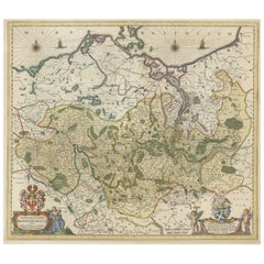
Antique Map of the Duchy of Lüneburg, Lower Saxony, Germany
Located in Langweer, NL
Antique map titled 'Ducatus Luneburgensis (..)'. Map of the Duchy of Lüneburg in Lower Saxony, Germany. Published by J. Janssonius, circa 1664. Jan Janssonius (also known as Johann ...
Category

Antique 17th Century Collectibles and Curiosities

Materials

Paper

Antique Map Of Brabantia Ducantus By Bleau Circa 1640
Located in Brussels, Brussels
map of theBrabantia Ducantus (Belgium) circa 1640 by Bléau. Bléau was well known for antique atlas that he draw during the 17 century beautiful map, double page folded in the middle,...
Category

French Renaissance Antique 17th Century Collectibles and Curiosities

Materials

Paper

Map of Languedoc-Roussillon and Provence in France and Piedmont in Italy, c1680
Located in Langweer, NL
Title: Antique map titled 'La basse Partie du Gouvernement de Languedoc, environne des Frontiers des Gouverns de Provence, de Dauphine de Lyonnais et de Guienne et Gascogne ; Les Fro...
Category

Antique 17th Century Collectibles and Curiosities

Materials

Paper

Historic 1690 Map of Lorraine in France by Allard - Cities of Toul, Nancy, Metz
Located in Langweer, NL
Exactissima Lotharingia - A Rare 17th Century Map of Lorraine by Carel Allard This fascinating map of Lorraine, created by Carel Allard around 1690, is a stunning example of coppe...
Category

Antique 17th Century Collectibles and Curiosities

Materials

Paper

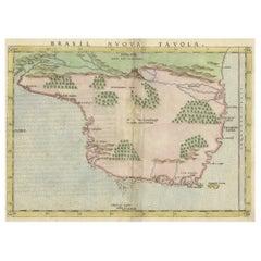
Original Antique Map of Brasil, Published in the 16th Century, 1561
Located in Langweer, NL
This important Ruscelli map of Brazil, from his work La Geografia di Claudio Tolomeo Alessandrino, is one of the earliest obtainable modern maps of the re...
Category

Antique 17th Century Collectibles and Curiosities

Materials

Paper

Antique Bird's-Eye Plan of Tutecoryn (Tuticorin or Thoothukudi), India, 1672
Located in Langweer, NL
Antique map, titled: 'Tutecoryn.' Bird's-eye plan of map of Tutecoryn (Tuticorin or Thoothukudi), India. This map originates from 'Naauwkeurige Beschryvinge van Malabar en Choroman...
Category

Antique 17th Century Collectibles and Curiosities

Materials

Paper

Old Print of Standia, a Greek Island 'Heraklion, Crete, Greece, Balkans', 1688
Located in Langweer, NL
Antique print Greece titled 'Het Eilant Standia'. Old print of the island Standia, near Crete, Greece. This print originates from 'Nauwkeurige Bes...
Category

Antique 17th Century Collectibles and Curiosities

Materials

Paper

Antique Map of the Region of Sarlat in France by Janssonius, 1657
Located in Langweer, NL
Antique map of France titled 'Le Diocese de Sarlat dioccesis Sarlatensis'. Decorative map of the Sarlat region, part of the Dordogne department. This map originates from 'Atlas Novus...
Category

Antique 17th Century Collectibles and Curiosities

Materials

Paper

Small Original Antique Map of the Lower Alsace region, Germany
Located in Langweer, NL
Antique map titled 'Alsatia Inferior'. Small original antique map of the Lower Alsace region, Germany. This map originates from 'Atlas minor Gerardi Mercatoris a I. Hondio plurimis a...
Category

Antique 17th Century Collectibles and Curiosities

Materials

Paper

Antique Map of Chili by Montanus, circa 1671
Located in Langweer, NL
Antique map titled 'Chili'. A very attractive map covering the known coastal region of Chile. The Andes are shown prominently, with two live volcanoes in the vicinity of Villarrica. ...
Category

Antique 17th Century Collectibles and Curiosities

Materials

Paper

Antique Map of the Island Java, Indonesia, c.1650
Located in Langweer, NL
Antique map titled 'Insulae Iavae cum parte insularum Boreno Sumatrae (..)'. Beautiful map of the island of Java and part of Borneo, Bali, Madura and Sumatra. With decorative carto...
Category

Antique 17th Century Collectibles and Curiosities

Materials

Paper

Antique Map of Modern Day Ukraine and Russia Titled Moscovie 'Moscow', Ca.1683
Located in Langweer, NL
Antique map of modern day Ukraine and Russia titled ‚Moscovie‘. Miniature map of the Moscovia region by A.M. Mallet. Artists and Engravers: Alain Manneson Mallet (1630-1706) spent...
Category

Antique 17th Century Collectibles and Curiosities

Materials

Paper

Antique Map of Asia Minor, showing Turkey, Cyprus and the Islands in the Aegean
Located in Langweer, NL
Antique map titled 'Natolia, quae olim Asia Minor'. Decorative map of Asia Minor, showing Turkey, Cyprus and the Islands in the Aegean. This attractive map shows all of Turkey, Cyprus and the Aegean Islands to a relatively high degree of accuracy. At the time the entire region was under the rule of the Ottoman Empire (Cyprus was conquered in 1571 from the Venetians). A maritime battle...
Category

Antique 17th Century Collectibles and Curiosities

Materials

Paper

Antique Miniature Map of Java by Bertius/Hondius '1618'
Located in Langweer, NL
Rare antique miniature map titled 'Iava Maior'. This map shows the northern coastline of Java (Indonesia) with numerous place names, but the southern coa...
Category

Antique 17th Century Collectibles and Curiosities

Materials

Paper

Antique Map of the City of Verdun by Merian, c.1650
Located in Langweer, NL
Antique map titled 'Verdun'. Orginal antique map of Verdun, a small city in the Meuse department in Grand Est in northeastern France. This map originates from 'Topographia Germaniae'...
Category

Antique 17th Century Collectibles and Curiosities

Materials

Paper

Antique Map of the Region of Touraine by Janssonius 'circa 1650'
Located in Langweer, NL
Antique map of France titled 'Touraine - Turonensis Ducatus'. Decorative map of the Touraine region, France. It shows the cities of Tours, Amboise and others. Published by J. Jansson...
Category

Antique 17th Century Collectibles and Curiosities

Materials

Paper

Antique Map of Northern Switzerland by Janssonius '1657'
Located in Langweer, NL
Antique map 'Zurichgow et Basiliensis provincia'. Detailed map of northern Switzerland, including Zurich and Basel. This map originates from 'Atlas Novus, Sive Theatrum Orbis Orbis T...
Category

Antique 17th Century Collectibles and Curiosities

Materials

Paper

Antique Map of France by Janssonius, c.1650
Located in Langweer, NL
Antique map titled 'Gallia Vetus'. Beautiful map of France based on Caesar's De Bello Gallico. In the columns to the left and right important tribes and people are described. Art...
Category

Antique 17th Century Collectibles and Curiosities

Materials

Paper

Antique Map of Epirus 'Albania, Greece' by J. Janssonius, circa 1650
Located in Langweer, NL
This map covers the northwestern coast of Greece and part of present-day Albania. The map was drawn by Johannes Wilhelm Laurenberg, a mathematician and historian who produced several...
Category

Antique 17th Century Collectibles and Curiosities

Materials

Paper

Antique Map of the Rhineland and Alsace Region with Original Hand Coloring
Located in Langweer, NL
Antique map titled 'Palitinat du Rhein, Alsace, et partie de Souabe de Franconie (..)'. Double-page engraved map of the Rhineland and Alsace with original/contemporary hand coloring....
Category

Antique 17th Century Collectibles and Curiosities

Materials

Paper

Antique Map of Germany of German in Roman Times, c.1660
Located in Langweer, NL
Antique map Germany titled 'Germaniae Veteris Typus'. Antique map probably by Blaeu or based on an earlier state by W. Blaeu. Minor differences shown in the cartouches. Top left ha...
Category

Antique 17th Century Collectibles and Curiosities

Materials

Paper

Antique Map of Africa Made after Hondius, circa 1655
Located in Langweer, NL
Antique map titled 'Africa Nova Tabula Auct Jud. Hondio'. Beautiful and rare paneled map of Africa, Based Upon Hondius' map. The first derivative of the map was issued separately by ...
Category

Antique 17th Century Collectibles and Curiosities

Materials

Paper

Antique Map of Northern Germany, showing the area of Mecklenburg-Vorpommern
Located in Langweer, NL
Antique map titled 'Meklenburg Ducatus'. Attractive map of northern Germany, showing the area of Mecklenburg-Vorpommern. Published by J. Janssonius, circa 1630. Jan Janssonius (als...
Category

Antique 17th Century Collectibles and Curiosities

Materials

Paper

Decorative Antique Map of the Berry Region, France, 1657
Located in Langweer, NL
Antique map of France titled 'Bituricum Ducatus - Duche de Berri'. Decorative map of the Berry region, France. Berry is a region located in the center of France. It was a provinc...
Category

Antique 17th Century Collectibles and Curiosities

Materials

Paper

Original Antique Map of the English counties Cornwall, Devon, Dorset, etc, 1633
Located in Langweer, NL
Antique map titled 'Cornubia, Devonia, Somersetus, Dorcestria, Wiltonia, Glocestria, Monumetha, Glamorgan, Caermarden, Penbrok, Cardigan, Radnor, Breknoke et Herfordia'. Old map of the English counties of Cornwall, Devon, Somerset, Dorset, Wiltshire, Gloucestershire, Herefordshire, Worcestershire etc. Originates from the 1633 German edition of the Mercator-Hondius Atlas Major, published by Henricus Hondius and Jan Jansson under the title: 'Atlas: das ist Abbildung der gantzen Welt, mit allen darin begriffenen Laendern und Provintzen: sonderlich von Teutschland, Franckreich, Niderland, Ost und West Indien: mit Beschreibung der selben.' Artists and Engravers: Gerard Mercator (1512 - 1594) originally a student of philosophy was one of the most renowned cosmographers and geographers of the 16th century, as well as an accomplished scientific instrument maker. He is most famous for introducing Mercators Projection, a system which allowed navigators to plot the same constant compass bearing on a flat...
Category

Antique 17th Century Collectibles and Curiosities

Materials

Paper

Antique Map of the Northwestern Coast of Spain
Located in Langweer, NL
Antique map titled 'Gallaecia Regnum'. Original old map of the northwestern coast of Spain, extending from the Asturias de Oviedo region and Aviles in the Northeast to Bayona and the...
Category

Antique 17th Century Collectibles and Curiosities

Materials

Paper

Original Antique Map of the Road from London to Bensington
Located in Langweer, NL
Antique map titled 'The Road from London to St. Davids in com: Pembroke (..)'. A strip map of the road from London to Bensington. The map is ornamented with numerous compass roses, a...
Category

Antique 17th Century Collectibles and Curiosities

Materials

Paper

Antique Map of the Holy Land Described in the Old and New Testament, ca.1660
Located in Langweer, NL
Antique map titled 'Geographiae Sacrae ex Veteri et Novo Testamento Desumptae Tabula Prima quae Totius Orbis Partes Continet.' Map of the lands described in the Old and New Testame...
Category

Antique 17th Century Collectibles and Curiosities

Materials

Paper

Rare Antique Print of A Cupid being Eaten by A Crocodile, ca. 1608
Located in Langweer, NL
Antique print of Cupid and a crocodile. This print originates from 'Amorum Emblemata', this work includes engravings of Cupids encountering the various trials of Love. The emblematic illustrations include verses in Latin, Dutch and French. The verse of this print would translate to 'Love is the opposite of a crocodile. They say the crocodile has such a nature, that he cries when he is killing and devouring men. But Amor has an opposite nature, for he laughs when he makes lovers perish'. Artists and Engravers: Otto van Veen...
Category

Antique 17th Century Collectibles and Curiosities

Materials

Paper

Old Map of the Dutch Provinces of Friesland and Groningen, The Netherlands, 1604
Located in Langweer, NL
Antique print, titled: 'Frisiae Occidentalis.' Handsome map of the Dutch Provinces of Friesland and Groningen. Embellished with strapwork title-car...
Category

Antique 17th Century Collectibles and Curiosities

Materials

Paper

Cartographic Elegance of Touraine: A 17th-Century Map Showing French Heritage
Located in Langweer, NL
"Ducatus Turonensis - Touraine," is a original antique historical map of the Touraine region, which is located in the heart of France, centered...
Category

Antique 17th Century Collectibles and Curiosities

Materials

Paper

Antique Map of the Franconia Region by Scherer, 1699
Located in Langweer, NL
Antique map titled 'Franconia multa numerat loca deiparae sacra in quibus magna recipit à dei matre beneficia.' Detailed uncommon map of the Franconia region in Germany. Source unkno...
Category

Antique 17th Century Collectibles and Curiosities

Materials

Paper

Calvary XVIIth Century, Religious
Located in Madrid, ES
Calvary XVIIth century, religious 17th Century Calvary, religious Ancient Calvary from the 17th century carved in boxwood Boxwood is characterized by its hardness and difficult pruning. It has traces of polychromy and gold. Measure: 65x45...
Category

European Classical Roman Antique 17th Century Collectibles and Curiosities

Materials

Fruitwood

Antique Map of Germany and Central Europe
Located in Langweer, NL
Antique map titled 'S. Imperium Romano-Germanicum oder Teutschland mit seinen angrantzenden Königreichen und Provincien'. Original antique map of Germany...
Category

Antique 17th Century Collectibles and Curiosities

Materials

Paper

Old Map Showing Info Related to the Ottoman Wars including Conflict Dates, c1690
Located in Langweer, NL
"Corso del Danubio da Vienna Sui a Vicopoli, e Paesi Adiacenti - Northwestern Sheet", Coronelli, Vincenzo Maria Subject: Central Europe, Danube River Period: 1690 (circa) Publicatio...
Category

Antique 17th Century Collectibles and Curiosities

Materials

Paper

Secreet-Boeck, by Abraham Canin, Dordrecht, 1601
Located in Delft, NL
Secreet-Boeck, by Abraham Canin, Dordrecht, 1601 Titel: Secreet-Boeck, Waer in vele diversche secreten ende heerlicke consten in veelderleye verscheyden materien, seker Latijnsche,...
Category

Dutch Antique 17th Century Collectibles and Curiosities

Materials

Paper

Original Antique Map of Turkey, Asia Minor and Cyprus
Located in Langweer, NL
Antique map titled 'Natoliae sive Asia Minor'. Original old map of Turkey, Asia Minor and Cyprus. Includes a decorative cartouches, sailing ship, sea mon...
Category

Antique 17th Century Collectibles and Curiosities

Materials

Paper

17th Century Topographical Map, French Champagne Region, Epernay, Iohan Peeters
Located in New York, NY
Fine topographical 17th century map by Iohan Peeters of the towns of Epernay and Lametz in the Champagne Region of North Eastern France. Fabulous period engraving for a Wine Cellar,...
Category

Dutch Antique 17th Century Collectibles and Curiosities

Materials

Paper

Antique Map of the City of Zutphen by Guicciardini, 1613
Located in Langweer, NL
Antique map Zutphen titled 'Zutphen'. This map depicts the city of Zutphen, Gelderland, The Netherlands. Originates from 'Discrittione di tutti i Paesi Bassi'. Artists and Engrav...
Category

Antique 17th Century Collectibles and Curiosities

Materials

Paper

Loudun and Mirebeau: A Cartographic Masterpiece of 17th Century France by Blaeu
Located in Langweer, NL
Cartography, 17th century. Willem (1571-1638) and Joan Blaeu (1596-1673), Theatrum Orbis Terrarum sive Atlas Novus..., 1635. Figure: Loudonois. Laudunum (Loudun); Mirebalais (Mirebea...
Category

Antique 17th Century Collectibles and Curiosities

Materials

Paper

Antique Map of the Province of Zeeland, The Netherlands by Coronelli, 1692
Located in Langweer, NL
Antique map titled 'Contado di Zelanda'. Beautiful map of the Dutch province of Zeeland. With the islands of Walcheren, Schouwen-Duiveland, Noord-Beveland, Zuid-Beveland, Tholen and ...
Category

Antique 17th Century Collectibles and Curiosities

Materials

Paper

Antique Map of the Burgundy Region by Merian, 1646
Located in Langweer, NL
Antique map titled 'Utriusque Burgundiae tum Ducatus tum Comitatus descriptio'. Old map of the Burgundy region of France. This map originates from 'Neuwe Archontologia cosmica'. Arti...
Category

Antique 17th Century Collectibles and Curiosities

Materials

Paper

Original Antique Engraving of Sakai in the Osaka Prefecture, Japan, 1669
Located in Langweer, NL
Antique print, titled: 'De Stadt Saccai. La Ville de Saccai.' - ('The City Saccai'). This plate shows a view of Sakai in the Osaka Prefecture, Japan. Sakai has been one of the la...
Category

Antique 17th Century Collectibles and Curiosities

Materials

Paper

Antique Plan of Duinkerke or Dunkirk in France by Guicciardini, 1612
Located in Langweer, NL
Antique map Duinkerke titled 'Duijnkerken'. Small plan of the city of Duinkerke/Dunkerque, France. Artists and Engravers: Lodovico Guicciardini (1521-1589): an Italian merchant fr...
Category

Antique 17th Century Collectibles and Curiosities

Materials

Paper

Antique Map centered on Nuremberg, Germany
Located in Langweer, NL
Antique map titled 'Territorium Norimbergense'. Beautiful map centered on Nuremberg, Germany. With decorative title cartouche and inset plan of the city. Published by W. Blaeu, circa...
Category

Antique 17th Century Collectibles and Curiosities

Materials

Paper

Antique Map of the Northeast of England by Mercator 'circa 1620'
Located in Langweer, NL
Antique map titled 'Eboracum Lincolnia, Derbia, Staffordia, Notinghamia, Lecestria, Rutlandia, et Norfolcia'. Decorative early map of the northeast of England, comprising the countie...
Category

Antique 17th Century Collectibles and Curiosities

Materials

Paper

Antique Print of Brittenburg 'Near Katwijk' in the Netherlands by Blaeu, 1649
Located in Langweer, NL
Antique print titled 'Arx Britannica'. View of De Brittenburg, a Roman ruin on the Dutch coast near Katwijk, The Netherlands. Originates from 'Toneel der Steeden' published by Joan B...
Category

Antique 17th Century Collectibles and Curiosities

Materials

Paper

Antique Map of the Limoges Region in France, c.1690
Located in Langweer, NL
Antique map titled 'Le Diocèse de Limoges'. Large map of the Limoges region, France. The map is dedicated to the bishop of Limoges, Antoine de Charpin. Artists and Engravers:...
Category

Antique 17th Century Collectibles and Curiosities

Materials

Paper

Lyonnais, Beaujolais, Forez, Mâconnais: A 1644 Depiction of France's Provinces
Located in Langweer, NL
An original antique map from 1644, depicting the French provinces of Lyonnais, Beaujolais, Forez, and Mâconnais. In this map, north is oriented to the right, which is a cartographic ...
Category

Antique 17th Century Collectibles and Curiosities

Materials

Paper

1616 Bertius Map of Sumatra, Singapore and the Straits of Malacca
Located in Langweer, NL
Title: "1616 Bertius Map of Sumatra and the Straits of Malacca" Description: This is an exquisite 1616 original antique map by Petrus Bertius, titled "Sumatra Insula," showcasing Su...
Category

Antique 17th Century Collectibles and Curiosities

Materials

Paper

Antique Map of the Coast of Africa and the Cape Verde Islands, ca.1680
Located in Langweer, NL
Antique map Africa titled 'Isles du Cap Verd Coste et Pays des Negres'. Antique map of the coast of Africa and the Cape Verde islands. Artis...
Category

Antique 17th Century Collectibles and Curiosities

Materials

Paper

Original Antique Map showing Southern India, Northern Sri Lanka & Malabar, 1652
Located in Langweer, NL
Antique map titled 'Presqu'Isle de l'Inde deca le Gange (..)'. Old map showing the southern part of India, including the northern part of Sri Lanka. With inset map of Southern India (Malabar). This map covers the subcontinent from the Bay of Bengal and the Gulf of Cambay to Ceylon. The Mogul Empire can be found in the north. Further south...
Category

Antique 17th Century Collectibles and Curiosities

Materials

Paper

Original Old Map of South East England Incl London, Oxford, Cambridge, Etc, 1633
Located in Langweer, NL
Antique map titled 'Warwicum, Northhamtonia, Huntingdonia, Cantabrigia, Suffolcia, Oxonium, Buckinghamia, Befordia, Harfordia, Essexia, Berceria, Middlesexia, Southhatonia, Surria, Catiu & Southsexia'. Old map of south east England. Includes London, Salisbury, Oxford, Cambridge, Leicester and Norwich and the Isle of Wight. Originates from the 1633 German edition of the Mercator-Hondius Atlas Major, published by Henricus Hondius and Jan Jansson under the title: 'Atlas: das ist Abbildung der gantzen Welt, mit allen darin begriffenen Laendern und Provintzen: sonderlich von Teutschland, Franckreich, Niderland, Ost und West Indien: mit Beschreibung der selben.' Artists and engravers: Gerard Mercator (1512 - 1594) originally a student of philosophy was one of the most renowned cosmographers and geographers of the 16th century, as well as an accomplished scientific instrument maker. He is most famous for introducing Mercators Projection, a system which allowed navigators to plot the same constant compass bearing on a flat map.
Category

Antique 17th Century Collectibles and Curiosities

Materials

Paper

Antique Map of the Artois Region 'France' by F. de Wit, circa 1680
Located in Langweer, NL
Antique map titled 'Tabula Comitatus Artesiae emendata'. Large map of the Artois region, France. Published by F. de Wit, circa 1680.
Category

Antique 17th Century Collectibles and Curiosities

Materials

Paper

Original Hand-Colored Antique Map of Ancient Germany, circa 1630
Located in Langweer, NL
Antique map titled 'Germaniae Veteris typus'. Very attractive map of ancient Germany. Published by G. Blaeu after A. Ortelius, circa 1630. Willem Jans...
Category

Antique 17th Century Collectibles and Curiosities

Materials

Paper

Antique Map of Northern Italy by F. de Wit, 1690
Located in Langweer, NL
A very decorative map centered on Genua, and including the towns of Milan, Torino, Parma, Cremona, etc. Decorative title cartouche upper right, five putti holding the arms of the reg...
Category

Antique 17th Century Collectibles and Curiosities

Materials

Paper

Scarce Antique Map of the Middle East, Surrounded by Latin Text, 1624
Located in Langweer, NL
Antique map titled 'Lumen Historium per Orientem (..).' Scarce map of the Middle East, surrounded by Latin text. The two insets show Israel and an oval world map. This map (from the last edition of Ortelius Theatri Orbis Terrarum Parergon, 1624) was engraved by Franciscus Hareio. Later, this map was copied by Hornius for his World Atlas (1653). Artists and Engravers: Franciscus Haraeus (Latinised form of Franciscus Verhaer; also known as Frans Verhaer), (Utrecht 1555? - Leuven, 11 January 1631), was a Dutch theologian, historian, and cartographer. He is best known for his history (from a Catholic point of view) of the Dutch Revolt...
Category

Antique 17th Century Collectibles and Curiosities

Materials

Paper

Antique Print of a Fleet of Nine Ships Departing to the East Indies '1603'
Located in Langweer, NL
Extremely rare original antique print of a fleet of nine ships departing from Amsterdam for a voyage to the East Indies, 1603. This may be the second voyage to the East Indies for the VOC under Steven van...
Category

Antique 17th Century Collectibles and Curiosities

Materials

Paper

Read More

Medal-Worthy Memorabilia from Epic Past Olympic Games

Get into the games! These items celebrate the events, athletes, host countries and sporting spirit.

Ahoy! You’ve Never Seen a Collection of Sailor Art and Kitsch Quite Like This

French trendsetter and serial collector Daniel Rozensztroch tells us about his obsession with objects related to seafaring men.

Pamela Shamshiri Shares the Secrets behind Her First-Ever Book and Its Effortlessly Cool Interiors

The sought-after designer worked with the team at Hoffman Creative to produce a monograph that beautifully showcases some of Studio Shamshiri's most inspiring projects.

Moroccan Artworks and Objects Take Center Stage in an Extraordinary Villa in Tangier

Italian writer and collector Umberto Pasti opens the doors to his remarkable cave of wonders in North Africa.

Montecito Has Drawn Royalty and Celebrities, and These Homes Are Proof of Its Allure

Hollywood A-listers, ex-pat aristocrats and art collectors and style setters of all stripes appreciate the allure of the coastal California hamlet — much on our minds after recent winter floods.

Whaam! Blam! Pow! — a New Book on Pop Art Packs a Punch

Publishing house Assouline and writer Julie Belcove have teamed up to trace the history of the genre, from Roy Lichtenstein, Andy Warhol and Yayoi Kusama to Mickalene Thomas and Jeff Koons.

The Sparkling Legacy of Tiffany & Co. Explained, One Jewel at a Time

A gorgeous new book celebrates — and memorializes — the iconic jeweler’s rich heritage.

What Makes a Gem-Encrusted Chess Set Worth $4 Million?

The world’s most opulent chess set, weighing in at 513 carats, is literally fit for a king and queen.
Recently Viewed

View All