18th Century and Earlier Collectibles and Curiosities

to
2,707
3,891
557
4,483
216
93
41
35
30
14
10
7
4
2
2
2
1
1
1
6,816
13,510
2,735
3,517
4,718
3,084
512
298
603
745
485
907
906
905
659
594
3,383
601
526
139
127
1,363
277
266
224
185
4,483
4,483
4,483
58
21
14
13
12
Period: 18th Century and Earlier
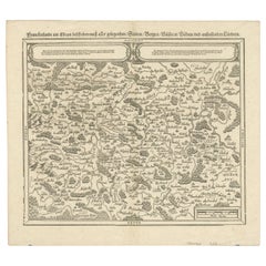
Early Woodcut Map of Franconia and Surrounding Regions, 1628
Located in Langweer, NL
Title: Early Woodcut Map of Franconia and Surrounding Regions, 1628 Franconia (Franckenlande) is a region in Germany. Historically, Franconia was a significant part of the Holy Roma...
Category

Antique 18th Century and Earlier Collectibles and Curiosities

Materials

Paper

Northern Schleswig and Haderslev Map by Johannes Mejer and Johannes Blaeu, 1662
Located in Langweer, NL
The map shows the Duchy of Schleswig, which spans the area between the North Sea coast, Kolding, and Flensburg. The maps were originally published by Johannes Mejer in the regional a...
Category

Antique 18th Century and Earlier Collectibles and Curiosities

Materials

Paper

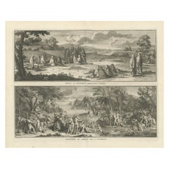
Print of Mourning of Greek Widows in Rama and Baptism in The River Jordan, 1730
Located in Langweer, NL
Description: Antique print titled 'Deuil des Femmes Greques a Rama' and 'Bapteme des Grecs dans le Jourdain'. The upper image depicts Mourning Greek widows in Rama, the lower ima...
Category

Antique 18th Century and Earlier Collectibles and Curiosities

Materials

Paper

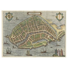
Beautiful Decorative Antique Map of the City of Dordrecht, the Netherlands, 1581
Located in Langweer, NL
Antique map titled 'Dordrecht'. Map of the city of Dordrecht, the Netherlands. Bird's-eye plan view of the city, with many ships and two coats of arms in upper corners. This map ...
Category

Antique 18th Century and Earlier Collectibles and Curiosities

Materials

Paper

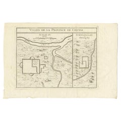
Antique Map of Two Cities in the Province of Shanxi or Chensi, China, 1748
Located in Langweer, NL
Antique map China titled ‘Villes de la Province de Chensi’. Interesting set of two local town plans of ""Si-Ngan-Fu: Capitale."" and ""Tchang Lan, Ou...
Category

Antique 18th Century and Earlier Collectibles and Curiosities

Materials

Paper

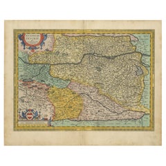
Austria by Wolfgang Lazius – A Magnificent 16th-Century Map from Ortelius
Located in Langweer, NL
Title: Avstriae Descrip – Wolfgang Lazius’ Map of Austria, 16th Century Description: This extraordinary map of Austria pays homage to the Austrian humanist and cartographer Wo...
Category

Antique 18th Century and Earlier Collectibles and Curiosities

Materials

Paper

Antique Map of the French Province Maine, Showing Le Mans, Alencon Etc., Ca1640
Located in Langweer, NL
Antique map titled 'Le Maine'. Old map of the province of Maine, France. It shows the cities of Le Mans, Alencon and others. This map originates from a composite atlas. Artis...
Category

Antique 18th Century and Earlier Collectibles and Curiosities

Materials

Paper

Original Antique Map of the Region of Torneå 'Tornio' in Northern Finland, 1759
Located in Langweer, NL
Antique map titled 'Carte des Environs de Tornea'. Original antique map of the region of Torneå (or Tornio), in northern Finland. This print originates from volume 19 of 'Histoir...
Category

Antique 18th Century and Earlier Collectibles and Curiosities

Materials

Paper

Napoleon Emperor Co. Framed Leda & the Swan Nude Relief on Brass Buckle Framed
Located in San Francisco, CA
Napoleon Emperor Co. Framed Leda & the Swan Nude Relief on Brass Buckle 8x10x2 framed Buckle 4"x2.5"
Category

Antique 18th Century and Earlier Collectibles and Curiosities

Materials

Brass

Antique Print of a House in Barbary, North Africa, 1773
Located in Langweer, NL
Antique print titled 'Gedeelte van een Huis in Barbarye (..)'. Old print depicting a view and two plans of a house in Barbary. Originates from the first Dutch editon of an interestin...
Category

Antique 18th Century and Earlier Collectibles and Curiosities

Materials

Paper

Antique Map of Africa with a Decorative Dedication to the Dauphin, 1717
Located in Langweer, NL
Antique map titled 'L'Afrique, Dressée Selon les Dernieres Relat. et Suivant les Nouvelles Decouvertes (..).' This map is a reduced derivative of De Fer's wall map of Africa (1696-98) with its characteristic thickened west coast. Unusual islands appear in the Atlantic and Indian Oceans including a mythical second island of St. Helena. Monomotapa is shown in the south and the southwest coastline is distorted and there is an incorrect placement and shape of the Cape of Good Hope. In Central Africa is a paragraph concerning the origin of the Nile in Abyssinia, however, the two sub-equatorial Ptolemaic lakes are still shown on the map. The map is graced with a decorative dedication to the Dauphin and a title cartouche featuring lime kilns. The map was first published in 1700. This scarse map originates from: 'Introduction a la geographie - avec unde description historique sur toutes...
Category

Antique 18th Century and Earlier Collectibles and Curiosities

Materials

Paper

Old Print of Stone with Elephants from the Bridge of Constantine, Algeria, 1773
Located in Langweer, NL
Antique print titled 'Steen in de brug van het oude Cirta (..)'. Old print depicting a stone with elephants from the bridge of Cirta/Constantine. Also depicts other architectural...
Category

Antique 18th Century and Earlier Collectibles and Curiosities

Materials

Paper

Antique Map of the County of Devon by Overton, 1713
Located in Langweer, NL
Antique map titled 'Devoniae Descriptio - The Description of Devon Shire'. Map of the County of Devon, England. This map originates from the 1713 edition of the 'Overton Atlas'. Henry Overton only revised the Devon map...
Category

Antique 18th Century and Earlier Collectibles and Curiosities

Materials

Paper

Old Dutch Map of Part of Syria and Phoenicia, 1773
Located in Langweer, NL
Antique print titled 'Gedeelte van Syriën en Phenicië'. Old map of part of Syria and Phoenicia. Originates from the first Dutch editon of an interesting travel account of Norther...
Category

Antique 18th Century and Earlier Collectibles and Curiosities

Materials

Paper

Antique Engraving of Deucalion and Pyrrha of Phthia, Thessaly, Greece, 1733
Located in Langweer, NL
Antique print titled 'Deucalion & Pyrrha (..)'. This print depicts Deucalion and Pyrrha. Deucalion, who reigned over the region of Phthia, had been forewarned of the flood by his...
Category

Antique 18th Century and Earlier Collectibles and Curiosities

Materials

Paper

Antique Miniature Map of the Maluku Islands by Lasor a Varea, 1713
Located in Langweer, NL
Antique map titled 'Isole Molucche'. Rare miniature map of the Maluku Islands or the Moluccas, Indonesia. This map originates from 'Universus Terrarum Orbis...
Category

Antique 18th Century and Earlier Collectibles and Curiosities

Materials

Paper

A Stunning 1744 Bowen Map: South East Germany & Queen of Hungary’s Dominions
Located in Langweer, NL
Title: A New and Correct Map of the South East part of Germany, 1744 This map by Emanuel Bowen, dating to around 1744, beautifully captures the southeastern part of Germany. The det...
Category

Antique 18th Century and Earlier Collectibles and Curiosities

Materials

Paper

Early Antique Map of Gelderland and Overijssel in the Netherlands, c.1625
Located in Langweer, NL
Antique map titled 'Geldria et Transysulana'. One of the earliest maps of Gelderland and Overijssel in the Netherlands, prepared by Gerard Mercator. Artists and Engravers: Gerard...
Category

Antique 18th Century and Earlier Collectibles and Curiosities

Materials

Paper

Antique Map of the Region of Franche-Comté by Janssonius, circa 1650
Located in Langweer, NL
Antique map titled 'Burgundiae Comitatus Franche Comté'. Old map of the historical and former region of Franche-Comté, France. As a region, it encompasse...
Category

Antique 18th Century and Earlier Collectibles and Curiosities

Materials

Paper

Antique Map of the Region of Namur by De Lat, 1737
Located in Langweer, NL
Untitled map of the region of Namur, Charlemont, Rochefort and surroundings, Belgium. This map originates from 'Nieuw en beknopt Kaart-Boekje vertoonende de XVII. Nederlandse Provint...
Category

Antique 18th Century and Earlier Collectibles and Curiosities

Materials

Paper

Antique Map of the Region of Vermandois and Cappelle by Janssonius, circa 1650
Located in Langweer, NL
Antique map of France titled 'Descriptio Veromanduorum - Gouvernement de la Cappelle'. Two detailed maps of France on one sheet. The Vermandois map is centered on the Oyse and Somme ...
Category

Antique 18th Century and Earlier Collectibles and Curiosities

Materials

Paper

Map of Constantinople, Bosphorus, the Coasts of Greece and the Archipelago, 1785
Located in Langweer, NL
This is a large 1785 map titled "Carte de la Ville de Constantinople et du Bosphore de Thrace", which includes detailed maps of Constantinople (modern-day Is...
Category

French Antique 18th Century and Earlier Collectibles and Curiosities

Materials

Paper

Antique Map of the Nassau Region in Western Germany
Located in Langweer, NL
Antique map titled 'Nassovia Principatus (..)'. Detailed map of the Nassau region in western Germany between Koblenz, Hadamar, Giessen, Frankfurt and Mainz. The map is filled with in...
Category

Antique 18th Century and Earlier Collectibles and Curiosities

Materials

Paper

Old Map of Ancient Spain and Portugal – Hispania Antiqua Featuring Roman Cities
Located in Langweer, NL
Title: "Hispania Antiqua in Tres Praecipuas Partes Divisa: Tarraconensem, Lusitaniam, et Bæticam" by Robert de Vaugondy, 18th Century Description: This beautifully detailed map titl...
Category

Antique 18th Century and Earlier Collectibles and Curiosities

Materials

Paper

Antique Map of the Northern Part of the Netherlands by Jaeger, 1784
Located in Langweer, NL
Antique print, titled: 'Carte topographique d'Allemagne contenant une partie des Provinces Unies, savoir la province de Friesland occidentale : une partie d'Overyssel, de Gueldre, d'...
Category

Antique 18th Century and Earlier Collectibles and Curiosities

Materials

Paper

Antique Map of the Arabian Peninsula by Bonne 'c.1780'
Located in Langweer, NL
Antique map titled 'Carte de l'Arabie, du Golfe Persique, et de la Mer Rouge (..)'. Original antique map of the Arabian Peninsula, including the horn...
Category

Antique 18th Century and Earlier Collectibles and Curiosities

Materials

Paper

Rare 17th-Century Map of Dauphiné in Southeastern France by F. De Wit, ca.1688
Located in Langweer, NL
Title: Rare Hand-Colored 17th-Century Map of Dauphiné by Frederik De Wit c. 1688 Description: This captivating 17th-century map of Dauphiné, titled "Nova et Accurata Delphinatus Vul...
Category

Antique 18th Century and Earlier Collectibles and Curiosities

Materials

Paper

Original Antique Print of the Benedictine Abbey of Gembloux, Belgium, ca.1660
Located in Langweer, NL
Antique print titled 'Celebrrima et Antiquissima Cemblacensis Oppidi Abbatia Ordinis S. Benedicti in Gallo-Brabantia'. Original antique print of the Benedictine Abbey of Gembloux...
Category

Antique 18th Century and Earlier Collectibles and Curiosities

Materials

Paper

Antique Map of the Circle of Franconia, 1757
Located in Langweer, NL
Antique map titled 'Cercle de Franconie (..)'. Map of the Circle of Franconia, Germany. Centered on Bamberg, Wurtzburg and Nuremberg. This map originates from 'Atlas Universel (..)'....
Category

Antique 18th Century and Earlier Collectibles and Curiosities

Materials

Paper

1767 D’Anville Map of the Holy Land: Ancient Divisions and Biblical Geography
Located in Langweer, NL
Ancient Map of Palestine or the Holy Land by D'Anville (1767) This detailed map, created by the renowned French cartographer Jean Baptiste Bourguignon d'Anville in 1767, depicts the...
Category

Antique 18th Century and Earlier Collectibles and Curiosities

Materials

Paper

Antique Map of the Wallis and Futuna Islands, French Overseas Territory, 1778
Located in Langweer, NL
Antique map titled 'Walliss Inseln, Isles de Wallis'. Old map of the Wallis and Futuna Islands, officially Territory of the Wallis and Futuna Islands, French overseas territory. The ...
Category

Antique 18th Century and Earlier Collectibles and Curiosities

Materials

Paper

Antique Miniature Map of the Old World and France by Mallet, circa 1683
Located in Langweer, NL
Antique map titled 'Planisphere du Monde - France'. Two miniature maps on one sheet. The upper map shows a hemisphere of the Old World. The lower map shows France. This map originate...
Category

Antique 18th Century and Earlier Collectibles and Curiosities

Materials

Paper

Original Antique 17th-Century Map of Shanxi (Xansi) Province, China – by Blaeu
Located in Langweer, NL
Antique 17th-Century Map of Shanxi Province, China – "Xansi" by Blaeu, with Artistic Cartouches Description: This beautifully engraved map of Shanxi Province, historically referred to as "Xansi," was created by Johannes Blaeu in 1655 as part of his renowned *Novus Atlas Sinensis*. This atlas was the first comprehensive Western collection focused on Chinese geography, produced with the guidance of Jesuit missionary Martino Martini. Blaeu’s attention to detail and artistic flair are evident in this representation of Shanxi, highlighting mountains, rivers, cities, towns, and key geographic features. The Great Wall of China, an iconic landmark, is also depicted. The map includes decorative cartouches that enhance its aesthetic appeal. The upper-left corner features the map's title framed in an ornate design, while the lower-right corner showcases a seated figure in traditional Chinese attire alongside a small globe, symbolizing the merging of European cartographic expertise and Chinese knowledge. Each city and geographic feature is labeled in Latin, making it a fascinating historical artifact of cross-cultural exploration. This map was crafted using the copperplate engraving technique, prized for its ability to produce fine, precise details. It is further embellished with hand-coloring, which brings the landscape and decorative elements to life. Blaeu’s maps are highly regarded for their accuracy, artistry, and historical significance, making this piece a valuable collectible. Shanxi Province, historically referred to as "Xansi," is renowned for its historical significance, natural landscapes, and rich cultural heritage. The region has been a crucial center of Chinese history and culture for centuries. Its name, meaning "West of the Mountains," refers to its location west of the Taihang Mountains. Shanxi has long been known for its coal resources, which have made it an important economic hub in modern times. Important places in Shanxi include Pingyao, a UNESCO World Heritage Site known for its well-preserved ancient city walls and traditional Chinese architecture. The Yungang Grottoes, near Datong, are another UNESCO site, famous for their intricate Buddhist carvings and statues. Mount Wutai, one of China’s Four Sacred Buddhist Mountains, is a significant religious site that attracts pilgrims and tourists alike. Taiyuan, the provincial capital, is known for its historical sites, including the Jinci Temple. Shanxi is also known for its role in the early development of Chinese banking, particularly during the Ming and Qing Dynasties. Keywords include antique map of Shanxi, Xansi map, Pingyao, Yungang Grottoes, Mount Wutai, 17th-century China map...
Category

Antique 18th Century and Earlier Collectibles and Curiosities

Materials

Paper

Antique Genealogy Chart of the Valois House in France, 1732
Located in Langweer, NL
Antique print titled 'Nouvelle Carte Genealogique des Branches du Cote Gauche (..)'. Set of two prints with a chart of the left branch of the genealogy of the Valois House, and the various branches formed through alliances, each with its coat of arms including the Counts and Dukes of Alencon, Anjou, Naples, Calabria, Burgundy, Brabant. With inset engraved views of the Hotel des Invalides in Paris, the Trianon, Versailles and St. Cloud. This print orginates from 'Atlas Historique'. The House of Valois...
Category

Antique 18th Century and Earlier Collectibles and Curiosities

Materials

Paper

Antique Sea Chart of Hudson Bay and Arctic Canada by Van Keulen, circa 1681
Located in Langweer, NL
Antique map titled 'Pascaarte vande Noorderzee Custen van America (..)'. Sea chart of Hudson Bay and Arctic Canada. Compass roses, loxodromic lines, and ships decorate the oceans and...
Category

Antique 18th Century and Earlier Collectibles and Curiosities

Materials

Paper

Antique Map of the Holy Land, c.1717
Located in Langweer, NL
Antique map Israel titled 'Tabula Geographica Terrae Sanctae'. Rare edition made after a map of the Holy Land by J. Bonfrerius. The map is oriented ...
Category

Antique 18th Century and Earlier Collectibles and Curiosities

Materials

Paper

Carved and Gilt Fragments with Polychrome Finish on Custom Acrylic Stand
Located in Dallas, TX
These old world fragments from a time of ornamentation and decadence will pop any space with a feeling of classic royal nobility. They are sturdily mounted on clear acrylic so that o...
Category

Antique 18th Century and Earlier Collectibles and Curiosities

Materials

Giltwood

Natives from Pegu, the Moluccan Islands, Penequais Indians and St Thomas, c.1605
Located in Langweer, NL
Antique print titled 'Provincie Pegu incola (..) - Incola ex Insulis Moluco (..) - Penequais familiae (..)'. Old print showing various figures including a man from Pegu, a man fr...
Category

Antique 18th Century and Earlier Collectibles and Curiosities

Materials

Paper

Original Hand-Colored Antique Print of Various Apples, 1758
Located in Langweer, NL
Antique print depicting apple variaties including the Rode Wijn-Appel, Geele Soete Silverling, Bellefleur, Oranje Appel, Bruindeling, Witte Renet, Groene Renet, Wildjes Appel (Reinet...
Category

Antique 18th Century and Earlier Collectibles and Curiosities

Materials

Paper

Antique Map of Boulogne-sur-Mer by Bellin '1764'
Located in Langweer, NL
Antique map titled 'Plan de la Ville de Boulogne'. Original antique map of Boulogne-sur-Mer, France. This map originates from 'Le petit atlas maritime: recueil de cartes et plans des...
Category

Antique 18th Century and Earlier Collectibles and Curiosities

Materials

Paper

Barados and St Christopher or St Kitts and Nevis Islands in the Caribbean, 1748
Located in Langweer, NL
This original map, a copperplate engraving by Le Rouge, presents two significant areas in the Caribbean. Titled "Isle St. Christophle une des Antilles aux anglois" and "La Barbade. d...
Category

Antique 18th Century and Earlier Collectibles and Curiosities

Materials

Paper

Antique Map of the Cambrai Region by Pitt, circa 1680
Located in Langweer, NL
Antique map titled 'Archiepiscopatus Cameracensis - Archevesche de Cambray'. Decorative map of the Cambrai region of France. This map originates from 'The English Atlas' by Moses Pit...
Category

Antique 18th Century and Earlier Collectibles and Curiosities

Materials

Paper

Old Antique Map of the Province of Friesland, the Netherlands, c.1580
Located in Langweer, NL
Antique map titled 'Frisia Occidentalis'. Old map of the province of Friesland, the Netherlands. This map is also known as the 'Pauwenkaart' ('peacock map'), referring to the peacock next to the inset map. Based on a manuscript map...
Category

Antique 18th Century and Earlier Collectibles and Curiosities

Materials

Paper

Antique Map of Friesland 'The Netherlands' by B. Schotanus, 1664
Located in Langweer, NL
Hand-colored map of the Dutch province Friesland. Also shows the Wadden islands Vlieland, Terschelling and Ameland and a part of Schiermonnikoog. With a decorative cartouche with two...
Category

Antique 18th Century and Earlier Collectibles and Curiosities

Materials

Paper

Paris 1960s Era Gold-Tone Metal and Bakelite Jeweled Medallion Handmade Belt
Located in Philadelphia, PA
From Paris, France, a 1960s Era belt made of gold-tone metal rectangular links with applied medallions, and bakelite 'jewels'. Unusual and impactful! Heavy and very well made. Ass...
Category

French Mid-Century Modern Antique 18th Century and Earlier Collectibles and Curiosities

Materials

Metal

Antique Map of the Region of Bouchain and Cambrai by Visscher 'circa 1680'
Located in Langweer, NL
Antique map titled 'Carte Nouvelle des Environs de Bouchain & Cambray'. Uncommon map of the region of Bouchain and Cambrai (Cambray, France) showing the camps of two armies.
Category

Antique 18th Century and Earlier Collectibles and Curiosities

Materials

Paper

Old Map of Indian Ocean & Sumatra, Java, Borneo, India, Arabia, Africa, c.1783
Located in Langweer, NL
Antique map titled 'Carte des Declinaisons et Inclinaisons de L'Aiguille Aimantée redigée d'après la table des observations Magnetiques faites par les Voyageurs depuis l'Année 1775'....
Category

Antique 18th Century and Earlier Collectibles and Curiosities

Materials

Paper

Map of Duchy of Brabant Centered on Fortress of Louvain or Leuven, Belgium, 1720
Located in Langweer, NL
Antique map titled 'Ducatus Brabantiae Nova Tabula in qua Lovanii Bruxellarum March S. Impreii Sylvae Ducis et Merchliniae Dominia.' This fully engraved copperplate map...
Category

Antique 18th Century and Earlier Collectibles and Curiosities

Materials

Paper

Antique Map of Islands in the Mediterranean by Bowen, 'c.1760'
Located in Langweer, NL
Antique map titled 'Particular Draughts of some of the chief African Islands (..)'. Eight small maps on one sheet including 'Islands of Malta Goze & Cuming, An Accurate Chart of Cape de Verde Islands…, Island of St Helena.., Island of Madera, Island of Teneriffe, The Bay of Agoa…, The Dutch Fort at the Cape of Good Hope…, A Draught of Table Bay...
Category

Antique 18th Century and Earlier Collectibles and Curiosities

Materials

Paper

Antique Map of Champagne France by Johann Baptist Homann circa 1710 Hand-Colored
Located in Langweer, NL
Antique Map of Champagne France by Johann Baptist Homann circa 1710 Hand-Colored This richly detailed antique map titled Tabula Geographica Campani...
Category

Antique 18th Century and Earlier Collectibles and Curiosities

Materials

Paper

Original Old Bird's-Eye View Plan of Sint-Winoksbergen or Bergen in France, 1649
Located in Langweer, NL
Antique map titled 'Berga Sti Winoci.' - Bird's-eye view plan of Sint-Winoksbergen in France, with key to locations and coats of arms. Text in Dutch on verso. This plan originates from the famous city Atlas: 'Toneel der Steeden' published by Joan Blaeu...
Category

Antique 18th Century and Earlier Collectibles and Curiosities

Materials

Paper

Antique Map of the Region of Elbogen & Eger, Czech Republic & Hungary, 1742
Located in Langweer, NL
Antique map titled 'Repraesentatio Geographica Circuli Egerani, nec non Elnbogensis : in quo simul viae Egeranae in Thermas Carolinas distincta delineatio conspicitur (..)'. Orig...
Category

Antique 18th Century and Earlier Collectibles and Curiosities

Materials

Paper

Antique Map of Northern Asia by Mallet, 1719
Located in Langweer, NL
Antique map titled 'Das Mitternächtige Theil des Alten Asien'. This sheet of five miniature maps describes the northern part of Asia in classical times, perhaps circa 150 AD. At the top, an overview map shows the main regions and territories, which are pictured in more detail below. From left to right, the four maps below depict Scythia east of the Imaus (Pamir) Mountains, Serica, Sychia west of the Pamir mountains, and Sarmatia, the last of which borders the Black Sea. Originates from Alain Manesson Mallet's 'Description de l 'Univers' (German edition). Artists and Engravers: Alain Manesson Mallet (1630-1706) was a French cartographer and engineer. He started his career as a soldier in the army of Louis XIV, became a Sergeant-Major in the artillery and an Inspector of Fortifications. He also served under the King of Portugal, before returning to France, and his appointment to the court of Louis XIV. His military engineering and mathematical background led to his position teaching mathematics at court. His major publications were Description de L'Univers (1683) in 5 volumes, and Les Travaux de Mars ou l'Art de la Guerre (1684) in 3 volumes. His Description de L'Universe contains a wide variety of information, including star maps...
Category

Antique 18th Century and Earlier Collectibles and Curiosities

Materials

Paper

Antique Map of Menorca / Minorca by Homann Heirs '1757'
Located in Langweer, NL
Antique map titled 'Carte Topographique de l'Isle Minorque'. Scarce decorative map of Menorca (or Minorca), with two gorgeous views of Mahon and Fort St. Phillipe at the bottom. Publ...
Category

Antique 18th Century and Earlier Collectibles and Curiosities

Materials

Paper

Bronze Mortar with Pestle, Spain, 17th Century
Located in Madrid, ES
Mortar with hand. Bronze. XVII century. Mortar with a circular base, cylindrical body and slightly outwardly flared mouth, decorated with a series of smooth horizontal moldings arranged both in the lower and upper areas and with simple vertical elements (which still maintain slight balustraded shapes) derived from of the ribs that these specimens used to have in the medieval Spanish...
Category

Spanish Baroque Antique 18th Century and Earlier Collectibles and Curiosities

Materials

Bronze, Other

Antique Map of Spain by N. de Fer, circa 1700
Located in Langweer, NL
Antique map of Spain and Portugal with a title cartouche. Nicolas de Fer was the youngest son of the Paris printer and publisher Antoine de Fer. At the ...
Category

Antique 18th Century and Earlier Collectibles and Curiosities

Materials

Paper

Old Dutch Map of the City of Carthage and the Bay of Carthage, 1773
Located in Langweer, NL
Antique print titled 'Kaart van de Legging van het Oude Karthago'. Old map of the city of Carthage and the Bay of Carthage. It was the center or capital city of the ancient Carthagin...
Category

Antique 18th Century and Earlier Collectibles and Curiosities

Materials

Paper

Decorative Bird's-Eye View Plan of Ieper or Ypres in Belgium, 1649
Located in Langweer, NL
Antique print, titled: 'Ypra.' Bird's-eye view plan of Ieper / Ypres in Belgium. With key to locations and coats of arms. Text in Latin on verso. This plan originates from the famous city Atlas: 'Toneel der Steeden' published by Joan Blaeu...
Category

Antique 18th Century and Earlier Collectibles and Curiosities

Materials

Paper

Antique Map of the Region of Dölitzsch by Schreiber, 1749
Located in Langweer, NL
Antique map titled 'Die Aemter Doelitsch, Bitterfeld und Zörbig'. Map of the region of Dölitzsch, Germany. This map originates from 'Atlas Selectus von allen Konigreichen und Landern...
Category

Antique 18th Century and Earlier Collectibles and Curiosities

Materials

Paper

Original Antique 17th-Century Map of Shaangxi (Xensi) Province, China – by Blaeu
Located in Langweer, NL
Antique 17th-Century Map of Shaangxi Province, China – "Xensi" by Blaeu, Featuring Decorative Cartouches Description: This exquisite 17th-century map of Shaangxi Province, historically known as Xensi Province, is an exceptional work by Johannes Blaeu, one of the most celebrated mapmakers of the Dutch Golden Age. Originally published in Blaeu's groundbreaking 'Novus Atlas Sinensis', this map is a masterful blend of geography and artistry. Blaeu's atlas was created in collaboration with Martino Martini, a Jesuit missionary whose insights into China provided European audiences with unprecedented geographical accuracy. The map meticulously charts Shaangxi's mountains, rivers, mines, cities, and towns, with names rendered in Latin. It also features a detailed section of the Great Wall of China, a symbol of the region's historical significance. The artistry of this map is further enhanced by its elaborate cartouches. At the top, a Chinese warrior is beautifully illustrated, while the lower-left corner displays a deer, possibly a reference to the elusive Pere David deer...
Category

Antique 18th Century and Earlier Collectibles and Curiosities

Materials

Paper

Read More

Medal-Worthy Memorabilia from Epic Past Olympic Games

Get into the games! These items celebrate the events, athletes, host countries and sporting spirit.

Ahoy! You’ve Never Seen a Collection of Sailor Art and Kitsch Quite Like This

French trendsetter and serial collector Daniel Rozensztroch tells us about his obsession with objects related to seafaring men.

Pamela Shamshiri Shares the Secrets behind Her First-Ever Book and Its Effortlessly Cool Interiors

The sought-after designer worked with the team at Hoffman Creative to produce a monograph that beautifully showcases some of Studio Shamshiri's most inspiring projects.

Moroccan Artworks and Objects Take Center Stage in an Extraordinary Villa in Tangier

Italian writer and collector Umberto Pasti opens the doors to his remarkable cave of wonders in North Africa.

Montecito Has Drawn Royalty and Celebrities, and These Homes Are Proof of Its Allure

Hollywood A-listers, ex-pat aristocrats and art collectors and style setters of all stripes appreciate the allure of the coastal California hamlet — much on our minds after recent winter floods.

Whaam! Blam! Pow! — a New Book on Pop Art Packs a Punch

Publishing house Assouline and writer Julie Belcove have teamed up to trace the history of the genre, from Roy Lichtenstein, Andy Warhol and Yayoi Kusama to Mickalene Thomas and Jeff Koons.

What Makes a Gem-Encrusted Chess Set Worth $4 Million?

The world’s most opulent chess set, weighing in at 513 carats, is literally fit for a king and queen.

Tauba Auerbach’s Geometric Pop-Up Book Is Mighty Rare, Thanks to a Hurricane

This sculptural art book has an epic backstory of its own.
Recently Viewed

View All