Mid-17th Century Collectibles and Curiosities

to
239
290
17
307
6
2
4,431
6,784
13,459
2,726
3,520
4,677
3,077
512
300
606
745
480
898
888
899
659
595
280
13
12
7
7
44
12
8
7
6
307
307
307
28
1
1
Period: Mid-17th Century
Map of the Duchy Clivia & Ravestein, Brabant in The Netherlands & Germany, 1635
Located in Langweer, NL
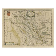
Antique map titled 'Clivia Ducatus et Ravestein Dominium.' Map of the Duchy Clivia and Ravestein, part of Brabant in The Nethe...
Category

Antique Mid-17th Century Collectibles and Curiosities

Materials

Paper

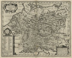
Original Rare Antique Map of the Ancient German Empire in Northern Europe, c1650
Located in Langweer, NL
Antique map titled 'Germaniae Veteris typus.' Map of the ancient German Empire in Northern Europe, based upon an earlier map by Ortelius. Extends fr...
Category

Antique Mid-17th Century Collectibles and Curiosities

Materials

Paper

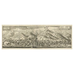
Large Panoramic View of Eisenerz, an Old Mining Town in Styria, Austria, c.1650
Located in Langweer, NL
Description: Antique print titled 'Der weyt berümpte Marckt und Bergwerck Eysenärtz im Hertzogtum Steyer'. Large panoramic view of Eisenerz, an old mining town in the Austrian st...
Category

Antique Mid-17th Century Collectibles and Curiosities

Materials

Paper

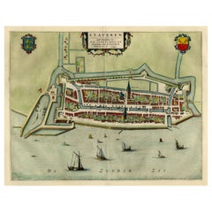
Original Antique Map of the City of Stavoren, Friesland, The Netherlands, 1649
Located in Langweer, NL
Antique map titled 'Staveren'. Original antique map of the city of Stavoren, Friesland, The Netherlands. This map originates from 'Toonneel der Steden van de Vereenighde Nederlanden'...
Category

Antique Mid-17th Century Collectibles and Curiosities

Materials

Paper

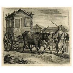
Old Print of a Large Procession of the Emperor's Niece in Japan, 1669
Located in Langweer, NL
Antique print titled 'Groote Staatsie der Kaisarlyke Nicht.' This print shows a large procession of the Emperor's Niece. It shows a small carriage d...
Category

Antique Mid-17th Century Collectibles and Curiosities

Materials

Paper

Antique Map of Frisian Cities Sloten, Ylst, Workum and Hindelopen by Blaeu, 1652
Located in Langweer, NL
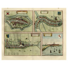
Antique print titled 'Slooten - Ylst - Worcum - Hinloopen'. Three plans and a bird's eye view on one sheet. The plans show the Frisian cities Sloten, IJlst, Workum and the view shows...
Category

Antique Mid-17th Century Collectibles and Curiosities

Materials

Paper

Detailed Original Antique Map of the Picardy Region of France, 1657
Located in Langweer, NL
Antique map of France titled 'Picardia vera et inferior'. Detailed map of the Picardy region of France. This map originates from 'Atlas Novus, Sive Theatrum Orbis Orbis Terrarum:...
Category

Antique Mid-17th Century Collectibles and Curiosities

Materials

Paper

Charming Map of Northeastern Spain with the Areas of Pamplona & Valladolid, 1634
Located in Langweer, NL
Antique map titled 'Biscaia, Guipiscoa, Navarra et Asturias de Santillana'. Charming map of Northeastern Spain with the areas of Pamplona and Valladolid. This map originates from...
Category

Antique Mid-17th Century Collectibles and Curiosities

Materials

Paper

Nice Hand-Colored Plan by Blaeu of Bolsward in Friesland, the Netherlands, 1652
Located in Langweer, NL
Antique print, titled: 'Bolswaert' - (Town plan of Bolsward). Plan of Bolsward in Friesland, the Netherlands. A cartouche and two coats of arms. From the town atlas 'Toneel der S...
Category

Antique Mid-17th Century Collectibles and Curiosities

Materials

Paper

Decorative Antique Map of the Dutch Province of Noord-Brabant, ca.1640
Located in Langweer, NL
Antique map titled 'Quarta pars Brabantiae cujus Sylvaducis Willebordus vanderBurgt desrib'. Highly detailed original antique map of the province of Noord-Brabant, the Netherlands. It shows the cities of 's-Hertogenbosch, Eindhoven and surroundings. Includes a decorative cartouche, 6 coats of arms, topped by winged cherubs and two larger coats of arms...
Category

Antique Mid-17th Century Collectibles and Curiosities

Materials

Paper

Original Antique Engraving of the Murder of Emperor Cubo in Kyoto, Japan, 1669
Located in Langweer, NL
Antique print, titled: ''t Vermoorde vande Keyser Cubus. Massacre de l'Empereur Cubo.' - ('Murder of the Emperor Cubo'). Two armies clash in Kyoto, where the reigning Emperor was...
Category

Antique Mid-17th Century Collectibles and Curiosities

Materials

Paper

Old Print of a Partridge in Front of The Walled City of Azemmour, Morocco, c1630
Located in Langweer, NL
Antique print, titled: 'Azaamurum.' - Caption in the top reads: 'Foenerari iniustum est'. A partridge in the foreground, with the walled city (Azemmour...
Category

Antique Mid-17th Century Collectibles and Curiosities

Materials

Paper

Beautiful Bird's-Eye View Plan of Enkhuizen in The Netherlands by Blaeu, 1649
Located in Langweer, NL
Antique print, titled: 'Topograhpiae Enchusae.' Bird's-eye view plan of Enkhuizen in The Netherlands, with key to locations and coats of arms. Text in Dutch on verso. This plan o...
Category

Antique Mid-17th Century Collectibles and Curiosities

Materials

Paper

Original Hand-Colored Antique Map of Artois or Artesia, France, ca.1650
Located in Langweer, NL
Antique map titled 'Artesia Comitatus Artois'. Map of Artois or Artesia, France. Artois is former province located in the northwestern part of France, boarding Belgium (Flanders)...
Category

Antique Mid-17th Century Collectibles and Curiosities

Materials

Paper

Old Print with a View on the City & Castle of Batavia 'Jakarta', Indonesia, 1668
Located in Langweer, NL
Antique print Indonesia titled ‘La ville de Batavie. De Stadt Batavia. Chateau de Batavia. ‘t Casteel van Batavia’. Antique print with a view on the city of Djakarta, Indonesia. ...
Category

Antique Mid-17th Century Collectibles and Curiosities

Materials

Paper

Antique Map of the French Province Maine, Showing Le Mans, Alencon Etc., Ca1640
Located in Langweer, NL
Antique map titled 'Le Maine'. Old map of the province of Maine, France. It shows the cities of Le Mans, Alencon and others. This map originates from a composite atlas. Artis...
Category

Antique Mid-17th Century Collectibles and Curiosities

Materials

Paper

Antique View of the Temple of Amidain Edo 'Tokyo' and the 7-Headed Horse, 1669
Located in Langweer, NL
Antique print, titled: 'De tempel der goude Amida.' - Interior view of the Temple of Amida (also Amitabha) in Edo (also Yedo/Jeddo, now Tokyo). The statue shows the God seated on...
Category

Antique Mid-17th Century Collectibles and Curiosities

Materials

Paper

Attractive Antique Map of Western Africa with Lots of Details on the Coast, 1655
Located in Langweer, NL
Title: "L'Afrique, ou Lybie ulterieure ou sont le Saara, ou Desert, le pays des negres, la Guinee, et les Pays circonv. Tirée en partie de Sanut, et de l'Arabe de Nubie; en partie de diverses Cartes veües jusques a present". Handsome map of Western Africa filled with information, much of it spurious, in the Sahara Desert, the Niger River and the coast of Guinea. Of particular interest are several incomplete rivers in the desert regions that appear and then disappear. The map is beautifully engraved with a title cartouche fashioned in the form of an oriental carpet. The map shows a fantastic level of detail near the coastlines, which extends into legend and Ptolemaic myth in the interior of the continent. Detail is particularly extensive in Guinea and the Gold and Ivory Coasts. The Niger River is traced to its Malian lakes. The Mediterranean is barely visible in the northern part of the map. This map incorporates the discoveries made by Samuel Blommaert, who was director of the Dutch West Indies Company, in addition to traveling extensively to Africa and settling the oldest land deed...
Category

Antique Mid-17th Century Collectibles and Curiosities

Materials

Paper

Old Print of a Ritual Honorary Suicide, Seppuku or Belly Cutting in Japan, 1669
Located in Langweer, NL
Description: antique print, titled: 'Manier der Buiksnyding.' - ('Method of belly cutting'). A nobleman must commit seppuku because of his crimes. He is kneeling on the ground an...
Category

Antique Mid-17th Century Collectibles and Curiosities

Materials

Paper

Antique Map of the Region of Saintonge by Janssonius, 1657
Located in Langweer, NL
Antique map 'La Saintonge vers le Midy avecq le Brovageais'. Decorative map of the Saintonge region, a former province of France located on the west central Atlantic coast. This map ...
Category

Antique Mid-17th Century Collectibles and Curiosities

Materials

Paper

Antique Map of Île de Ré and Île d'Oléron by Janssonius, 1657
Located in Langweer, NL
Antique map 'Insulae Divimartini et Vliarus vulgo l'isle de Re et Oleron'. Decorative map of Île de Ré and Île d'Oléron. This map originates from 'Atlas Novu...
Category

Antique Mid-17th Century Collectibles and Curiosities

Materials

Paper

Antique Map of Asia Minor (Natolia) – Janssonius, circa 1650
Located in Langweer, NL
Natolia, quae olim Asia Minor – Antique Map of Anatolia by Janssonius, ca. 1650 This finely engraved 17th-century map titled “Natolia, quae olim Asia Minor” presents the region of A...
Category

Dutch Antique Mid-17th Century Collectibles and Curiosities

Materials

Paper

Antique Map of the Region of Lyon by Hondius, circa 1630
Located in Langweer, NL
Antique map titled 'Lionnois, Forest et Beauiolois'. Old map of the former region of Lyon, Vienne, Bresse, Rohan and the Rhône River. This map originates f...
Category

Antique Mid-17th Century Collectibles and Curiosities

Materials

Paper

Antique Map of Styria by Mercator 'circa 1650'
Located in Langweer, NL
Antique map titled 'Stiria'. Original antique map of Styria, Austria. Published by G. Mercator, circa 1650.
Category

Antique Mid-17th Century Collectibles and Curiosities

Materials

Paper

Original Oil on Wood Panel of St. Anthony of Padua
Located in Miami, FL
Original oil on panel of Saint offering the Child, by an unidentified artist. --This painting represents St. Anthony of Padua. The scene is one tha...
Category

Spanish Baroque Antique Mid-17th Century Collectibles and Curiosities

Materials

Wood, Paint

Antique Map of Ærø, Denmark – 'Aroe Insulae' from Blaeu’s Spanish Atlas, c.1665
Located in Langweer, NL
Antique Map of Ærø, Denmark – 'Aroe Insulae' from Blaeu’s Spanish Atlas, c.1665 Antique map titled 'Aroe Insulae delineatio geometrica'. This rare map presents the island of Ærø (Ar...
Category

Dutch Antique Mid-17th Century Collectibles and Curiosities

Materials

Paper

Antique Map of Northern Jutland by Kaerius, 1628
Located in Langweer, NL
Antique map titled 'Iutia Septentrionalis'. Copper engraved map of Northern Jutland (Denmark) by P. Kaerius. This map originates from 'Atlas Minor (..)' by G. Mercator.
Category

Antique Mid-17th Century Collectibles and Curiosities

Materials

Paper

Antique Map of the Island of Funen by Kaerius, 1628
Located in Langweer, NL
Antique map titled 'Fionia'. Copper engraved map of the Island of Funen (Denmark) by P. Kaerius. Funen is Denmark's second largest island, between the Jutland peninsula, and the capi...
Category

Antique Mid-17th Century Collectibles and Curiosities

Materials

Paper

Antique Map of the Hainaut and Namur Region by Janssonius, 'circa 1640'
Located in Langweer, NL
Antique map titled 'Comitatuum Hannoniae et Namurci Descriptio'. Old map of the region of Hainaut and Namur, France. Published by J. Janssonius, circa 1640.
Category

Antique Mid-17th Century Collectibles and Curiosities

Materials

Paper

Antique Map of the Region of Maine by Janssonius, circa 1650
Located in Langweer, NL
Antique map of France titled 'Diocese du Mans vulgo le Mains'. Decorative map of the region of Maine, France. Published by J. Janssonius.
Category

Antique Mid-17th Century Collectibles and Curiosities

Materials

Paper

Antique Map of the Region of Étampes and Sens by Hondius, circa 1630
Located in Langweer, NL
Antique map titled 'Gastinois et Senonois'. Old map of the region of Étampes and Sens, France. It shows the cities of Sens, Melun, Étampes, Orleans, Fontainebleau, Montargis and othe...
Category

Antique Mid-17th Century Collectibles and Curiosities

Materials

Paper

Antique Map of the Region of Vermandois and Cappelle by Janssonius, circa 1650
Located in Langweer, NL
Antique map of France titled 'Descriptio Veromanduorum - Gouvernement de la Cappelle'. Two detailed maps of France on one sheet. The Vermandois map is centered on the Oyse and Somme ...
Category

Antique Mid-17th Century Collectibles and Curiosities

Materials

Paper

Antique Map of Northern Switzerland by Janssonius '1657'
Located in Langweer, NL
Antique map 'Zurichgow et Basiliensis provincia'. Detailed map of northern Switzerland, including Zurich and Basel. This map originates from 'Atlas Novus, Sive Theatrum Orbis Orbis T...
Category

Antique Mid-17th Century Collectibles and Curiosities

Materials

Paper

Antique Map of the Region of Lake Geneva by Janssonius '1657'
Located in Langweer, NL
Antique map 'Das Wiflispur Gergow'. Detailed map of Switzerland showing Waadt and the Lake of Geneva and the city of Geneva, Fribourg and partly Bern. This map originates from 'Atlas...
Category

Antique Mid-17th Century Collectibles and Curiosities

Materials

Paper

Antique Map of the Region of Limoge by Janssonius, '1657'
Located in Langweer, NL
Antique map 'Totius Lemovici et consinium provinciaru quantum ad dioecesin Lemovicensen spectant'. Decorative map of the province of Limoge based on the important map of Antoin-Jean ...
Category

Antique Mid-17th Century Collectibles and Curiosities

Materials

Paper

Antique Map of the Region of Bretagne by Janssonius '1657'
Located in Langweer, NL
Antique map 'Duche de Bretaigne'. Detailed map of Bretagne, France. With decorative cartouches for the title, key and scale, a large armorial and several vignette galleons. This map ...
Category

Antique Mid-17th Century Collectibles and Curiosities

Materials

Paper

Antique Map of Beauce by Janssonius, 1657
Located in Langweer, NL
Antique map 'Belsia vulgo la Beausse'. Decorative map of the region of Beauce, a natural region in northern France, located between the Seine and Loire rivers. This map originates fr...
Category

Antique Mid-17th Century Collectibles and Curiosities

Materials

Paper

Antique Map of the Region of Picardy by Janssonius, 1657
Located in Langweer, NL
Antique map of France titled 'Picardia vera et inferior'. Detailed map of the Picardy region of France. This map originates from 'Atlas Novus, Sive Theatrum Orbis Orbis Terrarum: In ...
Category

Antique Mid-17th Century Collectibles and Curiosities

Materials

Paper

Antique Map of Dunkirk 'France' by J. Blaeu, 1649
Located in Langweer, NL
Antique map titled 'Duynkercka'. Published by J. Blaeu, 1649. Dutch text on verso.
Category

Antique Mid-17th Century Collectibles and Curiosities

Materials

Paper

Antique Map of Java by Janssonius, circa 1650
Located in Langweer, NL
Antique map titled 'Insulae Iavae cum parte insularum Borneo Sumatrae, et circumjacentium insularum novissima delineatio'. Beautiful map of Java and parts of Bali, Borneo, Sumatra an...
Category

Antique Mid-17th Century Collectibles and Curiosities

Materials

Paper

Original Antique Hand-Colored Map of Friesland by C. Merian, 1659
Located in Langweer, NL
This is a hand-colored engraving of the province of Friesland in the Netherlands, created by the Swiss-born engraver and artist Matthäus Merian (1593–1650) and included in "Topograph...
Category

Antique Mid-17th Century Collectibles and Curiosities

Materials

Paper

OriginaAntique 17th-Century Map of Guizhou Province, China – (Qveichev) by Blaeu
Located in Langweer, NL
Title: Antique 17th-Century Map of Guizhou Province, China – "Qveichev" by Blaeu, Richly Illustrated and Colored Description: This remarkable map of Guizhou Province, historically known as "Qveichev," was created by Johannes Blaeu and published in 1655 as part of his *Novus Atlas Sinensis*. This atlas, developed in collaboration with Jesuit missionary Martino Martini, marked the first Western attempt at a comprehensive geographic representation of China. Blaeu’s map offers a detailed depiction of the mountainous terrain, rivers, and towns of Guizhou, a province known for its rugged beauty and cultural diversity. The map is adorned with two decorative cartouches, each reflecting the artistic and cultural influences of the time. The title cartouche in the lower-right corner features two figures in traditional Chinese attire, symbolizing the blend of European cartographic mastery and Chinese heritage. The upper-left corner includes a secondary cartouche with an explanatory key, adding a touch of elegance to the map’s functionality. Towns, mountains, and rivers are meticulously labeled in Latin, showcasing Blaeu’s dedication to detail and accuracy. Crafted using the copperplate engraving technique, this map demonstrates exceptional precision. The hand-coloring enhances its visual appeal, highlighting borders and geographic features with vibrant tones. Blaeu’s work is not only a tool for geographic understanding but also a piece of art that embodies the spirit of exploration during the Dutch Golden Age. Guizhou Province, historically known as "Qveichev," is renowned for its breathtaking natural landscapes, rich ethnic diversity, and historical significance. As one of China's most mountainous regions, Guizhou is characterized by dramatic karst formations, lush green hills, and cascading waterfalls. The province is also home to a variety of ethnic minority groups, including the Miao, Dong, and Bouyei, whose traditions, colorful costumes, and vibrant festivals make the region culturally significant. Famous features and important places include Huangguoshu Waterfall, one of Asia's largest and most iconic waterfalls, located near the city of Anshun. Zhijin Cave, a vast karst cave system, is celebrated for its stunning stalactites and stalagmites. Kaili is known as the cultural center of Miao traditions, with picturesque villages and celebrated festivals. Zunyi holds historical importance for the Zunyi Conference, a pivotal event in the Chinese Communist Party's history. Fanjing Mountain, a UNESCO World Heritage Site, stands out for its unique biodiversity and sacred Buddhist sites. Keywords: antique map of China, Guizhou map, Qveichev, 17th-century China map...
Category

Antique Mid-17th Century Collectibles and Curiosities

Materials

Paper

Territorium Norimbergense - Antique Map of Nürnberg by Janssonius (1645-58)
Located in Langweer, NL
This is an antique map of Nürnberg, titled "Territorium Norimbergense," created by Johannes Janssonius and published between 1645 and 1658. It is a copperplate engraving printed on p...
Category

Antique Mid-17th Century Collectibles and Curiosities

Materials

Paper

Decorative Hand-Colored Map of Germany by Nicolas Sanson, 1648
Located in Langweer, NL
Title: Hand-Colored Map of Germany by Nicolas Sanson, 1648 This hand-colored map, titled "Allemagne," was created by Nicolas Sanson, a prominent 17th-century French cartographer and...
Category

Antique Mid-17th Century Collectibles and Curiosities

Materials

Paper

Historic Map of the Bishopric of Paderborn by Blaeu, a Masterpiece of 1645
Located in Langweer, NL
This hand-colored map, titled "Paderbornensis Episcopatus Descriptio Nova," depicts the Bishopric of Paderborn, a historical ecclesiastical territory within the Holy Roman Empire, lo...
Category

Antique Mid-17th Century Collectibles and Curiosities

Materials

Paper

Map of Northwestern Switzerland (Basel and Zurich Region) by Willem & Jan Blaeu
Located in Langweer, NL
Map of Northwestern Switzerland by Willem & Jan Blaeu (Circa 1650) This is a detailed map of Northwestern Switzerland, specifically depicting the region between Basel and Zurich, cr...
Category

Antique Mid-17th Century Collectibles and Curiosities

Materials

Paper

Mapping Stormarn: Johannes Meier's 1650 Cartographic Masterpiece
Located in Langweer, NL
This detailed description enhances our understanding of the historical map titled "Landtcarte von dem Furstenthumbe Stormarn," a copper etching by Johannes Meier (Mejer), dated to 16...
Category

Antique Mid-17th Century Collectibles and Curiosities

Materials

Paper

Original Oil on Panel of St. Anthony of Padua , by Unidentified Artist
Located in Miami, FL
Original oil on panel of Saint offering the Child, by an unidentified artist. --This painting represents St. Anthony of Padua. The scene is one that is often chosen to represent ...
Category

Spanish Baroque Antique Mid-17th Century Collectibles and Curiosities

Notitia Iuris [juris] Belgici, Francisco Zypaeo, Antverpiae , 1665
Located in Bilzen, BE
"Notitia Iuris [juris] Belgici, Francisco Zypaeo, Antverpiae - Law Of The Spanish Netherlands 1665" Summary of the Law of the Spanish Netherlands Zype, François van den (Franciscus) ...
Category

Belgian Spanish Colonial Antique Mid-17th Century Collectibles and Curiosities

Materials

Paper

Denbighshire & Flintshire – Antique Map from Drayton’s Poly-Olbion, 1622
Located in Langweer, NL
Denbighshire & Flintshire – Antique Map from Drayton’s Poly-Olbion, 1622 This rare and original antique map of Denbighshire and Flintshire in Wales originates from the celebrated Po...
Category

Antique Mid-17th Century Collectibles and Curiosities

Materials

Paper

Antique County Map of Cheshire, Dutch, Framed, Cartography, Janssonius, C.1660
Located in Hele, Devon, GB
This is an antique county map of Cheshire. A Dutch, framed atlas engraving by Johannes Janssonius, dating to the 17th century and later. A treat for the collector or county native,...
Category

Dutch Charles II Antique Mid-17th Century Collectibles and Curiosities

Materials

Glass, Wood, Paper

Old Print of Japanese Noblewoman Transported in a Rickshaw or Jinrikisha, 1669
Located in Langweer, NL
Untitled antique print of a Japanese noblewoman transported in a pushed rickshaw or jinrikisha. This print originates from Arnoldus Montanus' "Gedenkwaerdige Gesantschappen der O...
Category

Antique Mid-17th Century Collectibles and Curiosities

Materials

Paper

Antique Bird's-eye View Plan of Zierikzee in Zeeland, The Netherlands, 1649
Located in Langweer, NL
Antique print, titled: 'Zirizea.' - A bird's-eye view plan of Zierikzee in The Netherlands, with key to locations and coats of arms. After Matheo Rollando and Stephano Bellemo. Latin tekst on verso. From the city Atlas: 'Toneel der Steeden' published by Joan Blaeu...
Category

Antique Mid-17th Century Collectibles and Curiosities

Materials

Paper

Map of the Shire of Westergo in the Province of Friesland, the Netherlands, 1664
Located in Langweer, NL
Antique map titled 'Westergoa Olim Westrachia.' Map of the shire of Westergo in the province of Friesland in the Netherlands, including Stavoren, Bolswar...
Category

Antique Mid-17th Century Collectibles and Curiosities

Materials

Paper

Old Map of the City of Franeker, Friesland by the Famous Mapmaker Blaeu, 1652
Located in Langweer, NL
Antique map titled 'Franekera'. Old map of the city of Franeker, Friesland. Also shows two cartouches, coats of arms and legend. This map originates from a Latin edition of the town ...
Category

Antique Mid-17th Century Collectibles and Curiosities

Materials

Paper

Governor of Miaco (Kyoto, Japan), Leaving the City in a Carriage, 1669
Located in Langweer, NL
Antique print, titled: 'Sortie pompeuse du Gouverneur de Miaco. 't Uytreyden des Gouverneurs van Miaco.' The governor of Miaco (Kyoto), in a carriage as part of a long procession...
Category

Antique Mid-17th Century Collectibles and Curiosities

Materials

Paper

Old Print Titled from War Comes Peace, City Amara in Africa in Background, C1630
Located in Langweer, NL
Antique print, titled: 'Amara in Africa.' Caption above the image reads: 'Ex bello Pax' (From War comes Peace). A lance is used as a roost for chickens. In the background the cit...
Category

Antique Mid-17th Century Collectibles and Curiosities

Materials

Paper

Decorative and Detailed Original Antique Map of Switzerland, 1657
Located in Langweer, NL
Antique map of Switzerland titled 'Helvetiae Rhetiae & Valesiae'. Decorative and detailed map of Switzerland. This map originates from 'Atlas Novus, Sive Theatrum Orbis Orbis Ter...
Category

Antique Mid-17th Century Collectibles and Curiosities

Materials

Paper

Handsome Old Detailed Map of the Low Countries by Famous Mapmaker Blaeu, ca.1635
Located in Langweer, NL
Antique map titled 'Novus XVII Inferioris Germaniae Provinciarum Typus'. Handsome - and much sought after- detailed map of the Low Countries by the world most famous map maker Bla...
Category

Antique Mid-17th Century Collectibles and Curiosities

Materials

Paper

Original Old Copper Engraved Map of the Region of Albi, Southern France, 1663
Located in Langweer, NL
Antique map titled 'Carte du Diocese d'Alby'. Original antique map of the region of Albi in Southern France. This map originates from 'Topographia Galliae dat is eene algemeene e...
Category

Antique Mid-17th Century Collectibles and Curiosities

Materials

Paper

Read More

Medal-Worthy Memorabilia from Epic Past Olympic Games

Get into the games! These items celebrate the events, athletes, host countries and sporting spirit.

Ahoy! You’ve Never Seen a Collection of Sailor Art and Kitsch Quite Like This

French trendsetter and serial collector Daniel Rozensztroch tells us about his obsession with objects related to seafaring men.

Pamela Shamshiri Shares the Secrets behind Her First-Ever Book and Its Effortlessly Cool Interiors

The sought-after designer worked with the team at Hoffman Creative to produce a monograph that beautifully showcases some of Studio Shamshiri's most inspiring projects.

Moroccan Artworks and Objects Take Center Stage in an Extraordinary Villa in Tangier

Italian writer and collector Umberto Pasti opens the doors to his remarkable cave of wonders in North Africa.

Montecito Has Drawn Royalty and Celebrities, and These Homes Are Proof of Its Allure

Hollywood A-listers, ex-pat aristocrats and art collectors and style setters of all stripes appreciate the allure of the coastal California hamlet — much on our minds after recent winter floods.

Whaam! Blam! Pow! — a New Book on Pop Art Packs a Punch

Publishing house Assouline and writer Julie Belcove have teamed up to trace the history of the genre, from Roy Lichtenstein, Andy Warhol and Yayoi Kusama to Mickalene Thomas and Jeff Koons.

What Makes a Gem-Encrusted Chess Set Worth $4 Million?

The world’s most opulent chess set, weighing in at 513 carats, is literally fit for a king and queen.

Tauba Auerbach’s Geometric Pop-Up Book Is Mighty Rare, Thanks to a Hurricane

This sculptural art book has an epic backstory of its own.
Recently Viewed

View All