Mid-17th Century Collectibles and Curiosities

to
239
290
17
307
6
2
4,431
6,787
13,467
2,724
3,525
4,678
3,076
513
301
606
745
481
898
888
898
659
595
280
13
12
7
7
43
12
8
7
5
307
307
307
28
1
1
Period: Mid-17th Century
Antique Map of Greece by J. Jansson, circa 1653
Located in Langweer, NL
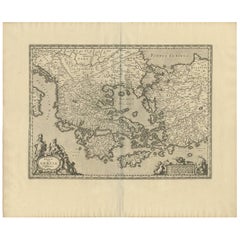
This is an authentic antique map of the Greece by Jan Jansson. The map was published in Amsterdam, circa 1653. This striking 17th century map of Greece was based on “Totius Graeciae ...
Category

Antique Mid-17th Century Collectibles and Curiosities

Materials

Paper

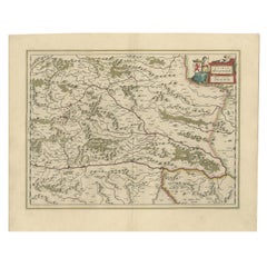
Map of Styria by William Blaeu, 1645: A Masterpiece of 17th-Century Cartography
Located in Langweer, NL
This 1645 map, created by Willem Janszoon Blaeu, represents Styria (Steyrmark), a historical region in present-day Austria, located in the Alpine regions. Blaeu, one of the most sign...
Category

Antique Mid-17th Century Collectibles and Curiosities

Materials

Paper

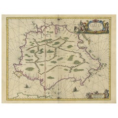
Antique Map of the Island of Borneo by Janssonius, circa 1650
Located in Langweer, NL
Antique map titled 'Insula Borneo et Occidentalis pars Celebis cum adjacentibus Insulis'. Rare sea chart of the island of Borneo. Published by J. Janssonius, circa 1650.
Category

Antique Mid-17th Century Collectibles and Curiosities

Materials

Paper

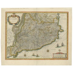
Antique Map of Catalonia by Blaeu, circa 1650
Located in Langweer, NL
Antique map titled 'Catalonia'. Antique map of Catalonia, extending from C. De Romani on the Northern Coast to Alfachs and Panicola in Valencia on the southern end of the coast and s...
Category

Antique Mid-17th Century Collectibles and Curiosities

Materials

Paper

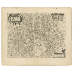
Antique Map of the Region of Rethelois by Janssonius, 1657
Located in Langweer, NL
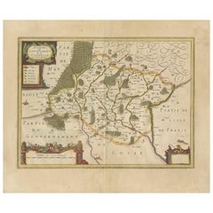
Antique map of France titled 'Dioecese de Rheims et le Païs de Rethel'. Detailed map, centered on the River Ayne and the River Velle and sowing Reims, Chalons, Sedan, Charleville, as...
Category

Antique Mid-17th Century Collectibles and Curiosities

Materials

Paper

Antique Map of the Region of Hauts-de-France by Hondius, circa 1630
Located in Langweer, NL
Antique map titled 'Description du Gouvernement de la Cappelle'. Old map of the region of Hauts-de-France including the cities of Vervins, Marle, Cappelle and others. This map origin...
Category

Antique Mid-17th Century Collectibles and Curiosities

Materials

Paper

Bishopric of Hildesheim Map in Northern Germany by Willem & Joan Blaeu, 1645
Located in Langweer, NL
This beautifully hand-colored map, titled "Episcopatus Hildesiensis Descriptio Novissima," depicts the Bishopric of Hildesheim, a historical ecclesiastical territory in present-day L...
Category

Antique Mid-17th Century Collectibles and Curiosities

Materials

Paper

Antique Map of Madagascar by Mariette 'c.1670'
Located in Langweer, NL
Antique map titled 'Isle Dauphine communement nommée par les Europeens Madagascar, et St. Laurens (..)'. Original large-scale antique map of Madagascar...
Category

Antique Mid-17th Century Collectibles and Curiosities

Materials

Paper

Battle of Wimpfen, 1622: Engraving by Matthäus Merian (ca. 1645)
Located in Langweer, NL
Title: Battle of Wimpfen, 1622: Engraving by Matthäus Merian (ca. 1645) Description: This antique copper engraving, created by the renowned Swiss-German engraver Matthäus Merian aro...
Category

Antique Mid-17th Century Collectibles and Curiosities

Materials

Paper

Original Hand-Colored Antique Map of Ancient Germany, circa 1630
Located in Langweer, NL
Antique map titled 'Germaniae Veteris typus'. Very attractive map of ancient Germany. Published by G. Blaeu after A. Ortelius, circa 1630. Willem Jans...
Category

Antique Mid-17th Century Collectibles and Curiosities

Materials

Paper

Circa 1659 Willem Blaeu Map: Southwestern Switzerland with Geneva & Lakes
Located in Langweer, NL
Circa 1659 Willem Blaeu Map: Southwestern Switzerland with Geneva & Lakes This detailed map from circa 1659 by Willem Blaeu, titled "Das Wiflispurgergow," highlights the southwestern region of Switzerland. It features significant landmarks such as Geneva, Lake Geneva (Lacus Lemannus), Lake Neuchatel, Lake Biel, Bern, Freiburg, and Lake Thuner. Based on the work of Gerard Mercator, this map is published with Spanish text on the verso, dating from the period between 1659 and 1672. Measuring 19.9 inches wide by 15.1 inches high, the map is rendered in full contemporary color on a bright sheet that bears a large watermark of the god Atlas. The condition is excellent, with a sharp impression, short centerfold separations at the top and bottom margins, and an archivally repaired tear in the right margin. Keywords: - Willem Blaeu map - Gerard Mercator - 17th-century Switzerland map...
Category

Antique Mid-17th Century Collectibles and Curiosities

Materials

Paper

The 17th Century Map of Northern Dithmarschen and Its Towns in Germany
Located in Langweer, NL
This is a detailed colored copperplate engraving depicting northern Dithmarschen, accompanied by town plans of Weßlingburen (now Wesselburen), Lunden, and Heyde (now Heide) at the to...
Category

Antique Mid-17th Century Collectibles and Curiosities

Materials

Paper

Antique Map of Southeast Asia 'India, Indonesia' by N. Visscher, circa 1670
Located in Langweer, NL
Antique map titled 'Indiae Orientalis, nec non Insularum Adiacentium Nova Descriptio.' The map centers on the Strait of Malacca and Malay Peninsula. It extends from India and the Mal...
Category

Antique Mid-17th Century Collectibles and Curiosities

Materials

Paper

Antique Map of the Spice Islands 'Moluccas', Indonesia by W. Blaeu, circa 1640
Located in Langweer, NL
Antique map titled 'Moluccae Insulae Celeberrimae'. Highly decorative antique map of the Spice Islands (Moluccas) published by W. Blaeu (circa 1640). This map features a large inset ...
Category

Antique Mid-17th Century Collectibles and Curiosities

Materials

Paper

Large Rhine River Map, Moselle and Meuse, by Willem Blaeu, Hand-coloured - 1640
Located in Langweer, NL
Rhine River & Tributaries Antique Map by Willem Blaeu, c.1640 This spectacular mid-seventeenth-century copper-engraved map, titled in Latin “Rhenus Fluvio...
Category

Dutch Antique Mid-17th Century Collectibles and Curiosities

Materials

Paper

Original Antique Map of the English counties Cornwall, Devon, Dorset, etc, 1633
Located in Langweer, NL
Antique map titled 'Cornubia, Devonia, Somersetus, Dorcestria, Wiltonia, Glocestria, Monumetha, Glamorgan, Caermarden, Penbrok, Cardigan, Radnor, Breknoke et Herfordia'. Old map of the English counties of Cornwall, Devon, Somerset, Dorset, Wiltshire, Gloucestershire, Herefordshire, Worcestershire etc. Originates from the 1633 German edition of the Mercator-Hondius Atlas Major, published by Henricus Hondius and Jan Jansson under the title: 'Atlas: das ist Abbildung der gantzen Welt, mit allen darin begriffenen Laendern und Provintzen: sonderlich von Teutschland, Franckreich, Niderland, Ost und West Indien: mit Beschreibung der selben.' Artists and Engravers: Gerard Mercator (1512 - 1594) originally a student of philosophy was one of the most renowned cosmographers and geographers of the 16th century, as well as an accomplished scientific instrument maker. He is most famous for introducing Mercators Projection, a system which allowed navigators to plot the same constant compass bearing on a flat...
Category

Antique Mid-17th Century Collectibles and Curiosities

Materials

Paper

Antique Map of Thracia ‘Greece’ by J. Janssonius, circa 1650
Located in Langweer, NL
This antique map of Thracia is engraved and published by J. Janssonius after the cartographical sources by Abraham Ortelius. Ornated in the upper left corner with a title cartouche a...
Category

Antique Mid-17th Century Collectibles and Curiosities

Materials

Paper

Original Antique Map of Brasil, Published in the 16th Century, 1561
Located in Langweer, NL
This important Ruscelli map of Brazil, from his work La Geografia di Claudio Tolomeo Alessandrino, is one of the earliest obtainable modern maps of the re...
Category

Antique Mid-17th Century Collectibles and Curiosities

Materials

Paper

Old Map Focusing on the Wine Region of Metz, the Moselle Region of France, 1657
Located in Langweer, NL
Antique map of France titled 'Territorium Metense'. Old map focusing on the wine region surrounding Metz, in the Moselle region of France. This map originates from 'Atlas Novus, ...
Category

Antique Mid-17th Century Collectibles and Curiosities

Materials

Paper

Beautiful Antique Map of the Moluccas or Spice Islands, Indonesia, ca.1650
Located in Langweer, NL
Antique map titled 'Insularum Moluccarum Nova Descriptio.' Beautiful map of the Moluccas. The famous Spice Islands, the cornerstone of the Dutc...
Category

Antique Mid-17th Century Collectibles and Curiosities

Materials

Paper

Original Antique Map of the City of Stavoren, Friesland, The Netherlands, 1649
Located in Langweer, NL
Antique map titled 'Staveren'. Original antique map of the city of Stavoren, Friesland, The Netherlands. This map originates from 'Toonneel der Steden van de Vereenighde Nederlanden'...
Category

Antique Mid-17th Century Collectibles and Curiosities

Materials

Paper

Description of the city of Delft, by Dirck can Bleyswijck - ILLUSTRATED, 1667
Located in Middletown, NY
A very good copy of Bleyswijck famous description of the history, topography, institutions, and commercial life of Delft in the 17th Century. The plates are exquisite depiction's of ...
Category

Dutch Antique Mid-17th Century Collectibles and Curiosities

Materials

Gold Leaf

Antique Hand-colored Map of Brandenburg, Germany
Located in Langweer, NL
Antique map titled 'Marchionatus Brandenburgicus'. Original antique map of Brandenburg, with Königsberg and Stettin, Germany. Published by J. Janssonius, circ 1650. Jan Janssonius ...
Category

Antique Mid-17th Century Collectibles and Curiosities

Materials

Paper

Decorative Antique Map of the Region of Cambrai, France, ca.1630
Located in Langweer, NL
Antique map titled 'l'Archevesche de Cambray'. Decorative map of the region of Cambrai, France. Includes the cities of Cambrai, Valencienes, Douai, and Bouchain. Artists and Engravers: Henricus...
Category

Antique Mid-17th Century Collectibles and Curiosities

Materials

Paper

Joseph GLANVILL. The Vanity of Dogmatizing. FIRST EDITION - 1661 - HIS 1st BOOK!
Located in Hillsborough, NJ
AUTHOR: GLANVILL, Joseph. TITLE: The Vanity of Dogmatizing: Or Confidence in Opinions Manifested in a Discourse of the Shortness and Uncertainty of Our Knowledge, and Its Causes, w...
Category

British Antique Mid-17th Century Collectibles and Curiosities

Materials

Leather

Rare Antique Engraving of Mount Fuji During an Earthquake in Tokyo, Japan, 1669
Located in Langweer, NL
Antique print, titled: 'Aertbeevinge tot Jedo.' - ('Earthquake in Edo'). A temple falls to ruins because of an earthquake in Yedo (or Edo, Jeddo; now Tokyo). Men and women lament...
Category

Antique Mid-17th Century Collectibles and Curiosities

Materials

Paper

Map of Le Maine by H. Hondius, 1633, Hand-Colored, Decorative and Historic
Located in Langweer, NL
Map of Le Maine by H. Hondius, 1633, Hand-Colored, Decorative and Historic This rare and beautifully executed antique map titled 'Le Maine' was published in 1633 by Henricus Hondius...
Category

Antique Mid-17th Century Collectibles and Curiosities

Materials

Paper

Antique Map of the Region of Oldenburg, Germany
Located in Langweer, NL
Antique map titled 'Oldenburg Comitatus'. Detailed old map of Oldenburg, Germany. The map also shows Bremen and the Jade Bight. Published by W. Blaeu, circa 1640. Willem Jansz. Blaeu...
Category

Antique Mid-17th Century Collectibles and Curiosities

Materials

Paper

Large Antique Lithography Map, Northamptonshire, Framed Cartography, John Speed
Located in Hele, Devon, GB
This is a large antique lithography map of Northamptonshire. An English, framed atlas engraving of cartographic interest by John Speed, dating to the early 17th century and later. Superb lithography reproduction of Northamtonshire - place names are written in 17th century English Displays a desirable aged patina and in very good order Fascinating Jacobean period cartography, set within a quality, later frame Reproduced here from its appearance in the 'Theatre of Great Britain' of 1627 published by George Humble Marked for John Speed as cartographer and George Humbell (sic) as seller Exceptional detail, as expected from a John Speed map...
Category

British Other Antique Mid-17th Century Collectibles and Curiosities

Materials

Glass, Wood, Paper

Antique Map of the Duchy of Westphalia, Germany
Located in Langweer, NL
Original antique map titled 'Westphalia Ducatus'. Fine map of the Duchy of Westphalia, Germany. The map is centered on Meschede and includes Arensberg, Beelick, and Brilon. Published...
Category

Antique Mid-17th Century Collectibles and Curiosities

Materials

Paper

Antique Map of Paraguay by A. Montanus, circa 1671
Located in Langweer, NL
Antique map titled 'Paraquaria Vulgo Paraguay Cum adjacentibus'. Antique map extending from Rio de Janiero to the Rio de la Plata basin. The map include...
Category

Antique Mid-17th Century Collectibles and Curiosities

Materials

Paper

Jousting Tournament in Japan, Held to Honor Toyotomi Hideyoshi in Jurazu, 1669
Located in Langweer, NL
Antique print, untitled. A jousting tournament in Japan, held to honor Taicosama (Toyotomi Hideyoshi ?) in Jurazu. Arnoldus Montanus' "Gedenkwaerdig...
Category

Antique Mid-17th Century Collectibles and Curiosities

Materials

Paper

Original Antique Engraving of Sakai in the Osaka Prefecture, Japan, 1669
Located in Langweer, NL
Antique print, titled: 'De Stadt Saccai. La Ville de Saccai.' - ('The City Saccai'). This plate shows a view of Sakai in the Osaka Prefecture, Japan. Sakai has been one of the la...
Category

Antique Mid-17th Century Collectibles and Curiosities

Materials

Paper

The Principality of Dombes: A 17th-Century Cartographic Jewel by Jan Jansson
Located in Langweer, NL
The text on the map "La principaute de Dombes; J. van den Eynde sculpit.; La Principavte de Dombes" indicates that it is a map of the principality of Dombes, engraved by J. van den E...
Category

Antique Mid-17th Century Collectibles and Curiosities

Materials

Paper

A Gold Highlighted Antique Map of Northamptonshire by Blaeu '1659'
Located in Langweer, NL
Antique map titled 'Comitatus Northantonensis vernacule Northamtonshire'. Original antique map of Northamptonshire, England. This map originates from 'Atlas Universal y Cosmographico...
Category

Antique Mid-17th Century Collectibles and Curiosities

Materials

Paper

Antique Plan of the Castle & City of Batavia 'Jakarta' on Java, Indonesia, c1669
Located in Langweer, NL
Antique map Batavia titled 'Ware Affbeeldinge wegens het Casteel ende Stadt Batavia'. Antique print of the castle and city of Batavia on the Island of Java'. Rare edition with En...
Category

Antique Mid-17th Century Collectibles and Curiosities

Materials

Paper

Antique Map of Africa Made after Hondius, circa 1655
Located in Langweer, NL
Antique map titled 'Africa Nova Tabula Auct Jud. Hondio'. Beautiful and rare paneled map of Africa, Based Upon Hondius' map. The first derivative of the map was issued separately by ...
Category

Antique Mid-17th Century Collectibles and Curiosities

Materials

Paper

Original Antique Map of the Area of Bremen and Lower Saxony
Located in Langweer, NL
Antique map titled 'Ducatus olim Episcopatus Bremensis et ostiorum Albis et Visurgis Fluviorum novissima Descriptio'. Original old map of the area of ??Bremen and Lower Saxony. Uncom...
Category

Antique Mid-17th Century Collectibles and Curiosities

Materials

Paper

Antique Map of the Region of 'Île de France' by Janssonius, circa 1650
Located in Langweer, NL
Antique map of France titled 'Le Gouvernement de L'Isle de France'. Paris is represented by a miniature plan of the city, making it distinct from the other towns of the region which ...
Category

Antique Mid-17th Century Collectibles and Curiosities

Materials

Paper

Cartographic Elegance of Touraine: A 17th-Century Map Showing French Heritage
Located in Langweer, NL
"Ducatus Turonensis - Touraine," is a original antique historical map of the Touraine region, which is located in the heart of France, centered...
Category

Antique Mid-17th Century Collectibles and Curiosities

Materials

Paper

Loudun and Mirebeau: A Cartographic Masterpiece of 17th Century France by Blaeu
Located in Langweer, NL
Cartography, 17th century. Willem (1571-1638) and Joan Blaeu (1596-1673), Theatrum Orbis Terrarum sive Atlas Novus..., 1635. Figure: Loudonois. Laudunum (Loudun); Mirebalais (Mirebea...
Category

Antique Mid-17th Century Collectibles and Curiosities

Materials

Paper

Lyonnais, Beaujolais, Forez, Mâconnais: A 1644 Depiction of France's Provinces
Located in Langweer, NL
An original antique map from 1644, depicting the French provinces of Lyonnais, Beaujolais, Forez, and Mâconnais. In this map, north is oriented to the right, which is a cartographic ...
Category

Antique Mid-17th Century Collectibles and Curiosities

Materials

Paper

Engraving of Dutch Attacking the Portuguese Fleet off Bantam, Indonesia, 1644
Located in Langweer, NL
Antique print titled 'Bantam'. Copper engraving of the Dutch attack on the Portuguese fleet off Bantam in 1601 depicted as the victory of Admiral Wolfert Harmensz and his 5 ships over 30 Portuguese ships. The ships in the battle include the Sultan of Bantam’s war galleys (ghali); ocean-going craft with sails, oars and a prow battering ram built according to Mediterranean standards learnt from Portuguese renegades and Turkish shipwrights. They were built to allow them to shoot the large cannon...
Category

Antique Mid-17th Century Collectibles and Curiosities

Materials

Paper

Antique Map of the Province of Overijssel, the Netherlands
Located in Langweer, NL
Original antique map titled 'Ditio Trans-Isulana'. Original old map of the province of Overijssel, the Netherlands. With coat of arms and two decorative cartouches. Published by J. J...
Category

Antique Mid-17th Century Collectibles and Curiosities

Materials

Paper

Antique Map of Macedonia, Northern Greece and part of Turkey in Europe
Located in Langweer, NL
Antique map titled 'Macedonia Epirus et Achaia'. Original old map of Macedonia, northern Greece, and part of Turkey in Europe. Published by W.J. Blaeu, circa 1640. Willem Janszoon ...
Category

Antique Mid-17th Century Collectibles and Curiosities

Materials

Paper

Antique Map of the Region of Valois by Hondius, circa 1630
Located in Langweer, NL
Antique map titled 'Le Pais de Valois'. Old map of the historic region of Valois, France. It corresponds to the southeastern quarter of the modern département of Oise, with an adjace...
Category

Antique Mid-17th Century Collectibles and Curiosities

Materials

Paper

Antique Map of Cheshire, North West England
Located in Langweer, NL
Antique map titled 'Cestria comitatus Palatinus'. Original old map of Cheshire, Northwest England. Published circa 1665 by J. Blaeu. Willem Jansz. Blaeu and his son Joan Blaeu are th...
Category

Antique Mid-17th Century Collectibles and Curiosities

Materials

Paper

Antique Map of Northern Germany, showing the area of Mecklenburg-Vorpommern
Located in Langweer, NL
Antique map titled 'Meklenburg Ducatus'. Attractive map of northern Germany, showing the area of Mecklenburg-Vorpommern. Published by J. Janssonius, circa 1630. Jan Janssonius (als...
Category

Antique Mid-17th Century Collectibles and Curiosities

Materials

Paper

Antique Map centered on Nuremberg, Germany
Located in Langweer, NL
Antique map titled 'Territorium Norimbergense'. Beautiful map centered on Nuremberg, Germany. With decorative title cartouche and inset plan of the city. Published by W. Blaeu, circa...
Category

Antique Mid-17th Century Collectibles and Curiosities

Materials

Paper

Antique Map of Asia Minor, showing Turkey, Cyprus and the Islands in the Aegean
Located in Langweer, NL
Antique map titled 'Natolia, quae olim Asia Minor'. Decorative map of Asia Minor, showing Turkey, Cyprus and the Islands in the Aegean. This attractive map shows all of Turkey, Cyprus and the Aegean Islands to a relatively high degree of accuracy. At the time the entire region was under the rule of the Ottoman Empire (Cyprus was conquered in 1571 from the Venetians). A maritime battle...
Category

Antique Mid-17th Century Collectibles and Curiosities

Materials

Paper

Antique Map of the Province of Kilan by Olearius '1662'
Located in Langweer, NL
Antique map titled 'A Map of ye Province of Kilan as it lies on ye Caspian Sea'. Rare map of the province of Kilan, near the Caspian Sea. Originates from 'The voyages and travells of the Ambassadors sent by Frederick Duke of Holstein, to the Great Duke of Muscovy, and the King of Persia...
Category

Antique Mid-17th Century Collectibles and Curiosities

Materials

Paper

Old Engraving of A Panoramic Bird's Eye View of Miaco 'Kyoto', Japan, 1669
Located in Langweer, NL
Description: Antique print, titled: 'Miako.' - A panaromic bird's eye view of Miaco (Kyoto). Arnoldus Montanus' "Gedenkwaerdige Gesantschappen der Oost-Indische Maatschappy in 't Ver...
Category

Antique Mid-17th Century Collectibles and Curiosities

Materials

Paper

Italian Renaissance Painted Lifesize Figure of Religious Scholar
Located in Queens, NY
Italian Renaissance painted pine life size figure of religious scholar holding book (17/18th Cent) Replacement finger
Category

Italian Renaissance Antique Mid-17th Century Collectibles and Curiosities

Materials

Pine

Antique Map of the Region involved in the Conquest of Cyrus the Great
Located in Langweer, NL
Antique map titled 'Tabula Itineris Decies Mille (..)'. This historical map illustrates the region involved in the conquest of Cyrus the Great (558-528 BC), the founder of the Persia...
Category

Antique Mid-17th Century Collectibles and Curiosities

Materials

Paper

Antique Map of the Rhineland and Alsace Region with Original Hand Coloring
Located in Langweer, NL
Antique map titled 'Palitinat du Rhein, Alsace, et partie de Souabe de Franconie (..)'. Double-page engraved map of the Rhineland and Alsace with original/contemporary hand coloring....
Category

Antique Mid-17th Century Collectibles and Curiosities

Materials

Paper

Original Map of the Military Situation After the Dutch Blockade of Antwerp, 1648
Located in Langweer, NL
Antique map titled 'Tabula Castelli ad Sandflitam (..)'. This map depicts the complex military situation that had developed after the Dutch blockade of Antwerp. All entrenchment'...
Category

Antique Mid-17th Century Collectibles and Curiosities

Materials

Paper

Map of East Friesland, The Netherlands & the Area Emden & Norden, Germany, 1635
Located in Langweer, NL
Antique map titled 'Typus Frisiae Orientalis.' Map of East Friesland and the area around Emden and Norden. Large inset map of the mouth of the Amasis River. The map is decorated with a large title cartouche and two large coats of arms...
Category

Antique Mid-17th Century Collectibles and Curiosities

Materials

Paper

Antique Map of Berkshire, South East England
Located in Langweer, NL
Antique map titled 'Bercheria vernacule Barkshire'. Original old map of Berkshire, a historic county in South East England. Published circa 1665 by J. Blaeu. Willem Jansz. Blaeu and ...
Category

Antique Mid-17th Century Collectibles and Curiosities

Materials

Paper

Original Antique Map of the Duchy of Holstein
Located in Langweer, NL
Antique map titled 'Ducatus Holsatiae Nova Tabula'. Original old map of the Duchy of Holstein, the northernmost territory of the Holy Roman Empire, from the mid-17th Century. To the ...
Category

Antique Mid-17th Century Collectibles and Curiosities

Materials

Paper

Antique Map of the region of Lennep, Blankenburg and Dortmund, Germany
Located in Langweer, NL
Antique map titled 'Berge Ducatus Marck Comitatus'. Original antique map of the region of Lennep, Blankenburg and Dortmund, Germany. Published by Hondius, circa 1644.
Category

Antique Mid-17th Century Collectibles and Curiosities

Materials

Paper

Read More

Medal-Worthy Memorabilia from Epic Past Olympic Games

Get into the games! These items celebrate the events, athletes, host countries and sporting spirit.

Ahoy! You’ve Never Seen a Collection of Sailor Art and Kitsch Quite Like This

French trendsetter and serial collector Daniel Rozensztroch tells us about his obsession with objects related to seafaring men.

Pamela Shamshiri Shares the Secrets behind Her First-Ever Book and Its Effortlessly Cool Interiors

The sought-after designer worked with the team at Hoffman Creative to produce a monograph that beautifully showcases some of Studio Shamshiri's most inspiring projects.

Moroccan Artworks and Objects Take Center Stage in an Extraordinary Villa in Tangier

Italian writer and collector Umberto Pasti opens the doors to his remarkable cave of wonders in North Africa.

Montecito Has Drawn Royalty and Celebrities, and These Homes Are Proof of Its Allure

Hollywood A-listers, ex-pat aristocrats and art collectors and style setters of all stripes appreciate the allure of the coastal California hamlet — much on our minds after recent winter floods.

Whaam! Blam! Pow! — a New Book on Pop Art Packs a Punch

Publishing house Assouline and writer Julie Belcove have teamed up to trace the history of the genre, from Roy Lichtenstein, Andy Warhol and Yayoi Kusama to Mickalene Thomas and Jeff Koons.

What Makes a Gem-Encrusted Chess Set Worth $4 Million?

The world’s most opulent chess set, weighing in at 513 carats, is literally fit for a king and queen.

Tauba Auerbach’s Geometric Pop-Up Book Is Mighty Rare, Thanks to a Hurricane

This sculptural art book has an epic backstory of its own.
Recently Viewed

View All