Mid-17th Century Collectibles and Curiosities

to
239
290
17
307
6
2
4,431
6,784
13,459
2,726
3,520
4,677
3,077
512
300
606
745
480
898
888
899
659
595
280
13
12
7
7
44
12
8
7
6
307
307
307
28
1
1
Period: Mid-17th Century
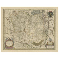
Antique Map of Brabant, the Netherlands, with Original Hand Coloring
Located in Langweer, NL
Original antique map titled 'Novissima et Accuratissima Brabantiae Ducatus Tabula'. Old map of Brabant, the Netherlands. North is to the right. Like all other maps of Brabantiae Duca...
Category

Antique Mid-17th Century Collectibles and Curiosities

Materials

Paper

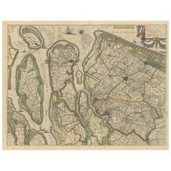
Antique Map of Delfland, Schieland and Islands of Zuid-Holland, the Netherlands
Located in Langweer, NL
Antique map titled 'Delflandia, Schielandia, et Insulae (..)'. Original antique map of Delfland, Schieland and islands of Zuid-Holland, the Netherlands. The 'Zuid-Hollandse Eilanden'...
Category

Antique Mid-17th Century Collectibles and Curiosities

Materials

Paper

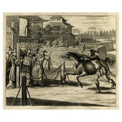
Original Antique Engraving of a Horse Race at a Japanese Racing Track, 1669
Located in Langweer, NL
Description: Antique print, titled: 'Japansche Ren-baanen.' - View of a race at a Japanese (horse) racing track. A man runs beside a horse (the horse's rein in his hand). A man w...
Category

Antique Mid-17th Century Collectibles and Curiosities

Materials

Paper

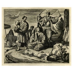
Original Engraving of Japanese Musicians Playing Native Music Instruments, 1669
Located in Langweer, NL
Antique print, titled: 'Japansche kamerspeelders.' - ('Japanese musicians'). Four chamber musicians are playing on native instruments outside. Arnol...
Category

Antique Mid-17th Century Collectibles and Curiosities

Materials

Paper

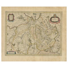
Antique Map by Janssonius of the Dutch Province of Overijsel, ca.1650
Located in Langweer, NL
Very good, given the age. Center fold as issued with wide margins. Sharp print with beautiful old-fashioned colouring, carbon copy on verso. Paper in the margins somewhat browned.
Category

Antique Mid-17th Century Collectibles and Curiosities

Materials

Paper

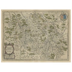
Old Map of the Bourbonnais Region of France, ca.1630
Located in Langweer, NL
Antique map titled 'Bourbonois - Borbonium Ducatus'. Old map of the Bourbonnais region of France. Bourbonnais was a historic province in the centre of France that corresponds to ...
Category

Antique Mid-17th Century Collectibles and Curiosities

Materials

Paper

Old Handcolored Antique Map of Pays De Caux in Normandy, France, ca.1640
Located in Langweer, NL
Antique map titled 'Le Pais de Caux'. Old map of Pays de Caux, France. Pays de Caux is an area in Normandy occupying the greater part of the French département of Seine Maritime ...
Category

Antique Mid-17th Century Collectibles and Curiosities

Materials

Paper

Original Hand-Colored Antique Map of Gelderland and Utrecht in the Netherlands
Located in Langweer, NL
Antique map titled 'Ducatus Geldriae novissima descriptio'. Detailed map of Gelderland, a province in the Netherlands. Two coats of arms, one with scale. Ships on ‘De Zuyderzee’. Pub...
Category

Antique Mid-17th Century Collectibles and Curiosities

Materials

Paper

Old Original Handcoloured Map of the Former Province of Perche, France, ca.1640
Located in Langweer, NL
Antique map titled 'Perchensis Comitatus - La Perche compte'. Old map of the former province of Perche, France. Until the French Revolution, Perche was bounded by four ancient te...
Category

Antique Mid-17th Century Collectibles and Curiosities

Materials

Paper

Antique County Map, Buckinghamshire, Bedfordshire, Dutch, Framed, Janssonius
Located in Hele, Devon, GB
This is an antique county map of Buckinghamshire and Bedfordshire. A Dutch, framed atlas engraving by Johannes Janssonius, dating to the 17th century and later. A treat for the col...
Category

Dutch Antique Mid-17th Century Collectibles and Curiosities

Materials

Paper

Original Antique Regional Map of France with Orleans, Auxerre and Montargis
Located in Langweer, NL
Original antique map titled 'Gastinois et Senonois'. Beautiful regional map of France. With Corbeil in the north, Pont sur Seyne in the east, Auxerre in the south, and Orleans in the...
Category

Antique Mid-17th Century Collectibles and Curiosities

Materials

Paper

Antique Map of Batavia, Dutch East Indies, Nowadays Jakarta, Indonesia, ca.1669
Located in Langweer, NL
Antique map titled 'Ware afbeeldinge wegens het Casteel ende Stadt Batavia gelegen opt groot Eylant Java Anno 1679. Plan de la Ville et du Chateau de Batavia en l'Isle de Iava. 1679....
Category

Antique Mid-17th Century Collectibles and Curiosities

Materials

Paper

Antique Engraving of the Statue of the Mythologic Hero Meleager, Rome. 1660
Located in Langweer, NL
Description: Antique print, titled: 'Meleager in Aedibus Pichinys.' Statue of Meleager in Rome. In Greek mythology, Meleager was a hero venerated in his temenos at Calydon in Aetolia. He was already famed as the host of the Calydonian boar hunt in the epic tradition that was reworked by Homer. From the 1660 Dutch edition of 'Icones et Segmenta Nobil. Signorum et Statuarum quae Romae extant' by Francois Perrier...
Category

Antique Mid-17th Century Collectibles and Curiosities

Materials

Paper

Antique Map of Holstein, Germany
Located in Langweer, NL
Antique map titled 'Holsatia Ducatus'. Original old map of Holstein, Germany. By Petrus Kaerius, published circa 1650. Pieter van den Keere (Latin: Petrus Kaerius 1571 – circa 1646) ...
Category

Antique Mid-17th Century Collectibles and Curiosities

Materials

Paper

Antique Map of Holstein, Germany
$359 Sale Price
20% Off
Beautiful Original Antique Map of Antwerp, Belgium by Mapmaker Blaeu, ca.1652
Located in Langweer, NL
Description: Antique map titled 'Antverpia; Gallis Anvers. Vernacule Antwerpen.' A very nicely coloured plan of Antwerp in Flanders, Belgium. West-oriented, with the river Scheld...
Category

Antique Mid-17th Century Collectibles and Curiosities

Materials

Paper

Detailed Map of the Holy Land, Showing the Travels of Christ & Apostles, ca.1650
Located in Langweer, NL
Antique map titled 'Het Beloofde Landt Canaan door wandelt van onsen Salichmaeker Jesu Christo neffens syne Apostelen.' Detailed map of the Holy Land, showing the travels of Christ and the Apostles, including Paul's travel's at sea and numerous sailing vessels. Below bible scenes such as the nativity and crucifiction of Christ. An excellent example of a Duch Bible map...
Category

Antique Mid-17th Century Collectibles and Curiosities

Materials

Paper

Print of the Temple of Sanjusangen-Do 'Thousand Armed Kannon' Kyoto, Japan, 1669
Located in Langweer, NL
Antique print, titled: 'Tempel met Duysent Beelden.' The Temple of Sanjusangen-Do in Kyoto, dedicated to the Thousand Armed Kannon. The central statue is that of Kannon. In front...
Category

Antique Mid-17th Century Collectibles and Curiosities

Materials

Paper

Old Color Engraving of Blaeu's first Map of Brazil, North Oriented to the Right
Located in Langweer, NL
Antique map titled 'Novus Brasiliae Typus'. Fine old color example of Blaeu's first map of Brazil, with north oriented to the right. Includes inset map of Baya de todos Santos, elaborate cartouche, 2 compass roses and richly embellished vignettes of native Brazilian life and animals. The interior of the map includes vignettes of indigenous animals and native scenes, including cannibalism. Inset within a decorative border is a small map of "Baya de todos Sanctos". In the sea are monsters, a galleon and two compass roses. The large title cartouche features a male and female Brazilian, both of whom are shown naked. Willem Janszoon Blaeu (1571-1638) was a prominent Dutch geographer and publisher. Born the son of a herring merchant, Blaeu chose not fish but mathematics and astronomy for his focus. He studied with the famous Danish astronomer Tycho Brahe...
Category

Antique Mid-17th Century Collectibles and Curiosities

Materials

Paper

Old Original Engraving of Prussia on the Southeast Coast of the Baltic Sea, 1632
Located in Langweer, NL
Description: Antique map titled 'Prussia'. Original map of Prussia, a historically prominent German state that originated in 1525 with a duchy centered on the region of Prussia o...
Category

Antique Mid-17th Century Collectibles and Curiosities

Materials

Paper

Antique Map of India and Southeast Asia by Sanson '1654'
Located in Langweer, NL
Antique map titled 'Partie Meridionale de l'Inde'. Early map of India and Southeast Asia. The map shows most of modern India, Bangladesh and Burma, the whole of Sri Lanka, Thailand, ...
Category

Antique Mid-17th Century Collectibles and Curiosities

Materials

Paper

Great Antique Bird's-Eye View Plan of Brielle by Blaeu in The Netherlands, 1649
Located in Langweer, NL
Antique print, titled: 'Briela.' Bird's-eye view plan of Brielle in The Netherlands. With key to locations and coats of arms. Text in Dutch on verso. This plan originates from the famous city Atlas: 'Toneel der Steeden' published by Joan Blaeu...
Category

Antique Mid-17th Century Collectibles and Curiosities

Materials

Paper

Original Old Map of South East England Incl London, Oxford, Cambridge, Etc, 1633
Located in Langweer, NL
Antique map titled 'Warwicum, Northhamtonia, Huntingdonia, Cantabrigia, Suffolcia, Oxonium, Buckinghamia, Befordia, Harfordia, Essexia, Berceria, Middlesexia, Southhatonia, Surria, Catiu & Southsexia'. Old map of south east England. Includes London, Salisbury, Oxford, Cambridge, Leicester and Norwich and the Isle of Wight. Originates from the 1633 German edition of the Mercator-Hondius Atlas Major, published by Henricus Hondius and Jan Jansson under the title: 'Atlas: das ist Abbildung der gantzen Welt, mit allen darin begriffenen Laendern und Provintzen: sonderlich von Teutschland, Franckreich, Niderland, Ost und West Indien: mit Beschreibung der selben.' Artists and engravers: Gerard Mercator (1512 - 1594) originally a student of philosophy was one of the most renowned cosmographers and geographers of the 16th century, as well as an accomplished scientific instrument maker. He is most famous for introducing Mercators Projection, a system which allowed navigators to plot the same constant compass bearing on a flat map.
Category

Antique Mid-17th Century Collectibles and Curiosities

Materials

Paper

Detailed Regional Antique Map of Northwestern France and Catholic Belgium, 1648
Located in Langweer, NL
Antique map titled 'Picardie et les Pays Bas Catholiques (..)'. Detailed regional map of Northwestern France and Catholic Belgium, from an early edition of Sanson's Atlas. Art...
Category

Antique Mid-17th Century Collectibles and Curiosities

Materials

Paper

Rare Antique Map of the Imperial Court in Peking China, 1665
Located in Langweer, NL
Antique print titled 'Platte Grondt van s Keysers Hof in Pekin. Forme de la Cour Imperiale de Peking'. This print originates from 'Joan Nieuhof, Het Gezands...
Category

Dutch Antique Mid-17th Century Collectibles and Curiosities

Materials

Paper

Arrival of the English King Charles II from Delft in The Hague, Holland, 1660
Located in Langweer, NL
Antique engraving with the title Arrival of the English King Charles II from Delft in The Hague, 25 May 1660. Episode during his tour through and departure from the Netherlands. Arrival at the Vijverberg and Het Groene Zoodje, salute shots are fired at the Hofvijver. In the air the fame and putti with the arms of the English king, Holland and The Hague. On the left part of the signs of the zodiac. Marked at the top: Page. 34. In the top the Arms of the King with the text: Honi soit qui mal y pense. This a maxim in the Anglo-Norman language, a dialect of Old Norman French spoken by the medieval ruling class in England, meaning "shamed be whoever thinks ill of it", usually translated as "shame on anyone who thinks evil of it" It has been used as the motto of the British chivalric Order of the Garter. In current French usage, the phrase may be used ironically to insinuate the presence of a hidden agenda or a conflict of interest. Makers (mentioned on the engraving): Pieter Philippe after a design of: Jacob...
Category

Antique Mid-17th Century Collectibles and Curiosities

Materials

Paper

Original Old Bird's-eye View plan of Sneek, Friesland, The Netherlands, 1649
Located in Langweer, NL
Antique map titled: 'Sneeck.' Bird's-eye view plan of Sneek, Friesland, The Netherlands. Text in Latin on verso. This plan originates from the famous city Atlas: 'Toneel der Steeden'...
Category

Antique Mid-17th Century Collectibles and Curiosities

Materials

Paper

Original Old Engraving, Bird's Eye View of Cangoxuma (Kagoshima) in Japan, 1669
Located in Langweer, NL
Rare Antique print, titled: 'Cangoxuma.' A stunning bird's eye view of the coastal city Cangoxuma (Kagoshima) in Japan. It shows several boats in the harbour, as well as the ligh...
Category

Antique Mid-17th Century Collectibles and Curiosities

Materials

Paper

Original Old Bird's-Eye View Plan of Sint-Winoksbergen or Bergen in France, 1649
Located in Langweer, NL
Antique map titled 'Berga Sti Winoci.' - Bird's-eye view plan of Sint-Winoksbergen in France, with key to locations and coats of arms. Text in Dutch on verso. This plan originates from the famous city Atlas: 'Toneel der Steeden' published by Joan Blaeu...
Category

Antique Mid-17th Century Collectibles and Curiosities

Materials

Paper

Antique Engraving with a Description of the Monkey Temple in Japan, 1669
Located in Langweer, NL
Antique print, titled: 'Beschryving van de Japansche Apen-tempel.' - ('Description of the Japanese Monkey Temple'). Interior of a temple filled wit...
Category

Antique Mid-17th Century Collectibles and Curiosities

Materials

Paper

Original Map with Bird's-Eye View of Zutphen in the Netherlands by Blaeu, 1649
Located in Langweer, NL
Antique print, titled: 'Zutphen.' - Bird's-eye view plan of Zutphen in The Netherlands, with key to locations and coats of arms. Text in Dutch on verso. This plan originates from the famous city Atlas: 'Toneel der Steeden' published by Joan Blaeu...
Category

Antique Mid-17th Century Collectibles and Curiosities

Materials

Paper

Map of the Alsace, France Incl the Rhine from Phillipsburg to South Basle, c1650
Located in Langweer, NL
Antique map titled 'Utriusquae Alsatiae Superioris Ac Inferioris Nova Tabula'. Map of the Alsace region (France) including the Rhine from Phillipsburg to south of Basle. Two deco...
Category

Antique Mid-17th Century Collectibles and Curiosities

Materials

Paper

Decorative Map of the Spice Islands in the Mollucas, Indonesia, ca.1640
Located in Langweer, NL
Antique map titled 'Moluccae Insulae Celeberrimae'. Decorative map of the Spice Islands. Inset of the Island of Bachian (Batjan) in an elaborate frame as well as a Moluccan couple in the lower right corner in Europeanized native dress. Artists and Engravers: Willem Janszoon Blaeu (1571-1638) was a prominent Dutch geographer and publisher. Born the son of a herring merchant, Blaeu chose not fish but mathematics and astronomy for his focus. He studied with the famous Danish astronomer Tycho...
Category

Antique Mid-17th Century Collectibles and Curiosities

Materials

Paper

Rare Etching of a Warrior Standing and Leaning on a Long Sword, ca.1658
Located in Langweer, NL
Etching of a warrior standing and leaning on a long sword. Originates from a figurine series 1653-1658, signed with his monogram. Artists and engravers: Sa...
Category

Antique Mid-17th Century Collectibles and Curiosities

Materials

Paper

Decorative Original Antique Print Depicting the Cavalry Marching in China, 1665
Located in Langweer, NL
Antique print titled ‘Kryghs-Ordre in het Marseren. L’Ordre de la Cavallerie en Marchant’. Decorative print depicting the cavalry. This print originates from ‘Joan Nieuhof, Het G...
Category

Antique Mid-17th Century Collectibles and Curiosities

Materials

Paper

Original Antique Hand-Colored Map of The East Indies and Southeast Asia, c.1644
Located in Langweer, NL
Antique map titled 'India quae Orientalis dicitur, et Insulae adiacentes'. Old map of the East Indies and Southeast Asia showing the area between India in the West and parts of J...
Category

Antique Mid-17th Century Collectibles and Curiosities

Materials

Paper

Antique Map of Drenthe, the Netherlands, with Original Hand Coloring
Located in Langweer, NL
Original antique map titled 'Illustribus ac Potentibus Comitatus Drentiae (..)'. Old map of the province of Drenthe, the Netherlands. Published by H. Hondius circa 1639. Hendrik ...
Category

Antique Mid-17th Century Collectibles and Curiosities

Materials

Paper

Detailed Antique Map of Northern Spanish Region of Aragon, c.1650
Located in Langweer, NL
Antique map titled 'Arragonia Regnum'. Detailed map of northern Spanish region of Aragon. The map is centered on the city of Zaragoza, aka, Saragossa. Shows towns, rivers, castle...
Category

Antique Mid-17th Century Collectibles and Curiosities

Materials

Paper

Antique Map of the region between Bergen op Zoom, Sandvliet, Hulst and Antwerp
Located in Langweer, NL
Original antique map titled 'Tabula Castelli ad Sandflitam (..)'. Detailed map of the region between Bergen op Zoom, Sandvliet, Hulst and Antwerp. Published by J. Janssonius, circa 1...
Category

Antique Mid-17th Century Collectibles and Curiosities

Materials

Paper

Decorative Bird's-Eye View Plan of Ieper or Ypres in Belgium, 1649
Located in Langweer, NL
Antique print, titled: 'Ypra.' Bird's-eye view plan of Ieper / Ypres in Belgium. With key to locations and coats of arms. Text in Latin on verso. This plan originates from the famous city Atlas: 'Toneel der Steeden' published by Joan Blaeu...
Category

Antique Mid-17th Century Collectibles and Curiosities

Materials

Paper

Antique Engraving of Edo 'or Jeddo, Yedo, Now Tokyo', 1669
Located in Langweer, NL
Antique print, titled: 'Iedo' A bird's eye view of Edo (or Jeddo, Yedo, now Tokyo) as seen from a nearby hill. 62 places are identified in a list (both in French and Dutch). Arno...
Category

Antique Mid-17th Century Collectibles and Curiosities

Materials

Paper

Antique Map of Turkey with Cyprus and Greece Islands by N. Sanson, circa 1652
Located in Langweer, NL
Antique map of Turkey, Anatolie with Cyprus and the Greece islands. Attractive scrolled title cartouche to top right corner. Blank verso.
Category

Antique Mid-17th Century Collectibles and Curiosities

Materials

Paper

Map of Southeast Asia, Extending from India to Tibet & Japan to New Guinea, 1640
Located in Langweer, NL
Antique map titled 'India quae Orientalis dicitur et Insulae adiacentes'. Map of Southeast Asia, extending from India to Tibet to Japan to New Guinea. This map is one of the firs...
Category

Antique Mid-17th Century Collectibles and Curiosities

Materials

Paper

Antique Map of the Region of Bourbonnais by Janssonius, circa 1640
Located in Langweer, NL
Antique map titled 'Bourbonois - Borbonium Ducatus'. Old map of the former region of Bourbonnais, France. It includes the cities of Bourbon, Moulins, Charenton, Brulles, Varennes and...
Category

Antique Mid-17th Century Collectibles and Curiosities

Materials

Paper

Original Antique Print of the Benedictine Abbey of Gembloux, Belgium, ca.1660
Located in Langweer, NL
Antique print titled 'Celebrrima et Antiquissima Cemblacensis Oppidi Abbatia Ordinis S. Benedicti in Gallo-Brabantia'. Original antique print of the Benedictine Abbey of Gembloux...
Category

Antique Mid-17th Century Collectibles and Curiosities

Materials

Paper

Detailed Original Antique Map of Thuringia, Germany by J. Janssonius, ca.1650
Located in Langweer, NL
Antique map titled 'Thuringiae Nova Descriptio.' Detailed map of Thuringia, Germany by J. Janssonius. With one cartouche, coat-of-arms and a mileage scale. With Erfurt in the centre....
Category

Antique Mid-17th Century Collectibles and Curiosities

Materials

Paper

Antique Map of the Burgundy Region by Merian '1646'
Located in Langweer, NL
Antique map titled 'Utriusque Burgundiae tum Ducatus tum Comitatus descriptio'. Old map of the Burgundy (Bourgogne) region of France. This map originates from 'Neuwe Archontologia co...
Category

Antique Mid-17th Century Collectibles and Curiosities

Materials

Paper

Works of William Shakespeare. 1632 - (Tragedy of Titus Andronicus) - page 75-76
Located in Hillsborough, NJ
AUTHOR: SHAKESPEARE, William. TITLE: The Works of William Shakespeare. (The Tragedy of Titus Andronicus) - page 75-76. PUBLISHER: London: Smethwick, J., Aspley, W., Hawkins, Richa...
Category

British Antique Mid-17th Century Collectibles and Curiosities

Materials

Paper

Antique Map of the Vermandois Region by Janssonius, circa 1650
Located in Langweer, NL
Antique map titled 'Vermandois'. Old map of the Vermandois region, France. Vermandois was a French County that appeared in the Merovingian period. Its na...
Category

Antique Mid-17th Century Collectibles and Curiosities

Materials

Paper

Antique Map of the Region of Blois by Janssonius, 'circa 1640'
Located in Langweer, NL
Antique map titled 'Description du Blaisois'. Old map of the region of Blois, France. It shows the city of Blois, Amboise, the Loire River and more. Published by J. Janssonius, circa...
Category

Antique Mid-17th Century Collectibles and Curiosities

Materials

Paper

Engraved Map of Northern England, Focusing on Northumberland, 1658
Located in Langweer, NL
Antique map titled 'Ancien Royaume de Northumberland, aujourdhuy Provinces de Nort (..)'. Engraved map of northern England, focusing on Northumber...
Category

Antique Mid-17th Century Collectibles and Curiosities

Materials

Paper

Antique Map of the Ancient British Isles by Janssonius 'circa 1640'
Located in Langweer, NL
Antique map titled 'Insularum Britannicarum Acurata Delineatio'. Original antique map of the ancient British Isles. England and Wales are labelled as B...
Category

Antique Mid-17th Century Collectibles and Curiosities

Materials

Paper

Beautiful Antique Map of Madagascar, The Comoros Islands & Reunion Island, 1667
Located in Langweer, NL
Antique map titled 'Isle d'Auphine, communement Nommée par les Europeens Madagascar, et St. Laurens, et par les Habitans du pays Madecase'. Beautiful map of Madagascar...
Category

Antique Mid-17th Century Collectibles and Curiosities

Materials

Paper

Antique Map of the Region of Le Mans 'France' by Blaeu, circa 1640
Located in Langweer, NL
Antique Map: Cenomanorum Galliae regionis typus vulgo le Mans – Blaeu, circa 1640 This beautifully engraved and hand-colored map depicts the historical province of Maine in northw...
Category

Antique Mid-17th Century Collectibles and Curiosities

Materials

Paper

Antique Map of Chili by Montanus, circa 1671
Located in Langweer, NL
Antique map titled 'Chili'. A very attractive map covering the known coastal region of Chile. The Andes are shown prominently, with two live volcanoes in the vicinity of Villarrica. ...
Category

Antique Mid-17th Century Collectibles and Curiosities

Materials

Paper

Antique Map of the Region of Franche-Comté by Janssonius, circa 1650
Located in Langweer, NL
Antique map titled 'Burgundiae Comitatus Franche Comté'. Old map of the historical and former region of Franche-Comté, France. As a region, it encompasse...
Category

Antique Mid-17th Century Collectibles and Curiosities

Materials

Paper

Antique Map of the Rhine-Palatinate by Janssonius, circa 1630
Located in Langweer, NL
Antique map titled 'Nova Descriptio Palatinatus Rheni'. Detailed map of the Rhine-Palatinate, a state of Germany located in the west of the country. The map tracks the course of the ...
Category

Antique Mid-17th Century Collectibles and Curiosities

Materials

Paper

Original Old Map of Leeuwarden, European Cultural Capital 2018, Holland, 1649
Located in Langweer, NL
Antique print, titled: 'Leoverdia.' This map shows Leoverdia (Leeuwarden). Bird's-eye view plan of Leeuwarden in The Netherlands, with key to locations and coats of arms. Text in...
Category

Antique Mid-17th Century Collectibles and Curiosities

Materials

Paper

Antique Map of the Region of Beauvais by Hondius, circa 1630
Located in Langweer, NL
Antique map titled 'Beauvaisis - Comitatus Belovacium'. Old map of the region of Beauvais, France. This map originates from a composite atlas and is signed by J. Hondius.
Category

Antique Mid-17th Century Collectibles and Curiosities

Materials

Paper

Old Map of the Alsace 'Elzas' Region with Lotharingen 'Lorraine', France, c1650
Located in Langweer, NL
Antique map titled 'Alsatia superior cum Suntgoia et Brisgoia'. Old map of the Alsace (or Elzas) region with Lotharingen (Lorraine), Strassburg, Freiburg, Basel etc. Source unkno...
Category

Antique Mid-17th Century Collectibles and Curiosities

Materials

Paper

Decorative Antique Map of the Berry Region, France, 1657
Located in Langweer, NL
Antique map of France titled 'Bituricum Ducatus - Duche de Berri'. Decorative map of the Berry region, France. Berry is a region located in the center of France. It was a provinc...
Category

Antique Mid-17th Century Collectibles and Curiosities

Materials

Paper

Read More

Medal-Worthy Memorabilia from Epic Past Olympic Games

Get into the games! These items celebrate the events, athletes, host countries and sporting spirit.

Ahoy! You’ve Never Seen a Collection of Sailor Art and Kitsch Quite Like This

French trendsetter and serial collector Daniel Rozensztroch tells us about his obsession with objects related to seafaring men.

Pamela Shamshiri Shares the Secrets behind Her First-Ever Book and Its Effortlessly Cool Interiors

The sought-after designer worked with the team at Hoffman Creative to produce a monograph that beautifully showcases some of Studio Shamshiri's most inspiring projects.

Moroccan Artworks and Objects Take Center Stage in an Extraordinary Villa in Tangier

Italian writer and collector Umberto Pasti opens the doors to his remarkable cave of wonders in North Africa.

Montecito Has Drawn Royalty and Celebrities, and These Homes Are Proof of Its Allure

Hollywood A-listers, ex-pat aristocrats and art collectors and style setters of all stripes appreciate the allure of the coastal California hamlet — much on our minds after recent winter floods.

Whaam! Blam! Pow! — a New Book on Pop Art Packs a Punch

Publishing house Assouline and writer Julie Belcove have teamed up to trace the history of the genre, from Roy Lichtenstein, Andy Warhol and Yayoi Kusama to Mickalene Thomas and Jeff Koons.

What Makes a Gem-Encrusted Chess Set Worth $4 Million?

The world’s most opulent chess set, weighing in at 513 carats, is literally fit for a king and queen.

Tauba Auerbach’s Geometric Pop-Up Book Is Mighty Rare, Thanks to a Hurricane

This sculptural art book has an epic backstory of its own.
Recently Viewed

View All