18th Century and Earlier More Furniture and Collectibles

to
2,888
4,167
1,111
5,329
300
156
136
81
57
53
50
28
16
5
3
3
2
2
2
2
1
10,642
31,797
15,230
6,673
13,813
6,709
927
562
1,134
1,409
1,059
2,884
2,958
2,592
1,207
818
3,396
952
716
499
284
2,008
463
372
372
266
5,329
5,329
5,329
58
21
14
13
12
Period: 18th Century and Earlier
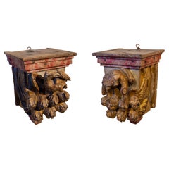
17th Century Pair of Carved and Gilded Wooden Mensulae with Birds
Located in Marbella, ES
17th century pair of carved and gilded wooden mensulae with birds.
Category

Spanish Antique 18th Century and Earlier More Furniture and Collectibles

Materials

Wood

17th Century Old Master Oil Painting Saint Bernard of Clairvaux, Spanish School
Located in Vero Beach, FL
17th century old master oil painting of Saint Bernard of Clairvaux. Spanish school. Dramatic expression and perfect use of chiaroscuro, the art of light and shadow effects, makes th...
Category

Spanish Baroque Antique 18th Century and Earlier More Furniture and Collectibles

Materials

Canvas

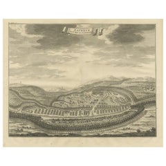
Panoramic Engraved View of the Town of Longvek 'or Lavek' in Cambodia, ca.1726
Located in Langweer, NL
Description: Antique print titled 'Eauweck, Hooft Stad van Cambodia'. Decorative panoramic view of the town of Longvek (or Lavek) in Cambodia. It was the second capital city during t...
Category

Antique 18th Century and Earlier More Furniture and Collectibles

Materials

Paper

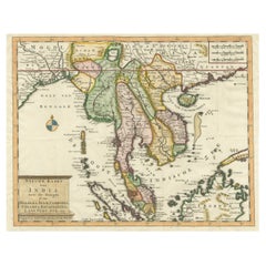
Antique Map of Indochina, the Malaysian Peninsula and Northern Sumatra
Located in Langweer, NL
Antique map titled 'Nieuwe Kaart van India over de Ganges of van Malakka, Siam, Cambodia, Chiampa, Kochinchina, Laos, Pegu, Ava, enz'. Original old map of Indochina, the Malaysian Pe...
Category

Antique 18th Century and Earlier More Furniture and Collectibles

Materials

Paper

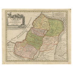
1718 Holy Land Map - Twelve Tribes, Six Provinces, Hand-Colored, Antique Map
Located in Langweer, NL
Title: Terra Sancta in XII olim Tribus nunc VI Provincias Dispertita Cartographer: Christoph Weigel the Elder (1654–1725) Publisher: Johann Ernst Adelbulner Publication Locatio...
Category

Antique 18th Century and Earlier More Furniture and Collectibles

Materials

Paper

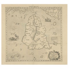
Rare Original Antique Ptolemy Map of Ceylon, Present Day Sri Lanka
Located in Langweer, NL
Original antique map titled 'Tab XII Asiae Taprobanam (..)'. For this map of Toprobana (Sri Lanka), Ptolemy drew on the accounts of travelers and sailors and though the information was secondhand and often inaccurate, it represented the most advanced account of the world's geography at that time. This map depicts the island with the typical misconceptions of the period with the enlarged island straddling the Equator and nearly divided by a ridge of mountains. A small part of India is incorrectly shown in the northeast corner of the map and a spurious coastline labeled Gangem fills the upper right corner. The stipple engraved sea contains an oriental ship...
Category

Antique 18th Century and Earlier More Furniture and Collectibles

Materials

Paper

18th Century Georgian Mahogany Bottle Holder on Stand
Located in Long Island City, NY
The bottle holder with a carrying handle. The stand on turned and fluted legs.
Category

Irish George III Antique 18th Century and Earlier More Furniture and Collectibles

Materials

Mahogany

Original Old Map with Many Details Around Manilla in the Philippine Islands
Located in Langweer, NL
Original antique map titled 'Carte du Canal des Iles Philippines (..) - Kaart van het Kanaal in de Filippynsche Eilanden (..)'. Striking and highly detailed chart of the Islands of the Philippines. Shows Islands, bays, reefs, soundings tracks of the Manila Galleon route, etc. Published 1724-1726 by Joannes van Braam...
Category

Antique 18th Century and Earlier More Furniture and Collectibles

Materials

Paper

18th Century Giltwood and Polychrome Painted Putti / Cherub
Located in Hastings, GB
Hand carved winged Italian Baroque Putti, water gilded over applied gesso, the face and head polychrome painted. Small hanging hook to the back of the head. Width 23 cm x Height 1...
Category

Italian Baroque Antique 18th Century and Earlier More Furniture and Collectibles

Materials

Gesso, Wood

18th Century French Tapestry
Located in Los Angeles, US
This is an authentic-style Aubusson tapestry pillow, showcasing the refined elegance of 18th-century French craftsmanship. Expertly woven in a flat-weave technique, the pillow featur...
Category

French Aubusson Antique 18th Century and Earlier More Furniture and Collectibles

Materials

Wool, Feathers

Large 1750 Map of the Kingdoms of Spain and Portugal by Robert de Vaugondy
Located in Langweer, NL
1750 Map of the Kingdoms of Spain and Portugal by Robert de Vaugondy Description: This map, titled *"Royaumes d'Espagne et de Portugal,"* was created in 1750 by the esteemed French ...
Category

Antique 18th Century and Earlier More Furniture and Collectibles

Materials

Paper

Rare Antique Map of Southwestern Europe and West Africa by V.M. Coronelli, 1692
Located in Langweer, NL
Antique Globe Gore: Southwestern Europe and West Africa by Vincenzo Coronelli This exquisite, hand-colored globe gore by Vincenzo Coronelli, one of the most renowned 17th-century cartographers, represents Southwestern Europe and West Africa. A segment of Coronelli's monumental 42-inch terrestrial globe, this gore is a remarkable example of the artistry and geographical knowledge of the late 1600s. Covering France, the Iberian Peninsula, and all of Africa west of a line extending from Algeria to the Bight of Benin, it also includes the Canary Islands and Madeira. Coronelli’s globe gores are celebrated for their exceptional engraving and accuracy, and this piece is no exception. The coastline of Africa is depicted with remarkable precision for its time, reflecting the latest geographical knowledge of European explorers. In contrast, the interior of Africa—still a mystery to European mapmakers—features mythical elements such as fantastical mountain ranges and exotic fauna. Giraffes, elephants, lions, and mysterious giant birds populate the landscape, offering a glimpse into the imagination and curiosity of the era. One notable detail is the Gambia...
Category

Antique 18th Century and Earlier More Furniture and Collectibles

Materials

Paper

18th Century Rare Dutch Mother of Pearl Pin Booklet with a Silver Back and Lock
Located in Delft, NL
18th century rare Dutch mother of pearl pin booklet with a silver back and lock A mother of pearl pin booklet with a silver back and lock. On ...
Category

Dutch Antique 18th Century and Earlier More Furniture and Collectibles

Materials

Silver

17th-Century Map of the Latin Patriarchate of Jerusalem by Melchior Tavernier
Located in Langweer, NL
Title: 17th-Century Map of the Latin Patriarchate of Jerusalem by Melchior Tavernier Description: This rare 17th-century map by Melchior Tavernier illustrates the geographical ext...
Category

Antique 18th Century and Earlier More Furniture and Collectibles

Materials

Paper

Antique Map of Asia Minor including part of the Greek Archipelago and Cyprus
Located in Langweer, NL
Antique map titled 'Chersonesi quae hodie Natolia Descriptio'. Decorative, smaller map of Asia Minor including part of the Greek Archipelago and Cyprus. The drape-style title cartouc...
Category

Antique 18th Century and Earlier More Furniture and Collectibles

Materials

Paper

Antique Map of the Adriatic Sea and the Balkan by J. Janssonius, circa 1650
Located in Langweer, NL
Striking large-scale map of the Greater Balkans. Decorated with two large-scale cartouches, one showing two swordsman at odds with one another and the other ...
Category

Antique 18th Century and Earlier More Furniture and Collectibles

Materials

Paper

Antique Print of the House of Roger Hudson by Campbell, 1725
Located in Langweer, NL
Antique print titled 'The Elevation of Roger Hudson Esqr. his house at Sunbury (..)'. Old engraving of the house of Roger Hudson in Sunbury. This print originates from 'Vitruvius Bri...
Category

Antique 18th Century and Earlier More Furniture and Collectibles

Materials

Paper

Antique Map of Eastern Seram, Part of the Maluku Island in East Indonesia, 1726
Located in Langweer, NL
Antique map titled 'De Landvoogdy van Amboina met de elf onderhoorige Eylanden.' Detailed map of the eastern part of Seram in Indonesia, part of the Maluku islands. Map of the southe...
Category

Antique 18th Century and Earlier More Furniture and Collectibles

Materials

Paper

Antique Town Plan of Emden ‘Germany’ by Braun & Hogenberg, 1597
Located in Langweer, NL
Antique map titled 'Embdena (..)'. Old, antique bird's-eye view plan of Emden, Germany. This bird's-eye view from the southwest over the Dollart shows Emden, which developed from a trading settlement in the 7th/8th centuries into a city as late as late 14th century. In 1494 it was granted staple rights, and in 1536 the harbour was extended. In the mid-16th century Emden's port was thought to have the most ships in Europe. Its population then was about 5,000, rising to 15,000 by the end of the 16th century. The Ems flowed directly under the city walls, but its course was changed in the 17th century by the construction of a canal. Emden has canals within its city limits, a typical feature of Dutch towns, which also enabled the extension of the harbour. Emden's first herring company was founded in 1553, and in 1595 Emden was created a Free Imperial City under the protection of Holland. Published by Braun...
Category

Antique 18th Century and Earlier More Furniture and Collectibles

Materials

Paper

Antique Print of Caesar's Camp, A Roman Battle Print, c.1753
Located in Langweer, NL
Antique battle map of Caesar's Camp. With detailed legend explaining the various elements of the print. This print most likely originates from an edition of 'The Commentaries of Caesar, Translated into English. To Which is Prefixed a Discourse Concerning The Roman Art of War...
Category

Antique 18th Century and Earlier More Furniture and Collectibles

Materials

Paper

Antique Map of Asia Minor, Region of the Nile and Region of the City of Carthage
Located in Langweer, NL
Three antique maps on one sheet titled 'Natoliae quae olim Asia Minor [with] Aegypti recentior descriptio [with] Carthaginis Celeberrimisinus Typus'. The first map covers Asia Minor,...
Category

Antique 18th Century and Earlier More Furniture and Collectibles

Materials

Paper

Original Antique Map of Brasil, Published in the 16th Century, 1561
Located in Langweer, NL
This important Ruscelli map of Brazil, from his work La Geografia di Claudio Tolomeo Alessandrino, is one of the earliest obtainable modern maps of the re...
Category

Antique 18th Century and Earlier More Furniture and Collectibles

Materials

Paper

Antique Map of Tartary and Northeast Asia, c.1750
Located in Langweer, NL
Antique map titled 'Carte de la tartarie occidentale'. An interesting map of Tartary and northeast Asia, from Lake Baykal, Partie du Siberia in the north, Pays des Kalkas at the cent...
Category

Antique 18th Century and Earlier More Furniture and Collectibles

Materials

Paper

Gerusalemme Liberata by Torquato Tasso – Elegant French 18th C "pocket" edition
Located in Middletown, NY
Paris: Prault, 1768 2 vols, 12mo, 5 3/8 x 3 1/8 inches (136 x 80 mm). Vol. 1: front. title, 2nd frontispiece, iii, 326; Vol. 2: title, 333 pp. Text in Italian. Frontispiece by Godefr...
Category

French Antique 18th Century and Earlier More Furniture and Collectibles

Materials

Gold Leaf

Antique Portrait of Ivan IV The Terrible, 1st Csar of All Russia, 1615
Located in Langweer, NL
Antique portrait titled 'Basilius Magnus (..)'. Portrait of Ivan IV (1530-84, 'the Terrible'). This print originates from 'Tooneel der keyseren ende coningen van christenryck sedert den onderganck van het Griecks keyserdom vervatende hare beeltnissen afcomsten ende voornaemste daden (..)'. Ivan IV Vasilyevich (Russian: ???´? ????´??????; 25 August 1530 – 28 March [O.S. 18 March] 1584),[2] commonly known in English as Ivan the Terrible...
Category

Antique 18th Century and Earlier More Furniture and Collectibles

Materials

Paper

17th Century English Needlework Lion Pillow
Located in Los Angeles, US
17th Century English Needlework Lion Pillow 13" X 8", handmade 17th century piece
Category

English Baroque Antique 18th Century and Earlier More Furniture and Collectibles

Materials

Wool, Feathers

Antique Map of Pannonia and Illyria by Cluver, 1685
Located in Langweer, NL
Antique map titled 'Pannonia et Illyricum.' Charming miniature map of Pannonia and Illyria, from the pocket atlas 'Introductionis in Universam Geographiam tam Veterem quam novam .. A...
Category

Antique 18th Century and Earlier More Furniture and Collectibles

Materials

Paper

Original Antique Map of England and Wales, with Decorative Cartouche
Located in Langweer, NL
Antique map titled 'England and Wales from the best Authorities'. Original antique map of England and Wales, with decorative cartouche. Engraved by T. Conder. Published circa 1790.
Category

Antique 18th Century and Earlier More Furniture and Collectibles

Materials

Paper

1750 Bellin Map of the Red River (Tonkin River) and Hanoi, Vietnam
Located in Langweer, NL
Title: 1750 Bellin Map of the Red River and Hanoi, Vietnam Description: This finely engraved eighteenth-century French map, titled Carte du Cours de la Riviere de Tunquin, was created by the renowned cartographer Jacques-Nicolas Bellin and published in 1750. It depicts the course of the Red River, historically referred to as the Tonkin River, from Hanoi, labeled as Cacho, Ville Capitale du Tunquin, to the Gulf of Tonkin, labeled as Baye de Tunquin. Bellin’s work was based on navigational surveys by an English explorer, as stated in the title, reflecting the growing European interest in Southeast Asia during the early colonial period. The Red River Delta was a crucial region for trade and agriculture, forming the backbone of Vietnam’s economic and cultural history. The river originates in China and flows through northern Vietnam, passing through Hanoi before emptying into the Gulf of Tonkin. This map captures the strategic importance of the river, as it served as a major trade route for goods and a point of interest for European navigators, merchants, and missionaries seeking access to Indochina. The map includes numerous geographical details. Hanoi is prominently labeled as the capital of Tonkin, a historical term used by Europeans to describe northern Vietnam. The surrounding settlements, islands, and tributaries are carefully marked, illustrating the intricate network of waterways that characterized the region. Notable features include Île de la Potterie, referring to a location known for ceramic production, and various sandbanks and fortified locations along the river. A decorative compass rose is placed in the upper left corner, reinforcing the map’s navigational purpose. The scale of measurement is provided in French leagues, labeled as Grandes Lieues...
Category

Antique 18th Century and Earlier More Furniture and Collectibles

Materials

Paper

Mapping the Heart of France: Willem Blaeu's 17th Century Île-de-France, ca.1650
Located in Langweer, NL
This original antique map titled "Le Gouvernement de l'Isle de France" represents the Île-de-France region, which historically was one of the provinces of France and contained the ci...
Category

Antique 18th Century and Earlier More Furniture and Collectibles

Materials

Paper

Child’s Chestnut Slant Front Desk, New England, 18th Century
Located in Savannah, GA
A child’s chestnut slant front desk, New England, late 18th century. White pine secondary wood. 21 ¼ inches wide by 12 inches deep by 23 inches tall
Category

American American Colonial Antique 18th Century and Earlier More Furniture and Collectibles

Materials

Chestnut

18th Century French Tapestry Pillow
Located in Los Angeles, US
This exquisite 18th-century French tapestry pillow measures 15” x 8” and showcases a beautifully aged patina with warm, earthy tones of burnt orange, golden tan, and deep brown. Wove...
Category

Unknown Aubusson Antique 18th Century and Earlier More Furniture and Collectibles

Materials

Wool, Feathers

Antique Map of Southern Palestine by Bachiene, 1763
Located in Langweer, NL
"Antique map of the south part of Palestine. This simplified map shows the most important cities of the Jewish Land. Source unknown, to be determined. Artists and Engravers: Made by ...
Category

Antique 18th Century and Earlier More Furniture and Collectibles

Materials

Paper

Antique Map of the Region of Charolais by Janssonius, 1657
Located in Langweer, NL
Antique map 'Les environs de L'Estang de Longpendu, comprenant une grande partie du Comté de Charolois'. Decorative map of the Charolais region. This map originates from 'Atlas Novus...
Category

Antique 18th Century and Earlier More Furniture and Collectibles

Materials

Paper

Rare Hand-Colored Antique Map of the Bassora 'Basra' Region in Iraq, 1680
Located in Langweer, NL
Description: Antique map titled 'Delineato Regionis Bassora cum Angis uminibus et Isulis.' Map of the Bassora (Basra) region, Iraq. Artists and Engravers: Made by 'Olfert Dapper' ...
Category

Antique 18th Century and Earlier More Furniture and Collectibles

Materials

Paper

Cross of Caravaca 17th Century
Located in Madrid, ES
Cross of caravaca XVII century. Very beautiful cross of caravaca made in bronze. 17th Century. Measurements: 15x6 cm. Good condition.
Category

Italian Gothic Antique 18th Century and Earlier More Furniture and Collectibles

Materials

Bronze

Antique Map of North Europe and East Asia by Vaugondy, circa 1750
Located in Langweer, NL
Antique map titled 'Carte des parties nord et est de L'Asie'. Map of the Northern parts and East Asia. Five maps on one sheet, showing California, Alaska and Syberia, Korea and Japan...
Category

Antique 18th Century and Earlier More Furniture and Collectibles

Clara REEVE. The Old English Baron: A Gothic Story. 1778 - 2ND ED (1ST ED THUS)
Located in Hillsborough, NJ
AUTHOR: REEVE, Clara. TITLE: The Old English Baron: A Gothic Story. PUBLISHER: London: For Edward and Charles Dilly, 1778. DESCRIPTION: SECOND EDITION (FIRST EDITION THUS). 1 vol...
Category

British Antique 18th Century and Earlier More Furniture and Collectibles

Materials

Leather

Hindi Sandstone Carving of Nandi / Nandikeshwara, 600-800 Years Old
Located in Kastrup, DK
Hindu sandstone carving depicting Nandi God in human form. 600-800 years old most likely older. An exceptional sculpture carved in sandstone from te...
Category

Burmese Other Antique 18th Century and Earlier More Furniture and Collectibles

Materials

Sandstone

Detailed Antique Map of Slavonia, the Region in Eastern Croatia, ca.1745
Located in Langweer, NL
Antique map titled 'Tabula Geographica exhibens Regnum Sclavoniae.' Detailed map of Slavonia, the region in eastern Croatia. Map is dated shortly after the Peace of Belgrade sign...
Category

Antique 18th Century and Earlier More Furniture and Collectibles

Materials

Paper

Antique Map of the Coast of China by Bellin, 1752
Located in Langweer, NL
Antique map titled 'Carte des Costes de Cochinchine, Tunquin et Partie de celles de Chine'. Detailed map of the region from the Cambodia River to Macao, along the coast of China. ...
Category

Antique 18th Century and Earlier More Furniture and Collectibles

Materials

Paper

Set of Two Antique Maps of Northern Italy by Homann Heirs, 1754
Located in Langweer, NL
Set of two maps of northern Italy showing the position of troups during the war in April and March 1746. The area covered includes the course of the River Po between Valenza (north of Alexandria) and San Benedetto...
Category

Antique 18th Century and Earlier More Furniture and Collectibles

Materials

Paper

Original Very Old Hand-Colored Map of Limousin or Limoges, France, ca.1600
Located in Langweer, NL
Antique map titled 'Totius Lemovici et Confinium (..).' - A handsome and detailed map of Limousin/Limoges, prepared by the well-known engraver, Petrus Kaerius. With an insert view ...
Category

Antique 18th Century and Earlier More Furniture and Collectibles

Materials

Paper

A General View of Jerusalem in the Early Part of the 18th Century" (circa 1752)
Located in Langweer, NL
The print is signed by the artist "S. Mynde sc." in the lower right corner. This suggests that the maker of the print is Samuel Mynde, a known engraver from the 18th century. His wor...
Category

Antique 18th Century and Earlier More Furniture and Collectibles

Materials

Paper

Boxwood Bilboquet Ball Game, treen, Late 18th Century
Located in Bilzen, BE
Bilboquet in turned boxwood, period, end of the 18th century. Dual use with point and ball. Beautiful patina of use. Total height 15 cm, ball diameter 4.8 cm.
Category

French Other Antique 18th Century and Earlier More Furniture and Collectibles

Materials

Wood

Rare 18th Century Waywiser By Jonathan Sissons
Located in Lincolnshire, GB
A super example of an early waywiser by Jonathan Sissons with a finely engraved center of the dial and a silvered readings dial, with the original hands. The oak and mahogany case ha...
Category

English Antique 18th Century and Earlier More Furniture and Collectibles

Materials

Silver, Brass

Map of Saint Helena Island: Early 18th-Century Copper Engraving by F. Bernard
Located in Langweer, NL
Map of Saint Helena Island: Early 18th-Century Copper Engraving by F. Bernard This rare and beautifully detailed copper engraving of Saint Helena Island dates from around 1722 and...
Category

Antique 18th Century and Earlier More Furniture and Collectibles

Materials

Paper

Circa 1800, Antique French Hand Carved Nutwood Putti Sculpture
Located in Lisse, NL
Lovely putti sculpture in typical Baroque Style. This beautiful and chubby putto sculpture was probably part of a larger Church ornament / sculpture o...
Category

French Baroque Antique 18th Century and Earlier More Furniture and Collectibles

Materials

Nutwood

Dutch 18th Century Copper Tobacco Box
Located in Delft, NL
A Dutch 18th century copper tobacco box A beautiful Dutch 18th century copper tobacco box with engraved on both sides and old Dutch text. The copper box is lined with tin on the ins...
Category

Dutch Antique 18th Century and Earlier More Furniture and Collectibles

Materials

Tin, Copper

Gothic Period Carved Stone Statue of Saint Nicholas
Located in Round Top, TX
A wonderful Gothic period hand carved stone statue of Saint Nicholas from the Avignon area of France. The now headless Saint Nicholas holds his staff an...
Category

French Antique 18th Century and Earlier More Furniture and Collectibles

Materials

Stone

Detailed Original Antique Plan of the City and Fort of Malacca, Malaysia, 1764
Located in Langweer, NL
Description: Antique map titled 'Plan de la Ville et Forteresse de Malaca'. Detailed plan of the city and fort of Malacca on the southern Malay Peninsula, commanding the strategic st...
Category

Antique 18th Century and Earlier More Furniture and Collectibles

Materials

Paper

Stunning Large Scale Antique Map of Martinique, Rare, Published 1758
Located in Langweer, NL
Antique map titled 'Carte Reduite de l'Isle de la Martinique Dressee au Depost des Cartes Plans et Journaux de la Marine.' Superb, large scale chart of th...
Category

Antique 18th Century and Earlier More Furniture and Collectibles

Materials

Paper

Admiral Viscount Bridport’s Gold and Hardstone Armorial Swivel Fob Seal
Located in Lymington, Hampshire
The openwork gold pendent mount supports a three sided faceted quartz, each side seal engraved respectively with the crest of Hood within the motto ‘Tria Juncta in Uno for the Order ...
Category

English Antique 18th Century and Earlier More Furniture and Collectibles

Materials

Quartz, Gold

Antique Map of the Northwestern Coast of Spain
Located in Langweer, NL
Antique map titled 'Gallaecia Regnum'. Original old map of the northwestern coast of Spain, extending from the Asturias de Oviedo region and Aviles in the Northeast to Bayona and the...
Category

Antique 18th Century and Earlier More Furniture and Collectibles

Materials

Paper

Large Map of Russian Discoveries in Siberia, Alaska & the Bering Strait, 1784
Located in Langweer, NL
1784 Russian Discoveries in Siberia, Alaska & the Bering Strait - Gerhard Friedrich Muller "Nouvelle Carte des Decouvertes Faites par des Vaisseaux Russiens Aux Cotes Inconnues de L'Amerique Septentrionale avec Les Pais Adiacents" is a seminal map by Gerhard Friedrich Muller, showcasing Russian discoveries in Siberia, Alaska, and the Bering Strait region. Originally published in 1754, this map served as a direct counter to Guillaume de L'Isle's speculative "fantasy" map of the same area, which prominently featured the fictitious Mer de l'Ouest (Sea of the West). This edition, published in 1784 by the Imperial Academy of Sciences in St. Petersburg, reflects the substantial geographic knowledge gained through Russian explorations, particularly the voyages of Vitus Bering. It accurately depicts the northern Pacific coasts, focusing on Siberia, the Aleutian Islands, and the Alaskan coast. The hand-coloring remains vibrant, emphasizing key geographic details, and a richly decorated rococo cartouche adorns the upper right, indicating the map's origins. This map is a significant artifact, illustrating the progression of cartographic accuracy and the influence of Russian expeditions in shaping the early knowledge of the North Pacific and Arctic regions. The 1784 edition of Gerhard Friedrich Muller's map features the routes of key Russian voyages that explored the North Pacific, specifically those related to the exploration of Siberia, Alaska, and the Bering Strait. These include: 1. Vitus Bering's Voyages (1728 and 1741) - The map shows routes of Vitus Bering, a Danish explorer in the Russian Navy, who led two important expeditions: - During his first Kamchatka Expedition (1728), Bering navigated through what is now known as the Bering Strait, proving that Siberia and Alaska were separated by a sea. - His second Kamchatka Expedition (1741) extended further eastward to Alaska. This journey greatly expanded European knowledge of the northern Pacific and confirmed Alaska as part of the North American continent. 2. Aleksei Chirikov's Route (1741) - As part of the second Kamchatka Expedition, Aleksei Chirikov, who was Bering's second-in-command, led a separate ship and reached the Alaskan coast, discovering the southeastern parts of Alaska and providing further detailed knowledge of the area. 3. Russian Navigators in the Aleutian Islands - The map also shows the exploration routes in and around the Aleutian Islands, which were instrumental for Russian fur...
Category

Antique 18th Century and Earlier More Furniture and Collectibles

Materials

Paper

Renaissance Silk Damask Circa 1600 Insects Pomegranates
Located in Canterbury, GB
Very rare panel of Silk Damask Comprising 4 panels hand stitched together, most likely originally a costume Finest quality silk. Beautiful organic dyed acid green colourway skllfull...
Category

Italian Renaissance Antique 18th Century and Earlier More Furniture and Collectibles

Materials

Silk

18th Century Georgian Mahogany Bedside Night Table
Located in Bedfordshire, GB
An Extremely Attractive And Very Good Quality 18th Century, George III, Chippendale Period Mahogany Bedside Night Table, Or Pot Cupboard, Having Well Figured Galleried Top With Attra...
Category

English Chippendale Antique 18th Century and Earlier More Furniture and Collectibles

Materials

Mahogany

Hand-Colored 17th-Century Map of Orléanais in France by Frederik De Wit c. 1688
Located in Langweer, NL
Title: Hand-Colored 17th-Century Map of Orléanais by Frederik De Wit c. 1688 Description: This beautifully crafted map, "Gouvernement General du Pays Orléanois," illustrates the Orl...
Category

Antique 18th Century and Earlier More Furniture and Collectibles

Materials

Paper

Detailed Original Old Map of the Southern Region of the Kingdom of Algiers 1773
Located in Langweer, NL
Antique map titled 'Kaart van het Zuidelyk Gedeelte van het Ryk Algiers'. Old map of the southern region of the Kingdom of Algiers, Algeria. Originates from the first Dutch edito...
Category

Antique 18th Century and Earlier More Furniture and Collectibles

Materials

Paper

Ancient Sealing Wax Seal , 18th Century
Located in Roma, IT
Ancient Sealing Wax Seal. Italy, late 18th Century. Good condition with signs of age.
Category

Italian Antique 18th Century and Earlier More Furniture and Collectibles

Materials

Other

Read More

Patchwork Quilts Are the Latest Nostalgic Design Trend

New or old, the coverlets add old-time charm to any space.

Medal-Worthy Memorabilia from Epic Past Olympic Games

Get into the games! These items celebrate the events, athletes, host countries and sporting spirit.

Ahoy! You’ve Never Seen a Collection of Sailor Art and Kitsch Quite Like This

French trendsetter and serial collector Daniel Rozensztroch tells us about his obsession with objects related to seafaring men.

39 Incredible Swimming Pools

It's hard to resist the allure of a beautiful pool. So, go ahead and daydream about whiling away your summer in paradise.

Pamela Shamshiri Shares the Secrets behind Her First-Ever Book and Its Effortlessly Cool Interiors

The sought-after designer worked with the team at Hoffman Creative to produce a monograph that beautifully showcases some of Studio Shamshiri's most inspiring projects.

Moroccan Artworks and Objects Take Center Stage in an Extraordinary Villa in Tangier

Italian writer and collector Umberto Pasti opens the doors to his remarkable cave of wonders in North Africa.

Montecito Has Drawn Royalty and Celebrities, and These Homes Are Proof of Its Allure

Hollywood A-listers, ex-pat aristocrats and art collectors and style setters of all stripes appreciate the allure of the coastal California hamlet — much on our minds after recent winter floods.

Whaam! Blam! Pow! — a New Book on Pop Art Packs a Punch

Publishing house Assouline and writer Julie Belcove have teamed up to trace the history of the genre, from Roy Lichtenstein, Andy Warhol and Yayoi Kusama to Mickalene Thomas and Jeff Koons.
Recently Viewed

View All