18th Century and Earlier More Furniture and Collectibles

to
2,894
4,166
1,110
5,326
299
156
136
81
58
53
50
26
16
5
3
3
2
2
2
2
1
10,611
31,760
15,219
6,679
13,793
6,701
930
562
1,135
1,405
1,055
2,877
2,956
2,585
1,205
819
3,396
951
713
501
284
1,986
456
370
369
263
5,326
5,326
5,326
58
21
14
13
12
Period: 18th Century and Earlier
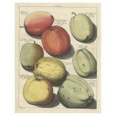
Old Original Hand-Colored Engraving of Various Apples, 1758
Located in Langweer, NL
Antique print depicting apple variaties including the Pigeon of Passe Pomme, Rode Herfst- of Winter Calville, Witte Ribbert of Ribling, Winter Parmain Pepping, Paasch Appel, Wyker Pe...
Category

Antique 18th Century and Earlier More Furniture and Collectibles

Materials

Paper

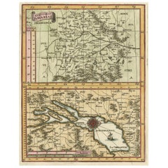
Map of the Electorate of Bavaria, Incl Lake Constance, by Jesuit Scherer, c.1700
Located in Langweer, NL
Antique map titled 'Electorat Bavariae.' Map of the Electorate of Bavaria by the Jesuit Heinrich Scherer. The lower map shows the Lake Constance. Source unknown, to be determined. ...
Category

Antique 18th Century and Earlier More Furniture and Collectibles

Materials

Paper

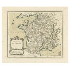
Antique Map of France with Decorative Title Cartouche
Located in Langweer, NL
Antique map titled 'Carte de la France'. Original old map of France. This map originates from 'Le Petit Atlas Maritime Recueil De Cartes et Plans Des Quatre Parties Du Monde (..) by ...
Category

Antique 18th Century and Earlier More Furniture and Collectibles

Materials

Paper

Prehistoric Mimbres Corrugated Bowl
Located in Coeur d'Alene, ID
Prehistoric Mimbres prehistoric pottery bowl in as found condition. The Mimbres region of the American Southwest is celebrated for the beautiful and expressive black-on-white pottery...
Category

American Prehistoric Antique 18th Century and Earlier More Furniture and Collectibles

Materials

Pottery

Ancient Course of the Ganges: A First Ptolemaic Map of India by Mercator, c.1584
Located in Langweer, NL
This remarkable map, titled "Asiae X Tab:", is a significant historical artifact that represents the convergence of knowledge and craftsmanship from two of the most esteemed figures in the history of geography and cartography. Created by Gerard Mercator and based on the geographical insights of Claudius Ptolemy, this map is part of the rare first issue published in Brussels in 1578. The map itself meticulously delineates the region between the Indus and Ganges rivers, an area of immense historical and geographical importance. It is an excellent representation of Ptolemy's second-century geographical data, which was fundamental in shaping the modern principles of mapmaking. Mercator, renowned for his precision and dedication to adhering closely to Ptolemy's original intentions, showcases this commitment through the detailed depiction of this significant Asian landscape. This edition stands out not only for its historical accuracy but also for its artistic execution. Gerard Mercator, who was also an innovator in the use of the italic hand for map lettering, first introduced this style in his "Literarum latinarum" in 1540. The use of italics in this map enhances its legibility and aesthetic appeal, which became a hallmark of the finest sixteenth and seventeenth-century Dutch maps, largely attributed to Mercator’s influence. The map measures 13 ½ x 18 inches and features fine hand coloring, which has been preserved in almost excellent condition alttough there some browning due to age. As a splendid example of the first issue from Mercator’s definitive edition of Ptolemy’s "Geographia", it not only serves as a testament to the rich history of geographical exploration but also stands as a beacon of the enduring legacy of its makers, shaping the future of cartographic design and precision. The map "Asiae X Tab:", focusing on the region between the Indus and Ganges rivers, highlights several areas and cities of historical and geographical importance that are likely of interest to scholars, historians, and collectors. Here are key locations depicted on the map: 1. **Indus River**: As one of the major rivers of Asia and a cradle of ancient civilizations like the Indus Valley Civilization, the Indus River holds significant historical importance. 2. **Ganges River**: Another crucial river not just for its cultural and religious significance in India, but also as a vital geographic feature in ancient and medieval maps...
Category

Antique 18th Century and Earlier More Furniture and Collectibles

Materials

Paper

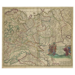
Antique Hand-Colored Map of Western Russia and Ukraine, c.1680
Located in Langweer, NL
Description: Antique map titled 'Novissima et Accuratissima Totius Russiae vulgo Muscoviae Tabula'. Antique map of Western Russia and Ukraine, published by Justus Danckerts. The ma...
Category

Antique 18th Century and Earlier More Furniture and Collectibles

Materials

Paper

Pl. 6 Antique Print of Château De Neuilly by Le Rouge, c.1785
Located in Langweer, NL
Antique print titled 'Grande Facade de Neuilly'. Copper engraving showing part of Château de Neuilly. This print originates from 'Jardins Anglo-Chinois à la Mode' by Georg Louis le R...
Category

Antique 18th Century and Earlier More Furniture and Collectibles

Materials

Paper

Antique Map of Stavoren by Priorato, 1673
Located in Langweer, NL
Antique map titled 'Staveren'. Original antique map of the city of Stavoren, Friesland, the Netherlands. This map orginates from 'Teatro del Belgio (..)', published in Frankfurt am Main in 1673 by Gualdo Priorato. Artists and Engravers: Author: Galeazzo Gualdo Priorato (1606-1678) entered military service at a very young age and served in Flanders under the Prince of Orange. After his retirement, he authored several historical accounts including the Teatro del Belgio, which described the Catholic/Protestant wars in Belgium and Netherlands during the seventeenth century. His superb plans do not show the internal layout of the cities, except for showing the locations of the major churches. Instead the emphasis is on the fortification, as well as on the surrounding site, rivers and canals...
Category

Antique 18th Century and Earlier More Furniture and Collectibles

Materials

Paper

Bronze Mortar, Tuscany, Second Half of 16th Century
Located in Bruxelles, BE
Bronze mortar with garlands, flowers and putti - Tuscany , second half of 17th century. Measures: height 10 diameter : 13 cm Artisans and healers used mortars for grinding food...
Category

Italian Renaissance Antique 18th Century and Earlier More Furniture and Collectibles

Materials

Bronze

Rare Hand-Colored Map of Franche-Comté and Burgundy by Frederik De Wit c. 1688
Located in Langweer, NL
Title: Rare Hand-Colored Map of Franche-Comté and Burgundy by Frederik De Wit c. 1688 Description: This stunning 17th-century map, titled "Comitatus Burgundiae vulgo La Franche Comt...
Category

Antique 18th Century and Earlier More Furniture and Collectibles

Materials

Paper

Rare Engraved City Plan of Nuremberg, Bavaria by Christoph Weigel, 1718
Located in Langweer, NL
Title: Rare Engraved City Plan of Nuremberg, Bavaria by Christoph Weigel, 1718 Description: This detailed city plan of Nuremberg, Bavaria was crafted by Christoph Weigel in 1718 an...
Category

Antique 18th Century and Earlier More Furniture and Collectibles

Materials

Paper

Rare Antique Print of Temptation and Expulsion, c.1780
Located in Langweer, NL
Antique print religion titled 'Tulit Igitur Mulier de Fructu Illius, et Comedit (..)'. This print depicts Temptation and Expulsion. Originates from 'Frescoes in the Sistine Chapel'. ...
Category

Antique 18th Century and Earlier More Furniture and Collectibles

Materials

Paper

Detailed Map of Southeast Asia From the Tip of Cambodia to Java, 1739
Located in Langweer, NL
Antique map titled 'Nieuwe kaart van de Sundasche Eilanden als Borneo, Sumatra en Groot Iava & c'. Detailed map of Southeast Asia, extending from the tip of Cambodia to Java. Thi...
Category

Antique 18th Century and Earlier More Furniture and Collectibles

Materials

Paper

Antique Map of the Cities of the Province of Hu-Quang by Basire, 1738
Located in Langweer, NL
Antique print titled 'Cities of the Province of Hu-Quang'. Old map depicting four walled cities of the Chinese Qing dynasty province of Hu-Quang (modern day HUNAN and part of surroun...
Category

Antique 18th Century and Earlier More Furniture and Collectibles

Materials

Paper

Martinique Map by Rigobert Bonne – French Antique Map, c.1768
Located in Langweer, NL
Map of Martinique by Rigobert Bonne, circa 1768 This is a detailed antique map of Martinique titled “Isle de la Martinique,” engraved by Rigobert Bonne around 1768 for the Atlas Encyclopédique. Bonne, a renowned French hydrographer and successor to Bellin, is celebrated for his scientifically precise and elegantly engraved maps. The map shows Martinique with its mountainous interior, rivers, and settlements labelled, including Fort Royal, Fort St. Pierre, Le Marin, and Le Prêcheur. Coastal features, bays, and capes are marked, along with anchorages important for maritime navigation in the 18th century. The depiction includes relief shown pictorially, characteristic of Bonne’s cartographic style, enhancing both geographic understanding and aesthetic appeal. This copperplate engraving retains original hand colouring outlining the coastlines in delicate blue and brown tones, typical for the period. It served as a key reference for scholars, navigators, and colonial administrators during France’s colonial presence in the Caribbean. Condition: Good condition overall. A strong impression with bright, original hand-colour outlines. General age toning, faint offsetting, and a vertical fold as issued in the atlas. Margins ample all around for framing. Framing suggestions: This historic Caribbean map...
Category

French Antique 18th Century and Earlier More Furniture and Collectibles

Materials

Paper

Map of Martinique, Guadeloupe, Marie-Galante, Désirade & Saintes by Bonne, 1788
Located in Langweer, NL
Map of Martinique, Guadeloupe, Marie-Galante, Désirade & Saintes by Bonne, 1788 This fine antique map, titled *Isle de la Martinique, Isles de la Guadeloupe, de Marie Galante, de la...
Category

French Antique 18th Century and Earlier More Furniture and Collectibles

Materials

Paper

Antique Map of Catalonia by Blaeu, circa 1650
Located in Langweer, NL
Antique map titled 'Catalonia'. Antique map of Catalonia, extending from C. De Romani on the Northern Coast to Alfachs and Panicola in Valencia on the southern end of the coast and s...
Category

Antique 18th Century and Earlier More Furniture and Collectibles

Materials

Paper

1758 Bellin Map of Guadeloupe and Marie-Galante – Caribbean Islands
Located in Langweer, NL
Thank you for noting the correct date on the map. Here is your **updated plain text catalog listing**: --- **Title (under 80 characters):** 1758 Bellin Map of Guadeloupe and Marie-Galante – Caribbean Islands **Description:** Original antique map titled *Carte de l’Isle de la Guadeloupe* by Jacques Nicolas Bellin, engraved for the *Histoire Générale des Voyages*, published in Paris in 1758. This finely engraved copperplate map depicts the French Caribbean island of Guadeloupe, showing its distinctive butterfly-shaped division into Basse-Terre and Grande-Terre. The surrounding smaller islands include Marie-Galante (bottom right) and Les Saintes. The map details numerous place names, parishes, rivers, bays, mountains, and anchorages. A decorative rococo title cartouche graces the upper right corner, complemented by a scale bar cartouche in the upper left. Jacques Nicolas Bellin (1703-1772) served as Hydrographer to the King and was one of the most prominent French cartographers of the 18th century, producing maps noted for their accuracy, elegance, and clarity. This map was created for the influential *Histoire Générale des Voyages* by Abbé Prévost. Condition report: Excellent condition. Strong and clean impression on fine laid paper with wide margins. Original hand coloring in outline and wash, highlighting coastlines and cartouches. Minor age toning at edges; verso blank. Framing suggestion: Frame with a classic gold or dark wood moulding and a neutral cream archival mat to emphasize the fine engraving and delicate color washes. Museum glass is recommended to preserve this 18th-century Caribbean map...
Category

French Antique 18th Century and Earlier More Furniture and Collectibles

Materials

Paper

Rare 17th Century Baroque Cabinet, South Germany Probably Augsburg, Wunderkammer
Located in Worpswede / Bremen, DE
A small architectural table cabinet, veneered in walnut and mulberry, the centre doors enclosing an arrangement of nine various sized drawers with bone knobs, behind a central door a...
Category

German Baroque Antique 18th Century and Earlier More Furniture and Collectibles

Materials

Brass

Aubusson Tapestry Cushion
Located in Palm Beach, FL
Antique Aubusson tapestry cushion with figures 18th century Measures: 20" x 18".
Category

French Antique 18th Century and Earlier More Furniture and Collectibles

Materials

Wool

Original Antique Map of the Region Between the Gulf of Lybia and the Red Sea
Located in Langweer, NL
Original antique map titled 'Aegyptus et Cyrene'. Detailed ancient map of the region between the Gulf of Lybia and the Red Sea, with marvelous detail along the Mediterranean Coastline and the Nile, Egypt. This map originates from 'Philippi Cluveri Introductionis in universam geographiam (..)' by P. Clüver. Published 1729. Philipp Clüver was an Early Modern German geographer and historian. Cluver's Geography was one of the most enduring works of the 17th & 18th Centuries, issued by several different publishers with many different sets of maps...
Category

Antique 18th Century and Earlier More Furniture and Collectibles

Materials

Paper

Greece 1660 Jan Jansson Watercolour Map Peloponesus Sive Morea I Laurenbergio
Located in West Sussex, Pulborough
We are delighted to offer for sale this Jan Jansson Date: 1660 (published) Amsterdam map of Greece. This is an authentic antique map of Peloponnese or...
Category

Danish Dutch Colonial Antique 18th Century and Earlier More Furniture and Collectibles

Materials

Copper

Captain Hood’s Gold and Hardstone Armorial Fob Seal
Located in Lymington, Hampshire
The openwork gold fluted pendent mount is channel set with an oval cornelian seal engraved with the coat of arms and crest of Hood with the arms of Periam in pretence for Captain Alexander Hood RN (1758-1798) who married Elizabeth Periam of Butleigh. English, circa 1790. Captain Hood (1758-1798) was a cousin of Samuel Hood, Viscount Hood, and of Alexander Hood, Viscount Bridport. His younger brother was Sir Samuel Hood who captained Zealous at the Battle of the Nile...
Category

English Antique 18th Century and Earlier More Furniture and Collectibles

Materials

Gold

Antique Map of the Area around the Abbey in Soligny-la-Trappe 'c.1710'
Located in Langweer, NL
Antique map titled 'La nouvelle Thebaide ou la Carte tres particuliere et exacte de l'Abbaye de la Maison Dieu Nostre Dame de la Trappe (..)'. Rare, original map of the area around t...
Category

Antique 18th Century and Earlier More Furniture and Collectibles

Materials

Paper

Map of East Frisian Islands & Northwestern Tip of Germany, Ostfriesland, c.1595
Located in Langweer, NL
Antique map titled 'Frisia Orientalis'. Beautiful map of east Frisian islands and the northwestern tip of Germany, Ostfriesland. With people in local costumes. Ornamented inset of the Eems estuary. Based on a manuscript map...
Category

Antique 18th Century and Earlier More Furniture and Collectibles

Materials

Paper

Antique Map of the World on Mercator Projection by Anson, 1749
Located in Langweer, NL
Antique map titled 'Nieuwe Wereld Kaart waar in de Reizen van den Hr. Anson rondsom de Wereld'. Original antique map of the world on Mercator'...
Category

Antique 18th Century and Earlier More Furniture and Collectibles

Materials

Paper

Antique Miniature Map of the Turkish Empire by Bertius '1618'
Located in Langweer, NL
Antique miniature map titled 'Turcicum Imperium'. Rare miniature map of the Turkish Empire. This map originates from 'Tabularum Geographicarum Contractarum Libri septem (..)' by P. B...
Category

Antique 18th Century and Earlier More Furniture and Collectibles

Materials

Paper

French Late 18th Ormolu and Sèvres Porcelain Barometer, Signed Giroux
Located in West Palm Beach, FL
An most elegant and extremely high quality French late 18th/ beginning of the 19th century, ormolu and Sèvres porcelain barometer, signed Giroux. The barometer has a central bottom a...
Category

French Antique 18th Century and Earlier More Furniture and Collectibles

Materials

Ormolu

Antique Print of the Town Hall of Batavia or Jakarta in Todays Indonesia, 1770
Located in Langweer, NL
Antique optical print titled 'Prospect des Rathhauses in Batavia (..)'. View of the town hall of Batavia, Indonesia. This is an optical print, also called 'vue optique' or 'vue d'opt...
Category

Antique 18th Century and Earlier More Furniture and Collectibles

Materials

Paper

Original Antique Bird's Eye View Plan of Hoorn, The Netherlands by Blaeu, c.1700
Located in Langweer, NL
Antique map titled 'Horna vulgo Hoorn'. Bird's eye view plan of Hoorn, The Netherlands. With title cartouche, coats of arms and key. From an atlas published by De Wit, ca. 1698-1...
Category

Antique 18th Century and Earlier More Furniture and Collectibles

Materials

Paper

Thraciae Veteris Typus – 1618 Ortelius Map of Ancient Thrace with Hand Color
Located in Langweer, NL
Thraciae Veteris Typus – 1618 Ortelius Map of Ancient Thrace with Hand Color This striking early 17th-century map, Thraciae Veteris Typus, was published in 1618 by Abraham Orteliu...
Category

Antique 18th Century and Earlier More Furniture and Collectibles

Materials

Paper

Antique Print of the Residence of Sir Gregory Page by Miller, c.1770
Located in Langweer, NL
Antique print titled 'Elevation of the Flank of Sir Gregory Page'. Architectural elevation of the residence of Sir Gregory Page. Sir Gre...
Category

Antique 18th Century and Earlier More Furniture and Collectibles

Materials

Paper

Antique Map of India and Ceylon, along with the Maldives
Located in Langweer, NL
Antique map titled 'Stato del Mogol con l'Isole di Ceilan e Maldive'. Beautiful map of India and Ceylon, along with the Maldives. Includes a large decorative title cartouche. The map...
Category

Antique 18th Century and Earlier More Furniture and Collectibles

Materials

Paper

Antique Map of Germany, the Netherlands, Bohemia, Bavaria and Switzerland, 1785
Located in Langweer, NL
Antique map titled 'Germany and the Netherlands from the latest authorities'. Depicts Germany, the Netherlands and the surrounding region including Bohemia, Bavaria, and Switzerland....
Category

Antique 18th Century and Earlier More Furniture and Collectibles

Materials

Paper

Friesland, Groningen, Drenthe, Overijssel – Antique Map by Seb. Münster, 1574
Located in Langweer, NL
Friesland, Groningen, Drenthe, Overijssel – Antique Map by Sebastian Münster, 1574 This rare and finely colored woodcut map of Northern Netherlands depicts the provinces of Friesl...
Category

Antique 18th Century and Earlier More Furniture and Collectibles

Materials

Paper

Map of the Margraviate and Electorate of Brandenburg by de Beaurain - ca.1750
Located in Langweer, NL
Historical Map of the Margraviate and Electorate of Brandenburg by Chevalier de Beaurain - Circa 1750 This impressive historical map, titled "Carte du Marquisat et Electorat de Br...
Category

Antique 18th Century and Earlier More Furniture and Collectibles

Materials

Paper

HOUSE OF LORDS. Remembrances for Order. 1712 - WITH THE GILT ARMS OF QUEEN ANNE
Located in Hillsborough, NJ
AUTHOR: HOUSE OF LORDS. TITLE: Remembrances for Order and decency to be kept in the Upper house of Parliament by the Lords, when His Majesty is not there. PUBLISHER: London, May 7...
Category

English Antique 18th Century and Earlier More Furniture and Collectibles

Materials

Leather

Brazil Coastline Map – Broenner Carte du Bresil, 1772 Captaincies
Located in Langweer, NL
Carte du Bresil Map, Broenner Krefeld 1772 – Brazil Coastline Captaincies This is an engraved map titled Carte du Bresil Prem. Partie, published in Krefeld (Germany) by J.J. Broenne...
Category

French Antique 18th Century and Earlier More Furniture and Collectibles

Materials

Paper

Striking Antique Map Centered on the Malay Peninsula
Located in Langweer, NL
Antique map titled 'D'Indiaanze Landschappen Zeen en Eylanden, van Couchin af tot in de Moluccos (...)'. Striking map of the region from the Philippines and Formosa to India and the ...
Category

Antique 18th Century and Earlier More Furniture and Collectibles

Materials

Paper

Antique 17th C. French Directoire Gilt Wood Fretwork Fireplace Tapestry Screen
Located in Dayton, OH
Extremely rare late 17th century museum quality giltwood fireplace screen. Features exceptional interlaced fretwork between ornately fluted columns mounted by pinecone finials. Inc...
Category

Directoire Antique 18th Century and Earlier More Furniture and Collectibles

Materials

Giltwood

1579 Ornate Map of Burgundy County by Ferdinand de Lannoy
Located in Langweer, NL
1579 Ornate Map of Burgundy County by Ferdinand de Lannoy Description of the Map: This is a beautifully detailed map of the Burgundy region, titled "Bvrgvndiae Comitatus Recentiss....
Category

Antique 18th Century and Earlier More Furniture and Collectibles

Materials

Paper

Old Map of the Margraviate of Brandenburg by Giacomo Cantelli da Vignola, 1687
Located in Langweer, NL
Historical Map of the Margraviate of Brandenburg by Giacomo Cantelli da Vignola - 1687 This magnificent map, titled Marchesato, et Elettorato di Brandeburgo con una gran Porzione ...
Category

Antique 18th Century and Earlier More Furniture and Collectibles

Materials

Paper

Antique Coastal Map of West Sumatra 'Indonesia' by J. Mannevillette, 1745
Located in Langweer, NL
Antique map titled 'Carte de la côte occidentale de l'isle Sumatra depuis la ligne équinoctiale jusqu'au détroit de la Sonde'. Beautiful coastal map of We...
Category

Antique 18th Century and Earlier More Furniture and Collectibles

Materials

Paper

Rare Old Map of the City of Stavoren, Friesland, the Netherlands, 1616
Located in Langweer, NL
Antique map titled 'Staveren'. Old map of the city of Stavoren, Friesland. This map originates from 'Rerum Frisicarum Historia' by U. Emmius. Artists and Engravers: Nicolaes ...
Category

Antique 18th Century and Earlier More Furniture and Collectibles

Materials

Paper

Antique Map of the British Isles by H. Chatelain, 1719
Located in Langweer, NL
Beautiful hand colored large format map of the British Isles, with large insets of the Eastern and Western Hemispheres and the coats of arms for Engl...
Category

Antique 18th Century and Earlier More Furniture and Collectibles

Materials

Paper

Bay of Saint Helena: French Naval Chart by N.B. Ingénieur de la Marine, ca.1770
Located in Langweer, NL
Bay of Saint Helena: French Naval Chart by N.B. Ingénieur de la Marine, 18th Century This meticulously detailed copper engraving, titled 'Carte de la Baye de Sainte Helene' (Map of the Bay of Saint Helena), was drawn by N.B., an engineer of the French Navy (*Ingénieur de la Marine*). The map was created based on the navigational observations of mariners and published in the 18th century, most likely in France. It offers a precise and practical representation of Saint Helena Bay, a crucial anchorage point in the South Atlantic Ocean. Saint Helena Bay, located on the island of Saint Helena, was an important stopover for ships sailing between Europe and Asia, particularly for Dutch and British vessels during the Age of Exploration and the later colonial period. Its significance was further heightened when the island became the final exile location of Napoleon Bonaparte from 1815 to 1821. The map shows the bay with impressive attention to detail, depicting the coastline with numerous soundings marked in French and English leagues (*Lieues Marines de France et d'Angleterre*), allowing navigators to gauge the water depth and avoid hazards. The bay’s natural topography, including hills and coastal elevations, is rendered in delicate engraving lines. A large central peak dominates the landscape, surrounded by rugged terrain, while a smaller inlet and river (*Riviere*) are also shown, highlighting the complex geography of the bay. A decorative fleur-de-lis compass rose marks the left side of the chart, indicating orientation and providing a clear sense of direction for mariners. The map's clean and elegant design reflects the French cartographic tradition of combining functional navigation aids with aesthetic appeal. The chart includes practical features such as scale indicators and coastal profiles that help sailors recognize the bay from a distance. The detailed soundings marked throughout the bay make this map an invaluable tool for understanding the navigational challenges of the area, particularly for large, heavily laden ships. This rare chart belongs to a series of marine maps...
Category

Antique 18th Century and Earlier More Furniture and Collectibles

Materials

Paper

Old Map of Ancient Times covering Egypt Towards Arabia and India to Java, c.1660
Located in Langweer, NL
Description: Antique map titled 'Erythraei Sive Rubri Maris Periplus olim ab arriano descriptus nunc vero ab abrah ortelio ex eodem delineatus'. Map of the Indian Ocean, or Erythraea...
Category

Antique 18th Century and Earlier More Furniture and Collectibles

Materials

Paper

1732 Henri Chatelain Map of the Holy Land Divided Among the Tribes of Israel
Located in Langweer, NL
Title: 1732 Henri Chatelain Map of the Holy Land Divided Among the Tribes of Israel This exquisite 18th-century map by Henri Chatelain, published in 1732, offers a detailed depict...
Category

Antique 18th Century and Earlier More Furniture and Collectibles

Materials

Paper

Dutch Antique Map of the West Coast of Africa, to the Cape of Good Hope, 1747
Located in Langweer, NL
Antique map of the Coast of Africa titled 'Kaart van de West Kust van Afrika (..)'. Map of the west coast of Africa, from 11 degrees south latitude to the Cape of Good Hope. This...
Category

Antique 18th Century and Earlier More Furniture and Collectibles

Materials

Paper

Beautiful Old Map of Spain and Portugal With Decorative Title Cartouche, ca.1740
Located in Langweer, NL
Antique map Spain titled 'L’Espagne dressée sur la Description qui en a eté faite par Rodrigo Mendez Sylva (..)'. Beautiful map of Spain with dec...
Category

Antique 18th Century and Earlier More Furniture and Collectibles

Materials

Paper

Antique Map of the Middle East by Mortier, 1700
Located in Langweer, NL
Antique map titled 'Carte de la Situation du Paradis Terrestre (..)'. Detailed map of the Holy Land and the Middle East, centered on the Garden of Eden and including a large Cyprus. ...
Category

Antique 18th Century and Earlier More Furniture and Collectibles

Materials

Paper

Large Title Cartouche and a View of Wilhermsdorf, Beieren, Germany, 1744
Located in Langweer, NL
Antique print titled 'Sauber und nach dem Leben gezeichnete Prospecten und Plans, von den wichtigsten der Holländisch-Ost-Indischen-Compagnie in Africa u: Asia (..)'. Frontispiece of...
Category

Antique 18th Century and Earlier More Furniture and Collectibles

Materials

Paper

Umbrella Stand, Copper Geometric Design ArtDeco , 40s
Located in Mombuey, Zamora
Rare Umbrella stand, Italy, Solid Copper It's a very original, different vase. I don't know if it's a vase or an umbrella stand. I've never seen one like it. The copper is solid, ...
Category

Italian Art Deco Antique 18th Century and Earlier More Furniture and Collectibles

Materials

Copper

1986 Antoni Tàpies Book: 'Tapies i la Nova Cultura'
Located in Barcelona, ES
Explore the artistic genius of Antoni Tàpies with this remarkable 1986 book, titled 'Tapies i la Nova Cultura,' edited by Polígrafa. This is a special illustrated edition, encapsulat...
Category

Spanish Antique 18th Century and Earlier More Furniture and Collectibles

Materials

Paper

Detailed Map of Friesland, Groningen and Drenthe, The Netherlands, 1706
Located in Langweer, NL
Antique map tited 'Frisiae Dominium vernacule Friesland verdeeld met de hoofd-deelen van Oostergoo, Westergoo en Sevenwolden (..)'. Detailed map of Friesland, Groningen and Drenthe, ...
Category

Antique 18th Century and Earlier More Furniture and Collectibles

Materials

Paper

Antique Lithography Map, Oxfordshire, English, Framed Cartography, Robert Morden
Located in Hele, Devon, GB
This is an antique lithography map of Oxfordshire. An English, framed atlas engraving of cartographic interest by Robert Morden, dating to the late 17th century and later. Superb l...
Category

British William and Mary Antique 18th Century and Earlier More Furniture and Collectibles

Materials

Paper

Great Antique Bird's-Eye View Plan of Brielle by Blaeu in The Netherlands, 1649
Located in Langweer, NL
Antique print, titled: 'Briela.' Bird's-eye view plan of Brielle in The Netherlands. With key to locations and coats of arms. Text in Dutch on verso. This plan originates from the famous city Atlas: 'Toneel der Steeden' published by Joan Blaeu...
Category

Antique 18th Century and Earlier More Furniture and Collectibles

Materials

Paper

Detailed 1720s Map – Siege of Douay and Lines of Circumvallation, France
Located in Langweer, NL
Detailed 1720s Map – Siege of Douay and Lines of Circumvallation, France This engraved map shows the detailed fortifications and surrounding region of Douay (Douai) in northern Fran...
Category

French Antique 18th Century and Earlier More Furniture and Collectibles

Materials

Paper

Antique Plan of Aigues-Mortes, France
Located in Langweer, NL
Antique map titled 'Plan d'Aiguesmortes et environs'. Original plan of the region of Aigues-Mortes, France. This map originates from 'Le Petit Atlas Maritime (..)' by J.N. Bellin. Pu...
Category

Antique 18th Century and Earlier More Furniture and Collectibles

Materials

Paper

Antique Roman Battle Print of the Camp Defence by Duncan, c.1753
Located in Langweer, NL
Antique battle map showing the various defence elements of a camp. With detailed legend explaining the various elements of the print. This print mo...
Category

Antique 18th Century and Earlier More Furniture and Collectibles

Materials

Paper

Read More

Medal-Worthy Memorabilia from Epic Past Olympic Games

Get into the games! These items celebrate the events, athletes, host countries and sporting spirit.

Ahoy! You’ve Never Seen a Collection of Sailor Art and Kitsch Quite Like This

French trendsetter and serial collector Daniel Rozensztroch tells us about his obsession with objects related to seafaring men.

39 Incredible Swimming Pools

It's hard to resist the allure of a beautiful pool. So, go ahead and daydream about whiling away your summer in paradise.

Pamela Shamshiri Shares the Secrets behind Her First-Ever Book and Its Effortlessly Cool Interiors

The sought-after designer worked with the team at Hoffman Creative to produce a monograph that beautifully showcases some of Studio Shamshiri's most inspiring projects.

Moroccan Artworks and Objects Take Center Stage in an Extraordinary Villa in Tangier

Italian writer and collector Umberto Pasti opens the doors to his remarkable cave of wonders in North Africa.

Montecito Has Drawn Royalty and Celebrities, and These Homes Are Proof of Its Allure

Hollywood A-listers, ex-pat aristocrats and art collectors and style setters of all stripes appreciate the allure of the coastal California hamlet — much on our minds after recent winter floods.

Whaam! Blam! Pow! — a New Book on Pop Art Packs a Punch

Publishing house Assouline and writer Julie Belcove have teamed up to trace the history of the genre, from Roy Lichtenstein, Andy Warhol and Yayoi Kusama to Mickalene Thomas and Jeff Koons.

What Makes a Gem-Encrusted Chess Set Worth $4 Million?

The world’s most opulent chess set, weighing in at 513 carats, is literally fit for a king and queen.
Recently Viewed

View All