18th Century and Earlier More Furniture and Collectibles

to
2,900
4,167
1,110
5,324
299
154
137
81
58
53
50
26
16
5
3
3
2
2
2
2
1
10,616
31,760
15,224
6,680
13,784
6,702
929
566
1,132
1,402
1,053
2,877
2,949
2,587
1,203
820
3,399
952
711
501
284
1,981
454
371
369
264
5,324
5,324
5,324
59
21
14
13
12
Period: 18th Century and Earlier
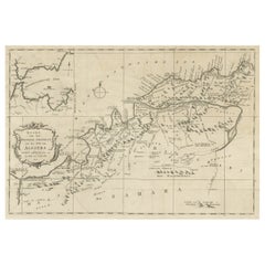
Old Map of the Western Region of the Kingdom of Algiers, Algeria, 1773
Located in Langweer, NL
Antique map titled 'Kaart van het Westelyk Gedeelte van het Ryk van Algiers'. Old map of the western region of the Kingdom of Algiers, Algeria. Originates from the first Dutch ed...
Category

Antique 18th Century and Earlier More Furniture and Collectibles

Materials

Paper

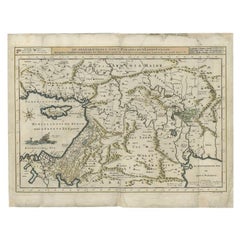
Antique Map of the Mediterranean and the Persian Gulf by Danckerts, c.1718
Located in Langweer, NL
Antique map titled 'De Gelegentheyt Van't Paradys en 't Landt Canaan.' Dutch Bible map covering the region between the Mediterranean and the Persian Gulf, f...
Category

Antique 18th Century and Earlier More Furniture and Collectibles

Materials

Paper

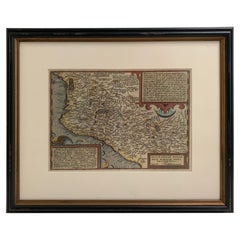
1608 Hispaniae Novae Sive Magnae Vera Descriptio Framed Mexico Map
Located in Stamford, CT
1608 Hispaniae Novae Sive Magnae Vera Descriptio Framed Mexico Map. As found custom black wooden frame/ matting. This map is based on the work of Abraham Ortelius as is an example o...
Category

Mexican Spanish Colonial Antique 18th Century and Earlier More Furniture and Collectibles

Materials

Glass, Wood, Paper

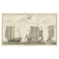
Antique Original Engraving of Chinese Vessels in the 18th Century, 1765
Located in Langweer, NL
Description: Plate no.34: 'Vaisseaux chinois.' (Chinese vessels.) This original auhentic plate originates from: 'Reize rondom de werreld, Gedaan in de jaaren 1740 tot 1744, door den ...
Category

Antique 18th Century and Earlier More Furniture and Collectibles

Materials

Paper

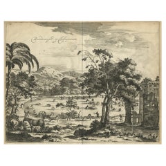
Old Engraving of The Catching of Horses on Jafnapatnam, Ceylon 'Sri Lanka', 1672
Located in Langweer, NL
Antique print, titled: 'Paardevangst op Jafnapatnam' - This plate shows the catching of horses on Jafnapatnam. The province of Jaffna , and specially the fort at Jaffnapatnam were th...
Category

Antique 18th Century and Earlier More Furniture and Collectibles

Materials

Paper

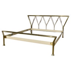
Brass double bed frame by Lipparini, 1970
Located in Manzano, IT
Sure, here is a sales review for the bed facility. Title: Rare and fine brass double bed by Lipparini, 1970s design Description: A unique opportunity for lovers of Italian design...
Category

Italian Modern Antique 18th Century and Earlier More Furniture and Collectibles

Materials

Brass

Antique Map of Peloponnesus, Greece by Pierre Antoine Tardieu, 1797
Located in Langweer, NL
This antique map, titled "Carte Ancienne d'Allemagne," represents ancient Germany and surrounding regions. It was published by the well-known Parisian mapmakers and publishers Jean-Baptiste-Louis Clouet and Alexandre Aimé Vuillemin in the late 18th century, specifically in 1787. The map covers the extensive geographical area of ancient Germany, highlighting various tribes and regions known at the time. Key features include: 1. **Geographical Boundaries**: The map outlines the territorial extents of ancient Germany, bordered by Gallia (France) to the west, Sarmatia (parts of Eastern Europe) to the east, and the Italian regions to the south. The northern boundary reaches the Oceanus Germanicus (North Sea) and the Sarmatian Sea (Baltic Sea). 2. **Tribal Regions**: It details numerous ancient Germanic...
Category

Antique 18th Century and Earlier More Furniture and Collectibles

Materials

Paper

18th-Century Map of Holstein and Surrounding Duchies by Homann Heirs
Located in Langweer, NL
18th-Century Map of Holstein and Surrounding Duchies by Homann Heirs Description: This finely detailed 18th-century map by the Homann Heirs (Homannische Erben) illustrates the Duc...
Category

Antique 18th Century and Earlier More Furniture and Collectibles

Materials

Paper

Antique Map of the Region of Sarlat in France by Janssonius, 1657
Located in Langweer, NL
Antique map of France titled 'Le Diocese de Sarlat dioccesis Sarlatensis'. Decorative map of the Sarlat region, part of the Dordogne department. This map originates from 'Atlas Novus...
Category

Antique 18th Century and Earlier More Furniture and Collectibles

Materials

Paper

1767 D’Anville Map of the Holy Land: Ancient Divisions and Biblical Geography
Located in Langweer, NL
Ancient Map of Palestine or the Holy Land by D'Anville (1767) This detailed map, created by the renowned French cartographer Jean Baptiste Bourguignon d'Anville in 1767, depicts the...
Category

Antique 18th Century and Earlier More Furniture and Collectibles

Materials

Paper

Louis XVI Style Pair of French Bronze Curtain Holdbacks, Gilded and Chiseled
Located in Prato, Tuscany
We kindly invite you to read the full description, as we aim to provide detailed technical and historical information to ensure the authenticity of our items. This is a unique and st...
Category

French Louis XVI Antique 18th Century and Earlier More Furniture and Collectibles

Materials

Bronze

Antique Map of the East Indies by Janssonius, c.1644
Located in Langweer, NL
Antique map titled 'India quae Orientalis dicitur, et Insulae adiacentes'. Old map of the East Indies and Southeast Asia showing the area between India in the West and parts of Japan...
Category

Antique 18th Century and Earlier More Furniture and Collectibles

Materials

Paper

Antique Map of the Lemsterland Township 'Friesland' by Halma, 1718
Located in Langweer, NL
Antique map Friesland titled 'Lemsterland de Seste Grietenije der Zevenwolden (..)'. Old map of Friesland, the Netherlands. This map depicts the region of Lemsterland and includes ci...
Category

Antique 18th Century and Earlier More Furniture and Collectibles

Materials

Paper

Small Detailed Antique Map of France, with Decorative Title Cartouche, 1754
Located in Langweer, NL
Antique map France titled 'An Accurate Map of France drawn from the best authorities'. Small, detailed map of France. With decorative title cartouche. ...
Category

Antique 18th Century and Earlier More Furniture and Collectibles

Materials

Paper

Austria by Wolfgang Lazius – A Magnificent 16th-Century Map from Ortelius
Located in Langweer, NL
Title: Avstriae Descrip – Wolfgang Lazius’ Map of Austria, 16th Century Description: This extraordinary map of Austria pays homage to the Austrian humanist and cartographer Wo...
Category

Antique 18th Century and Earlier More Furniture and Collectibles

Materials

Paper

Grand Map of Europe by Frederick de Wit, Circa 1690: A Baroque Era Masterpiece.
Located in Langweer, NL
This is an attractive historical map of Europe created by Frederick de Wit, published around 1690. Here's a detailed description of the map and additional context about its creation:...
Category

Dutch Antique 18th Century and Earlier More Furniture and Collectibles

Materials

Paper

Brussels 16th Century Pillow - 19" X 9"
Located in Los Angeles, US
Elevate your space with the Brussels 16th Century Pillow, measuring 19" x 9". This exquisite piece captures the essence of historical charm, adding sophistication to any setting
Category

Belgian Mid-Century Modern Antique 18th Century and Earlier More Furniture and Collectibles

Materials

Wool, Cotton

Large Antique Map of the City of Bremen and Surroundings, Germany
Located in Langweer, NL
Original antique map titled 'Prospect und Grundris der Keiserl Freyen Reichs und Ansee Stadt Bremen (..)'. This is a superb chart of the city of Bremen and the surrounding small villages with particular emphasis on the many rivers and canals...
Category

Antique 18th Century and Earlier More Furniture and Collectibles

Materials

Paper

Old Print of Nature Godess Sibyl and Puzza of China on a Lotus Flower, ca.1725
Located in Langweer, NL
Antique print, titled: 'Puzza ou la Cybele des Chinois (…)' - This plates hows Puzza, Sibyl of China and Puzza sitting on a Lotus flower. Source unknown, to be determined. Artists...
Category

Antique 18th Century and Earlier More Furniture and Collectibles

Materials

Paper

Antique Detailed Map of Jerusalem in Israël with Extensive Key and Scale, 1698
Located in Langweer, NL
Antique map titled 'Jerusalem.' Plan of the ancient city of Jerusalem. With extensive key and scale. Source unknown, to be determined. Artists and Engravers: Made by 'Cornelis de...
Category

Antique 18th Century and Earlier More Furniture and Collectibles

Materials

Paper

Rare Small Map of Sumatra, Java, Borneo, Macassar, Madura, Bali, 1614
Located in Langweer, NL
One of the first maps of the Indonesia islands of Java, Bali, Sumbawa etc. in early days of the Dutch Indies. Also showing Banten, Jakarta (Jacatra), Indr...
Category

Antique 18th Century and Earlier More Furniture and Collectibles

Materials

Paper

Rare 17th-Century Map of Dauphiné in Southeastern France by F. De Wit, ca.1688
Located in Langweer, NL
Title: Rare Hand-Colored 17th-Century Map of Dauphiné by Frederik De Wit c. 1688 Description: This captivating 17th-century map of Dauphiné, titled "Nova et Accurata Delphinatus Vul...
Category

Antique 18th Century and Earlier More Furniture and Collectibles

Materials

Paper

Old Print of the Governor-General's Residence in Batavia, Indonesia, 1739
Located in Langweer, NL
Antique print titled 'Ein Prospect Sr. Hoch-Edelheit des Herrn Gen: Gouverneurs Hoff und Wohnhausses in dem Castel Batavia wie dasselbe von innen anzusehen'. Old print with a view of the Governor-General's residence in Batavia. This print originates from from 'Allerneuester Geographische- und Topographischer Schau-platz, von Africa und Ost-Indien'. Artists and Engravers: Johann Wolfgang Heydt, a German artist who worked for the Dutch East India...
Category

Antique 18th Century and Earlier More Furniture and Collectibles

Materials

Paper

Antique Print of the House of Richard Rooth The Elms, in Surrey, England, 1717
Located in Langweer, NL
Antique print titled 'The Elevation of Richard Rooth his House at Epsom in Surrey (..)'. Elevation of the house of Richard Rooth, The Elms. This print ori...
Category

Antique 18th Century and Earlier More Furniture and Collectibles

Materials

Paper

Antique Map of East Asia by Coronelli, circa 1690
Located in Langweer, NL
Antique map of East Asia showing New Holland and parts of Van Diemens Land and New Zealand. This map is the right hand part of a two sheet map, but is complete on its own. This map o...
Category

Antique 18th Century and Earlier More Furniture and Collectibles

Materials

Paper

Original Antique Engraving of a Horse Race at a Japanese Racing Track, 1669
Located in Langweer, NL
Description: Antique print, titled: 'Japansche Ren-baanen.' - View of a race at a Japanese (horse) racing track. A man runs beside a horse (the horse's rein in his hand). A man w...
Category

Antique 18th Century and Earlier More Furniture and Collectibles

Materials

Paper

Original Hand-colored Antique Map of Denmark by S. Neele, 1790
Located in Langweer, NL
Antique very decorative engraving of Denmark engraved by S. Neele. Published in November 1790 by John Trusler. Tape on verso.
Category

Antique 18th Century and Earlier More Furniture and Collectibles

Materials

Paper

Antique Map of the Islands of Banda, Indonesia from a Very Rare Edition, 1725
Located in Langweer, NL
Antique map titled 'Les Iles de Banda (..).' (The islands of Banda, Indonesia.) Extremely rare in this edition. This plate originates from the very scarse: 'La galerie agreable d...
Category

Antique 18th Century and Earlier More Furniture and Collectibles

Materials

Paper

Antique Map of South American, The West Indies & Most of Africa, Ca.1775
Located in Langweer, NL
Antique map titled 'Carte pour Servir a l' Histoire Philosophique et Politique des Etablissemens et du Commerce des Europeens dans les deux Indes'. This map is roughly centered o...
Category

Antique 18th Century and Earlier More Furniture and Collectibles

Materials

Paper

Antique Map of the Coast of Guinea and the Cape Verde Islands
Located in Langweer, NL
Antique map titled 'Carte de la Guinée (..)'. This map was originally part of a 2 sheet larger map of Eastern Africa, showing the Cape Verde Islands and Senegal. This map originates ...
Category

Antique 18th Century and Earlier More Furniture and Collectibles

Materials

Paper

Dreamy Geode End Cut Resembling Murano Glass Crystal Mineral Slice
Located in London, GB
This beautiful end cut of a geode resembles a piece of Murano glass. Greenish colours, punctuated by cut stalactite "eyes" blur into orange areas and create a wonderful aesthetic. A ...
Category

South American Antique 18th Century and Earlier More Furniture and Collectibles

Materials

Agate, Amethyst, Quartz

Rare Antique Map of Friesland in Roman Times, Published 1778
Located in Langweer, NL
Antique map titled 'Carte de la Frise, entre les Embouchures du Rhin & de l'Eems, ij compris l'isle Bataves, dressée selon leur ancienne position le Gouvernement des Romains & des Fr...
Category

Antique 18th Century and Earlier More Furniture and Collectibles

Materials

Paper

Johannes Janssonius' 17th-Century Map of the Duchy of Bremen in Germany
Located in Langweer, NL
The map titled "Ducatus olim Episcopatus Bremensis et ostiorum Albis et Visurgis Fluviorum novissima Descriptio" by Johannes Janssonius provides a rich historical and geographical il...
Category

Antique 18th Century and Earlier More Furniture and Collectibles

Materials

Paper

French 18th Century Balance Scale
Located in Round Top, TX
A handsome French 18th century balance scale in iron and brass. The balance mechanism is in iron. The foot and the plates are in brass. The...
Category

French Antique 18th Century and Earlier More Furniture and Collectibles

Materials

Brass, Iron

Antique Map of Province Friesland, The Netherlands, 1787
Located in Langweer, NL
Antique map titled 'Nieuwe Kaart van Friesland behoorende tot het Vaderlandsch Woordenboek van Jacobus Kok'. Original antique map of the province of Friesland, the Netherlands. This ...
Category

Antique 18th Century and Earlier More Furniture and Collectibles

Materials

Paper

Antique Map of Friesland, A Dutch Province, c.1780
Located in Langweer, NL
Antique map titled 'Dominii Frisiae (..)'. Original antique map of Friesland. 3rd state, most likely published after 1775 (De Rijke, 46.3). Artists and Engravers: Published by P. Sch...
Category

Antique 18th Century and Earlier More Furniture and Collectibles

Materials

Paper

Cartographic Elegance: The Art and Science of 17th-Century Asian Maps, ca.1681
Located in Langweer, NL
This original antique map is an artifact from a pivotal era in cartography, reflecting not only the geographical knowledge of its time but also the intertwining of art and science in...
Category

Antique 18th Century and Earlier More Furniture and Collectibles

Materials

Paper

Antique Map of the Province of Overijssel, the Netherlands
Located in Langweer, NL
Original antique map titled 'Ditio Trans-Isulana'. Original old map of the province of Overijssel, the Netherlands. With coat of arms and two decorative cartouches. Published by J. J...
Category

Antique 18th Century and Earlier More Furniture and Collectibles

Materials

Paper

Antique Print of the Battle of Romans near the River Sicoris or Segre in France
Located in Langweer, NL
Antique battle map of the Segre river. With detailed legend explaining the various elements of the print. This print most likely originates from an edition of 'The Commentaries of Ca...
Category

Antique 18th Century and Earlier More Furniture and Collectibles

Materials

Paper

Original Antique 17th-Century Map of Shanxi (Xansi) Province, China – by Blaeu
Located in Langweer, NL
Antique 17th-Century Map of Shanxi Province, China – "Xansi" by Blaeu, with Artistic Cartouches Description: This beautifully engraved map of Shanxi Province, historically referred to as "Xansi," was created by Johannes Blaeu in 1655 as part of his renowned *Novus Atlas Sinensis*. This atlas was the first comprehensive Western collection focused on Chinese geography, produced with the guidance of Jesuit missionary Martino Martini. Blaeu’s attention to detail and artistic flair are evident in this representation of Shanxi, highlighting mountains, rivers, cities, towns, and key geographic features. The Great Wall of China, an iconic landmark, is also depicted. The map includes decorative cartouches that enhance its aesthetic appeal. The upper-left corner features the map's title framed in an ornate design, while the lower-right corner showcases a seated figure in traditional Chinese attire alongside a small globe, symbolizing the merging of European cartographic expertise and Chinese knowledge. Each city and geographic feature is labeled in Latin, making it a fascinating historical artifact of cross-cultural exploration. This map was crafted using the copperplate engraving technique, prized for its ability to produce fine, precise details. It is further embellished with hand-coloring, which brings the landscape and decorative elements to life. Blaeu’s maps are highly regarded for their accuracy, artistry, and historical significance, making this piece a valuable collectible. Shanxi Province, historically referred to as "Xansi," is renowned for its historical significance, natural landscapes, and rich cultural heritage. The region has been a crucial center of Chinese history and culture for centuries. Its name, meaning "West of the Mountains," refers to its location west of the Taihang Mountains. Shanxi has long been known for its coal resources, which have made it an important economic hub in modern times. Important places in Shanxi include Pingyao, a UNESCO World Heritage Site known for its well-preserved ancient city walls and traditional Chinese architecture. The Yungang Grottoes, near Datong, are another UNESCO site, famous for their intricate Buddhist carvings and statues. Mount Wutai, one of China’s Four Sacred Buddhist Mountains, is a significant religious site that attracts pilgrims and tourists alike. Taiyuan, the provincial capital, is known for its historical sites, including the Jinci Temple. Shanxi is also known for its role in the early development of Chinese banking, particularly during the Ming and Qing Dynasties. Keywords include antique map of Shanxi, Xansi map, Pingyao, Yungang Grottoes, Mount Wutai, 17th-century China map...
Category

Antique 18th Century and Earlier More Furniture and Collectibles

Materials

Paper

Antique Map of the Tonkin River ‘Vietnam’ by J.N. Bellin, 1764
Located in Langweer, NL
One of the maps produced by Bellin for Prevost d'Exiles' influential travel book, ‘L'Histoire Generale des Voyages’. This map depicts part of Southeast Asia, most likely northern Vie...
Category

Antique 18th Century and Earlier More Furniture and Collectibles

Materials

Paper

American Chippendale Rare Miniature Slant Front Desk w/ original Brasses c1780s
Located in Savannah, GA
This rare and important slant top desk is an exceptional example of a miniature piece of furniture. Bearing all the desirable features of a Chippendale, this desk has a dovetailed tw...
Category

American Chippendale Antique 18th Century and Earlier More Furniture and Collectibles

Materials

Brass

Il pastor fido, tragicommedia pastorale - by G. B. Guarini - 1597
Located in Middletown, NY
Guarini, Giovanni Battista Il pastor fido; Tragicomedia pastorale Tours: Giametto Metaieri, 1592 12mo5 1/2 x 3 inches (140 x 76 mm); 146 pp. including a sonnet in French by R. Briss...
Category

European Antique 18th Century and Earlier More Furniture and Collectibles

Materials

Gold Leaf

Antique Map of the Kingdom of Hungary and Transylvania, circa 1780
Located in Langweer, NL
Antique Map of the Kingdom of Hungary and Surrounding Regions by S. Robert, circa 1780 This beautifully engraved map titled Royaume de Hongrie, Principauté de Transilvanie, Esclavon...
Category

French Antique 18th Century and Earlier More Furniture and Collectibles

Materials

Paper

Veteris Orbis Climata – Ancient World Map after Strabo by Cellarius, 1731
Located in Langweer, NL
Veteris Orbis Climata – Ancient World Map after Strabo by Cellarius, 1731 This fascinating hand-colored antique map, titled Veteris Orbis Climata ex...
Category

Antique 18th Century and Earlier More Furniture and Collectibles

Materials

Paper

18th Century French Louis XVI Walnut Coffer or Blanket Chest
Located in Houston, TX
18th century French Louis XVI walnut coffer or blanket chest. 18th century French Louis XVI, Renaissance or Gothic style walnut coffer or chest from Dijon. This gorgeous coffer, trun...
Category

French Louis XVI Antique 18th Century and Earlier More Furniture and Collectibles

Materials

Walnut

Unique Historical Riding Spur of the 16-17th Century+ Horseshoe
Located in Nový Bor, CZ
A beautiful, unique riding spur probably dating from the 16-17th century, As an accessory, there is also a historic horseshoe. The spur is in very good condition, there is no major d...
Category

Renaissance Antique 18th Century and Earlier More Furniture and Collectibles

Materials

Metal

Rare & Intricate Prisoner-of-war Carved Bone Gaming Set, circa late 18 century
Located in TEYJAT, FR
This is a fine example of a French prisoner-of-war bone gaming piece, dating from the late 18th to early 19th century. These intricate objects were crafted by French prisoners during...
Category

French Antique 18th Century and Earlier More Furniture and Collectibles

Materials

Bone

Antique Map of the Caucasus by Seale, 1799
Located in Langweer, NL
Antique map titled 'Sarmatia'. Old map of the Caucasus with the Caspian and Black Sea. Originates from 'Geographia Antiqua (..)'. Artists and Engravers: Richard William Seale (1703-1...
Category

Antique 18th Century and Earlier More Furniture and Collectibles

Materials

Paper

Set of Three 18th Century Vellum Sunday Sermon Books
By Vivien, R.P. Michael, Alfonso Maria De Liguori
Located in valatie, NY
Set of Three 18th Century Vellum Sunday Sermon Books. 1.) Sermoni Per Tutte Le Domeniche Dell' Anno (Sermons for all the Sundays in a Year) by Monsignore Alfonso Maria De Liguori. Na...
Category

Italian Antique 18th Century and Earlier More Furniture and Collectibles

Materials

Paper, Animal Skin

Chinese Porcelain Dollhouse Miniature Blue and White Kangxi Vase '1662-1722'
Located in Delft, NL
Chinese Porcelain Dollhouse miniature blue and white Kangxi vase Kangxi (1662-1722), ca 1720 With a scene of floral decor and long Eliza The porcelain vase...
Category

Chinese Antique 18th Century and Earlier More Furniture and Collectibles

Materials

Porcelain

Antique 16th Century Brussels Tapestry Pillow 15'' X 12''
Located in Los Angeles, US
Antique 16th century Brussels tapestry pillow. 15'' X 12'' x 6''.
Category

French Empire Antique 18th Century and Earlier More Furniture and Collectibles

Materials

Wool

Antique Sea Chart of the Coast of Sumatra, Indonesia, circa 1775
Located in Langweer, NL
Antique map titled 'Carte de la Côte Occidentale de l'Isle Sumatra'. Sea chart of the part of the south-western coast of Sumatra with the Nassau (Nias) and Fortune isles. Artists ...
Category

Antique 18th Century and Earlier More Furniture and Collectibles

Materials

Paper

Antique Map of Champagne France by Johann Baptist Homann circa 1710 Hand-Colored
Located in Langweer, NL
Antique Map of Champagne France by Johann Baptist Homann circa 1710 Hand-Colored This richly detailed antique map titled Tabula Geographica Campani...
Category

Antique 18th Century and Earlier More Furniture and Collectibles

Materials

Paper

Antique Print of Cape or Cabo Verde, Africa, c.1750
Located in Langweer, NL
Antique print titled 'Gezigt van Kabo Verde' and 'Zydelings Gezigt van Kabo Verde'. Old print of Cabo Verde with a double view of the island coast. Engraved...
Category

Antique 18th Century and Earlier More Furniture and Collectibles

Materials

Paper

Antique Map of the Region of Flanders in Belgium, 1737
Located in Langweer, NL
Untitled map of the region of Flanders, Belgium. This map originates from 'Nieuw en beknopt Kaart-Boekje vertoonende de XVII. Nederlandse Provintien (..)'. Artists and Engravers: A...
Category

Antique 18th Century and Earlier More Furniture and Collectibles

Materials

Paper

A Portuguese Polychrome & Giltwood Presentoir, 18th Century
Located in Sheffield, MA
A Portuguese Baroque Polychrome & Giltwood Presentoir 18th Century With elaborate scroll and flower carved canopy and framework Height 30 in. Width 18 in. Depth 10 in. ...
Category

Portuguese Baroque Antique 18th Century and Earlier More Furniture and Collectibles

Old Engraving of Antiquities found in a Bed of Chalk, Winchester, England, 1789
Located in Langweer, NL
Antique print titled 'Antiquities found in a bed of chalk, near Winchester, 1789'. Antique print depicting antiquities found near Winchester. Artists and Engravers: Made by J. Basire...
Category

Antique 18th Century and Earlier More Furniture and Collectibles

Materials

Paper

Original Antique 17th-Century Map of Shaangxi (Xensi) Province, China – by Blaeu
Located in Langweer, NL
Antique 17th-Century Map of Shaangxi Province, China – "Xensi" by Blaeu, Featuring Decorative Cartouches Description: This exquisite 17th-century map of Shaangxi Province, historically known as Xensi Province, is an exceptional work by Johannes Blaeu, one of the most celebrated mapmakers of the Dutch Golden Age. Originally published in Blaeu's groundbreaking 'Novus Atlas Sinensis', this map is a masterful blend of geography and artistry. Blaeu's atlas was created in collaboration with Martino Martini, a Jesuit missionary whose insights into China provided European audiences with unprecedented geographical accuracy. The map meticulously charts Shaangxi's mountains, rivers, mines, cities, and towns, with names rendered in Latin. It also features a detailed section of the Great Wall of China, a symbol of the region's historical significance. The artistry of this map is further enhanced by its elaborate cartouches. At the top, a Chinese warrior is beautifully illustrated, while the lower-left corner displays a deer, possibly a reference to the elusive Pere David deer...
Category

Antique 18th Century and Earlier More Furniture and Collectibles

Materials

Paper

18th Century Mahogany Low Boy with Cabriole Legs and Slipper Feet
Located in Long Island City, NY
18th century mahogany low boy with cabriole legs and slipper feet. Consisting of one long and two short drawers, with original pierced batwing brass h...
Category

English George III Antique 18th Century and Earlier More Furniture and Collectibles

Materials

Brass

Read More

Medal-Worthy Memorabilia from Epic Past Olympic Games

Get into the games! These items celebrate the events, athletes, host countries and sporting spirit.

Ahoy! You’ve Never Seen a Collection of Sailor Art and Kitsch Quite Like This

French trendsetter and serial collector Daniel Rozensztroch tells us about his obsession with objects related to seafaring men.

39 Incredible Swimming Pools

It's hard to resist the allure of a beautiful pool. So, go ahead and daydream about whiling away your summer in paradise.

Pamela Shamshiri Shares the Secrets behind Her First-Ever Book and Its Effortlessly Cool Interiors

The sought-after designer worked with the team at Hoffman Creative to produce a monograph that beautifully showcases some of Studio Shamshiri's most inspiring projects.

Moroccan Artworks and Objects Take Center Stage in an Extraordinary Villa in Tangier

Italian writer and collector Umberto Pasti opens the doors to his remarkable cave of wonders in North Africa.

Montecito Has Drawn Royalty and Celebrities, and These Homes Are Proof of Its Allure

Hollywood A-listers, ex-pat aristocrats and art collectors and style setters of all stripes appreciate the allure of the coastal California hamlet — much on our minds after recent winter floods.

Whaam! Blam! Pow! — a New Book on Pop Art Packs a Punch

Publishing house Assouline and writer Julie Belcove have teamed up to trace the history of the genre, from Roy Lichtenstein, Andy Warhol and Yayoi Kusama to Mickalene Thomas and Jeff Koons.

What Makes a Gem-Encrusted Chess Set Worth $4 Million?

The world’s most opulent chess set, weighing in at 513 carats, is literally fit for a king and queen.
Recently Viewed

View All