18th Century and Earlier More Furniture and Collectibles

to
2,900
4,129
1,110
5,286
299
154
137
81
58
53
50
26
16
5
3
3
2
2
2
2
1
10,614
31,732
15,224
6,678
13,767
6,695
929
566
1,131
1,402
1,051
2,871
2,941
2,586
1,202
819
3,362
951
711
501
284
1,938
415
370
369
264
5,286
5,286
5,286
59
21
14
13
12
Period: 18th Century and Earlier
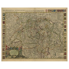
Beautiful Antique Handcolored Map of Switzerland with 33 Coats of Arms, ca.1705
Located in Langweer, NL
Antique map Switerzland titled 'La Suisse Divisee en ses Treze Cantons, ses Alliez & ses Sujets (..)'. Beautiful map of Switzerland with 33 coats of arms. The map is dedicated to t...
Category

Antique 18th Century and Earlier More Furniture and Collectibles

Materials

Paper

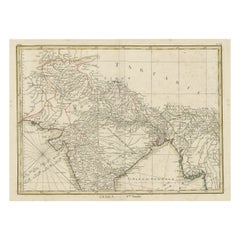
Old Map of North India From Kandahar East to Burma 'Pegu' and South to Goa, 1776
Located in Langweer, NL
Description: Antique map titled 'Indes Iere Feuille'. Old map of northern India. Covers the subcontinent from Kandahar east as far as Burma (Pegu) and south to just past Goa. Names...
Category

Antique 18th Century and Earlier More Furniture and Collectibles

Materials

Paper

Antique Map of New England and Part of Canada by Vaugondy 'circa 1755'
Located in Langweer, NL
Antique map titled 'Partie de l'Amérique septent qui comprend la nouvelle France ou le Canada'. Decorative and highly detailed map of New England an...
Category

Antique 18th Century and Earlier More Furniture and Collectibles

Materials

Paper

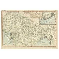
Antique Map of part of Central and Southern Asia
Located in Langweer, NL
Antique map titled 'Carte de la Partie Superieure de l'Inde en deca du Gange. Comprise entre la Cote du Concan et celle d'Orixa, avec l'Empire du Mogol, le Bengale, le R. d'Asham, pa...
Category

Antique 18th Century and Earlier More Furniture and Collectibles

Materials

Paper

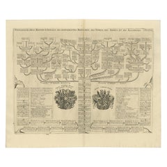
Antique Genealogy Chart of the Duchy of Anhalt Dessau, Bernburg and Zerbst, 1732
Located in Langweer, NL
Antique print titled 'Genealogie de la Maison d'Anhalt'. Chart of the genealogy of the house of the Duchy of Anhalt. Two coats of arms, on the left Anhalt-...
Category

Antique 18th Century and Earlier More Furniture and Collectibles

Materials

Paper

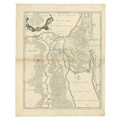
Antique Map of The Nile, Egypt and the Red Sea by Bachiene, 1765
Located in Langweer, NL
Antique map titled 'De XIde Landkaart verbeeldende Egypte en de Woestyne der Schelf-Zee (..).' Map of Biblical Egypt and the Red Sea. With title cartouche, compass rose and scale. Th...
Category

Antique 18th Century and Earlier More Furniture and Collectibles

Materials

Paper

Original Antique Map of the Duchy of Luxembourg by De Wit, Amsterdam circa 1680
Located in Langweer, NL
Map of the Duchy of Luxembourg by De Wit, Amsterdam circa 1680 Rare original antique map of the Duchy of Luxembourg by Frederick de Wit, published in Amsterdam circa 1680. A highly ...
Category

Dutch Antique 18th Century and Earlier More Furniture and Collectibles

Materials

Paper

1640 Willem Blaeu Map Entitled "Contado di molise et principato vltra, " Ric.a003
Located in Norton, MA
1640 Willem Blaeu map entitled "Contado di molise et principato vltra," Colored Ric. a003 Measures: 38 x 49.6 cm and wide margins DBLAEU. Cou...
Category

Dutch Antique 18th Century and Earlier More Furniture and Collectibles

Materials

Paper

Ciel de Lit, 18th Century
Located in New Orleans, LA
Also known as a baldacchino, baldaquin, or baldachin. It showcases intricate craftsmanship with gilded metallic elements. The decorative motifs include festooned garlands, floral pat...
Category

French Antique 18th Century and Earlier More Furniture and Collectibles

Materials

Wood

Antique Map of the Pacific Ocean by Renneville, 1725
Located in Langweer, NL
Rare map of the Southern Pacific, illustrating Le Maire's tracks, extending from the La Maire Straits to Nova Guinea, with a large inset of the northern Coastline of New Guinea and a...
Category

Antique 18th Century and Earlier More Furniture and Collectibles

Materials

Paper

Original Italian Antique Map of Asia Minor and Cyprus and Neighboring Regions
Located in Langweer, NL
Antique map titled 'Natolia detta anticamente Asia Minor (..)'. Rare map of Asia Minor (Turkey) and Cyprus and neighboring regions. The map provides one of the most detailed and up t...
Category

Antique 18th Century and Earlier More Furniture and Collectibles

Materials

Paper

1700 Guillaume Delisle Map: Western Mediterranean & Moorish North Africa
Located in Langweer, NL
1700 Guillaume Delisle Map: Western Mediterranean & Moorish North Africa This hand-colored map from 1700 by Guillaume Delisle, titled "In Notitiam Ecclesiasticam Africae Tabula Geographica," offers a detailed look at the regions under Moorish control during the later medieval period. It encompasses the northern African coast from Morocco to Libya, the Iberian Peninsula, and the western Mediterranean, including notable islands such as Sardinia, Corsica, Malta, the Balearics, and Sicily, where a smoking Mount Etna is depicted. The map is embellished with three decorative cartouches, adding artistic flair to the detailed geographical renderings. Engraved by Jean Baptiste Liebaux, the map measures 25.2 inches wide by 19.1 inches high. It features a sharp impression with contemporary outline color, later enhanced cartouches, and is printed on a bright sheet with a Society of Jesus watermark. The condition is very good, with an archivally repaired centerfold separation at the bottom and light toning along the edges. Keywords: - Guillaume Delisle map - Western Mediterranean historical map - Northern Africa map...
Category

Antique 18th Century and Earlier More Furniture and Collectibles

Materials

Paper

Original Antique Map of the Virgin Islands with Insets of Caribbean Isles, 1787
Located in Langweer, NL
Antique map titled 'Supplément pour les Isles Antilles (..)'. Original old map of the Virgin Islands, with insets of Barbuda, St. Kits, Antigua, Dominica, St. Lucia, Barbados, St. Vi...
Category

Antique 18th Century and Earlier More Furniture and Collectibles

Materials

Paper

Old Map by Blaeu of the City of Franeker, Friesland, The Netherlands, 1649
Located in Langweer, NL
Antique map titled 'Franekera'. Old map of the city of Franeker, Friesland. Also shows two cartouches, coats of arms and legend. This map originates from a Latin edition of the t...
Category

Antique 18th Century and Earlier More Furniture and Collectibles

Materials

Paper

Antique Print of Adam and Eve Eating the Apple from the Tree '1674'
Located in Langweer, NL
Description: Antique print, titled: 'Lussa dei sumpto violantur ab arbore pomo, Efficit hoc tacitis vipera saeua dolis.' - This original antique print shows a scene from Genesis in t...
Category

Antique 18th Century and Earlier More Furniture and Collectibles

Materials

Paper

Old Map of the Kingdoms of Fez, Algiers, Segelmese, Tafilet and Morocco, ca.1760
Located in Langweer, NL
Antique map titled 'A Map of the Empire of Morocco Comprehending the Kingdoms of Fez, Morocco'. Original antique map of the kingdoms of Fez, Algiers, Segelmese, Tafilet and Moroc...
Category

Antique 18th Century and Earlier More Furniture and Collectibles

Materials

Paper

Stunning Decorative Antique Map of East Frisia with an Inset of Emden, c.1610
Located in Langweer, NL
Description: Antique map titled 'Typus Frisie Orientalis a Dullarto (..)'. One of the most decorative maps of East Frisia and its important shipping center of Emden and the Watten Is...
Category

Antique 18th Century and Earlier More Furniture and Collectibles

Materials

Paper

Europe Divided into Principal States by Jean Denis Janvier, Paris, 1782
Located in Langweer, NL
This is a historical map of Europe titled "L'Europe divisee en ses Principaux Etats," created by Jean Denis Janvier in 1782. This beautiful map depicts the political boundaries and...
Category

Antique 18th Century and Earlier More Furniture and Collectibles

Materials

Paper

Very Attractive Handcolored Antique Plan of Cochin in India, 1744
Located in Langweer, NL
Antique map titled 'The City of Cochin (..).' Plan of Cochin, Malabar Coast, India, during the attack by Admiral van Goens in 1663. This map was published in 'The True and Exact Desc...
Category

Antique 18th Century and Earlier More Furniture and Collectibles

Materials

Paper

Untitled Print of a Ruin, De Bruyn, c.1700
Located in Langweer, NL
This plate shows a ruin near the water. Source unknown, to be determined. Most likely engraved by C. de Bruijn, c.1700. Artists and Engravers: Cornelis de Bruijn (also spelled Cornel...
Category

Antique 18th Century and Earlier More Furniture and Collectibles

Materials

Paper

Original Antique Engravings of Various Churches on Ceylon 'Sri Lanka', 1732
Located in Langweer, NL
Antique print titled 'The Church Poelepolay, The Church Mogommate, The church Tambamme, the Church Mulipatto'. Antique print with four views of the churches of Poelepolay, Mogommate,...
Category

Antique 18th Century and Earlier More Furniture and Collectibles

Materials

Paper

Les Vieux Hotels De Paris, Decorations Exterieureset Interieures, 20 Portfolios
Located in North Yorkshire, GB
It is rare to find a set of twenty of these volumes, which were published between 1920 and 1930. Each volume contains a title page and varying amounts of text in French - up to 24 pa...
Category

Antique 18th Century and Earlier More Furniture and Collectibles

Materials

Paper

Antique Map of South West Germany with an Inset of Brisac or Brisach, France
Located in Langweer, NL
Antique map Germany titled 'A New and Accurate Map of the South West part of Germany. Comprehending the Archbishoprics of Mentz and Treves, the Ele...
Category

Antique 18th Century and Earlier More Furniture and Collectibles

Materials

Paper

Old Map of the Lower Bishopric of Münster (1726-1750) by Sanson & Ottens, c.1750
Located in Langweer, NL
Historical Map of the Lower Bishopric of Münster (1726-1750) by Sanson & Ottens – Hand-Colored Copperplate Engraving The map titled "BASSE PARTIE DE L'EVESCHE DE MUNSTER" is a detai...
Category

Antique 18th Century and Earlier More Furniture and Collectibles

Materials

Paper

Original Hand-colored Antique Map of the Southern Part of India
Located in Langweer, NL
Antique map titled 'Orarum Malabariae, Coromandelae &c Tabula Accuratissima - Carte des Cotes de Malabar et de Coromandel'. Beautiful map of the southern part of India. It focuses on trade routes within India, as well as the Coromandel and Malabar Coasts...
Category

Antique 18th Century and Earlier More Furniture and Collectibles

Materials

Paper

Antique Map of Novaya Zemlya by Bellin, 1758
Located in Langweer, NL
Antique map titled 'Partie de la Mer Glaciale Contenant la Nouvelle Zemle et le Pais des Samoiedes'. This map features Novaya Zemlya, the island off northern Russia in the Barents Se...
Category

Antique 18th Century and Earlier More Furniture and Collectibles

Materials

Paper

Pl. 1 Antique Print of the Stowe House by Le Rouge, 1776
Located in Langweer, NL
Antique print titled 'Chateau de Stowe, du Coté des Jardins'. Copper engraving showing the garden side of the Stowe House. This print originates from 'Jard...
Category

Antique 18th Century and Earlier More Furniture and Collectibles

Materials

Paper

French Gilt Ciborium – Silver Cup, Louis XV Period (circa 1740–1760)
Located in Bilzen, BE
"French Gilt Ciborium – Silver Cup, Louis XV Period (circa 1740–1760)" French Gilded Ciborium – Silver Bowl, Gilded Copper Base & Lid Louis XV Period (c. 1740–1760) / Reassembled & H...
Category

French Louis XV Antique 18th Century and Earlier More Furniture and Collectibles

Materials

Silver, Copper

Antique Map of CAP Providence, St. David's Cove and Surroundings
Located in Langweer, NL
Antique map titled 'Baye du Cap Upright (..)'. Eight charts on one sheet of Cap Providence, St. David's Cove, the Bay of the Island, Swallow's Haven, Puzzlin...
Category

Antique 18th Century and Earlier More Furniture and Collectibles

Materials

Paper

The Valley of Inspruck: An 18th-Century Engraved Perspective, 1792
Located in Langweer, NL
Title: "The Valley of Inspruck: An 18th-Century Engraved Perspective" This elegant original antique engraving, titled "The Valley of Inspruck," showcases a serene view of the Innsbruck Valley. The artwork is delicately rendered, capturing the grandeur of the mountains and the pastoral tranquility of the valley. The print depicts a detailed landscape scene, replete with towering craggy peaks that loom over a peaceful settlement nestled in the valley. A striking feature is the contrast between the ruggedness of the natural environment and the cultivated lands and architecture, indicating a harmonious coexistence of humanity with nature. It was published as directed on January 1, 1792, by T & G Egerton of Whitehall for the author. Albanis Beaumont is credited with the original design ('Del.' for delineavit, indicating he drew the initial illustration), and Cornelis Apostool is noted for the engraving work ('Sculp.' for sculpsit, indicating he engraved the image). The publication of this print during the late 18th century aligns with a time when there was a heightened interest in natural beauty and the picturesque, reflected in the art and literature of the Romantic period. This print would have appealed to those with an appreciation for both the aesthetic and the sublime qualities of the European landscape. The publication by T & G Egerton, a reputable firm known for their work in the arts, and the involvement of a skilled artist and engraver like Beaumont and Apostool, respectively, underline the quality and desirability of the print. It is a piece that would attract collectors of fine engravings and admirers of European landscapes, offering a window into the aesthetic values and artistic endeavors of the late 18th century. As a historical piece, this print offers a view into the past, inviting contemplation of the rich cultural and natural heritage of the Innsbruck area. It is a valuable collectible for enthusiasts of antique maps and prints...
Category

Antique 18th Century and Earlier More Furniture and Collectibles

Materials

Paper

Antique Print of the House of John Waller by Campbell, 1725
Located in Langweer, NL
Antique print titled 'The Elevation of Iohn Waller Esqr. his house in Beaconsfield in Buckinghamshire (..)'. Old engraving of the house of John Waller in Beaconsfield. This print ori...
Category

Antique 18th Century and Earlier More Furniture and Collectibles

Materials

Paper

Antique Map of the Region of Île-de-France by Hondius, circa 1630
Located in Langweer, NL
Antique map titled Gouvernement de l'Isle de France'. Old map of the region of Île-de-France, France. It is located in the north-central part of the country and often called the régi...
Category

Antique 18th Century and Earlier More Furniture and Collectibles

Materials

Paper

Antique Roman Bronze Rare Architects Geometrical Compass/Divider 3.AD
Located in Doha, QA
Extremely rare and one of a kind ancient Roman bronze geometrical compass/divider. It is in an excellent condition for its age. The Compass is displayed on a dark marble block with a...
Category

Italian Classical Roman Antique 18th Century and Earlier More Furniture and Collectibles

Materials

Stone, Bronze

Map of Europe Highlighting Ancient and Modern Geographical Divisions (1794)
Located in Langweer, NL
Map of Europe Highlighting Ancient and Modern Geographical Divisions (1794). Germany, France, Italy, Spain, and the British Isles – Map by D’Anville (1794). This detailed 18th-cent...
Category

Antique 18th Century and Earlier More Furniture and Collectibles

Materials

Paper

1634 Mercator/Jansson Map: Eastern Austria with Vienna, Hand-Colored
Located in Langweer, NL
1634 Mercator/Jansson Map: Eastern Austria with Vienna, Hand-Colored This hand-colored map from 1634, titled "Austria Archiducatus," by Mercator and Jansson, depicts the eastern reg...
Category

Antique 18th Century and Earlier More Furniture and Collectibles

Materials

Paper

Original Antique Copper Engraving of a Portrait of John the Evangelist, 1708
Located in Langweer, NL
Antique print, titled: 'Das Bildnus des H. Evangelisten Johannis (…).' - This original antique plate shows a portrait of John the Evangelist. From: Biblia : das ist die gantze He...
Category

Antique 18th Century and Earlier More Furniture and Collectibles

Materials

Paper

Original Map of the East Indies Including Sumatra, Java, Borneo & Malaysia, 1747
Located in Langweer, NL
Antique map titled 'Carte des Isles Java, Sumatra, Borneo (..) - Kaart van de Eilanden van Iava, Sumatra, Borneo (..)'. Map of the East Indies including Sumatra, Java, Borneo and...
Category

Antique 18th Century and Earlier More Furniture and Collectibles

Materials

Paper

Antique Map of Germany from a 17th Century Pocket Atlas, 1685
Located in Langweer, NL
Antique map titled 'Nova Totius Germaniae descriptio.' Miniature map of Germany, from the pocket atlas 'Introductionis in Universam Geographiam tam Veterem...
Category

Antique 18th Century and Earlier More Furniture and Collectibles

Materials

Paper

Antique Map of Gloucestershire by Camden, c.1607
Located in Langweer, NL
Antique map titled 'Glocestriae comitatus olim sedes Dobunorum'. Map of Gloucestershire, England. This map originates from Camden?s 'Britannia' ...
Category

Antique 18th Century and Earlier More Furniture and Collectibles

Materials

Paper

Antique Colored Engraving of Madras 'Chennai' and Fort St. George in India, 1751
Located in Langweer, NL
Antique print titled 'Plan de Madras et du Fort St. Georges'. Plan of the city of Madras (or Chennai), the capital of the state of Tamil Nadu, India. Also shows a plan of Fort St. Ge...
Category

Antique 18th Century and Earlier More Furniture and Collectibles

Materials

Paper

1625 Petrus Plancius / Cloppenburg Map of the Holy Land with Biblical Vignettes
Located in Langweer, NL
1625 Petrus Plancius / Johannes Cloppenburg Map of the Holy Land with Biblical Vignettes This exquisite 1625 map by Petrus Plancius and Johannes Cloppenburg represents the Holy Lan...
Category

Antique 18th Century and Earlier More Furniture and Collectibles

Materials

Paper

Antique Engraved Map of Italy in Roman Times, ca.1730
Located in Langweer, NL
Plain engr. map of Italy according to the division of Emperor Augustus by G. Delisle. Title: "Tabula Italiae Antiquae In Regiones XI Ab Augusto Divisae Et Tum Ad Mensuras Itinerari...
Category

Antique 18th Century and Earlier More Furniture and Collectibles

Materials

Paper

1584 Ortelius Map of Switzerland: A Cartographic Reversal
Located in Langweer, NL
This is a fine example of Ortelius' map of Switzerland from his *Theatrum Orbis Terrarum*, recognized as the first modern atlas of the world. The map is oriented with south at the top, which reverses the typical north-up orientation seen in most modern maps. It highlights significant geographical features such as Lake Geneva (Lemanus Lacus) to the right of the map and the Rhine river entering Switzerland near the center. The *Theatrum Orbis Terrarum*, first published in 1570 by Abraham Ortelius in Antwerp, was groundbreaking as it compiled uniform maps with supporting text in a single volume, marking a departure from earlier collections of maps that were custom-assembled on demand. This atlas included a wealth of sixteenth-century cartographic knowledge, reflecting the extensive global explorations occurring after the discovery of America...
Category

Antique 18th Century and Earlier More Furniture and Collectibles

Materials

Paper

Antique Map of Leeuwarden, Capital of Friesland, the Netherlands, by Blaeu, 1649
Located in Langweer, NL
Antique map titled 'Leoverdia.' Bird's-eye view plan of Leeuwarden, Friesland, the Netherlands. With key to locations and coats of arms. Text in Dutch on verso. This plan origina...
Category

Antique 18th Century and Earlier More Furniture and Collectibles

Materials

Paper

Old Map Depicting Turkey, Persia, Arab and Black Sea Etc, 1778
Located in Langweer, NL
Antique map titled 'Turquie d'Asie, Arabie, Perse, Tartarie Independante'. Old map of Turkey in Asia. The map shows all of Turkey and the Black Sea, and extends east to include t...
Category

Antique 18th Century and Earlier More Furniture and Collectibles

Materials

Paper

Navigating the Spice Trade: A Maritime Chart of the Banda Sea, 1799
Located in Langweer, NL
This original antique map is an 18th-century nautical chart by Laurie & Whittle, a well-known British firm that was involved in the publication of maps, charts, and maritime books. ...
Category

Antique 18th Century and Earlier More Furniture and Collectibles

Materials

Paper

Louis XV Period Gilded Barometer with Thermometer
Located in Pembroke, MA
An elegant French gilded wood barometer with thermometer (period Louis XV, Circa 1760). Barometer has been fitted with a new mercury tube, ...
Category

French Louis XV Antique 18th Century and Earlier More Furniture and Collectibles

Materials

Giltwood, Glass

Crete Map 1749 – Homann Heirs Engraving of Candia with Aegean Islands
Located in Langweer, NL
Crete Map 1749 – Homann Heirs Engraving of Candia with Aegean Islands This fine 1749 map titled 'Insula Creta hodie Candia' presents an 18th-century cartographic portrait of the isl...
Category

German Antique 18th Century and Earlier More Furniture and Collectibles

Materials

Paper

Limoges enamel plaque the Assumption of Mary, silver frame. France, around 1600
Located in Gorssel, GE
Limoges enamel pax depicting the Assumption of Mary, in a silver frame in Renaissance style decorated with scrollwork and five angel heads, ca. 1600. Total height: 14.8 cm., width...
Category

French Antique 18th Century and Earlier More Furniture and Collectibles

Materials

Copper, Enamel, Silver

Hainaut Map Ortelius 1590 – Rare Hand-Colored French-Belgian Border Map
Located in Langweer, NL
Decorative 16th Century Map of Northern France by Ortelius, circa 1590 This richly colored antique map titled *Nobilis Hannoniae Comitatus Descriptio* depicts the County of Hainaut ...
Category

Belgian Antique 18th Century and Earlier More Furniture and Collectibles

Materials

Paper

Exquisite 1600 Ortelius Map of Artois, France: A Collector’s Piece
Located in Langweer, NL
Exquisite 1600 Ortelius Map of Artois, France: A Collector’s Piece with Rich Historical Detail Description of the Map: This map, titled "Atrebatum Regionis Vera Descriptio," create...
Category

Antique 18th Century and Earlier More Furniture and Collectibles

Materials

Paper

Original Rare Map of the Holy Land Showing the Twelve Tribes of Israel's, 1782
Located in Langweer, NL
Antique map titled 'Carte des Douze Tribus D'Israel (..).' Map of the Holy Land showing the twelve tribes of Israel's. Tribes are all named...
Category

Antique 18th Century and Earlier More Furniture and Collectibles

Materials

Paper

18th Century Italian Antique Oil on Canvas Painting Saint Francesco Saverio
Located in Casale Monferrato, IT
Beautiful antique Italian oil painting on canvas. Excellent pictorial quality great attention to detail. Italian school of the 18th century. Not signed. A beautiful religious painting Saint Francesco...
Category

Italian Antique 18th Century and Earlier More Furniture and Collectibles

Materials

Canvas

Antique Map of the Congo, Gabon and Angola by N. Sanson, circa 1700
Located in Langweer, NL
Attractive map of Gabon, the Congo and Angola from Cape Lopez and Sao Tomé to approximately the border with present-day Namibia. The map is fully engraved with mountains, rivers, for...
Category

Antique 18th Century and Earlier More Furniture and Collectibles

Materials

Paper

Antique Map of the Province of Overijssel by Coronelli, c.1692
Located in Langweer, NL
Antique map titled 'Tran-siselana' Splendid detailed and decorative map of the province of Overijssel in the Netherlands by Vincenzo Coronelli. An elaborate title cartouche garlanded...
Category

Antique 18th Century and Earlier More Furniture and Collectibles

Materials

Paper

Antique Map of New England and Eastern Canada by Homann Heirs, circa 1755
Located in Langweer, NL
Antique map titled 'Partie Orientale de la Nouvelle France ou du Canada (..)'. Original antique map of New England and Eastern Canada made a...
Category

Antique 18th Century and Earlier More Furniture and Collectibles

Materials

Paper

Antique Print of Inhabitants of Arakan in Southern Myanmar 'Burma', 1738
Located in Langweer, NL
Antique print titled 'Il mode nel quale si vestono gti abilanti di Arakan'. Engraving of inhabitants of Arakan, a historic coastal region in Southeast Asia. This print originates fro...
Category

Antique 18th Century and Earlier More Furniture and Collectibles

Materials

Paper

Antique Map of the Region of Bresse by Hondius, circa 1630
Located in Langweer, NL
Antique map titled 'Bresse'. Old map of the former region of Bresse, France. It is located in the regions of Auvergne-Rhône-Alpes and Bourgogne-Franche-Comté of eastern France. This ...
Category

Antique 18th Century and Earlier More Furniture and Collectibles

Materials

Paper

Antique Map of India as Described It Was before the 5th Century, 1744
Located in Langweer, NL
Antique map titled 'India, as described by all Authors before the fifth Century'. Detailed map of part of India, including Hyrcania, Parthia, Carmania, Gedorossii, Drangiana, Aria, M...
Category

Antique 18th Century and Earlier More Furniture and Collectibles

Materials

Paper

Antique Map of the Burgundy Region by Merian, 1646
Located in Langweer, NL
Antique map titled 'Utriusque Burgundiae tum Ducatus tum Comitatus descriptio'. Old map of the Burgundy region of France. This map originates from 'Neuwe Archontologia cosmica'. Arti...
Category

Antique 18th Century and Earlier More Furniture and Collectibles

Materials

Paper

Read More

Medal-Worthy Memorabilia from Epic Past Olympic Games

Get into the games! These items celebrate the events, athletes, host countries and sporting spirit.

Ahoy! You’ve Never Seen a Collection of Sailor Art and Kitsch Quite Like This

French trendsetter and serial collector Daniel Rozensztroch tells us about his obsession with objects related to seafaring men.

39 Incredible Swimming Pools

It's hard to resist the allure of a beautiful pool. So, go ahead and daydream about whiling away your summer in paradise.

Pamela Shamshiri Shares the Secrets behind Her First-Ever Book and Its Effortlessly Cool Interiors

The sought-after designer worked with the team at Hoffman Creative to produce a monograph that beautifully showcases some of Studio Shamshiri's most inspiring projects.

Moroccan Artworks and Objects Take Center Stage in an Extraordinary Villa in Tangier

Italian writer and collector Umberto Pasti opens the doors to his remarkable cave of wonders in North Africa.

Montecito Has Drawn Royalty and Celebrities, and These Homes Are Proof of Its Allure

Hollywood A-listers, ex-pat aristocrats and art collectors and style setters of all stripes appreciate the allure of the coastal California hamlet — much on our minds after recent winter floods.

Whaam! Blam! Pow! — a New Book on Pop Art Packs a Punch

Publishing house Assouline and writer Julie Belcove have teamed up to trace the history of the genre, from Roy Lichtenstein, Andy Warhol and Yayoi Kusama to Mickalene Thomas and Jeff Koons.

What Makes a Gem-Encrusted Chess Set Worth $4 Million?

The world’s most opulent chess set, weighing in at 513 carats, is literally fit for a king and queen.
Recently Viewed

View All