18th Century More Furniture and Collectibles

to
1,881
2,622
611
3,265
158
136
57
49
49
46
38
25
13
5
2
2
1
1
1
5,284
10,610
31,725
15,224
6,682
13,764
6,702
929
566
1,133
1,402
1,051
2,871
2,937
2,588
1,203
817
2,192
652
389
229
116
1,145
282
265
216
203
3,265
3,265
3,265
21
14
13
12
11
Period: 18th Century
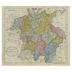
Antique Map of Germany, the Netherlands, Bohemia, Bavaria and Switzerland, 1785
Located in Langweer, NL
Antique map titled 'Germany and the Netherlands from the latest authorities'. Depicts Germany, the Netherlands and the surrounding region including Bohemia, Bavaria, and Switzerland....
Category

Antique 18th Century More Furniture and Collectibles

Materials

Paper

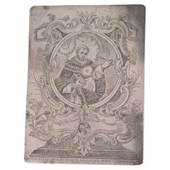
Engraved Copper Plate – 18th Century
Located in Madrid, ES
Interesting and rare original 18th-century copper plate used for printing religious engravings. The plate is finely engraved with a burin, depicting sacred scenes typical of the devo...
Category

European Baroque Antique 18th Century More Furniture and Collectibles

Materials

Copper

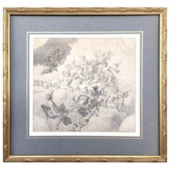
Original Drawing, Circle of Giovanni Battista Tiepolo 1696-1770 Venice, Italy
By Giovanni Battista Tiepolo
Located in Vero Beach, FL
Original Drawing, Circle of Giovanni Battista Tiepolo 1696-1770 Venice, Italy Although we offer this old master drawing as circle of Tiepolo, we are convinced, based on the composi...
Category

Italian Rococo Antique 18th Century More Furniture and Collectibles

Materials

Paper

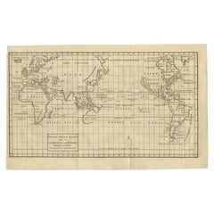
Antique Map of the World on Mercator Projection by Anson, 1749
Located in Langweer, NL
Antique map titled 'Nieuwe Wereld Kaart waar in de Reizen van den Hr. Anson rondsom de Wereld'. Original antique map of the world on Mercator'...
Category

Antique 18th Century More Furniture and Collectibles

Materials

Paper

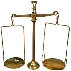
French 18th Century Balance Scale
Located in Round Top, TX
A handsome French 18th century balance scale in iron and brass. The balance mechanism is in iron. The foot and the plates are in brass. The...
Category

French Antique 18th Century More Furniture and Collectibles

Materials

Brass, Iron

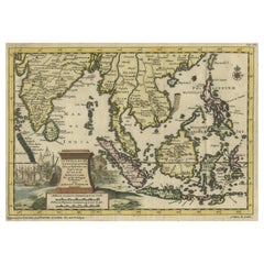
Striking Antique Map Centered on the Malay Peninsula
Located in Langweer, NL
Antique map titled 'D'Indiaanze Landschappen Zeen en Eylanden, van Couchin af tot in de Moluccos (...)'. Striking map of the region from the Philippines and Formosa to India and the ...
Category

Antique 18th Century More Furniture and Collectibles

Materials

Paper

Dutch Antique Map of the West Coast of Africa, to the Cape of Good Hope, 1747
Located in Langweer, NL
Antique map of the Coast of Africa titled 'Kaart van de West Kust van Afrika (..)'. Map of the west coast of Africa, from 11 degrees south latitude to the Cape of Good Hope. This...
Category

Antique 18th Century More Furniture and Collectibles

Materials

Paper

Detailed Map of Friesland, Groningen and Drenthe, The Netherlands, 1706
Located in Langweer, NL
Antique map tited 'Frisiae Dominium vernacule Friesland verdeeld met de hoofd-deelen van Oostergoo, Westergoo en Sevenwolden (..)'. Detailed map of Friesland, Groningen and Drenthe, ...
Category

Antique 18th Century More Furniture and Collectibles

Materials

Paper

Antique Map of the Middle East by Mortier, 1700
Located in Langweer, NL
Antique map titled 'Carte de la Situation du Paradis Terrestre (..)'. Detailed map of the Holy Land and the Middle East, centered on the Garden of Eden and including a large Cyprus. ...
Category

Antique 18th Century More Furniture and Collectibles

Materials

Paper

Antique Map of India and Ceylon, along with the Maldives
Located in Langweer, NL
Antique map titled 'Stato del Mogol con l'Isole di Ceilan e Maldive'. Beautiful map of India and Ceylon, along with the Maldives. Includes a large decorative title cartouche. The map...
Category

Antique 18th Century More Furniture and Collectibles

Materials

Paper

Old Map of Ancient Assyria Divided into Syria, Mesopotamia, Babylonia & Assyria
Located in Langweer, NL
This map, "Assyria vetus diuisa in Syriam, Messopotamiam, Babyloniam, et Assyriam", by Pierre Mortier, is a late 17th-century depiction of the historical Middle East. Title: Ancie...
Category

Antique 18th Century More Furniture and Collectibles

Materials

Paper

Antique Map of Africa with a Decorative Dedication to the Dauphin, 1717
Located in Langweer, NL
Antique map titled 'L'Afrique, Dressée Selon les Dernieres Relat. et Suivant les Nouvelles Decouvertes (..).' This map is a reduced derivative of De Fer's wall map of Africa (1696-98) with its characteristic thickened west coast. Unusual islands appear in the Atlantic and Indian Oceans including a mythical second island of St. Helena. Monomotapa is shown in the south and the southwest coastline is distorted and there is an incorrect placement and shape of the Cape of Good Hope. In Central Africa is a paragraph concerning the origin of the Nile in Abyssinia, however, the two sub-equatorial Ptolemaic lakes are still shown on the map. The map is graced with a decorative dedication to the Dauphin and a title cartouche featuring lime kilns. The map was first published in 1700. This scarse map originates from: 'Introduction a la geographie - avec unde description historique sur toutes...
Category

Antique 18th Century More Furniture and Collectibles

Materials

Paper

18th Century Polish Brass Hanukkah Lamp
Located in New York, NY
The backplate is cast and pierced with a central two-handled vase of flowers, flanked by fully formed birds with their heads turned outward. The side panels fitted with two servant lights, fronted by a row of eight oil fonts. Scholars theorize that these Polish Chanukah Lamps that bear two servant lights (as opposed to the singular servant light normally found on a Chanukah Lamp), served a purpose, having been used on one of the days that Chanukah fell on the Sabbath, as Sabbath Candlesticks. For another example, see page 296 of the book “Five Centuries of Hanukkah Lamps...
Category

Polish Antique 18th Century More Furniture and Collectibles

Materials

Brass

Old Print of Stone with Elephants from the Bridge of Constantine, Algeria, 1773
Located in Langweer, NL
Antique print titled 'Steen in de brug van het oude Cirta (..)'. Old print depicting a stone with elephants from the bridge of Cirta/Constantine. Also depicts other architectural...
Category

Antique 18th Century More Furniture and Collectibles

Materials

Paper

Antique Engraving of Deucalion and Pyrrha of Phthia, Thessaly, Greece, 1733
Located in Langweer, NL
Antique print titled 'Deucalion & Pyrrha (..)'. This print depicts Deucalion and Pyrrha. Deucalion, who reigned over the region of Phthia, had been forewarned of the flood by his...
Category

Antique 18th Century More Furniture and Collectibles

Materials

Paper

Antique Plan of Aigues-Mortes, France
Located in Langweer, NL
Antique map titled 'Plan d'Aiguesmortes et environs'. Original plan of the region of Aigues-Mortes, France. This map originates from 'Le Petit Atlas Maritime (..)' by J.N. Bellin. Pu...
Category

Antique 18th Century More Furniture and Collectibles

Materials

Paper

Antique Engraved Map of the Northern Part of Greece and the Aegean Sea, Ca.1730
Located in Langweer, NL
Title: "GRÆCIÆ PARS Septentrionalis". Hand Coloured Engraved map by G. Delisle of the northern part of the Aegean. In the top left corner a distance scale included. Condition...
Category

Antique 18th Century More Furniture and Collectibles

Materials

Paper

Rare George III Celestial Pocket Globe by Cary, London
By Cary
Located in Oxfordshire, United Kingdom
A fine and rare 3" celestial pocket globe by G & W Cary, Strand, London circa 1791, housed in its original sharkskin case. A companion globe to terrestrial globes of this type we...
Category

English George III Antique 18th Century More Furniture and Collectibles

Materials

Plaster

Original Antique Plan of the Fortress of Charedsch in Persia or Iran, ca.1780
Located in Langweer, NL
Antique map, titled: 'Plan de la Citadelle de la Ville de Charedsch.' Plan of the fortress of Charedsch, Iran / Persia. This original antique print originates from 'Reize naar Ar...
Category

Antique 18th Century More Furniture and Collectibles

Materials

Paper

Rare Engraved City Plan of Nuremberg, Bavaria by Christoph Weigel, 1718
Located in Langweer, NL
Title: Rare Engraved City Plan of Nuremberg, Bavaria by Christoph Weigel, 1718 Description: This detailed city plan of Nuremberg, Bavaria was crafted by Christoph Weigel in 1718 an...
Category

Antique 18th Century More Furniture and Collectibles

Materials

Paper

Martinique Map by Rigobert Bonne – French Antique Map, c.1768
Located in Langweer, NL
Map of Martinique by Rigobert Bonne, circa 1768 This is a detailed antique map of Martinique titled “Isle de la Martinique,” engraved by Rigobert Bonne around 1768 for the Atlas Encyclopédique. Bonne, a renowned French hydrographer and successor to Bellin, is celebrated for his scientifically precise and elegantly engraved maps. The map shows Martinique with its mountainous interior, rivers, and settlements labelled, including Fort Royal, Fort St. Pierre, Le Marin, and Le Prêcheur. Coastal features, bays, and capes are marked, along with anchorages important for maritime navigation in the 18th century. The depiction includes relief shown pictorially, characteristic of Bonne’s cartographic style, enhancing both geographic understanding and aesthetic appeal. This copperplate engraving retains original hand colouring outlining the coastlines in delicate blue and brown tones, typical for the period. It served as a key reference for scholars, navigators, and colonial administrators during France’s colonial presence in the Caribbean. Condition: Good condition overall. A strong impression with bright, original hand-colour outlines. General age toning, faint offsetting, and a vertical fold as issued in the atlas. Margins ample all around for framing. Framing suggestions: This historic Caribbean map...
Category

French Antique 18th Century More Furniture and Collectibles

Materials

Paper

Map of Martinique, Guadeloupe, Marie-Galante, Désirade & Saintes by Bonne, 1788
Located in Langweer, NL
Map of Martinique, Guadeloupe, Marie-Galante, Désirade & Saintes by Bonne, 1788 This fine antique map, titled *Isle de la Martinique, Isles de la Guadeloupe, de Marie Galante, de la...
Category

French Antique 18th Century More Furniture and Collectibles

Materials

Paper

1758 Bellin Map of Guadeloupe and Marie-Galante – Caribbean Islands
Located in Langweer, NL
Thank you for noting the correct date on the map. Here is your **updated plain text catalog listing**: --- **Title (under 80 characters):** 1758 Bellin Map of Guadeloupe and Marie-Galante – Caribbean Islands **Description:** Original antique map titled *Carte de l’Isle de la Guadeloupe* by Jacques Nicolas Bellin, engraved for the *Histoire Générale des Voyages*, published in Paris in 1758. This finely engraved copperplate map depicts the French Caribbean island of Guadeloupe, showing its distinctive butterfly-shaped division into Basse-Terre and Grande-Terre. The surrounding smaller islands include Marie-Galante (bottom right) and Les Saintes. The map details numerous place names, parishes, rivers, bays, mountains, and anchorages. A decorative rococo title cartouche graces the upper right corner, complemented by a scale bar cartouche in the upper left. Jacques Nicolas Bellin (1703-1772) served as Hydrographer to the King and was one of the most prominent French cartographers of the 18th century, producing maps noted for their accuracy, elegance, and clarity. This map was created for the influential *Histoire Générale des Voyages* by Abbé Prévost. Condition report: Excellent condition. Strong and clean impression on fine laid paper with wide margins. Original hand coloring in outline and wash, highlighting coastlines and cartouches. Minor age toning at edges; verso blank. Framing suggestion: Frame with a classic gold or dark wood moulding and a neutral cream archival mat to emphasize the fine engraving and delicate color washes. Museum glass is recommended to preserve this 18th-century Caribbean map...
Category

French Antique 18th Century More Furniture and Collectibles

Materials

Paper

Antique Map of Boulogne-sur-Mer by Bellin '1764'
Located in Langweer, NL
Antique map titled 'Plan de la Ville de Boulogne'. Original antique map of Boulogne-sur-Mer, France. This map originates from 'Le petit atlas maritime: recueil de cartes et plans des...
Category

Antique 18th Century More Furniture and Collectibles

Materials

Paper

SECOND HALF OF THE 18th CENTURY PAIR OF NEOCLASSIC BEDSIDE TABLES
Located in Firenze, FI
Pair of bedside tables in solid fir wood and walnut veneer. The bedside tables are decorated with geometric inlays in fruit wood and walnut, present on the top and sides, which give ...
Category

Italian Neoclassical Revival Antique 18th Century More Furniture and Collectibles

Materials

Fruitwood, Walnut, Fir

18th / Early 19th Century Miniature Painting
Located in Delft, NL
An 18th / early 19th century miniature painting An 18th / early 19th century miniature painting painted on glass and framed. The copper framed miniature painting in another copp...
Category

European Antique 18th Century More Furniture and Collectibles

Materials

Copper

Historical Map of Northern Europe and Russia - Engraved for I. Harrison, 1788
Located in Langweer, NL
Historical Map of Northern Europe and Russia - Engraved for I. Harrison, 1788 This impressive historical map titled A New Map of Europe Containing Denmark, Norway, Sweden and Russ...
Category

Antique 18th Century More Furniture and Collectibles

Materials

Paper

HOUSE OF LORDS. Remembrances for Order. 1712 - WITH THE GILT ARMS OF QUEEN ANNE
Located in Hillsborough, NJ
AUTHOR: HOUSE OF LORDS. TITLE: Remembrances for Order and decency to be kept in the Upper house of Parliament by the Lords, when His Majesty is not there. PUBLISHER: London, May 7...
Category

English Antique 18th Century More Furniture and Collectibles

Materials

Leather

Antique Map of Islands in the Mediterranean by Bowen, 'c.1760'
Located in Langweer, NL
Antique map titled 'Particular Draughts of some of the chief African Islands (..)'. Eight small maps on one sheet including 'Islands of Malta Goze & Cuming, An Accurate Chart of Cape de Verde Islands…, Island of St Helena.., Island of Madera, Island of Teneriffe, The Bay of Agoa…, The Dutch Fort at the Cape of Good Hope…, A Draught of Table Bay...
Category

Antique 18th Century More Furniture and Collectibles

Materials

Paper

Antique Map of the Holy Land, c.1717
Located in Langweer, NL
Antique map Israel titled 'Tabula Geographica Terrae Sanctae'. Rare edition made after a map of the Holy Land by J. Bonfrerius. The map is oriented ...
Category

Antique 18th Century More Furniture and Collectibles

Materials

Paper

Historical Map of the Duchy of Lauenburg by Johann Baptist Homann - Circa 1720
Located in Langweer, NL
Historical Map of the Duchy of Lauenburg by Johann Baptist Homann - Circa 1720 This splendid historical map titled Ducatus Lauemburgicus is a highly detailed and beautifully engra...
Category

Antique 18th Century More Furniture and Collectibles

Materials

Paper

Spanish 17th Century Malle - Marriage Trunk
Located in Round Top, TX
A very handsome 17th century marriage trunk from the Catalan region of Spain. Beautifully constructed from wood, clad with leather and wonderful iron or...
Category

Spanish Antique 18th Century More Furniture and Collectibles

Materials

Iron

Louis XVI Style Pair of French Bronze Curtain Holdbacks, Gilded and Chiseled
Located in Prato, Tuscany
We kindly invite you to read the full description, as we aim to provide detailed technical and historical information to ensure the authenticity of our items. This is a unique and st...
Category

French Louis XVI Antique 18th Century More Furniture and Collectibles

Materials

Bronze

French Late 18th Ormolu and Sèvres Porcelain Barometer, Signed Giroux
Located in West Palm Beach, FL
An most elegant and extremely high quality French late 18th/ beginning of the 19th century, ormolu and Sèvres porcelain barometer, signed Giroux. The barometer has a central bottom a...
Category

French Antique 18th Century More Furniture and Collectibles

Materials

Ormolu

Brazil Coastline Map – Broenner Carte du Bresil, 1772 Captaincies
Located in Langweer, NL
Carte du Bresil Map, Broenner Krefeld 1772 – Brazil Coastline Captaincies This is an engraved map titled Carte du Bresil Prem. Partie, published in Krefeld (Germany) by J.J. Broenne...
Category

French Antique 18th Century More Furniture and Collectibles

Materials

Paper

Antique Map of Northern Asia by Mallet, 1719
Located in Langweer, NL
Antique map titled 'Das Mitternächtige Theil des Alten Asien'. This sheet of five miniature maps describes the northern part of Asia in classical times, perhaps circa 150 AD. At the top, an overview map shows the main regions and territories, which are pictured in more detail below. From left to right, the four maps below depict Scythia east of the Imaus (Pamir) Mountains, Serica, Sychia west of the Pamir mountains, and Sarmatia, the last of which borders the Black Sea. Originates from Alain Manesson Mallet's 'Description de l 'Univers' (German edition). Artists and Engravers: Alain Manesson Mallet (1630-1706) was a French cartographer and engineer. He started his career as a soldier in the army of Louis XIV, became a Sergeant-Major in the artillery and an Inspector of Fortifications. He also served under the King of Portugal, before returning to France, and his appointment to the court of Louis XIV. His military engineering and mathematical background led to his position teaching mathematics at court. His major publications were Description de L'Univers (1683) in 5 volumes, and Les Travaux de Mars ou l'Art de la Guerre (1684) in 3 volumes. His Description de L'Universe contains a wide variety of information, including star maps...
Category

Antique 18th Century More Furniture and Collectibles

Materials

Paper

18th Century Chinese Porcelain Dollhouse Miniatures Blue and White Vases
Located in Delft, NL
18th Century Chinese Porcelain Dollhouse Miniatures Blue and White Vases Two miniature Chinese porcelain dollhouse vases. Chinese porcel...
Category

Chinese Antique 18th Century More Furniture and Collectibles

Materials

Porcelain

Antique Map of the Circle of Franconia, 1757
Located in Langweer, NL
Antique map titled 'Cercle de Franconie (..)'. Map of the Circle of Franconia, Germany. Centered on Bamberg, Wurtzburg and Nuremberg. This map originates from 'Atlas Universel (..)'....
Category

Antique 18th Century More Furniture and Collectibles

Materials

Paper

Antique Map of the Nassau Region in Western Germany
Located in Langweer, NL
Antique map titled 'Nassovia Principatus (..)'. Detailed map of the Nassau region in western Germany between Koblenz, Hadamar, Giessen, Frankfurt and Mainz. The map is filled with in...
Category

Antique 18th Century More Furniture and Collectibles

Materials

Paper

Captain Hood’s Gold and Hardstone Armorial Fob Seal
Located in Lymington, Hampshire
The openwork gold fluted pendent mount is channel set with an oval cornelian seal engraved with the coat of arms and crest of Hood with the arms of Periam in pretence for Captain Alexander Hood RN (1758-1798) who married Elizabeth Periam of Butleigh. English, circa 1790. Captain Hood (1758-1798) was a cousin of Samuel Hood, Viscount Hood, and of Alexander Hood, Viscount Bridport. His younger brother was Sir Samuel Hood who captained Zealous at the Battle of the Nile...
Category

English Antique 18th Century More Furniture and Collectibles

Materials

Gold

Antique Map of the Biblical Kingdom of Israel by Lindeman, c.1758
Located in Langweer, NL
Antique map titled 'De IVde Landkaart vertoonende het Koningryk Israels benevens deszelfs overheerde Landschappen (..).' Map of the biblical Kingdom of Israel under the Kings Saul, D...
Category

Antique 18th Century More Furniture and Collectibles

Materials

Paper

Vintage Ikat 1850 Antique Pillow 19" x 11"
Located in Los Angeles, US
This vibrant 1850 Ikat pillow features bold abstract motifs in warm and earthy tones. The traditional pattern, rendered in soft browns and rust, adds a dynamic and energetic flair to...
Category

Unknown Mid-Century Modern Antique 18th Century More Furniture and Collectibles

Materials

Wool, Cotton

Original Hand-Colored Antique Print of Various Apples, 1758
Located in Langweer, NL
Antique print depicting apple variaties including the Rode Wijn-Appel, Geele Soete Silverling, Bellefleur, Oranje Appel, Bruindeling, Witte Renet, Groene Renet, Wildjes Appel (Reinet...
Category

Antique 18th Century More Furniture and Collectibles

Materials

Paper

Antique Map of the Indonesian and Philippine Archipelagos by R. de Vaugondy
Located in Langweer, NL
Striking and highly detailed map of the region from Sumatra and Malaca and Southern China to the Philipines, New Guinea and Northern Australia, centered on Borneo. Includes a large i...
Category

Antique 18th Century More Furniture and Collectibles

Materials

Paper

Detailed 1720s Map – Siege of Douay and Lines of Circumvallation, France
Located in Langweer, NL
Detailed 1720s Map – Siege of Douay and Lines of Circumvallation, France This engraved map shows the detailed fortifications and surrounding region of Douay (Douai) in northern Fran...
Category

French Antique 18th Century More Furniture and Collectibles

Materials

Paper

Batavia Market Scenes & Government House – Antique Prints VOC Period, c.1780
Located in Langweer, NL
Batavia Views – Government House and Market Scenes, circa 1780 This is an original late 18th-century engraving featuring two detailed views of Batavia (now Jakarta, Indonesia) under...
Category

Dutch Antique 18th Century More Furniture and Collectibles

Materials

Paper

Antique Print of Hagley Hall in Worcestershire, England, ca.1770
Located in Langweer, NL
Antique print titled 'Principal Front of Hagley'. Main facade of Hagley Hall, Worcestershire. Hagley Hall is a Grade I listed 18th-century house in Hagley, Worcestershire, the ho...
Category

Antique 18th Century More Furniture and Collectibles

Materials

Paper

18th Century Pair of Italian Polychrome Coffers
Located in Marbella, ES
18th century pair of Italian polychrome coffers, hand painted in green and typical Italian period ochre color vegetable and ornamental motifs. Featured in "Arredo Domestico", a c...
Category

Italian Antique 18th Century More Furniture and Collectibles

Materials

Wood

Antique Map of Trincomalee and Tambalagam Bay, 1758
Located in Langweer, NL
Antique map titled 'Bay de Trinquemale'. Map of Trincomalee and Tambalagam Bay in Sri Lanka. While these maps by Van Schley after Bellin were initially made for 'Histoire Generale de...
Category

Antique 18th Century More Furniture and Collectibles

Materials

Paper

Italian Gilt Reliquary Box
Located in Dallas, TX
This 18th century Italian gilded reliquary box is made to contain a personal relic or shine. It has brackets for wall mounting. The front of the door has...
Category

Italian Antique 18th Century More Furniture and Collectibles

Materials

Giltwood

Old Map of the Kingdom of Tonga, Also Known as the Friendly Islands, ca.1780
Located in Langweer, NL
Antique print, titled: 'Carte des Isles des Amis.' Map of the Kingdom of Tonga, also known as the Friendly Islands, and one of the last hereditary monarchies. Cook named this gro...
Category

Antique 18th Century More Furniture and Collectibles

Materials

Paper

Antique Map of Anjouan Island by Valentijn, 1726
Located in Langweer, NL
Antique map titled 'Anzuany'. This map depicts the island of Anjouan, one of the Comoros islands situated between Madagascar and Africa. The map is oriented with north to the left wi...
Category

Dutch Antique 18th Century More Furniture and Collectibles

Barados and St Christopher or St Kitts and Nevis Islands in the Caribbean, 1748
Located in Langweer, NL
This original map, a copperplate engraving by Le Rouge, presents two significant areas in the Caribbean. Titled "Isle St. Christophle une des Antilles aux anglois" and "La Barbade. d...
Category

Antique 18th Century More Furniture and Collectibles

Materials

Paper

Large Scale Map of Greece, Extending to Cythera with Inset of Macedonia, ca.1786
Located in Langweer, NL
Antique map titled 'Graeciae Antiquae'. Large scale map of Greece, extends south to the island of Cythera. Inset map shows details of Macedonia. Pu...
Category

Antique 18th Century More Furniture and Collectibles

Materials

Paper

1732 Henri Chatelain Map of the Holy Land Divided Among the Tribes of Israel
Located in Langweer, NL
Title: 1732 Henri Chatelain Map of the Holy Land Divided Among the Tribes of Israel This exquisite 18th-century map by Henri Chatelain, published in 1732, offers a detailed depict...
Category

Antique 18th Century More Furniture and Collectibles

Materials

Paper

Antique Map of the Port of Zihuatanejo in Mexico, c.1740
Located in Langweer, NL
Antique map titled 'Plan du Port de Chequetan ou Seguataneo'. Map of the Mexican port of Zihuatanejo. This area was originally named Cihuatlán in Aztec, which means 'Place of Women,'...
Category

Antique 18th Century More Furniture and Collectibles

Materials

Paper

Rare Antique Engraving of Microscopes, 1749
Located in Langweer, NL
Antique print titled 'A true Representation of sveral microscopes with some objects (..)'. Print of various microscopes, illustrating several microscope parts. This print originates ...
Category

Antique 18th Century More Furniture and Collectibles

Materials

Paper

Map of the Margraviate and Electorate of Brandenburg by de Beaurain - ca.1750
Located in Langweer, NL
Historical Map of the Margraviate and Electorate of Brandenburg by Chevalier de Beaurain - Circa 1750 This impressive historical map, titled "Carte du Marquisat et Electorat de Br...
Category

Antique 18th Century More Furniture and Collectibles

Materials

Paper

Antique Map of the Arabian Peninsula by Bonne 'c.1780'
Located in Langweer, NL
Antique map titled 'Carte de l'Arabie, du Golfe Persique, et de la Mer Rouge (..)'. Original antique map of the Arabian Peninsula, including the horn...
Category

Antique 18th Century More Furniture and Collectibles

Materials

Paper

Old Map of the Western Region of the Kingdom of Algiers, Algeria, 1773
Located in Langweer, NL
Antique map titled 'Kaart van het Westelyk Gedeelte van het Ryk van Algiers'. Old map of the western region of the Kingdom of Algiers, Algeria. Originates from the first Dutch ed...
Category

Antique 18th Century More Furniture and Collectibles

Materials

Paper

Read More

Medal-Worthy Memorabilia from Epic Past Olympic Games

Get into the games! These items celebrate the events, athletes, host countries and sporting spirit.

Ahoy! You’ve Never Seen a Collection of Sailor Art and Kitsch Quite Like This

French trendsetter and serial collector Daniel Rozensztroch tells us about his obsession with objects related to seafaring men.

39 Incredible Swimming Pools

It's hard to resist the allure of a beautiful pool. So, go ahead and daydream about whiling away your summer in paradise.

Pamela Shamshiri Shares the Secrets behind Her First-Ever Book and Its Effortlessly Cool Interiors

The sought-after designer worked with the team at Hoffman Creative to produce a monograph that beautifully showcases some of Studio Shamshiri's most inspiring projects.

Moroccan Artworks and Objects Take Center Stage in an Extraordinary Villa in Tangier

Italian writer and collector Umberto Pasti opens the doors to his remarkable cave of wonders in North Africa.

Montecito Has Drawn Royalty and Celebrities, and These Homes Are Proof of Its Allure

Hollywood A-listers, ex-pat aristocrats and art collectors and style setters of all stripes appreciate the allure of the coastal California hamlet — much on our minds after recent winter floods.

Whaam! Blam! Pow! — a New Book on Pop Art Packs a Punch

Publishing house Assouline and writer Julie Belcove have teamed up to trace the history of the genre, from Roy Lichtenstein, Andy Warhol and Yayoi Kusama to Mickalene Thomas and Jeff Koons.

What Makes a Gem-Encrusted Chess Set Worth $4 Million?

The world’s most opulent chess set, weighing in at 513 carats, is literally fit for a king and queen.
Recently Viewed

View All