18th Century More Furniture and Collectibles

to
1,880
2,657
615
3,304
157
136
57
49
49
46
38
25
13
5
2
2
1
1
1
5,323
10,622
31,763
15,223
6,682
13,788
6,700
929
565
1,134
1,403
1,053
2,877
2,953
2,586
1,203
818
2,227
652
390
230
118
1,187
321
265
216
203
3,304
3,304
3,304
21
14
13
12
11
Period: 18th Century
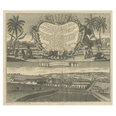
Large Title Cartouche and a View of Wilhermsdorf, Beieren, Germany, 1744
Located in Langweer, NL
Antique print titled 'Sauber und nach dem Leben gezeichnete Prospecten und Plans, von den wichtigsten der Holländisch-Ost-Indischen-Compagnie in Africa u: Asia (..)'. Frontispiece of...
Category

Antique 18th Century More Furniture and Collectibles

Materials

Paper

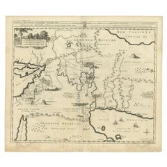
Antique Map of the Middle East by Mortier, 1700
Located in Langweer, NL
Antique map titled 'Carte de la Situation du Paradis Terrestre (..)'. Detailed map of the Holy Land and the Middle East, centered on the Garden of Eden and including a large Cyprus. ...
Category

Antique 18th Century More Furniture and Collectibles

Materials

Paper

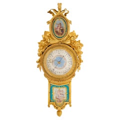
French Late 18th Ormolu and Sèvres Porcelain Barometer, Signed Giroux
Located in West Palm Beach, FL
An most elegant and extremely high quality French late 18th/ beginning of the 19th century, ormolu and Sèvres porcelain barometer, signed Giroux. The barometer has a central bottom a...
Category

French Antique 18th Century More Furniture and Collectibles

Materials

Ormolu

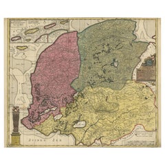
Detailed Map of Friesland, Groningen and Drenthe, The Netherlands, 1706
Located in Langweer, NL
Antique map tited 'Frisiae Dominium vernacule Friesland verdeeld met de hoofd-deelen van Oostergoo, Westergoo en Sevenwolden (..)'. Detailed map of Friesland, Groningen and Drenthe, ...
Category

Antique 18th Century More Furniture and Collectibles

Materials

Paper

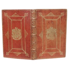
HOUSE OF LORDS. Remembrances for Order. 1712 - WITH THE GILT ARMS OF QUEEN ANNE
Located in Hillsborough, NJ
AUTHOR: HOUSE OF LORDS. TITLE: Remembrances for Order and decency to be kept in the Upper house of Parliament by the Lords, when His Majesty is not there. PUBLISHER: London, May 7...
Category

English Antique 18th Century More Furniture and Collectibles

Materials

Leather

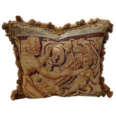
Aubusson Tapestry Cushion
Located in Palm Beach, FL
Antique Aubusson tapestry cushion with figures 18th century Measures: 20" x 18".
Category

French Antique 18th Century More Furniture and Collectibles

Materials

Wool

Antique Roman Battle Print of the Camp Defence by Duncan, c.1753
Located in Langweer, NL
Antique battle map showing the various defence elements of a camp. With detailed legend explaining the various elements of the print. This print mo...
Category

Antique 18th Century More Furniture and Collectibles

Materials

Paper

Rare Theodore Danckerts Map of the Lower Rhine and Moselle River Regions
Located in Langweer, NL
Original antique map titled 'Accuratissima Rheni Inferioris Mosae et Mosellae Tabula'. Rare Theodore Danckerts map of the Lower Rhine and Moselle River Regions. The map covers the lo...
Category

Antique 18th Century More Furniture and Collectibles

Materials

Paper

Antique Plan of Aigues-Mortes, France
Located in Langweer, NL
Antique map titled 'Plan d'Aiguesmortes et environs'. Original plan of the region of Aigues-Mortes, France. This map originates from 'Le Petit Atlas Maritime (..)' by J.N. Bellin. Pu...
Category

Antique 18th Century More Furniture and Collectibles

Materials

Paper

Brazil Coastline Map – Broenner Carte du Bresil, 1772 Captaincies
Located in Langweer, NL
Carte du Bresil Map, Broenner Krefeld 1772 – Brazil Coastline Captaincies This is an engraved map titled Carte du Bresil Prem. Partie, published in Krefeld (Germany) by J.J. Broenne...
Category

French Antique 18th Century More Furniture and Collectibles

Materials

Paper

Original Antique Map of the Region of Torneå 'Tornio' in Northern Finland, 1759
Located in Langweer, NL
Antique map titled 'Carte des Environs de Tornea'. Original antique map of the region of Torneå (or Tornio), in northern Finland. This print originates from volume 19 of 'Histoir...
Category

Antique 18th Century More Furniture and Collectibles

Materials

Paper

Antique Map of Africa with a Decorative Dedication to the Dauphin, 1717
Located in Langweer, NL
Antique map titled 'L'Afrique, Dressée Selon les Dernieres Relat. et Suivant les Nouvelles Decouvertes (..).' This map is a reduced derivative of De Fer's wall map of Africa (1696-98) with its characteristic thickened west coast. Unusual islands appear in the Atlantic and Indian Oceans including a mythical second island of St. Helena. Monomotapa is shown in the south and the southwest coastline is distorted and there is an incorrect placement and shape of the Cape of Good Hope. In Central Africa is a paragraph concerning the origin of the Nile in Abyssinia, however, the two sub-equatorial Ptolemaic lakes are still shown on the map. The map is graced with a decorative dedication to the Dauphin and a title cartouche featuring lime kilns. The map was first published in 1700. This scarse map originates from: 'Introduction a la geographie - avec unde description historique sur toutes...
Category

Antique 18th Century More Furniture and Collectibles

Materials

Paper

Old Print of Stone with Elephants from the Bridge of Constantine, Algeria, 1773
Located in Langweer, NL
Antique print titled 'Steen in de brug van het oude Cirta (..)'. Old print depicting a stone with elephants from the bridge of Cirta/Constantine. Also depicts other architectural...
Category

Antique 18th Century More Furniture and Collectibles

Materials

Paper

Old Dutch Map of Part of Syria and Phoenicia, 1773
Located in Langweer, NL
Antique print titled 'Gedeelte van Syriën en Phenicië'. Old map of part of Syria and Phoenicia. Originates from the first Dutch editon of an interesting travel account of Norther...
Category

Antique 18th Century More Furniture and Collectibles

Materials

Paper

Antique Engraving of Deucalion and Pyrrha of Phthia, Thessaly, Greece, 1733
Located in Langweer, NL
Antique print titled 'Deucalion & Pyrrha (..)'. This print depicts Deucalion and Pyrrha. Deucalion, who reigned over the region of Phthia, had been forewarned of the flood by his...
Category

Antique 18th Century More Furniture and Collectibles

Materials

Paper

Antique Map of the County of Devon by Overton, 1713
Located in Langweer, NL
Antique map titled 'Devoniae Descriptio - The Description of Devon Shire'. Map of the County of Devon, England. This map originates from the 1713 edition of the 'Overton Atlas'. Henry Overton only revised the Devon map...
Category

Antique 18th Century More Furniture and Collectibles

Materials

Paper

Antique Print of a House in Barbary, North Africa, 1773
Located in Langweer, NL
Antique print titled 'Gedeelte van een Huis in Barbarye (..)'. Old print depicting a view and two plans of a house in Barbary. Originates from the first Dutch editon of an interestin...
Category

Antique 18th Century More Furniture and Collectibles

Materials

Paper

Antique Map of the Arabian Peninsula by Bonne 'c.1780'
Located in Langweer, NL
Antique map titled 'Carte de l'Arabie, du Golfe Persique, et de la Mer Rouge (..)'. Original antique map of the Arabian Peninsula, including the horn...
Category

Antique 18th Century More Furniture and Collectibles

Materials

Paper

Antique Map of the Region of Namur by De Lat, 1737
Located in Langweer, NL
Untitled map of the region of Namur, Charlemont, Rochefort and surroundings, Belgium. This map originates from 'Nieuw en beknopt Kaart-Boekje vertoonende de XVII. Nederlandse Provint...
Category

Antique 18th Century More Furniture and Collectibles

Materials

Paper

Original Drawing, Circle of Giovanni Battista Tiepolo 1696-1770 Venice, Italy
By Giovanni Battista Tiepolo
Located in Vero Beach, FL
Original Drawing, Circle of Giovanni Battista Tiepolo 1696-1770 Venice, Italy Although we offer this old master drawing as circle of Tiepolo, we are convinced, based on the composi...
Category

Italian Rococo Antique 18th Century More Furniture and Collectibles

Materials

Paper

Map of the Margraviate and Electorate of Brandenburg by de Beaurain - ca.1750
Located in Langweer, NL
Historical Map of the Margraviate and Electorate of Brandenburg by Chevalier de Beaurain - Circa 1750 This impressive historical map, titled "Carte du Marquisat et Electorat de Br...
Category

Antique 18th Century More Furniture and Collectibles

Materials

Paper

Detailed 1720s Map – Siege of Douay and Lines of Circumvallation, France
Located in Langweer, NL
Detailed 1720s Map – Siege of Douay and Lines of Circumvallation, France This engraved map shows the detailed fortifications and surrounding region of Douay (Douai) in northern Fran...
Category

French Antique 18th Century More Furniture and Collectibles

Materials

Paper

Antique Map of the Northern Part of the Netherlands by Jaeger, 1784
Located in Langweer, NL
Antique print, titled: 'Carte topographique d'Allemagne contenant une partie des Provinces Unies, savoir la province de Friesland occidentale : une partie d'Overyssel, de Gueldre, d'...
Category

Antique 18th Century More Furniture and Collectibles

Materials

Paper

Batavia Market Scenes & Government House – Antique Prints VOC Period, c.1780
Located in Langweer, NL
Batavia Views – Government House and Market Scenes, circa 1780 This is an original late 18th-century engraving featuring two detailed views of Batavia (now Jakarta, Indonesia) under...
Category

Dutch Antique 18th Century More Furniture and Collectibles

Materials

Paper

1732 Henri Chatelain Map of the Holy Land Divided Among the Tribes of Israel
Located in Langweer, NL
Title: 1732 Henri Chatelain Map of the Holy Land Divided Among the Tribes of Israel This exquisite 18th-century map by Henri Chatelain, published in 1732, offers a detailed depict...
Category

Antique 18th Century More Furniture and Collectibles

Materials

Paper

Bay of Saint Helena: French Naval Chart by N.B. Ingénieur de la Marine, ca.1770
Located in Langweer, NL
Bay of Saint Helena: French Naval Chart by N.B. Ingénieur de la Marine, 18th Century This meticulously detailed copper engraving, titled 'Carte de la Baye de Sainte Helene' (Map of the Bay of Saint Helena), was drawn by N.B., an engineer of the French Navy (*Ingénieur de la Marine*). The map was created based on the navigational observations of mariners and published in the 18th century, most likely in France. It offers a precise and practical representation of Saint Helena Bay, a crucial anchorage point in the South Atlantic Ocean. Saint Helena Bay, located on the island of Saint Helena, was an important stopover for ships sailing between Europe and Asia, particularly for Dutch and British vessels during the Age of Exploration and the later colonial period. Its significance was further heightened when the island became the final exile location of Napoleon Bonaparte from 1815 to 1821. The map shows the bay with impressive attention to detail, depicting the coastline with numerous soundings marked in French and English leagues (*Lieues Marines de France et d'Angleterre*), allowing navigators to gauge the water depth and avoid hazards. The bay’s natural topography, including hills and coastal elevations, is rendered in delicate engraving lines. A large central peak dominates the landscape, surrounded by rugged terrain, while a smaller inlet and river (*Riviere*) are also shown, highlighting the complex geography of the bay. A decorative fleur-de-lis compass rose marks the left side of the chart, indicating orientation and providing a clear sense of direction for mariners. The map's clean and elegant design reflects the French cartographic tradition of combining functional navigation aids with aesthetic appeal. The chart includes practical features such as scale indicators and coastal profiles that help sailors recognize the bay from a distance. The detailed soundings marked throughout the bay make this map an invaluable tool for understanding the navigational challenges of the area, particularly for large, heavily laden ships. This rare chart belongs to a series of marine maps...
Category

Antique 18th Century More Furniture and Collectibles

Materials

Paper

Antique Map of Boulogne-sur-Mer by Bellin '1764'
Located in Langweer, NL
Antique map titled 'Plan de la Ville de Boulogne'. Original antique map of Boulogne-sur-Mer, France. This map originates from 'Le petit atlas maritime: recueil de cartes et plans des...
Category

Antique 18th Century More Furniture and Collectibles

Materials

Paper

Antique Map of the Holy Land, c.1717
Located in Langweer, NL
Antique map Israel titled 'Tabula Geographica Terrae Sanctae'. Rare edition made after a map of the Holy Land by J. Bonfrerius. The map is oriented ...
Category

Antique 18th Century More Furniture and Collectibles

Materials

Paper

Antique Map of the Wallis and Futuna Islands, French Overseas Territory, 1778
Located in Langweer, NL
Antique map titled 'Walliss Inseln, Isles de Wallis'. Old map of the Wallis and Futuna Islands, officially Territory of the Wallis and Futuna Islands, French overseas territory. The ...
Category

Antique 18th Century More Furniture and Collectibles

Materials

Paper

Antique Map of Islands in the Mediterranean by Bowen, 'c.1760'
Located in Langweer, NL
Antique map titled 'Particular Draughts of some of the chief African Islands (..)'. Eight small maps on one sheet including 'Islands of Malta Goze & Cuming, An Accurate Chart of Cape de Verde Islands…, Island of St Helena.., Island of Madera, Island of Teneriffe, The Bay of Agoa…, The Dutch Fort at the Cape of Good Hope…, A Draught of Table Bay...
Category

Antique 18th Century More Furniture and Collectibles

Materials

Paper

Antique Map of the Nassau Region in Western Germany
Located in Langweer, NL
Antique map titled 'Nassovia Principatus (..)'. Detailed map of the Nassau region in western Germany between Koblenz, Hadamar, Giessen, Frankfurt and Mainz. The map is filled with in...
Category

Antique 18th Century More Furniture and Collectibles

Materials

Paper

Antique Map of Menorca / Minorca by Homann Heirs '1757'
Located in Langweer, NL
Antique map titled 'Carte Topographique de l'Isle Minorque'. Scarce decorative map of Menorca (or Minorca), with two gorgeous views of Mahon and Fort St. Phillipe at the bottom. Publ...
Category

Antique 18th Century More Furniture and Collectibles

Materials

Paper

Antique Map of France by Zannoni, 1765
Located in Langweer, NL
Antique map titled 'La France divisée en ses LVIII Provinces (..)'. Beautiful old map of France. This map originates from 'Atlas Historique de la France Ancienne et Moderne' by M. Ri...
Category

Antique 18th Century More Furniture and Collectibles

Materials

Paper

18th / Early 19th Century Miniature Painting
Located in Delft, NL
An 18th / early 19th century miniature painting An 18th / early 19th century miniature painting painted on glass and framed. The copper framed miniature painting in another copp...
Category

European Antique 18th Century More Furniture and Collectibles

Materials

Copper

Antique Map of the Circle of Franconia, 1757
Located in Langweer, NL
Antique map titled 'Cercle de Franconie (..)'. Map of the Circle of Franconia, Germany. Centered on Bamberg, Wurtzburg and Nuremberg. This map originates from 'Atlas Universel (..)'....
Category

Antique 18th Century More Furniture and Collectibles

Materials

Paper

Old Map of Indian Ocean & Sumatra, Java, Borneo, India, Arabia, Africa, c.1783
Located in Langweer, NL
Antique map titled 'Carte des Declinaisons et Inclinaisons de L'Aiguille Aimantée redigée d'après la table des observations Magnetiques faites par les Voyageurs depuis l'Année 1775'....
Category

Antique 18th Century More Furniture and Collectibles

Materials

Paper

Vintage Ikat 1850 Antique Pillow 19" x 11"
Located in Los Angeles, US
This vibrant 1850 Ikat pillow features bold abstract motifs in warm and earthy tones. The traditional pattern, rendered in soft browns and rust, adds a dynamic and energetic flair to...
Category

Unknown Mid-Century Modern Antique 18th Century More Furniture and Collectibles

Materials

Wool, Cotton

Map of Duchy of Brabant Centered on Fortress of Louvain or Leuven, Belgium, 1720
Located in Langweer, NL
Antique map titled 'Ducatus Brabantiae Nova Tabula in qua Lovanii Bruxellarum March S. Impreii Sylvae Ducis et Merchliniae Dominia.' This fully engraved copperplate map...
Category

Antique 18th Century More Furniture and Collectibles

Materials

Paper

18th-Century French Master’s Lock
Located in New Orleans, LA
French Master’s Lock 18th Century Ingeniously crafted with a hidden mechanism, this 18th-century French lock, known as a serrure de maîtrise, or master’s lock, was likely used by sa...
Category

French Antique 18th Century More Furniture and Collectibles

Materials

Iron

18th Century Chinese Porcelain Dollhouse Miniatures Blue and White Vases
Located in Delft, NL
18th Century Chinese Porcelain Dollhouse Miniatures Blue and White Vases Two miniature Chinese porcelain dollhouse vases. Chinese porcel...
Category

Chinese Antique 18th Century More Furniture and Collectibles

Materials

Porcelain

Antique Map of the Region of Elbogen & Eger, Czech Republic & Hungary, 1742
Located in Langweer, NL
Antique map titled 'Repraesentatio Geographica Circuli Egerani, nec non Elnbogensis : in quo simul viae Egeranae in Thermas Carolinas distincta delineatio conspicitur (..)'. Orig...
Category

Antique 18th Century More Furniture and Collectibles

Materials

Paper

Antique Map of the Eastern Part of the World by Tirion, 1755
Located in Langweer, NL
Antique map titled 'Nieuwe Kaart van het Oostelykste Deel der Weereld, dienende tot Aanwyzing van de Scheepstogten der Nederlanderen naar Oostindië'. Australia (Nieuw Holland) shown ...
Category

Dutch Antique 18th Century More Furniture and Collectibles

Materials

Paper

Old Dutch Map of the City of Carthage and the Bay of Carthage, 1773
Located in Langweer, NL
Antique print titled 'Kaart van de Legging van het Oude Karthago'. Old map of the city of Carthage and the Bay of Carthage. It was the center or capital city of the ancient Carthagin...
Category

Antique 18th Century More Furniture and Collectibles

Materials

Paper

Antique Map of Northern Asia by Mallet, 1719
Located in Langweer, NL
Antique map titled 'Das Mitternächtige Theil des Alten Asien'. This sheet of five miniature maps describes the northern part of Asia in classical times, perhaps circa 150 AD. At the top, an overview map shows the main regions and territories, which are pictured in more detail below. From left to right, the four maps below depict Scythia east of the Imaus (Pamir) Mountains, Serica, Sychia west of the Pamir mountains, and Sarmatia, the last of which borders the Black Sea. Originates from Alain Manesson Mallet's 'Description de l 'Univers' (German edition). Artists and Engravers: Alain Manesson Mallet (1630-1706) was a French cartographer and engineer. He started his career as a soldier in the army of Louis XIV, became a Sergeant-Major in the artillery and an Inspector of Fortifications. He also served under the King of Portugal, before returning to France, and his appointment to the court of Louis XIV. His military engineering and mathematical background led to his position teaching mathematics at court. His major publications were Description de L'Univers (1683) in 5 volumes, and Les Travaux de Mars ou l'Art de la Guerre (1684) in 3 volumes. His Description de L'Universe contains a wide variety of information, including star maps...
Category

Antique 18th Century More Furniture and Collectibles

Materials

Paper

Original Hand-Colored Antique Print of Various Apples, 1758
Located in Langweer, NL
Antique print depicting apple variaties including the Rode Wijn-Appel, Geele Soete Silverling, Bellefleur, Oranje Appel, Bruindeling, Witte Renet, Groene Renet, Wildjes Appel (Reinet...
Category

Antique 18th Century More Furniture and Collectibles

Materials

Paper

Antique Map of the Region of Dölitzsch by Schreiber, 1749
Located in Langweer, NL
Antique map titled 'Die Aemter Doelitsch, Bitterfeld und Zörbig'. Map of the region of Dölitzsch, Germany. This map originates from 'Atlas Selectus von allen Konigreichen und Landern...
Category

Antique 18th Century More Furniture and Collectibles

Materials

Paper

Antique Map of Asia and Australia with a Speculative Coastline, 1777
Located in Langweer, NL
Antique map titled 'A New & Accurate Map of Asia'. Detailed map of Asia and Australia, shows a still largely speculative Southern Australian coastline. Originates from Middleton's 'C...
Category

Antique 18th Century More Furniture and Collectibles

Materials

Paper

Antique Map of the Biblical Kingdom of Israel by Lindeman, c.1758
Located in Langweer, NL
Antique map titled 'De IVde Landkaart vertoonende het Koningryk Israels benevens deszelfs overheerde Landschappen (..).' Map of the biblical Kingdom of Israel under the Kings Saul, D...
Category

Antique 18th Century More Furniture and Collectibles

Materials

Paper

Antique Map of the Region of Batavia by Van Schley, c.1750
Located in Langweer, NL
Antique map titled 'Carte des environs de Batavia - Kaart van de Buitenstreken van Batavia'. Map of the Batavia area (Jakarta) in Indonesia. With cartouche, scale and compass rose. P...
Category

Antique 18th Century More Furniture and Collectibles

Materials

Paper

Antique Print of Hagley Hall in Worcestershire, England, ca.1770
Located in Langweer, NL
Antique print titled 'Principal Front of Hagley'. Main facade of Hagley Hall, Worcestershire. Hagley Hall is a Grade I listed 18th-century house in Hagley, Worcestershire, the ho...
Category

Antique 18th Century More Furniture and Collectibles

Materials

Paper

Barados and St Christopher or St Kitts and Nevis Islands in the Caribbean, 1748
Located in Langweer, NL
This original map, a copperplate engraving by Le Rouge, presents two significant areas in the Caribbean. Titled "Isle St. Christophle une des Antilles aux anglois" and "La Barbade. d...
Category

Antique 18th Century More Furniture and Collectibles

Materials

Paper

Antique Map of the Indonesian and Philippine Archipelagos by R. de Vaugondy
Located in Langweer, NL
Striking and highly detailed map of the region from Sumatra and Malaca and Southern China to the Philipines, New Guinea and Northern Australia, centered on Borneo. Includes a large i...
Category

Antique 18th Century More Furniture and Collectibles

Materials

Paper

Antique Map of the World in 12 Globe Gores by Scherer, 'circa 1702'
Located in Langweer, NL
Antique map titled 'Typus Totius Orbis Terraquei Geographice Delineatus, Et Ad Usum Globo Materiali Superinducendus'. Beautiful example of Scherer's map of the World, configured in 12 globe gores. California is shown as an island. Fascinating Northwest Passage...
Category

Antique 18th Century More Furniture and Collectibles

Materials

Paper

SECOND HALF OF THE 18th CENTURY PAIR OF NEOCLASSIC BEDSIDE TABLES
Located in Firenze, FI
Pair of bedside tables in solid fir wood and walnut veneer. The bedside tables are decorated with geometric inlays in fruit wood and walnut, present on the top and sides, which give ...
Category

Italian Neoclassical Revival Antique 18th Century More Furniture and Collectibles

Materials

Fruitwood, Walnut, Fir

Old Map of the Kingdom of Tonga, Also Known as the Friendly Islands, ca.1780
Located in Langweer, NL
Antique print, titled: 'Carte des Isles des Amis.' Map of the Kingdom of Tonga, also known as the Friendly Islands, and one of the last hereditary monarchies. Cook named this gro...
Category

Antique 18th Century More Furniture and Collectibles

Materials

Paper

Large Sea Chart of the Zuyder Zee & The Northsea with the Wadden Islands, 1773
Located in Langweer, NL
The copper engraving by Herman van Loon, published by Pieter Mortier in 'Le Neptune François' in Amsterdam, is a remarkable piece within the realm of seventeenth-century cartography....
Category

Antique 18th Century More Furniture and Collectibles

Materials

Paper

Map of Constantinople, Bosphorus, the Coasts of Greece and the Archipelago, 1785
Located in Langweer, NL
This is a large 1785 map titled "Carte de la Ville de Constantinople et du Bosphore de Thrace", which includes detailed maps of Constantinople (modern-day Is...
Category

French Antique 18th Century More Furniture and Collectibles

Materials

Paper

Carved and Gilt Fragments with Polychrome Finish on Custom Acrylic Stand
Located in Dallas, TX
These old world fragments from a time of ornamentation and decadence will pop any space with a feeling of classic royal nobility. They are sturdily mounted on clear acrylic so that o...
Category

Antique 18th Century More Furniture and Collectibles

Materials

Giltwood

Large Scale Map of Greece, Extending to Cythera with Inset of Macedonia, ca.1786
Located in Langweer, NL
Antique map titled 'Graeciae Antiquae'. Large scale map of Greece, extends south to the island of Cythera. Inset map shows details of Macedonia. Pu...
Category

Antique 18th Century More Furniture and Collectibles

Materials

Paper

Antique Grain Trunk, c1800, FR-0049
Located in Scottsdale, AZ
Antique Grain trunk, c.1800 Very Cool hardware and detailing. Large sized. Good Condition. Wonderful character and paint Item #: FR-0049 Dimensions...
Category

French French Provincial Antique 18th Century More Furniture and Collectibles

Materials

Iron

Read More

Medal-Worthy Memorabilia from Epic Past Olympic Games

Get into the games! These items celebrate the events, athletes, host countries and sporting spirit.

Ahoy! You’ve Never Seen a Collection of Sailor Art and Kitsch Quite Like This

French trendsetter and serial collector Daniel Rozensztroch tells us about his obsession with objects related to seafaring men.

39 Incredible Swimming Pools

It's hard to resist the allure of a beautiful pool. So, go ahead and daydream about whiling away your summer in paradise.

Pamela Shamshiri Shares the Secrets behind Her First-Ever Book and Its Effortlessly Cool Interiors

The sought-after designer worked with the team at Hoffman Creative to produce a monograph that beautifully showcases some of Studio Shamshiri's most inspiring projects.

Moroccan Artworks and Objects Take Center Stage in an Extraordinary Villa in Tangier

Italian writer and collector Umberto Pasti opens the doors to his remarkable cave of wonders in North Africa.

Montecito Has Drawn Royalty and Celebrities, and These Homes Are Proof of Its Allure

Hollywood A-listers, ex-pat aristocrats and art collectors and style setters of all stripes appreciate the allure of the coastal California hamlet — much on our minds after recent winter floods.

Whaam! Blam! Pow! — a New Book on Pop Art Packs a Punch

Publishing house Assouline and writer Julie Belcove have teamed up to trace the history of the genre, from Roy Lichtenstein, Andy Warhol and Yayoi Kusama to Mickalene Thomas and Jeff Koons.

What Makes a Gem-Encrusted Chess Set Worth $4 Million?

The world’s most opulent chess set, weighing in at 513 carats, is literally fit for a king and queen.
Recently Viewed

View All