Benelux - Collectibles and Curiosities

to
4,807
6,818
15,097
11,597
6,767
37
14
114
31
28
27
27
19
17
14
14
12
6
5
4
4
3
2
2
3,245
2,596
926
51
380
205
69
82
20
10
17
7
32
44
30
15
7
5,802
520
361
108
99
1,336
370
279
157
121
6,818
6,817
6,817
104
58
20
14
14
Item Ships From: Benelux
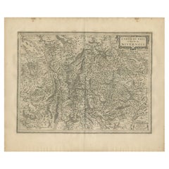
Antique Map of the Region of Nivernais by Janssonius, 1657
By Johannes Janssonius
Located in Langweer, NL
Antique map of France titled 'Carte du Païs et Duché de Nivernois'. Decorative map of the Nivernais region, part of Burgundy, France. This map originates from 'Atlas Novus, Sive Thea...
Category

17th Century Antique Benelux - Collectibles and Curiosities

Materials

Paper

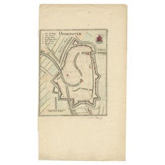
Antique Map of the City of Oudewater by Merian, 1659
Located in Langweer, NL
Antique map titled 'Oudewater'. Plan of the city of Oudewater, the Netherlands. This map originates from 'Topographia Germania Inferioris' by C. Merian, 1659. Artists and Engraver...
Category

17th Century Antique Benelux - Collectibles and Curiosities

Materials

Paper

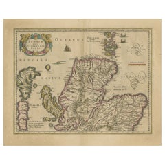
Original Antique Map of the Northern Part of Scotland, circa 1640
Located in Langweer, NL
The antique map, titled 'Scotiae pars septentrionalis,' depicts the northern part of Scotland. Crafted by Hondius around 1640, this map is a historical treasure showcasing the geogra...
Category

Mid-17th Century Antique Benelux - Collectibles and Curiosities

Materials

Paper

Rare Hand-Colored Antique Map of the Bassora 'Basra' Region in Iraq, 1680
Located in Langweer, NL
Description: Antique map titled 'Delineato Regionis Bassora cum Angis uminibus et Isulis.' Map of the Bassora (Basra) region, Iraq. Artists and Engravers: Made by 'Olfert Dapper' ...
Category

1680s Antique Benelux - Collectibles and Curiosities

Materials

Paper

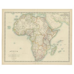
Antique Map of Africa by Johnston (1909)
Located in Langweer, NL
Antique map titled 'Africa'. Original antique map of Africa. This map originates from the ‘Royal Atlas of Modern Geography’. Published by W. & A....
Category

Early 20th Century Benelux - Collectibles and Curiosities

Materials

Paper

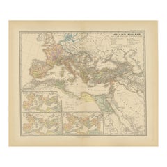
Imperium Romanum: A Detailed Map of the Roman Empire in its Zenith, 1880
Located in Langweer, NL
This original antique map, titled "IMPERIVM ROMANVM", is a detailed depiction of the Roman Empire at the height of its power. The main map encompasses the vast expanse of the Roman territories, stretching from the British Isles in the northwest to the deserts of Arabia and the northern fringes of Africa in the southeast. **Key Features of the Map:** 1. **Territorial Colors**: The map uses different colors to distinguish the various provinces of the Roman Empire. These color-coded areas are to represent the administrative divisions within the Empire. 2. **Topography**: It shows a considerable amount of topographical detail, with mountain ranges, rivers, and bodies of water such as the Mediterranean Sea, prominently displayed. 3. **Cities and Settlements**: Cities are marked, with symbols indicative of their size or importance. Major cities such as Rome, Constantinople, Alexandria, and Carthage are highlighted. 4. **Road Networks**: There appear to be lines connecting various cities and towns, which could represent the famous Roman road network that facilitated trade and military movements. 5. **Latin Text...
Category

1880s Antique Benelux - Collectibles and Curiosities

Materials

Paper

View of the City Banten or Bantam Near the Western End of Java, Indonesia, c1725
Located in Langweer, NL
Antique print titled 'La Ville de Bantam capitale du Roiaume de meme nom'. A bird's eye view of the city Banten or Bantam near the western end of Java in Indonesia. Several tall ...
Category

1720s Antique Benelux - Collectibles and Curiosities

Materials

Paper

Historical Map of the Duchy of Lauenburg by Johann Baptist Homann - Circa 1720
Located in Langweer, NL
Historical Map of the Duchy of Lauenburg by Johann Baptist Homann - Circa 1720 This splendid historical map titled Ducatus Lauemburgicus is a highly detailed and beautifully engra...
Category

1720s Antique Benelux - Collectibles and Curiosities

Materials

Paper

Old Map of Ancient Assyria Divided into Syria, Mesopotamia, Babylonia & Assyria
Located in Langweer, NL
This map, "Assyria vetus diuisa in Syriam, Messopotamiam, Babyloniam, et Assyriam", by Pierre Mortier, is a late 17th-century depiction of the historical Middle East. Title: Ancie...
Category

Early 1700s Antique Benelux - Collectibles and Curiosities

Materials

Paper

Large Antique County Map of Norfolk, England
Located in Langweer, NL
Antique map titled 'A Map of Norfolk from the best Authorities'. Original old county map of Norfolk, England. Engraved by John Cary. Originates from 'N...
Category

Early 19th Century Antique Benelux - Collectibles and Curiosities

Materials

Paper

Antique Print of the Statue of Joan of Arc by Knight, 1835
Located in Langweer, NL
Antique print titled 'Statue of the Maid of Orleans at Rouen'. Old print of the statue of Joan of Arc in Rouen, France. This print originates from 'One...
Category

19th Century Antique Benelux - Collectibles and Curiosities

Materials

Paper

Antique Map of the Region of Charolais by Janssonius, 1657
By Johannes Janssonius
Located in Langweer, NL
Antique map 'Les environs de L'Estang de Longpendu, comprenant une grande partie du Comté de Charolois'. Decorative map of the Charolais region. This map originates from 'Atlas Novus...
Category

Mid-17th Century Antique Benelux - Collectibles and Curiosities

Materials

Paper

Antique Map of North Europe and East Asia by Vaugondy, circa 1750
Located in Langweer, NL
Antique map titled 'Carte des parties nord et est de L'Asie'. Map of the Northern parts and East Asia. Five maps on one sheet, showing California, Alaska and Syberia, Korea and Japan...
Category

Mid-18th Century Antique Benelux - Collectibles and Curiosities

Detailed Antique Map of Slavonia, the Region in Eastern Croatia, ca.1745
Located in Langweer, NL
Antique map titled 'Tabula Geographica exhibens Regnum Sclavoniae.' Detailed map of Slavonia, the region in eastern Croatia. Map is dated shortly after the Peace of Belgrade sign...
Category

1740s Antique Benelux - Collectibles and Curiosities

Materials

Paper

Lugo 1901: A Cartographic Chronicle of Galicia's Ancient Roman Walled City
Located in Langweer, NL
The map presents the province of Lugo, located in the autonomous community of Galicia in northwestern Spain, as it was in 1901. Notable features include: - **Topography**: The provi...
Category

Early 1900s Antique Benelux - Collectibles and Curiosities

Materials

Paper

Antique Print of the Colonel of Strelitz, Mecklenburg, Germany, 1805
Located in Langweer, NL
Antique costume print titled 'Oberster der Strelitzen - Colonel du Corps de Strelits 1698'. This print depicts the Colonel of Strelitz, Germany. Originates from a rare costume book t...
Category

19th Century Antique Benelux - Collectibles and Curiosities

Materials

Paper

Original Very Old Hand-Colored Map of Limousin or Limoges, France, ca.1600
Located in Langweer, NL
Antique map titled 'Totius Lemovici et Confinium (..).' - A handsome and detailed map of Limousin/Limoges, prepared by the well-known engraver, Petrus Kaerius. With an insert view ...
Category

Early 1600s Antique Benelux - Collectibles and Curiosities

Materials

Paper

Old Decorative Pictorial Map of the United States, circa 1953
Located in Langweer, NL
Antique map titled 'A Pictorial Map of the United States of America Showing Principal Regional Resources, Products, and Natural Features'. This information-packed map was create by the General Drafting Company for the New Jersey Bell Telephone Company. The main map features over 700 drawings in full color including points of interest, natural resources, and agricultural products. At bottom are inset maps showing railroad lines, air routes, telephone lines, as well as a pictorial map of New Jersey...
Category

20th Century Benelux - Collectibles and Curiosities

Materials

Paper

Antique Print of a Cave in Saint-leu-taverny in France C.1785
Located in Langweer, NL
Antique print titled 'Vüe dessinée dans l'intérieur de la Grotte de St. Leu Taverni'. Copper engraving showing a cave in Saint-Leu-Taverny. This print originates from 'Jardins Anglo-...
Category

18th Century Antique Benelux - Collectibles and Curiosities

Materials

Paper

Antique Map of the Northwestern Coast of Spain
Located in Langweer, NL
Antique map titled 'Gallaecia Regnum'. Original old map of the northwestern coast of Spain, extending from the Asturias de Oviedo region and Aviles in the Northeast to Bayona and the...
Category

Mid-17th Century Antique Benelux - Collectibles and Curiosities

Materials

Paper

Antique Map of Central and Southern China by Kuyper, 1880
Located in Langweer, NL
Plate 53 : 'China, Midden en Zuid.' (China, Central and South). This lithographed map originates from: 'Wereld-atlas voor Kantoor en Huiskamer' (transl: World Atlas for the office an...
Category

19th Century Antique Benelux - Collectibles and Curiosities

Materials

Paper

Antique Map of the Sinai Peninsula, '1895'
Located in Langweer, NL
Antique map titled 'Peninsula of Sinaï'. Lithographed map of the Sinai Peninsula, a peninsula in Egypt, and the only part of the country located in Asia. It is situated between the M...
Category

Late 19th Century Antique Benelux - Collectibles and Curiosities

Materials

Paper

Antique Map of Overijssel by Colom, 1635
Located in Langweer, NL
Antique map titled 'Ditio Trans-Isulana'. Original antique map of the province of Overijssel, the Netherlands. This map originates from 'Vyerige Colom verthonende de 17 Nederlandsche...
Category

17th Century Antique Benelux - Collectibles and Curiosities

Materials

Paper

Antique Map of the South Part of Great Britain by Tirion, c.1750
By Isaak Tirion
Located in Langweer, NL
Antique map titled 'Nieuwe Kaart van 'T Zuider Gedeelte van Groot Britannie behelzende Het Koningryk Engeland (..).' Attractive map showing the south part of Great Britain; the K...
Category

18th Century Antique Benelux - Collectibles and Curiosities

Materials

Paper

French Antique Map of Oceania with Details of the Australian Colonies, c.1840
Located in Langweer, NL
Antique map Oceania titled 'Océanie par C.V. Monin'. Old map of Oceania with an inset of New South Wales. Originates from 'Atlas Classique de la Géographie Ancienne (..)'. Artists ...
Category

19th Century Antique Benelux - Collectibles and Curiosities

Materials

Paper

Set of Two Antique Maps of Northern Italy by Homann Heirs, 1754
Located in Langweer, NL
Set of two maps of northern Italy showing the position of troups during the war in April and March 1746. The area covered includes the course of the River Po between Valenza (north of Alexandria) and San Benedetto...
Category

Mid-18th Century Antique Benelux - Collectibles and Curiosities

Materials

Paper

Antique Map of Jamaica and Hispaniola (Saint-Domingue and Santo Domingo), 1802
Located in Langweer, NL
This is an original antique map titled "Carte des Isles de la Jamaïque et de St. Domingue," depicting the islands of Jamaica and Saint-Domingue (modern-day Haiti and the Dominican Re...
Category

Early 1800s Antique Benelux - Collectibles and Curiosities

Materials

Paper

Antique Print of 'The Marriage of Cana' Made after Paolo Veronese 'c.1890'
Located in Langweer, NL
Antique print titled 'The Marriage of Cana'. Original antique print on chine collé, made after the painting by Paolo Veronese. Source unknown, to be determined. Published circa 1890.
Category

Late 19th Century Antique Benelux - Collectibles and Curiosities

Materials

Paper

Original Antique Map of the Bay and the Island of Arguin, Mauritania, 1747
Located in Langweer, NL
Antique map titled ’Plan de la Baye et Isle d'Arguim (..) - Oppervlakte van de Baai en 't Eiland van Arguin (..)'. Original antique map of the bay and the island of Arguin. This ...
Category

1740s Antique Benelux - Collectibles and Curiosities

Materials

Paper

Detailed Original Antique Plan of the City and Fort of Malacca, Malaysia, 1764
Located in Langweer, NL
Description: Antique map titled 'Plan de la Ville et Forteresse de Malaca'. Detailed plan of the city and fort of Malacca on the southern Malay Peninsula, commanding the strategic st...
Category

1760s Antique Benelux - Collectibles and Curiosities

Materials

Paper

Detailed Antique Map of Hungary and Transylvania by Tirion, 1753
Located in Langweer, NL
Title: Nieuwe Kaart van’t Koninkryk Hongaryen en Zevenbergen by Isaak Tirion, 1753 – Antique Map of Hungary and Transylvania Description: This is an antique 1753 map titled *Nieuwe Kaart van’t Koninkryk Hongaryen en Zevenbergen*, created by the notable Dutch cartographer and publisher Isaak Tirion. The map showcases the Kingdom of Hungary and the region of Transylvania (referred to as "Zevenbergen") as they appeared in the mid-18th century. Tirion’s maps are well-known for their clarity, precision, and attention to geographic detail, making them highly sought after by collectors of antique maps. This map provides a detailed view of Hungary and Transylvania, including borders, towns, cities, rivers, and mountain ranges. It was created using the latest discoveries and updates of the time and reflects the political landscape of the region, which was part of the Habsburg Empire during a period of territorial changes and consolidations. The map’s borders are highlighted with color to distinguish different regions, and significant cities such as Buda, Pest, and Debrecen are clearly labeled. Isaak Tirion was one of the most prominent Dutch publishers of the 18th century, particularly known for his *Nieuwe en Beknopte Hand-Atlas* (New and Concise Hand Atlas) series, which included a wide range of maps of Europe and beyond. His works were appreciated for their cartographic accuracy and artistic quality. This map is a valuable piece for collectors interested in 18th-century European maps, particularly those that highlight Central Europe, Hungary, Transylvania, and the Habsburg Empire. It is a fine example of the craftsmanship of Isaak Tirion and offers insight into the historical geography of the region. Condition: Excellent for its age, with finely preserved hand-coloring and wide margins. Slight edge wear typical of maps from this period. Effective keywords that may help attract collectors or enthusiasts interested in historical maps of Hungary, Transylvania, and Central Europe: - Antique map of Hungary - Historical map of Transylvania - 18th-century map of Central Europe - Habsburg Empire map - Isaak Tirion map - Nieuwe Kaart van’t Koninkryk Hongaryen en Zevenbergen - Kingdom of Hungary map...
Category

1750s Antique Benelux - Collectibles and Curiosities

Materials

Paper

Antique Print of 'The Nativity' made after Lorenzo di Credi 'c.1890'
Located in Langweer, NL
Antique print titled 'The Nativity'. Original antique print on chine collé, made after the painting by Lorenzo di Credi. Source unknown, to be determined. Published circa 1890.
Category

Late 19th Century Antique Benelux - Collectibles and Curiosities

Materials

Paper

Antique Print of the Rialto Bridge in Venice in Italy, 1835
Located in Langweer, NL
Antique print titled 'The Rialto at Venice'. Old print of the Rialto Bridge (or Ponte di Rialto) in Venice, Italy. This print originates from 'One Hundred and Fifty Wood Cuts selecte...
Category

19th Century Antique Benelux - Collectibles and Curiosities

Materials

Paper

Antique Map of North America by A & C. Black, 1870
Located in Langweer, NL
Antique map titled 'North America'. Original antique map of North America. This map originates from ‘Black's General Atlas of The World’. Published by A & C. Black, 1870.
Category

Late 19th Century Antique Benelux - Collectibles and Curiosities

Materials

Paper

Vue du Chateau d'Ouandipore, Prévost, 1802
Located in Langweer, NL
Vue du Chateau d'Ouandipore'. (View of the Castle of Wandipore in Tibet). This original antique print is taken from 'Histoire générale des voyages (?).', pu...
Category

19th Century Antique Benelux - Collectibles and Curiosities

Materials

Paper

Print of the Solemn Celebration Sapan Giacche in Pegu, Burma 'Myanmar', 1725
Located in Langweer, NL
Antique print, titled: 'Fete Solennelle de Pegu appelee Sapan Giacche' This plate shows the Solemn celebration called Sapan Giacche in Pegu or Bago, the capital of the Bago Regio...
Category

1720s Antique Benelux - Collectibles and Curiosities

Materials

Paper

Stunning Large Scale Antique Map of Martinique, Rare, Published 1758
Located in Langweer, NL
Antique map titled 'Carte Reduite de l'Isle de la Martinique Dressee au Depost des Cartes Plans et Journaux de la Marine.' Superb, large scale chart of th...
Category

18th Century Antique Benelux - Collectibles and Curiosities

Materials

Paper

Detailed Original Old Map of the Southern Region of the Kingdom of Algiers 1773
Located in Langweer, NL
Antique map titled 'Kaart van het Zuidelyk Gedeelte van het Ryk Algiers'. Old map of the southern region of the Kingdom of Algiers, Algeria. Originates from the first Dutch edito...
Category

18th Century Antique Benelux - Collectibles and Curiosities

Materials

Paper

La Coruña 1901: A Cartographic View of Galicia's Maritime Province
Located in Langweer, NL
This antique map for sale showcases the province of La Coruña (in Galician, A Coruña), located in the northwest of Spain, within the autonomous community of Galicia, as of the year 1...
Category

Early 1900s Antique Benelux - Collectibles and Curiosities

Materials

Paper

Antique Map of the Isthmus of Mount Athos by Choiseul-Gouffier, 1809
Located in Langweer, NL
Antique map titled 'Plan de l'Isthme du Mont Athos'. Old map of the isthmus of Mount Athos, a mountain and peninsula in northeastern Greece and an important centre of Eastern Orthodox monasticism. This map originates from 'Voyage pittoresque de la Grèce' by M.G.F.A. de Choiseul...
Category

19th Century Antique Benelux - Collectibles and Curiosities

Materials

Paper

Antique Map of Scandinavia by Lapie, 1842
Located in Langweer, NL
Antique map titled 'Carte de la Scandinavie comprenant les Royaumes de Suède de Norwege et de Danemark'. Map of Scandinavia including Sweden, Norway and Denma...
Category

Mid-19th Century Antique Benelux - Collectibles and Curiosities

Materials

Paper

1908 Burlington Arts Club Catalogue: Faience of Persia & Near East, 27 Plates
Located in Langweer, NL
Burlington Fine Arts Club: Exhibition of the Faience of Persia and the Nearer East. Published: London, 1908 Printed by Chiswick Press This exquisite and rare folio volume showca...
Category

Early 1900s Antique Benelux - Collectibles and Curiosities

Materials

Paper

1601 Miniature Map of Southeast Asia & Nova Guinea by Ortelius, Vrients Edition
Located in Langweer, NL
This miniature map of the East Indies and Nova Guinea was created by Abraham Ortelius and published in 1601 as part of the "Epitome" by Giovanni Battista Vrients. It is a finely hand...
Category

Early 1600s Antique Benelux - Collectibles and Curiosities

Materials

Paper

Colonial Crossroads: Angola and Mozambique in 1903
Located in Langweer, NL
The image for sale is an original historical map from 1903 that shows the Portuguese colonies of Angola on the left and Mozambique on the right. These two territories on the African ...
Category

Early 1900s Antique Benelux - Collectibles and Curiosities

Materials

Paper

West View of Cowdray House – Historic Sussex Estate Engraving, 1796
Located in Langweer, NL
West View of Cowdray House – Antique Engraving of Viscount Montague’s Estate, 1796 This detailed antique engraving captures the west-facing elevation of Cowdray House, the celebrate...
Category

18th Century English Antique Benelux - Collectibles and Curiosities

Materials

Paper

Old Map of Turkey in Asia with Mosul Environs and Assyrian Ruins Inset , 1859
Located in Langweer, NL
Turkey in Asia – Antique Map by W\.G. Blackie, 1859, with Inset of Assyrian Ruins This finely detailed antique map titled *Turkey in Asia* is an original engraving from W\.G. Blacki...
Category

Mid-19th Century English Antique Benelux - Collectibles and Curiosities

Materials

Paper

Old Map Covering All of Southeast Asia from Persia to the Timor Island, 1712
Located in Langweer, NL
Description: Antique map titled 'A New Map of the East Indies'. Old map covering all of Southeast Asia from Persia to the Timor Island, inclusive of the modern day nations of India, ...
Category

1710s Antique Benelux - Collectibles and Curiosities

Materials

Paper

Religious Antique Print of a Knight of the Order of Santiago, 1845
Located in Langweer, NL
Antique print titled 'Chevalier de l'Ordre de St. Jaques de l'Epee'. Print of a Knight of the Order of Santiago, Order of St. James of the Sword. This print originates from 'Histoire...
Category

19th Century Antique Benelux - Collectibles and Curiosities

Materials

Paper

Architectural Print of French Villa de la Hutte A Deauville by Chabat, c.1900
Located in Langweer, NL
Antique print titled 'Villa de la Hutte A Deauville, Mr. E. Saintin Architecte'. This print depicts the design of a building in France. Originates from 'La Brique et La Terre Cuite' ...
Category

20th Century Benelux - Collectibles and Curiosities

Materials

Paper

Leeuwarden Friesland City View – Antique Engraving by Jollain, c.1670
Located in Langweer, NL
Antique Bird’s Eye View of Leeuwarden, Friesland, by Jollain, circa 1670 This rare and decorative antique engraving presents a panoramic bird’s eye view of the fortified city of Lee...
Category

17th Century French Antique Benelux - Collectibles and Curiosities

Materials

Paper

Antique Map of England and Ireland by Lattre, 1789
Located in Langweer, NL
Antique map titled 'Les Royaumes d'Angleterre d'Ecosse et d'Irlande'. Original antique map of England and Ireland. Originates from 'Petit Atlas ...
Category

18th Century Antique Benelux - Collectibles and Curiosities

Materials

Paper

Antique Hand-Colored Print of an Armenian Monk, 1845
Located in Langweer, NL
Antique print titled 'Moine Arménien' or Armenian Monk. The nowadays Mekhitarists or Mechitarists are a monastic order of the Armenian Catholic Church founded in 1700 by Abbot Mek...
Category

1840s Antique Benelux - Collectibles and Curiosities

Materials

Paper

Fine Engraving Depicting an Officer's Mess in the Low Countries, 'Holland', 1754
Located in Langweer, NL
Title on Page (Dutch and French): CORPS DE GARDE van Hollandsche Officiers / Corps de Garde des Officiers Hollandois". Amst., 1754. Fine engraving depicting an officer's mess by J. Punt and P. Tanjé after a painting by C. Troost, with coat of arms engraved in lower margin and dedication to G. Braamcamp ("beminnaar der schilderkonst"). Waiting room with reading, smoking and card playing officers. Right, one of them studies a map of the Netherlands. On the wall a coat of arms with the Dutch lion. At the bottom of the margin the coat of arms and an assignment to Gerrit Braamcamp, who had the original painting in his collection. Cornelis Troost...
Category

1750s Antique Benelux - Collectibles and Curiosities

Materials

Paper

Antique Map of the Ancient British Isles by Janssonius 'circa 1640'
Located in Langweer, NL
Antique map titled 'Insularum Britannicarum Acurata Delineatio'. Original antique map of the ancient British Isles. England and Wales are labelled as B...
Category

Mid-17th Century Antique Benelux - Collectibles and Curiosities

Materials

Paper

Dutch 18th Century Copper Tobacco Box
Located in Delft, NL
A Dutch 18th century copper tobacco box A beautiful Dutch 18th century copper tobacco box with engraved on both sides and old Dutch text. The copper box is lined with tin on the ins...
Category

18th Century Dutch Antique Benelux - Collectibles and Curiosities

Materials

Tin, Copper

Handcolored Antique Print of Officers and Horses of the Belgium Army, 1833
Located in Langweer, NL
One nicely hand coloured print of an original serie of 23 plates, showing officers and soldiers discussing matters. published in 1833. Rare. From a serie of beautiful lithographed plates with Belgian military costumes after Madou and printed by Dero-Becker. Comes from a Belgian military costume album, dedicated to the Belgian King, and financed by subscribers, some 90 Belgian nobility and officers of the Belgian Army...
Category

1830s Antique Benelux - Collectibles and Curiosities

Materials

Paper

Roman Italy and Provinces: A Cartographic Snapshot, 1880
Located in Langweer, NL
The map titled "ITALIA, Gallia Cisalpina, Sicilia, Sardinia, Corsica" focuses on Italy and its surrounding regions during Roman times. It offers a detailed depiction of the Italian peninsula, the Po Valley (Gallia Cisalpina), and the islands of Sicily, Sardinia, and Corsica. Produced as part of the "Spruner-Menke Atlas Antiquus" by Karl Spruner von Merz and edited by Theodorus Menke, this map reflects the 19th-century European scholarship on ancient geography and history. The period represented is likely during the Roman Republic or early Roman Empire, suggested by the level of detail in regions like Latium and Campania, which were central to Roman culture and power. This era was marked by Roman expansion and consolidation of the Italian peninsula, as well as the Punic Wars, which led to Roman dominance over the Mediterranean. What makes this map interesting is its: 1. **Rich Detail**: The map delineates the intricate network of Roman roads, cities, and colonies, showing the infrastructure that facilitated Roman administration and control. 2. **Strategic Locations**: It identifies strategic locations like harbors and passes, crucial for trade and military campaigns. 3. **Geographic Accuracy**: It reflects the geographical knowledge of the time, with an accurate representation of the topography that shaped the development of these regions. 4. **Cultural and Historical Sites**: Insets of important sites like Syracuse offer a closer look at places of historical significance. 5. **Educational Purpose**: The map was designed to aid in the study of Roman history, providing a visual tool for understanding the ancient world...
Category

1880s Antique Benelux - Collectibles and Curiosities

Materials

Paper

Antique Map of Utrecht in The Netherlands, 1883
Located in Langweer, NL
Antique map titled 'Utrecht'. Map of Utrecht, a province of the Netherlands. This map originates from 'Atlas van Nederland volgens de nieuwe spelregels' by J. Kuyper. Artists and En...
Category

19th Century Antique Benelux - Collectibles and Curiosities

Materials

Paper

Detailed Antique Map of the Black Sea, Balkans and Asia Minor
Located in Langweer, NL
Antique map titled 'Nuova Carta del Europa Turchesca (..)'. This is an Italian version of Tirion's detailed map of the Black Sea, Balkans, and Asia Minor. It is embellished with a si...
Category

Mid-18th Century Antique Benelux - Collectibles and Curiosities

Materials

Paper

Antique Map of Granada Spain – Hand-Coloured Tassin Engraving 1651
Located in Langweer, NL
Antique Map of Granada Spain – Hand-Coloured Tassin Engraving 1651 This beautiful hand-coloured engraved map depicts the historic Kingdom of Granada in southern Spain, created by th...
Category

Mid-17th Century French Antique Benelux - Collectibles and Curiosities

Materials

Paper

Read More

Medal-Worthy Memorabilia from Epic Past Olympic Games

Get into the games! These items celebrate the events, athletes, host countries and sporting spirit.

Ahoy! You’ve Never Seen a Collection of Sailor Art and Kitsch Quite Like This

French trendsetter and serial collector Daniel Rozensztroch tells us about his obsession with objects related to seafaring men.

Pamela Shamshiri Shares the Secrets behind Her First-Ever Book and Its Effortlessly Cool Interiors

The sought-after designer worked with the team at Hoffman Creative to produce a monograph that beautifully showcases some of Studio Shamshiri's most inspiring projects.

Moroccan Artworks and Objects Take Center Stage in an Extraordinary Villa in Tangier

Italian writer and collector Umberto Pasti opens the doors to his remarkable cave of wonders in North Africa.

Montecito Has Drawn Royalty and Celebrities, and These Homes Are Proof of Its Allure

Hollywood A-listers, ex-pat aristocrats and art collectors and style setters of all stripes appreciate the allure of the coastal California hamlet — much on our minds after recent winter floods.

Whaam! Blam! Pow! — a New Book on Pop Art Packs a Punch

Publishing house Assouline and writer Julie Belcove have teamed up to trace the history of the genre, from Roy Lichtenstein, Andy Warhol and Yayoi Kusama to Mickalene Thomas and Jeff Koons.

What Makes a Gem-Encrusted Chess Set Worth $4 Million?

The world’s most opulent chess set, weighing in at 513 carats, is literally fit for a king and queen.

Tauba Auerbach’s Geometric Pop-Up Book Is Mighty Rare, Thanks to a Hurricane

This sculptural art book has an epic backstory of its own.
Recently Viewed

View All