Continental Europe Maps
to
4,203
5,134
5,487
200
5,133
1
2
2
2
1
2,808
2,007
318
1
179
12
1
68
3
3
3
2
3
1
5,115
17
11
10
8
408
147
81
80
52
5,134
5,134
5,134
104
59
20
14
13
Item Ships From: Continental Europe
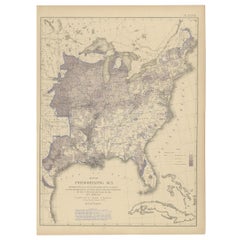
Antique Chart of the US Predominating Sex, 1874
Located in Langweer, NL
Antique chart titled 'Map of predominating sex showing the local excess of males or of females in the distribution of population over the territory of th...
Category
Late 19th Century Antique Continental Europe Maps
Materials
Paper
$476 Sale Price
20% Off
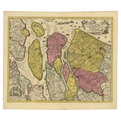
Detailed Map of Southern Holland, Incl the Hague, Rotterdam, Delft, Gouda, c1680
Located in Langweer, NL
Antique map titled 'Delflandia, Schielandia et circumjacentes Insulae ut Voorna, Overflackea, Goerea, Yselmonda et aliae.'
Detailed map of Southern Holland, which includes the ci...
Category
1680s Antique Continental Europe Maps
Materials
Paper
$967 Sale Price
34% Off
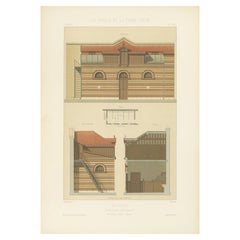
Pl. XXVIII Ecuries, Chabat, c.1900
Located in Langweer, NL
Antique print titled 'Ecuries (Boulevard Beauséjour) Mr. Pierre Chabat Architecte'. This print depicts the design of buildings in France. Originates from 'La Brique et La Terre Cuite...
Category
20th Century Continental Europe Maps
Materials
Paper
$114 Sale Price
20% Off
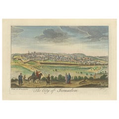
A General View of Jerusalem in the Early Part of the 18th Century" (circa 1752)
Located in Langweer, NL
The print is signed by the artist "S. Mynde sc." in the lower right corner. This suggests that the maker of the print is Samuel Mynde, a known engraver from the 18th century. His wor...
Category
1750s Antique Continental Europe Maps
Materials
Paper
$419 Sale Price
20% Off
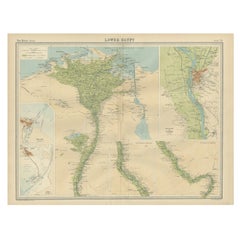
Antique Map of Lower Egypt, Showing Port Said, Suez and Surroundings, 1922
Located in Langweer, NL
Antique map of Africa titled 'Lower Egypt '.
Old map of Africa depicting Egypt, Port Said, Suez and surroundings. This map originates from 'The Times' atla...
Category
20th Century Continental Europe Maps
Materials
Paper
$180 Sale Price
20% Off
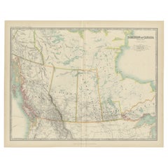
Antique Map of Canada by Johnston '1909'
Located in Langweer, NL
Antique map titled 'Dominion of Canada'. Original antique map of Canada. This map originates from the ‘Royal Atlas of Modern Geography’. Publishe...
Category
Early 20th Century Continental Europe Maps
Materials
Paper
$238 Sale Price
20% Off
Decorative Antique Map of Central Asia
Located in Langweer, NL
Antique map titled 'Carte de la Tartarie Indépendante (..)'. Decorative map of Central Asia (Tartary). Covers from the Black Sea south to China, north to Russia, and south to Persia ...
Category
Late 18th Century Antique Continental Europe Maps
Materials
Paper
$371 Sale Price
20% Off
Old Views of Cabo Santa Maria & Tierra del Fuego, Chile, 1749
Located in Langweer, NL
Antique print titled 'Kaap Sint Maria aan 't begin van de Straat Magellaan (..)'. Coastal views of Cabo Santa Maria and Tierra del Fuego on the Argent...
Category
18th Century Antique Continental Europe Maps
Materials
Paper
$180 Sale Price
30% Off
Antique Engraving of the Islands Wanooa, Wateeoo, Mangeea, Toobouai, Cook, 1803
Located in Langweer, NL
Antique map South Pacific Islands, Polynesia. Originates from 'Reizen Rondom de Waereld door James Cook (..)'.
Artists and Engravers: Translated by J.D. Pasteur. Published by Hon...
Category
19th Century Antique Continental Europe Maps
Materials
Paper
$266 Sale Price
20% Off
Antique Map of Zeeland, The Netherlands, by Jaillot, 1693
Located in Langweer, NL
Antique map titled 'Le Comte de Zeelande (..).' Detailed map of the province of Zeeland, The Netherlands. Details shown include fortified towns, roads, sandbanks and marshlands. Base...
Category
17th Century Antique Continental Europe Maps
Materials
Paper
$847 Sale Price
20% Off
Detailed Antique Map of Southeast England, incl Warwickshire and Hampshire, 1690
Located in Langweer, NL
Antique map titled 'Orientalior districtus Regni Angliae (..)'.
Detailed map of southeast England encompassing the country from Lincolnshire and the Wash south and including Warw...
Category
1690s Antique Continental Europe Maps
Materials
Paper
$809 Sale Price
20% Off
Original Antique Engraved Map of the Russian Empire, 1778
Located in Langweer, NL
Description: Antique map titled 'A New and Correct Map of the Russian Empire'.
Original antique map of the Russian Empire. This map originates from Moore's 'New and Complete Coll...
Category
1770s Antique Continental Europe Maps
Materials
Paper
$523 Sale Price
20% Off
Antique Map of Sweden and Norway by Lowry, '1852'
Located in Langweer, NL
Antique map titled 'Sweden and Norway'. Two individual sheets of Sweden and Norway. This map originates from 'Lowry's Table Atlas constructed and engraved from the most recent Author...
Category
Mid-19th Century Antique Continental Europe Maps
Materials
Paper
$190 Sale Price / set
20% Off
Coast of Northumberland, England, Incl the Holy & Farne Islands, Etc, 1693
Located in Langweer, NL
Antique map titled 'Holy Island, Staples and Barwick.'
A map of the coast of Northumberland, England. This map includes Holy Island, Buckton, Sunderland and the Farne Islands. Th...
Category
1690s Antique Continental Europe Maps
Materials
Paper
$361 Sale Price
20% Off
Antique Map of Great Britain and Ireland by Brion de la Tour, 1766
Located in Langweer, NL
Antique map titled 'Les Isles Britanniques (..).'
Attractive map of Great Britain surrounded by an engraved border printed from a separate coppe...
Category
18th Century Antique Continental Europe Maps
Materials
Paper
$523 Sale Price
20% Off
Antique Map of Sweden and Norway by Johnston, 1882
Located in Langweer, NL
Antique map titled 'Sweden & Norway (Scandinavia)'. Old map of Sweden and Norway, with inset map of Stockholm. This map originates from 'The Royal Atlas ...
Category
19th Century Antique Continental Europe Maps
Materials
Paper
$128 Sale Price
20% Off
Antique Map of the Swabia Region of Germany by Cary, '1811'
By John Cary
Located in Langweer, NL
Antique map titled 'A New Map of the Circle of Swabia'. Antique map of Swabia in Southwestern Germany. Covers from the Upper Rhine region south as far as Switzerland, Lake Constance ...
Category
Early 19th Century Antique Continental Europe Maps
Materials
Paper
$238 Sale Price
20% Off
Attractive Detailed Authentic Map Showing Bavaria, Germany and Austria, c.1740
Located in Langweer, NL
Antique map titled 'Nieuwe Kaart van de Beyersche en Oostenryksche Kreits (..).' Attractive detailed map showing Bavaria, Germany and Austria. Source unknown, to be determined.
Ar...
Category
18th Century Antique Continental Europe Maps
Materials
Paper
$571 Sale Price
20% Off
Rare Map of the Philippines; Joseph Freewills Island & Mindanao South End, 1773
Located in Langweer, NL
Three charts on one sheet titled '1) A Dangerous Shoal 2) Joseph Freewills Island 3) The South End of Mindanao'.
It shows Captain Carteret's voyage: Saint George's Channel to Min...
Category
1770s Antique Continental Europe Maps
Materials
Paper
$228 Sale Price
20% Off
Antique Map of of Bengal and the mouth of the Ganges River
Located in Langweer, NL
Antique map titled 'Carte du Bengale, avec la partie Septentrionale (..)'. Original antique map of Bengal and the mouth of the Ganges river. This map ori...
Category
Late 18th Century Antique Continental Europe Maps
Materials
Paper
Antique Map of Buru Island, Indonesia, c.1725
Located in Langweer, NL
Antique map titled 'Boero'. Original antique map of Buru island. With an inset of the lake on top of the inland mountain. This map originates from Valentyn's 'Oud en Nieuw Oost Indie...
Category
18th Century Antique Continental Europe Maps
Materials
Paper
$523 Sale Price
20% Off
Antique Map of Spain and Portugal, with Frame Style Border
Located in Langweer, NL
Antique map titled 'Espagne et Portugal'. Attractive map of Spain and Portugal. The map covers all of Spain and Portugal from France to the Mediterranean Sea and includes the Baleari...
Category
Mid-19th Century Antique Continental Europe Maps
Materials
Paper
$114 Sale Price
20% Off
Antique Map of Finistère ‘France’ by V. Levasseur, 1854
By Victor Levasseur
Located in Langweer, NL
Antique map titled 'Dépt. du Finistère'. Map of the French department of Finistère, Brittany, France. This area of France is known for its cider production and excellent boar hunting...
Category
Mid-19th Century Antique Continental Europe Maps
Materials
Paper
$171 Sale Price
20% Off
Original Hand-Colored Antique County Map of Durham, England, 1804
Located in Langweer, NL
Antique county map of Durham first published c.1800. Villages, towns, and cities illustrated include Gateshead, South Shields, and Darlington.
C...
Category
Early 1800s Antique Continental Europe Maps
Materials
Paper
$309 Sale Price
20% Off
Antique Map of South America by J. Cook, 1775
Located in Langweer, NL
Antique map titled 'Kaart van het Zuidlyk Eind van Amerika'. Map of the sourthern part of South America, focusing on Cook's tracks around the Cape Horn and T...
Category
Mid-18th Century Antique Continental Europe Maps
Materials
Paper
$809 Sale Price
20% Off
Antique Map of Thracia ‘Greece’ by J. Janssonius, circa 1650
Located in Langweer, NL
This antique map of Thracia is engraved and published by J. Janssonius after the cartographical sources by Abraham Ortelius. Ornated in the upper left corner with a title cartouche a...
Category
Mid-17th Century Antique Continental Europe Maps
Materials
Paper
$809 Sale Price
20% Off
Antique Map of Turkey and Greece, 1842
By Pierre M. Lapie
Located in Langweer, NL
Antique map titled 'Carte de la Turquie d'Europe et de la Grèce Moderne'. Map of Turkey and Greece. This map originates from 'Atlas universel de géographie ancienne et moderne (..)' ...
Category
19th Century Antique Continental Europe Maps
Materials
Paper
$333 Sale Price
20% Off
Antique Map of Eaton 'Ohio' by Titus, 1871
Located in Langweer, NL
Antique map titled 'Eaton'. Original antique map of Eaton, Ohio. This map originates from 'Atlas of Preble County Ohio' by C.O. Titus. Published 1871.
Category
Late 19th Century Antique Continental Europe Maps
Materials
Paper
$380 Sale Price
20% Off
Old Bird's Eye View of the European Trading Posts at Sabi, Benin, Africa, 1748
Located in Langweer, NL
Antique print titled 'Vue des comtoirs Europeins de Xavier ou Sabi (..) - Gezigt der Europese Faktooryen, te Xavier of Sabi (..)'.
Bird's eye view of the European trading posts a...
Category
1740s Antique Continental Europe Maps
Materials
Paper
$266 Sale Price
20% Off
Set of 4 Antique Maps of part of the United States of America
Located in Langweer, NL
Set of four individual antique maps of part of the United States. Published as part of a set of six individual maps.
These maps originate from Stielers Handatlas, published circa 1...
Category
Mid-19th Century Antique Continental Europe Maps
Materials
Paper
$711 Sale Price / set
35% Off
Antique Map of the Mongol Empire, 1767
Located in Langweer, NL
Antique map titled 'The Moguls Empire divided into its principal governments'. Old map of India, Bangladesh, and parts of eastern China.
Artists and Engravers: Published in the G...
Category
18th Century Antique Continental Europe Maps
Materials
Paper
$98 Sale Price
20% Off
Large Scale Map of Greece with Inset Map of Macedonia, c.1786
Located in Langweer, NL
Antique map titled 'Graeciae Antiquae'. Large scale map of Greece, extends south to the island of Cythera. Inset map shows details of Macedonia. Publis...
Category
18th Century Antique Continental Europe Maps
Materials
Paper
Antique Map of Germany with the Empire of Austria by Wyld '1845'
Located in Langweer, NL
Antique map titled 'The Confederated States of Germany with the Empire of Austria, and The Kingdoms of Prussia and Poland'. Original antique map of ...
Category
Mid-19th Century Antique Continental Europe Maps
Materials
Paper
$285 Sale Price
20% Off
Antique Map of the Malay Archipelago with Images of Indigenous People, 1851
Located in Langweer, NL
John Tallis & Company, often simply known as Tallis, was renowned for the production of maps and illustrated geographical publications in the mid-19th century. Tallis maps, such as t...
Category
1850s Antique Continental Europe Maps
Materials
Paper
$323 Sale Price
20% Off
Antique Map of France under the Reign of Philip II by Zannoni, 1765
Located in Langweer, NL
Antique map France titled 'Carte de l'accroissement du Domaine sous Philippe Auguste (..)'. Beautiful old map of France. This map originates from 'Atlas Historique de la France Ancie...
Category
18th Century Antique Continental Europe Maps
Materials
Paper
$140 Sale Price
20% Off
Antique Map of Lower Silesia of The Famous Mapmaker Blaeu, c.1650
Located in Langweer, NL
Antique map titled 'Ducatus Silesiae Wolanus'. \
Antique map depicting lower Silesia with the cities of Wolow (Wohlau), Winsko (Winzig), Herrnstadt, Chobie (Koben), Lubin (Lüben), R...
Category
17th Century Antique Continental Europe Maps
Materials
Paper
$809 Sale Price
20% Off
Beira Alta: A Cartographic Journey Through Portugal's Heartland in 1903
Located in Langweer, NL
The uploaded image is a historical map of the Beira Alta region in Portugal. The map is detailed, showing the topography, hydrography, and transportation networks of the region, incl...
Category
Early 1900s Antique Continental Europe Maps
Materials
Paper
$276 Sale Price
20% Off
Decorative Dutch Antique Map of North and South America, 1841
Located in Langweer, NL
Description: Antique map titled 'Amerika'. Small map of North and South America.
This map originates from the Dutch publication 'De Aarde, beschouwd in haren Natuurlijken Toestan...
Category
1840s Antique Continental Europe Maps
Materials
Paper
$333 Sale Price
20% Off
Antique Map of Noord-Holland and the Island Texel in The Netherlands, c.1870
Located in Langweer, NL
Antique map titled 'De Provincie Noord-Holland'. Map of the province of Noord-Holland, the Netherlands. This map originates from 'F. C. Brugsma's Atlas van het Koninkrijk der Nederla...
Category
19th Century Antique Continental Europe Maps
Materials
Paper
$133 Sale Price
20% Off
Antique Map Featuring Turkey, Persia, India, Egypt & Arabia by James Wyld, 1839
Located in Langweer, NL
The map titled "Map of the countries lying between Turkey & Birmah, comprising Asia Minor, Persia, India, Egypt & Arabia and including the Black, Caspian & Red Seas" is an antique ma...
Category
1830s Antique Continental Europe Maps
Materials
Paper
$361 Sale Price
20% Off
Antique Map of Germany by Hederichs 'circa 1740'
Located in Langweer, NL
Antique map titled 'Germania'. Rare miniature map of Germany and surroundings. This map covers the entirety of those lands traditionally occupied by Germanic peoples, from the Blatic...
Category
Mid-18th Century Antique Continental Europe Maps
Materials
Paper
$238 Sale Price
20% Off
Antique Map of Eastern Mediterranean and Asia Minor by a Benedictine, c.1725
Located in Langweer, NL
Antique map titled 'Byzondere Afbeelding der Landschappen, van de Apostelen bevaren en doorwandelt om het Evangelium J. C. te Prediken.' Map of the lands travelled by the Apostles to...
Category
18th Century Antique Continental Europe Maps
Materials
Paper
$285 Sale Price
20% Off
Roman Balkans: Pannonia, Illyricum, Dacia, Moesia, Thracia, Macedonia and Thyris
Located in Langweer, NL
This original antique map showcases the Roman provinces in the Balkan region and parts of Central and Eastern Europe. The title "PANNONIA, ILLYRICUM DACIA, MOESIA, THRACIA, MACEDONIA...
Category
1880s Antique Continental Europe Maps
Materials
Paper
$352 Sale Price
20% Off
Coloured Antique Map of Sicily, Sardinia, Corfu, Elba, Malta and Zerbi (Jerba)
By Abraham Ortelius
Located in Langweer, NL
Antique map titled 'Insularum Aliquot Maris Mediterranei Descriptio'. A very attractive example of Ortelius' map combining, on one page, maps of the islands of Sicily, Sardinia, Corfu, Elba, Malta and Zerbi (Jerba, off the coast of Tunisia.) The maps detail fortifications on the islands and other major features. (Jerba, for instance, is shown connected to the mainland by a causeway.) The waters are attractively engraved and are sailed by ships. A shipwreck, north of Malta, indicates the point at which St. Paul is thought to have shipwrecked. Volcanoes are indicated in the Sicily map...
Category
16th Century Antique Continental Europe Maps
Materials
Paper
$1,571 Sale Price
40% Off
Copper Engraved Grenada Map by John Thompson Published in 1810
Located in Langweer, NL
John Thomson's original antique map of Grenada, dating back to 1810 and hailing from Edinburgh, stands as a testament to meticulous cartography. This historical piece, adorned with o...
Category
Early 19th Century Antique Continental Europe Maps
Materials
Paper
$228 Sale Price
20% Off
Miniature Antique Map of England and Wales
Located in Langweer, NL
Miniature map titled 'England & Wales'. Original antique map of England & Wales. This map originates from 'Darton's New Miniature Atlas' publis...
Category
Early 19th Century Antique Continental Europe Maps
Materials
Paper
$247 Sale Price
20% Off
Antique Map of Wisconsin with Inset Geological Map of Wisconsin
Located in Langweer, NL
Antique map titled 'Wisconsin'. Original antique map of Wisconsin, United States. With inset geological map of Wisconsin. This print originates from '...
Category
Late 19th Century Antique Continental Europe Maps
Materials
Paper
$276 Sale Price
20% Off
Original Normandy Map by Frederick de Wit, 1705, with Inset of Channel Islands
Located in Langweer, NL
Normandy Map by Frederick de Wit, 1705, with Inset of Channel Islands
Description:
This beautifully engraved and hand-colored map, titled Duché et Gouvernement General de Normandie,...
Category
Early 1700s Antique Continental Europe Maps
Materials
Paper
Map of Le Maine by H. Hondius, 1633, Hand-Colored, Decorative and Historic
Located in Langweer, NL
Map of Le Maine by H. Hondius, 1633, Hand-Colored, Decorative and Historic
This rare and beautifully executed antique map titled 'Le Maine' was published in 1633 by Henricus Hondius...
Category
1630s Antique Continental Europe Maps
Materials
Paper
Antique Map of the Region of Oldenburg, Germany
By Willem Blaeu
Located in Langweer, NL
Antique map titled 'Oldenburg Comitatus'. Detailed old map of Oldenburg, Germany. The map also shows Bremen and the Jade Bight. Published by W. Blaeu, circa 1640. Willem Jansz. Blaeu...
Category
Mid-17th Century Antique Continental Europe Maps
Materials
Paper
$419 Sale Price
20% Off
Decorative Antique Sea Chart of Zeeland, a Province of the Netherlands, ca.1730
Located in Langweer, NL
Antique map titled 'Comitatus Zelandiae Tabula emendata a Frederico De Wit'.
Decorative sea chart of Zeeland, a province of the Netherlands. Although the title reads F. de Wit, thi...
Category
1730s Antique Continental Europe Maps
Materials
Paper
$1,095 Sale Price
20% Off
Original Decorative Antique Map of Prussia, 1628
Located in Langweer, NL
Antique map titled 'Prussia'. Original antique map of Prussia, a historically prominent German state that originated in 1525 with a duchy centered on th...
Category
1620s Antique Continental Europe Maps
Materials
Paper
$523 Sale Price
20% Off
Antique Print of Richmond Place by Woolfe, c.1770
Located in Langweer, NL
Antique print titled 'Elevation of Sir Asgill's Villa at Richmond in Surry (..)'. Plan and facade of Richmond Place or Asgill House, Richmond, London. This print originates from 'Vit...
Category
18th Century Antique Continental Europe Maps
Materials
Paper
Attractive Hand-Tinted Antique Map of Japan, Published in 1752
Located in Langweer, NL
Nice decorative hand tinted map of Japan with the title (in French): Carte de L'Empire du Japon Bellin, 1752
This antique map is engraved with very attractive title cartouche.
...
Category
1750s Antique Continental Europe Maps
Materials
Paper
$533 Sale Price
20% Off
Rare Old English Sea Chart of Part of Indonesia with Java, Madura and Bali, 1711
Located in Langweer, NL
Antique map titled 'A Large Draught of the East End of Java and Madura shewing the Streights of Bally.'
Rare early example of this working English Sea Chart of part of Indonesia ...
Category
1710s Antique Continental Europe Maps
Materials
Paper
$1,571 Sale Price
20% Off
Antique Map of The United States of North America, 1882
Located in Langweer, NL
This is a historical map titled "The United States of North America, Central Part" from the 1882 Blackie Atlas. It depicts the continental United States with a high level of detail, ...
Category
1880s Antique Continental Europe Maps
Materials
Paper
$238 Sale Price
20% Off
Decorative Early Hand-Colored Map of the Northeast of England, ca.1620
Located in Langweer, NL
Antique map titled 'Eboracum, Lincolnia, Derbia, Staffordia, Notinghamia, Lecestria, Rutlandia et Norfolcia'.
Decorative early map of the northeast of England, comprising the cou...
Category
1620s Antique Continental Europe Maps
Materials
Paper
$638 Sale Price
20% Off
Antique Map of Saxon England according to the Anglo-Saxon Chronicle
Located in Langweer, NL
Antique map titled 'Saxon England According to the Saxon Chronicle'. Map of Saxon England based upon descriptions in the Anglo-Saxon Chronicle, a collection of annals in Old English ...
Category
Early 19th Century Antique Continental Europe Maps
Materials
Paper
$428 Sale Price
20% Off
Antique Map of South East Asia, Australia and the Indian Ocean, 1726
By F. Valentijn
Located in Langweer, NL
Antique map titled 'Tabula Indiae Orientalis'.
Beautiful detailed map of Australia, Southeast Asia and the Indian Ocean. The map features a fine depiction of the outlines of the western two-thirds of Australia, based on the discoveries of explorers working for the Dutch East India Company (the VOC). These include Willem Jansz's discoveries in the Gulf of Carpentaria in 1606; the encounters of Dirk...
Category
Mid-18th Century Dutch Antique Continental Europe Maps
Materials
Paper
$6,857 Sale Price
20% Off
Old Original Map of Chormandel & Malabar, India & Ceylon, Now Sri Lanka, 1726
Located in Langweer, NL
Antique map titled 'Nieuwe Kaart van Choromandel ende Malabar'.
Antique map depicting the southern part of India and the northern tip of Ceylon, Sri Lanka. This map originates from...
Category
1720s Antique Continental Europe Maps
Materials
Paper
$523 Sale Price
20% Off
Recently Viewed
View AllMore Ways To Browse
Vintage Industrial Bins
Vintage Liquor Labels
Vintage Utensil Holders
Vintage Wicker Wine Bottles
Vintage Wrought Iron Fire Screen
Viso Porcelain
Wall Mount Water Fountains
Wedding Cabinets and Armoires
Wedgwood Green Jasperware
Wedgwood Portrait
West German Pot
White Ceramic Garden Stool
White Ironstone China
White Lacquer Bar Cart
Woman With Water Jug
Wooden Chest 1800
Wooden Tea Cart
Worcester Jug
