Collectibles and Curiosities on Sale

to
5,750
1,406
7,122
74
52
445
181
174
93
82
52
46
40
37
27
24
17
15
10
8
7
5
4
2,720
2,366
2,036
126
569
832
346
123
39
87
139
85
236
142
116
73
49
4,997
1,292
671
299
249
1,499
517
467
285
284
7,248
7,222
7,243
104
56
21
21
18
Sale Items
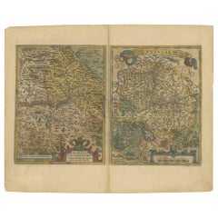
Map of the Region of Basel and Northern Switzerland by Ortelius, circa 1603
Located in Langweer, NL
Two original antique maps on one sheet titled 'Basiliensis Territorii Descriptio Nova [with] Circulus sive Liga Sueviae'. The first centers on Basel, Switzerland, located on the Rhine River...
Category

Antique Early 17th Century Maps

Materials

Paper

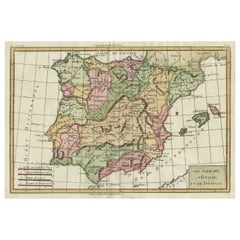
Map of Spain & Portugal Incl. the islands of Ibiza, Minorque & Majorque, 1780
Located in Langweer, NL
Antique map titled 'Les Royaumes d'Espagne et de Portugal.' Map of Spain and Portugal. Includes the islands of Ibiza, Minorque, and Majorque. Shows towns, rivers, some topographi...
Category

Antique 1780s Maps

Materials

Paper

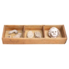
Cabinet of Curiosities Drawer Sculptural Artwork, circa 1950
Located in Barcelona, ES
Cabinet of curiosities of plaster figures and pieces in a wooden niche. Made in traditional Catalan atelier in Olot, Spain, circa 1950. Olot has a long tradition in the product...
Category

Vintage 1950s Spanish Modern Religious Items

Materials

Plaster, Wood

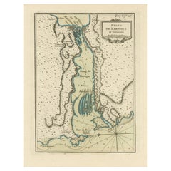
Antique Map of the Region of Martigues, France
Located in Langweer, NL
Title: "Etang de Martigues et Environs: Antique Map of the Martigues Region, France" Description: This antique map, titled "Etang de Martigue et Environs," offers a detailed view of...
Category

Antique Mid-18th Century Maps

Materials

Paper

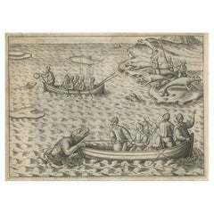
Rare Map of Kildin Island in Russia Plus Engraving of Seal Hunting, 1614
Located in Langweer, NL
Insula Kilduyn. Orig. copper-engraving after details from J. H. van Linschoten's map taken from his account of the three expeditions undertaken by Willem Barents in 1594, in an attem...
Category

Antique Early 17th Century Maps

Materials

Paper

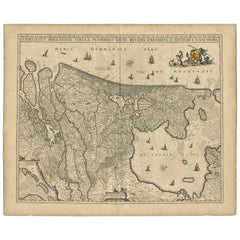
Antique Map of the Netherlands by N. Visscher, 1684
Located in Langweer, NL
Antique map titled 'Comitatus Hollandiae Tabula Pluribus Locis Recens Emendata a Nicolao I. Visschero'. West to the top. Lower left inset of the Wadden Islands, Texel, Vlieland, Ters...
Category

Antique Late 17th Century Maps

Materials

Paper

Antique Map of Jefferson County 'Ohio' by Titus, 1871
Located in Langweer, NL
Antique map titled 'Jefferson'. Original antique map of Jefferson, Ohio. This map originates from 'Atlas of Preble County Ohio' by C.O. Titus. Published 1871.
Category

Antique Late 19th Century Maps

Materials

Paper

Antique Map of France by Johnston (1909)
Located in Langweer, NL
Antique map titled 'France'. Original antique map of France. With inset maps of France in provinces, part of the Riviera and Corsica. This map or...
Category

Early 20th Century Maps

Materials

Paper

1970s Spine Shaped 'Proteo' Halogen Table Lamp, Italy
By Mario Bertorelle
Located in St- Leonard, Quebec
Bold spine shaped and articulated Proteo halogen table lamp. Playful, easy adjustable in various sculptural shape. Well made solid construction with black PVC parts and rubber joint. Measure: 21 in. high when curl as pictured, 36 in straight up. 2 intensity switch. 50 watt 2 pin light...
Category

Vintage 1970s Italian Mid-Century Modern Table Lamps

Materials

PVC

Antique Map of Westphalia, West Orientation
Located in Langweer, NL
Antique map titled 'Nova totius Westphaliae Descriptio'. Detailed map of Westphalia, Northern Germany. Oriented to the west. The area shown extends from Ha...
Category

Antique Late 17th Century Maps

Materials

Paper

1864 Johnson's Map of the West Indies and Bermuda
Located in Langweer, NL
Title: 1864 Johnson's Map of the West Indies and Bermuda Description: This is an 1864 map titled "Johnson's West Indies," published by Johnson and Ward. The map provides a detailed ...
Category

Antique 1860s Maps

Materials

Paper

Antique Print of a Chestnut by Knoop, 1758
Located in Langweer, NL
Antique print of a chestnut. Originates from 'Pomologia' by J. H. Knoop. Artists and Engravers: Published by Johann Hermann Knoop (c.1700-1769). Condition: Good, general age-re...
Category

Antique 18th Century Maps

Materials

Paper

Narrative of the Expedition of an American Squadron by M.C. Perry, '1857'
Located in Langweer, NL
'Narrative of the expedition of an American squadron to the China Seas and Japan; performed in the years 1852, 1853, and 1854' by M.C. Perry. Complete narrative with tinted lithograp...
Category

Antique Mid-19th Century Books

Materials

Paper

Black Americana Boy with Straw Hat Tobacco Leaf Plaque
Located in West Palm Beach, FL
Black Americana boy with straw hat tobacco leaf plaque, realistically cast with the boy in the straw hat breaking through a tobacco leaf.
Category

Early 20th Century High Victorian Figurative Sculptures

Materials

Metal

Antique Map of the Dutch Province of Gelderland, 1725
Located in Langweer, NL
Antique map titled 'Frisiae Haereditariae seu Trajectini Episcopatus Gelria?. Map of the province of Gelderland, the Netherlands. This map originates from 'Atlas Descriptio, secundum...
Category

Antique 18th Century Maps

Materials

Paper

Niels Erik From Modernist Silver Pendant Necklace with Agate
By Niels Erik From
Located in Esbjerg, DK
A late 1960s or early 1970s pendant necklace by Danish silversmith N. E. From. The ovale pendant has a polished insert of red/rose agate. Its comes with its original 50 cm box neckla...
Category

Vintage 1970s Danish Mid-Century Modern Collectible Jewelry

Materials

Agate, Sterling Silver

Antique Print of 'The Cowper Madonna' Made after Raphael 'c.1890'
Located in Langweer, NL
Antique print titled 'The Cowper Madonna'. Original antique print on chine collé, made after the painting by Raphael. Source unknown, to be determined. Published circa 1890.
Category

Antique Late 19th Century Prints

Materials

Paper

Antique Map of British North America, The Dominion of of Canada, 1882
Located in Langweer, NL
This map is titled "British North America, Dominion of Canada," from the 1882 Blackie Atlas. It features the geographical area that comprises modern-day Canada, with notable features...
Category

Antique 1880s Maps

Materials

Paper

Antique Map of the Netherlands and IJmuiden by Beekman & Schuiling, 1927
Located in Langweer, NL
Two maps on one sheet titled 'Nederland Landbouwkaart' and 'Nederland Groote Verkeerswegen'. With an inset map of the harbour of IJmuiden (The Netherlands). This map originates from ...
Category

20th Century Maps

Materials

Paper

Antique Molding Plane
Located in Chapel Hill, NC
Antique molding plane stamped J.Keen (owner) and overstamped maker in Edinburgh & Glasgow. Beech. 9 1/2"w., 6"d., 1"h. Whitehall Antiques is a family ...
Category

Antique 19th Century Scottish Historical Memorabilia

Materials

Wood

Antique Molding Plane
$75 Sale Price
34% Off
Original 1859 Map of Asia from W.G. Blackie's Imperial Atlas of Modern Geography
Located in Langweer, NL
Antique map titled 'Asia'. Original antique map of Asia. This map originates from ‘The Imperial Atlas of Modern Geography’. Published by W. G. Blackie, 1859. The "Classic Cartograph...
Category

Antique Mid-19th Century Maps

Materials

Paper

Old Colourful Decorative Map of Turkey in Europe, 1846
Located in Langweer, NL
Antique map titled 'Turkey in Europe'. Old map of Turkey in Europe. This map originates from 'A New Universal Atlas Containing Maps of the various Em...
Category

Antique 1840s Maps

Materials

Paper

Johannes Janssonius' 17th-Century Map of the Duchy of Bremen in Germany
Located in Langweer, NL
The map titled "Ducatus olim Episcopatus Bremensis et ostiorum Albis et Visurgis Fluviorum novissima Descriptio" by Johannes Janssonius provides a rich historical and geographical il...
Category

Antique 1650s Maps

Materials

Paper

Decorative Antique Map of the Southern Part of South America, 1806
Located in Langweer, NL
Description: Antique map titled 'Paraguay, Chili, Terre Magellan?' Decorative map of the southern part of South America by Robert de Vaugondy, revised and published by Delamarche. Source unknown, to be determined. Artists and Engravers: Charles Francois Delamarche (1740-1817) founded the important and prolific Paris based Maison Delamarche map publishing firm in the late 18th century. A lawyer by trade Delamarche entered the map business with the acquisition from Jean-Baptiste Fortin of Robert de Vaugondy's map plates...
Category

Antique Early 1800s Maps

Materials

Paper

Antique Print of the Book of Hours by Gibb, 1890
Located in Langweer, NL
Antique print titled 'Book of Hours'. Chromolithographic plate originating from 'The Royal House of Stuart. Illustrated By a Series of Forty Plates in Co...
Category

Antique 19th Century Prints

Materials

Paper

Antique Map of Doubs ‘France’ by V. Levasseur, 1854
By Victor Levasseur
Located in Langweer, NL
Antique map titled 'Dépt. du Doubs'. Map of the French department of Doubs, France. The whole is surrounded by elaborate decorative engravings designed to illustrate both the natural...
Category

Antique Mid-19th Century Maps

Materials

Paper

Old Map of the French Department of Cantal, France
By Victor Levasseur
Located in Langweer, NL
Antique map titled 'Dépt. du Cantal'. Map of the French department of Cantal, France. This area of France is known for its production of Cantal, a firm cheese, named after the region...
Category

Antique Mid-19th Century Maps

Materials

Paper

Antique Print of 'The Adoration of the Magi' Made after Ghirlandajo 'c.1890'
Located in Langweer, NL
Antique print titled 'The Adoration of the Magi'. Original antique print on chine collé, made after the painting by Ghirlandajo. Source unknown, to be determined. Published circa 1890.
Category

Antique Late 19th Century Prints

Materials

Paper

Antique Map of the Northern Hemisphere, 1782
Located in Langweer, NL
Antique map titled 'Hémisphère Septentrional pour voir plus distinctement les Terres Arctiques (..)'. Map of the Northern Hemisphere, originall...
Category

Antique 1780s Maps

Materials

Paper

Original Antique Map of the Empire of Japan, Centered on the Bay of Osaka, c1752
Located in Langweer, NL
Antique map titled 'Carte de L'Empire de Japon (..).' Map of the Empire of Japan. Centered on the Bay of Osaka, this map covers from Hirado (here identified as I. Firando) and Na...
Category

Antique 1750s Maps

Materials

Paper

Antique Bird's Eye View of Scheveningen Near The Hague, the Netherlands, 1730
Located in Langweer, NL
Antique print titled 'Afbeeldinge van Schevelinge in den Jaare 1729'. Bird's eye view of Scheveningen near The Hague / Den Haag, the Netherlands. This print originates from 'Beschr...
Category

Antique 1730s Maps

Materials

Paper

Antique Map of West Kalimantan (Schwaner Mountains), Borneo, Indonesia, 1900
Located in Langweer, NL
Antique map of West Kalimantan, Borneo. It shows the region of the Schwaner Mountains. This map originates from 'Atlas van Nederlandsch Oost- en West-Indië' by I. Dornseiffen. Arti...
Category

20th Century Maps

Materials

Paper

Antique Print of Liège / Luik in Belgium by Braun & Hogenberg, 1575
Located in Langweer, NL
Antique print titled 'Leodium'. View of Liège / Luik, Belgium with surrounding hills and the city wall. With text explaining the origins of Liège, a cartouche expressing thanks to th...
Category

Antique 16th Century Prints

Materials

Paper

Rare Original Miniature Map of Papua New Guinea and the Salomon Islands, 1600
Located in Langweer, NL
Very handsome original old coloured copper engraving of Papua and the Solomon Island. Title of the map 'Descriptio Novae Guneae et Inss. Salom. On the reverse text in Latin. Ve...
Category

Antique Early 1600s Maps

Materials

Paper

Antique Map of the Berchtesgaden Region by Scherer, 1699
Located in Langweer, NL
Antique map titled 'Principat et praepositura Berchtesgadensis (..).' Detailed uncommon map of the Berchtesgaden region in southern Bavaria, Germany. Source unknown, to be determined...
Category

Antique 17th Century Maps

Materials

Paper

Antique Plan of Duinkerke or Dunkirk in France by Guicciardini, 1612
Located in Langweer, NL
Antique map Duinkerke titled 'Duijnkerken'. Small plan of the city of Duinkerke/Dunkerque, France. Artists and Engravers: Lodovico Guicciardini (1521-1589): an Italian merchant fr...
Category

Antique 17th Century Maps

Materials

Paper

Detailed Old Map showing Spain and Portugal Incl. Majorca, Minorca & Ibiza, 1740
Located in Langweer, NL
Antique map titled 'Nieuwe Kaart van Spanje en Portugal.' Attractive detailed map showing Spain and Portugal. Including Majorca, Minorca and Ibiza. Title in block-style cartouche...
Category

Antique 1740s Maps

Materials

Paper

Antique Map of South America by Scherer, c.1700
By Thomas Kitchin
Located in Langweer, NL
Antique map of part of South America. Two maps on a single sheet, each depicting nearly the same area. On close examination there are slight differences in the rivers, lakes and moun...
Category

Antique 18th Century Maps

Materials

Paper

Antique Uncommon Map of Bohemia, Moravia and Silesia, 1699
Located in Langweer, NL
Antique map titled 'B. V. Boleslaviensis in Bohemia, Moravia et Silesia (..).' Detailed uncommon map of the Bohemia, Moravia and Silesia. Source unknown, to be determined. Artists...
Category

Antique 17th Century Maps

Materials

Paper

Detailed Regional Map of the Gulf of Bengal and the Lower Ganges River, ca.1750
Located in Langweer, NL
Title of this original and rare antique map: Nouvelle Carte Du Royaume De Bengale Mapmaker: Jacques-Nicolas Bellin (1703-1772). He was among the most important mapmakers of the eighteenth century. In 1721, at only the age of 18, he was appointed Hydrographer to the French Navy. In August 1741, he became the first Ingénieur de la Marine of the Dépôt des cartes...
Category

Antique 1750s Maps

Materials

Paper

Mid-19th Century Map of Australasia by Carl Flemming - 1855
Located in Langweer, NL
Title: "Mid-19th Century Map of Australasia by Carl Flemming - 1855" Description: This original 1855 antique map from the Sohr-Berghaus Atlas, created by Carl Flemming, is a detaile...
Category

Antique 1850s Maps

Materials

Paper

Original Antique Map of England, Ireland, Scotland and Wales
Located in Langweer, NL
Antique map titled 'Les Isles Britanniques, ou sont les Royaumes d Angleterre (..)'. Detailed map of England, Ireland, Scotland and Wales, with French coast and part of the Netherlan...
Category

Antique Early 18th Century Maps

Materials

Paper

Alicante in a 1901 Antique Map: Maritime Gateway of Spain's Costa Blanca
Located in Langweer, NL
An original antique map of the province of Alicante, dated 1901. It is part of the atlas series by D. Benito Chias y Carbo, featuring cartographic elements. Here are some characteri...
Category

Antique Early 1900s Maps

Materials

Paper

Antique Print of the Horse Guards at Whitehall, Westminster, London, ca.1770
Located in Langweer, NL
Description: Antique print titled 'East Front of the Horse Guards at Whitehall'. Architectural elevation of the Horse Guards at Whitehall. T...
Category

Antique 1770s Prints

Materials

Paper

Antique Map of the Ancient Greek Colonization
Located in Langweer, NL
Antique map titled 'Map I containing the Western Division of the Grecian Colonies & Conquests'. Original antique map of the ancient Greek colonization. Frontispiece map of 'The Histo...
Category

Antique Late 18th Century Maps

Materials

Paper

Antique Map of Asian Turkey, Levant, and Mesopotamia by Tardieu, circa 1802
Located in Langweer, NL
This is an original antique map titled "Carte de la Turquie Asiatique," depicting the Asian territories of the Ottoman Empire. Created by Pierre Antoine Tardieu, this map illustrates...
Category

Antique Early 1800s French Maps

Materials

Paper

Antique Print of the Giants Attempting to Scale Heaven, 1733
Located in Langweer, NL
Antique print titled 'Les Géans ou les Titans (..)'. This print depicts the Giants attempting to Scale Heaven by piling mountains upon one another. Giants were the children of Gaia o...
Category

Antique 18th Century Prints

Materials

Paper

Beautiful Antique Map with Views of Dendermonde, Belgium, 1735
Located in Langweer, NL
Antique map titled 'Teneramonda vulgo Dendermonde'. Beautiful map with views of Dendermonde, Belgium. This map originates from 'Flandria illustrata, sive provinciae ac comitatus huju...
Category

Antique 18th Century Prints

Materials

Paper

Antique Map of the City of Bolsward, Friesland in The Netherlands, c.1598
Located in Langweer, NL
Antique map titled ‘Bolzvardia vetus in Frisia Foederis (..)’. Old map of the city of Bolsward, Friesland. Originally part of a sheet together with the cities of Stavoren, Harlingen ...
Category

Antique 16th Century Maps

Materials

Paper

Chinese Export Sterling Silver Walking Stick Handle, circa 1900
Located in Chapel Hill, NC
Chinese Export sterling silver walking stick handle, circa 1900. Monogram of the famous ichthyologist Dr. Hugh McCormick Smith, "H...
Category

Early 20th Century Chinese Chinese Export Historical Memorabilia

Materials

Silver

Antique Plan of Meaco, Kyoto, Japan
Located in Langweer, NL
Antique map titled 'Plan de la Ville de Meaco - Platte-Grond van de Stad Miaco'. Detailed and unusual antique copper engraved plan of Kyoto, ancient named Meaco, when it was the capi...
Category

Antique Mid-18th Century Maps

Materials

Paper

Set of Three Antique Skittles in Wood, circa 1950
Located in Barcelona, ES
Set of three antique skittles, circa 1950. From unknown manufacturer, Spain. In original condition, with minor wear consistent with age and use, p...
Category

Vintage 1950s Spanish Mid-Century Modern Games

Materials

Paper

Original Antique Map of the Dutch Provinces of Overijssel and Drenthe, 1635
Located in Langweer, NL
Antique map titled 'Transiselania Dominium vernacule Over-Yssel.' - Map of the Dutch Provinces of Overijssel and Drenthe. Dedicated to Mr. Bartold Wich...
Category

Antique 1630s Maps

Materials

Paper

Antique Map of China and Japan by Tardieu, 1821
Located in Langweer, NL
Antique map titled 'Carte de la Chine et du Japon'. Detailed map of China, showing Korea, Japan and Taiwan. This map originates from 'L'histoire général des voyages' by J.F. de la Harpe.
Category

Antique Early 19th Century Maps

Materials

Paper

Napoleon III Gilt Bronze & Boulle Barometer & Thermometer Gervais Durand
By Gervais Durand
Located in Miami, FL
Exquisite Pair of fine Antique Gilt Bronze Mounted Tortoiseshell Inlaid Ebonized Boulle Marquetry Instruments by Gervais-Maximilien-Eugene Durand. Originals featuring exquisite bronz...
Category

Antique 19th Century French Napoleon III Scientific Instruments

Materials

Bronze, Brass

Cartographic Depiction of Flensburg and Surrounding Territories, Anno 1648
Located in Langweer, NL
Title: Landtcarte Vonn dem Ambte Flensborg, ohne Nordgoeßherde. Anno 1648. Description: This exquisitely detailed and old coloured map of Flensburg was crafted by the noted cartogr...
Category

Antique 1640s German Maps

Materials

Paper

Set of Three Antique Maps of Africa by Colton (circa 1855)
Located in Langweer, NL
Set of three individual maps of Africa including 'North West Africa', 'North Eastern Africa' and 'Southern Africa'. All three maps are surrounded by Colton's typical spiral motif border. Colton names numerous African tribes and nations throughout. An interesting set of maps...
Category

Antique Mid-19th Century Maps

Materials

Paper

Antique Map of the World by Balbi '1847'
Located in Langweer, NL
Antique map titled 'Planisphère'. Original antique map of the world. This map originates from 'Abrégé de Géographie (..)' by Adrien Balbi. Pub...
Category

Antique Mid-19th Century Maps

Materials

Paper

Interesting Original Antique Print of the Hunting Methods of Persians, 1731
Located in Langweer, NL
Antique print titled 'De Manier van Jagen der Persianen'. This print shows the hunting methods of Persians. This print originates from 'Hedendaagsche historie of Tegenwoordige staat ...
Category

Antique 18th Century Prints

Materials

Paper

Antique Print with Views of Tinian Island, the Northern Mariana Islands, 1749
Located in Langweer, NL
Antique print titled 'Le cote du sud-ouest de l'Ile de Tinian' and 'Vue de la rade de Tinian, ou le Centurion fit de l'eau.' Views of the south-west side of the island of Tinian and a view of the anchorage of Tinian, where the Centurion got water. This print originates from 'Reize rondsom de Werreld (..)' by George Anson, published 1749. Tinian is one of the three principal islands of the Commonwealth of the Northern Mariana Islands...
Category

Antique 18th Century Prints

Materials

Paper

Read More

Medal-Worthy Memorabilia from Epic Past Olympic Games

Get into the games! These items celebrate the events, athletes, host countries and sporting spirit.

Ahoy! You’ve Never Seen a Collection of Sailor Art and Kitsch Quite Like This

French trendsetter and serial collector Daniel Rozensztroch tells us about his obsession with objects related to seafaring men.

Pamela Shamshiri Shares the Secrets behind Her First-Ever Book and Its Effortlessly Cool Interiors

The sought-after designer worked with the team at Hoffman Creative to produce a monograph that beautifully showcases some of Studio Shamshiri's most inspiring projects.

Moroccan Artworks and Objects Take Center Stage in an Extraordinary Villa in Tangier

Italian writer and collector Umberto Pasti opens the doors to his remarkable cave of wonders in North Africa.

Montecito Has Drawn Royalty and Celebrities, and These Homes Are Proof of Its Allure

Hollywood A-listers, ex-pat aristocrats and art collectors and style setters of all stripes appreciate the allure of the coastal California hamlet — much on our minds after recent winter floods.

Whaam! Blam! Pow! — a New Book on Pop Art Packs a Punch

Publishing house Assouline and writer Julie Belcove have teamed up to trace the history of the genre, from Roy Lichtenstein, Andy Warhol and Yayoi Kusama to Mickalene Thomas and Jeff Koons.

What Makes a Gem-Encrusted Chess Set Worth $4 Million?

The world’s most opulent chess set, weighing in at 513 carats, is literally fit for a king and queen.

Tauba Auerbach’s Geometric Pop-Up Book Is Mighty Rare, Thanks to a Hurricane

This sculptural art book has an epic backstory of its own.
Recently Viewed

View All