Maps on Sale
to
4,200
18
4,223
1
3
2
2
1
1
1
1
2,332
1,659
232
1
130
12
1
67
1
3
4
2
4,214
10
8
7
7
151
45
39
33
28
4,224
4,224
4,224
104
55
18
13
11
Sale Items
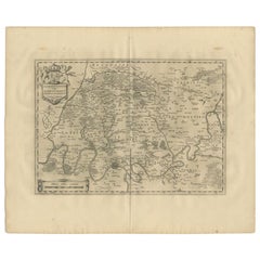
Antique Map of the Region of 'Île de France' by Janssonius, 1657
By Johannes Janssonius
Located in Langweer, NL
Antique map of France titled 'Ager Parisiensis vulgo l'Isle de France'. Old map of Paris and adjacent regions. This map originates from 'Atlas Novus, ...
Category
Antique 17th Century Maps
Materials
Paper
$405 Sale Price
20% Off
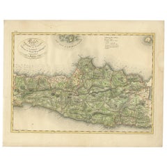
Antique Map of Central and East Java by Van den Bosch, 1818
Located in Langweer, NL
Antique map titled 'Kaart van de Keizers en Sultans Landen benevens de Strand Regentschappen op het Eiland Java'. Map of three central and easterly provinces of the island of Java. O...
Category
Antique Early 19th Century Maps
Materials
Paper
$1,146 Sale Price
20% Off
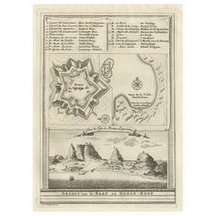
Old Print with a View of the Cape of Good Hope and Table Bay, South Africa, 1750
Located in Langweer, NL
Antique print titled 'Gezigt van de Kaap de Goede-Hoop'.
Old print with a view of the Cape of Good Hope and Table Bay. Engraved by J. van Schley for a Du...
Category
Antique 1750s Maps
Materials
Paper
$181 Sale Price
20% Off
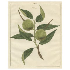
Antique Print of a Chestnut by Knoop, 1758
Located in Langweer, NL
Antique print of a chestnut. Originates from 'Pomologia' by J. H. Knoop.
Artists and Engravers: Published by Johann Hermann Knoop (c.1700-1769).
Condition: Good, general age-re...
Category
Antique 18th Century Maps
Materials
Paper
$315 Sale Price
20% Off
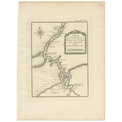
Antique Map of the Tonkin River ‘Vietnam’ by J.N. Bellin, 1764
Located in Langweer, NL
One of the maps produced by Bellin for Prevost d'Exiles' influential travel book, ‘L'Histoire Generale des Voyages’. This map depicts part of Southeast Asia, most likely northern Vie...
Category
Antique Mid-18th Century Maps
Materials
Paper
$234 Sale Price
20% Off
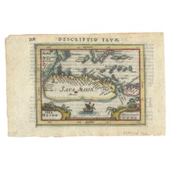
Rare 16th Century Original Handcolored Miniature Map of Java, Indonesia, 1616
Located in Langweer, NL
Very handsome original old coloured copper engraving by Bertius of the island of Java in the early days of the Dutch colonisation - at that time named The Dutch East Indies or nowada...
Category
Antique 1610s Maps
Materials
Paper
$468 Sale Price
20% Off
Antique Map of the Ancient Greek Colonization
Located in Langweer, NL
Antique map titled 'Map I containing the Western Division of the Grecian Colonies & Conquests'. Original antique map of the ancient Greek colonization. Frontispiece map of 'The Histo...
Category
Antique Late 18th Century Maps
Materials
Paper
$171 Sale Price
20% Off
Circa 1659 Blaeu Family Map: Glogau and the Odra River Valley, Silesia
Located in Langweer, NL
Circa 1659 Blaeu Family Map: Glogau and the Odra River Valley, Silesia
This hand-colored map from circa 1659 by the Blaeu Family, titled "Ducatus Silesiae Glogani Vera Delineatio," provides a detailed view of the Odra River valley in western Poland, centered around the city of Glogau.
The map, based on the work of Silesian cartographer Jonas Scultetus, is oriented with north to the left. It intricately details forests, rivers, lakes, and numerous small villages.
A large decorative title cartouche features an ornate coat of arms and a key to the map's symbols. The bottom right includes a finely crafted scale of miles cartouche, adorned with calipers and a pair of falcons.
Published between 1659 and 1672, the map has Spanish text on the verso.
Measuring 19.9 inches wide by 16.4 inches high, it is in good condition with full contemporary color on a bright sheet, a watermark of the god Atlas, some marginal soiling, and a few short tears along the edges.
Keywords:
- Blaeu Family map
- Silesia historical map
- Glogau map
- Odra River valley
- 17th-century Poland map
- Jonas Scultetus
- Decorative cartouches
- Historical cartography
- Antique maps of Poland...
Category
Antique 1650s Maps
Materials
Paper
$1,050 Sale Price
20% Off
Original Antique Map of England, Ireland, Scotland and Wales
Located in Langweer, NL
Antique map titled 'Les Isles Britanniques, ou sont les Royaumes d Angleterre (..)'. Detailed map of England, Ireland, Scotland and Wales, with French coast and part of the Netherlan...
Category
Antique Early 18th Century Maps
Materials
Paper
$276 Sale Price
20% Off
Antique Plan of Duinkerke or Dunkirk in France by Guicciardini, 1612
Located in Langweer, NL
Antique map Duinkerke titled 'Duijnkerken'. Small plan of the city of Duinkerke/Dunkerque, France.
Artists and Engravers: Lodovico Guicciardini (1521-1589): an Italian merchant fr...
Category
Antique 17th Century Maps
Materials
Paper
$219 Sale Price
20% Off
Antique Map of Africa and Arabia with Inset Map of Ethiopia and Eritrea, 1845
Located in Langweer, NL
Antique map titled 'Mittel- und Nord-Africa (östl. Theil) und Arabien'. This map depicts North and Central Africa and Arabia with an inset map of Habesch (Ethiopia and Eritrea).
Ar...
Category
Antique 19th Century Maps
Materials
Paper
$210 Sale Price
20% Off
Antique Map of the Israel Township of Ohio by Titus '1871'
Located in Langweer, NL
Antique map titled 'Israel'. Original antique map of Israel, Ohio. This map originates from 'Atlas of Preble County Ohio' by C.O. Titus. Published 1871.
Category
Antique Late 19th Century Maps
Materials
Paper
$238 Sale Price
20% Off
Colorful Detailed Antique Map of Europe, Published in 1882
Located in Langweer, NL
"The Antique Map of Europe from 'The Comprehensive Atlas and Geography of the World,' published in 1882 by Blackie & Son, is a testament to meticulous cartography and scholarly preci...
Category
Antique 1880s Maps
Materials
Paper
$181 Sale Price
20% Off
Old Map of the Empire of the Assyriens & the Tigres and Euphrates Rivers, 1683
Located in Langweer, NL
Antique map titled 'Empire des Assyriens' and 'Assyrie Chaldee et Mesopotamie selon les Anciens'.
Two maps on one sheet, the upper sheet showing the Empire of the Assyriens and the second showing the region of the Tigres and Euphrates Rivers. This map originates from Alain Manesson Mallet's 'Description de l 'Univers'.
Artists and engravers: Alain Manesson Mallet (1630–1706) was a French cartographer and engineer. He started his career as a soldier in the army of Louis XIV, became a Sergeant-Major in the artillery and an Inspector of Fortifications. He also served under the King of Portugal, before returning to France, and his appointment to the court of Louis XIV. His military engineering and mathematical background led to his position teaching mathematics at court. His major publications were Description de L'Univers (1683) in 5 volumes, and Les Travaux de Mars ou l'Art de la Guerre (1684) in 3 volumes.
His Description de L'Universe contains a wide variety of information, including star maps...
Category
Antique 1680s Maps
Materials
Paper
$267 Sale Price
20% Off
Old Map of the French Department of Cantal, France
By Victor Levasseur
Located in Langweer, NL
Antique map titled 'Dépt. du Cantal'. Map of the French department of Cantal, France. This area of France is known for its production of Cantal, a firm cheese, named after the region...
Category
Antique Mid-19th Century Maps
Materials
Paper
$324 Sale Price
20% Off
1692 Engraved Map: Detailed Mogul Empire, India to Afghanistan, Hand-Colored
Located in Langweer, NL
1692 Map of the Mogul Empire by Jacques Peeters
This finely engraved map, published in 1692 by Jacques Peeters, showcases the Mogul Empire region, covering areas from northern India...
Category
Antique 1690s Maps
Materials
Paper
$468 Sale Price
20% Off
Antique Map of Russia in Europe by A & C, Black, 1870
Located in Langweer, NL
Antique map titled 'Russia in Europe'. Original antique map of Russia in Europe. This map originates from ‘Black's General Atlas of The World’. Published by A & C. Black, 1870.
Category
Antique Late 19th Century Maps
Materials
Paper
$262 Sale Price
20% Off
The 1649 Haderschleben Map of Western Jutland and North Sea Islands
Located in Langweer, NL
This is a beautiful example of an antique map, titled "Westertheil des Amptes Haderschleben Zusambt Rieben und dem Loehmcloster Anno 1649." It's a hand-colored copper etching by Matt...
Category
Antique 1640s Maps
Materials
Paper
$592 Sale Price
20% Off
Rare Map of Kildin Island in Russia Plus Engraving of Seal Hunting, 1614
Located in Langweer, NL
Insula Kilduyn. Orig. copper-engraving after details from J. H. van Linschoten's map taken from his account of the three expeditions undertaken by Willem Barents in 1594, in an attem...
Category
Antique Early 17th Century Maps
Materials
Paper
$716 Sale Price
20% Off
Circa 1802 Map of the Troad Region by Tardieu – From the Voyage de la Troade
Located in Langweer, NL
This is a large fold-out map titled *Carte de la Troade*, measuring approximately 53.5 x 68 cm, engraved by Tardieu, and extracted from the atlas of *Voyage de la Troade, fait dans l...
Category
Antique Early 1800s French Maps
Materials
Paper
$223 Sale Price
25% Off
Antique Map of Three Cities of China's Hubei and Hunan Provinces by Bellin
By Jacques-Nicolas Bellin
Located in Langweer, NL
Antique print titled 'Plans de Quelques villes de la province de Hou-Quang.' Three bird's-eye view plans of walled cities in what are now China's Hubei (Hou-Quang) and Hunan Province...
Category
Antique Mid-18th Century Maps
Materials
Paper
$157 Sale Price
20% Off
1880 Map of the Caribbean and Central America by Adolf Stieler
Located in Langweer, NL
This is a detailed map titled "West-Indien und Central-Amerika," created by Adolf Stieler and published in Gotha in 1880. The map covers the Caribbean islands and the Central America...
Category
Antique 1880s Maps
Materials
Paper
$276 Sale Price
20% Off
Antique Map of Loire ‘France’ by V. Levasseur, 1854
Located in Langweer, NL
Antique map titled 'Dépt. de la Loire'. Map of the French department of Loire, France. This area of France is part of the Loire Valley wine growing region. The area includes 87 appel...
Category
Antique Mid-19th Century Maps
Materials
Paper
$143 Sale Price
20% Off
Antique Print of the Book of Hours by Gibb, 1890
Located in Langweer, NL
Antique print titled 'Book of Hours'. Chromolithographic plate originating from 'The Royal House of Stuart. Illustrated By a Series of Forty Plates in Co...
Category
Antique 19th Century Prints
Materials
Paper
$81 Sale Price
20% Off
Antique Map of the Dutch Province of Gelderland, 1725
Located in Langweer, NL
Antique map titled 'Frisiae Haereditariae seu Trajectini Episcopatus Gelria?. Map of the province of Gelderland, the Netherlands. This map originates from 'Atlas Descriptio, secundum...
Category
Antique 18th Century Maps
Materials
Paper
$122 Sale Price
20% Off
Detailed Antique Map of Northern Sumatra, Indonesia, circa 1825
Located in Langweer, NL
Antique map titled 'Partie de l'Ile de Sumatra'. Chart showing the northern part of Sumatra. Originates from 'Atlas Universel' by P.M. Vandermaelen.
Artists and Engravers: Philip...
Category
Antique 19th Century Maps
Materials
Paper
$401 Sale Price
20% Off
Decorative Antique Map of the Southern Part of South America, 1806
Located in Langweer, NL
Description: Antique map titled 'Paraguay, Chili, Terre Magellan?'
Decorative map of the southern part of South America by Robert de Vaugondy, revised and published by Delamarche. Source unknown, to be determined.
Artists and Engravers: Charles Francois Delamarche (1740-1817) founded the important and prolific Paris based Maison Delamarche map publishing firm in the late 18th century. A lawyer by trade Delamarche entered the map business with the acquisition from Jean-Baptiste Fortin of Robert de Vaugondy's map plates...
Category
Antique Early 1800s Maps
Materials
Paper
$525 Sale Price
20% Off
Original Antique Map of the Empire of Japan, Centered on the Bay of Osaka, c1752
Located in Langweer, NL
Antique map titled 'Carte de L'Empire de Japon (..).'
Map of the Empire of Japan. Centered on the Bay of Osaka, this map covers from Hirado (here identified as I. Firando) and Na...
Category
Antique 1750s Maps
Materials
Paper
$802 Sale Price
20% Off
Original 1859 Map of Asia from W.G. Blackie's Imperial Atlas of Modern Geography
Located in Langweer, NL
Antique map titled 'Asia'. Original antique map of Asia. This map originates from ‘The Imperial Atlas of Modern Geography’. Published by W. G. Blackie, 1859.
The "Classic Cartograph...
Category
Antique Mid-19th Century Maps
Materials
Paper
$238 Sale Price
20% Off
Antique Map of Jefferson County 'Ohio' by Titus, 1871
Located in Langweer, NL
Antique map titled 'Jefferson'. Original antique map of Jefferson, Ohio. This map originates from 'Atlas of Preble County Ohio' by C.O. Titus. Published 1871.
Category
Antique Late 19th Century Maps
Materials
Paper
$238 Sale Price
20% Off
Antique Map of the Northern Hemisphere, 1782
Located in Langweer, NL
Antique map titled 'Hémisphère Septentrional pour voir plus distinctement les Terres Arctiques (..)'.
Map of the Northern Hemisphere, originall...
Category
Antique 1780s Maps
Materials
Paper
$1,432 Sale Price
20% Off
Antique Map of the Berchtesgaden Region by Scherer, 1699
Located in Langweer, NL
Antique map titled 'Principat et praepositura Berchtesgadensis (..).' Detailed uncommon map of the Berchtesgaden region in southern Bavaria, Germany. Source unknown, to be determined...
Category
Antique 17th Century Maps
Materials
Paper
$214 Sale Price
20% Off
Antique Map of South America by Scherer, c.1700
By Thomas Kitchin
Located in Langweer, NL
Antique map of part of South America. Two maps on a single sheet, each depicting nearly the same area. On close examination there are slight differences in the rivers, lakes and moun...
Category
Antique 18th Century Maps
Materials
Paper
$143 Sale Price
20% Off
Detailed Regional Map of the Gulf of Bengal and the Lower Ganges River, ca.1750
Located in Langweer, NL
Title of this original and rare antique map: Nouvelle Carte Du Royaume De Bengale
Mapmaker: Jacques-Nicolas Bellin (1703-1772).
He was among the most important mapmakers of the eighteenth century. In 1721, at only the age of 18, he was appointed Hydrographer to the French Navy. In August 1741, he became the first Ingénieur de la Marine of the Dépôt des cartes...
Category
Antique 1750s Maps
Materials
Paper
$601 Sale Price
20% Off
Old Map of the Arabian Peninsula with Parts of Egypt, Sudan, Eritrea & Ethiopia
Located in Langweer, NL
"Carte de l'Arabie, du Golfe Persique, et de la Mer Rouge, avec l'Egypte, la Nubie et l'Abissinie", Bonne, Rigobert
Subject: Arabia
Period: 1780 (circa)
Publication: Atlas de Toutes...
Category
Antique 1780s Maps
Materials
Paper
$362 Sale Price
20% Off
Antique Uncommon Map of Bohemia, Moravia and Silesia, 1699
Located in Langweer, NL
Antique map titled 'B. V. Boleslaviensis in Bohemia, Moravia et Silesia (..).' Detailed uncommon map of the Bohemia, Moravia and Silesia. Source unknown, to be determined.
Artists...
Category
Antique 17th Century Maps
Materials
Paper
$458 Sale Price
20% Off
Antique Print with Views of Tinian Island, the Northern Mariana Islands, 1749
Located in Langweer, NL
Antique print titled 'Le cote du sud-ouest de l'Ile de Tinian' and 'Vue de la rade de Tinian, ou le Centurion fit de l'eau.' Views of the south-west side of the island of Tinian and a view of the anchorage of Tinian, where the Centurion got water. This print originates from 'Reize rondsom de Werreld (..)' by George Anson, published 1749.
Tinian is one of the three principal islands of the Commonwealth of the Northern Mariana Islands...
Category
Antique 18th Century Prints
Materials
Paper
$178 Sale Price
66% Off
1874 Map of the United States with Territorial Boundaries
Located in Langweer, NL
Title: 1874 Map of the United States with Territorial Boundaries
Description: This is an 1874 map titled "Map of the United States," showcasing the country during a period of rapid ...
Category
Antique 1870s Maps
Materials
Paper
$248 Sale Price
20% Off
17th Century Cartographic Marvel: A Detailed Engraving of Guangzhou (Kanton)
Located in Langweer, NL
This engraving of Guangzhou ("Kanton") is from a French edition of Olfert Dapper's work. The French edition titled "Description de l’Empire de la Chine" was published in 1674. It is ...
Category
Antique 1670s Maps
Materials
Paper
$1,050 Sale Price
20% Off
Old Map of the French department of Creuse, France
By Victor Levasseur
Located in Langweer, NL
Antique map titled 'Dépt. de la Creuse'. Map of the French department of Creuse, France. This region is well known for its apple cider made from Limousin apples and its international...
Category
Antique Mid-19th Century Maps
Materials
Paper
$324 Sale Price
20% Off
Hand Colored Antique Map of the Department of Nièvre, France
By Victor Levasseur
Located in Langweer, NL
Antique map titled 'Dept. de la Nièvre'. Map of the French department of Nievre, France. Part of the prestiegous Burgundy or Bourgogne wine region this area is known for its producti...
Category
Antique Mid-19th Century Maps
Materials
Paper
$324 Sale Price
20% Off
Antique Map of North America by Levasseur '1875'
Located in Langweer, NL
Antique map titled 'Carte générale de l'Amérique Septentrionale'. Large map of North America. This map originates from 'Atlas de Géographie Modern...
Category
Antique Late 19th Century Maps
Materials
Paper
$477 Sale Price
20% Off
Antique Map of the Netherlands by N. Visscher, 1684
Located in Langweer, NL
Antique map titled 'Comitatus Hollandiae Tabula Pluribus Locis Recens Emendata a Nicolao I. Visschero'. West to the top. Lower left inset of the Wadden Islands, Texel, Vlieland, Ters...
Category
Antique Late 17th Century Maps
Materials
Paper
$1,050 Sale Price
20% Off
Original Antique Map of the Dutch Provinces of Overijssel and Drenthe, 1635
Located in Langweer, NL
Antique map titled 'Transiselania Dominium vernacule Over-Yssel.' - Map of the Dutch Provinces of Overijssel and Drenthe. Dedicated to Mr. Bartold Wich...
Category
Antique 1630s Maps
Materials
Paper
$458 Sale Price
20% Off
Antique Map of Doubs ‘France’ by V. Levasseur, 1854
By Victor Levasseur
Located in Langweer, NL
Antique map titled 'Dépt. du Doubs'. Map of the French department of Doubs, France. The whole is surrounded by elaborate decorative engravings designed to illustrate both the natural...
Category
Antique Mid-19th Century Maps
Materials
Paper
$171 Sale Price
20% Off
Crossroads of Empires: A John Tallis Map of the Isthmus of Panama, 1851
Located in Langweer, NL
The Tallis map of the Isthmus of Panama is a beautifully detailed work, characteristic of the maps produced by John Tallis & Company, which was one of the last cartographic firms to ...
Category
Antique 1850s Maps
Materials
Paper
$276 Sale Price
20% Off
VOC Ships, Native People & Coastal Views of Islands near Papua New Guinea, 1726
Located in Langweer, NL
Antique print titled 'Het Eylandt Takel, als gy daar langhs seylt (..)'.
Five engravings on one sheet showing the native boats and peoples and coastal views of islands near New Gui...
Category
Antique 1720s Maps
Materials
Paper
$420 Sale Price / item
20% Off
Map of Europe Highlighting Ancient and Modern Geographical Divisions (1794)
Located in Langweer, NL
Map of Europe Highlighting Ancient and Modern Geographical Divisions (1794). Germany, France, Italy, Spain, and the British Isles – Map by D’Anville (1794).
This detailed 18th-cent...
Category
Antique 1790s Maps
Materials
Paper
$1,614 Sale Price
20% Off
Turkey in Asia: Biblical Regions and the Holy Land from The Royal Atlas (1856)
Located in Langweer, NL
This antique map titled "Turkey in Asia (Biblical Regions) The Holy Land and its Borders" comes from "The Royal Illustrated Atlas", which was published in 1856 by A. Fullarton & Co. ...
Category
Antique Mid-19th Century Maps
Materials
Paper
$630 Sale Price
20% Off
Old Print of Farmers Harvesting Cinnamon on the Island Ceylon or Sri Lanka, 1672
Located in Langweer, NL
Antique print, titled: 'Hoe men de Caneel schilt opt Eyland Ceylon.'
This rare original plate shows a group of farmers harvesting cinnamon on the island of Ceylon / Sri Lanka. Du...
Category
Antique 1670s Prints
Materials
Paper
$362 Sale Price
20% Off
Minho: A Legacy of Lush Landscapes and Living Traditions in Portugal, 1903
Located in Langweer, NL
Ths authentic print is a historical map of the Minho region in the northwestern part of Portugal. The map includes detailed geographical features, such as rivers, mountain ranges, an...
Category
Antique Early 1900s Maps
Materials
Paper
$324 Sale Price
20% Off
Antique Map of Turkey in Asia 'Asia Minor' by Vuillemin, 1846
Located in Langweer, NL
Antique map titled 'Turqui D'Asie'. Map of Turkey in Asia / Asia Minor. This attractive original old antique print / plate / map originates from: 'Atlas Uni...
Category
Antique 19th Century Maps
Materials
Paper
$71 Sale Price
20% Off
Large Antique Map of Bass Strait, Tasmania, Australia by Cook, 1803
Located in Langweer, NL
Antique map Australia titled 'Kaart van Basses Straat tusschen Nieuw Zuid Wales en van Diemensland (..)'. Large chart of Bass Strait and one of t...
Category
Antique 19th Century Maps
Materials
Paper
$4,298 Sale Price
20% Off
1700 Guillaume Delisle Map: Western Mediterranean & Moorish North Africa
Located in Langweer, NL
1700 Guillaume Delisle Map: Western Mediterranean & Moorish North Africa
This hand-colored map from 1700 by Guillaume Delisle, titled "In Notitiam Ecclesiasticam Africae Tabula Geographica," offers a detailed look at the regions under Moorish control during the later medieval period.
It encompasses the northern African coast from Morocco to Libya, the Iberian Peninsula, and the western Mediterranean, including notable islands such as Sardinia, Corsica, Malta, the Balearics, and Sicily, where a smoking Mount Etna is depicted.
The map is embellished with three decorative cartouches, adding artistic flair to the detailed geographical renderings.
Engraved by Jean Baptiste Liebaux, the map measures 25.2 inches wide by 19.1 inches high.
It features a sharp impression with contemporary outline color, later enhanced cartouches, and is printed on a bright sheet with a Society of Jesus watermark.
The condition is very good, with an archivally repaired centerfold separation at the bottom and light toning along the edges.
Keywords:
- Guillaume Delisle map
- Western Mediterranean historical map
- Northern Africa map...
Category
Antique Early 1700s Maps
Materials
Paper
$869 Sale Price
20% Off
Antique Map of France at the Beginning of the 17th Century by Zannoni, 1765
By G. A. Rizzi-zannoni
Located in Langweer, NL
Antique map France titled 'Carte pour servir à intelligence de l'Histoire de France (..)'. Beautiful old map of France. This map originates from 'At...
Category
Antique 18th Century Maps
Materials
Paper
$151 Sale Price
20% Off
Antique Map of the East Indies by Bonne '1776'
Located in Langweer, NL
Antique map titled 'Indes IVe Feuille'. Very decorative original antique map of the East Indies. Covbers from the Gulf of Siam (Gulf of Thailand) and Malacca (Malaysia) eastward to i...
Category
Antique Late 18th Century Maps
Materials
Paper
$525 Sale Price
20% Off
Antique Print of Decorative Art in the Renaissance Period, 1869
Located in Langweer, NL
Old print of decorative art in the Renaissance period. This print originates from 'L'Ornement polychrome'. A beautiful work containing about 2000 patterns of all the styles of Art ol...
Category
Antique 19th Century Prints
Materials
Paper
$171 Sale Price
20% Off
Antique Map of China and Japan by Tardieu, 1821
Located in Langweer, NL
Antique map titled 'Carte de la Chine et du Japon'. Detailed map of China, showing Korea, Japan and Taiwan. This map originates from 'L'histoire général des voyages' by J.F. de la Harpe.
Category
Antique Early 19th Century Maps
Materials
Paper
$692 Sale Price
20% Off
Set of Three Antique Maps of Africa by Colton (circa 1855)
Located in Langweer, NL
Set of three individual maps of Africa including 'North West Africa', 'North Eastern Africa' and 'Southern Africa'. All three maps are surrounded by Colton's typical spiral motif border. Colton names numerous African tribes and nations throughout. An interesting set of maps...
Category
Antique Mid-19th Century Maps
Materials
Paper
$334 Sale Price / set
20% Off
Antique Coastal Views and a Map of Van Diemens Land (Tasmania), Australia, 1803
Located in Langweer, NL
Antique map Tasmania titled 'Kaart van Diemens Land'.
Coastal views and a map of van Diemens Land (Tasmania). Originates from 'Reizen Rondom de Waereld ...
Category
Antique Early 1800s Maps
Materials
Paper
$821 Sale Price
20% Off
Recently Viewed
View AllMore Ways To Browse
Statutes And Sculptures
Swedish Gustavian Glass Cabinet
Swiss Chalet Chairs
Tea Cup Art Nouveau
Tea Cup Holder
Teak Buddha
Teak Gentlemans
Thomasville Hollywood Regency
Thomire Clock
Three Legged Vessel
Three Tier Serving Trays
Tibet Earring
Tibetan Antique Cabinet
Tiffany And Co China
Tiffany Blue Rims
Tiffany Sterling Ice Tea Spoons
Torchiere Sculpture
Tortoise Christian Dior
