Maps on Sale
to
4,188
18
4,211
1
3
2
2
1
1
1
1
2,327
1,651
233
1
131
12
1
67
1
3
4
2
4,202
10
8
7
7
165
51
41
37
32
4,212
4,212
4,212
104
55
18
12
11
Sale Items
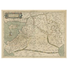
Mercator's Ptolemaic Map of the Holy Land, Cyprus and Syria, circa 1580
Located in Langweer, NL
Antique map titled 'Asiae IIII Tab'. Beautiful map of Mercator's Ptolemaic map of the Holy Land, Cyprus, Syria, etc. Originates from Mercator's 'Geograph...
Category
Antique 16th Century Maps
Materials
Paper
$658 Sale Price
20% Off
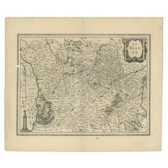
Antique Map of the Region of Beauce in France by Janssonius, c.1650
Located in Langweer, NL
Antique map of France titled 'La Beauce'. Decorative map of the region of Beauce, a natural region in northern France, located between the Seine and Loire ri...
Category
Antique 17th Century Maps
Materials
Paper
$391 Sale Price
20% Off
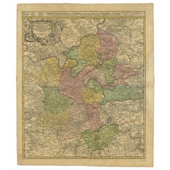
Antique Map of the Region of Paris by Homann Heirs, c.1720
By Homann Heirs
Located in Langweer, NL
Antique map titled 'Agri Parisiensis Tabula particularis, qua maxima Pars Insulae Franciae (..).' Incredibly detailed map showing everything from tiny villages to forests, farmland, ...
Category
Antique 18th Century Maps
Materials
Paper
$191 Sale Price
20% Off
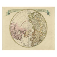
Beautiful Antique Map of the Northern Hemisphere with California as an Island
By Isaak Tirion
Located in Langweer, NL
Antique map titled 'Nieuwe Kaart van de Noord Pool na de alderlaatste ontdekking int licht gebracht tot Amsterdam door Isaak Tirion'. Beautiful map of the Northern Hemisphere and Nor...
Category
Antique Mid-18th Century Maps
Materials
Paper
$687 Sale Price
20% Off
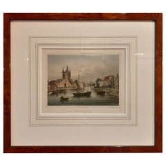
Neatly Framed Decorative Hand-Colored View of Zierikzee, the Netherlands, 1858
Located in Langweer, NL
Antique print titled 'Zierikzee'.
View of the city of Zierikzee, the Netherlands. This print originates from 'Het koningrijk der Nederlanden voorgesteld in eene reeks van 136 naa...
Category
Antique 1850s Maps
Materials
Paper
$467 Sale Price
20% Off
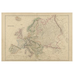
Antique Map of Europe by W. G. Blackie, 1859
Located in Langweer, NL
Antique map titled 'Europe'. Original antique map of Europe. This map originates from ‘The Imperial Atlas of Modern Geography’. Published by W. G. Blackie, 1859.
Category
Antique Mid-19th Century Maps
Materials
Paper
$238 Sale Price
20% Off
Sebastian Münster's 16th Century Map of the British Isles, ca.1590
Located in Langweer, NL
GREAT BRITAIN -- "ENGELLANDT mit dem anstossenden Reich Schottlandt so vorzeiten Albion und Britannia haben geheissen". (Basel, c. 1590).
Partly handcolored woodcut double-page map from S. Munster's 'Cosmographey'. 330 x 408 mm. (Lower margin cut short (touching the line), tiny hole in upper margin, sl. foxed/browned, lower right corner a bit thumbed).
Sebastian Münster's 16th Century Map of the British Isles from 'Cosmographia Universalis...
Category
Antique 16th Century Maps
Materials
Paper
$611 Sale Price
20% Off
Antique Map of North Africa showing Egypt, Mauritania and Africa Minor, 1672
Located in Langweer, NL
Antique map titled 'Africa Minor, Mauritania , Aegyptus.' Charming miniature map of North Africa, showing Egypt, Mauritania and Africa Minor. This map originates from the pocket atla...
Category
Antique 17th Century Maps
Materials
Paper
$214 Sale Price
20% Off
Antique Map of Prussia by Janssonius, 1628
Located in Langweer, NL
Antique map titled 'Prussia'. Original antique map of Prussia, a historically prominent German state that originated in 1525 with a duchy centered on th...
Category
Antique Mid-17th Century Maps
Materials
Paper
$191 Sale Price
20% Off
Map of Denmark, Norway & Iceland: Early 19th Century from the 1802 Tardieu Atlas
Located in Langweer, NL
Antique Map Description
Title: Royaume de Danemarck: Première Carte. Danemarck, Norwege et Islande
Publication Details:
- **Atlas Title:** Nouvel Atlas Universel de Géographie Anc...
Category
Antique Early 1800s Maps
Materials
Paper
$458 Sale Price
20% Off
Guadeloupe and Dependencies: Mid-19th Century Map from France Pittoresque Series
Located in Langweer, NL
This map titled "Guadeloupe et Dépendances" is part of the France Pittoresque series and provides a detailed view of the island of Guadeloupe and its surrounding dependencies.
Features:
- The map shows the two main landmasses of Guadeloupe: Basse-Terre and Grande-Terre, separated by a narrow channel.
- Several smaller islands, including Marie-Galante, Les Saintes, and La Désirade, are also depicted.
- The main cities, towns, and geographical features are labeled, with emphasis on the island's mountain ranges and rivers, particularly on Basse-Terre.
- An inset at the bottom right provides a detailed plan of Pointe-à-Pitre, a major city and port on the island. The grid layout of the streets is clearly shown, reflecting urban planning of the time.
Artistic and Cartographic Details:
- The map uses clear linework to differentiate between the different islands and the sea, with significant natural features such as mountains and rivers carefully depicted.
- The map was drawn by Monin and engraved by Jacqueline and Barrière, whose names appear in the lower right corner.
- The scale in the lower left corner is measured in leagues, showing distances both by land and sea.
Historical Context:
- This map likely dates to the mid-19th century, a period when Guadeloupe was a key French colony in the Caribbean. Guadeloupe was known for its sugar and coffee plantations, which played a significant role in France's colonial economy.
- Maps like this were often used for administrative, military, and educational purposes to give a comprehensive view of France's overseas territories.
The map of Guadeloupe et Dépendances from the France Pittoresque series likely dates to the mid-19th century, around 1840 to 1860. This period corresponds to the height of French colonial influence in Guadeloupe, and the map's style, detailed urban planning, and cartographic techniques are consistent with maps produced in that era.
The specific publication date could be further narrowed down if the map was part of a known edition of the France Pittoresque atlas, but based on the cartographic style and historical context, 1840–1860 is a reasonable estimate.
Here are some relevant keywords people might use when searching for a map of Guadeloupe and its surrounding areas:
1. Guadeloupe map
2. Basse-Terre and Grande-Terre map
3. French Caribbean islands map...
Category
Antique 1850s Maps
Materials
Paper
$114 Sale Price
20% Off
Guadeloupe and Dependencies: 19th Century French Map and Inset of Pointe-à-Pitre
Located in Langweer, NL
This map titled "La Guadeloupe et ses Dépendances" (Guadeloupe and its Dependencies) is from a Petit Atlas National series, focusing on the French Caribbean islands of Guadeloupe, Ma...
Category
Antique 1820s Maps
Materials
Paper
$133 Sale Price
20% Off
Map of French Guiana, Suriname and Cayenne: Plan from Petit Atlas National, 1820
Located in Langweer, NL
This map, titled "Guyane" (French Guiana), is part of the Petit Atlas National series, focusing on French colonies. Here are the key elements of the map and its context:
Features:
-...
Category
Antique 1820s Maps
Materials
Paper
$152 Sale Price
20% Off
Antique Map of the Eastern Hemisphere by Wyld, 1842
Located in Langweer, NL
Antique map titled 'Eastern Hemisphere'. Large map depicting the continents Europe, Asia, Afrika and Australia.
Artists and Engravers: James Wyld (1812–1887) was a British geograph...
Category
Antique 19th Century Maps
Materials
Paper
$1,050 Sale Price
20% Off
Antique Map of the British Isles According to the Geography of the Roman Empire
Located in Langweer, NL
Antique map titled 'Insulae Britannicae'. Interesting map of Britain, Scotland, and Ireland. It shows a rudimentary outline of the islands according to the geography of the Roman Emp...
Category
Antique Late 18th Century Maps
Materials
Paper
$171 Sale Price
20% Off
Antique Map of Bavaria in Southern Germany and Austria, 1806
Located in Langweer, NL
Antique map titled 'Cercles de Baviere et d'Autriche.' This map shows Bavaria in southern Germany and Austria. By Robert de Vaugondy, revised and published by Delamarche. Source unkn...
Category
Antique 19th Century Maps
Materials
Paper
$334 Sale Price
20% Off
Original Antique Map of Prussia, ca.1630
Located in Langweer, NL
Antique map titled 'Prussia - Preussen'. Original map of Prussia, a historically prominent German state that originated in 1525 with a duchy centered on...
Category
Antique 1630s Maps
Materials
Paper
$649 Sale Price
20% Off
Antique Print of a Ruin in Peru, South America, 1857
Located in Langweer, NL
Untitled print of a ruin in Peru. This print originates from 'Die Kunstwerke vom Alterthum bis auf die Gegenwart, oder, Wegweiser durch das ganze Gebiet der bildenden Kunst : enthalt...
Category
Antique 19th Century Prints
Materials
Paper
$152 Sale Price
20% Off
Attractive Hand-Colored Antique Plan of Nagapattinam in India, 1744
Located in Langweer, NL
Antique map titled 'Negapatam.' Attractive bird's-eye view of Nagapattinam, India from Churchill's 'A Collection of Voyages and Travels, some now first printed from original manuscri...
Category
Antique 18th Century Maps
Materials
Paper
$528 Sale Price
25% Off
Original Antique Map of Brecknockshire, Wales
Located in Langweer, NL
Antique map titled 'Brecknoc comitaus pars olim silurum'. Original old map of Brecknockshire, Wales. Engraved by R. Vaughan after Christopher Saxton. Published circa 1640.
Category
Antique Mid-17th Century Maps
Materials
Paper
$420 Sale Price
20% Off
Old Map of North Africa Depicting Libya, Morocco, Algeria, Tunis Etc, 1922
Located in Langweer, NL
Antique map of Africa titled 'Northern Africa'.
Old map of North Africa depicting Libya, Morocco, Algeria, Tunis and surroundings. This map originates from 'The Times' atlas.
...
Category
Vintage 1920s Maps
Materials
Paper
$114 Sale Price
20% Off
Map of England and Surrounding Regions: Early 19th Century - 1802 Tardieu Atlas
Located in Langweer, NL
Title: Isles Britanniques. Troisieme Carte, Angleterre
Publication Details:
- **Atlas Title:** Nouvel Atlas Universel de Géographie Ancienne et Moderne
- **Purpose:** For the Nouve...
Category
Antique Early 1800s Maps
Materials
Paper
$362 Sale Price
20% Off
Rare Antique Print of a Fountain by Delsenbach, c.1730
Located in Langweer, NL
Antique print titled 'Veue de la grotte de Thetis et de la haute gerbe (..)'. View of a fountain, most likely in the Gardens of Versailles. Source unknown, to be determined. Artists ...
Category
Antique 18th Century Prints
Materials
Paper
$210 Sale Price
20% Off
Old Decorative Map of Austria, Centered on the Danube River and Vienna, Ca.1720
Located in Langweer, NL
Antique map titled 'Archiducatus Austriae inferioris (..).' Decorative map of Austria, centered on the course of the Danube River and Vienna. Shows the region from Enss and Steyr to ...
Category
Antique 1720s Maps
Materials
Paper
$267 Sale Price
20% Off
Antique Map of the Departments of France by Migeon, 1880
By J. Migeon
Located in Langweer, NL
Antique map titled 'France par Départements'. Old map of France with a decorative vignette of Strasbourg and an inset map of Corsica. This map originate...
Category
Antique 19th Century Maps
Materials
Paper
$114 Sale Price
20% Off
Original Blaeu Map of Southeast Asia from India to Tibet and Japan to New Guinea
Located in Langweer, NL
Antique map titled 'India quae Orientalis dicitur et Insulae Adiacentes'.
Beautiful map of Southeast Asia, extending from India to Tibet to Japan to New Guinea. It was the first po...
Category
Antique 1640s Maps
Materials
Paper
$3,342 Sale Price
20% Off
Rare Engraving with a View of the City of Kom in Egypt
Located in Langweer, NL
This is an original antique print of the city of Kom in Egypt.
Category
Antique Late 18th Century Prints
Materials
Paper
$248 Sale Price
20% Off
Map of Northern India & Surrounding Regions, incl Kabul, Candahar & Bhutan, 1710
Located in Langweer, NL
Antique map titled 'Magni Mogolis Imperium de Novo Correctum et Divisum Per F. de Witt Amstelodami.'
Map of Northern India and surrounding regions. This includes Kabul and Candah...
Category
Antique 1710s Maps
Materials
Paper
$1,165 Sale Price
20% Off
Antique Map of the Islands of Schiatti and Scopoli, Greece, 1687
Located in Langweer, NL
Antique map titled 'Schiatti - Scopoli.' This original antique map shows the islands Schiatti and Scopoli in Greece. Source unknown, to be determined.
Artists and Engravers: Made by...
Category
Antique 17th Century Maps
Materials
Paper
$167 Sale Price
20% Off
Antique Map of the Island of Kyra Panagia by Dapper, 1688
Located in Langweer, NL
Antique map titled 'Pelagnisi.' Map of the island of Kyra Panagia, Pelagnisi (Pelagos), Greece. This map originates from 'Nauwkeurige Beschrijving der eilanden in de Archipel der Mid...
Category
Antique 17th Century Maps
Materials
Paper
$143 Sale Price
20% Off
Antique Map of British North America by W. G. Blackie, 1859
Located in Langweer, NL
Antique map titled 'British North America'. Original antique map of British North America. This map originates from ‘The Imperial Atlas of Mode...
Category
Antique Mid-19th Century Maps
Materials
Paper
$238 Sale Price
20% Off
The 17th Century Map of Northern Dithmarschen and Its Towns in Germany
Located in Langweer, NL
This is a detailed colored copperplate engraving depicting northern Dithmarschen, accompanied by town plans of Weßlingburen (now Wesselburen), Lunden, and Heyde (now Heide) at the to...
Category
Antique 1640s Maps
Materials
Paper
$1,088 Sale Price
20% Off
Algarve: A Tapestry of Sea and Sunlight in an Antique Map, 1903
Located in Langweer, NL
The image is a historical map of the Algarve, the southernmost region of Portugal. The map is titled "FARO. ALGARVE," indicating that it is centered around the city of Faro, which is...
Category
Antique Early 1900s Maps
Materials
Paper
$372 Sale Price
20% Off
Two Original Antique Engravings with the Dutch and German North Sea Coast, c1650
Located in Langweer, NL
Antique map titled 'Nieuwe Caerte waerinne vertoont wordt de gantsche Vaert van Amsterdam over de Watten tot de stadt Hamborch toe'.
Two maps with the Dutch and German North Sea ...
Category
Antique 1650s Maps
Materials
Paper
$563 Sale Price
20% Off
Steel Engraving of Haddon Hall, River Wye, Bakewell, Derbyshire, England, 1875
Located in Langweer, NL
Antique print titled 'The Terrace, Haddon Hall'.
Steel engraving of the terrace of Haddon Hall. Haddon Hall is an English country house on the River Wye ...
Category
Antique 1870s Prints
Materials
Paper
$171 Sale Price
20% Off
Antique Print of Cairo in Egypt, 1698
Located in Langweer, NL
Untitled antique print with two views of Cairo, Egypt. 78: Palace of Sultan Gori. 79. Tower and aqueduct. This print originates from 'Reizen van Cornelis de Bruyn, door de vermaardst...
Category
Antique 17th Century Dutch Prints
Materials
Paper
$276 Sale Price
20% Off
Antique Map of New South Wales with an Inset of Sydney, Australia, 1833
Located in Langweer, NL
Antique map of Australia titled 'New South Wales'. Old map of New South Wales, Australia. With an inset map of Sydney. Arists and Engravers: Engraved by J. & C. Walker. Published by ...
Category
Antique 19th Century Maps
Materials
Paper
$525 Sale Price
20% Off
Antique Map of Bavaria, Bayern, with original Hand Coloring
Located in Langweer, NL
Antique map titled 'Bavariae Circulus atq Electoratus tam cum Adiacentibus quam insertis Regionibus'. Original old map of Bavaria, Bayern, Germany. The map stretches south to Innsbru...
Category
Antique Late 17th Century Maps
Materials
Paper
$448 Sale Price
20% Off
Antique Print of Batavia 'Jakarta', in the Dutch East Indies, 1744
Located in Langweer, NL
Two views on one plate titled 'A Prospect of The Town of Batavia (and) A View of the Citadel of Batavia'. Beautiful views of Batavia (Jakarta), Indonesia. The upper view shows the ci...
Category
Antique 18th Century Prints
Materials
Paper
$210 Sale Price
20% Off
Antique Map of the World, Mercator Projection, by Wyld, '1845'
Located in Langweer, NL
Antique map titled 'The World'. Original antique world map, on Mercator's projection. This map originates from 'An Atlas of the World, Compr...
Category
Antique Mid-19th Century Maps
Materials
Paper
$334 Sale Price
20% Off
Antique Map of the Region of Mansfeld, Saxony-Anhalt, Germany
By Abraham Ortelius
Located in Langweer, NL
Antique map titled 'Mansfeldiae Comitatus Descriptio'. Original antique map of the region of Mansfeld, Saxony-Anhalt, Germany. Shows the area between Halle a. d. Saale, Aschersleben,...
Category
Antique Early 17th Century Maps
Materials
Paper
$630 Sale Price
20% Off
Extremele Rare, Original Miniature Map of Prussia, ca.1640
Located in Langweer, NL
Antique map titled 'Prussia'. Extremele rare, original miniature map of Prussia, a historically prominent German state that originated in 1525 with a du...
Category
Antique 1640s Maps
Materials
Paper
$840 Sale Price
20% Off
Antique Map of Northern Germany, Including Schleswig-Holstein and Hamburg
Located in Langweer, NL
Antique map titled 'Basse Partie de la Basse Saxe ou sont les Duchés de Sleswick, Holsace, Meckelenbourg et Lauvenbourg (..)'. Original old map of northern Germany, including Schlesw...
Category
Antique Mid-17th Century Maps
Materials
Paper
$515 Sale Price
20% Off
Antique Map of Asia by V. Levasseur, 1854
By Victor Levasseur
Located in Langweer, NL
Antique map titled 'Asie'. Map of the main Asian continent. The decorated border shows various images, as well as two blocks of statistical text on the continent, including populatio...
Category
Antique Mid-19th Century French Maps
Materials
Paper
$246 Sale Price
25% Off
Antique Print of a Cap and Lace Collar by Gibb, 1890
Located in Langweer, NL
Antique print titled 'Skull-Cap of King Charles I - Lace Collar'. Chromolithographic plate originating from 'The Royal House of Stuart. Illustrated By a Series of Forty Plates in Col...
Category
Antique 19th Century Prints
Materials
Paper
$81 Sale Price
20% Off
Antique Map of Portugal by Placide, c.1700
Located in Langweer, NL
Antique map titled 'Le Portugal dedié au Roy (..)'. Large and detailed map of Portugal. With a small inset map of Porto. Artists and Engravers: Publish...
Category
Antique 18th Century Maps
Materials
Paper
$377 Sale Price
20% Off
Rare Antique Copper Engraving of a Map of Pegu and Arakan, Burma (Myanmar), 1714
Located in Langweer, NL
Antique map Myanmar (Birma) titled 'Les Royaumes de Pegu et d'Aracan'.
Rare map of Pegu and Arakan made after a map engraved by Pieter van den Keere and published in the 1628 edi...
Category
Antique 1710s Maps
Materials
Paper
$515 Sale Price
20% Off
Antique Map of Africa by A & C, Black, 1870
Located in Langweer, NL
Antique map titled 'Africa'. Original antique map of Africa. This map originates from ‘Black's General Atlas of The World’. Published by A & C. Black, 1870.
Category
Antique Late 19th Century Maps
Materials
Paper
$262 Sale Price
20% Off
Rare Antique Map of the Region of Franekeradeel, The Netherlands 1664
Located in Langweer, NL
Antique map titled 'De Grietenije van Franeker deel (..)'. Map of the Grietenij of Franekeradeel, Friesland, The Netherlands. Multiple cartouches, key and coat of arms. Originates fr...
Category
Antique 17th Century Maps
Materials
Paper
$117 Sale Price
20% Off
Old Costume Print Showing People at the Fair in Rotterdam, The Netherlands, 1817
Located in Langweer, NL
Antique costume print titled 'Group at the Fair at Rotterdam'.
Old costume print depicting a group of people from Rotterdam. This print originates from 'The Costume of the Nether...
Category
Antique 1810s Prints
Materials
Paper
$229 Sale Price
20% Off
Antique Map of the Department De Tarn, 'France' by v. Levasseur, c. 1852
Located in Langweer, NL
Antique map titled 'Dépt Du Tarn'. Map of the French department of Du tarn, France.
This area produces a variety of traditional wines, including Cahors, Mauzac, Loin de l’Oeil an...
Category
Antique Mid-19th Century French Maps
Materials
Paper
$214 Sale Price
20% Off
Antique Map of South Italy and the Island of Sardinia by Johnston (1909)
Located in Langweer, NL
Antique map titled 'South Italy and the Island of Sardinia'. Original antique map of South Italy and the Island of Sardinia. With inset map of Naples. Th...
Category
Early 20th Century Maps
Materials
Paper
$238 Sale Price
20% Off
Antique Print of Bantam, Java, Indonesia by De Bry, c.1610
Located in Langweer, NL
Untitled print of Bantam, former city and sultanate of Java, Indonesia. It lay near the site of the present-day city of Banten, on Banten Bay, at the extreme northwest of the island....
Category
Antique 17th Century Prints
Materials
Paper
$362 Sale Price
20% Off
Original Antique Map in Frame of Greece by Smith '1818'
Located in Langweer, NL
Nicely framed map titled 'Greece'. Original antique map of Greece published by C. Smith, 1818. Frame included.
Category
Antique Early 19th Century Maps
Materials
Paper
$334 Sale Price
20% Off
Antique Map of Basses Pyrénées ‘France’ by V. Levasseur, 1854
By Victor Levasseur
Located in Langweer, NL
Antique map titled 'Dépt. des Bses. Pyrénées'. Map of the French department of Basses Pyrenees, France. This department includes the Jurancon wine region, famous for its production d...
Category
Antique Mid-19th Century Maps
Materials
Paper
$171 Sale Price
20% Off
Original Antique Map of Peru with Regions Outlined in Color
Located in Langweer, NL
Antique map titled 'Carte du Pérou'. This map of Peru and the surrounding region shows excellent detail of the river systems and mountain ranges in the are...
Category
Antique Early 19th Century Maps
Materials
Paper
$248 Sale Price
20% Off
The Astronomer Unique Historical Folk Art Painting Signed 1918
Located in South Burlington, VT
Unique Historical Work of Art Dated 1918 "L' Astronome (The Astronomer) by Fedinant Roybet.
This is an original and one-of-a-kind artistic presentation- a superb pyrography incis...
Category
Early 20th Century French Scientific Instruments
Materials
Wood
$716 Sale Price
20% Off
Biblical Map of the Region from the Mediterranean through the Persian Gulf, 1720
Located in Langweer, NL
Antique map titled 'Carte de la Situation du Paradis Terrestre, Et des Pais Habitez par les Patriarches Dressee pour bien entendre l'Histoire Sainte, Par Messire Pierre Daniel Huet.'
This interesting map covers the region from the Mediterranean through the Persian Gulf. Detail is omitted in favor of Biblical depictions including the Sermon on the Mount...
Category
Antique 1720s Maps
Materials
Paper
$458 Sale Price
20% Off
Antique Map of the Adour River, Near Bayonne, France
Located in Langweer, NL
Antique map titled 'Cours de la riviere de l'Adour depuis la mer jusqua Bayonne'. Original old map of the Adour river, near Bayonne, France. This map originates from 'Le Petit Atlas ...
Category
Antique Mid-18th Century Maps
Materials
Paper
$324 Sale Price
20% Off
Antique Map of the Province of Constantine, Algeria by Migeon, 1880
Located in Langweer, NL
Antique map titled 'Province de Constantine'. Old map of the province of Constantine, Algeria. The Department of Constantine existed from 1848 to 1962 and was one of the three admini...
Category
Antique 19th Century Maps
Materials
Paper
$100 Sale Price
20% Off
Recently Viewed
View AllMore Ways To Browse
Statutes And Sculptures
Swedish Gustavian Glass Cabinet
Swiss Chalet Chairs
Tea Cup Art Nouveau
Tea Cup Holder
Teak Buddha
Teak Gentlemans
Thomasville Hollywood Regency
Thomire Clock
Three Legged Vessel
Three Tier Serving Trays
Tibet Earring
Tibetan Antique Cabinet
Tiffany And Co China
Tiffany Blue Rims
Tiffany Sterling Ice Tea Spoons
Torchiere Sculpture
Tortoise Christian Dior
