Maps on Sale
to
4,191
18
4,214
1
3
2
2
1
1
1
1
2,329
1,653
232
1
130
12
1
67
1
3
4
2
4,205
10
8
7
7
162
51
41
35
30
4,215
4,215
4,215
104
55
18
13
11
Sale Items
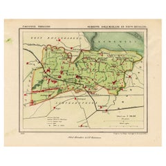
Antique Map of Kollumerland, a Township in Friesland, The Netherlands, 1868
Located in Langweer, NL
Antique map titled 'Provincie Friesland - Gemeente Kollumerland en Nieuw-Kruisland'.
Map of the township of Kollumerland including Kollum, Westergeest, Burum and many other villa...
Category
Antique 19th Century Maps
Materials
Paper
$124 Sale Price
20% Off
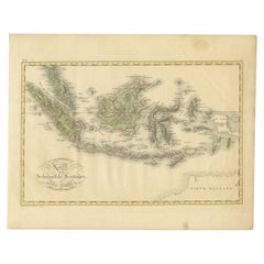
Antique Map of the Dutch East Indies by Van den Bosch '1818'
Located in Langweer, NL
Antique map titled 'Kaart der Nederlandsche Bezittingen in Oost-Indiën'.
Rare and attractive map of the Dutch East Indies, it shows the Dutch possessions in the 19th century. This ...
Category
Antique Early 19th Century Maps
Materials
Paper
$1,337 Sale Price
20% Off
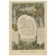
Hand Colored Antique Map of the department of Lozere, France
By Victor Levasseur
Located in Langweer, NL
Antique map titled 'Dept. de la Lozère'. Map of the French department of Lozere, France. This remote mountainous part of Languedoc is rural, sparcely populated, and extremely beautif...
Category
Antique Mid-19th Century Maps
Materials
Paper
$324 Sale Price
20% Off
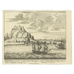
Antique Print of Gibraltar, c.1720
Located in Langweer, NL
Antique print titled 'Gibraltar verovert door de Pr. van Hessen Darmstadt (..)'. Copper engraving of the capture of the fortified town of Gibraltar in 1704 during the War of the Span...
Category
Antique 18th Century Prints
Materials
Paper
$420 Sale Price
20% Off
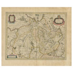
Antique Map by Janssonius of the Dutch Province of Overijsel, ca.1650
Located in Langweer, NL
Very good, given the age. Center fold as issued with wide margins. Sharp print with beautiful old-fashioned colouring, carbon copy on verso. Paper in the margins somewhat browned.
Category
Antique 1650s Maps
Materials
Paper
$420 Sale Price
20% Off
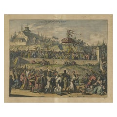
Original Copper Engraving with View of the Palace and Chinese Emperor, ca.1700
Located in Langweer, NL
Title: "The Station used by the great Mandaryns Staetsie der groote Mandarijns / The Station used by the great Mandaryns Staetsie der groote Mandarijns. 1665.
The richly illustrat...
Category
Antique Early 1700s Prints
Materials
Paper
$229 Sale Price
20% Off
Antique Map of the Township of Vries in the Dutch Province of Drenthe, 1865
Located in Langweer, NL
Drenthe: Gemeente Vries, Bunne, Donderen, Tijnaarloo, Zeijen. These scarse detailed maps of Dutch Towns originate from the 'Gemeente-atlas' of Jacob Kuyper. This atlas of all towns i...
Category
Antique 19th Century Maps
Materials
Paper
$133 Sale Price
20% Off
Rare Antique Miniature Map of Pakistan, India and Cambaia, ca.1616
Located in Langweer, NL
Old 17th century miniature antique map of 'Cambaia' , from the 1616 edition of Jadocus Hondius Atlas by Petrus Bertius.
Original copperplate engraving with hand coloring.
Carto...
Category
Antique 17th Century Maps
Materials
Paper
$372 Sale Price
20% Off
Antique Map of the Rhine centered on Cologne, Germany, with original coloring
Located in Langweer, NL
Antique map titled 'Archiepsiscopatus et Electoratus Coloniensis (..)'. Original antique map of the Rhine river, centered on Cologne, Germany. The Rhine River cuts across this map fr...
Category
Antique Early 18th Century Maps
Materials
Paper
$515 Sale Price
20% Off
Antique Map of Celtic Europe by Cluver, 1678
Located in Langweer, NL
Antique map Europe titled 'Europam sive Celticam Veterem'. Rare map of Celtic Europe. Made after A. Ortelius, originates from 'Introductionis in uni...
Category
Antique 17th Century Maps
Materials
Paper
$286 Sale Price
20% Off
Antique Map of the Region of Twente, in The East of The Netherlands, 1884
Located in Langweer, NL
Antique map titled 'Twente '. Old map of the region of Twento including cities and villages like Oldenzaal, Delden and Hengelo. This map orginates from 'Atlas behoorende bij Wandelin...
Category
Antique 19th Century Maps
Materials
Paper
$152 Sale Price
20% Off
Large Antique County Map of Northumberland, England
Located in Langweer, NL
Antique map titled 'A Map of Northumberland from the best Authorities'. Original old county map of Northumberland, England. Engraved by John Cary. Originates from 'New British Atlas'...
Category
Antique Early 19th Century Maps
Materials
Paper
$229 Sale Price
20% Off
Original Antique Map of England and Wales with Large Cartouche
Located in Langweer, NL
Antique map titled 'Le Royaume d'Angleterre divisé en plusieurs Parties (..)'. Large and rare map of England and Wales by J.B. Nolin after Coronelli. With decorative cartouche, table...
Category
Antique Late 17th Century Maps
Materials
Paper
$420 Sale Price
20% Off
Antique Map of the British Isles by Delamarche, 1806
Located in Langweer, NL
Antique map titled 'Les Isles Britanniques.' Decorative map of the British Isles by Robert de Vaugondy, revised and published by Delamarche. Source unkno...
Category
Antique 19th Century Maps
Materials
Paper
$143 Sale Price
20% Off
Large Antique County Map of Huntingdonshire, England
Located in Langweer, NL
Antique map titled 'A Map of Huntingdonshire from the best Authorities'. Original old county map of Huntingdonshire, England. Engraved by John Cary. Originates from 'New British Atla...
Category
Antique Early 19th Century Maps
Materials
Paper
$219 Sale Price
20% Off
Antique Map of the Coast of Guinea from, Cape Apollonia to the Volta River
Located in Langweer, NL
Antique map titled 'Suite de la Coste de Guinée (..) - Vervolg van de Kust van Guinée (..)'. Decorative map of the coast of Guinea from, Cape Apollonia to the Volta River. Engraved b...
Category
Antique Mid-18th Century Maps
Materials
Paper
$343 Sale Price
20% Off
Antique Map of the Islands Near Ceylon by Baldaeus, 1672
By Philip Baldaeus
Located in Langweer, NL
Antique print, untitled. This original antique print shows the islands Leyden, Middelburg, Hammenhiel, Bramines, Dona Clara and Deserta near Ceylon / Sri Lanka, with their Dutch name...
Category
Antique 17th Century Maps
Materials
Paper
$119 Sale Price
20% Off
Antique Map of the Santa Cruz Islands with Inset of Carteret and Gower Islands
Located in Langweer, NL
Antique map titled 'Isles de la Reine Charlotte (..)'. A detailed chart of the Santa Cruz islands, to the north of the New Hebrides, with Carteret's track in "Swallow"; including an ...
Category
Antique Late 18th Century Maps
Materials
Paper
$286 Sale Price
20% Off
Antique Map of France Showing Post-Napoleonic Departments, 1816
Located in Langweer, NL
Antique map of France titled 'France divided into departments'. Detailed map of France, colored by post-Napoleonic Departments. With an inset map of Corsica...
Category
Antique 19th Century Maps
Materials
Paper
$267 Sale Price
20% Off
Old Antique Print of Fort Noordwijk, Batavia in the Dutch East Indies, 1739
Located in Langweer, NL
Antique print titled 'Ein Prospect des Forts Nortweijck, wie sich dasselbe wan man von Jacatra komt, mit seiner Gegend präsentiret'.
Old print of Fort Noordwijk, Batavia (Jakarta). This print originates from from 'Allerneuester Geographische- und Topographischer Schau-platz, von Africa und Ost-Indien'.
Artists and Engravers: Johann Wolfgang Heydt, a German artist who worked for the Dutch East India...
Category
Antique 1730s Maps
Materials
Paper
$534 Sale Price
20% Off
Old Engraving of the Ruins of the Palace of Cleopatra in Old Egypt, Africa
Located in Langweer, NL
This plate shows views of the ruins of the Palace of Cleopatra, Egypt. Source unknown, to be determined. Artists and Engravers: Cornelis de Bruijn (also spelled Cornelius de Bruyn, p...
Category
Antique 18th Century Prints
Materials
Paper
Bird's-Eye Plan of Jerusalem in Israël, a Rare Original Engraving, 1750
Located in Langweer, NL
Antique map titled 'De VIIde Landkaart Verbeeldende de Stad Jerusalem Beneven de daar Omgelegen Bergen en Dalen (..).'
Bird's-eye plan of Jerusalem in Israel. This map shows the mo...
Category
Antique 18th Century Maps
Materials
Paper
$716 Sale Price
20% Off
Original Engraved Antique Map of the World, Colorful and Decorative, C.1780
By Pierre François Tardieu
Located in Langweer, NL
Antique map titled 'Mappemonde en Deux Hemispheres ou l'on a Indique les Nouvelles Decouvertes' - This handsome double hemisphere map presents a ...
Category
Antique 18th Century Maps
Materials
Paper
$448 Sale Price
20% Off
Antique Print of Haridwar City in Uttarakhand, India, 1837
Located in Langweer, NL
Antique print titled 'Hurduwar in Ostindien'. View of Haridwar, India, seen from the Ganges River. This print originates from 'Meyer´s Universum oder Abbildung und Beschreibung des S...
Category
Antique 19th Century Prints
Materials
Paper
$85 Sale Price
20% Off
Antique Map of the Township of Muntendam in Groningen, the Netherlands, 1862
Located in Langweer, NL
Groningen: Gemeente Muntendam. These scarse detailed maps of Dutch Towns originate from the 'Gemeente atlas van de Provincie Groningen in 62 kaarten.' by C. Fehse. This atlas of all ...
Category
Antique 19th Century Maps
Materials
Paper
$181 Sale Price
20% Off
Antique Map of the Township of Nijeveen in The Netherlands, 1865
Located in Langweer, NL
Drenthe: Gemeente Nijeveen, Kolderveen. These scarse detailed maps of Dutch Towns originate from the 'Gemeente-atlas' of Jacob Kuyper. This atlas of all towns in the Netherlands was ...
Category
Antique 19th Century Maps
Materials
Paper
$181 Sale Price
20% Off
Detailed Antique Map of Asia Minor & Cyprus with Historical Notes, 1732
Located in Langweer, NL
Antique map titled 'Carte De L'Asie Inferieure Selon Les Auteurs Anciens (..)'. Detailed map of Asia Minor & Cyprus. With historical notes. This original old antique print / plate or...
Category
Antique 18th Century Maps
Materials
Paper
$238 Sale Price
20% Off
Antique Map of the Burgundy Region by Mallet, c.1683
Located in Langweer, NL
Antique map titled 'Cercle de Bourgogne'. Detailed miniature map of the Burgundy region, France. Also shows the Netherlands and Belgium. Originates from Mallet's 'Description de l'Un...
Category
Antique 17th Century Maps
Materials
Paper
$81 Sale Price
20% Off
Antique Optica Print of Amsterdam from the Old Rampart, Netherlands, C.1760
Located in Langweer, NL
Antique print titled 'A view of Amsterdam tacken from the Old Rampart'. Beautiful view of Amsterdam, the Netherlands. This is an optical print, also called 'vue optique' or 'vue d'op...
Category
Antique 18th Century Prints
Materials
Paper
$420 Sale Price
20% Off
Map of the West African coast from the North of Mauretania to Guinee, 1788
Located in Langweer, NL
Antique map titled 'Particular Map of the Western Coast of Africa, from Cape Blanco to Cape de Verga, and of the Course of the Rivers Senega and Gambia.'
Map of the African coast...
Category
Antique 1780s English Maps
Materials
Paper
$362 Sale Price
20% Off
Antique Map of Delfland by Cruquius, 1712
Located in Langweer, NL
Map no. 25 of a large wall map of Delfland, The Netherlands. The map covers the region of Polder Berkel. To the right, coat of arms of 'De Staten van Ho...
Category
Antique 18th Century Maps
Materials
Paper
$706 Sale Price
20% Off
Antique Colourful Antique Map of Spain and Portugal, 1815
Located in Langweer, NL
Antique map of Spain and Portugal. Thomson's map includes both countries in full, with Spain being divided into its various semi-autonomous provin...
Category
Antique 1810s Maps
Materials
Paper
$276 Sale Price
20% Off
Vintage Print of the Lady of Stavoren by Voskuijl, 1946
Located in Langweer, NL
Vintage lithograph titled 'Vrouwtje van Stavoren'. Lithograph of the Lady of Stavoren, a folk tale from the Netherlands which originated in the 16th century. Published 1946.
Arti...
Category
20th Century Maps
Materials
Paper
$276 Sale Price
20% Off
Late 16th Century Sheet with Copper Engravings of India, Pakistan, etc, 1598
Located in Langweer, NL
One sheet with two engraved maps, one on each site, and text in Italian. Late 16th century copper engravings in great condition, considering its age.
"Tavola Decima Dell'Asia" - Tabula Asiae X" Plate X (10). Pakistan, Cashmir, Bangla Desh, North-India...
Category
Antique 16th Century Maps
Materials
Paper
$534 Sale Price
20% Off
Antique Map of the Cape Verde Islands, Africa, ca.1670
Located in Langweer, NL
Antique map titled 'Pascaert van de Soute Eylanden ofte Ilhas de Cabo Verde'.
This map depicts the Cape Verde Islands (Africa). Islands titled 'Ile de B...
Category
Antique 1670s Maps
Materials
Paper
$630 Sale Price
20% Off
Antique Map of Leeuwarden and Surroundings, in Friesland, the Netherlands, 1865
Located in Langweer, NL
Friesland: Gemeente Leeuwarden. These scarse detailed maps of Dutch Towns originate from the 'Gemeente-atlas' of Jacob Kuyper. This atlas of all towns in the Netherlands was publishe...
Category
Antique 19th Century Maps
Materials
Paper
$210 Sale Price
20% Off
Antique Print of a Cap and Glove by Gibb, 1890
Located in Langweer, NL
Antique print titled 'Skull Cap of King Charles I - Glove of King Charles I'. Chromolithographic plate originating from 'The Royal House of Stuart. Illustrated by a Series of Forty P...
Category
Antique 19th Century Prints
Materials
Paper
$81 Sale Price
20% Off
Antique Map of the Township of Westerbork, Drenthe in the Netherlands, 1865
Located in Langweer, NL
Drenthe: Gemeente Westerbork, Elp, Zwiggelte, Orvelte. These scarse detailed maps of Dutch Towns originate from the 'Gemeente-atlas' of Jacob Kuyper. This atlas of all towns in the N...
Category
Antique 19th Century Maps
Materials
Paper
$210 Sale Price
20% Off
Leicestershire – Antique Map of Leicester by Richard Blome, Britannia 1673
Located in Langweer, NL
Leicestershire – Antique Map of Leicester by Richard Blome, Britannia 1673
This original antique map titled A Mapp of the Country of Leicester presents a detailed and decorative dep...
Category
Antique Late 17th Century English Maps
Materials
Paper
$420 Sale Price
20% Off
Antique Map of the War Situation in Europe and Asia, 1944
Located in Langweer, NL
Antique map titled 'Newsmap for the Armed Forces'. This "newsmap" was issued on Monday, December 18, 1944, and covers the news from December 6-13, 1945 - the 275th week of the war. T...
Category
20th Century Maps
Materials
Paper
$716 Sale Price
20% Off
Handcolored Antique Print of the Marine Administration of the Belgium Army, 1833
Located in Langweer, NL
One nicely hand coloured print of an original serie of 23 plates, showing marine officers and soldiers discussing matters on the seaside. published in 1833. Rare.
From a serie of beautiful lithographed plates with Belgian military costumes after Madou and printed by Dero-Becker. Comes from a Belgian military costume album, dedicated to the Belgian King, and financed by subscribers, some 90 Belgian nobility and officers of the Belgian Army...
Category
Antique 1830s Arms, Armor and Weapons
Materials
Paper
$210 Sale Price
20% Off
Antique Plan of Batavia and the Castle in the Dutch East Indies, 1763
Located in Langweer, NL
Antique map titled 'Grundriss von der Stadt und dem Schlosse Batavia.' Plan of the city and the castle of Batavia in the Dutch East Indies / Indonesia. From 'Algemeine Welthistorie (...
Category
Antique 18th Century Maps
Materials
Paper
$372 Sale Price
20% Off
Beautiful Antique Print of Garden Architecture by Van Laar, 1802
Located in Langweer, NL
Untitled print of garden architecture. It shows a garden building.
This print originates from 'Magazijn van tuin-sieraden'. The book is compile...
Category
Antique 19th Century Prints
Materials
Paper
$124 Sale Price
20% Off
Miniature Map of England and Wales with Hand Coloring
Located in Langweer, NL
Antique map titled 'England and Wales'. An attractive miniature map of England and Wales enhanced with hand coloring. Originates from Cary's 'Traveller'...
Category
Antique Late 18th Century Maps
Materials
Paper
$248 Sale Price
20% Off
Original Hand-Colored Antique Map of Gelderland and Utrecht in the Netherlands
Located in Langweer, NL
Antique map titled 'Ducatus Geldriae novissima descriptio'. Detailed map of Gelderland, a province in the Netherlands. Two coats of arms, one with scale. Ships on ‘De Zuyderzee’. Pub...
Category
Antique Mid-17th Century Maps
Materials
Paper
$716 Sale Price
50% Off
Large Antique County Map of Derbyshire, England
Located in Langweer, NL
Antique map titled 'A Map of Derbyshire from the best Authorities'. Original old county map of Derbyshire, England. Engraved by John Cary. Originates from 'New British Atlas' by John...
Category
Antique Early 19th Century Maps
Materials
Paper
$267 Sale Price
20% Off
Old Map of the Moluccas and Part of Sulawesi Indonesia by Vandermaelen, c 1825
Located in Langweer, NL
Antique map titled 'Partie des Iles Moluques'. Map of a portion of the Moluccas and part of Sulawesi. Includes the Maluku islands Buru, Sula, Bacan and more. Originates from 'Atlas U...
Category
Antique 19th Century Maps
Materials
Paper
$601 Sale Price
20% Off
Antique Map the Windward or South Caribbean Islands and Guiana, 1859
Located in Langweer, NL
Antique map titled 'The Windward or South Caribbean Islands'. Original antique map of South Caribbean Islands. This map originates from ‘The Imperial Atlas of Modern Geography’. Published by W. G. Blackie, 1859.
The Windward Islands, also known as the Islands of Barlovento, are the southern, generally larger islands of the Lesser Antilles. Part of the West Indies, they lie south of the Leeward Islands...
Category
Antique Mid-19th Century Maps
Materials
Paper
$248 Sale Price
20% Off
Antique German Print of Macau or Macao in Asia, Published Around 1800
Located in Langweer, NL
Description: Antique print China titled 'Ansicht der Stadt Macao von der See Seite'. Miniature view of the city of Macao/Macau, China. The scene il...
Category
Antique Early 19th Century Maps
Materials
Paper
$152 Sale Price
20% Off
Antique Map of the City of Leeuwarden by Priorato, 1673
Located in Langweer, NL
Antique map titled 'Leverden'. This map depicts the city of Leeuwarden (Friesland, The Netherlands). This original antique print originates from 'Teatro del Belgio (…)', published in...
Category
Antique 17th Century Maps
Materials
Paper
$114 Sale Price
20% Off
Antique Print of Various Island in French Polynesia, circa 1774
Located in Langweer, NL
Two antique maps on one sheet titled 'Havre d'Ohamaneno a Ulietea' and Havre d'Oopoa a Ulietea'. Also with German subtitles. The upper image depicts Ohamaneno (Vaiaau) Harbour Raiatea (Ulietea) - Leeward Islands...
Category
Antique 18th Century Prints
Materials
Paper
$229 Sale Price
20% Off
Original Antique Map of the Maluku Islands or Moluccas
Located in Langweer, NL
Antique map titled 'Carte Particuliere des Isles Moluques - Byzondere Kaart der Molukze Eylanden'. This map depicts the islands of Herij, Ternate, Tidor, Pottebackers, Timor, Machian...
Category
Antique Mid-18th Century Maps
Materials
Paper
$181 Sale Price
20% Off
Antique Map of Part of Borneo 'Kalimantan' Indonesia, by Vandermaelen, C.1825
Located in Langweer, NL
Antique map titled 'Partie de l'Ile de Bornéo'. Map of a portion of Borneo, primarily the Southern part of the Island, the Strait of Macassar and the Staffinaff Islands. Originates f...
Category
Antique 19th Century Maps
Materials
Paper
$592 Sale Price
20% Off
Antique Map of Switzerland by Homann Heirs, c.1732
Located in Langweer, NL
Antique map titled 'Potentissimae Helvetiorum Reipublicae (..)'. Beautiful detailed map of Switzerland, showing the 13 cantons. The large title cartouche showing 13 coat of arms of t...
Category
Antique 18th Century Maps
Materials
Paper
$375 Sale Price
20% Off
Original Antique Hand-Colored Optica Print of the Hague, C.1760
Located in Langweer, NL
Antique print titled 'Vue de la Haye en Hollande - Prospect von Gravenhag in Holland'. Beautiful view of The Hague, the Netherlands. This is an optical print, also called 'vue optiqu...
Category
Antique 18th Century Prints
Materials
Paper
$343 Sale Price
20% Off
Original Hand-Colored Antique Regional Map of Switzerland, 1753
Located in Langweer, NL
Antique map Switzerland titled 'Territorium Reipublicae liberae Helveticae Scaphusiensis (..)'. Regional map of Switzerland.
Artists and En...
Category
Antique 1750s Maps
Materials
Paper
$563 Sale Price
20% Off
Large Antique County Map of Durham, England
Located in Langweer, NL
Antique map titled 'A Map of Durham from the best Authorities'. Original old county map of Durham, England. Engraved by John Cary. Originates from 'New ...
Category
Antique Early 19th Century Maps
Materials
Paper
$248 Sale Price
20% Off
Rare Print of the Governor-General's Residence in Batavia 'Jakarta', Indonesia
Located in Langweer, NL
Antique print titled 'Ein Prospect Sr. Hoch-Edelheit des Herrn Gen: Gouverneurs Hoff und Wohnhausses in dem Castel Batavia wie dasselbe von innen anzusehen'. Old print with a view of the Governor...
Category
Antique 18th Century Prints
Materials
Paper
$620 Sale Price
20% Off
Antique Map of the Wadden Islands, 1792
Located in Langweer, NL
Antique map titled 'Der Vlie Strom'. Map of the Wadden islands with Vlieland in the middle (The Netherlands). This map originates from 'Schauplatz der fünf Theile der Welt' published...
Category
Antique 18th Century Maps
Materials
Paper
$334 Sale Price
20% Off
Antique Map of the Region of Fulda by Homann, c.1730
Located in Langweer, NL
Antique map titled 'S.R.I. Principatus Fuldensis in Buchonia'. Rare edition of the large JB Homann map of the principality of Fulda, Germany.
Artists and Engravers: Johann Baptist...
Category
Antique 18th Century Maps
Materials
Paper
$186 Sale Price
20% Off
Recently Viewed
View AllMore Ways To Browse
Statutes And Sculptures
Swedish Gustavian Glass Cabinet
Swiss Chalet Chairs
Tea Cup Art Nouveau
Tea Cup Holder
Teak Buddha
Teak Gentlemans
Thomasville Hollywood Regency
Thomire Clock
Three Legged Vessel
Three Tier Serving Trays
Tibet Earring
Tibetan Antique Cabinet
Tiffany And Co China
Tiffany Blue Rims
Tiffany Sterling Ice Tea Spoons
Torchiere Sculpture
Tortoise Christian Dior
