Items Similar to Vintage Print of the Lady of Stavoren by Voskuijl, 1946

Want more images or videos?
Request additional images or videos from the seller
1 of 6
Vintage Print of the Lady of Stavoren by Voskuijl, 1946
About the Item
Vintage lithograph titled 'Vrouwtje van Stavoren'. Lithograph of the Lady of Stavoren, a folk tale from the Netherlands which originated in the 16th century. Published 1946.
Artists and Engravers: Gijs Voskuijl.
Condition: Very good, passe-partout/matting included. Please study image carefully.
Date: 1946
Overall size: 35 x 35 cm.
We sell original antique maps to collectors, historians, educators and interior decorators all over the world. Our collection includes a wide range of authentic antique maps from the 16th to the 20th centuries. Buying and collecting antique maps is a tradition that goes back hundreds of years. Antique maps have proved a richly rewarding investment over the past decade, thanks to a growing appreciation of their unique historical appeal. Today the decorative qualities of antique maps are widely recognized by interior designers who appreciate their beauty and design flexibility. Depending on the individual map, presentation, and context, a rare or antique map can be modern, traditional, abstract, figurative, serious or whimsical. We offer a wide range of authentic antique maps for any budget.
- Dimensions:Height: 13.78 in (35 cm)Width: 13.78 in (35 cm)Depth: 0 in (0.01 mm)
- Materials and Techniques:
- Period:
- Date of Manufacture:1946
- Condition:Good, given age. A few spots in the margins. Original folds as issued. General age-related toning and/or occasional minor defects from handling. Please study image carefully.
- Seller Location:Langweer, NL
- Reference Number:
About the Seller
5.0
Platinum Seller
These expertly vetted sellers are 1stDibs' most experienced sellers and are rated highest by our customers.
Established in 2009
1stDibs seller since 2017
1,932 sales on 1stDibs
Typical response time: <1 hour
- ShippingRetrieving quote...Ships From: Langweer, Netherlands
- Return PolicyA return for this item may be initiated within 14 days of delivery.
More From This SellerView All
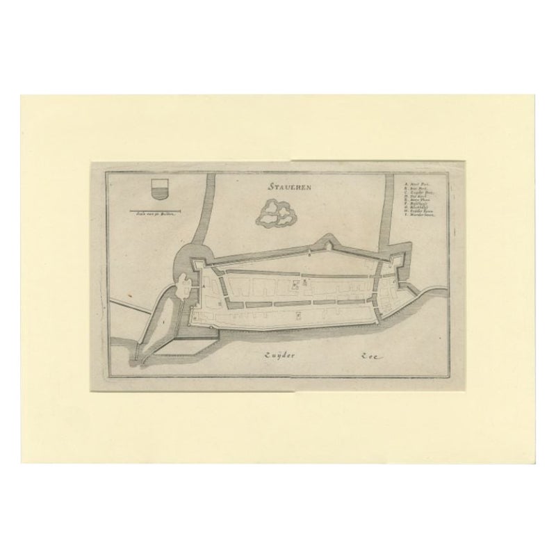
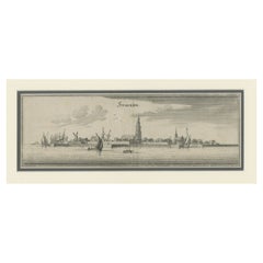
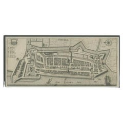
- Antique Print of the Frisian Harbour City of Stavoren in the Netherlands, 1659Located in Langweer, NLAntique print titled 'Stavern'. Panoramic view of the city of Stavoren, Friesland. This print originates from 'Topographia Germaniae Inferioris'. Artists and Engravers: Matthaus M...Category
Antique 17th Century Prints
MaterialsPaper
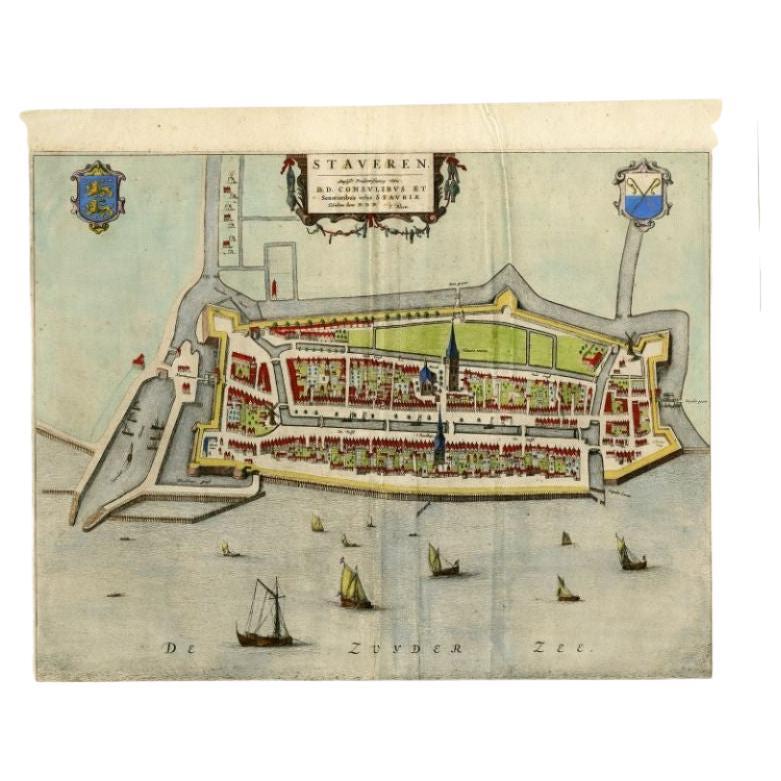
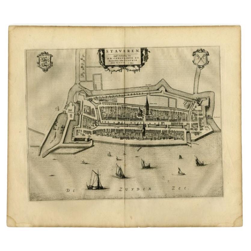
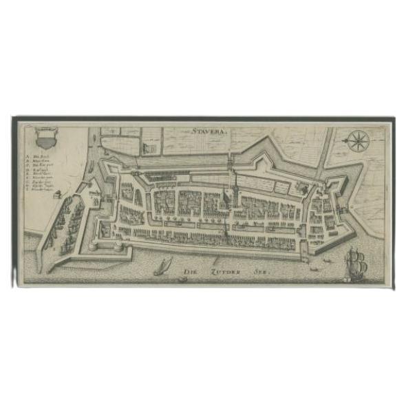
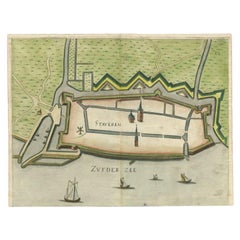
- Antique Map of the City of Stavoren by Merian, 1659Located in Langweer, NLAntique map titled 'Staveren'. Original antique map of the city of Stavoren, Friesland, the Netherlands. This map originates from 'Topographia Germania Inferioris' by C. Merian. Publ...Category
Antique 17th Century Maps
MaterialsPaper
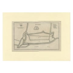
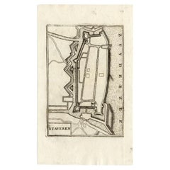
- Antique Map of Stavoren by Priorato, 1673Located in Langweer, NLAntique map titled 'Staveren'. Original antique map of the city of Stavoren, Friesland, the Netherlands. This map orginates from 'Teatro del Belgio (..)', published in Frankfurt am M...Category
Antique 17th Century Maps
MaterialsPaper
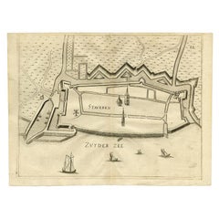
- Antique Map of Stavoren by Merian, c.1650Located in Langweer, NLAntique map titled 'Stavera'. Map of the city of Stavoren, Friesland. With German legend. Trimmed, originally published on one sheet with a map of Bolsward and Hindeloopen. Artists a...Category
Antique 17th Century Maps
MaterialsPaper
- Antique Map of Stavoren by Coronelli, 1706Located in Langweer, NLAntique map titled 'Staveren'. Rare antique map of the city of Stavoren, Friesland, the Netherlands. This map originates from 'Teatro della Guerra' by P. Coronelli, 1706. Artists and...Category
Antique 18th Century Maps
MaterialsPaper
- Antique Map of Stavoren by Priorato, 1673Located in Langweer, NLAntique map titled 'Staveren'. Original antique map of the city of Stavoren, Friesland, the Netherlands. This map orginates from 'Teatro del Belgio (..)', published in Frankfurt am M...Category
Antique 17th Century Maps
MaterialsPaper
You May Also Like
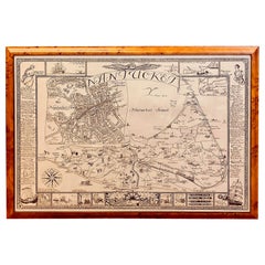
- Vintage Map of Nantucket Town by Ruth Haviland Sutton, 1946Located in Nantucket, MAVintage Map of Nantucket Town by Ruth Haviland Sutton, 1946, a classic vintage tourist map of Nantucket Island showing historic landmarks and geogr...Category
Vintage 1940s American Other Maps
MaterialsPaper
- Francois Linke 1855-1946, the Belle Epoque of French Furniture by C Payne (Book)Located in North Yorkshire, GBA beautiful hardback book which is in very good condition, with its dust jacket. Linke is considered by many to have been the greatest Parisian cabinet maker of his day when the worl...Category
Early 20th Century Books
MaterialsPaper
- "Lady Washington's Reception, " Engraved by A. H. Ritchie, Antique Print, 1865Located in Colorado Springs, COThis 1865, hand-colored engraving by A. H. Ritchie is entitled Lady Washington's Reception and is based on Daniel F. Huntington's original painting "Th...Category
Antique 1860s American Prints
MaterialsPaper
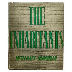
- The Inhabitants, Wright Morris, 1st Edition, Scribner's, 1946Located in London, GBFirst Edition, published by Charles Scribner's Sons, New York & London, 1946. "The Inhabitants" is a stunning collection of photographs by the acclaimed artist and writer Wright Mor...Category
Vintage 1940s American Mid-Century Modern Books
MaterialsPaper
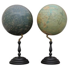
- Pair of Philip & Son Globes, circa 1946By George Philip & SonLocated in London, GBA wonderful set of Terrestrial and Celestial 12 inch globes by George Philip and Son. Presented on brass inclined plain mounts attached to original turned ebonized wooden bases and uprights with axes secured at the top by brass acorn finials. Unusually, the terrestrial globe has a copyright date shown under the cartouche, 1946. The celestial globe is printed in beige against a dark blue background and shows the constellations and many named stars. Solid lines connect the stars within constellations rather than illustrating them as mythological and other figures.? A cartouche is present that includes the title and maker's address. When looking at the stars from Earth the viewpoint is effectively inside a celestial sphere. The surface of a celestial globe shows the star field as a projection viewed from the outside and is therefore reversed, with the constellations appearing as their mirror images. The terrestrial globe is printed in several colours and comprises of twelve coated lithographic paper gores with polar calottes over a twelve inch card sphere. The age of the globe has been confirmed by the political borders and named cities displayed. The globe is nicely detailed and has a grid network of parallels and meridians. It shows all the continents and countries as they were at the time it was printed and also indicates all the principal steamship routes with distances in nautical miles. The globe also has a printed Analemma - a diagram showing the declination of the Sun for every day in the year and the equation of time. The Analemma therefore shows the position of the Sun in the sky as seen from a fixed location on Earth at the same mean solar time, as the sun's position varies over the course of a year. A cartouche is present that includes the title and maker's address. Dimensions of each globe: 30.5 cm/12 inches (diameter) x 59 cm/23 1/4 inches (max height). George Philip, (1800–1882) was a cartographer and map publisher. He founded George Philip & Sons in 1834 in Liverpool primarily as a bookseller and stationer, but rapidly expanding to become a publisher of primarily maps, atlases and educational works. He had one son, also George (1823–1902), who was admitted to the business in 1848. George senior was born in Huntly, Aberdeenshire and by 1819 he had become assistant to the Liverpool bookseller, William Grapel before going on to start his own business. He used cartographers (such as John Bartholomew the elder, August Petermann, and William Hughes) to produce maps on copper plates. Philip then had these printed and hand-coloured by his women tinters. The business expanded rapidly and by the time he produced his county maps of 1862 he was using machine...Category
Vintage 1940s British Globes
MaterialsBrass
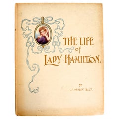
- The Life of Emma, Lady Hamilton by J T Herbert Baily, 1st EdLocated in valatie, NYThe Life of Emma, Lady Hamilton by J T Herbert Baily. Published by Menzies London, 1905. 1st Ed hardcover no dust jacket as published. 137 untrimmed pages with all 23 portraits of Lady Hamilton each with a tissue guard. Dame Emma Hamilton...Category
Antique Early 1900s English Books
MaterialsPaper


Recently Viewed
View AllMore Ways To Browse
Leicestershire Antique Map
Alabama Antique Map
Antique Alabama Map
Berkshire Antique Map
Ontario Map
Warwickshire Antique Map
Antique Map Of Alabama
Heinrich Kiepert On Sale
Hertfordshire Antique Map
Poired Metal
Ruscelli Map
Antique Map Kentucky
Antique Map Tennessee
Antique Maps Of Tennessee
Huntingdonshire Antique Map
Mappemonde Antique
Tennessee Map
Antique Bermuda Maps