Antique Maps Cambridge
Antique 1830 Map of Eastern England with Suffolk, Norfolk Cambridge, Huntingdon
Located in Langweer, NL
Title: Antique 1830 Map of Eastern England with Suffolk, Norfolk, Cambridge, and Huntingdon
Category
1830s Antique Maps Cambridge
Materials
Paper
$408
H 10.44 in W 12.88 in D 0.01 in
Original Old Map of South East England Incl London, Oxford, Cambridge, Etc, 1633
Located in Langweer, NL
'.
Old map of south east England. Includes London, Salisbury, Oxford, Cambridge, Leicester and Norwich
Category
1630s Antique Maps Cambridge
Materials
Paper
$1,105 Sale Price / item
20% Off
H 16.15 in W 21.26 in D 0 in
Cambridge map 17th century engraving after John Speed
By John Speed
Located in London, GB
."
Pieter van den Keere (1571 - circa 1646) after John Speed (1551 or 1552 - 1629)
Map of Cambridgeshire
Category
1620s Antique Maps Cambridge
Materials
Engraving
Map of Cambridge, c.1572 engraving by Braun & Hogenberg
Located in London, GB
& Hogenberg
Map of Cambridge
Engraving with later hand colouring
34 x 45 cm
This map is taken from the
Category
16th Century Realist Antique Maps Cambridge
Materials
Engraving
$3,125
H 13.39 in W 17.72 in
Map of Cambridge 18th century engraving by Sutton Nichols
Located in London, GB
."
Sutton Nichols (1668 - 1729)
Map of Cambridgeshire
Engraving
43 x 36 cm
Signed in plate lower left.
A
Category
18th Century Antique Maps Cambridge
Materials
Engraving
Pieter van der Aa: Map of Cambridge, after David Loggan
By Pieter Van Der Aa
Located in London, GB
Pieter van der Aa (1659-1733), after David Loggan (1634–1692)
Map of Cambridge
12 x 16 cm
Engraving
Category
Early 18th Century Realist Antique Maps Cambridge
Materials
Engraving
$486
H 4.73 in W 6.3 in
Map of Cambridge, engraving Pieter van der Aa after David Loggan
By Pieter Van Der Aa
Located in London, GB
Pieter van der Aa (1659 - 1733), after David Loggan (1634 - 1692)
Map of Cambridge
Engraving
12 x
Category
Early 18th Century Realist Antique Maps Cambridge
Materials
Engraving
$388
H 4.73 in W 6.3 in
Mid 19th Century Pair of Framed English Maps of Oxford and Cambridge
Located in Los Angeles, CA
This pair of maps featuring Oxford and Cambridge is beautifully preserved in custom black wood
Category
19th Century English Victorian Antique Maps Cambridge
Materials
Paper, Wood
$1,875 / set
H 15.5 in W 19 in D 1.5 in
Michael Drayton 1622 Cambridgeshire Map for Poly-Olbion original antique vintage
By Michael Drayton
Located in London, GB
(1563-1631)
Map of Cambridge and the Isle of Ely (1622) engraved by William Hole for Drayton’s Poly
Category
1620s Surrealist Antique Maps Cambridge
Materials
Engraving
$902
H 9.45 in W 12.21 in D 0.04 in
Recent Sales
Antique Collegiate Map, Cambridge, English, Framed Cartography, Victorian, 1838
Located in Hele, Devon, GB
This is an antique collegiate map of Cambridge. An English, framed coloured lithograph of
Category
Early 19th Century British Early Victorian Antique Maps Cambridge
Materials
Glass, Wood, Paper
H 17.33 in W 19.3 in D 0.99 in
First Map of Cambridge in 1575, by Georg Braun and Franz Hogenberg
By Franz Hogenberg
Located in London, GB
Braun (German, 1541-1622) and Frans Hogenberg (German, Flemish 1535-1590)
Map of Cambridge (1575)
33 x
Category
16th Century Realist Antique Maps Cambridge
Materials
Engraving
People Also Browsed
Stowe Vermont Village Sleigh Ride, Mid Century Winter Figurative Landscape
By Walter Thomas Sacks
Located in Soquel, CA
Stowe Vermont Village Sleigh Ride - Mid Century Winter Figurative Landscape
A bright, crisp morning and a sleigh ride through new snow in Stowe, Vermont is this charming winter land...
Category
1940s Post-War Antique Maps Cambridge
Materials
Canvas, Oil
$2,700 Sale Price
22% Off
H 33 in W 28 in D 3 in
Large Original Antique Map of New Jersey, USA, circa 1900
Located in St Annes, Lancashire
Fabulous map of New Jersey
Original color
Engraved and printed by the George F. Cram Company, Indianapolis.
Published, circa 1900
Unframed
Repairs to minor edge tears
Category
1890s American Antique Maps Cambridge
Materials
Paper
Portrait of Anne, Lady Russell, later Countess of Bedford
By Anthony van Dyck
Located in London, GB
A three-quarter length portrait of Anne, Lady Russell, later Countess of Bedford (1615-1684), in a blue dress. Attributed to Sir Anthony Van Dyck.
Anne Carr, Lady Russell, an estee...
Category
17th Century Antique Maps Cambridge
Materials
Oil
$211,124 Sale Price
24% Off
H 53.125 in W 43.25 in
Antique Map of New England and Eastern Canada by Homann Heirs, circa 1755
Located in Langweer, NL
Antique map titled 'Partie Orientale de la Nouvelle France ou du Canada (..)'. Original antique map of New England and Eastern Canada made after J.N. Bellin. The map extends from Lak...
Category
Mid-18th Century Antique Maps Cambridge
Materials
Paper
$1,802 Sale Price
25% Off
H 21.07 in W 24.22 in D 0.02 in
Saint Michael Archangel López 18th Century Paint Oil on canvas Spanish school
Located in Riva del Garda, IT
18th-century Spanish Colonial School
Attributed to Juan Pedro López (Caracas, Venezuela, 1724 - 1787)
Saint Michael the Archangel
Oil on canvas
91 x 69 - Framed 105 x 85 cm
DETAIL...
Category
18th Century Old Masters Antique Maps Cambridge
Materials
Oil
$8,372 Sale Price
20% Off
H 41.34 in W 33.47 in
19th Century Victorian Cast Iron Tiled Fireplace Insert.
Located in Edinburgh, GB
A well balanced and pleasing 19th Century English cast iron fireplace insert with colourful tiles each side. A generous outer frame with a raised cast decorative border, a central ch...
Category
1880s English Victorian Antique Maps Cambridge
Materials
Iron
Old Rotary Telephone Bakelite Bell Telephone Company 1942
Located in Poperinge, BE
Cool vintage rotary telephone by Bell Telephone Company, Belgium, dated inside 1942.
This beautiful and elegant model has a bakelite horn and a black metal housing.
You know, these...
Category
1940s Belgian Antique Maps Cambridge
Materials
Metal
Mughal School, 18th century – Emperor Jahangir in his harem in flagrante delicto
Located in Middletown, NY
Emperor Jahangir in his harem surrounded by lotus blossoms; symbols of paradise itself.
Circa 1690. Gouache and ink with gold heightening on cream laid paper, 8 1/2 x 6 1/4 inches (...
Category
17th Century Rajput Antique Maps Cambridge
Materials
Gold
$800
H 8.27 in W 6.3 in
French 19th century Chickens in a landscape
By Charles-Emile Jacque
Located in Woodbury, CT
French 19th century Chickens in a landscape
Charles-Emile Jacque (23 May 1813 – 7 May 1894) was a French painter of animals (animalier) and engraver who was, with Jean-François Mill...
Category
1870s Victorian Antique Maps Cambridge
Materials
Oil, Wood Panel
$2,360 Sale Price
20% Off
H 13 in W 18 in
A 18ct Gold Nib Must de Cartier Platinum Cased Trinity Fountain Pen
By Cartier
Located in Reading, Berkshire
Vintage Cartier 18ct Gold Plated Nib Trinity Fountain Pen With Box
This Must de Cartier fountain pen has a body in engine turned silver metal with gadroon motif.
Finished with th...
Category
1980s French Art Deco Antique Maps Cambridge
Materials
Gold, Silver Plate
$1,236 / set
H 5.52 in W 2.37 in D 1.07 in
Bessarabian Rug, 1810
Located in New York, NY
Bessarabian rug, 1810
Russia, circa 1810
Tapestry woven carpet
Imperial Tapestry Factory, St. Petersburg
Having an Adamesque central medallion on a warm caramel ground, with swan...
Category
Early 19th Century Russian Antique Maps Cambridge
Materials
Wool
Portrait of a Gentleman in a Landscape, Scottish Portraiture, Portrait, Wealthy
Located in Grand Rapids, MI
John Pairman (Scottish, 1788 - 1843)
Signed: J Pairman 1820 (Lower, Right)
" Portrait of a Gentleman ", 1820
Oil on Canvas
22 1/4" x 18 5/8"
Housed in a 2 3/4" Husar Frame
Ove...
Category
Early 19th Century Antique Maps Cambridge
Materials
Canvas, Oil
$5,700 Sale Price
40% Off
H 27.5 in W 23.5 in
Portrait of Lady Caroline Price
By George Romney
Located in Miami, FL
DESCRIPTION: Perhaps the best Romney in private hands. If Vogue Magazine existed in the late 18th century, this image of Lady Caroline Price would be on one of its covers. The e...
Category
1970s Old Masters Antique Maps Cambridge
Materials
Oil, Canvas
Large 16th-17th Century Flemish tapestry
Located in Henley-on Thames, Oxfordshire
An important LARGE Flemish tapestry
16th-17th century
Old Testament subject of King Solomon, standing before his tent in armour and receiving a gift of two peacocks, from an old m...
Category
17th Century Belgian Baroque Antique Maps Cambridge
Materials
Textile
Mughal School, 17th century – Emperor Jahangir reclining in his harem
Located in Middletown, NY
An illuminated page from a book likely in reference to palace life during Emperor Jahangir's reign over the Mughal Empire.
Circa 1690. Gouache and ink with gold heightening on light...
Category
18th Century Rajput Antique Maps Cambridge
Materials
Gold
$1,000
H 10.79 in W 5.4 in
Mughal School, 18th century Emperor Jangahir on a pleasure boat with his harem a
Located in Middletown, NY
Emperor Jahangir depicted with his harem attendees aboard a pleasure cruise, the water filled with lotus blossoms; symbols of paradise itself.
Circa 1750. Gouache and ink with gold ...
Category
18th Century Rajput Antique Maps Cambridge
Materials
Gold
$850
H 5.4 in W 10.79 in
Get Updated with New Arrivals
Save "Antique Maps Cambridge", and we’ll notify you when there are new listings in this category.
Antique Maps Cambridge For Sale on 1stDibs
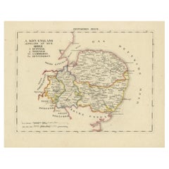
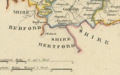
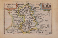
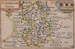
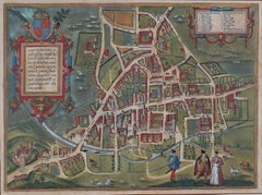
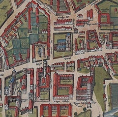
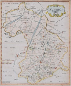
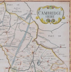
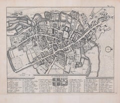
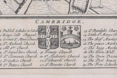
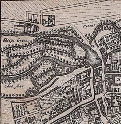
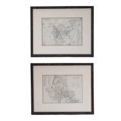
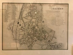
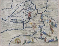
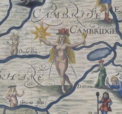
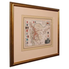
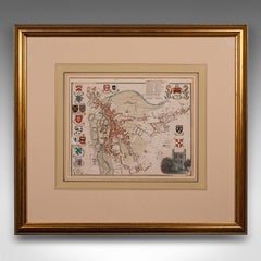
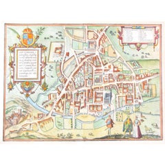
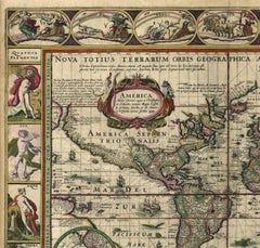
You are likely to find exactly the antique maps cambridge you’re looking for on 1stDibs, as there is a broad range for sale. There are many modern and Surrealist versions of these works for sale. Finding the perfect antique maps cambridge may mean sifting through those created during different time periods — you can find an early version that dates to the 18th Century and a newer variation that were made as recently as the 20th Century. If you’re looking to add an antique maps cambridge to create new energy in an otherwise neutral space in your home, you can find a work on 1stDibs that features elements of gray, beige, brown, white and more. Finding an appealing antique maps cambridge — no matter the origin — is easy, but
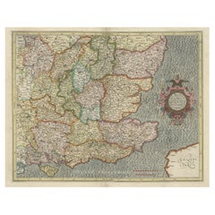
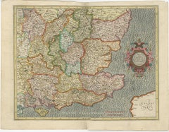
 Pieter Van Der Aa, Gerard Mercator, Frans Hogenberg, Michael Drayton and Oswald Birley each produced popular versions that are worth a look. Frequently made by artists working in engraving, paint and watercolor, these artworks are unique and have attracted attention over the years.
How Much is a Antique Maps Cambridge?
The price for an antique maps cambridge in our collection starts at $125 and tops out at $45,494 with the average selling for $344.