Hand Drawn Map
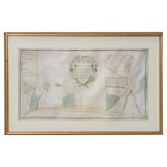
Mid-18th Century Hand Drawn English Farm Map on Vellum, circa 1740s
Located in San Francisco, CA
Mid-18th century hand drawn English farm map on Vellum circa 1740s
Henry Maxted & Isaac Terry
Category
Antique Mid-18th Century English Maps
Materials
Lambskin
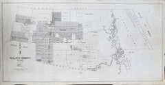
TEXAS WILLACY COUNTY MAP TEXAS AREA 1870s-1910 ORIGINAL HAND DRAWN
Located in San Antonio, TX
1900s
"Willacy County"
Early original hand drawn Texas County Maps (1870s-1910)
About 50 years ago or so
Category
Early 1900s Realist Landscape Drawings and Watercolors
Materials
Ink
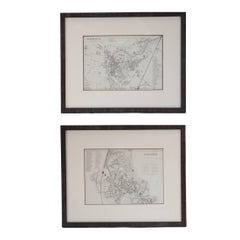
Mid 19th Century Pair of Framed English Maps of Oxford and Cambridge
Located in Los Angeles, CA
frames. These hand-drawn maps showcase exquisite lettering and a remarkable level of detail, exemplifying
Category
Antique 19th Century English Victorian Prints
Materials
Paper, Wood
$1,875 / set
H 15.5 in W 19 in D 1.5 in
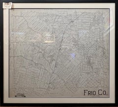
TEXAS FRIO COUNTY MAP PEARSALL TEXAS AREA 1870S-1910 ORIGINAL HAND DRAWN
Located in San Antonio, TX
Texas County Maps 1870s-1910
Image Size: 37 x 40
Frame Size: 43 x 47
Medium: Original Hand Drawn
Category
Early 1900s Realist Landscape Drawings and Watercolors
Materials
Ink
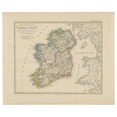
Ireland Map – Provincial and County Divisions 1851
Located in Langweer, NL
Hand-Atlas. The map was drawn and engraved by F. v. Stülpnagel, a noted German cartographer. It
Category
Antique Mid-19th Century German Maps
Materials
Paper
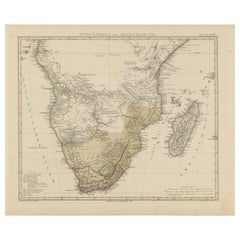
Southern Africa & Madagascar Antique Map – Beautiful 1857 Edition
Located in Langweer, NL
of Adolf Stieler’s renowned Hand-Atlas. The map was drawn and engraved under the direction of F. v
Category
Antique Mid-19th Century German Maps
Materials
Paper
$438
H 14.77 in W 17.88 in D 0.01 in
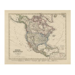
United States, Canada & Mexico – 1857 North America Map
Located in Langweer, NL
renowned Hand-Atlas. The map was drawn and engraved by F. v. Stülpnagel, a leading German cartographer of
Category
Antique Mid-19th Century German Maps
Materials
Paper
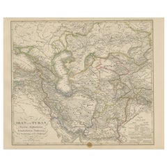
Iran and Turan Map – Persia, Afghanistan, Baluchistan, Turkestan 1858
Located in Langweer, NL
Adolf Stieler’s esteemed Hand-Atlas, the map was drawn and engraved by F. v. Stülpnagel.
The map
Category
Antique Mid-19th Century German Maps
Materials
Paper
$402
H 14.77 in W 17.88 in D 0.01 in
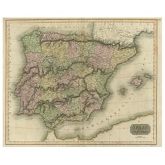
Antique Colourful Antique Map of Spain and Portugal, 1815
Located in Langweer, NL
prominent in the left hand quadrants of the map. Drawn & engraved for Thomson's New General Atlas
Category
Antique 1810s Maps
Materials
Paper
$274 Sale Price
20% Off
H 20.87 in W 27.96 in D 0 in
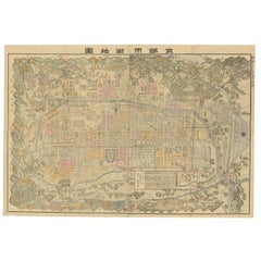
Historical Large Map of Kyoto, Japan (1905) - Published by Kobayashi
Located in Langweer, NL
that time.
2. Cartographic Style:
- The map is hand-drawn with meticulous detail, characteristic of
Category
Early 20th Century Maps
Materials
Paper
$1,658 Sale Price
20% Off
H 21.26 in W 30.91 in D 0.02 in
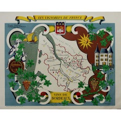
Stunning illustrated wine map by French artist Rémy Hétreau in the 1950s
Located in PARIS, FR
of the composition, a finely drawn map of Bordeaux highlights its most famous wine-growing areas
Category
1950s Prints and Multiples
Materials
Paper, Lithograph
$1,065
H 26.38 in W 33.47 in
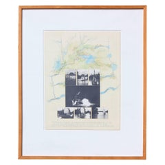
"Hog Bayou Ritual" Mixed Media Collage 1982
By Roy Fridge
Located in Houston, TX
Mixed media collage of hand drawn maps and photographs titled "Hog Bayou Ritual" by Roy Fridge
Category
1980s Modern Mixed Media
Materials
Watercolor, Photographic Paper, Pencil
Charte von Sud-America (Map of South America) - Etching with Hand-Drawn Outlines
Located in Soquel, CA
Map of south America, engraved by Franz Pluth (Czech, 1800-1871), from the book "Neueste Länder
Category
1820s Other Art Style More Prints
Materials
Paper, Printer's Ink, Etching
$260 Sale Price
20% Off
H 23 in W 19 in D 0.75 in
Framed Early 19th Century Drawn and Engraved Map of China
By John Knighton Thomson
Located in San Francisco, CA
Hand drawn and tinted engraved map of China dated 1815
Created for Thomson's New General Atlas
Category
Antique Early 19th Century European Prints
Materials
Paper
2012 Pomerol
Located in Bath, GB
Johan Berglund, and a number of hand-drawn maps by proprietors.
Condition
Bound in the publisher's
Category
2010s British Books
Materials
Paper
Through the Grand Canyon from Wyoming to Mexico, by Ellsworth L. Kolb, 1963
Located in Colorado Springs, CO
.” In total, there are actually 103 black and white plates, one color frontispiece, and one hand-drawn
Category
Vintage 1960s American Books
Materials
Fabric, Paper
$450
H 8.57 in W 6.63 in D 1.38 in
Antique Manuscript Map - Forest of Andely
Located in Houston, TX
Charming hand drawn ink and watercolor map of the Forest of Andely, in the Normandy area, France
Category
1890s More Art
Materials
Ink, Paper, Watercolor
Obsearvatorio Planetokirómano
By Pedro Friedeberg
Located in Ciudad de México, MX
upper level, hands—drawn as maps—allude to chiromancy, linking the human body to the order of the
Category
21st Century and Contemporary Abstract Expressionist Abstract Prints
Materials
Color
Map of Palestine or Judea, Illustrating the History of the New Testament
By Rev. Nathan B. Rogers
Located in New York, NY
engraving or printed publication, this precisely rendered wall map was entirely drawn by hand, the product
Category
19th Century More Art
Materials
Canvas, Paper, Ink, Pen
Recent Sales
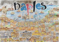
In Loving Memory of Naples - Map of the City, Painting, Watercolor on Watercolor
Located in Yardley, PA
Hand drawn and Hand Painted Map of the City of Napoli, Italy. Very detailed artwork. Artemisia
Category
2010s Other Art Style Drawings and Watercolor Paintings
Materials
Watercolor
American Revenue Cutter Service Ensign (Flag) Belonging to Cpt. William Bagley
Located in York County, PA
father).
(2) A tintype of a woman believed to be Laura Barnes Bagley.
(3) A map with hand-drawn
Category
Antique 1870s American Political and Patriotic Memorabilia
H 53.75 in W 81.25 in D 2.5 in
American Revenue Cutter Service Ensign Belonging To Capt. W. H. Bagley
Located in York County, PA
believed to be Laura Barnes Bagley.
(3) A map with hand-drawn notations by Bagley, detailing routes he
Category
Antique 1870s American Political and Patriotic Memorabilia
H 53.75 in W 81.25 in D 2.5 in
Map of New York City, Antique Hand-Colored Map, 1876
Located in Colorado Springs, CO
-published by J. Disturnell in 1876, as is shown here. The plan includes detailed hand-coloring. The map was
Category
Antique 1870s American Maps
Materials
Paper
Northern Italy Map – Lombardy, Venetia, Tuscany, and Sardinia 1857
Located in Langweer, NL
part of Adolf Stieler’s esteemed Hand-Atlas. The map was drawn and engraved by F. v. Stülpnagel. It
Category
Antique Mid-19th Century German Maps
Materials
Paper
Antique Map of Spain and Portugal by Thomson, 1815
Located in Langweer, NL
prominent in the left hand quadrants of the map. Drawn & engraved for Thomson's New General Atlas. Artists
Category
Antique 19th Century Maps
Materials
Paper
Kingdom of the Two Sicilies Map – Southern Italy and Sicily 1857
Located in Langweer, NL
as part of Adolf Stieler’s renowned Hand-Atlas, this map was drawn and engraved by F. v. Stülpnagel
Category
Antique Mid-19th Century German Maps
Materials
Paper
English Regency Period Framed Watercolor, Map of the West Indies & Caribbean Sea
Located in Philadelphia, PA
painted as a geography lesson, the subject is a hand drawn and colored map of the West Indies Islands in
Category
Antique Late 18th Century English Regency Paintings
Materials
Fruitwood, Paper
H 2 in W 14 in D 15.25 in
Dutchess County, American Guide Series, First Edition
Located in valatie, NY
and hand drawn plates with original folding maps. Great information about New York's Dutchess County
Category
Vintage 1930s American Books
Materials
Paper
SCHOOL GIRL HAND DRAWN MAP OF MASSACHUSETTS, circa 1815
Located in Essex, MA
Pen and ink school girl hand drawn map of Massachusetts, rendered in great detail with topography
Category
Antique 19th Century American Maps
Materials
Paper, Ink, Pen
Map of East Africa
Located in Middleburg, VA
This is a one-of-a-kind hand drawn and then hand-painted map of East Africa enlarged by Sgt. G
Category
Early 20th Century Maps
Vintage Nautical Map of the Mediterranean
Located in West Hollywood, CA
Vintage hand drawn nautical map chart tracing the routes and stops of the USS John W. Weeks while
Category
20th Century Unknown Maps
Materials
Wood
Very Rare Original 18th Century Ottoman Turkish Map - Mustafa II
Located in San Francisco, CA
Extremely rare, original 18th century Ottoman Turkish hand drawn and hand painted map of the
Category
Antique 18th Century and Earlier Turkish Nautical Objects
Materials
Paper
French Napoleon III Framed Hand Drawn Map of France, 1870s
Located in Austin, TX
A hand drawn map of France from the Napoleon III period in the 1870s. Signed by Marie Cretin. Frame
Category
Antique 1870s French Napoleon III Maps
Materials
Glass, Wood, Paper
Hand-Drawn School Girl Map of the United States, circa 1831
By Lydia Mudge
Located in Essex, MA
A wonderfully naive, yet accomplished hand-drawn school girl map of the United States, circa 1831
Category
Antique 1830s American Maps
People Also Browsed
Mid-Victorian Moorish wrought & cast iron pergola or decorative garden structure
Located in London, GB
A monumental Moorish mid-Victorian wrought iron Pergola or Decorative Garden Structure, a unique masterpiece in High Victorian Ironwork design. Our research confirms it is French, da...
Category
Antique Late 19th Century European Moorish Architectural Elements
Materials
Wrought Iron
$116,084
H 240 in W 552 in D 120 in
Mid Century Pair of Campaign Style Rosewood Stands
Located in Palm Beach, FL
Chic pair of vintage campaign style stands crafted in dramatic grained rosewood with a drawer and two doors each, burnished brass hardware and simple block feet. Perfect marriage of ...
Category
Mid-20th Century American Campaign Night Stands
Materials
Brass
Fine Vintage Laguna Pot Native American Pueblo
Located in London, GB
Fine Vintage Laguna Pot Native American Pueblo
Finely painted in linear geometric designs
Period 1970s signed on base R Reano
Condition Good
Category
20th Century American Native American Objects
Materials
Pottery
Antique Sliver Napkin Holder Swann Birds Decorative Tissue Organiser Home Décor
Located in Wembley, GB
Add a touch of vintage charm to your dinner table with this beautiful swan napkin holder. Crafted from high-quality metal with silver, it is the perfect addition to any home decor. T...
Category
Vintage 1960s British Art Deco Animal Sculptures
Materials
Metal, Silver Leaf, Sheet Metal, Sterling Silver, Silver Plate
$317 Sale Price
47% Off
H 6.11 in W 5.91 in D 1.97 in
Exceptional 19th Century English Chinoiserie Pagoda Display Cabinet
Located in Houston, TX
Large-scale 19th century English display cabinet executed in the Chinoiserie tradition. Constructed in carved mahogany and conceived as a tripartite architectural façade, each glazed...
Category
Antique 19th Century English Chinese Chippendale Vitrines
Materials
Glass, Mahogany
$187,500
H 102 in W 84.5 in D 22.5 in
Vintage Greek Mythology Warrior Wall Plate
Located in Elkhart, IN
A beautiful vintage decorative Greek wall plate featuring mythological warriors and a Greek key border
Greece, Mid-20th Century
Hand painted terracotta
Very good original vintage ...
Category
Mid-20th Century Greek Classical Greek Decorative Art
Materials
Terracotta, Paint
Pair Campaign Style Curio Display Cabinets by Henredon
By Henredon
Located in Dallas, TX
We are very pleased to offer a great pair of gorgeous, sleek and minimalist display cabinets made by the famous Henredon furniture makers, made in the USA. Part of Henredon’s early 1...
Category
Late 20th Century American Mid-Century Modern Cabinets
Materials
Brass
Campaign Style Lacquered Tall Fitted Cabinets by Henredon, Pair
By Henredon
Located in Dallas, TX
Vintage Campaign style chifforobes or cabinets, made by esteemed American manufacturer, Henredon. Part of Henredon’s early Scene One collection. Each cabinet professionally lacquered...
Category
Vintage 1970s American Campaign Cabinets
Materials
Brass
Pair of Anglo-Indian Campaign Style Rosewood Nightstands
By M. Hayat & Bros Ltd.
Located in Palm Beach, FL
Pair of British colonial five-drawer stands crafted in indigenous rosewood with paneled sides and tops, brass campaign hardware, and featuring brass inlaid floral designs. Attributed...
Category
20th Century Indian Anglo-Indian Night Stands
Materials
Rosewood
Handmade Antique Native American Navajo Rug 2.10' x 5.2', 1900s - 2B23
Located in Bordeaux, FR
Introducing our Handmade Antique Native American Navajo Rug, a captivating piece steeped in history. Measuring 2.10’ x 5.2’ (89cm x 158cm), this rug from the early 1900s is in good c...
Category
Antique Early 1900s North and South American Rugs
Materials
Wool
$3,031 Sale Price
20% Off
W 35.04 in L 62.21 in
19th Century Satsuma Japanese Hand Painted Porcelain Tea or Coffee Set 15 Pieces
By Satsuma
Located in Casale Monferrato, IT
Beautiful hand painted and gold porcelain tea or coffee set Satsuma Japanese 15 pieces, 1880s. The service is complete to serve six people at the table includes: 1 teapot, 1 sugar bo...
Category
Antique 1880s Japanese Porcelain
Materials
Porcelain
$1,776 / set
H 6.7 in W 7.49 in D 4.73 in
Botanical Elegance: A Triptych of 19th-Century Floral Art, 1896
Located in Langweer, NL
"Botanical Elegance: A Triptych of 19th-Century Floral Art"
An exquisite collection of original antique prints from "Favourite Flowers of Garden and Greenhouse" by the esteemed bot...
Category
Antique 1890s Prints
Materials
Paper
$322 Sale Price / set
20% Off
H 6.07 in W 9.53 in D 0 in
Authentic Talavera Decorative Vase Folk Art Vessel Mexican Ceramic Blue White
By Cesar
Located in Queretaro, Queretaro
Elegant white and blue vase made with the Talavera technique. Artist, Cesar Torres portraits the colonial art of Mexico.
The Talavera is not just a simple painted ceramic: its ex...
Category
21st Century and Contemporary Mexican Spanish Colonial Ceramics
Materials
Ceramic, Clay, Majolica
Antique Pair of English Campaign Chests
By Shapland & Petter
Located in Palm Beach, FL
Impressive pair of English antique five drawer campaign chests crafted in mahogany in a two piece construction with brass hardware and turned feet. Signed Shapland & Petter one of En...
Category
Early 20th Century English Campaign Commodes and Chests of Drawers
Materials
Brass
Native American Tomahawk
By Native American Art
Located in Coeur d'Alene, ID
Classic Native American Eastern Plains Indian tomahawk. With tulip shaped bowl and maple wire wrapped shaft. One tin cone drop with horse hair. Beautiful layered steel blade with dar...
Category
Early 20th Century American Native American Objects
Materials
Metal
Fornasetti Astrolabio plate series
By Fornasetti
Located in London, GB
Astrolabio series 2 of 2 ceramic and gold dishes by Piero Fornasetti. Italian with original malachite print decorated boxes.
Category
Vintage 1960s Italian Mid-Century Modern Ceramics
Materials
Ceramic
Get Updated with New Arrivals
Save "Hand Drawn Map", and we’ll notify you when there are new listings in this category.
Hand Drawn Map For Sale on 1stDibs
With a vast inventory of beautiful furniture at 1stDibs, we’ve got just the hand drawn map you’re looking for. Frequently made of paper, wood and ceramic, every hand drawn map was constructed with great care. Find 47 options for an antique or vintage hand drawn map now, or shop our selection of 2 modern versions for a more contemporary example of this long-cherished piece. Your living room may not be complete without a hand drawn map — find older editions for sale from the 18th Century and newer versions made as recently as the 21st Century. A hand drawn map is a generally popular piece of furniture, but those created in Baroque, Victorian and Georgian styles are sought with frequency. Many designers have produced at least one well-made hand drawn map over the years, but those crafted by Gerard Mercator, Antonio Zatta and G.F. Cruchley's are often thought to be among the most beautiful.
How Much is a Hand Drawn Map?
Prices for a hand drawn map can differ depending upon size, time period and other attributes — at 1stDibs, they begin at $50 and can go as high as $238,935, while the average can fetch as much as $1,737.
More Ways To Browse
Cape Dutch Furniture
Saint Estephe
Revenue Cutter
Eagle Of The French National Guard
Yixing Pottery
Ypsilanti Wicker
Yves Lohe
Zaccagnini Horse
Zanetti Glass Birds
1stdibs 50
12 Set Plates Fornasetti
14 Drawer Dresser
15th Century Corpus Christi
15th Century Corpus
16th Century Clothing
16th Century Sword
17th Century Safe
17th Century Spoon
