Hand Drawn Map
to
2
19
8
14
6
5
5
4
4
3
2
2
2
2
2
2
2
1
1
1
1
1
1
1
1
1
1
1
1
Sort By
Mid-18th Century Hand Drawn English Farm Map on Vellum, circa 1740s
Located in San Francisco, CA
Mid-18th century hand drawn English farm map on Vellum circa 1740s
Henry Maxted & Isaac Terry
Category
Antique Mid-18th Century English Maps
Materials
Lambskin
Extremely Large Hand-Drawn Manuscript Map of Surinam, 1830, History of Slavery
Located in Amsterdam, NL
A unique large hand-drawn map of Surinam by Albrecht Helmut Hiemcke (German, 1760-1839
Category
Antique Mid-19th Century Surinamer Maps
Materials
Paper
H 34.85 in W 97.05 in D 0.08 in
Very Large Hand-Drawn View of St Iago Cape Verde, by Frederici, 1783
Located in Amsterdam, NL
inwoonders op St Iago
(View of the island, and the roadstead of St. Iago. Drawn by Johann Christian
Category
Antique Late 18th Century Cape Verdean Dutch Colonial Maps
Materials
Paper
"Northern Flight" (2024) By Jen Greta Cart, Original Acrylic Painting on Panel
Located in Denver, CO
depicts a heron flying over a hand drawn map of the landscape below.
Category
2010s Impressionist Animal Paintings
Materials
Acrylic, Wood Panel
Mid 19th Century Pair of Framed English Maps of Oxford and Cambridge
Located in Los Angeles, CA
frames. These hand-drawn maps showcase exquisite lettering and a remarkable level of detail, exemplifying
Category
Antique 19th Century English Victorian Prints
Materials
Paper, Wood
Antique Colourful Antique Map of Spain and Portugal, 1815
Located in Langweer, NL
prominent in the left hand quadrants of the map. Drawn & engraved for Thomson's New General Atlas
Category
Antique 1810s Maps
Materials
Paper
Historical Large Map of Kyoto, Japan (1905) - Published by Kobayashi
Located in Langweer, NL
that time.
2. Cartographic Style:
- The map is hand-drawn with meticulous detail, characteristic of
Category
Early 20th Century Maps
Materials
Paper
Stunning illustrated wine map by French artist Rémy Hétreau in the 1950s
Located in PARIS, FR
of the composition, a finely drawn map of Bordeaux highlights its most famous wine-growing areas
Category
1950s Prints and Multiples
Materials
Paper, Lithograph
"Hog Bayou Ritual" Mixed Media Collage 1982
By Roy Fridge
Located in Houston, TX
Mixed media collage of hand drawn maps and photographs titled "Hog Bayou Ritual" by Roy Fridge
Category
1980s Modern Mixed Media
Materials
Watercolor, Photographic Paper, Pencil
Charte von Sud-America (Map of South America) - Etching with Hand-Drawn Outlines
Located in Soquel, CA
Map of south America, engraved by Franz Pluth (Czech, 1800-1871), from the book "Neueste Länder
Category
1820s Other Art Style More Prints
Materials
Paper, Printer's Ink, Etching
H 23 in W 19 in D 0.75 in
Framed Early 19th Century Drawn and Engraved Map of China
By John Knighton Thomson
Located in San Francisco, CA
Hand drawn and tinted engraved map of China dated 1815
Created for Thomson's New General Atlas
Category
Antique Early 19th Century European Prints
Materials
Paper
Engraved Commemorative Surinam Plantation Glass, History of 18th Century Slavery
Located in Amsterdam, NL
& Duisburg, Saltzhagen and another Saxen, but Halle in Saxen.
On an important large hand-drawn map in our
Category
Antique Mid-18th Century Surinamer Glass
Materials
Glass
H 3.71 in Dm 8.86 in
Antique Manuscript Map - Forest of Andely
Located in Houston, TX
Charming hand drawn ink and watercolor map of the Forest of Andely, in the Normandy area, France
Category
1890s More Art
Materials
Ink, Paper, Watercolor
Map of Palestine or Judea, Illustrating the History of the New Testament
By Rev. Nathan B. Rogers
Located in New York, NY
engraving or printed publication, this precisely rendered wall map was entirely drawn by hand, the product
Category
19th Century More Art
Materials
Canvas, Paper, Ink, Pen
SCHOOL GIRL HAND DRAWN MAP OF MASSACHUSETTS, circa 1815
Located in Essex, MA
Pen and ink school girl hand drawn map of Massachusetts, rendered in great detail with topography
Category
Antique 19th Century American Maps
Materials
Paper, Ink, Pen
In Loving Memory of Naples - Map of the City, Painting, Watercolor on Watercolor
Located in Yardley, PA
Hand drawn and Hand Painted Map of the City of Napoli, Italy. Very detailed artwork. Artemisia
Category
2010s Other Art Style Drawings and Watercolor Paintings
Materials
Watercolor
American Revenue Cutter Service Ensign (Flag) Belonging to Cpt. William Bagley
Located in York County, PA
father).
(2) A tintype of a woman believed to be Laura Barnes Bagley.
(3) A map with hand-drawn
Category
Antique 1870s American Political and Patriotic Memorabilia
H 53.75 in W 81.25 in D 2.5 in
American Revenue Cutter Service Ensign Belonging To Capt. W. H. Bagley
Located in York County, PA
believed to be Laura Barnes Bagley.
(3) A map with hand-drawn notations by Bagley, detailing routes he
Category
Antique 1870s American Political and Patriotic Memorabilia
H 53.75 in W 81.25 in D 2.5 in
Hand-Drawn School Girl Map of the United States, circa 1831
By Lydia Mudge
Located in Essex, MA
A wonderfully naive, yet accomplished hand-drawn school girl map of the United States, circa 1831
Category
Antique 1830s American Maps
Map of New York City, Antique Hand-Colored Map, 1876
Located in Colorado Springs, CO
-published by J. Disturnell in 1876, as is shown here. The plan includes detailed hand-coloring. The map was
Category
Antique 1870s American Maps
Materials
Paper
Antique Map of Spain and Portugal by Thomson, 1815
Located in Langweer, NL
prominent in the left hand quadrants of the map. Drawn & engraved for Thomson's New General Atlas. Artists
Category
Antique 19th Century Maps
Materials
Paper
English Regency Period Framed Watercolor, Map of the West Indies & Caribbean Sea
Located in Philadelphia, PA
painted as a geography lesson, the subject is a hand drawn and colored map of the West Indies Islands in
Category
Antique Late 18th Century English Regency Paintings
Materials
Fruitwood, Paper
H 2 in W 14 in D 15.25 in
Dutchess County, American Guide Series, First Edition
Located in valatie, NY
and hand drawn plates with original folding maps. Great information about New York's Dutchess County
Category
Vintage 1930s American Books
Materials
Paper
Map of East Africa
Located in Middleburg, VA
This is a one-of-a-kind hand drawn and then hand-painted map of East Africa enlarged by Sgt. G
Category
Early 20th Century Maps
Vintage Nautical Map of the Mediterranean
Located in West Hollywood, CA
Vintage hand drawn nautical map chart tracing the routes and stops of the USS John W. Weeks while
Category
20th Century Unknown Maps
Materials
Wood
Very Rare Original 18th Century Ottoman Turkish Map - Mustafa II
Located in San Francisco, CA
Extremely rare, original 18th century Ottoman Turkish hand drawn and hand painted map of the
Category
Antique 18th Century and Earlier Turkish Nautical Objects
Materials
Paper
French Napoleon III Framed Hand Drawn Map of France, 1870s
Located in Austin, TX
A hand drawn map of France from the Napoleon III period in the 1870s. Signed by Marie Cretin. Frame
Category
Antique 1870s French Napoleon III Maps
Materials
Wood, Paper, Glass
Get Updated with New Arrivals
Save "Hand Drawn Map", and we’ll notify you when there are new listings in this category.
Hand Drawn Map For Sale on 1stDibs
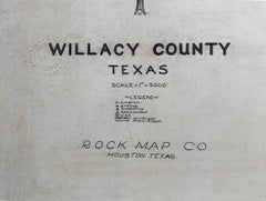
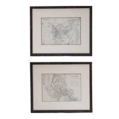
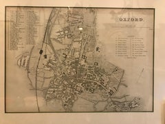
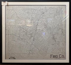
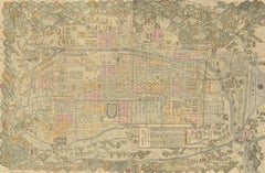
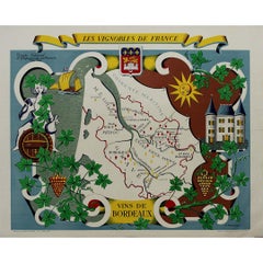
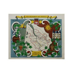
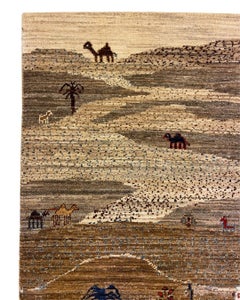
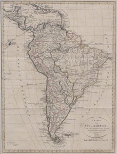
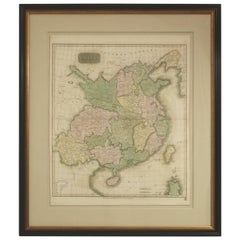
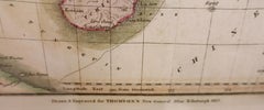
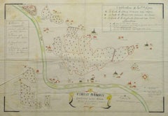
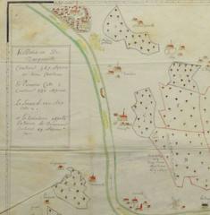
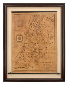
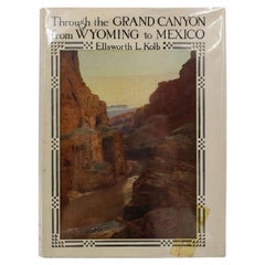
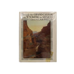
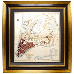
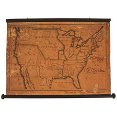
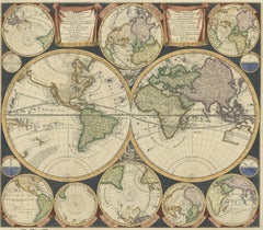
With a vast inventory of beautiful furniture at 1stDibs, we’ve got just the hand drawn map you’re looking for. Frequently made of paper, wood and ceramic, every hand drawn map was constructed with great care. Find 47 options for an antique or vintage hand drawn map now, or shop our selection of 2 modern versions for a more contemporary example of this long-cherished piece. Your living room may not be complete without a hand drawn map — find older editions for sale from the 18th Century and newer versions made as recently as the 21st Century. A hand drawn map is a generally popular piece of furniture, but those created in Baroque, Victorian and Georgian styles are sought with frequency. Many designers have produced at least one well-made hand drawn map over the years, but those crafted by Gerard Mercator, Antonio Zatta and G.F. Cruchley's are often thought to be among the most beautiful.
How Much is a Hand Drawn Map?
Prices for a hand drawn map can differ depending upon size, time period and other attributes — at 1stDibs, they begin at $50 and can go as high as $238,935, while the average can fetch as much as $1,737.