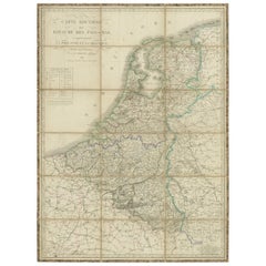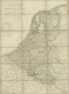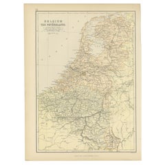
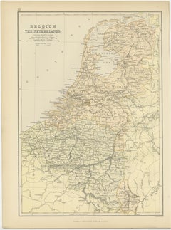
1882 Map of Belgium and The Netherlands Highlighting Geographical Details
$260
H 14.97 in W 11.03 in D 0 in
1882 Map of Belgium and The Netherlands Highlighting Geographical Details
Located in Langweer, NL
The map also captures the flat landscapes of The Netherlands, including the Zuiderzee (now largely reclaimed as the IJsselmeer) and the intricate network of canals.
Category
Antique 1880s British Maps
Materials
Paper