
Map Of Oxford

to
27
1
13
10
7
6
5
4
4
3
2
2
2
1
1
1
1
1
1
1
1
1
1
1
2
1
1
1
1
Sort By
Mid 19th Century Pair of Framed English Maps of Oxford and Cambridge
Located in Los Angeles, CA
This pair of maps featuring Oxford and Cambridge is beautifully preserved in custom black wood
Category

Antique 19th Century English Victorian Prints

Materials

Paper, Wood

Mychael Barratt, On the Shoulders of Giants, Bright Illustrative Map of Oxford
By Mychael Barratt
Located in Deddington, GB
limited edition screen print by Mychael Barratt. Barratt has brought Oxford to life with this beautifully
Category

21st Century and Contemporary Contemporary Landscape Prints

Materials

Paper, Screen

Original Old Map of South East England Incl London, Oxford, Cambridge, Etc, 1633
Located in Langweer, NL
'. Old map of south east England. Includes London, Salisbury, Oxford, Cambridge, Leicester and Norwich
Category

Antique 1630s Maps

Materials

Paper

Mabel Oliver Rae, etching of Keble College, Oxford
Located in London, GB
To see our other views and maps of England - including London, Oxford and Cambridge, scroll down to
Category

Early 20th Century Modern Landscape Prints

Materials

Etching

Mabel Oliver Rae, etching of Merton Tower, Oxford
Located in London, GB
To see our other views and maps of England - including London, Oxford and Cambridge, scroll down to
Category

Early 20th Century Modern Landscape Prints

Materials

Etching

Mabel Oliver Rae, etching of Tom Tower, Oxford
Located in London, GB
To see our other views and maps of England - including London, Oxford and Cambridge, scroll down to
Category

Early 20th Century Modern Landscape Prints

Materials

Etching

John Speede Map The Countye of Monmouth
By John Speed
Located in London, GB
To see our other views and maps of England - including London, Oxford and Cambridge, scroll down to
Category

17th Century Realist Landscape Prints

Materials

Engraving

Map of Oxfordshire coloured 18th century engraving by Thomas Kitchin
By Thomas Kitchin
Located in London, GB
map also sports a list of the University of Oxford's colleges, its rectories and vicarages, and a
Category

1760s Landscape Prints

Materials

Engraving

John Speede, Map of the County of Surrey, described and divided into hundreds
By John Speed
Located in London, GB
To see our other views and maps of England - including London, Oxford and Cambridge, scroll down to
Category

17th Century Realist Landscape Prints

Materials

Engraving

Original Vintage Travel Poster Oxford University British Railways Fred Taylor
By Fred Taylor
Located in London, GB
artwork by Fred Taylor (1875-1963) depicting an aerial map view of the city of Oxford including parks, the
Category

Vintage 1950s British Posters

Materials

Paper

John Speede Map The Countye Palatine of Chester with that most ancient citie
By John Speed
Located in London, GB
To see our other views and maps of England - including London, Oxford and Cambridge, scroll down to
Category

17th Century Realist Landscape Prints

Materials

Engraving

South Prospect of Somerset House engraving c. 1753 for Stow's Survey of London
Located in London, GB
To see our other views and maps of England - including London, Oxford and Cambridge, scroll down to
Category

1750s Realist Landscape Prints

Materials

Engraving

Mabel Oliver Rae, Etching of Kings College Cambridge
Located in London, GB
To see our other views and maps of England - including London, Oxford and Cambridge, scroll down to
Category

Early 20th Century Modern Landscape Prints

Materials

Etching

Mabel Oliver Rae, etching of Clare Bridge, Cambridge
Located in London, GB
To see our other views and maps of England - including London, Oxford and Cambridge, scroll down to
Category

Early 20th Century Modern Landscape Prints

Materials

Etching

Eton College, Windsor, Essex Watercolour of College Buildings
Located in London, GB
To see our other views and maps of England - including London, Oxford and Cambridge, scroll down to
Category

Mid-20th Century Modern Landscape Drawings and Watercolors

Materials

Watercolor

Prospect of Durham from the River 19th Century Watercolour
Located in London, GB
To see our other views and maps of England - including London, Durham, Oxford and Cambridge, scroll
Category

19th Century Realist Landscape Drawings and Watercolors

Materials

Watercolor

Dulwich College J Oliphant Engraving 1775 Harrison's History of London
Located in London, GB
To see our other views and maps of England - including London, Oxford and Cambridge, scroll down to
Category

1770s Realist More Art

Materials

Engraving

Southwark Cathedral engraving c. 1753 for Stow's Survey of London
Located in London, GB
To see our other views and maps of England - including London, Oxford and Cambridge, scroll down to
Category

1750s Realist Landscape Prints

Materials

Engraving

Samuel Buck (1696-1779) Ruins of Byland Abbey Yorkshire Engraving Print
Located in London, GB
To see our other views and maps of England - including London, Oxford and Cambridge, scroll down to
Category

1720s Realist More Art

Materials

Engraving

Mabel Oliver Rae, Etching of Kings College Cambridge from the Meadow (c.1920)
Located in London, GB
To see our other views and maps of England - including London, Oxford and Cambridge, scroll down to
Category

Early 20th Century Modern Landscape Prints

Materials

Etching

Eton College Windsor Watercolour 19th Century England British painting Victorian
Located in London, GB
To see our other views and maps of England - including London, Oxford and Cambridge, scroll down to
Category

Late 19th Century Modern Landscape Drawings and Watercolors

Materials

Watercolor

Mabel Oliver Rae, Trinity College Cambridge Great Court Etching (c.1920)
Located in London, GB
To see our other views and maps of England - including London, Oxford and Cambridge, scroll down to
Category

1920s Modern Landscape Prints

Materials

Etching

William Roxby Beverley 'Durham Cathedral from the North East' University
Located in London, GB
To see our other views and maps of England - including London, Durham, Oxford and Cambridge, scroll
Category

19th Century Victorian Landscape Drawings and Watercolors

Materials

Watercolor

Sir Hugh Casson, 'St. Albans Cathedral' proof print (c.1980)
By Hugh Casson
Located in London, GB
To see our other views and maps of England - including London, Oxford and Cambridge, scroll down to
Category

1980s Realist Landscape Drawings and Watercolors

Materials

Digital

Original Vintage Travel Poster Oxford University British Railways Fred Taylor
By Fred Taylor
Located in London, GB
artwork by Fred Taylor (1875-1963) depicting an aerial map view of the city of Oxford including parks, the
Category

1950s More Prints

Materials

Paper

Map of Oxford 18th-century engraving by Pieter van der Aa after David Loggan
By Pieter Van Der Aa
Located in London, GB
Pieter van der Aa (1659-1733), after David Loggan (1634–1692) Map of Oxford Engraving 12 x 16 cm
Category

Early 18th Century Realist Prints and Multiples

Materials

Engraving

Lawrence Josset Eton College Engraving 1980 after Canaletto Public School UK
Located in London, GB
To see our other views and maps of England - including London, Oxford and Cambridge, scroll down to
Category

Mid-20th Century Modern Landscape Prints

Materials

Engraving

Michael Lyne (1912-1989) In the Berkeley Hunt Hill Country Kingscot Fox Hunting
By Michael Lyne
Located in London, GB
To see our other views and maps of England - including London, Oxford and Cambridge, scroll down to
Category

Mid-20th Century Realist Landscape Paintings

Materials

Gouache

Get Updated with New Arrivals
Save "Map Of Oxford", and we’ll notify you when there are new listings in this category.

Map Of Oxford For Sale on 1stDibs

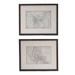
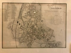
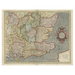
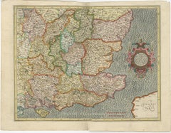
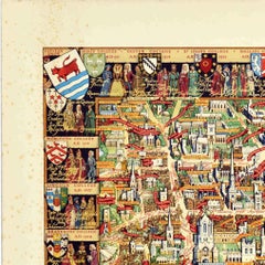
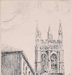
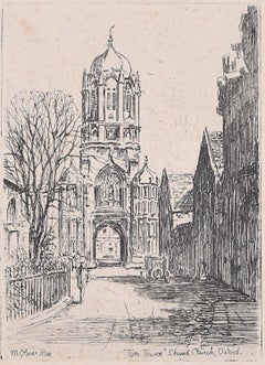
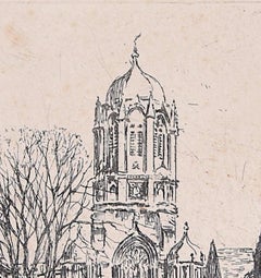
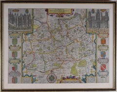
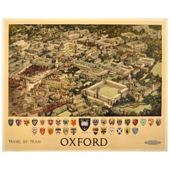
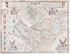
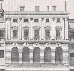
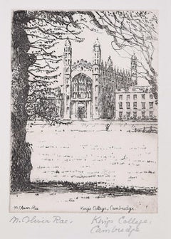
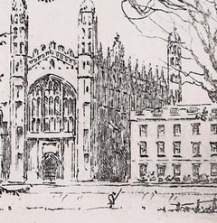
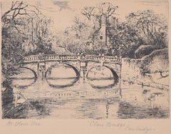
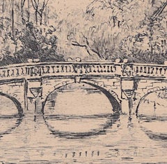
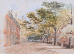
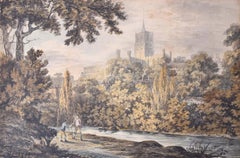
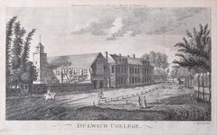
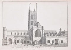
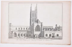
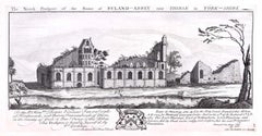
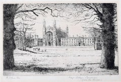
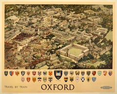
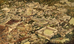
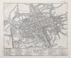
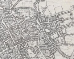
You are likely to find exactly the map of oxford you’re looking for on 1stDibs, as there is a broad range for sale. Find modern versions now, or shop for 
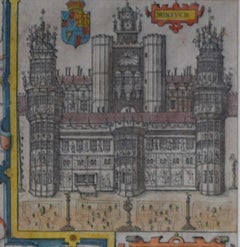
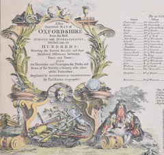
modern creations for a more modern example of these cherished works. Finding the perfect map of oxford may mean sifting through those created during different time periods — you can find an early version that dates to the 18th Century and a newer variation that were made as recently as the 21st Century. On 1stDibs, the right map of oxford is waiting for you and the choices span a range of colors that includes gray, beige, brown and blue. Creating a map of oxford has been a part of the legacy of many artists, but those crafted by Pieter Van Der Aa, Rob Tarbell, Michael Pajon, Scott Pattinson and Leslie MacDonald Gill are consistently popular. Frequently made by artists working in
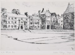
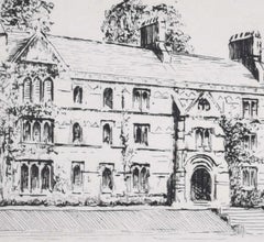
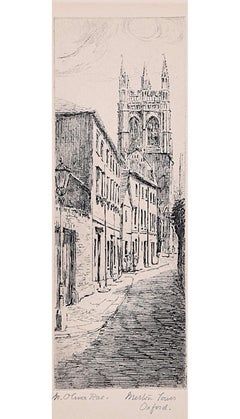
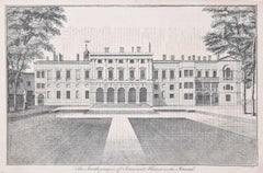
 engraving, paint and paper, these artworks are unique and have attracted attention over the years.

How Much is a Map Of Oxford?

A map of oxford can differ in price owing to various characteristics — the average selling price for items in our inventory is $676, while the lowest priced sells for $48 and the highest can go for as much as $45,494.
Questions About Map Of Oxford
  • 1stDibs ExpertMarch 15, 2024
    A white Oxford shirt is a white dress shirt or casual sports shirt made of Oxford cloth, which is a durable and heavily structured fabric that consists of multiple weft threads that cross over an equal number of warp threads. Oxford cloth is said to have originated in a Scottish mill during the 19th century. The popularization of the Oxford cloth button-down shirt style, which is commonly abbreviated as OCBD, has been traced to when Brooks Brothers president John Brooks witnessed a polo match in England back then. He was so compelled by the fact that the players’ shirt collars were fastened to their shirts with buttons that he returned to the States and created a shirt design informed by the players’ garments. Oxford shirts now come in all kinds of colors and prints. On 1stDibs, shop a variety of shirts.
  • 1stDibs ExpertAugust 26, 2024
    The difference between Derby and Oxford shoes is the laces. Oxford shoes feature a closed lacing system with the lacing stitched to the vamp, while the vamp on a Derby extends down to the toe piece. As a result, Oxfords have a more formal look. Find a selection of Oxford and Derby shoes on 1stDibs.