Map Stand
to
17
88
32
48
34
33
26
25
17
17
15
10
8
7
7
7
6
6
6
5
3
3
3
2
2
2
2
1
1
1
1
1
1
1
1
1
1
1
31
4
2
1
1
Sort By
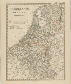
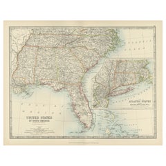
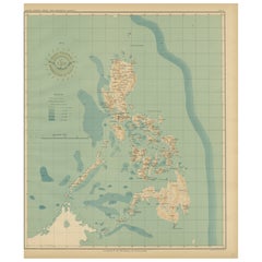
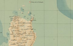
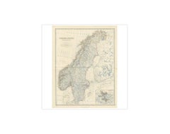
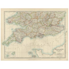
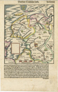
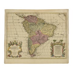
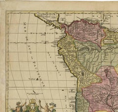
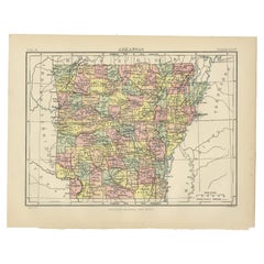
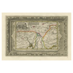
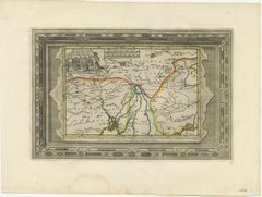
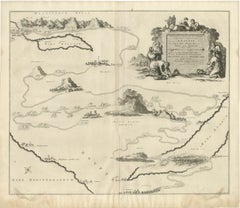
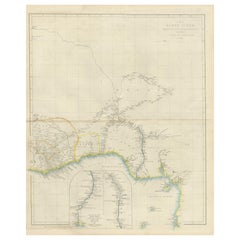
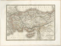
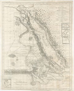
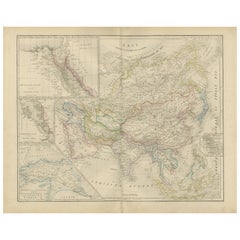
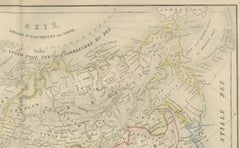
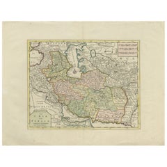
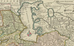
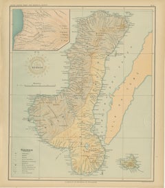
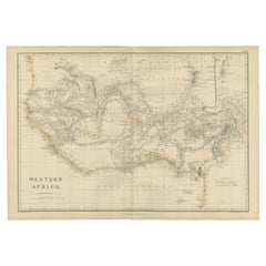
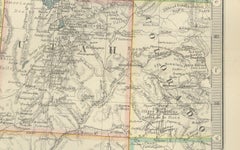
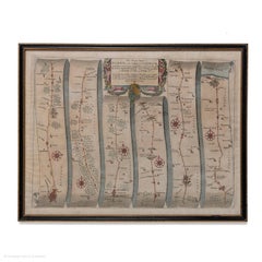
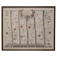
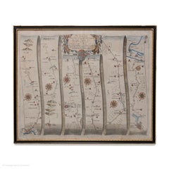
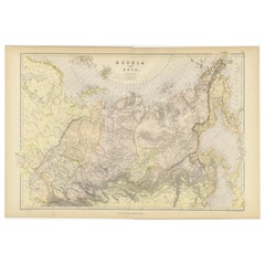
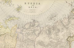
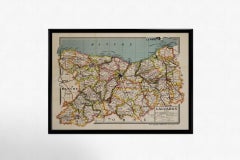
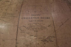
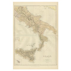
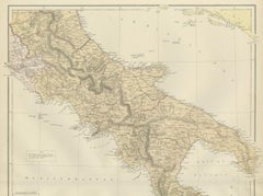
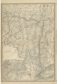
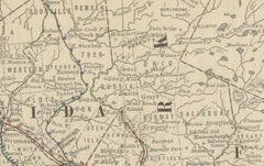
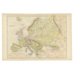
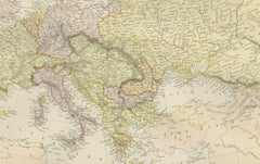
Colorful Detailed Antique Map of Europe, Published in 1882
Located in Langweer, NL
"The Antique Map of Europe from 'The Comprehensive Atlas and Geography of the World,' published in
Category
Antique 1880s Maps
Materials
Paper
$177 Sale Price
20% Off
H 14.97 in W 22.45 in D 0 in
Original Antique Map of the South Part of Italy with an Inset of Malta, 1882
Located in Langweer, NL
admirers of antique craftsmanship, this map stands as both a striking display and a testament to
Category
Antique 1880s Maps
Materials
Paper
$195 Sale Price
20% Off
H 22.45 in W 14.97 in D 0 in
Original Antique Map of the Island of Dominica in the West Indies, 1794
Located in Langweer, NL
MAP OF THE ISLAND OF DOMINICA for the History of the West Indies, by Bryan Edwards. Esq.
Dominica
Category
Antique 1790s Maps
Materials
Paper
$223 Sale Price
20% Off
H 10.44 in W 7.88 in D 0 in
Map of the Southeastern USA and Atlantic States – Vintage 1903 Geography
Located in Langweer, NL
for American history, cartography, or antique décor, this map stands as both a piece of art and a
Category
Early 20th Century Maps
Materials
Paper
$396
H 14.49 in W 18.51 in D 0.01 in
Cartographic Elegance of Touraine: A 17th-Century Map Showing French Heritage
Located in Langweer, NL
elaborately decorated atlases of the time, the map stands as a testament to the Blaeu's dedication to
Category
Antique 1630s Maps
Materials
Paper
$456 Sale Price
20% Off
H 20.08 in W 23.82 in D 0 in
Copenhagen (Kiöbenhaven) Map with City View – Antique German Atlas Print, 1844
Located in Langweer, NL
cartographic representations. This particular map stands out not only for its urban accuracy but also for its
Category
Antique Mid-19th Century German Maps
Materials
Paper
$407
H 13.59 in W 16.34 in D 0.02 in
Three Antique Maps on One Folio: Turkey, Northern Egypt, and Ancient Carthage
Located in Langweer, NL
located in present-day Tunis.
- Maritime Scene: The map stands out for its depiction of numerous oared
Category
Antique 16th Century Maps
Materials
Paper
$803
H 12.72 in W 19.49 in D 0 in
Antique Map of Southern England & Wales, 1903, with Coastal Details and Railways
Located in Langweer, NL
coloring and intricate engraving, ensuring the map stands out as a sophisticated and elegant addition to
Category
Early 20th Century Maps
Materials
Paper
$326
H 14.49 in W 18.9 in D 0.01 in
Engraving of a Map of Florida, the Gulf Coast, Caribbean & Central America, 1728
Located in Langweer, NL
appeal of the map.
As a collector's item, this map stands out for its remarkable precision and attention
Category
Antique Mid-18th Century Dutch Maps
Materials
Paper
$15,956
H 24.61 in W 40.56 in D 0.02 in
Sweden & Norway – Antique Map of Scandinavia with Stockholm Inset, 1865
Located in Langweer, NL
high production quality.
This map stands out for its delicate coloration, precise typography, and
Category
Antique Mid-19th Century English Maps
Materials
Paper
$256 Sale Price
20% Off
H 24.41 in W 19.1 in D 0.02 in
Antique Map of Piedmont, Savoy and Liguria by Justus Danckerts, Amsterdam c.1690
Located in Langweer, NL
European powers.
Danckerts’s map stands out for its clarity and precision, showing a dense network of
Category
Antique Late 17th Century Maps
Materials
Paper
$989
H 20.48 in W 23.86 in D 0.01 in
Friesland, Groningen and Overijssel – Rare Woodcut Map by Münster, c. 1550
Located in Langweer, NL
, reprinted in over 30 editions and translated into several languages. This map stands out not only for its
Category
Antique 16th Century Maps
Materials
Paper
$535
H 11.82 in W 7.64 in D 0.01 in
Map of South America 1792 by Elwe – Hand-Colored Antique Dutch Engraving
By J.B. Elwe
Located in Langweer, NL
edition of this map stands as one of the most decorative and desirable renditions of South America before
Category
Antique Late 18th Century European Maps
Materials
Paper
$1,979
H 21.46 in W 25.6 in D 0.02 in
Benedictus Goes’ Route – Antique Map of Tartary to China by Van der Aa, 1714
Located in Langweer, NL
travelers.
This map stands out for its unusual framing device: a bold ornamental border engraved to
Category
Antique Early 18th Century Dutch Maps
Materials
Paper
$503 Sale Price
20% Off
H 12.72 in W 17.21 in D 0.02 in
1698 Mercator Ptolemaic Map of Asia East of the Ganges
Located in Langweer, NL
: 1698
- Source: Mercator’s Ptolemy Atlas
This map stands as a testament to the historical and
Category
Antique 1680s Maps
Materials
Paper
$875 Sale Price
20% Off
H 16.93 in W 15.83 in D 0.01 in
Barados and St Christopher or St Kitts and Nevis Islands in the Caribbean, 1748
Located in Langweer, NL
, delineated by its parishes.
Crafted in 1746, this map stands as a historical artifact showcasing the
Category
Antique Mid-18th Century Maps
Materials
Paper
$335 Sale Price
20% Off
H 13.98 in W 9.65 in D 0 in
Map of the Persian Empire circa 1750 by Tirion – Hand-Colored Dutch Map
Located in Langweer, NL
respected and used throughout Europe in the mid-18th century, and this map of Persia stands out for its
Category
Antique 1750s Dutch Maps
Materials
Paper
$687
H 16.34 in W 21.54 in D 0.01 in
Antique Map of Alaska '1904'
Located in Langweer, NL
historical document. Here are some aspects of this map that stand out:
**Geographical Detail**: The map
Category
Early 20th Century Maps
Materials
Paper
Maitland Smith Globe on Stand
Located in Norwell, MA
World globe with brass horizon band. Intricately carved pedestal base with ball and claw feet. Quite detailed. By the famous Maitland Smith, globe itself is from Replogle. 62" H x 26...
Category
Vintage 1970s North American Maps
Materials
Wood
Western Africa Antique Map by W. G. Blackie, 1859
Located in Langweer, NL
The antique map titled 'Western Africa' presents an original depiction of the region. Originating
Category
Antique Mid-19th Century Maps
Materials
Paper
$232 Sale Price
20% Off
H 14.57 in W 21.26 in D 0.02 in
Map of Western United States 1903 – Railroads, State Borders, and Terrain
Located in Langweer, NL
stand out. This map would make a wonderful centerpiece in an office, library, or living space
Category
Early 20th Century Maps
Materials
Paper
$396
H 18.51 in W 14.49 in D 0.01 in
Road Map, John Ogilby, No 54, London, Yarmouth, Britannia
By John Ogilby
Located in BUNGAY, SUFFOLK
modern collector, the road maps of the 'Britannia' stand apart. No other series incorporates such a
Category
Antique 1670s English Baroque Maps
Materials
Paper
1692 Jacq. Peeters Map: East Indies, Indonesia, Japan, Philippines and Singapore
Located in Langweer, NL
1692 Jacques Peeters Map: East Indies, Indonesia & Japan with Unique Inset
This hand-colored map
Category
Antique 1690s Maps
Materials
Paper
$614 Sale Price
20% Off
H 5.5 in W 6.5 in D 0.02 in
Vintage Globe on Regency Pedestal Stand
Located in Pasadena, TX
This is a nice vintage globe. It sits on a pedestal tripod base. The base is constructed in a regency style. This globe comes from the office of Roger Rolke of Shell Oil Co.
A nice ...
Category
20th Century American Maps
Materials
Wood
Early 20th Century French Carved Walnut Folding Magazine Stand or Map Rack
Located in Dallas, TX
Crafted in France circa 1920, this elegant folding display stand reflects the Moorish Revival style
Category
Early 20th Century French Magazine Racks and Stands
Materials
Walnut
$1,300
H 34.5 in W 25 in D 5.5 in
Map Road Strip Britannia Sheet 2 John Ogilby London Aberistwith Islip Bramyard
By John Ogilby
Located in BUNGAY, SUFFOLK
the modern collector, the road maps of the 'Britannia' stand apart. No other series incorporates such
Category
Antique 17th Century English Baroque Maps
Materials
Paper
$2,692
H 14.38 in W 19.3 in D 0.79 in
Road Map John Ogilby No 75 Kings Lyn Harwich, Britannia Framed Wallhanging
By John Ogilby
Located in BUNGAY, SUFFOLK
the modern collector, the road maps of the 'Britannia' Stand apart. No other series incorporates such
Category
Antique 1670s European Baroque Maps
Materials
Paper
$2,692
H 15.75 in W 19.69 in D 0.6 in
Map Road John Ogilby Britannia No 74 Ipswich to Norwich Cromer Framed
By John Ogilby
Located in BUNGAY, SUFFOLK
the English countryside, available to the modern collector, the road maps of the 'Britannia' Stand
Category
Antique 1670s English Baroque Maps
Materials
Paper
$2,692
H 15.36 in W 19.69 in D 0.6 in
English Mahogany Wooden Folio Stand, Map and Document Holder, circa 1820
Located in Hamilton, Ontario
Regency era mahogany wood folio stand rack, map, poster, document holder used in a library, office
Category
Antique Early 19th Century English Regency Magazine Racks and Stands
Materials
Wood
$5,200 Sale Price
20% Off
H 46 in W 31.63 in D 27 in
European Vintage Earth Globe on Stand with Compass
Located in Sofia, BG
Vintage handmade world globe standing on a base with small compass in the bottom. The piece is in fare condition with no restaurations ever made.
France, circa 1950
Category
Mid-20th Century French Maps
Materials
Plastic, Paper
Road Map No43 London to Kings Lynn, Royston to Downham, John Ogilby, Britannia
By John Ogilby
Located in BUNGAY, SUFFOLK
maps of the 'Britannia' Stand apart. No other series incorporates such a wealth of detail on the face
Category
Antique Late 17th Century British Charles II Maps
Materials
Paper
$2,692
H 20.48 in W 24.41 in D 0.4 in
Road Map John Ogilby London St David's Britannia No 15 Abingdon Monmouth Framed
By John Ogilby
Located in BUNGAY, SUFFOLK
John Ogilby (British 1600-1676) Cosmographer and Geographick Printer to Charles II. A road map from
Category
Antique 1670s English Baroque Maps
Materials
Paper
$2,692
H 20.48 in W 24.41 in D 0.6 in
Road Map Britannia No 32 the Road from London to Barnstable John Ogilby Framed
By John Ogilby
Located in BUNGAY, SUFFOLK
the modern collector, the road maps of the 'Britannia' Stand apart. No other series incorporates such
Category
Antique Late 17th Century English Charles II Maps
Materials
Paper
$2,692
H 20.48 in W 24.41 in D 0.6 in
Road Map Britannia No 15 London to St Davids John Ogilby Brown Gilt Frame
By John Ogilby
Located in BUNGAY, SUFFOLK
maps of the 'Britannia' stand apart. No other series incorporates such a wealth of detail on the face
Category
Antique Late 17th Century British Charles II Maps
Materials
Paper
$2,692
H 22.05 in W 26.19 in D 0.6 in
Road Map Britannia No 25 London to the Lands End, John Ogilby Brown Gilded Frame
By John Ogilby
Located in BUNGAY, SUFFOLK
Senan in Cornwall. By John Ogilby His Majesties Cosmographer. A road map from Britannia, 1675/6. No 25
Category
Antique Late 17th Century British Charles II Maps
Materials
Paper
$2,692
H 22.05 in W 26.19 in D 0.6 in
Road Map Britannia 1675/6 No 5 Road London to Barwick, London Stilton Grey Frame
By John Ogilby
Located in BUNGAY, SUFFOLK
John Ogilby (British 1600-1676) cosmographer and geographick printer to Charles II.
A road map from
Category
Antique Late 17th Century British Charles II Maps
Materials
Paper
$2,692
H 22.84 in W 25.99 in D 0.4 in
French Umbrella Holder Stand or Wastebasket with Globe Map of Afrique or Africa
Located in New York, NY
A demi-lune shape (half-moon) metal umbrella holder stand featuring the map of "Afrique" (Africa in
Category
Mid-20th Century French Umbrella Stands
Materials
Metal
$975
H 19.38 in W 11.5 in D 9.25 in
Mid-Century Modern 1970s Paul McCobb Style Brass Stand Replogle Globe
By Replogle Globes, Paul McCobb
Located in St. Louis, MO
Often attributed to Paul McCobb, because of the same brass tubing that McCobb used in his furniture. Circa 1970s Replogle globe is in very nice condition with raised topography and t...
Category
Vintage 1970s American Mid-Century Modern Maps
Materials
Brass
19th C. Terrestrial Globe on Stand for H.B. Nims After Copley
Located in Bridgeport, CT
Manufactured for H.B. Nims & Co., Troy New York, last quarter 19th c. After the original engravings by Charles Copley done in 1852.
Printed paper on wood with brass/ bronze meridian ...
Category
Antique Late 19th Century American Victorian Maps
Materials
Bronze, Iron
Jacques Liozu Magazine Rack with Whimsical Silk Screened Maps France 1950s
By Piero Fornasetti
Located in Meer, VAN
Jacques Liozu Magazine Rack with Whimsical Silk Screened Maps, Paris, France, 1950s.
This is a
Category
Mid-20th Century French Mid-Century Modern Magazine Racks and Stands
Materials
Metal
$2,533
H 17.33 in W 17.72 in D 6.3 in
Detailed Antique Cartography of Asian Russia, 1882
Located in Langweer, NL
this map of Asian Russia stands as a testament to the era's dedication to exploration, understanding
Category
Antique 1880s Maps
Materials
Paper
$307 Sale Price
20% Off
H 14.97 in W 22.45 in D 0 in
Griffin's 1955 Northern Ireland original map - Tourism - Geography
Located in PARIS, FR
Griffin's 1955 Northern Ireland map stands out as a captivating representation of the region's
Category
1950s Prints and Multiples
Materials
Linen, Lithograph, Paper
$1,863
H 37.8 in W 24.02 in
Circa 1950 original map poster of Calvados, designed by André Lesot - Normandy
Located in PARIS, FR
This circa 1950 original map poster of Calvados, designed by André Lesot, is a beautifully detailed
Category
1950s Prints and Multiples
Materials
Lithograph, Paper, Linen
Geological Map of Africa by A.K. Johnston – Mountains and Valleys 1852
Located in Langweer, NL
, combining scientific precision with artistic presentation. This map stands out not only for its geographical
Category
Antique Mid-19th Century Scottish Prints
Materials
Paper
$302 / item
H 10.79 in W 13.59 in D 0.01 in
1943 original map " Les vins des Côtes du Rhône - Groupe Septentrional"
Located in PARIS, FR
the German occupation of France in World War II, this map stands as both a technical cartographic
Category
1940s Prints and Multiples
Materials
Lithograph, Paper
$1,164
H 41.34 in W 17.72 in
Italian Mid-Century Modern World Map Globe Pipe Holder Stand
Located in Haddonfield, NJ
Super charming piper holder featuring a world map design and two indentations that hold the bowls
Category
Mid-20th Century Italian Mid-Century Modern Tobacco Accessories
Materials
Ceramic
Vintage Mid Century Modern Globe Stand Decor Retro Wood Petal Map World Seattle
Located in Seattle, WA
World Ocean globe rising on a Mid-Century Modern Art deco stand, 14in Diameter 33" tall. Some light
Category
Vintage 1970s Mid-Century Modern Globes
Materials
Wood
1947 original map Gouvernement Généraux du Poitou, du Pays d'Aunis
Located in PARIS, FR
distillation.
What makes Larmat’s map stand out is not only its geographical accuracy but also its attention
Category
1940s Prints and Multiples
Materials
Lithograph, Paper
$1,281
H 17.72 in W 25.6 in
1947 original map "Le Cognac Bois ordinaires & Bois communs" by Larmat
Located in PARIS, FR
celebration of French cultural heritage. The map stands as a testament to the importance of terroir in Cognac
Category
1940s Prints and Multiples
Materials
Lithograph, Paper
$1,164
H 17.72 in W 24.81 in
Mid Century Modern 1970s Rotating Replogle World Globe with Brass Floor Stand
By Replogle Globes, Paul McCobb
Located in San Jose, CA
Vintage world map Replogle globe with stand in brass, circa 1970's. This piece rotates on a full
Category
Vintage 1970s American Mid-Century Modern Globes
Materials
Brass
$1,475
H 35 in Dm 14.75 in
Napoleon III French Marble and Bronze Astronomical Sciences Clock
Located in Vancouver, British Columbia
bronze atop which are maps of the heavens. He stands on a black marble shaped base bordered with gilt
Category
Antique Late 19th Century French Napoleon III Mantel Clocks
Materials
Bronze
Natural Citrine Cluster with Crystal Flower, Golden Orange Color, Natural Decor
Located in Ametista Do Sul, BR
specimen are World-Class, with a formation that resembles a map. We custom-ordered a stand to best showcase
Category
2010s Brazilian Natural Specimens
Materials
Agate, Amethyst, Crystal, Rock Crystal
$1,320 Sale Price
20% Off
H 13.4 in W 7.5 in D 4 in
''The Uiterwaard Full of Life'', Contemporary Dutch Oil Painting of a Landscape
By Frank Dekkers
Located in Utrecht, NL
landscape. Type the coordinates in Google Maps and you can stand where he stood.
Frank Dekkers studied at
Category
2010s Contemporary Landscape Paintings
Materials
Oil, Panel
$4,800
H 27.96 in W 35.83 in D 0.4 in
''Low Tide'', Contemporary Dutch Oil Painting of a Landscape
By Frank Dekkers
Located in Utrecht, NL
landscape. Type the coordinates in Google Maps and you can stand where he stood.
Frank Dekkers studied at
Category
2010s Contemporary Landscape Paintings
Materials
Oil, Panel
$4,800
H 27.96 in W 35.83 in D 0.4 in
''Flowering Poplars'', Contemporary Dutch Oil Painting of a Landscape
By Frank Dekkers
Located in Utrecht, NL
landscape. Type the coordinates in Google Maps and you can stand where he stood.
Frank Dekkers studied at
Category
2010s Contemporary Landscape Paintings
Materials
Oil, Panel
$4,800
H 27.96 in W 35.83 in D 0.4 in
''Rain in the Spring', Contemporary Dutch Oil Painting of a Landscape
By Frank Dekkers
Located in Utrecht, NL
landscape. Type the coordinates in Google Maps and you can stand where he stood.
Frank Dekkers studied at
Category
2010s Contemporary Landscape Paintings
Materials
Oil, Panel
$4,800
H 27.96 in W 35.83 in D 0.4 in
''The Polder in a Heat Wave'', Contemporary Dutch Oil Painting of a Landscape
By Frank Dekkers
Located in Utrecht, NL
landscape. Type the coordinates in Google Maps and you can stand where he stood.
Frank Dekkers studied at
Category
2010s Contemporary Landscape Paintings
Materials
Oil, Panel
$4,800
H 27.96 in W 35.83 in D 0.4 in
''September Morning'', Contemporary Dutch Oil Painting of a Landscape
By Frank Dekkers
Located in Utrecht, NL
landscape. Type the coordinates in Google Maps and you can stand where he stood.
Frank Dekkers studied at
Category
2010s Contemporary Landscape Paintings
Materials
Oil, Panel
$4,800
H 27.96 in W 35.83 in D 0.4 in
- 1
Get Updated with New Arrivals
Save "Map Stand", and we’ll notify you when there are new listings in this category.
Map Stand For Sale on 1stDibs
Choose from an assortment of styles, material and more with respect to the map stand you’re looking for at 1stDibs. Frequently made of metal, paper and wood, every map stand was constructed with great care. You’ve searched high and low for the perfect map stand — we have versions that date back to the 19th Century alongside those produced as recently as the 20th Century are available. Each map stand bearing Mid-Century Modern, Art Deco or Regency hallmarks is very popular. A well-made map stand has long been a part of the offerings for many furniture designers and manufacturers, but those produced by George Philip & Son and Replogle Globes are consistently popular.
How Much is a Map Stand?
A map stand can differ in price owing to various characteristics — the average selling price 1stDibs is $1,800, while the lowest priced sells for $425 and the highest can go for as much as $6,500.
More Ways To Browse
Olivier Rousteing
Bomber Jacket Embroidered
Balmain Crystal
Balmain Bomber
Joan Mayor
Cosmographia Universalis
Balmain Beaded Jacket
Terrarium On Stand
1960 Vintage Santa Claus
A Teno
Aage Rasmus Selsbo
Abalone Fish Bottle Opener
Aboriginal Wood Carving
Abumi Japanese Stirrup
Adelaide Robineau
African Bronze Head Benin
African Gong
Agnes Escala