Antique Marine Maps
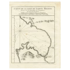
Bay of Saint Helena: French Naval Chart by N.B. Ingénieur de la Marine, ca.1770
Located in Langweer, NL
Helena), was drawn by N.B., an engineer of the French Navy (*Ingénieur de la Marine*). The map was
Category
1770s Antique Marine Maps
Materials
Paper
$168
H 9.85 in W 7.49 in D 0.01 in
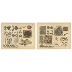
Antique Fossil Chromolithographs – Marine Life, Plants & Vertebrates, c.1880
Located in Langweer, NL
Antique Fossil Chromolithographs – Marine Life, Plants & Vertebrates, c.1880
This pair of antique
Category
Late 19th Century German Antique Marine Maps
Materials
Paper
$349 / set
H 12.72 in W 16.62 in D 0.01 in
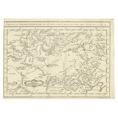
Antique Map of Western Tartary, with Information from Kyrkov's Surveys
Located in Langweer, NL
Antique Map of Western Tartary & Mongolia – Bellin, 1749
Antique engraved map titled “Carte de la
Category
Mid-18th Century Antique Marine Maps
Materials
Paper
$315
H 9.18 in W 12.72 in D 0.02 in
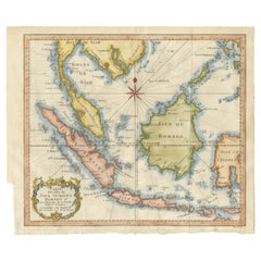
Java, Sumatra & Borneo Map – Bellin & van Schley Decorative Chart, 1750s
Located in Langweer, NL
the Royal Society of London and the Académie de Marine, the map exemplifies mid-18th-century French
Category
Mid-18th Century French Antique Marine Maps
Materials
Paper
$391 Sale Price
50% Off
H 10.44 in W 12.6 in D 0 in
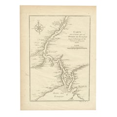
1750 Bellin Map of the Red River (Tonkin River) and Hanoi, Vietnam
Located in Langweer, NL
Plans de la Marine. His maps were widely published in maritime atlases and travel accounts, providing
Category
1750s Antique Marine Maps
Materials
Paper
$156
H 10.12 in W 7.21 in D 0.01 in
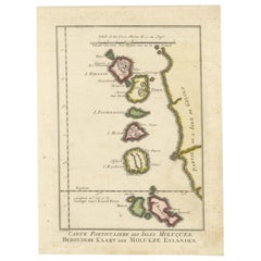
Old Map of the Spice Islands, Moluccas by Bellin, Published in 1771
Located in Langweer, NL
Title: 1771 Jacques-Nicolas Bellin Map of the Moluccas, the Spice Islands of Indonesia
Category
1770s French Antique Marine Maps
Materials
Paper
$192 Sale Price
20% Off
H 10.36 in W 7.72 in D 0.01 in
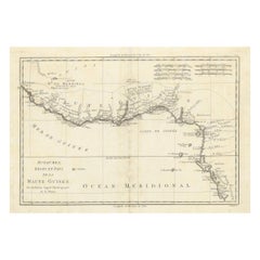
18th Century Map of Upper Guinea: Kingdoms and Coastal Regions of West Africa
Located in Langweer, NL
. Bonne, Ingenieur-Hydrographe de la Marine, indicating that this map was produced by a hydrographer, in
Category
1780s Antique Marine Maps
Materials
Paper
$231 Sale Price
20% Off
H 11.34 in W 15.56 in D 0 in
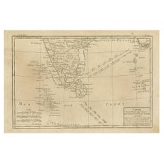
Antique Map of Southern India, Sri Lanka & Maldives with Ocean Currents, 1790
Located in Langweer, NL
Antique Map of Southern India, Sri Lanka & Maldives with Ocean Currents – Rigobert Bonne
Antique
Category
Late 18th Century Antique Marine Maps
Materials
Paper
$270 Sale Price
20% Off
H 9.77 in W 14.85 in D 0.02 in
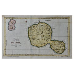
Captain Cook's Exploration of Tahiti 18th C. Hand-Colored Map by Bellin
By Jacques-Nicolas Bellin
Located in Alamo, CA
particular interest to the Ministère de la Marine. His maps of Canada and of French territories in North
Category
Mid-18th Century French Antique Marine Maps
Materials
Paper
$775
H 11.38 in W 17.5 in D 0.13 in
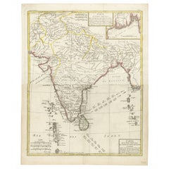
Map of India and Ceylon with Inset of Calcutta and the Ganges, by Bonne, 1780
Located in Langweer, NL
The map on offer is an antique copperplate engraving of India and Ceylon (Sri Lanka), created by
Category
1780s French Antique Marine Maps
Materials
Paper
$385
H 17.72 in W 14.18 in D 0.01 in
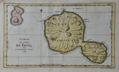
Captain Cook's Exploration of Tahiti: 18th C. Hand-colored Map by Bellin
By Jacques-Nicolas Bellin
Located in Alamo, CA
particular interest to the Ministère de la Marine. His maps of Canada and of French territories in North
Category
Late 18th Century Antique Marine Maps
Materials
Engraving
Recent Sales
Harwich Woodbridg and Handfordwater with the Sands from the Nazeland [...].
By Herman Moll
Located in Zeeland, Noord-Brabant
in Collins' "Great Britain's Coasting Pilot", the first wholly English marine atlas. These maps were
Category
Late 17th Century Antique Marine Maps
Materials
Engraving
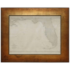
Very Rare Marine Map of Florida, France, 1864
Located in Miami Beach, FL
Rare marine map engraving of Florida and the Gulf of Mexico dated 1864. The inscription reads
Category
1860s French Beaux Arts Antique Marine Maps
Materials
Giltwood, Paper
Old Map of the Mariana Island, Guam and Saipan, 1752
Located in Langweer, NL
Générale des Voyages par le Sr. Bellin Ingr. de la Marine 1752'. A map of the northern Pacific Ocean
Category
1750s Antique Marine Maps
Materials
Paper
Antique Map of Argentina and Uruguay, La Plata, Buenos Aires, Montevideo
By Jacques-Nicolas Bellin
Located in New York, NY
to the Ministère de la Marine. His maps of Canada and of French territories in North America (New
Category
1750s Antique Marine Maps
Materials
Paper, Ink
French Portrait
Located in Atlanta, GA
Early 19th century French portrait of a woman in lovely garments with marine map.
Category
19th Century French Antique Marine Maps
Materials
Canvas
People Also Browsed
Large 19th Century Antique Indian Hindu Ganesha Figural Votive Brass Oil Lamp
Located in Portland, OR
A large antique early 19th century Indian brass votive oil lamp modeled as the Hindu deity, Lord Ganesha, circa 1800.
A finely cast brass figure of Lord Ganesha with a crown of snak...
Category
Early 19th Century Indian Anglo-Indian Antique Marine Maps
Materials
Brass
$850
H 13.5 in W 12 in D 7 in
An equestrian portrait of Field Marshal Sir John Ligonier, 1st Earl of Ligonier
By David Morier
Located in Stoke, Hampshire
David Morier (c.1705–1770 London)
An equestrian portrait of Field Marshal Sir John Ligonier, 1st Earl of Ligonier (1680–1770)
Oil on canvas
Canvas size - 40 x 50 in
Framed size - 48 ...
Category
18th Century Old Masters Antique Marine Maps
Materials
Oil
Japanese Antique Zen Rosewood Mala Prayer Bead String 800 Beads With Alms Bowl
Located in South Burlington, VT
Rare find!: 24 feet long Zen monk Mala Prayer Bead String plus original wooden alms bowl with its original attached triangular shaped stone ojime.
A huge antique communal 24 foot p...
Category
Early 20th Century Japanese Meiji Antique Marine Maps
Materials
Wood
$360 Sale Price / set
58% Off
H 0.6 in W 283 in D 0.6 in
Set of Five Antique Swedish Copper Cake Mold Forms
Located in Haddonfield, NJ
Collection of five Scandinavian early 19th Century copper cakes baking mold pan featuring an intricate tiered design. Historically, Scandinavia had an important cake baking tradition...
Category
Early 19th Century Swedish Folk Art Antique Marine Maps
Materials
Copper
Chinese Peranakan Inlaid Hardwood Pagoda Display Cabinet, Early 20th Century
Located in Austin, TX
An impressive pagoda form carved hardwood display cabinet with bone and boxwood inlay, crafted for the Peranakan (Straits-Chinese) community in Southeast Asia, mostly likely Malaysia...
Category
1910s Asian Chinoiserie Antique Marine Maps
Materials
Bone, Hardwood, Boxwood
$17,500
H 77.5 in W 40 in D 16 in
Pair of Mid-20th Century Carved Doors from Borneo on Stands
Located in Atlanta, GA
A pair of hand carved wooden doors from Borneo on custom iron bases, mid-20th century. This vintage pair of doors from the island of Borneo are nicely sized, being approximately 5.75...
Category
Mid-20th Century Indonesian Antique Marine Maps
Materials
Iron
Dayak Tribe Mat with Spiral, Animal and Human Tribal Motifs, Borneo, Indonesia
Located in Jimbaran, Bali
This floor mat once occupied a tribal long house of the Dayak Tribe of Borneo. It is made from woven dyed and natural coloured rattan fibres & features a stunning array of tribal...
Category
Late 20th Century Indonesian Tribal Antique Marine Maps
Materials
Rattan
$1,400
W 40.16 in L 84.65 in
Modern Sculpture with a Primitive Borneo Door
Located in Alessandria, Piemonte
Primitive Borneo Granary old Door, with residue of color on a facade: suitable as a modern wood sculpture on support -
I can darken the wood with simple wax on request.
M/251.
Inte...
Category
Late 18th Century Malaysian Primitive Antique Marine Maps
Materials
Wood
French Panetière Bread Safe, c. 1850
Located in Chicago, IL
This exceptional display of woodworking is a 19th-century panetière, or bread box, once used daily in a country home in the south of France. An iconic form of French Provincial furni...
Category
Mid-19th Century French French Provincial Antique Marine Maps
Materials
Brass
Asian Khmer Cambodia Stoned Carved Head Bust of Male Buddhist Buddha Shiva Deity
Located in Studio City, CA
A wonderfully sand stone-carved Asian deity figure / sculpture likely from Cambodia. The detailed head is likely that of the divinity deity Shiva, sometimes referred to as the smilin...
Category
19th Century Cambodian Antique Marine Maps
Materials
Sandstone
$1,495
H 7 in W 4.5 in D 4 in
Antique Celebration Pot, Indian, Bronze, Diwali Vase, Ganesh, Lakshmi, Victorian
Located in Hele, Devon, GB
This is an antique celebration pot. An Indian, bronze Diwali vase depicting Ganesha and Lakshmi, dating to the early Victorian period, circa 1850.
Wonderfully presented antique bo...
Category
Mid-19th Century Indian Antique Marine Maps
Materials
Bronze
$2,784
H 4.93 in W 5.91 in D 5.91 in
Antique Print with a Native of Borneo ‘Indonesia’ by Temminck, circa 1840
Located in Langweer, NL
Antique print titled 'Een Dajakker in krijgsdos, uit het hooger gedeelte der rivier Doeson'. This print originates from 'Verhandelingen over de natuurlijke geschiedenis der Nederland...
Category
Mid-19th Century Antique Marine Maps
Materials
Paper
$542
H 17.72 in W 12.21 in D 0.02 in
Antique Panoramic View of the Town of Malacca, Malaysia, 1726
Located in Langweer, NL
Antique print Malaysia titled 'De Stad Malacka'.
Decorative panoramic view of the town of Malacca with European vessels in the foreground. The old Church of St. Paul's on the hil...
Category
1720s Antique Marine Maps
Materials
Paper
$717 Sale Price
30% Off
H 13.39 in W 21.26 in D 0 in
19th Century Indian Marble Carving of Ganesha, Remover of Obstacles
Located in Stamford, CT
Marble carving of the elephant headed four armed Hindu God Ganesha. With traces of old paint, it now has a rich honey patina from years of devotees touching the surface. Shown seated...
Category
Late 19th Century Indian Anglo-Indian Antique Marine Maps
Materials
Marble
Rare Antique Map of the Dutch East Indies 'Indonesia', 1774
Located in Langweer, NL
Rare decorative engraved map of the Dutch East Indies, or nowadays Indonesia.
Title (in old Dutch): NIEUWE EN NAUKEURIGE KAART DER OOST-INDISCHE EILANDEN volgens de laatste ontde...
Category
1770s Antique Marine Maps
Materials
Paper
$1,157 Sale Price
20% Off
H 23.82 in W 18.12 in D 0 in
Set Of 10 Mid-Century Aluminum And Brass Pots, Baking Pan And Sieve 1940s
Located in Palermo, IT
Set of 10 Mid-Century Aluminum and Brass Saucepans, Baking Pan and Sieve 1940s
The large pots have a diameter of 27 cm.
Good condition, signs of aging.
Category
1940s Italian Antique Marine Maps
Materials
Aluminum, Brass
$907 / set
H 9.06 in Dm 10.63 in
Get Updated with New Arrivals
Save "Antique Marine Maps", and we’ll notify you when there are new listings in this category.
Antique Marine Maps For Sale on 1stDibs
Find a variety of antique marine maps available on 1stDibs. Frequently made of paper, fabric and wool, all antique marine maps available were constructed with great care. Antique marine maps have been produced for many years, with earlier versions available from the 18th Century and newer variations made as recently as the 20th Century. Antique marine maps bearing Victorian hallmark is very popular at 1stDibs. There have been many well-made antique marine maps over the years, but those made by Jacques-Nicolas Bellin are often thought to be among the most beautiful.
How Much are Antique Marine Maps?
Antique marine maps can differ in price owing to various characteristics — the average selling price at 1stDibs is $493, while the lowest priced sells for $107 and the highest can go for as much as $275,000.
More Ways To Browse
The Village Voice
Tibor Reich
Tiffany 8 Day Travel Clock
Tiffany Bon Bon
Tiffany Co Tea Cups
Tiffany Cup Saucer
Tiffany Glass Jar
Tiffany Industries Tiffany Office Furniture
Tiffany Napkin Ring
Tiffany Silver Goblets
Tiffany Slag Box
Tiffany Strawberry
Tiffany Tongs
Tiger Maple Chippendale Chest
Tiger Planter
Tiger Wood Bed Frame
Tiki Totem
Tin Figurines
![Herman Moll - Harwich Woodbridg and Handfordwater with the Sands from the Nazeland [...]. Antique Harwich Woodbridg and Handfordwater with the Sands from the Nazeland [...].](https://a.1stdibscdn.com/archivesE/upload/a_5923/1508759714837/IMG_0315_2_master.jpg?width=240)
