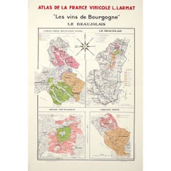
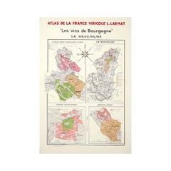
By Louis Larmat
Located in PARIS, FR
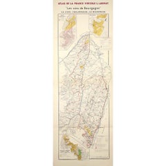
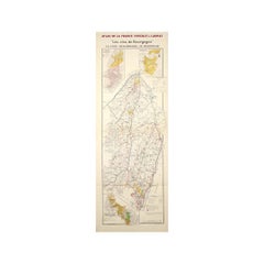
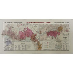
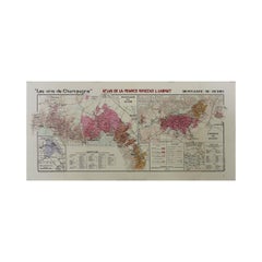
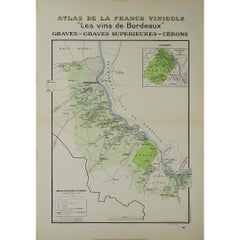
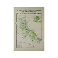
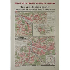
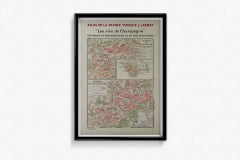
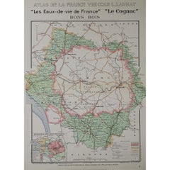
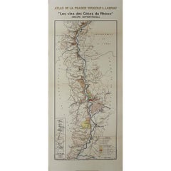
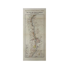
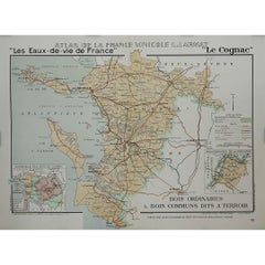
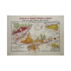
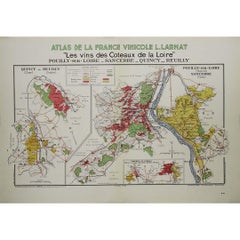
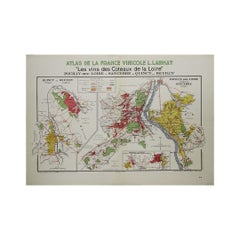
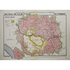
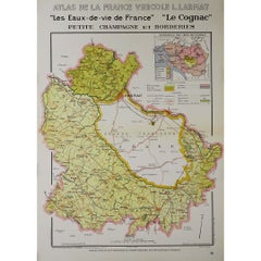
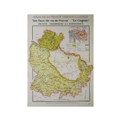
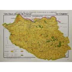
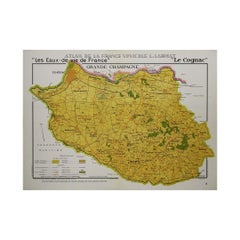
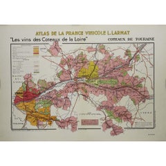
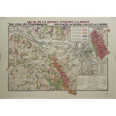
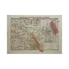
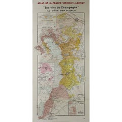
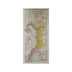
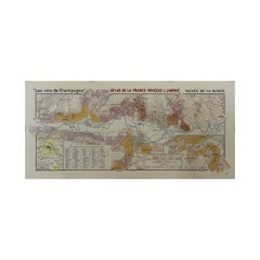
The 1944 original map "Atlas de la France Vinicole – Les vins de Champagne – La Côte des Blancs" by Louis Larmat is a historically significant and beautifully crafted piece of French vinous cartography. Part of Larmat's celebrated "Atlas de la France Vinicole", this map specifically focuses on the Côte des Blancs, one of Champagne's most prestigious sub-regions, renowned for its exceptional Chardonnay vineyards. Printed by Dorel in Paris, this map stands as both a functional tool for understanding Champagne’s wine geography and a work of art, capturing the essence of the region’s terroir.
Louis Larmat was a distinguished French cartographer and oenologist, whose meticulous work in creating detailed maps of France's wine regions earned him a lasting legacy in the world of viticulture. His maps, including the one of La Côte des Blancs, were revolutionary at the time for their precision, detail, and artistic presentation. These maps provided winemakers, merchants, and connoisseurs with essential knowledge about the intricate vineyard landscapes that define the unique qualities of France’s wines.
The Côte des Blancs, located south of Épernay, is world-famous for its Chardonnay vineyards, which produce some of the finest Blanc de Blancs Champagnes. Larmat’s map of this region showcases the specific villages and vineyard locations that contribute to the unique character of these wines. Villages such as Avize, Cramant, Le Mesnil-sur-Oger, and Oger are featured prominently, each known for producing grapes with distinct qualities due to the area’s chalky soils and cool climate. These attributes, illustrated in fine detail on the map, play a critical role in the crispness, finesse, and minerality that are hallmarks of the region's Chardonnay-based wines.
Larmat’s "Côte des Blancs" map is a detailed representation of the topography of the region. It shows the rolling hills, chalk-rich subsoil, and the geographic features that are so crucial to Champagne’s terroir. The map highlights how the vineyards benefit from the exposure to the sun on the east-facing slopes, which is crucial for ripening the Chardonnay grapes. The careful shading and line work reflect the elevation and natural contours of the land, helping the viewer understand the climatic and soil conditions that make La Côte des Blancs such a prized area for viticulture.
The Côte des Blancs region is especially important in Champagne production, as it is the primary source of grapes used to make Blanc de Blancs Champagnes, which are crafted exclusively from Chardonnay grapes. These wines are known for their elegance, freshness, and longevity, and Larmat’s map emphasizes the geographic factors that contribute to these qualities. The representation of key vineyards and their surrounding features offers insight into why this area is so highly regarded for Chardonnay production.
Printed by Dorel in Paris in 1944, this map holds historical significance beyond its geographical content. Produced during the tumultuous final years of World War II, the map reflects the resilience and cultural importance of French winemaking during a challenging time in the country’s history. Despite the war’s disruptions, France’s dedication to documenting and preserving its wine heritage persisted, and Larmat’s maps, including this one of the Côte des Blancs, stand as a testament to that effort.
The Larmat "Atlas de la France Vinicole" series was groundbreaking for its era, providing comprehensive and scientifically accurate maps of France’s wine...
Category
1940s Louis Larmat Art
MaterialsPaper, Lithograph