Nicolaes de Bruyn Art

to
1
Overall Width
to
Overall Height
to
1
1
1
1
1
1
1
11,378
2,863
2,494
1,459
1
Artist: Nicolaes de Bruyn
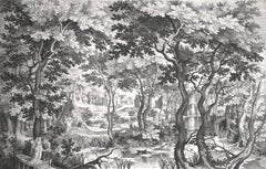
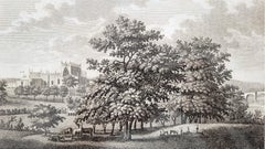
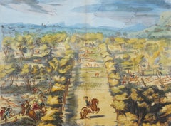
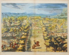
Landscape with Pair on Wooden Bridge

Landscape with Pair on Wooden Bridge

By Nicolaes de Bruyn

Located in Chicago, IL

Engraving after Egidius Coninxloo (c. 1581 - 1619), executed by Nicolaes De Bruyn (Antwerp 1571 - 1652 Amsterdam) Unidentified watermark

Category

Early 17th Century Old Masters Nicolaes de Bruyn Art

Materials

Engraving

Related Items
18th C. Portrait of Edward Stanley from Henry VIII's Court after Holbein Drawing

18th C. Portrait of Edward Stanley from Henry VIII's Court after Holbein Drawing

By Hans Holbein

Located in Alamo, CA

This is an 18th century engraved portrait of "Edward Stanley" created by Francesco Bartolozzi (1728–1815), after a drawing by Hans Holbein the Younger (1497- 1543) in the 16th century. Holbein was the official artist in the court of King Henry VIII. Bartolozzi used both etching and stipple engraving techniques to create the work which was published by John Chamberlaine in London in 1793 in "The Book of Imitations of Original Drawings by Hans Holbein in the Collection of His Majesty". Edward Stanley, 3rd Earl of Derby...

Category

Late 18th Century Old Masters Nicolaes de Bruyn Art

Materials

Engraving, Etching
Daniel Marot's The Siege of the Dutch Fortified City of Ypres by Louis XIV

Daniel Marot's The Siege of the Dutch Fortified City of Ypres by Louis XIV

By Daniel Marot

Located in Alamo, CA

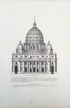
"Ypres, Grand Ville Riche & Marchande" is an engraving and etching by Daniel Marot (le Vieux) (1661–1752). It depicts a view of the siege of the city of Ypres and its citadel on the left in the Spanish Netherlands by Louis XIV's troops. This battle took place between March 18 and March 25, 1678, as part of the Franco-Dutch War. Marot illustrated in great detail (best appreciated with magnification) the French attack on the strong pentagonal citadel on the extreme left, which had been built recently in anticipation of a French attack. The trenches built by the French approaching the town are seen on the right. King Louis XIV can be seen in the foreground surveying the battle mounted on his white horse, surrounded by his officers and troops. The print is presented in an attractive ornate black wood frame with a cream-colored double mat with a black inner trim. It is glazed with plexiglas. The frame measures 25.38" x 22.63" x .88". The engraving, frame, mat and glazing are in excellent condition. Artist: Daniel Marot (1661–1752) was also called "Le Vieux". He was the son of the famous architect, Jean Marot. Marot had diverse interests and talents. In addition to his art, he designed garden projects, architectural ornaments, furniture, and even upholstery. Marot as a Huguenot protestant was forced to leave France in 1685 following the revocation of the Edict of Nantes. He emigrated to Holland, where he worked for William of Orange (an arch enemy of his former employer Louis XIV). Marot was largely responsible for the interiors of Williams palace at the Loo. In 1694 he went Britain as William had married Queen Mary and he had become King William III of England. He later returned to Holland in about 1698 and died in the Hague in 1752. He left a lasting legacy on the decorative arts in the Netherlands, where his grand version of the Louis XIV style remained popular into the 1730s. Historical Background: In October 1677, Mary Stuart, niece and possible successor of Charles II of England, married Louis XIV's arch enemy William III of Orange...

Category

Late 17th Century Old Masters Nicolaes de Bruyn Art

Materials

Engraving, Etching
Limon Lavrae: A 17th C. Hand-colored Engraving of Lemon Anatomy by G. Ferrari

Limon Lavrae: A 17th C. Hand-colored Engraving of Lemon Anatomy by G. Ferrari

By Giovanni Battista Ferrari

Located in Alamo, CA

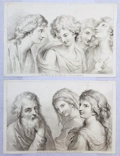
This 17th century hand-colored engraving of a lemon entitled "Limon Lavrae", plate 219 from Giovanni Baptista Ferrari's publication "Hesperides, sive, De Malorum Aureorum Cultura Etu...

Category

17th Century Old Masters Nicolaes de Bruyn Art

Materials

Engraving

Ancient Roman Architecture: Original Framed 18th C. Etching by G. Piranesi

Ancient Roman Architecture: Original Framed 18th C. Etching by G. Piranesi

By Giovanni Battista Piranesi

Located in Alamo, CA

"Veduta del Sepolcro della Famiglia Plauzia per la Strada Che Conduce da Roma a Tivoli vicino a Ponte Lugano" from "Le Antichità Romane" (Roman Antiquities), one of the most famous works by Piranesi. "Antichita" illustrates the tombs along the Appian Way...

Category

Early 18th Century Old Masters Nicolaes de Bruyn Art

Materials

Etching, Engraving, Drypoint

Northern Italy: A 16th Century Hand-colored Map by Abraham Ortelius

Northern Italy: A 16th Century Hand-colored Map by Abraham Ortelius

By Abraham Ortelius

Located in Alamo, CA

This is a framed 16th century hand-colored copperplate map of northern Italy entitled "Veronae Urbis Territorium a Bernardo Bragnolo Descriptium" by Abraham Ortelius from his atlas "Theatrum Orbis Terrarum", which was the first modern atlas of the world, with the first volume published in 1570. This map was part of a subsequent volume, published in Antwerp in 1584. It was based on an earlier map by Bernardo Brognoli. This beautiful map of northern Italy is focussed on Verona and its environs, including Mantua. Lake Garda and the South Tyrol mountains are prominently depicted. There is a very large striking cartouche in the upper left and a decorative distance scale in the lower right. This striking hand-colored map of northern Italy is presented in a gold-colored wood frame and an olive green-colored mat. It is glazed with UV conservation glass. All mounting materials used are archival. The frame measures 21.5" high by 28" wide by 0.75" deep. There is a central vertical fold, as issued, with slight separation of the lower portion of the fold. There are faint spots in the upper and right margins, but the map is otherwise in very good condition. Abraham Ortelius (also known as Ortels, Orthellius, and Wortels) (1527-1598) was a Dutch cartographer, geographer, and cosmographer. He began his career as a map colorist. In 1547 he entered the Antwerp guild of St Luke as an "illuminator of maps". He had an affinity for business from an early age and most of his journeys before 1560, were for business. He was a dealer in antiques, coins, maps, and books. 
His business income allowed him to acquire an extensive collection of medals, coins, and antiques, as well as a large library of books...

Category

16th Century Old Masters Nicolaes de Bruyn Art

Materials

Engraving

Ancient Roman Statues in the Vatican: A Grouping of Three 18th C. Engravings

Ancient Roman Statues in the Vatican: A Grouping of Three 18th C. Engravings

By Vincenzo Dolcibene

Located in Alamo, CA

This is a set of three framed 18th century engravings depicting statues found in the Vatican, including: "Pescatore" (Fisherman), "Pastore" (Shepherd) and "Istrione" (Actor), "Gia ne...

Category

1780s Old Masters Nicolaes de Bruyn Art

Materials

Engraving

Besler Autumn Snowflake and Meadow Saffron Flowers: 17th C. Botanical Engraving

Besler Autumn Snowflake and Meadow Saffron Flowers: 17th C. Botanical Engraving

By Basilius Besler 1

Located in Alamo, CA

A hand-colored copperplate engraving entitled "Leucoium bulbosum autumnale tenufolium (Autumn Snowflake); Colchicum vulgare Polyanthos; Colchicum biflorum; Colchicum vulgare album; C...

Category

17th Century Old Masters Nicolaes de Bruyn Art

Materials

Engraving

Red Roses: A Framed 17th C. Hand-colored Botanical Engraving by Basilius Besler

Red Roses: A Framed 17th C. Hand-colored Botanical Engraving by Basilius Besler

By Basilius Besler 1

Located in Alamo, CA

"Rosa ex rubro nigricans" (Red Roses); a hand-colored copper engraving from Basilius Besler's landmark work, Hortus Eystettensis (Garden at Eichstatt), first published in 1613 in Eichstatt, Germany near Nuremberg and later in 1640 and 1713. This engraving is presented in a glossy silver and matte gold-colored wood frame with a green edge and an elaborate double cream-colored French mats with light mauve bands; each accented by a broad decorative marbleized green band. It is glazed with plexiglass. There is text offset and a very small crease in the left margin, but the print is otherwise in excellent condition. Provenance: W. Graham Arader Gallery...

Category

17th Century Old Masters Nicolaes de Bruyn Art

Materials

Engraving

Besler Hand Colored Botanical Engraving of Wood Pink & Cottage Pink Flowers

Besler Hand Colored Botanical Engraving of Wood Pink & Cottage Pink Flowers

By Basilius Besler 1

Located in Alamo, CA

A 17th century hand-colored copper plate engraving entitled "Caryophyllus Maior Sylve Strisvarie Gatus" (Wood Pink & Cottage Pink Flowers) from Basilius Besler's landmark work, Hortus Eystettensis (Garden at Eichstatt), first published in 1613 in Eichstatt, Germany near Nuremberg and later in 1640 and 1713. This engraving is presented in a silver and gold-colored wood frame with a green edge and three elaborate cream-colored French mats...

Category

17th Century Old Masters Nicolaes de Bruyn Art

Materials

Engraving

View of Seravalle, Italy: A 16th Century Hand-colored Map by Braun & Hogenberg

View of Seravalle, Italy: A 16th Century Hand-colored Map by Braun & Hogenberg

By Franz Hogenberg

Located in Alamo, CA

This is an original 16th century copperplate originally hand-colored engraved map of View of Seravalle, Italy entitled "Seravallum Celeberrimum Marchiae Tarvisiniae in Agro Foro Juliensi Opp. - Seravalli, quam vides, Spectator, iconem, operi huic nostro suis sumptib. . . ." by Georg Braun & Franz Hogenberg, from their famous city atlas "Civitates Orbis Terrarum", published in Augsberg, Germany in 1575. The map depicts a view of Seravalle, now Vittorio Veneto, in San Marino, Italy, north of Venice, in a topographically accurate bird's-eye view from the south. A water-filled moat is seen to the south of the city walls and farmland to the east. Two men are depicted standing on a hill in the lower right in conversation next to grain sacks and a grazing horse, while a younger man behind them to the right herds a mule carrying presumably pigs. A very colorful and ornate title cartouche is in the upper center and coat-of-arms are in the right and left upper corners. Serravalle lies in an idyllic setting in the foothills and surrounded by orchards. St Mary's Cathedral with its tall bell tower is prominent in the center of the town. The marketplace and town hall with a bell tower in the square are depicted. Houses and shops are around the main square. Serravalle's importance as an agricultural centre is emphasized by the figures in the foreground. In 1337 Serravalle was conquered by the Republic of Venice. In 1866 the town was united with neighbouring Ceneda to form the town of Vittorio Veneto. The following is an English translation of an excerpt from the French description of the city on the back of the map: "Serravalle, a market town renowned for cloth, wine and grain, is in such a beautiful situation that the number of its inhabitants, attracted by the loveliness of the place, has grown so much at times that the wall encircling it has had to be enlarged for the third time. The city with the surrounding town once belonged to the Church in Ceneda as an imperial fief. It subsequently became the seat of the Da Camino family (a princely house that at that time was one of the five most noble in all Italy). Now the city is under the sway of the Venetians but is prudently governed by them. For they send only one city councillor with instructions to ensure that justice prevails and to collect duties. In all else, power lies in the hands of the noble families." This is a translation of the Latin in the title cartouche on the front: "The picture of the town of Serravalle, which you see, viewer, has been contributed to our work entirely at his own expense by Minutius, son of Hieronymus Minutius, a noble gentleman and one renowned for the far-reaching competence of his jurisdiction. We saw him sojourning in Cologne, where he was on business for Gregory XIII; while our good wishes accompany him, we should also like to accompany him on his way with this remembrance, even though it might be against his will, so that even those who have not seen him may learn of his excellence. However, those who do not yet know him will also see his excellence if God the Almighthy does not summon erring souls too soon back to the eternal seat of the Blessed." References: Van der Krogt 4, 4728, State 1; Taschen, Braun and Hogenberg, p.331; Fauser, #14960 This striking hand-colored city view is printed on laid, chain-linked paper with wide margins. The sheet measures 16" high by 21" wide. There is a central vertical fold as issued and French text on the verso, with Latin on the front. There is some discoloration in the upper and right margins which may represent some watercolor paint from the time of the original hand-coloring of the map. There is a small hole to the right of the upper portion of the vertical fold, which is only visible when held up to light and an area of reinforcement on the verso of the lower vertical fold. The map is otherwise in very good to excellent condition. Braun and Hogenberg's 'The Civitates Orbis Terrarum' was the second atlas of maps ever published and the first atlas of cities and towns of the world. It is one of the most important books published in the 16th century. Most of the maps in the atlas were engraved by Franz Hogenberg and the text, with its descriptions of the history and additional factual information of the cities, was written by a team of writers and edited by Georg Braun. The work contained 546 bird-eye views and map views of cities and towns from all over the world. It gave graphic representation of the main features of the illustrated cities and towns, including the buildings and streets. Although the ordinary buildings are stylized, the principal buildings are reproduced from actual drawings created on location. The principal landmarks and streets can still be recognized today. In addition, the maps often include the heraldic arms of the city, the nature of the surrounding countryside, the important rivers, streams and harbors, even depicting stone bridges, wooden pontoons, flat-bottomed ferries, ships and working boats, wharves and jetties, as well as land-based activities, including horsemen, pedestrians, wagons, coaches, and palanquins. Small vignettes are often included which illustrate the trade, occupations and habits of the local inhabitants, such as agriculture, paper-making and textiles, as well as local forms of punishment, such as gibbets, wheels, floggings etc. Large figures dressed in their local costume are often presented out of proportion in the foreground. The aim of the authors was to give as much information as possible in a pleasing visual form. They succeeded in creating maps that were both informative and decorative works of art. The atlas is a wonderful glimpse of life in medieval Europe. Georg Braun (1541-1622) was German Catholic...

Category

16th Century Old Masters Nicolaes de Bruyn Art

Materials

Engraving

Europe: An Original 18th Century Hand-colored Map by E. Bowen

Europe: An Original 18th Century Hand-colored Map by E. Bowen

By Emanuel Bowen 1

Located in Alamo, CA

This is an original 18th century hand-colored map entitled "A New & Accurate Map of Europe Drawn from the Best Authorities Assisted by the Most Improved Modern Charts and Maps." by E...

Category

Mid-18th Century Old Masters Nicolaes de Bruyn Art

Materials

Engraving

Nicolaes De Bruyn art for sale on 1stDibs.

Find a wide variety of authentic Nicolaes de Bruyn art available for sale on 1stDibs. You can also browse by medium to find art by Nicolaes de Bruyn in engraving and more. Much of the original work by this artist or collective was created during the 18th century and earlier and is mostly associated with the Old Masters style. Not every interior allows for large Nicolaes de Bruyn art, so small editions measuring 23 inches across are available. Customers who are interested in this artist might also find the work of Anthonie Waterloo, Jan Frans van Bloemen (Orizzonte), and Frans Hogenberg. Nicolaes de Bruyn art prices can differ depending upon medium, time period and other attributes. On 1stDibs, the price for these items starts at $10,500 and tops out at $10,500, while the average work can sell for $10,500.

Artists Similar to Nicolaes de Bruyn