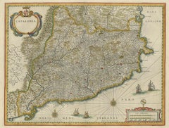
By Willem Blaeu
Located in Wilton Manors, FL
About this Item
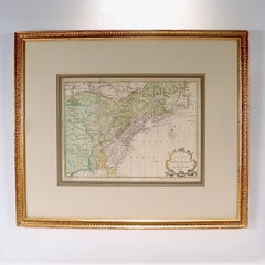
Map. Engraving. Image measures 14.75 x 19.25". Framed measurement: 24.5 x 27 inches.
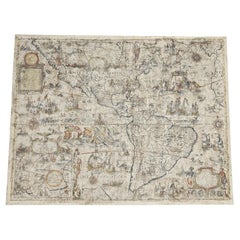
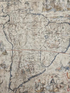
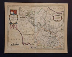
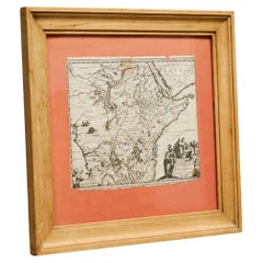
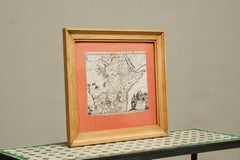
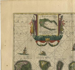
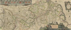
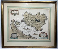
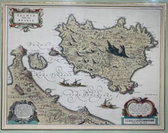
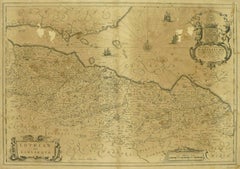
This stunning circa 1640 map of the volcanic island of Ischia located in the Tyrrhenian Sea on the northern part of the Gulf of Naples depicts the mountainous island in exquisite detail. A combination of a map and a Bird's-eye view, it covers the island as well the coast of nearby Naples. The peninsula of Capo Miseno as well as the island of Procida are included. Oriented with north at the bottom, the map beautifully notes the various towns, cities, rivers, fields, etc. Forests and mountains are rendered in profile with the highest peak of Mount Epomeo clearly towering above the rest. Individual buildings and castles are rendered in profile, including the medieval Aragonese Castle that stands on the volcanic rocky islet that connects to the larger island of Ischia by a stone bridge. Ships are seen sailing in the Gulf of Naples. At the time this map was issued, the Barbary Pirates operated in the region and for centuries terrorized the islanders. Many of the inhabitants ended up as slaves to the pirates. The map includes three decorative cartouches including a beautiful title cartouche in the top left corner. The map is in very good condition with minor wear along the centerfold.
Adding value and visual appeal to this piece is the stunning ca. 1950s professional custom frame with exquisite French matting. Gold leaf detailing.
Willem Blaeu...
Category
17th Century Baroque Willem Blaeu
MaterialsLaid Paper, Engraving