18th Century and Earlier Maps
to
2,341
2,861
110
2,974
26
12
1
1
2,974
2,233
473
3
288
34
9
126
8
36
9
2
5
4
3
2
2,960
30
20
3
3
322
123
77
62
48
2,974
2,974
2,974
63
24
16
13
13
Period: 18th Century and Earlier
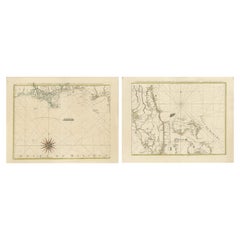
Map of Florida, Louisiana and the Bahamas – Set of Rare French Sea Charts, 1777
Located in Langweer, NL
1777 Le Rouge Map of Florida, Louisiana, and the Bahamas. Lot of 2 large maps: "Carte de la Floride Occidentale et Louisiane & La Peninsule et Golfe de la Floride"
This rare and im...
Category
Antique 18th Century and Earlier Maps
Materials
Paper
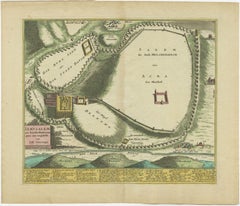
1720 Weigel Engraving of Jerusalem: A Biblical View from Josephus' Perspective
Located in Langweer, NL
1720 Weigel Map of Jerusalem Based on Josephus' Writings
This intricate 1720 bird's-eye view map of ancient Jerusalem by I.H. Coccejo, engraved by Christoph Weigel, offers a fasc...
Category
Antique 18th Century and Earlier Maps
Materials
Paper
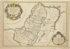
1709 Map of the Holy Land - Twelve Tribes of Israel, Hand-Colored, Antique Map
Located in Langweer, NL
This is a beautiful 1709 map of the Holy Land, titled "Iudaea seu Terra Sancta quae Hebraeorum sive Israelitarum in suas duodecim Tribus divisa," by Guillaume Sanson and Alexis Huber...
Category
Antique 18th Century and Earlier Maps
Materials
Paper
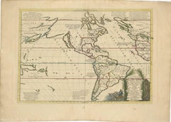
Mythical Atlantis Restored - A 1694 Map of the Americas and Ancient Geography
Located in Langweer, NL
This rare and fascinating map, titled "Atlantis Insula a Nicolao Sanson Antiquitati Restituta" by Guillaume Sanson, presents an unusual interpretation of the Western Hemisphere, comb...
Category
Antique 18th Century and Earlier Maps
Materials
Paper
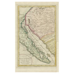
Map of Baja California and Mexico - Jesuit Observations and Native Tribes, 1777
Located in Langweer, NL
1777 A. Krevelt Map of Baja California and Northwestern Mexico - Jesuit Observations and Native Tribes
A. Krevelt - Carte de la Californie d'Après les observations les plus exactes ...
Category
Antique 18th Century and Earlier Maps
Materials
Paper
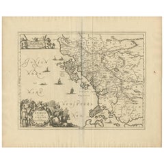
Antique Map of Epirus 'Albania, Greece' by J. Janssonius, circa 1650
Located in Langweer, NL
This map covers the northwestern coast of Greece and part of present-day Albania. The map was drawn by Johannes Wilhelm Laurenberg, a mathematician and historian who produced several...
Category
Antique 18th Century and Earlier Maps
Materials
Paper
Original Antique Map of Jerusalem Based on Josephus' Writings by Weigel, ca.1720
Located in Langweer, NL
1720 Weigel Map of Jerusalem Based on Josephus' Writings
This intricate 1720 bird's-eye view map of ancient Jerusalem by I.H. Coccejo, engraved by Christoph Weigel, offers a fasc...
Category
Antique 18th Century and Earlier Maps
Materials
Paper
Very Attractive Antique Map of the World as Planisphere, Shows Cook's Voyages
Located in Langweer, NL
Antique map titled 'Chart of the World, according to Mercators Projection'. This world map shows the various discoveries of Captain James Cook during his 3 voyages between 1768 and 1780, and the English and French Explorers who followed immediately thereafter, including Vancouver and La Perouse. This edition of the map is significantly revised from the editions issued immediately after the official report of Cook's Voyages were integrated into the map, showing better detail in New Zealand, Australia, the Northwest Coast of America and North East coast of Asia, along with Greenland. A new large lake also appears for the first time in the Western part of North America, shortly before the commencement of the Lewis...
Category
Antique 18th Century and Earlier Maps
Materials
Paper
$1,329 Sale Price
25% Off
Original Antique Map of Ancient Greece, Achaia, Corinth, 1786
Located in St Annes, Lancashire
Great map of Ancient Greece. Showing the region of Thessaly, including Mount Olympus
Drawn by J.D. Barbie Du Bocage
Copper plate engraving by P.F Tardieu
Original hand color...
Category
French Other Antique 18th Century and Earlier Maps
Materials
Paper
Old Original Print Depicting the Ruins of the City of Palmyra, Syria, 1782
Located in Langweer, NL
The print is a detailed 18th-century engraving depicting the ruins of the ancient city of Palmyra in Syria. It is titled "Ruins of Palmyra" and was published by Harrison & Co in the ...
Category
English Antique 18th Century and Earlier Maps
Materials
Paper
16th Century Map of Saudi Arabia, the Persian Gulf and Red Sea, ca. 1574
Located in Langweer, NL
Ptolemaic map of the Arabian Peninsula based on the 1548 map of Giacomo Gastaldi. It covers nearly all of the peninsula, but does not include the head of the Red Sea. The coastlines ...
Category
Antique 18th Century and Earlier Maps
Materials
Paper
$440 Sale Price
20% Off
Very Decorative Rare Antique Map of the Northern Part of Africa, 1702
Located in Langweer, NL
Antique map titled 'Africae Pars Borealis.'
Very decorative antique map of the northern part of Africa by Heinrich Scherer. The map is full of the spurious geography of the perio...
Category
Antique 18th Century and Earlier Maps
Materials
Paper
$935 Sale Price
20% Off
Finely Engraved Historical Map of Middle East and Asia, c.1745
Located in Langweer, NL
Description: Antique map titled'Theatrum Historicum pars Orientalis.'
Finely engraved historical map with a profusion of details. It shows the Middle East and Asia. Decorative ti...
Category
Antique 18th Century and Earlier Maps
Materials
Paper
$1,370 Sale Price
20% Off
Antique Map of France by Janssonius, c.1650
Located in Langweer, NL
Antique map titled 'Gallia Vetus'. Beautiful map of France based on Caesar's De Bello Gallico. In the columns to the left and right important tribes and people are described.
Art...
Category
Antique 18th Century and Earlier Maps
Materials
Paper
$496 Sale Price
20% Off
Antique Miniature Map of France and the Low Countries by Mallet, circa 1719
Located in Langweer, NL
Antique map titled 'France - Païs-Bas'. Miniature Map of France and the Low Countries. Published by A.M. Mallet, circa 1719.
Frame included. We carefully pack our framed items to ...
Category
Antique 18th Century and Earlier Maps
Materials
Paper
$165 Sale Price
20% Off
1792 Hand-Colored Plan of St. Petersburg and Moscow in Russia
Located in Langweer, NL
Title: 1792 Hand-Colored Plan of St. Petersburg and Moscow
Description: This rare 1792 map features detailed plans of two iconic Russian cities, St. Petersburg and Moscow. The upp...
Category
Antique 18th Century and Earlier Maps
Materials
Paper
Spectacular Antique Original Engraving of a Town Plan of Jerusalem, 1708
Located in Langweer, NL
Description: Antique map titled 'Erster Abriss der Stadt Jerusalem wie sie Furnemblich zur Zeit des Hernn Christi beschaffen (..).'
Spectacular town plan...
Category
Antique 18th Century and Earlier Maps
Materials
Paper
$1,275 Sale Price
20% Off
Greece and Ottoman Balkans Map – Homann Engraving ca. 1720
Located in Langweer, NL
Greece and the Danube Basin Map c.1720 – Antique Engraving of the Balkans
This remarkable early 18th-century map presents a sweeping view of southeastern Europe, centering on the co...
Category
European Antique 18th Century and Earlier Maps
Materials
Paper
Antique County Map, Shropshire, English, Atlas Engraving, Richard Blome, C.1673
Located in Hele, Devon, GB
This is an antique county map of Shropshire. An English, framed atlas engraving by Richard Blome, dating to the 17th century and later.
A treat for the collector or county native, ...
Category
British Restauration Antique 18th Century and Earlier Maps
Materials
Glass, Wood, Paper
Antique 1743 Map – Travels of Jesus Christ & Apostles by Seutter
Located in Langweer, NL
Antique 1743 Map – Travels of Jesus Christ & Apostles by Seutter
This is an original antique map titled “Carte des Voyages de Notre Seigneur Jesus-Christ et des Actes des Apotres St...
Category
German Antique 18th Century and Earlier Maps
Materials
Paper
Antique Map of the Northern Hemisphere and North Pole by Tirion, circa 1754
Located in Langweer, NL
Antique map titled 'Nieuwe Kaart van de Noord Pool na de alderlaatste ondekking int licht gebracht'. Map of the Northern Hemisphere and North Pole, which shows the NE Passage, but no...
Category
Antique 18th Century and Earlier Maps
Materials
Paper
$665 Sale Price
24% Off
Very Decorative Original Antique Map of the World, Published in France in c.1780
Located in Langweer, NL
Antique map titled 'L'Ancien Monde Et Le Nouveau en Deux Hemispheres' - Double hemisphere map of the World, showing the contemporary geographical...
Category
Antique 18th Century and Earlier Maps
Materials
Paper
$727 Sale Price
20% Off
18th-Century Map of the Swiss Confederation by Robert de Vaugondy
Located in Langweer, NL
Title: 18th-Century Map of the Swiss Confederation by Robert de Vaugondy
Description: This detailed 18th-century map by Gilles Robert de Vaugondy presents the Swiss Confederation,...
Category
Antique 18th Century and Earlier Maps
Materials
Paper
Original Antique Map of Canaan, Armenia, Syria, Mesopotamia and Arabia, 1709
Located in Langweer, NL
Antique map titled 'Descriptio Paradisi et Terrae Canaan'.
Original antique map of Canaan, Armenia, Syria, Mesopotamia and Arabia. It displays the Middle East from the eastern Mediterranean Sea to the Persian Gulf...
Category
Antique 18th Century and Earlier Maps
Materials
Paper
$637 Sale Price
20% Off
The 'Brazen Sea' in Solomon's Temple and a Cross Section of the Brazen Sea, 1725
Located in Langweer, NL
Two religious images on one sheet titled 'Kopere Zee in den Tempel van Salomon' and 'Doorsnede van de Kopere Zee des Tempels van Salomon'.
The 'Brazen Sea' in Solomon's Temple an...
Category
Antique 18th Century and Earlier Maps
Materials
Paper
$368 Sale Price
20% Off
Antique Map of the Coast of Southern France, 1793
Located in Langweer, NL
Antique map titled '14th Chart of the Coast of France, from Port Vendres to the Petit Rhône'. Original map with later hand coroling of the coast of Southern France.
The "14th Chart of the Coast of France, from Port Vendres to the Petit Rhône" is an antique map that offers a detailed depiction of the southern coast of France, specifically highlighting the Mediterranean coastline. This map, which dates back to 1793, was originally part of "Le Petit Neptune Français; Or, French Coasting Pilot," a publication designed for maritime navigation along the French coastlines.
Key Features of the Map:
1. **Geographic Coverage**:
- The map covers the southern French coastline from Port Vendres in the west to the Petit Rhône in the east.
- It includes notable regions such as Languedoc, the Gulf of Lyon, and parts of Catalonia (Spain).
2. **Notable Places**:
- **Montpellier**: A major city in the Diocese of Montpellier, an important cultural and economic center.
- **Narbonne**: Located in the Diocese of Narbonne, a historical city with Roman heritage.
- **Agde**: Situated in the Diocese of Agde, known for its ancient Greek colony origins.
- **Béziers**: Part of the Diocese of Béziers, another city with deep historical roots dating back to Roman times.
- **Port Vendres**: A critical port near the Spanish border.
- **Catalonia**: Including parts of northeastern Spain, emphasizing the coastal connection between France and Spain.
3. **Dioceses and Regions**:
- The map is marked with various dioceses such as Montpellier, Agde, Narbonne, and Béziers, indicating ecclesiastical boundaries.
- It highlights the broader region of Languedoc, a historical province known for its wine production and medieval history.
4. **Navigational Aids**:
- The map features a compass rose with radiating lines, a common navigational aid in maritime maps...
Category
Antique 18th Century and Earlier Maps
Materials
Paper
$226 Sale Price
20% Off
Antique World Map by P. Schenk '1706'
By Peter Schenk
Located in Langweer, NL
Antique map titled 'Diversa Orbis Terrae. Visu Incedente per Coluros Tropicorum, Ambos Ejus Polos, et Parciularis Sphaerae Zenith, in Planum Orthographica Projectio (..) Plat Ontwerp van verscheyde Aert-klooten (..)'. One of the earliest Dutch World Maps to focus on a more modern cartographic style, based on Carel Allard's map of 1696. This map represented a noteworthy shift from the traditional decorative Dutch 17th century maps where the margins would be full of classical mythological...
Category
Antique 18th Century and Earlier Maps
Materials
Paper
$5,103 Sale Price
20% Off
Map of Virgin Islands and Lesser Antilles by Rigobert Bonne, c. 1780
Located in Langweer, NL
Map of Virgin Islands and Lesser Antilles by Rigobert Bonne, c. 1780
This fine antique map is titled 'Supplément pour les Isles Antilles, extrait des cartes angloises' and was engraved by Rigobert Bonne, Ingénieur-Hydrographe de la Marine, around 1780. It depicts:
Upper half:
* The Virgin Islands (*Les Isles Vierges*), including:
* St. Thomas
* St. John
* Tortola
* Virgin Gorda
* Jost Van Dyke
* Surrounding smaller islands and passages.
* Parts of Puerto Rico visible left.
Lower half:
Nine inset maps of individual Caribbean islands with coastal details:
1. I. de la Barboude (Barbuda)
2. I. St. Christophe (St. Kitts)
3. I. Antigoa (Antigua)
4. I. de la Dominique (Dominica)
5. I. de Sainte Lucie (St. Lucia)
6. I. de la Barbade (Barbados)
7. I. de St. Vincent
8. I. de la Grenade (Grenada)
9. I. de Tabago (Tobago)
Features:
* Coastal names, bays, capes, and harbours noted.
* Fine clear engraving typical of Bonne’s atlases for maritime use.
* Scale bar with French lieues marines.
Engraver: Rigobert Bonne
Date: circa 1780
Published in: Atlas Encyclopédique
Condition:
Good dark impression on laid paper with wide margins. Some slight toning along centre fold and faint edge wear consistent with age. Original platemark visible.
Framing suggestions:
Display with other Bonne Caribbean or West Indies maps in a travel, history, or colonial themed wall. Ideal floated in a black or walnut wood frame with archival matting to preserve the crisp engraving.
Keywords:
Rigobert Bonne Caribbean maps...
Category
French Antique 18th Century and Earlier Maps
Materials
Paper
Rare Antique Map of the Middle East, ca.1690
Located in Langweer, NL
Description: Antique print, untitled.
Two decorative maps on one sheet of the middle east in biblical times. Source unknown, to be determined.
Artists and Engravers: Anonymous...
Category
Antique 18th Century and Earlier Maps
Materials
Paper
$340 Sale Price
20% Off
Rare 1572 Map of Ancient Rome with Monuments by Ligorio, Braun & Hogenberg
Located in Langweer, NL
Rare 1572 Map of Ancient Rome with Monuments by Ligorio, Braun & Hogenberg
This remarkable 16th-century map, *Urbis Romae Situs cum ils quae adhuc Conspiciuntur Veter. Monumet Rel...
Category
Antique 18th Century and Earlier Maps
Materials
Paper
Saint Domingue Map 1793 – Colonial Haiti and Dominican Republic Plan
Located in Langweer, NL
1793 Map of Saint Domingue (Haiti and DR) – Colonial Island Plan
This antique map is titled “A Map of the Island of St. Domingo” and dates from circa 1793. It depicts the entire isl...
Category
English Antique 18th Century and Earlier Maps
Materials
Paper
Original Antique Map of Arabia and the Red Sea
Located in Langweer, NL
Antique map titled 'Carte de la Coste d'Arabie (..) - Kaart van de Kust van Arabië (..)'. This is a Dutch version, engraved by J. van Schley, of Bellin's map of Arabia and the Red Sea...
Category
Antique 18th Century and Earlier Maps
Materials
Paper
$444 Sale Price
20% Off
1711 Star Chart of Southern Sky with Mythical Constellations and Exotic Animals
Located in Langweer, NL
1711 Star Chart of the Southern Sky - "Mappa Stellarum Australium quae in Altitudine Poli Borei Graduum"
This beautiful star chart, engraved by Arnold van Westerhout in 1711, shows ...
Category
Antique 18th Century and Earlier Maps
Materials
Paper
$1,597 Sale Price
20% Off
Rare 1757 Jesuit Map of California and Baja, Dedicated to the King of Spain
Located in Langweer, NL
Title: Rare 1757 Jesuit Map of California and Baja, Dedicated to the King of Spain
This rare and detailed map, titled *Carte de la Californie Levee par la Société des Jésuites*, wa...
Category
Antique 18th Century and Earlier Maps
Materials
Paper
Antique Engraving with a Plan of Rhodes, Greece, 1688
Located in Langweer, NL
Description: Antique map, titled: 'Rhodos.' - Plan of Rhodes, Greece. This map originates from 'Nauwkeurige Beschrijving der eilanden in de in de Archipel der Middellantsche Zee', by...
Category
Antique 18th Century and Earlier Maps
Materials
Paper
$425 Sale Price
20% Off
Antique Map of Yemen by Schraembl, 1789
Located in Langweer, NL
Antique map titled 'Karte von dem groessten Theil des Landes Jemen'. Original map of Yemen, this map is the first printed map specifically of Yemen, and t...
Category
Antique 18th Century and Earlier Maps
Materials
Paper
$850 Sale Price
20% Off
Rare Original Map of New Amsterdam (New York) – “Restitutio”, ca. 1674 –
Located in Dronten, NL
An exceptionally rare and original 17th-century engraving of New Amsterdam, now New York City, published by the renowned Amsterdam cartographer Carel (Carolus) Allard around 1674. Kn...
Category
Dutch Antique 18th Century and Earlier Maps
Materials
Paper
Original Hand-Colored Antique Regional Map of Switzerland, 1753
Located in Langweer, NL
Antique map Switzerland titled 'Territorium Reipublicae liberae Helveticae Scaphusiensis (..)'. Regional map of Switzerland.
Artists and En...
Category
Antique 18th Century and Earlier Maps
Materials
Paper
$557 Sale Price
20% Off
Original Antique Hand-colored World Map with or without Frame, '1696'
Located in Langweer, NL
Antique world map titled 'Mappe-Monde dressee sur les Observations de Mrs. de l'Academie Royale des Sciences (..)'. Beautiful original antique world map...
Category
Antique 18th Century and Earlier Maps
Materials
Paper
$4,253 Sale Price
20% Off
Biblical Map and Family Trees of the Holy Land by Chatelain, ca. 1720
Located in Langweer, NL
Title: 1720 Chatelain Map of the Holy Land with Biblical Family Trees and Chronology
Description:
This fascinating 18th-century folio map by Henry Abraham Chatelain combines geo...
Category
Antique 18th Century and Earlier Maps
Materials
Paper
Rare Hand-Colored Map of Lorraine and Barrois, France by Frederik De Wit c. 1688
Located in Langweer, NL
Title: Rare Hand-Colored Map of Lorraine and Barrois by Frederik De Wit c. 1688
Description: This remarkable 17th-century map, titled "Generalis Lotharingiae Ducatus," offers a deta...
Category
Antique 18th Century and Earlier Maps
Materials
Paper
Large Antique Map of the East Indies, with Inset of the Philippines
Located in Langweer, NL
Antique map titled 'A Map of the East Indies (..)'. Large antique map of Southeast Asia, India, and part of China, extending to Tibet, the Maladives, Sumatra, part of Borneo, Hainan,...
Category
Antique 18th Century and Earlier Maps
Materials
Paper
$463 Sale Price
20% Off
North & South America: A 17th Century Hand-colored Map by Jansson & Goos
Located in Alamo, CA
A 17th century hand-colored map of North & South America entitled "Americae Descriptio" by the cartographer Johannes Jansson, published in Jansson's Atlas Minor in Amsterdam in 1628....
Category
Dutch Antique 18th Century and Earlier Maps
Materials
Paper
Jerusalem and Temple Imaginary Map by Blome, Published London 1689
Located in Langweer, NL
Imaginary Plan of Jerusalem by Blome after Villalpando, 1689
This impressive antique engraving presents an imaginary plan of Jerusalem by Richard Blome, published in 1689. The engra...
Category
English Antique 18th Century and Earlier Maps
Materials
Paper
Antique Map of London by Tirion '1754'
Located in Langweer, NL
Antique map titled 'Kaart van Londen enz. en van het naby gelegen land ruim een Uur gaans rondsom dezelve Stad; getrokken uit de groote gemeeten Kaart van Hr. John Rocque'. In the se...
Category
Antique 18th Century and Earlier Maps
Materials
Paper
$756 Sale Price
20% Off
Antique Map of Morocco Showing Towns of Marakesh, Taradant and Fez, 1636
Located in Langweer, NL
Antique map titled 'Fezzae et Marocchi regna Africae Celeberrima'. Map of Morocco, showing large fortified towns of Marakesh, Taradante and Fez, towns, mountains, rivers, lakes, etc....
Category
Antique 18th Century and Earlier Maps
Materials
Paper
$1,181 Sale Price
20% Off
Antique Print of the Korte Vijverberg in The Hague, The Netherlands, c.1760
Located in Langweer, NL
Antique print titled 'Gesicht by de Doelen over de Korte Vyverberg tot Gravenhaghe'. Beautiful view on the Korte Vijverberg, next to the Hofvijver in The Hague. On the right-hand sid...
Category
Antique 18th Century and Earlier Maps
Materials
Paper
Java, Sumatra & Borneo Map – Bellin & van Schley Decorative Chart, 1750s
Located in Langweer, NL
Carte des Isles de Java, Sumatra, Borneo – Decorative Map by Bellin & van Schley, 1750s
This richly detailed and decorative map titled Carte des Isles de Java Sumatra Borneo & les d...
Category
European Antique 18th Century and Earlier Maps
Materials
Paper
$614 Sale Price
20% Off
Antique Print of the Marketplace in Anamooka, Tonga Islands, c.1790
Located in Langweer, NL
Antique print titled 'View in Anamooka and the Inhabitants'. Depicts the marketplace that was established in a ring in front of the main house in Anamooka, Tonga - named the Friendly Islands because of his reception when James Cook's third Pacific voyage arrived there in May 1777.
Artists and Engravers: Engraved for Bankes's 'New System of Geography'. Published by Royal Authority.
Condition: Good, age-related toning. Please study image carefully.
Date: c.1790
Overall size: 38.6 x 23.2 cm.
Image size: 30.6 x 21.5 cm.
A View at Anamooka
This engraving after a drawing comes from the official account of Cook's third voyage, 'A voyage to the Pacific Ocean'.
Captain James Cook (1728-1779) made three separate voyages to the Pacific (with the ships Endeavour, Resolution, Adventure, and Discovery) and did more than any other voyager to explore the Pacific and Southern Ocean. Cook not only encountered Pacific cultures for the first time, but also assembled the first large-scale collections of Pacific objects to be brought back to Europe. He was killed in Hawaii in 1779.
Cook was in Nomuka (Annamooka), Tonga or Friendly Isles from May 1-14, 1777.
"On May 2 1777 the expedition reached Nomuka and anchored in the harbour on the north side of the island, which Cook had already used in June 1774. Both ships were in want of refreshments. A camp was erected on shore both as a trading post and a workshop for repairs. Watering, cutting wood...
Category
Antique 18th Century and Earlier Maps
Materials
Paper
$226 Sale Price
20% Off
Antique Map of the Province Groningen in The Netherlands, c.1680
Located in Langweer, NL
Antique map titled 'Groningae et Omlandiae Dominium vulgo de Provincie van Stadt en Lande'.
Old map of the province of Groningen, the Netherlands. This map originates from 'Germani...
Category
Antique 18th Century and Earlier Maps
Materials
Paper
$463 Sale Price
20% Off
1640 Map of North Africa Nova Barbariae Descriptio or The Barbarian Coast
Located in Langweer, NL
1640 Antique Map of North Africa 'Nova Barbariae Descriptio' by Johannes Janssonius
This antique map titled Nova Barbariae Descriptio*, published by Johannes Janssonius around 1640,...
Category
Antique 18th Century and Earlier Maps
Materials
Paper
$453 Sale Price
20% Off
West Coast of Africa, Guinea & Sierra Leone: An 18th Century Map by Bellin
Located in Alamo, CA
Jacques Bellin's copper-plate map entitled "Partie de la Coste de Guinee Dupuis la Riviere de Sierra Leona Jusquau Cap das Palmas", depicting the coast of Guinea and Sierra Leone in ...
Category
French Antique 18th Century and Earlier Maps
Materials
Paper
Antique Map of Tracks of Anson's Ships around South America & Cape Horn, 1749
Located in Langweer, NL
Description: Antique map titled 'Kaart van het Zuidelykste Gedeelte van Zuider Amerika (..) - Carte de la Partie Meridionale de l'Amerique Meridionale (..)'.
Detailed chart tracking the route of Capt. George Anson's ship The Centurion in 1745. The chart shows the tracks of Anson's ships around South America & Cape Horn to the Juan Fernandes Islands, with notes on currents and positions.
In 1740 Capt. George Anson (1697-1762) of the Royal Navy, was given command of a squadron of ships. As England was at war with France and Spain, Anson's task was to intercept and capture a Spanish treasure...
Category
Antique 18th Century and Earlier Maps
Materials
Paper
$614 Sale Price
20% Off
Antique Map of the Bildt Region by Schotanus, 1664
Located in Langweer, NL
Antique map titled 'De Grietenije van der Bildt (..)' Map of the Grietenij of Het Bildt, Friesland, The Netherlands. Multiple cartouches, key and coat of arms. Originates from ""Besc...
Category
Antique 18th Century and Earlier Maps
Materials
Paper
1584 Abraham Ortelius Map of Lower Burgundy, France
Located in Langweer, NL
1584 Abraham Ortelius Map of Lower Burgundy, France
Description of the Map:
This antique map by Abraham Ortelius, titled "Bvrgvndiae Inferioris Qvae Dvcatvs Nomine Censetur Des," w...
Category
Antique 18th Century and Earlier Maps
Materials
Paper
$1,200 Sale Price
20% Off
Old Genuine Antique Map of Tartary in the Russian Far East
Located in Langweer, NL
Original antique map titled 'Tartaria sive Magni Chami Imperium'. This great map of Tartary covers all of eastern Asia between the Caspian Sea and northern China and Manchuria. Being...
Category
Antique 18th Century and Earlier Maps
Materials
Paper
$1,323 Sale Price
20% Off
Rare Antique Map of the Americas with Island California by Danckerts, c.1680
Located in Langweer, NL
Rare Antique Map of the Americas with Island California by Justus Danckerts, ca. 1696
This exceptional antique map titled Novissima et Accuratissima Totius Americae Descriptio per I...
Category
Dutch Antique 18th Century and Earlier Maps
Materials
Paper
Large 1750 Map of the Kingdoms of Spain and Portugal by Robert de Vaugondy
Located in Langweer, NL
1750 Map of the Kingdoms of Spain and Portugal by Robert de Vaugondy
Description:
This map, titled *"Royaumes d'Espagne et de Portugal,"* was created in 1750 by the esteemed French ...
Category
Antique 18th Century and Earlier Maps
Materials
Paper
$614 Sale Price
20% Off
Original Antique Map of Normandy, France
Located in Langweer, NL
Antique map titled 'Carte de Normandie (..)'. Attractive map of Normandy, France. it depicts the former French Duchy of Normandy, covers the region fro...
Category
Antique 18th Century and Earlier Maps
Materials
Paper
$746 Sale Price
20% Off
Antique 18th Century Map of the Province of Pensilvania 'Pennsylvania State'
Located in Philadelphia, PA
A fine antique of the colony of Pennsylvania.
Noted at the top of the sheet as a 'Map of the province of Pensilvania'.
This undated and anonymous map is thought to be from the Gentleman's Magazine, London, circa 1775, although the general appearance could date it to the 1760's.
The southern boundary reflects the Mason-Dixon survey (1768), the western boundary is placed just west of Pittsburgh, and the northern boundary is not marked.
The map has a number of reference points that likely refer to companion text and appear to be connected to boundaries. The western and southern boundaries are marked Q, R, S, for example. A diagonal line runs from the Susquehanna R to the Lake Erie P. A broken line marked by many letters A, B, N, O, etc., appears in the east.
There are no latitude or longitude markings, blank verso.
Framed in a shaped contemporary gilt wooden frame and matted under a cream colored matte.
Bearing an old Graham Arader Gallery...
Category
British American Colonial Antique 18th Century and Earlier Maps
Materials
Paper
