18th Century and Earlier Maps
to
2,336
2,863
64
2,930
26
12
1
1
2,930
2,261
475
3
290
34
10
126
10
37
9
2
5
4
3
3
2,916
30
20
3
3
293
110
72
53
43
2,930
2,930
2,930
59
21
13
12
12
Period: 18th Century and Earlier
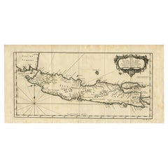
Antique Map of Java and Madura Island, Indonesia, c.1760
Located in Langweer, NL
Antique map titled 'Idee de l'Isle de Java.'
Well engraved and attractive chart of the island shows all principal harbors and coastal details, plus rivers, mountains and volcanoe...
Category
Antique 18th Century and Earlier Maps
Materials
Paper
$428 Sale Price
20% Off
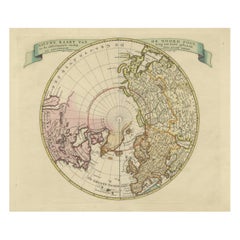
Beautiful Antique Map of the Northern Hemisphere with California as an Island
By Isaak Tirion
Located in Langweer, NL
Antique map titled 'Nieuwe Kaart van de Noord Pool na de alderlaatste ontdekking int licht gebracht tot Amsterdam door Isaak Tirion'. Beautiful map of the Northern Hemisphere and Nor...
Category
Antique 18th Century and Earlier Maps
Materials
Paper
$685 Sale Price
20% Off
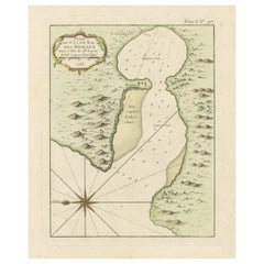
Roseaux, St. Lucia Island Map by BELLIN, Handcolored Engraving, 1763
Located in Langweer, NL
Dating back to around 1763, this antique hand-colored print, a creation by Jacques Nicolas Bellin, unveils a meticulously detailed "Plan du Cul de Sac des Roseaux dans l'Isle de Ste....
Category
Antique 18th Century and Earlier Maps
Materials
Paper
$276 Sale Price
20% Off
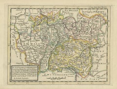
Decorative Original Antique Map of Southern Germany, c.1730
Located in Langweer, NL
"Antique map titled 'The South West Part of Germany. Containing ye Dominions of the Archbishops and Electors of Mentz Y Treves, and of ye Elec. Palatine of ye Rhine; with Franconia, ...
Category
Antique 18th Century and Earlier Maps
Materials
Paper
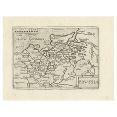
Extremele Rare, Original Miniature Map of Prussia, ca.1640
Located in Langweer, NL
Antique map titled 'Prussia'. Extremele rare, original miniature map of Prussia, a historically prominent German state that originated in 1525 with a du...
Category
Antique 18th Century and Earlier Maps
Materials
Paper
$837 Sale Price
20% Off
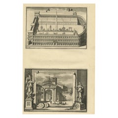
Antique Engraving of Circus Flaminius, a Circular Area in Ancient Rome, 1704
Located in Langweer, NL
Description: Antique print, titled: 'Circus Flaminius (…)' -
This original old antique print shows a reconstruction of Circus Flaminius, a large, circular area in ancient Rome, l...
Category
Antique 18th Century and Earlier Maps
Materials
Paper
$180 Sale Price
20% Off
Antique County Map, Hampshire, English, Framed Cartography, Robert Morden, 1700
Located in Hele, Devon, GB
This is an antique county map of Hampshire. An English, framed atlas engraving of cartographic interest By Robert Morden, dating to the late 17th century and later.
Superb lithogra...
Category
British Other Antique 18th Century and Earlier Maps
Materials
Glass, Wood, Paper
Rare Antique Copper Engraving of a Map of Pegu and Arakan, Burma (Myanmar), 1714
Located in Langweer, NL
Antique map Myanmar (Birma) titled 'Les Royaumes de Pegu et d'Aracan'.
Rare map of Pegu and Arakan made after a map engraved by Pieter van den Keere and published in the 1628 edi...
Category
Antique 18th Century and Earlier Maps
Materials
Paper
$513 Sale Price
20% Off
Antique Map: Carte du Détroit du Sond with Copenhagen Inset, 1693
Located in Langweer, NL
Antique Map: Carte du Détroit du Sond with Copenhagen Inset, Jaillot/Mortier, 1693
This rare and striking antique map, titled *Carte du détroit du Sond contenant les costes de l’Is...
Category
Antique 18th Century and Earlier Maps
Materials
Paper
$2,141 Sale Price
20% Off
Rare Antique Print of a Fountain by Delsenbach, c.1730
Located in Langweer, NL
Antique print titled 'Veue de la grotte de Thetis et de la haute gerbe (..)'. View of a fountain, most likely in the Gardens of Versailles. Source unknown, to be determined. Artists ...
Category
Antique 18th Century and Earlier Maps
Materials
Paper
$209 Sale Price
20% Off
Mercator's Ptolemaic map of Taprobana, (Ceylon) Sri Lanka
Located in Langweer, NL
Antique map titled 'Asiae XII Tab'. Mercator's Ptolemaic map of Taprobana. The map shows Ptolemy's erroneous location of the island of Sri Lanka near the equator, with a bit of India...
Category
Antique 18th Century and Earlier Maps
Materials
Paper
$552 Sale Price
20% Off
Choir Stalls – Rochester Cathedral Gothic Architecture Engraving, 1790
Located in Langweer, NL
Choir Stalls – Rochester Cathedral Gothic Architecture Engraving, 1790
This finely executed antique print depicts the intricately carved wooden stalls in the choir of Rochester Cath...
Category
English Antique 18th Century and Earlier Maps
Materials
Paper
Antique Map of the Province of Friesland, The Netherlands, c.1760
Located in Langweer, NL
Antique map titled 'Frisiae Dominium vernacule Friesland, verdeeld in de Hoofd-deelen van Oostergoo, Westergoo en Sevenwolden, Als ook der XI Steden Zynde noch onderscheiden in XXX G...
Category
Antique 18th Century and Earlier Maps
Materials
Paper
$516 Sale Price
20% Off
Rare Hand-Colored Antique Map of the Bassora 'Basra' Region in Iraq, 1680
Located in Langweer, NL
Description: Antique map titled 'Delineato Regionis Bassora cum Angis uminibus et Isulis.'
Map of the Bassora (Basra) region, Iraq.
Artists and Engravers: Made by 'Olfert Dapper' ...
Category
Antique 18th Century and Earlier Maps
Materials
Paper
$1,094 Sale Price
20% Off
Map of Europe Highlighting Ancient and Modern Geographical Divisions (1794)
Located in Langweer, NL
Map of Europe Highlighting Ancient and Modern Geographical Divisions (1794). Germany, France, Italy, Spain, and the British Isles – Map by D’Anville (1794).
This detailed 18th-cent...
Category
Antique 18th Century and Earlier Maps
Materials
Paper
$1,608 Sale Price
20% Off
Antique Map of Portugal by Placide, c.1700
Located in Langweer, NL
Antique map titled 'Le Portugal dedié au Roy (..)'. Large and detailed map of Portugal. With a small inset map of Porto. Artists and Engravers: Publish...
Category
Antique 18th Century and Earlier Maps
Materials
Paper
$375 Sale Price
20% Off
Attractive Hand-Colored Antique Plan of Nagapattinam in India, 1744
Located in Langweer, NL
Antique map titled 'Negapatam.' Attractive bird's-eye view of Nagapattinam, India from Churchill's 'A Collection of Voyages and Travels, some now first printed from original manuscri...
Category
Antique 18th Century and Earlier Maps
Materials
Paper
$526 Sale Price
25% Off
Chile Coast Bay Map – Antique 1749 Chart by Anson from Voyage Around the World
Located in Langweer, NL
Antique map titled 'Plan van een Baai en Haven aan de Kust van Chili (..) - Plan d'une Baye de la Côte du Chili (..)'. Original antique map of a bay on the coast of Chile discovered ...
Category
Antique 18th Century and Earlier Maps
Materials
Paper
Imperial map of Northern Russia with Archangel, Lapland and Permia, c.1730
Located in Langweer, NL
Imperial map of Northern Russia with Archangel, Lapland, and Permia, c.1730
Description:
This intricately engraved and hand-colored map presents the northern reaches of the Russian ...
Category
German Antique 18th Century and Earlier Maps
Materials
Paper
Rare Antique Map of the Region of Franekeradeel, The Netherlands 1664
Located in Langweer, NL
Antique map titled 'De Grietenije van Franeker deel (..)'. Map of the Grietenij of Franekeradeel, Friesland, The Netherlands. Multiple cartouches, key and coat of arms. Originates fr...
Category
Antique 18th Century and Earlier Maps
Materials
Paper
$117 Sale Price
20% Off
Old Eastern Balkans Map, with Dalmatia, Croatia, Slavonia, Bosnia, Serbia, 1633
Located in Langweer, NL
Antique map titled 'Sclavonia, Croatia, Bosnia cum Dalmatiae Parte'. Old map of the Eastern Balkans with the geographical & political divisions of Dalmatia, Croatia, Slavonia, Bosnia, Serbia, etc. The map details the course of the Danube, Sauus, and Drauus Rivers. Originates from the 1633 German edition of the Mercator-Hondius Atlas Major, published by Henricus Hondius and Jan Jansson under the title: 'Atlas: das ist Abbildung der gantzen Welt, mit allen darin begriffenen Laendern und Provintzen: sonderlich von Teutschland, Franckreich, Niderland, Ost und West Indien: mit Beschreibung der selben.'
Artists and Engravers: Gerard Mercator (1512 - 1594) originally a student of philosophy was one of the most renowned cosmographers and geographers of the 16th century, as well as an accomplished scientific instrument maker. He is most famous for introducing Mercators Projection, a system which allowed navigators to plot the same constant compass bearing on a flat map...
Category
Antique 18th Century and Earlier Maps
Materials
Paper
$904 Sale Price
20% Off
Biblical Map of the Region from the Mediterranean through the Persian Gulf, 1720
Located in Langweer, NL
Antique map titled 'Carte de la Situation du Paradis Terrestre, Et des Pais Habitez par les Patriarches Dressee pour bien entendre l'Histoire Sainte, Par Messire Pierre Daniel Huet.'
This interesting map covers the region from the Mediterranean through the Persian Gulf. Detail is omitted in favor of Biblical depictions including the Sermon on the Mount...
Category
Antique 18th Century and Earlier Maps
Materials
Paper
$456 Sale Price
20% Off
Antique Map of Nisari, Le Simie, Carchi Elimoia and Piscopia, Greece, 1687
Located in Langweer, NL
Antique map titled 'Carchi Elimoia, Nisari, Le Simie, Piscopia.' Sheet with four maps on one page showing Nisyros, Simi and other islands, Greece. Source unknown, to be determined. A...
Category
Antique 18th Century and Earlier Maps
Materials
Paper
$399 Sale Price
20% Off
1718 Ides & Witsen Map "Route D'amsterdam a Moscow Et De La Ispahan Et Gamron
Located in Norton, MA
1718 Ides & Witsen map, entitled
"Route D'Amsterdam A Moscow Et De La Ispahan Et Gamron,"
Ric.b005
Subject: Eastern Europe and Central Asia
Period: 1718 (published)
Publicati...
Category
Dutch Antique 18th Century and Earlier Maps
Materials
Paper
Antique Print of Althorp, Previous Home of Lady Diana Spencer in England, 1725
Located in Langweer, NL
Antique print titled 'Althrop in Northamptonshire (..)'.
Old engraving of Althorp, Northamptonshire.
Althorp is a Grade I listed stately home and estate in the civil parish of Althorp, in West Northamptonshire, England of about 13,000 acres (5,300 ha). By road it is about 6 miles (9.7 km) northwest of the county town of Northampton and about 75 miles (121 km) northwest of central London, situated between the villages of Great Brington and Harlestone. It has been held by the prominent aristocratic Spencer family for more than 500 years, and has been owned by Charles Spencer, 9th Earl Spencer since 1992. It was also the home of Lady Diana Spencer...
Category
Antique 18th Century and Earlier Maps
Materials
Paper
$549 Sale Price
44% Off
Antique Map of Eastern Turkey, Caucasus, Israel through Iraq and part of Arabia
Located in Langweer, NL
Antique map titled 'Nieuwe Kaart van Irak Arabia, Kurdistan, Diarbek, Turkomannia, Syrie en het Heilige Land'. Beautiful map including eastern Turkey, the Caucasus, Israel through Ir...
Category
Antique 18th Century and Earlier Maps
Materials
Paper
$437 Sale Price
20% Off
Antique Print of Batavia 'Jakarta', in the Dutch East Indies, 1744
Located in Langweer, NL
Two views on one plate titled 'A Prospect of The Town of Batavia (and) A View of the Citadel of Batavia'. Beautiful views of Batavia (Jakarta), Indonesia. The upper view shows the ci...
Category
Antique 18th Century and Earlier Maps
Materials
Paper
$209 Sale Price
20% Off
Original Antique Map of Egypt in Frame by C. Weigel, circa 1720
Located in Langweer, NL
The map is an antique depiction of ancient Egypt, divided into its regions and nomes, also including areas like Troglodytica, Marmarica, and Ethiopia above Egypt. Christophorus Weige...
Category
Antique 18th Century and Earlier Maps
Materials
Paper
$928 Sale Price
20% Off
1654 Nicolas Sanson Map of Southern India and Southeast Asia
Located in Langweer, NL
1654 Nicolas Sanson Map of Southern India and Southeast Asia - Partie Meridionale de L'Inde
This 1654 map by Nicolas Sanson, titled "Partie Meridionale de L'Inde en deux Presqu'Is...
Category
Antique 18th Century and Earlier Maps
Materials
Paper
Antique Engravings of Japan incl a Map and the Arrival of the Dutch, 1732
Located in Langweer, NL
Original antique print titled 'Succession des Empereurs du Japon avec une Description de Meurtre de l'Empereur Cubo et la Reception des Ambassadeurs Hollandois en ce Pays la'. It sho...
Category
Antique 18th Century and Earlier Maps
Materials
Paper
Old Antique Print of Fort Noordwijk, Batavia 'Jakarta, Indonesia', 1739
Located in Langweer, NL
Antique print titled 'Ein Prospect des Forts Nortweijck, wie sich dasselbe wan man von Jacatra komt, mit seiner Gegend präsentiret'.
Old print of Fort Noordwijk, Batavia (Jakarta)....
Category
Antique 18th Century and Earlier Maps
Materials
Paper
$742 Sale Price
20% Off
Antique Print of Bantam, Java, Indonesia by De Bry, c.1610
Located in Langweer, NL
Untitled print of Bantam, former city and sultanate of Java, Indonesia. It lay near the site of the present-day city of Banten, on Banten Bay, at the extreme northwest of the island....
Category
Antique 18th Century and Earlier Maps
Materials
Paper
$361 Sale Price
20% Off
Antique Map of Dutch & Belgium Provinces Limburg, Namen and Ardennes, ca.1635
Located in Langweer, NL
Antique print, titled: 'Leodiensis Dioecesis.'
Detailed map including the Dutch and Belgium provinces Limburg and the Belgium province of Namen and Ardennes. Exquisitely engraved...
Category
Antique 18th Century and Earlier Maps
Materials
Paper
$618 Sale Price
20% Off
Antique Map of the British Isles According to the Geography of the Roman Empire
Located in Langweer, NL
Antique map titled 'Insulae Britannicae'. Interesting map of Britain, Scotland, and Ireland. It shows a rudimentary outline of the islands according to the geography of the Roman Emp...
Category
Antique 18th Century and Earlier Maps
Materials
Paper
$171 Sale Price
20% Off
Original Old Map of the Environs of Batavia in the Dutch East Indies (Indonesia)
Located in Langweer, NL
Antique map titled 'Carte des Environs de Batavia'. Map of the environs of Batavia (now Jakarta), Indonesia. This print originates from volume 8 of 'Histoire générale des voyages'. P...
Category
Antique 18th Century and Earlier Maps
Materials
Paper
$285 Sale Price
20% Off
Map of Languedoc by Willem Blaeu, Antique French Copper Engraving 1635
Located in Langweer, NL
Map of Languedoc by Willem Blaeu, Antique French Copper Engraving 1635
This fine antique map titled "Langvedoc" depicts the historical province of Languedoc in southern France and w...
Category
Antique 18th Century and Earlier Maps
Materials
Paper
Map of Brittany and Western France by Gerard Valk, circa 1690
Located in Langweer, NL
Map of Brittany and Western France by Gerard Valk, circa 1700
This finely detailed antique map, titled *Praefectura Ducatus Britanniae, Quae Superior et Inferior*, was created aroun...
Category
Dutch Antique 18th Century and Earlier Maps
Materials
Paper
Antique Map of Russia by N. Sanson, 1705
Located in Langweer, NL
A strongly engraved map of European Russia showing its political divisions, major topographical features, cities and towns. Extends to the Sea of Azov and the tip of the Caspian Sea ...
Category
Antique 18th Century and Earlier Maps
Materials
Paper
$285 Sale Price
20% Off
Antique Map of the Adriatic Sea and the Balkan by J. Janssonius, circa 1650
Located in Langweer, NL
Striking large-scale map of the Greater Balkans. Decorated with two large-scale cartouches, one showing two swordsman at odds with one another and the other ...
Category
Antique 18th Century and Earlier Maps
Materials
Paper
$904 Sale Price
20% Off
Antique Map of Piedmont, Savoy and Liguria by Justus Danckerts, Amsterdam c.1690
Located in Langweer, NL
Map of Piedmont, Savoy and Liguria by Justus Danckerts, Amsterdam c.1690
This richly detailed and decorative map, titled *Tabula Generalis Ducatus Sabaudiae Principatus Pedemontii C...
Category
Antique 18th Century and Earlier Maps
Materials
Paper
Antique Map of Essex by Overton, circa 1710
Located in Langweer, NL
Antique map titled 'Essex, devided into Hundreds, with the most antient and fayre Towne Colchester (..)'. Map of Essex, England. Includes an inset town pl...
Category
Antique 18th Century and Earlier Maps
Materials
Paper
$904 Sale Price
20% Off
Original Antique Map of the Philippines, Malaysia, Indonesia, Singapore, c.1690
Located in Langweer, NL
Antique map titled 'Isole dell' Indie, diuise in Filippine, Molucche e della Sonda'.
Old map of the Philippines, Malaysia, Indonesia, Singapore, Northern Australia and contiguous i...
Category
Antique 18th Century and Earlier Maps
Materials
Paper
$2,141 Sale Price
20% Off
Old Engraving the City and Harbour of Pathmos, Patmos or Patimo in Greece, 1725
Located in Langweer, NL
Antique print, titled: 'Gezicht van het eiland en de haven van Pathmos (…).'
This plate shows a view of the city and harbour of Pathmos, Patmos or Patimo in Greece. This plate or...
Category
Antique 18th Century and Earlier Maps
Materials
Paper
$885 Sale Price
20% Off
Rare Antique Map of 'Barbarie' or Northern Africa, 1655
Located in Langweer, NL
Antique map titled 'Partie de la Coste de Barbarie en Africque ou sont les Royaumes de Tunis et Tripoli et Pays Circomvoisins'. This map depicts North Africa with Malta and originate...
Category
Antique 18th Century and Earlier Maps
Materials
Paper
Mercator's Ptolemaic Map of the Holy Land, Cyprus and Syria, circa 1580
Located in Langweer, NL
Antique map titled 'Asiae IIII Tab'. Beautiful map of Mercator's Ptolemaic map of the Holy Land, Cyprus, Syria, etc. Originates from Mercator's 'Geograph...
Category
Antique 18th Century and Earlier Maps
Materials
Paper
$656 Sale Price
20% Off
Antique Map of the City of Gorinchem by Merian, 1659
Located in Langweer, NL
Antique map titled 'Gorckum'. This print depicts the city of Gorinchem (or Gorcum/Gorkum, The Netherlands). This print originates from 'Topographia Germaniae Inferioris (..)' by C. M...
Category
Antique 18th Century and Earlier Maps
Materials
Paper
$94 Sale Price
20% Off
Antique Map of Silesia centered on Glogau
Located in Langweer, NL
Antique map titled 'Ducatus Silesiae Glogani vera delineatio'. This decorative map shows the Odra River valley based on the Silesian cartographer, Jonas Scultetus. The map is oriente...
Category
Antique 18th Century and Earlier Maps
Materials
Paper
$647 Sale Price
20% Off
Original Antique Map of Brecknockshire, Wales
Located in Langweer, NL
Antique map titled 'Brecknoc comitaus pars olim silurum'. Original old map of Brecknockshire, Wales. Engraved by R. Vaughan after Christopher Saxton. Published circa 1640.
Category
Antique 18th Century and Earlier Maps
Materials
Paper
$418 Sale Price
20% Off
Old Map of The Southern Part of Norway, Covering the Region Around Bergen, c1650
Located in Langweer, NL
Antique map titled 'Nova et Accurata Tabula Episcopatuum Stavangriensis et Asloiensis'.
Old map of the southern part of Norway, it covers the region around Bergen. Decorated with...
Category
Antique 18th Century and Earlier Maps
Materials
Paper
$780 Sale Price
20% Off
Antique Map of the Namur Region in France by Coronelli, c.1695
Located in Langweer, NL
Antique map titled 'Contado di Namur (..)'. Old map of the Namur region in central Belgium. Includes several coats of arms.
Artists and Engravers: The remarkable Vincenzo Coronell...
Category
Antique 18th Century and Earlier Maps
Materials
Paper
$447 Sale Price
20% Off
Orignal Hand-Colored Antique Map of Chili by W. Blaeu, 1658
By Willem Blaeu
Located in Langweer, NL
Very decorative antique map of Chili published by W. Blaeu, 1658. This map depicts Chile from Copiapo southward to the island of Chiloé with ships and sea monsters adorning the sea. ...
Category
Antique 18th Century and Earlier Maps
Materials
Paper
$889 Sale Price
20% Off
Early Woodcut Map of the Rhine River Region in Germany and Holland, circa 1628
Located in Langweer, NL
Early Woodcut Map of the Rhine River Region, "Die Dritte Tafel des Rheinstroms," ca. 16th Century
This early woodcut map, titled "Die Dritte Tafel des Rheinstroms Innhaltend das Nid...
Category
Antique 18th Century and Earlier Maps
Materials
Paper
Antique Map of Java in The Dutch East Indies, Now Indonesia, c.1690
Located in Langweer, NL
Antique map titled 'Insulae Iavae cum parte insularum Boreno Sumatrae (..)'.
Beautiful map of the Island of Java and part of Borneo, Bali, Madura and Sumatra. Artists and Engrave...
Category
Antique 18th Century and Earlier Maps
Materials
Paper
$2,617 Sale Price
20% Off
Charming Miniature Map of Thrace or Thrake in Southeast Europe, 1685
Located in Langweer, NL
Antique map titled 'Thraciae Descriptio.'
Charming miniature map of Thrace, from the pocket atlas 'Introductionis in Universam Geographiam tam Veterem quam novam .. Acessit P. Be...
Category
Antique 18th Century and Earlier Maps
Materials
Paper
$314 Sale Price
20% Off
Antique Map of a Bay of Borneo, Indonesia, c.1760
Located in Langweer, NL
Antique map titled 'La Baye de l'isle et Ville de Borneo'. Small map depicting a Bay of Borneo.
Artists and Engravers: Anonymous.
Condition: Good, general age-related toning. ...
Category
Antique 18th Century and Earlier Maps
Materials
Paper
Antique Map of Greece by J. Jansson, circa 1653
Located in Langweer, NL
This is an authentic antique map of the Greece by Jan Jansson. The map was published in Amsterdam, circa 1653. This striking 17th century map of Greece was based on “Totius Graeciae ...
Category
Antique 18th Century and Earlier Maps
Materials
Paper
$837 Sale Price
20% Off
Stunning Large Scale Antique Map of Martinique, Rare, Published 1758
Located in Langweer, NL
Antique map titled 'Carte Reduite de l'Isle de la Martinique Dressee au Depost des Cartes Plans et Journaux de la Marine.'
Superb, large scale chart of th...
Category
Antique 18th Century and Earlier Maps
Materials
Paper
$2,379 Sale Price
20% Off
Antique Map of the Maluku Islands by Bellin, c.1750
Located in Langweer, NL
Antique map titled 'Carte Particuliere des Isles Moluques'. This map depicts the islands of Herij, Ternate, Tidor, Pottebackers, Timor, Machian and Bachian. The Moluccan islands were...
Category
Antique 18th Century and Earlier Maps
Materials
Paper
$118 Sale Price
20% Off
Detailed 18th-Century Map of Paris and Its Surrounding Regions by Johann Homann
Located in Langweer, NL
This map, titled “Agri Parisiensis Tabula particularis,” was created and published by the German cartographer Johann Baptist Homann (1664–1724), or his workshop, in Nuremberg. Homann...
Category
Antique 18th Century and Earlier Maps
Materials
Paper
Antique Map of the Island of Borneo by Janssonius, circa 1650
Located in Langweer, NL
Antique map titled 'Insula Borneo et Occidentalis pars Celebis cum adjacentibus Insulis'. Rare sea chart of the island of Borneo. Published by J. Janssonius, circa 1650.
Category
Antique 18th Century and Earlier Maps
Materials
Paper
$1,754 Sale Price
24% Off
