18th Century and Earlier Maps
to
2,336
2,869
64
2,936
26
12
1
1
2,936
2,266
475
3
290
34
10
126
10
37
9
2
5
4
3
3
2,922
30
20
3
3
307
111
81
53
52
2,936
2,936
2,936
59
21
13
12
12
Period: 18th Century and Earlier
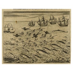
Old Print of Ascension Island with Ships, a Whale and Flying Fish, 1601
Located in Langweer, NL
Antique print, titled: 'Vera effigies et delineato Insulae Ascenstio …' - Bird's eye view of Ascension Island. Five large sailing ships in the background and flying fish and waterfowl in the foreground. On the rear an image of four ships sailing towards a whale, accompanied by fowl, flying fish and dolphins. From 'Indiae Orientalis', 1598-1604.
Artists and Engravers: Made by an anonymous engraver after 'Jean Theodore de Bry...
Category
Antique 18th Century and Earlier Maps
Materials
Paper
$266 Sale Price
20% Off
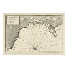
Antique Plan of Alicante Bay, Spain
Located in Langweer, NL
Antique map titled 'Plan de la Baye d'Alicant'. Black and white harbor chart /port plan of Alicante Bay, Spain. This map originates from the scarce atlas 'Recueil de Plusiers Plans d...
Category
Antique 18th Century and Earlier Maps
Materials
Paper
$513 Sale Price
20% Off
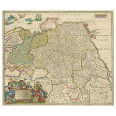
Antique Map of Russia and Central Asia, showing the Northeast Passage
Located in Langweer, NL
Antique map titled 'Generalis Totius Imperii Moscovitici (..)'. Decorative map of Russia and Central Asia, showing the Northeast Passage. The map covers the entirety of the Russian Empire at the time, stretching from the Arctic Circle in the north to the "Oceanus Orientalis" and the northern parts China (Chinae Septentrionalis confinia), Mongolia and India in the south. Published by J.B. Homann, circa 1730.
Johann Baptist Homann was born 1664 in Oberkammlach. He founded his business 1702 in Nuremberg, Germany. After a long period of Dutch domination in map publishing, the Homann publishing house became the most important map...
Category
Antique 18th Century and Earlier Maps
Materials
Paper
$846 Sale Price
20% Off
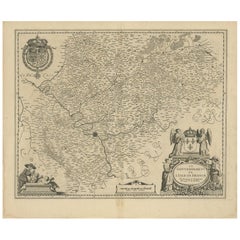
Antique Map of the Region of 'Île de France' by Janssonius, circa 1650
Located in Langweer, NL
Antique map of France titled 'Le Gouvernement de L'Isle de France'. Paris is represented by a miniature plan of the city, making it distinct from the other towns of the region which ...
Category
Antique 18th Century and Earlier Maps
Materials
Paper
$428 Sale Price
20% Off
Antique Plan of the City of Damietta Egypt by C. Niebuhr, 1774
Located in Langweer, NL
Antique print titled 'Grundris der Stadt Damiât'. This print originates from 'Reisebeschreibung nach Arabien und andern umliegenden Ländern' by C. Niebuhr, 1774.
Category
Antique 18th Century and Earlier Maps
Materials
Paper
$171 Sale Price
20% Off
Large Decorative Antique Map of the Mediterranean, ca.1770
Located in Langweer, NL
Antique map titled 'Carte de la Mer Mediterranee en Douze Feuilles'.
First map out of twelve fine engraved double-page and folding maps that join to create a large wall map...
Category
Antique 18th Century and Earlier Maps
Materials
Paper
$1,084 Sale Price
20% Off
Antique Map of the Iberian Peninsula with two decorative Cartouches
Located in Langweer, NL
Antique map titled 'Hispaniae et Portugalliae Regna'. Original old map of the Iberian peninsula showing Spain, Portugal and the Balearic Islands. Two beautiful cartouches with severa...
Category
Antique 18th Century and Earlier Maps
Materials
Paper
$1,417 Sale Price
20% Off
Antique Map of the Area Around Venice in Italy by H. Hondius, circa 1606
By Gerard Mercator, Jodocus Hondius
Located in Langweer, NL
Attractive and early map of the area around Venice, Italy. With South-Tirol in the North, areas of Krain (Slovenia), Croatia, Ferrara, Modena and Piacenza. In the east with areas aro...
Category
Dutch Antique 18th Century and Earlier Maps
Materials
Paper
Rare Antique Map of Japan with Place Names Given in Dutch Nomenclature, 1726
Located in Langweer, NL
Antique map titled 'Nieuwe Kaart van het Eyland Japan'.
Rare map of Japan, it shows each of the Japanese provinces, with place names along the route from Nagasaki to Edo. The place...
Category
Antique 18th Century and Earlier Maps
Materials
Paper
$2,140 Sale Price
20% Off
Antique Map of the Gambia River by J. Van Schley, circa 1750
Located in Langweer, NL
"Carte de la Riviere de Gambra ou Gambie. Depuis son Embouchure Jusqu a Eropina". Orig. copper-engraving after Capt. J. Leach's map of the region from 1732. With ornamental title cartouche and Dutch...
Category
Antique 18th Century and Earlier Maps
Materials
Paper
$347 Sale Price
20% Off
Charting the Course of Empire: Bonne's 1770 Masterpiece Maps of the Indian Ocean
Located in Langweer, NL
A voyage through history with an exquisite collection of Rigobert Bonne's 1770 maps, as featured in the coveted Atlas Moderne circa 1770. Each map, a cartographic treasure, captures ...
Category
Antique 18th Century and Earlier Maps
Materials
Paper
$466 Sale Price / set
20% Off
Antique Map of Asia by Dussy, 1778
Located in Langweer, NL
Antique map of Asia titled 'Indostan presqu'isles de l'Inde, Chine, Tartarie Independante'. Depicting South-East Asia including Hindustan, India an...
Category
French Antique 18th Century and Earlier Maps
Materials
Paper
$209 Sale Price
20% Off
Antique Map of Stavoren by Priorato, 1673
Located in Langweer, NL
Antique map titled 'Staveren'. Original antique map of the city of Stavoren, Friesland, the Netherlands. This map orginates from 'Teatro del Belgio (..)', published in Frankfurt am Main in 1673 by Gualdo Priorato. Artists and Engravers: Author: Galeazzo Gualdo Priorato (1606-1678) entered military service at a very young age and served in Flanders under the Prince of Orange. After his retirement, he authored several historical accounts including the Teatro del Belgio, which described the Catholic/Protestant wars in Belgium and Netherlands during the seventeenth century. His superb plans do not show the internal layout of the cities, except for showing the locations of the major churches. Instead the emphasis is on the fortification, as well as on the surrounding site, rivers and canals...
Category
Antique 18th Century and Earlier Maps
Materials
Paper
Decorative View of the Indonesian Town of Bantam 'Banten', Java, 1726
Located in Langweer, NL
Decorative town-view of the town of Bantam (Banten). In lower margin key a-z to the principal places in town.
The Banten Sultanate was founded in the 16th century and centred in ...
Category
Antique 18th Century and Earlier Maps
Materials
Paper
$532 Sale Price
20% Off
Rare Small Antique Map of Great Britain and Ireland
Located in Langweer, NL
Antique map titled 'La Grande Bretagne et Irlande'. Small antique map of Great Britain and Ireland. Source unknown, to be determined. Publ...
Category
Antique 18th Century and Earlier Maps
Materials
Paper
$218 Sale Price
20% Off
Antique Map of the Arabian Peninsula by Franceschini, '1739'
Located in Langweer, NL
Antique map titled 'Conventus et Residentiae'. Rare map of the Arabian Peninsula. This map originates from 'Provinciarum et Conventum Fratrum Discalc...
Category
Antique 18th Century and Earlier Maps
Materials
Paper
$535 Sale Price
40% Off
Antique Optical View of The Coronation Ceremony of The Emperor of China, ca.1770
Located in Langweer, NL
Antique print China titled 'Vue perspective de la grande Ceremonie du couronnement de l'Empereur de la Chine'.
Optical view of the coronation c...
Category
Antique 18th Century and Earlier Maps
Materials
Paper
$642 Sale Price
20% Off
Antique Map of Mar del Sur, Chile, Peru, New Guinea and Tierra del Fuego, 1621
Located in Langweer, NL
Uncommon and rare map of Mar del Sur and the coast of Peru. With inset maps of part of New Guinea and Tierra del Fuego. This map originates from 'Miroir Oost &...
Category
Antique 18th Century and Earlier Maps
Materials
Paper
$713 Sale Price
20% Off
Antique Map of Manipa, Nusa-Laut, Saparua & Haruku 'Indonesia' by F. Valentijn
Located in Langweer, NL
Four maps of islands and two figures in native dress. The islands are: Manipa, Nusa-Laut (Noessa-Laoet), Saparua (Honimoa) and Haruku (Oma). These islands...
Category
Antique 18th Century and Earlier Maps
Materials
Paper
$808 Sale Price
20% Off
Antique Map of Westergo, Friesland in the the Netherlands, by Tirion, 1744
By Isaak Tirion
Located in Langweer, NL
Antique map titled 'Westergo'. Original antique map of Westergo, part of the province of Friesland, the Netherlands. Published 1744.
Artists and Engravers: Isaak Tirion (1705 in U...
Category
Antique 18th Century and Earlier Maps
Materials
Paper
$608 Sale Price
20% Off
Antique Map of the Harbour of Praia, Santiago Island, Cape Verde, c.1750
Located in Langweer, NL
Antique map titled 'A Draught of ye Harbour of Praya in the Island St. Jago (..)'. Uncommon map showing the harbour of Praia on Santiago Island, Cape Verde. Source unknown, to be det...
Category
Antique 18th Century and Earlier Maps
Materials
Paper
Antique Map of Macedonia, Northern Greece and part of Turkey in Europe
Located in Langweer, NL
Antique map titled 'Macedonia Epirus et Achaia'. Original old map of Macedonia, northern Greece, and part of Turkey in Europe. Published by W.J. Blaeu, circa 1640.
Willem Janszoon ...
Category
Antique 18th Century and Earlier Maps
Materials
Paper
$761 Sale Price
20% Off
Old Detailed Trade Route and Shipping Map from Italy to the Low Countries, c1671
Located in Langweer, NL
Antique map of Italy titled 'Carta Nova accurata del Passagio et strada dalli Peis Bassi per via de Allemgna per Italia et per via di Pesi Suizeri a Geenea, Lione et Roma (..)'. Detailed trade route and shipping map...
Category
Antique 18th Century and Earlier Maps
Materials
Paper
$1,141 Sale Price
20% Off
Antique Plan of Batavia, Nowadays Jakarta, Indonesia, 1780
Located in Langweer, NL
Antique map titled 'Plan der Stad en 't Kasteel Batavia'. A very rare late 18th century detailed plan of Batavia with an alpha-numeric key showing the main areas and buildings (only ...
Category
Antique 18th Century and Earlier Maps
Materials
Paper
$1,758 Sale Price
20% Off
Original Antique Map of Africa with large decorative cartouche
Located in Langweer, NL
Original antique map titled 'L'Afrique divisée en ses principaux États'. Attractive and precise map of Africa, with large decorative cartouche. Engraved by Janvier. Published by Dela...
Category
Antique 18th Century and Earlier Maps
Materials
Paper
$941 Sale Price
20% Off
1797 Tardieu Map of Southeast Asia: The Malay Archipelago and Beyond
Located in Langweer, NL
An original historical map titled 'Presqu' Île Au Dela Du Gange et Archipel De L'Inde', created by Pierre Francois Tardieu and published in the "Atlas Universel" by Pierre Grégoire C...
Category
Antique 18th Century and Earlier Maps
Materials
Paper
$1,094 Sale Price
20% Off
Antique Print of the West Front of Rolls House by Campbell, 1725
Located in Langweer, NL
Antique print titled 'The West Front of the Rolls in Chancery Lane (..)'. Print of the west front of Rolls House, Chancery Lane, London. This print originates from 'Vitruvius Britann...
Category
Antique 18th Century and Earlier Maps
Materials
Paper
Antique Map of the Empire of the Great Mogol and the Kingdom of Kachimere
Located in Langweer, NL
Antique map titled 'Genealogie des Empereurs Mogols depuis Tamberlan ou Tamerlan'. Two maps, a genealogical tree and three indigenous views of the Mogol Empire on one sheet with desc...
Category
Antique 18th Century and Earlier Maps
Materials
Paper
$551 Sale Price
20% Off
Antique Map of Denmark by Münster '1588'
Located in Langweer, NL
Antique map titled 'Beschreibung des Königreichs Dennmarck (..)'. Early map of Denmark. This map originates from 'Cosmographey Oder beschreibung Aller Länder (..)' by Sebastian Münster.
Category
Antique 18th Century and Earlier Maps
Materials
Paper
$261 Sale Price
20% Off
Antique Map of Germany and Central Europe
Located in Langweer, NL
Antique map titled 'S. Imperium Romano-Germanicum oder Teutschland mit seinen angrantzenden Königreichen und Provincien'. Original antique map of Germany...
Category
Antique 18th Century and Earlier Maps
Materials
Paper
$1,046 Sale Price
20% Off
Pl. 8 Antique Print of Garden Pavilions by Le Rouge, c.1785
Located in Langweer, NL
Antique print titled 'Pavillon pour les jardins (..)'. Copper engraving showing the pavilions of knight Worsley of Hovingham and knight Willoughby. This print originates from 'Jardin...
Category
Antique 18th Century and Earlier Maps
Materials
Paper
Original Detailed Antique Map of the East Coast of Africa, 1747
Located in Langweer, NL
Antique map titled 'Carte de la coste Orientale d'Afrique - Kaart van de Oostkust van Afrika'.
Original antique map of the east coast of Africa. Reaches from Cape of Good Hope an...
Category
Antique 18th Century and Earlier Maps
Materials
Paper
$180 Sale Price
20% Off
Antique Map of Cheshire, North West England
Located in Langweer, NL
Antique map titled 'Cestria comitatus Palatinus'. Original old map of Cheshire, Northwest England. Published circa 1665 by J. Blaeu. Willem Jansz. Blaeu and his son Joan Blaeu are th...
Category
Antique 18th Century and Earlier Maps
Materials
Paper
$1,141 Sale Price
20% Off
Antique Print of the Melville House in Fife, Scotland, 1725
Located in Langweer, NL
Antique print titled 'The Elevation of Melvin House in the Shire of Fyfe (..)'.
Old engraving of Melville House in Fife, Scotland. This print originates from 'Vitruvius Britannic...
Category
Antique 18th Century and Earlier Maps
Materials
Paper
$523 Sale Price
20% Off
Map & Views of the Cape Verde Islands, in the Atlantic Ocean, West-Africa, 1775
Located in Langweer, NL
Various maps and views on one plate titled 'Praya Bay (..)', 'The Cape Verd Islands (..)' and 'A view of Praya Bay (..)'.
Map and views of the Cape Verde islands, in the Atlantic Ocean west of Africa. Printed from two copper plates, published for Robert Sayer...
Category
Antique 18th Century and Earlier Maps
Materials
Paper
$599 Sale Price
20% Off
Antique Map of Northern Germany, showing the area of Mecklenburg-Vorpommern
Located in Langweer, NL
Antique map titled 'Meklenburg Ducatus'. Attractive map of northern Germany, showing the area of Mecklenburg-Vorpommern. Published by J. Janssonius, circa 1630.
Jan Janssonius (als...
Category
Antique 18th Century and Earlier Maps
Materials
Paper
$751 Sale Price
20% Off
Antique Map of the Holy Land with Picture Frame Border
Located in Langweer, NL
Antique map titled 'Terre Sainte Suivant les Nouvelles Observations (..)'. Original old map of the Holy Land with the picture frame border. The term "Holy Land" usually refers to a t...
Category
Antique 18th Century and Earlier Maps
Materials
Paper
$837 Sale Price
20% Off
Detailed Antique Map of the Southern Part of European Russia and Ukraine, 1752
Located in Langweer, NL
Antique map titled 'Partie meridionale de la Russie Européenne'.
Detailed map of the southern part of European Russia by Robert de Vaugondy. It covers from Moscow south to Georgia and from Poland east to the Volga River, including Crimea and Ukraine.
Artists and engravers: Gilles Robert de Vaugondy (1688-1766) was the head of a leading family of geographers in eighteenth century France. Gilles got his start when he jointly inherited the shop of Pierre-Moullart Sanson, grandson of the famous geographer Nicholas Sanson. The inheritance included the business, its stock of plates, and a roller press...
Category
Antique 18th Century and Earlier Maps
Materials
Paper
$723 Sale Price
20% Off
Original Antique Map of Asia
Located in Langweer, NL
Antique map titled 'l'Asie'. Original antique map of Asia. Engraved by André after Bonne. Published circa 1780.
Category
Antique 18th Century and Earlier Maps
Materials
Paper
$275 Sale Price
20% Off
Antique Map of the course of the Don & Voga rivers
Located in Langweer, NL
Antique map titled 'Chart of the Course of The Don & the Volga through the Region of The Kosaks'. SW Russia & Ukraine: interesting map showing the course of th...
Category
Antique 18th Century and Earlier Maps
Materials
Paper
$137 Sale Price
20% Off
Antique Map centered on Nuremberg, Germany
Located in Langweer, NL
Antique map titled 'Territorium Norimbergense'. Beautiful map centered on Nuremberg, Germany. With decorative title cartouche and inset plan of the city. Published by W. Blaeu, circa...
Category
Antique 18th Century and Earlier Maps
Materials
Paper
$1,141 Sale Price
20% Off
Antique Map of Asia Minor, showing Turkey, Cyprus and the Islands in the Aegean
Located in Langweer, NL
Antique map titled 'Natolia, quae olim Asia Minor'. Decorative map of Asia Minor, showing Turkey, Cyprus and the Islands in the Aegean. This attractive map shows all of Turkey, Cyprus and the Aegean Islands to a relatively high degree of accuracy. At the time the entire region was under the rule of the Ottoman Empire (Cyprus was conquered in 1571 from the Venetians). A maritime battle...
Category
Antique 18th Century and Earlier Maps
Materials
Paper
$627 Sale Price
20% Off
Large Antique Map of Ancient Spain and Portugal, Published in circa 1760
Located in Langweer, NL
Antique map titled 'Hispania Antiqua (..)'. Map of ancient Spain and Portugal. Engraved by G. Delahaye. Published circa 1760, by or after Sanson & Vaugondy.
Category
Antique 18th Century and Earlier Maps
Materials
Paper
$418 Sale Price
20% Off
Small Original Antique Map of the Lower Alsace region, Germany
Located in Langweer, NL
Antique map titled 'Alsatia Inferior'. Small original antique map of the Lower Alsace region, Germany. This map originates from 'Atlas minor Gerardi Mercatoris a I. Hondio plurimis a...
Category
Antique 18th Century and Earlier Maps
Materials
Paper
$323 Sale Price
20% Off
Antique Map of Continental Asia, with Japan, Arabia, India, Russia, etc c.1702
Located in Langweer, NL
Antique map titled 'Totius Asiae Continens (..).' On this map of continental Asia and the adjacent islands Japan is shown with an oversized Terra Iedso (Hokkaido) connected with Honshu via a narrow isthmus. The Compagnie Land of the de Vries expedition is shown above, separated by a narrow strait named after the explorer. Nova Zembla is depicted correctly as an island, but the northeastern part of Siberia, the Chukchi peninsula and Kamchatka are missing. A portion of Australia is shown as Nova Hollandia...
Category
Antique 18th Century and Earlier Maps
Materials
Paper
Antique Map of the City of Leeuwarden by Leti, 1690
Located in Langweer, NL
Antique map titled 'Leovardia.' A plan of Leeuwarden in Friesland, the Netherlands. With two coats of arms, the title in a scroll and an index of 30 buildings in the lower right. Fro...
Category
Antique 18th Century and Earlier Maps
Materials
Paper
$635 Sale Price
20% Off
Pl. 5 Antique Architecture Print of Various Vases and Other Ornaments by Neuffor
Located in Langweer, NL
Antique print titled 'Pour l'Usage des Poëles'. Old print showing the design of various vases and other ornaments. This print originates from 'Recueil Élémentaire d?Architecture' by ...
Category
Antique 18th Century and Earlier Maps
Materials
Paper
Three Antique Maps on One Folio: Turkey, Northern Egypt, and Ancient Carthage
Located in Langweer, NL
The map consists of three distinct sections on a single folio sheet:
1. **Map of Turkey**:
- Orientation: The map is oriented with the east at the top, which is a common practic...
Category
Antique 18th Century and Earlier Maps
Materials
Paper
1633 Map "La Souverainete De Sedan Et De Raucourt, Et La Prevoste Ric0011
Located in Norton, MA
1653 map entitled
"La Souverainete de Sedan et de Raucourt, et la Prevoste de Doncheri,"
Ric0011
Description:
Lovely map centered on Sedan and Doncheri and the Meuze River fr...
Category
Dutch Antique 18th Century and Earlier Maps
Materials
Paper
Old Map Showing Info Related to the Ottoman Wars including Conflict Dates, c1690
Located in Langweer, NL
"Corso del Danubio da Vienna Sui a Vicopoli, e Paesi Adiacenti - Northwestern Sheet", Coronelli, Vincenzo Maria
Subject: Central Europe, Danube River
Period: 1690 (circa)
Publicatio...
Category
Italian Antique 18th Century and Earlier Maps
Materials
Paper
$627 Sale Price
20% Off
Rare Engravings of Council of War in Bantam and Javanese Local Traders, 1614
Located in Langweer, NL
One leaf with an engraving on each site and text in old Dutch. One side shows the War Council of the locals in Bantam and the other side show some vegetables traders of Bantam.
B...
Category
Antique 18th Century and Earlier Maps
Materials
Paper
$428 Sale Price
20% Off
Antique Map of Bonthain Bay, Sulawesi, Celebes
Located in Langweer, NL
Antique map titled 'Vue de la Baye de Bonthain (..)'. Map of the island Sulawesi (Celebes), Indonesia that Philip Carteret rested his crew and made repairs to his ship the Swallow fo...
Category
Antique 18th Century and Earlier Maps
Materials
Paper
$209 Sale Price
20% Off
Antique Map of the Cities of the Qing Dynasty Provinces in China, 1738
Located in Langweer, NL
Antique print titled 'Cities of the Province of Kyang-si, Fo-kyen, Shan-Si & Yun-nan'. Old map depicting four walled cities of the Chinese Qing dynasty provinces Yunnan, Shanxi, Fuji...
Category
Antique 18th Century and Earlier Maps
Materials
Paper
$247 Sale Price
20% Off
Antique Map of Korea and Southern China by Bonne '1771'
Located in Langweer, NL
Antique map titled 'Carte de la Tartarie Chinoise'. Original antique map of Korea and Southern China. Covers from the Lop Nor region eastward to K...
Category
Antique 18th Century and Earlier Maps
Materials
Paper
$547 Sale Price
20% Off
Antique Map of the region of Trier, Mainz and Cologne, Germany
Located in Langweer, NL
Antique map titled 'Synopsis Circuli Rhenani Inferioris sive Electorum Rheni (..)'. Original antique map of the region of Trier, Mainz and Cologne, Germany. Published by T.C. Lotter,...
Category
Antique 18th Century and Earlier Maps
Materials
Paper
$456 Sale Price
20% Off
Antique Map of Northern China and Far Eastern Russia Around the Amur River, 1754
Located in Langweer, NL
Antique map titled 'Carte De La Tartarie Orientale (..)'. A map for this far eastern portion of what is present day northern China and far eastern Russia...
Category
Antique 18th Century and Earlier Maps
Materials
Paper
$475 Sale Price
20% Off
Antique Map of Southern England and Wales by Zatta, 1784
Located in Langweer, NL
"Antique map titled 'Parte Meridionale dell' Inghilterra e del Pricipato di Galles'. Engraved map of the southern part of England and Wales, with title cartouche. Shows political and...
Category
Antique 18th Century and Earlier Maps
Materials
Paper
$202 Sale Price
20% Off
Antique Map of the Region of Valois by Hondius, circa 1630
Located in Langweer, NL
Antique map titled 'Le Pais de Valois'. Old map of the historic region of Valois, France. It corresponds to the southeastern quarter of the modern département of Oise, with an adjace...
Category
Antique 18th Century and Earlier Maps
Materials
Paper
$475 Sale Price
20% Off
Antique Map of Southeast Asia with Decorative Allegorical Cartouche
Located in Langweer, NL
Antique map titled 'Les Indes Orientales et leur Archipel'. Old map of Southeast Asia, the Straits of Malaca, Philippines, Sumatra, Java, India etc., extending north to Canton and Ma...
Category
Antique 18th Century and Earlier Maps
Materials
Paper
$894 Sale Price
20% Off
Antique Print of Various Apples by Knoop, 1758
Located in Langweer, NL
Antique print depicting apple variaties including the Framboos-Appel, Herfst Bloem-Soete, Somer-Parmain, Peer-Soete, Soete Dolphyn, Roode Herfst-Striepeling, Witte Soete Silverling, ...
Category
Antique 18th Century and Earlier Maps
Materials
Paper
$304 Sale Price
20% Off
