18th Century and Earlier Maps
to
2,334
2,903
63
2,969
26
12
1
1
2,969
2,280
474
3
290
34
10
126
10
37
9
2
5
4
3
3
2,955
30
20
3
3
354
117
94
81
52
2,969
2,969
2,969
58
21
13
12
12
Period: 18th Century and Earlier
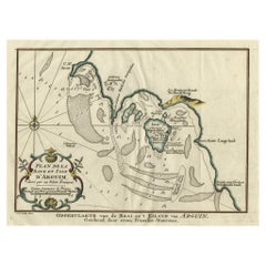
Original Antique Map of the Bay and the Island of Arguin, Mauritania, 1747
Located in Langweer, NL
Antique map titled ’Plan de la Baye et Isle d'Arguim (..) - Oppervlakte van de Baai en 't Eiland van Arguin (..)'.
Original antique map of the bay and the island of Arguin. This ...
Category
Antique 18th Century and Earlier Maps
Materials
Paper
$247 Sale Price
20% Off
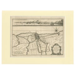
Old Engraving of Batavia 'Jakarta, Indonesia' with Map and Harbour View, 1750
Located in Langweer, NL
Antique map titled 'Carte des environs de Batavia '. French map of the Batavia area (Jakarta) in Indonesia. With cartouche, scale and compass rose. Published circa 1750.
The map i...
Category
Antique 18th Century and Earlier Maps
Materials
Paper
$524 Sale Price
20% Off
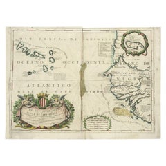
Antique Map of the Cape Verde Islands and Part of Senegal, West Africa, 1690
Located in Langweer, NL
Antique map titled 'Bocche del Fivme Negro et Isole di Capo Verde'. Beautiful double-page map of the Cape Verde Islands and part of the coast of Senegal, with large decorative cartou...
Category
Italian Antique 18th Century and Earlier Maps
Materials
Paper
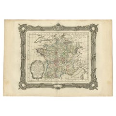
Antique Map of France at the End of the Reign of Jean II by Zannoni, 1765
Located in Langweer, NL
Antique map France titled 'La France sous la fin du Regne de Jean II (..)'. Beautiful old map of France. This map originates from 'Atlas Historique de la France Ancienne et Moderne' ...
Category
Antique 18th Century and Earlier Maps
Materials
Paper
$151 Sale Price
20% Off
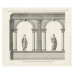
Antique Print of a Section of the Kew Gardens, London, England, c.1785
Located in Langweer, NL
Antique print titled 'Coupe sur la longueur d'une partie de la Galerie des Antiques dans les jardins de Kew'.
Copper engraving showing a section of the Royal Botanic...
Category
Antique 18th Century and Earlier Maps
Materials
Paper
$343 Sale Price
20% Off
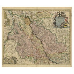
Rhine Splendor: Antique Map of the Lower Rhine Region, circa 1680
Located in Langweer, NL
The antique map titled 'Novissima et Accuratissima Archiepiscopatus et Electoratus Coloniensis Ducatuum Iuliancensis et Montensis et Meursiae Comitatus' is a handsome and detailed ma...
Category
Antique 18th Century and Earlier Maps
Materials
Paper
$915 Sale Price
20% Off
Old Map of Region Champagne-Ardenne with Reims, Troyes & Épernay in France, 1759
Located in Langweer, NL
Antique map titled 'Tabula Geographica Campaniae (..).'
Detailed map of the Champagne region in France by J. B. Homann, covering the region Champagne-Ardenne with Reims, Troyes a...
Category
Antique 18th Century and Earlier Maps
Materials
Paper
$700 Sale Price
30% Off
Antique Map of the Islands Within the Queen Charlotte's Islands
Located in Langweer, NL
Antique map titled 'Cote Septentrional de la plus grande des Isles de la Reine Charlotte (..)'. Map and coastal view of the islands within the Queen Charlotte's Islands (Santa Cruz I...
Category
Antique 18th Century and Earlier Maps
Materials
Paper
$314 Sale Price
20% Off
Antique Print with Views of Sir Charles Saunders Island and Other Islands, 1774
Located in Langweer, NL
Explore the captivating world of the 18th century with this exquisite antique print titled 'Isles de Sir Charles Saunder Latitude (...)'. I A journey through time as you delve into t...
Category
Antique 18th Century and Earlier Maps
Materials
Paper
$305 Sale Price
20% Off
Cemetery on Amsterdam Island, French Territory in the Indian Ocean, ca.1785
Located in Langweer, NL
Antique print titled 'Begraafplaats op het eiland Amsterdam'.
Engraved view of a local cemetery on Amsterdam Island, a small French territory in the southern Indian Ocean. Origin...
Category
Antique 18th Century and Earlier Maps
Materials
Paper
$276 Sale Price
20% Off
Antique Map of the City of Workum by Blaeu, 1649
Located in Langweer, NL
Antique map titled 'Worckum'. Old map of the city of Workum, Friesland. Originates from J. Blaeu's 'Town Book'.
Artists and Engravers: Joan Blaeu (23 September 1596 - 28 May 1673...
Category
Antique 18th Century and Earlier Maps
Materials
Paper
$123 Sale Price
20% Off
Antique Frontispiece of an Old Dutch Book Depicting Globe Makers, 1717
Located in Langweer, NL
Antique frontispiece titled 'Iets voor Allen'. This print originates from 'Iets voor Allen, zijnde een Verhandeling en Verbeelding Van allerhande Standen, Studien, Konsten, Wetenscha...
Category
Antique 18th Century and Earlier Maps
Materials
Paper
Antique Map of England, Also Showing Calais
Located in Langweer, NL
Antique map titled 'Carte de l'Angleterre pour le Voyage dans les trois Royaumes'. Original old map of England, also showing Calais. This map originates from 'Voyage dans les trois r...
Category
Antique 18th Century and Earlier Maps
Materials
Paper
$133 Sale Price
20% Off
Engraving of Idols of Secotam Village in Virginia 'or now North Carolina', 1721
Located in Langweer, NL
Two religious images on one plate. Upper image 'Kiwasa idole des Virginiens'.
Kiwasa, this Idol is placed in the temple of the town of Secotam, as the keeper of the king's dead c...
Category
Antique 18th Century and Earlier Maps
Materials
Paper
$419 Sale Price
20% Off
Antique Map of the Mughal Empire by Van der Aa, C.1725
Located in Langweer, NL
Antique map titled 'Royaume de Grand Mogol (..).' This map shows the extend of the Mughal Empire, which includes northern India, from Golconda to Afghanistan and eastwards to Bengal....
Category
Antique 18th Century and Earlier Maps
Materials
Paper
Antique Print with Charts of York's Bay and Surroundings
Located in Langweer, NL
Antique map titled 'Côte depuis la Baye d'York (..)'. Charts of York's Bay, Haven of the Three Islands, St. David's Bay, and Elizabeth's Bay.
Published in an edition of John Hawk...
Category
Antique 18th Century and Earlier Maps
Materials
Paper
$419 Sale Price
20% Off
Original Antique Hand- Map of Africa by Allard '1697'
Located in Langweer, NL
Antique map titled 'Novissima et Perfectissima Africae (..)'. Beautiful large map of Africa. This is the 3rd state of the map, with climate notation add...
Category
Antique 18th Century and Earlier Maps
Materials
Paper
$1,161 Sale Price
35% Off
Original Copper-Engraving of Westergo, Part of Friesland, the Netherlands, 1744
Located in Langweer, NL
Antique map titled 'Westergo'.
Original antique map of Westergo, part of the province of Friesland, the Netherlands. Published 1744.
Artists and engravers: Isaak Tirion (1705 ...
Category
Antique 18th Century and Earlier Maps
Materials
Paper
$610 Sale Price
20% Off
Original Antique Map of England with Decorative Cartouche
Located in Langweer, NL
Antique map titled 'l'Angleterre (..)'. Original antique map of England, with beautiful hand coloring and decorative cartouche. This map originates from 'Nouvel Atlas Portatif destin...
Category
Antique 18th Century and Earlier Maps
Materials
Paper
$276 Sale Price
20% Off
Antique Map of Sumatra, Indonesia 'c.1780'
Located in Langweer, NL
Antique map titled 'Neue Karte von der Insel Sumatra'. Extremely rare map of Sumatra, Indonesia. Published circa 1780.
Category
Antique 18th Century and Earlier Maps
Materials
Paper
$2,502 Sale Price
40% Off
Original Hand-Colored Antique Print of Various Apples, 1758
Located in Langweer, NL
Antique print depicting apple variaties including the Syden Hemmetje, Somer-Erveling, Suiker-Appel, Princes-Appel, Witte Bloem-Soete, Swaan-Appel, Roode Gulderling, Rode Herfst-Cabri...
Category
Antique 18th Century and Earlier Maps
Materials
Paper
$164 Sale Price
20% Off
Antique Map of Swabia, 1685
Located in Langweer, NL
Antique map titled 'Sueviae quae cis Codanum fuit finum Antiqua defcriptio.' Miniature map of Swabia, a medieval Duchy in south-west Germany, that also included part of Poland, from ...
Category
Antique 18th Century and Earlier Maps
Materials
Paper
Old Print of VOC Ships in the Sea Near Batavia (Jakarta, Indonesia), 1779
Located in Langweer, NL
Antique print Batavia titled 'De Reede van Batavia'.
Beautiful view of the sea near Batavia (Jakarta, Indonesia), with several ships lying at anchor.
Artists and Engravers: Ma...
Category
Antique 18th Century and Earlier Maps
Materials
Paper
$743 Sale Price
20% Off
Old Map of the Bourbonnais Region of France, ca.1630
Located in Langweer, NL
Antique map titled 'Bourbonois - Borbonium Ducatus'.
Old map of the Bourbonnais region of France. Bourbonnais was a historic province in the centre of France that corresponds to ...
Category
Antique 18th Century and Earlier Maps
Materials
Paper
$600 Sale Price
20% Off
Antique Map of the Bay of Brusc, France
Located in Langweer, NL
Antique map titled 'Carte de la rade du Brusc'. Original map of the bay of Brusc, France. This map originates from 'Le Petit Atlas Maritime (..)' by J.N. Bellin. Published 1764.
...
Category
Antique 18th Century and Earlier Maps
Materials
Paper
$324 Sale Price
20% Off
Original Antique Map of the Duchy of Holstein
By Willem Blaeu
Located in Langweer, NL
Antique map titled 'Ducatus Holsatiae Nova Tabula'. Original old map of the Duchy of Holstein, the northernmost territory of the Holy Roman Empire, from the mid-17th Century. To the ...
Category
Antique 18th Century and Earlier Maps
Materials
Paper
$1,048 Sale Price
20% Off
Antique Map of Western Tartary and the Gobi Desert of the Russian Empire, c.1750
Located in Langweer, NL
Antique map titled 'A Map of Western Tartary Drawn from the Survey of the Jesuits and Mr. Kyrillow's Map of the Russian Empire'. Map of the Gobi Desert and the eastern portion of the...
Category
Antique 18th Century and Earlier Maps
Materials
Paper
$333 Sale Price
20% Off
Original Antique County Map of Derbyshire, England
Located in Langweer, NL
Antique map titled 'Darbyshire'. Original antique map of the country of Derbyshire, England. Engraved by Robert Morden. Sold by Abel Swale, Awnsham and John Churchill...
Category
Antique 18th Century and Earlier Maps
Materials
Paper
$524 Sale Price
20% Off
Original Antique Map of England, Showing the Most Memorable Battles
Located in Langweer, NL
Antique map titled 'Carte d'Angleterre ou l'on fait observer les Batailes les plus Memorables de ce Royaume'. Original antique map of England, showing the most memorable battles. Thi...
Category
Antique 18th Century and Earlier Maps
Materials
Paper
$209 Sale Price
20% Off
Antique Map of the Coastline Between Calais and Estaples and Northern France
Located in Langweer, NL
Antique map titled 'Caletensium et Bononiensium Ditionis Accurata Delinatio [on sheet with] Veromanduorum Eorumque Confinium Exactissima Discriptio'. Two maps on a folio sheet. Calentensium covers the coastline between Calais and Estaples based in part on a four-sheet map by Nicolas de Nicolay...
Category
Antique 18th Century and Earlier Maps
Materials
Paper
$324 Sale Price
20% Off
Antique Map of Holstein, Germany
Located in Langweer, NL
Antique map titled 'Holsatia Ducatus'. Original old map of Holstein, Germany. By Petrus Kaerius, published circa 1650. Pieter van den Keere (Latin: Petrus Kaerius 1571 – circa 1646) ...
Category
Antique 18th Century and Earlier Maps
Materials
Paper
$362 Sale Price
20% Off
Antique Map of France with Inset showing the Northern Departments
Located in Langweer, NL
Antique map titled 'The Republic of France divided according to its 103 Departments'. Decorative map of France. Includes a large cartouche and an in...
Category
Antique 18th Century and Earlier Maps
Materials
Paper
$629 Sale Price
20% Off
Antique Map of The Harbour of Acapulco in Mexico, 1749
Located in Langweer, NL
Description: Antique map titled 'Plan van de Haven van Acapulco (..) - Plan du Port d'Acapulco (..)'. Original antique map of the Port of Acapulco on the coast of Mexico in the South...
Category
Antique 18th Century and Earlier Maps
Materials
Paper
$343 Sale Price
20% Off
Antique Map of Saldanha Bay 'Near Cape Town, South Africa' by Bellin, 1750
Located in Langweer, NL
Antique map titled ‘Carte De La Baye De Saldana ou Saldane Dressee sur les Remarques des Navigateurs’. Detailed plan of Saldanha Bay, northwest of Cape Town, South Africa. This map o...
Category
Antique 18th Century and Earlier Maps
Materials
Paper
Antique Map of the Region Between the Seine and Loire Rivers by Janssonius, 1657
Located in Langweer, NL
Antique map of France titled 'Gastinois et Senonois'. Regional map of central France, northeast of Orleans showing the area between the Seine and Loire Rivers. Includes Auxerre, Sens...
Category
Antique 18th Century and Earlier Maps
Materials
Paper
$275 Sale Price
20% Off
Antique Map of Africa with French Cartouche and Scale, c.1780
Located in Langweer, NL
Antique map titled 'L'Afrique'. Original antique map of Africa. With beautiful title cartouche and scale. Source unknown, to be determined.
Artists and Engravers: Gilles Robert de...
Category
Antique 18th Century and Earlier Maps
Materials
Paper
$333 Sale Price
20% Off
Antique Map of the British Isles by Lotter, 1764
Located in Langweer, NL
Antique map titled 'Le Grand Bretagne ou les Royaumes d'Angleterre et d'Ecosse'. Old engraved map of the British Isles (main islands United Kingdom & Ire...
Category
Antique 18th Century and Earlier Maps
Materials
Paper
$319 Sale Price
20% Off
Detailed Antique Map of Western Belgium and Eastern France by Coronelli, 1690
Located in Langweer, NL
Antique map titled 'Contado d'Hannonia (..)'. Map of western Belgium and eastern France, from south of Brussels (not shown) to Cambrai, France, generally centered around the towns of...
Category
Antique 18th Century and Earlier Maps
Materials
Paper
$467 Sale Price
20% Off
Antique Map of Eastern Tartary as Surveyed by the Jesuits, 1746
Located in Langweer, NL
Antique map titled 'A Map of Eastern Tartary as Surveyed by the Jesuits in 1709, 10 & 11'. The map covers much of the course of the Amur River or Heilong Jiang, the world's tenth lon...
Category
Antique 18th Century and Earlier Maps
Materials
Paper
$276 Sale Price
20% Off
Old Sea Chart of Northern Norway, also depicting Part of Lapland & Russia, 1702
Located in Langweer, NL
Antique map titled 'The Coast of Norway and Lapland, from North kyn to the River Kola'.
Sea Chart of Northern Norway, also depicting part of Lapland and Russia. The map covers from the Kola river to what the map calls Fishers Island...
Category
Antique 18th Century and Earlier Maps
Materials
Paper
$467 Sale Price
20% Off
Antique Hand-Coloured Map of India, Sri Lanka, Maldives, ca.1599
Located in Langweer, NL
Title: Tabula Asiae XI - 1599
Very old and decorative map of India, Sri Lanka and the Maledives. Put this map in a frame on the wall and amaze your visitors. This original engravi...
Category
Antique 18th Century and Earlier Maps
Materials
Paper
$533 Sale Price
20% Off
Print of the Solemn Celebration Sapan Giacche in Pegu, Burma 'Myanmar', 1725
Located in Langweer, NL
Antique print, titled: 'Fete Solennelle de Pegu appelee Sapan Giacche'
This plate shows the Solemn celebration called Sapan Giacche in Pegu or Bago, the capital of the Bago Regio...
Category
Antique 18th Century and Earlier Maps
Materials
Paper
$324 Sale Price
20% Off
Cross Erected in Memory of Queen Eleanor, Basire, 1791
Located in Langweer, NL
Antique print titled 'The Cross erected in memory of Queen Eleanor, near Northampton'. Antique print depicting the Eleanor cross near Northampton. Artists and Engravers: Made by J. B...
Category
Antique 18th Century and Earlier Maps
Materials
Paper
$143 Sale Price
20% Off
Antique Map of the City of Brielle 'The Netherlands' by L. Guicciardini, 1625
Located in Langweer, NL
Plan of Brielle, Briel, Den Briel in the Province of Zuid-Holland, The Netherlands, Holland. This map originates from the 1625 edition of 'Discrittione di tutti i Paesi Bassi', by L....
Category
Antique 18th Century and Earlier Maps
Materials
Paper
$171 Sale Price
20% Off
Original Old & Rare View of the City of Workum, Friesland, The Netherlands, 1616
Located in Langweer, NL
Antique map titled 'Worcum'. This print depicts the city of Workum (Friesland, The Netherlands). With German captions. This print originates from 'Rerum Frisicarum Historia' publishe...
Category
Antique 18th Century and Earlier Maps
Materials
Paper
$400 Sale Price
20% Off
Old Map of Ceylon 'Sri Lanka' with The North Oriented to The Left, 1731
Located in Langweer, NL
Description: Antique map Ceylon titled 'Nieuwe Kaart van t Eland Ceilon'.
Old map of present-day Sri Lanka with north oriented to the left. The ...
Category
Antique 18th Century and Earlier Maps
Materials
Paper
$619 Sale Price
20% Off
Antique Map of the Island of Djerba by Coronelli '1691'
Located in Langweer, NL
Antique map titled 'Isola e Castello di Gerbi'. Original antique map of the Island of Djerba, Tunisia, in Africa. Includes an inset of the Djerba Castle in upper right. This map orig...
Category
Antique 18th Century and Earlier Maps
Materials
Paper
$333 Sale Price
20% Off
Antique Print of the Battle of Camaret in the Nine Years War, Near Brest, France
Located in Langweer, NL
Antique print titled 'Plan of the Attack of Camaret Bay, on the Coast of Bretagne, thro which lies the Harbour of Brest'. Striking plan showing the details of the battle at the mouth of Cameret Bay. Includes a battle plan...
Category
Antique 18th Century and Earlier Maps
Materials
Paper
$619 Sale Price
20% Off
Antique Map of Tracks of Anson's Ships around South America & Cape Horn, 1749
Located in Langweer, NL
Description: Antique map titled 'Kaart van het Zuidelykste Gedeelte van Zuider Amerika (..) - Carte de la Partie Meridionale de l'Amerique Meridionale (..)'.
Detailed chart tracking the route of Capt. George Anson's ship The Centurion in 1745. The chart shows the tracks of Anson's ships around South America & Cape Horn to the Juan Fernandes Islands, with notes on currents and positions.
In 1740 Capt. George Anson (1697-1762) of the Royal Navy, was given command of a squadron of ships. As England was at war with France and Spain, Anson's task was to intercept and capture a Spanish treasure...
Category
Antique 18th Century and Earlier Maps
Materials
Paper
$619 Sale Price
20% Off
Antique Map of the City of Zutphen by Guicciardini, 1613
Located in Langweer, NL
Antique map Zutphen titled 'Zutphen'. This map depicts the city of Zutphen, Gelderland, The Netherlands. Originates from 'Discrittione di tutti i Paesi Bassi'.
Artists and Engrav...
Category
Antique 18th Century and Earlier Maps
Materials
Paper
$160 Sale Price
20% Off
Antique Print of the Tiber River in Rome, Italy, 1704
Located in Langweer, NL
Antique print titled 'Insulae Tiberinae et Pontis Senatorii Vestigia'. This original antique print shows a view of the Tiber River in Rome with the Bridge 'Ponte dei Senatori'. Above more images of Rome. Originates from 'Beschryving van Oud en Nieuw Rome. Verdeelt in drie Deelen. In 't Fransch beschreven door den Heer Francois Desseine. En in 't Nederduitsch vertaalt.', by Francois Desseine and published by Francois Halma in 1704, first published in French in 1690. Copies of this work are rarely complete as the maps and engravings are of high quality matching the work of Piranesi.
Artists and Engravers: Jan Goeree (1670-1731) was a Dutch engraver and poet. He was the son of the Middelburg bookseller Willem Goeree. Born in Middelburg, but soon they moved to Amsterdam. Initially he focussed on painting, assumably a student of Gerard de Lairesse...
Category
Antique 18th Century and Earlier Maps
Materials
Paper
Original Antique Regional Map of France with Orleans, Auxerre and Montargis
Located in Langweer, NL
Original antique map titled 'Gastinois et Senonois'. Beautiful regional map of France. With Corbeil in the north, Pont sur Seyne in the east, Auxerre in the south, and Orleans in the...
Category
Antique 18th Century and Earlier Maps
Materials
Paper
$800 Sale Price
20% Off
Antique Map of Europe by Keizer & de Lat, 1788
Located in Langweer, NL
Antique map titled 'Kaartje van Europa (..)'. Uncommon original antique map of Europe. This map originates from 'Nieuwe Natuur- Geschied- en Handelkundige Zak- en Reisatlas' by Gerri...
Category
Antique 18th Century and Earlier Maps
Materials
Paper
$381 Sale Price
20% Off
Antique Map of Batavia, Dutch East Indies, Nowadays Jakarta, Indonesia, ca.1669
Located in Langweer, NL
Antique map titled 'Ware afbeeldinge wegens het Casteel ende Stadt Batavia gelegen opt groot Eylant Java Anno 1679. Plan de la Ville et du Chateau de Batavia en l'Isle de Iava. 1679....
Category
Antique 18th Century and Earlier Maps
Materials
Paper
$1,287 Sale Price
20% Off
Antique Map of Overijssel by Van der Aa, c.1715
Located in Langweer, NL
Antique map titled 'L'Over-Issel'. This map depicts the Dutch province Overijssel. This map originates from 'Nouvel Atlas, très exact et fort commode pour toutes sortes de personnes,...
Category
Antique 18th Century and Earlier Maps
Materials
Paper
$181 Sale Price
20% Off
Original Antique Map of Juan Fernandez by Van Schley, 1757
Located in Langweer, NL
Antique map titled 'Carte Particuliere de l'Isle de Juan Fernandez - Byzondere Kaart van 't Eiland Juan Fernandez'.
Map of the Chilean Juan Fernandez Island, topped by a view of it...
Category
Antique 18th Century and Earlier Maps
Materials
Paper
$276 Sale Price
20% Off
Antique Miniature Map of the Western Hemisphere, with California as an Island
Located in Langweer, NL
Antique miniature map titled 'Nouveau Continent avec plusieurs Isles et Mers'. Decorative map of the Western Hemisphere, published by Alain Manesson Mallet. The map shows California as an Island...
Category
Antique 18th Century and Earlier Maps
Materials
Paper
$419 Sale Price
20% Off
Antique Print of Longford Castle, South of Salisbury, Wiltshire, England, 1766
Located in Langweer, NL
Antique print titled 'Longford Castle the Seat of the Earl of Radnor in Wiltshire'.
Large engraving of Longford Castle, Wiltshire. Source unknown, to be determined. Artists and Engravers: Engraved by Miller.
Longford Castle stands on the banks of the River Avon...
Category
Antique 18th Century and Earlier Maps
Materials
Paper
$724 Sale Price
20% Off
Detailed Map of the Holy Land, Showing the Travels of Christ & Apostles, ca.1650
Located in Langweer, NL
Antique map titled 'Het Beloofde Landt Canaan door wandelt van onsen Salichmaeker Jesu Christo neffens syne Apostelen.'
Detailed map of the Holy Land, showing the travels of Christ and the Apostles, including Paul's travel's at sea and numerous sailing vessels. Below bible scenes such as the nativity and crucifiction of Christ. An excellent example of a Duch Bible map...
Category
Antique 18th Century and Earlier Maps
Materials
Paper
$638 Sale Price
20% Off
Antique Map of the Port of Acapulco in Mexico, 1749
Located in Langweer, NL
Antique map titled 'Plan van de Haven van Acapulco (..) - Plan du Port d'Acapulco (..)'. Original antique map of the Port of Acapulco on the coast of Mexico in the Southern Sea, at 1...
Category
Antique 18th Century and Earlier Maps
Materials
Paper
