18th Century and Earlier Maps
to
2,334
2,903
63
2,969
26
12
1
1
2,969
2,279
474
3
290
34
10
126
10
37
9
2
5
4
3
3
2,955
30
20
3
3
354
117
94
81
52
2,969
2,969
2,969
58
21
13
12
12
Period: 18th Century and Earlier
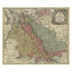
Old Map of the Rhine & German Cities Incl Düsseldorf, Bonn, Köln, Etc., c.1730
Located in Langweer, NL
Antique map Germany titled 'Mappa Geographica continens Archiepiscopatum et Electoratum Coloniensem (..)'.
This antique map depicts the Rhine r...
Category
Antique 18th Century and Earlier Maps
Materials
Paper
$934 Sale Price
20% Off
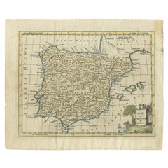
Antique Map of Spain and Portugal by Kitchin, 1770
Located in Langweer, NL
Antique map titled 'Spain and Portugal by Tho. Kitchin'. Rare detailed map of Spain and Portugal, with decorative title cartouche in the lower right...
Category
Antique 18th Century and Earlier Maps
Materials
Paper
$133 Sale Price
20% Off
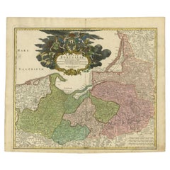
Antique Map of the Baltic Region by Homann Heirs, c.1730
Located in Langweer, NL
Antique map titled 'Regnum Borussiae gloriosis auspicijs Seerenissimi et Potentissimi Princip Friderici III (..).' Detailed map of the Baltic region from Memel to Pomerania, extendin...
Category
Antique 18th Century and Earlier Maps
Materials
Paper
$448 Sale Price
20% Off
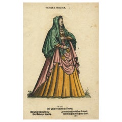
Rare Early Plate of a Woman from Venice, Italy in 16th Century Costume, 1577
Located in Langweer, NL
Antique print, titled: 'CXXII. Veneta Mulier'
This rare early plate shows a woman from Venice, Italy in 16th century costume. From: 'Habitus praecipuorum populorum tam virorum qu...
Category
Antique 18th Century and Earlier Maps
Materials
Paper
$457 Sale Price
20% Off
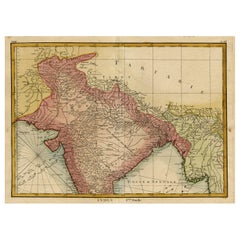
Original and Colourful Map of Northern India with Surrounding Regions, 1783
Located in Langweer, NL
Antique map titled 'Indes'. A map of Northern India with surrounding regions. From Lattre's 'Atlas moderne ou collection de cartes sur toutes les parties du globe terrestre...
Category
Antique 18th Century and Earlier Maps
Materials
Paper
$543 Sale Price
20% Off
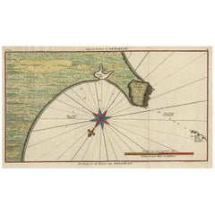
Original Antique Map of the Bay and Rocks of Petatlan, Mexico, 1749
Located in Langweer, NL
Antique map titled 'Baye et Rochers de Petaplan (..) - De Baay en de Rotsen van Petaplan (..)'.
Original antique map of the bay and rocks of Petatlan, Mexico. This map originates...
Category
Antique 18th Century and Earlier Maps
Materials
Paper
$343 Sale Price
20% Off
Detailed Antique Map of Portugal, Published for the 'Gentleman's Magazine', 1758
Located in Langweer, NL
Antique map Portugal titled 'A Map of the Kingdom of Portugal'.
Detailed map of Portugal, published for the 'Gentleman's Magazine'.
Artist...
Category
Antique 18th Century and Earlier Maps
Materials
Paper
$457 Sale Price
20% Off
Old Print with a View of the Dutch Church in Batavia 'Jakarta, Indonesia', 1738
Located in Langweer, NL
Antique print titled 'Ein Perspectivischer Aufzug der neu erbauten Holländischen Kirch zu Batavia, welche von Ao. 1733. bis 1736. mit grossen Kosten der Ed;en Ost-Indischen Compagnie...
Category
Antique 18th Century and Earlier Maps
Materials
Paper
$743 Sale Price
20% Off
Old Sea Charts of Tourane Bay & the Con Dao Islands 'Pulo Condor', Vietnam, 1780
Located in Langweer, NL
Description: Two maps on one sheet titled 'Carte d'une partie de la Cote de Cochinchine [and] Plan de l'Isle Condor'.
Sea charts of the coast of Vietnam around the Tourane Bay an...
Category
Antique 18th Century and Earlier Maps
Materials
Paper
$619 Sale Price
20% Off
Antique Map of the Harbour of Tongatabu by Cook, C.1783
Located in Langweer, NL
Antique map titled 'Sketch of Tongataboo Harbour (..)'. Antique map of the harbour of Tongatabu, one of the Tonga Islands. Originates from an edition of Cook's Voyages.
Artists an...
Category
Antique 18th Century and Earlier Maps
Materials
Paper
$324 Sale Price
20% Off
Encoloured Engraving of Cliff Kaloiero or Caloiero Island, Panaia, Greece, 1688
Located in Langweer, NL
Antique print Greece titled 'De Klip van Kaloiero'. Old print of the Island Kaloiero or Panaia, Greece. This print originates from 'Nauwkeurige Be...
Category
Antique 18th Century and Earlier Maps
Materials
Paper
$276 Sale Price
20% Off
Antique Map of the Region Between the Black and Caspian Sea by Cellarius, 1731
Located in Langweer, NL
Antique map titled 'Bosporus, Maeotis, Iberia, Albania, et Sarmatia Asiatica.' Map of the region between the Black and Caspian Seas in early Sarmatian time...
Category
Antique 18th Century and Earlier Maps
Materials
Paper
$166 Sale Price
20% Off
Antique Map of the Region of Cambrai in France, c.1630
Located in Langweer, NL
Antique map titled 'l'Archevesche de Cambray'. Decorative map of the region of Cambrai, France. Includes the cities of Cambrai, Valencienes, Douai, and Bouchain.
Artists and Engrav...
Category
Antique 18th Century and Earlier Maps
Materials
Paper
Antique Map of the City of Ypres by Beaulieu, 1729
Located in Langweer, NL
Antique map titled 'Plan de la Ville d'Ipren/Plan der Stadt Ipren'. Map of the city of Ieper/Ypres in Belgium. This map originates from 'Histoire Militaire du Prince Eugene de Savoye...
Category
Antique 18th Century and Earlier Maps
Materials
Paper
$212 Sale Price
20% Off
Antique Map of the County of Hainaut by Jaillot, 1692
Located in Langweer, NL
Antique map titled 'Le Comté de Haynaut divisé en Chateliensis, Balliages, Prevoste's (..)'. Large map of the county of Hainaut (France) with its most important cities, Mons (Bergen)...
Category
Antique 18th Century and Earlier Maps
Materials
Paper
$212 Sale Price
20% Off
Antique Map of the Artois region by Visscher, c.1690
Located in Langweer, NL
Antique map titled 'Geographica Artesiae Comitatus Tabula'. Large map of the Artois region, France. Also shows part of Flanders. Artists and Engravers: Nicolaes Visscher II (1649, Am...
Category
Antique 18th Century and Earlier Maps
Materials
Paper
$318 Sale Price
20% Off
Original Old Bird's-eye View plan of Sneek, Friesland, The Netherlands, 1649
Located in Langweer, NL
Antique map titled: 'Sneeck.' Bird's-eye view plan of Sneek, Friesland, The Netherlands. Text in Latin on verso. This plan originates from the famous city Atlas: 'Toneel der Steeden'...
Category
Antique 18th Century and Earlier Maps
Materials
Paper
$1,096 Sale Price
20% Off
Antique Plan of the Harbour of Taloo by Cook, c.1781
Located in Langweer, NL
Antique map titled 'Sketch of the Harbours on the North Side of Eimeo (..)'. Plan of the harbour of Taloo in the Island of Moorea, one of the Society Islands, French Polynesia. Origi...
Category
Antique 18th Century and Earlier Maps
Materials
Paper
$219 Sale Price
20% Off
Early Bird's-Eye View of Rio Di Janeiro and Guanabara Bay, Brazil, 1702
Located in Langweer, NL
Antique print titled 'Rio Janeiro'.
Bird's-eye view of Rio di Janeiro and Guanabara Bay, Brazil. From the French edition (translation by Renneville) of Commelin's 'Recueil des Vo...
Category
Antique 18th Century and Earlier Maps
Materials
Paper
$247 Sale Price
20% Off
Antique Map of the Russian Empire in Europe, ca.1780
Located in Langweer, NL
Description: Antique map titled 'Bowles's New Pocket Map of the Russian Empire in Europe, Comprehending the West Part of the Empire in Asia' Large and detai...
Category
Antique 18th Century and Earlier Maps
Materials
Paper
$810 Sale Price
20% Off
Antique Map of Coiba Island, Panama, South America, C.1740
Located in Langweer, NL
Antique map titled 'Plan de la partie orientale de l'Isle de Quibo'. Map of the eastside of Coiba Island (Quibo), Panama, showing the shoreline around Port de Dames indicating soft s...
Category
Antique 18th Century and Earlier Maps
Materials
Paper
$324 Sale Price
20% Off
Portrait of Fernando Alvarez de Toledo y Pimentel, Grand duke of Alba, c.1690
Located in Langweer, NL
Antique print, titled: 'Ferdinand de Tolede. Duc d'Albe.'
Portrait of Fernando Alvarez de Toledo y Pimentel, Grand duke of Alba (1507-1582). Source un...
Category
Antique 18th Century and Earlier Maps
Materials
Paper
$495 Sale Price
20% Off
Decorative Map of the Spice Islands in the Mollucas, Indonesia, ca.1640
Located in Langweer, NL
Antique map titled 'Moluccae Insulae Celeberrimae'.
Decorative map of the Spice Islands. Inset of the Island of Bachian (Batjan) in an elaborate frame as well as a Moluccan couple in the lower right corner in Europeanized native dress.
Artists and Engravers: Willem Janszoon Blaeu (1571-1638) was a prominent Dutch geographer and publisher. Born the son of a herring merchant, Blaeu chose not fish but mathematics and astronomy for his focus. He studied with the famous Danish astronomer Tycho...
Category
Antique 18th Century and Earlier Maps
Materials
Paper
$810 Sale Price
28% Off
Antique Print of the Village of Loenen, The Netherlands, c.1790
Located in Langweer, NL
Antique print titled 't'Dorp Loenen'. View of the village of Loenen, the Netherlands. This print originates from 'Vaderlandsche gezigten'.
Artists and Engravers: Engraved by K.F....
Category
Antique 18th Century and Earlier Maps
Materials
Paper
Old Print with a Genealogical Tree of the Chinese Imperial Dynasties, 1732
Located in Langweer, NL
Antique print titled 'Succession des Empereurs de la Chine divisée en XXII Familles'.
Old print with a genealogical tree of the Chinese imperial dynasties. This print originates ...
Category
Antique 18th Century and Earlier Maps
Materials
Paper
$524 Sale Price
20% Off
Antique Map of the Moluccas or the Famed Spice Islands of Indonesia, 1724
Located in Langweer, NL
Antique map Spice Islands titled 'De landvoogdy van Amboina met de elf onderhoorige Eylanden'.
This map depicts the central islands of the Maluku Arc...
Category
Antique 18th Century and Earlier Maps
Materials
Paper
$848 Sale Price
20% Off
Original Map with Bird's-Eye View of Zutphen in the Netherlands by Blaeu, 1649
Located in Langweer, NL
Antique print, titled: 'Zutphen.' - Bird's-eye view plan of Zutphen in The Netherlands, with key to locations and coats of arms. Text in Dutch on verso. This plan originates from the famous city Atlas: 'Toneel der Steeden' published by Joan Blaeu...
Category
Antique 18th Century and Earlier Maps
Materials
Paper
$1,191 Sale Price
20% Off
Map of the African Coast, Gulf of Guinea, from Sierra Leone to Gabon, 1788
Located in Langweer, NL
Antique map titled 'Drawn from d'Anvilles Map of the Coast of Guinea, Between Sierra Leone and the crossing of the Line.'
Map of the African coast, Gulf of Guinea, from Sierra Le...
Category
English Antique 18th Century and Earlier Maps
Materials
Paper
$438 Sale Price
20% Off
Antique Map of Tartary and Northeast Asia by Bellin, circa 1750
Located in Langweer, NL
Antique map titled 'Carte de la Tartarie Occidentale'. Map of Tartary and northeast Asia, from Lake Baykal, Partie du Siberia in the north, Pays des Kalkas at the center, as well as ...
Category
European Antique 18th Century and Earlier Maps
Materials
Paper
$133 Sale Price
20% Off
Antique Map of Friesland in the Netherlands, 1770
Located in Langweer, NL
Antique map titled 'De Synode van Friesland, in VI Klassen verdeeld door W.A. Bachiene?. Map of the province of Friesland, the Netherlands. This map originates from 'Nieuwe kerkelyke...
Category
Antique 18th Century and Earlier Maps
Materials
Paper
$143 Sale Price
20% Off
Rare Original 16th Century Antique Map of Greece, 1598
Located in Langweer, NL
Beautiful and rare antique map of Greece with Albania, Mecedonia, Romania, Dalmatia and the peninsula of Salento to the Golf of Taranto. Also clearly shown the islands of the Aegaian...
Category
Antique 18th Century and Earlier Maps
Materials
Paper
$343 Sale Price
20% Off
Map of the Alsace, France Incl the Rhine from Phillipsburg to South Basle, c1650
Located in Langweer, NL
Antique map titled 'Utriusquae Alsatiae Superioris Ac Inferioris Nova Tabula'.
Map of the Alsace region (France) including the Rhine from Phillipsburg to south of Basle. Two deco...
Category
Antique 18th Century and Earlier Maps
Materials
Paper
$343 Sale Price
20% Off
Antique Map of Flanders, Belgium by Homann Heirs, c.1735
Located in Langweer, NL
Antique map titled 'Comitatus Flandriae in omnes ejusdem subjecentes Ditioes (..).' Original antique map of Flanders, Belgium. This map details the coastline from Grevelingen to Zeel...
Category
Antique 18th Century and Earlier Maps
Materials
Paper
$524 Sale Price
20% Off
Map of the Western Coast of South America from Ecuador into Chili, ca.1780
Located in Langweer, NL
Antique map titled 'Carte du Perou avec une partie des pays qui en sont a l'est.'
Map of the western coast of South America extending from Ecuador, through Peru and present-day B...
Category
Antique 18th Century and Earlier Maps
Materials
Paper
$324 Sale Price
20% Off
Original Old Engraving, Bird's Eye View of Cangoxuma (Kagoshima) in Japan, 1669
Located in Langweer, NL
Rare Antique print, titled: 'Cangoxuma.'
A stunning bird's eye view of the coastal city Cangoxuma (Kagoshima) in Japan. It shows several boats in the harbour, as well as the ligh...
Category
Antique 18th Century and Earlier Maps
Materials
Paper
$810 Sale Price
20% Off
Decorative Original Antique Print Depicting the Cavalry Marching in China, 1665
Located in Langweer, NL
Antique print titled ‘Kryghs-Ordre in het Marseren. L’Ordre de la Cavallerie en Marchant’.
Decorative print depicting the cavalry. This print originates from ‘Joan Nieuhof, Het G...
Category
Antique 18th Century and Earlier Maps
Materials
Paper
$343 Sale Price
20% Off
Antique Hand-Coloured Miniature Map of Ancient Europe, c.1685
Located in Langweer, NL
Antique map of Europe titled 'Europe Ancienne, Das alte Europa'. Hand-coloured miniature map with much detail. German subtitle.
Artists and Engravers: Alain Manneson Mallet (1630-...
Category
Antique 18th Century and Earlier Maps
Materials
Paper
$333 Sale Price
20% Off
Antique Print of the Royal Palace of Naples in Italy, c.1760
Located in Langweer, NL
Antique print titled 'Amplissimas Aedes quas Pro Regio (..)'.
Old engraving of the Royal Palace of Naples, Italy. It was one of the four residences near Naples used by the House of...
Category
Antique 18th Century and Earlier Maps
Materials
Paper
$791 Sale Price
20% Off
Old Original Antique Map of the Sunda Islands of Indonesia, 1756
Located in Langweer, NL
Title: Isles De La Sonde.
Attractive old decorative map of the Isles de la Sonde, Borneo, Sumatra, Java and Malacca ( Malaysia) with the Straits of Malacca. Penang is spelled as P...
Category
Antique 18th Century and Earlier Maps
Materials
Paper
$524 Sale Price
20% Off
Antique Map Showing Estates of 1669 in Amsterdam, Published in c.1767
Located in Langweer, NL
Antique map titled 'Kaart der landeryen, gelegen aan of onder de honderd gaarden, zo in de Buitenvelder- als Stads-polder; van welken de gestreepten, voor 't geregt van Nieuwer-Amste...
Category
Antique 18th Century and Earlier Maps
Materials
Paper
$238 Sale Price
20% Off
Antique Map of the Malabar Coast by Baldaeus, 1744
Located in Langweer, NL
Antique map titled 'Descriptio Nova Imperii Malabar (..).' Nice map of the Malabar Coast. This map was published in 'The True and Exact Description of th...
Category
Antique 18th Century and Earlier Maps
Materials
Paper
$331 Sale Price
20% Off
Antique Map of the German Empire by Le Rouge, 1743
Located in Langweer, NL
Antique map Germany titled 'L'Empire d'Allemagne dedie a Monseigneur Amelot (..)'. Antique map of the German Empire, with outline coloring.
Art...
Category
Antique 18th Century and Earlier Maps
Materials
Paper
$147 Sale Price
20% Off
Nice Sheet of the Sangihe Archipelago in Indonesia & California Island, 1788
Located in Langweer, NL
Antique map titled 'De Noord Pool waar in aangetoont werd alle de Nieuwe Landen (..)
De Eilanden van Sangir Sjauw en Pangasare (..)'. Interesting map that includes a map of the N...
Category
Antique 18th Century and Earlier Maps
Materials
Paper
$580 Sale Price
25% Off
Antique Map of France by Bowen, c.1790
Located in Langweer, NL
Antique map titled 'France from the best Authorities'. Original antique map of France. Engraved for Barlow's General history of Europe. Published circa 1790.
Artists and Engraver...
Category
Antique 18th Century and Earlier Maps
Materials
Paper
$324 Sale Price
20% Off
Antique Map of The Netherlands in The The Saxons and The Franks Period, 1718
Located in Langweer, NL
Antique map Friesland titled 'Summaria descriptio Fresiae Universae (..)'. Old map of Friesland, the Netherlands. Depicts the general delineation of Friesland during its widest sprea...
Category
Antique 18th Century and Earlier Maps
Materials
Paper
$305 Sale Price
20% Off
Antique Engraving of Dutch and German North Sea Coast of Friesland, ca.1680
Located in Langweer, NL
Antique map titled 'Tabula Nova In qua accuratè demonstratur tota Navigatio ab Amstelodami Statione per Vada vulgo de Watten Hamburgum usq.' -
Two maps with the Dutch and German North Sea coast of Friesland, with West Frisian Islands and below East Frisian Islands with inset map of the Elbe around Hamburg. With title and a scale cartouche. Map by Henricus Hondius...
Category
Antique 18th Century and Earlier Maps
Materials
Paper
$1,096 Sale Price
20% Off
Antique Map of Drenthe, the Netherlands, with Original Hand Coloring
Located in Langweer, NL
Original antique map titled 'Illustribus ac Potentibus Comitatus Drentiae (..)'. Old map of the province of Drenthe, the Netherlands. Published by H. Hondius circa 1639.
Hendrik ...
Category
Antique 18th Century and Earlier Maps
Materials
Paper
$429 Sale Price
20% Off
Large and Detailed Map of the Russian Empire in Asia, ca.1780
Located in Langweer, NL
Description: Antique map titled 'Bowles's New Pocket Map of the East Part of the Russian Empire in Asia'. Large and detailed map of the Russian Empire in Asia. Source unknown, to be determined.
Artists and Engravers: Made by 'Thomas & Carington Bowles' after 'D'Anville'. Thomas Bowles, born around 1712, was map publisher and seller in London...
Category
Antique 18th Century and Earlier Maps
Materials
Paper
$810 Sale Price
20% Off
Antique Map of the Provinces of Gelderland and Overijssel by Kaerius, 1617
Located in Langweer, NL
Antique map titled 'Geldria et Transysulana'. Scarse map by Kaerius of the provinces Gelderland and Overijssel in the Netherlands. Large cartouche with coat of arms and sailing ship ...
Category
Antique 18th Century and Earlier Maps
Materials
Paper
$679 Sale Price
20% Off
Antique Map of Batavia, Capital of The Dutch East Indies at the Time, 1751
Located in Langweer, NL
Antique map titled 'Carte von den Gegenden um Batavia ...' (Map of Batavia and surroundings.) This print shows a map and a view of Batavia, (Jakarta) Indones...
Category
Antique 18th Century and Earlier Maps
Materials
Paper
$429 Sale Price
20% Off
Antique Map of the Dutch Provinces Groningen and Drenthe, C.1660
Located in Langweer, NL
Antique map titled 'Dominii Groningae nec non maximae partis Drentiae (..)'. Map of Groningen and Drenthe in the north-east part of the Netherlands. Inset upper right corner of the "...
Category
Antique 18th Century and Earlier Maps
Materials
Paper
$538 Sale Price
20% Off
Antique Map of Scandinavia by T. Jefferys, circa 1750
Located in Langweer, NL
Antique map titled 'Sweden, Denmark, Norway & Finland'. An original mid-18th century copper engraved antique map of Scandinavia by Thomas Jefferys....
Category
Antique 18th Century and Earlier Maps
Materials
Paper
$181 Sale Price
20% Off
Antique Handcolored Engraving of Dabhol or Dabul in India, '1757'
Located in Langweer, NL
Antique print titled 'Dabul'. Old print of the port city Dabhol in India. In the 15th and 16th centuries, Dabul was an opulent Muslim trade center. Around 1660 it was annexed to the ...
Category
Antique 18th Century and Earlier Maps
Materials
Paper
$343 Sale Price
20% Off
Antique Map of the region between Bergen op Zoom, Sandvliet, Hulst and Antwerp
Located in Langweer, NL
Original antique map titled 'Tabula Castelli ad Sandflitam (..)'. Detailed map of the region between Bergen op Zoom, Sandvliet, Hulst and Antwerp. Published by J. Janssonius, circa 1...
Category
Antique 18th Century and Earlier Maps
Materials
Paper
$514 Sale Price
20% Off
Views of Amsterdam, Middelburg and Pylsteerten Island, Indonesia, 1726
Located in Langweer, NL
Antique print from an old Dutch publication of a VOC mission to nowadays Indonesia titled 'Pylsteerten Eyland als het O.N.O. 6 Mylen van u is ; Pylsteerten Eyland als het O.Z.O. 3 Mylen van u is ; Aldus vertoond t'Eyland Amsterdam als het Oost Noort Oost 3 Mylen van u is ; Aldus vertoond't Eyland Middelburg als het Oost ten Zuyde 4 Mylen van u is'. Views of Amsterdam...
Category
Antique 18th Century and Earlier Maps
Materials
Paper
$152 Sale Price
20% Off
Antique Map of the Bay Near Huchou Island by Van Schley, 1758
Located in Langweer, NL
Antique map titled 'Carte de la Baye d' Hocsieu et des entrees de la Riviere de Chang situees dans la Province de Foyken.' Original antique map of the bay nea...
Category
Antique 18th Century and Earlier Maps
Materials
Paper
$164 Sale Price
20% Off
Antique Map of Africa, Cartouche with Elephant Tusks and Horned Serpent, 1737
Located in Langweer, NL
Antique map of Africa titled 'Africa Secundum Legitimas Projectionis Stereographicae regulas (..)'.
Johann Matthias Haas' revision of J.B. Homann's 1715 map of Africa, augmented to include important cartographic developments as recorded by Guillaume Delisle and D'Anville. The map presents a fairly accurate picture without most of the fictitious lakes and rivers of previous cartography, focusing on the known coastal regions of the continent, leaving the interior blank or marked Terra Incognito. Egypt, Nubia and Abyssinia are shown as distinct entities, Lake Nyasa is shown as Lac Marawi, and the Congo is located. The Dutch settlements of Castell Batov and Stellenbosch are shown at the Cape. The most striking feature of the map is the large title cartouche that is framed by elephant tusks and a horned serpent. In the foreground is a scene of natives negotiating with European traders, surrounded by indigenous animals. In the background is a view of Table Bay...
Category
Antique 18th Century and Earlier Maps
Materials
Paper
$934 Sale Price
20% Off
Charming 18th Century Miniature Map of Greece, 1685
Located in Langweer, NL
Antique map titled 'Graeciae Descriptio.' Charming miniature map of Greece from the pocket atlas 'Introductionis in Universam Geographiam tam Veterem qu...
Category
Antique 18th Century and Earlier Maps
Materials
Paper
$333 Sale Price
20% Off
Antique Map of India and Southeast Asia by Sanson '1654'
Located in Langweer, NL
Antique map titled 'Partie Meridionale de l'Inde'. Early map of India and Southeast Asia. The map shows most of modern India, Bangladesh and Burma, the whole of Sri Lanka, Thailand, ...
Category
Antique 18th Century and Earlier Maps
Materials
Paper
$1,144 Sale Price
20% Off
Antique Print of Forts and Views of the East Indies by Chatelain (1719)
Located in Langweer, NL
Antique print titled 'Vue et Description de Quelques-Uns des Principaux Forts des Hollandois dans les Indes'. Interesting sheet with seven detailed views illustrating the most import...
Category
French Antique 18th Century and Earlier Maps
Materials
Paper
$408 Sale Price
30% Off
