Items Similar to Antique Map of the Harbour of Tongatabu by Cook, C.1783


Want more images or videos?
Request additional images or videos from the seller
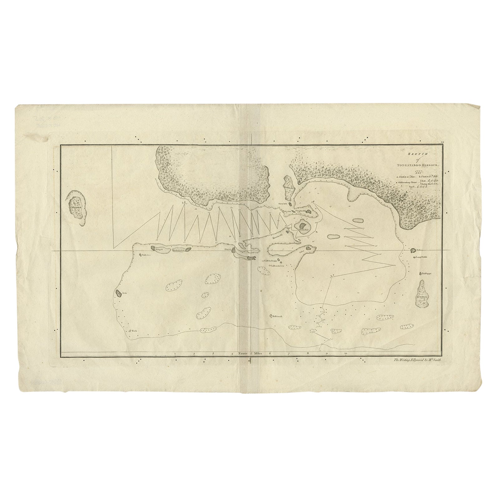
Antique Map of the Harbour of Tongatabu by Cook, C.1783
About the Item
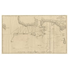
Antique map titled 'Sketch of Tongataboo Harbour (..)'. Antique map of the harbour of Tongatabu, one of the Tonga Islands. Originates from an edition of Cook's Voyages.
Artists and Engravers: Published by Nicol, G. and Cadell, London.
Condition: Good, some wear and age-related toning. Defect lower left margin and a small defect in the map near folding line. Please study image carefully.
Date: c.1783
Overall size: 45 x 29 cm.
Image size: 39.5 x 22 cm.
We sell original antique maps to collectors, historians, educators and interior decorators all over the world. Our collection includes a wide range of authentic antique maps from the 16th to the 20th centuries. Buying and collecting antique maps is a tradition that goes back hundreds of years. Antique maps have proved a richly rewarding investment over the past decade, thanks to a growing appreciation of their unique historical appeal. Today the decorative qualities of antique maps are widely recognized by interior designers who appreciate their beauty and design flexibility. Depending on the individual map, presentation, and context, a rare or antique map can be modern, traditional, abstract, figurative, serious or whimsical. We offer a wide range of authentic antique maps for any budget.
- Dimensions:Height: 11.42 in (29 cm)Width: 17.72 in (45 cm)Depth: 0 in (0.01 mm)
- Materials and Techniques:
- Period:
- Date of Manufacture:circa 1783
- Condition:Condition: Good, some wear and age-related toning. Defect lower left margin and a small defect in the map near folding line. Please study image carefully.
- Seller Location:Langweer, NL
- Reference Number:
About the Seller
5.0
Platinum Seller
These expertly vetted sellers are 1stDibs' most experienced sellers and are rated highest by our customers.
Established in 2009
1stDibs seller since 2017
1,956 sales on 1stDibs
Typical response time: <1 hour
- ShippingRetrieving quote...Ships From: Langweer, Netherlands
- Return PolicyA return for this item may be initiated within 14 days of delivery.
More From This SellerView All
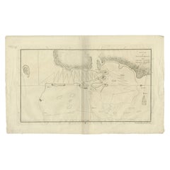
- Original Antique Map of the Harbour of Tongatabu by Cook, 1784Located in Langweer, NLAntique map titled 'Sketch of Tongataboo Harbour (..)'. Antique map of the harbour of Tongatabu, one of the Tonga Islands. Originates from an edition of Cook's Voyages. Artists an...Category
Antique 18th Century Maps
MaterialsPaper
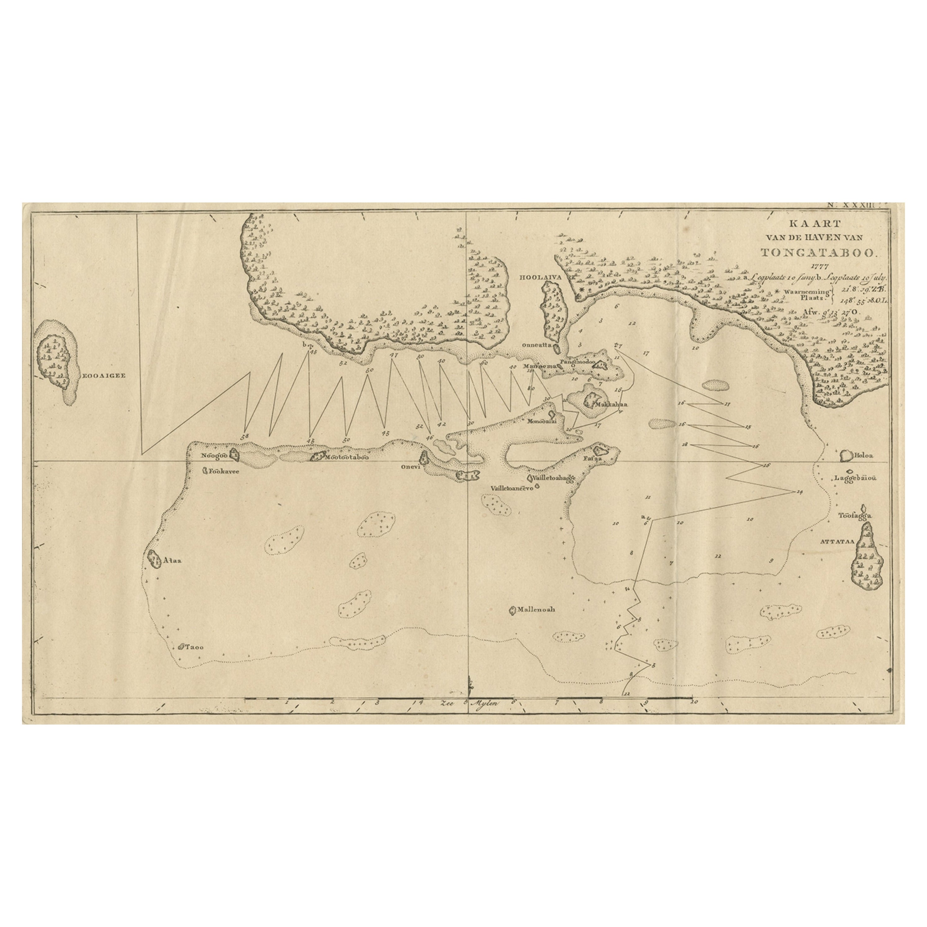
- Antique Map of the Harbour of Tongatabu, One of the Tonga Islands, 1803Located in Langweer, NLAntique map Tonga titled 'Kaart van de Haven van Tongataboo'. Antique map of the harbour of Tongatabu, one of the Tonga Islands. Originates from 'Reizen Rondom de Waereld door Ja...Category
Antique Early 1800s Maps
MaterialsPaper
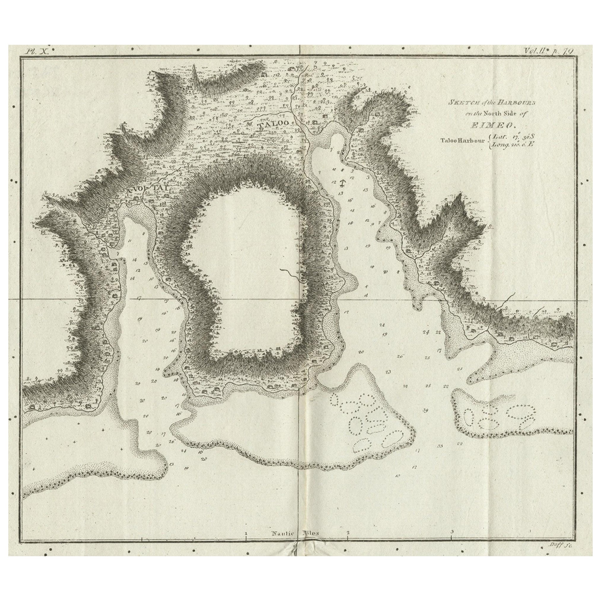
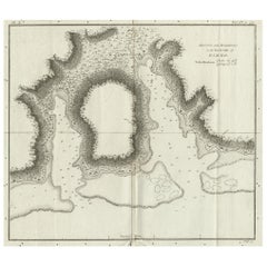
- Antique Map of the Harbour of Taloo by J. Cook, 1803By James CookLocated in Langweer, NLAntique map French Polynesia titled 'Schets van de Havenen aan de Noord Zijde van Eimeo'. Plan of the harbour of Taloo in the Island of Moorea, one of the Society Islands, French Polynesia. Originates from 'Reize rondom de Waereld door James Cook...Category
Antique Early 19th Century Dutch Maps
MaterialsPaper
- Antique Plan of the Harbour of Taloo by Cook, c.1781Located in Langweer, NLAntique map titled 'Sketch of the Harbours on the North Side of Eimeo (..)'. Plan of the harbour of Taloo in the Island of Moorea, one of the Society Islands, French Polynesia. Origi...Category
Antique 18th Century Maps
MaterialsPaper
- Antique Map of South America by J. Cook, 1775Located in Langweer, NLAntique map titled 'Kaart van het Zuidlyk Eind van Amerika'. Map of the sourthern part of South America, focusing on Cook's tracks around the Cape Horn and T...Category
Antique Mid-18th Century Maps
MaterialsPaper
- Antique Map of Suffren Island by Cook, 1803Located in Langweer, NLAntique map Australia titled 'Gezigt van het Eil. Suffren'. Antique map of Suffren Island. Originates from 'Reizen Rondom de Waereld door James C...Category
Antique 19th Century Maps
MaterialsPaper


You May Also Like
- Captain Cook's Exploration of Tahiti 18th C. Hand-Colored Map by BellinBy Jacques-Nicolas BellinLocated in Alamo, CAThis beautiful 18th century hand-colored copper plate engraved map is entitled "Carte de l'Isle de Taiti, par le Lieutenant J. Cook" was created by Jacques Nicolas Bellin and publish...Category
Antique Mid-18th Century French Maps
MaterialsPaper
- Original Antique Map of The World by Thomas Clerk, 1817Located in St Annes, LancashireGreat map of The Eastern and Western Hemispheres On 2 sheets Copper-plate engraving Drawn and engraved by Thomas Clerk, Edinburgh. Published by Mackenzie And Dent, 1817 ...Category
Antique 1810s English Maps
MaterialsPaper
- Original Antique Map of The Netherlands, Engraved by Barlow, Dated 1807Located in St Annes, LancashireGreat map of Netherlands Copper-plate engraving by Barlow Published by Brightly & Kinnersly, Bungay, Suffolk. Dated 1807 Unframed.Category
Antique Early 1800s English Maps
MaterialsPaper
- Map of the Republic of GenoaLocated in New York, NYFramed antique hand-coloured map of the Republic of Genoa including the duchies of Mantua, Modena, and Parma. Europe, late 18th century. Dimension: 25...Category
Antique Late 18th Century European Maps
- Antique Map of Italy by Andriveau-Goujon, 1843By Andriveau-GoujonLocated in New York, NYAntique Map of Italy by Andriveau-Goujon, 1843. Map of Italy in two parts by Andriveau-Goujon for the Library of Prince Carini at Palazzo Carini i...Category
Antique 1840s French Maps
MaterialsLinen, Paper
- Original Antique Map of Russia By Arrowsmith. 1820Located in St Annes, LancashireGreat map of Russia Drawn under the direction of Arrowsmith Copper-plate engraving Published by Longman, Hurst, Rees, Orme and Brown, 1820 Unframed.Category
Antique 1820s English Maps
MaterialsPaper


Recently Viewed
View AllMore Ways To Browse
Collection Of Sketches
Antique Cook
18th Century Sketch
Cook Islands
Cook London
Antique World Chart
Used Nautical Charts
Antique Char
Map Of Great Britain
Hand Painted Antique Map
Antique Furniture Depot
Antique Mexico Map
Antique Map Mexico
Hemisphere Antiques
Antique Road Maps
Antique Road Map
17th Century Scottish
Antique Maps Of Mexico