19th Century Maps
to
1,669
2,188
70
2,261
72
9
5
4
2
2
1
1
2,930
2,261
475
3
290
34
10
126
10
37
9
2
5
4
3
3
2,223
66
28
12
10
335
174
106
101
97
2,261
2,261
2,261
104
23
9
8
7
Period: 19th Century
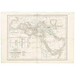
Géographie des Hébreux – Tableau de la Dispersion des Enfants de Noé, 1837
Located in Langweer, NL
Géographie des Hébreux – Tableau de la Dispersion des Enfants de Noé, 1837
This antique map, titled Géographie des Hébreux ou Tableau de la Dispersion des ...
Category
French Antique 19th Century Maps
Materials
Paper
$228 Sale Price
20% Off
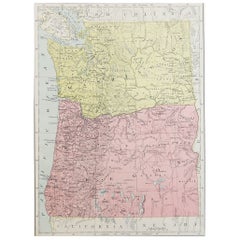
Original Antique Map of the American State of Washington, 1889
Located in St Annes, Lancashire
Great map of Washington
Drawn and Engraved by W. & A.K. Johnston
Published By A & C Black, Edinburgh.
Original colour
Unframed.
Category
Scottish Victorian Antique 19th Century Maps
Materials
Paper
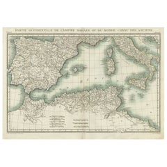
Iberian Peninsula & Mediterranean Map: Western Roman Empire, by Tardieu, 1802
Located in Langweer, NL
Antique Map with Title: "Partie Occidentale de l'Empire Romain ou du Monde connu des Anciens"
Publication Details:
- Atlas Title: Nouvel Atlas Universel de Géographie Ancienne et M...
Category
Antique 19th Century Maps
Materials
Paper
$513 Sale Price
20% Off
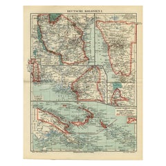
Antique Map of German Colonies by Meyer, 1895
Located in Langweer, NL
Antique map titled 'Deutsche Kolonien.' Lithographed map of the German Colonies. German East-Africa, German Southeast-Africa, Cameroon, Marshall-Islands, German Colonies in the Pacif...
Category
Antique 19th Century Maps
Materials
Paper
$104 Sale Price
20% Off
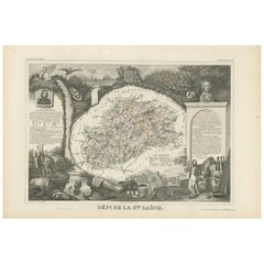
Antique Map of Haute-Saone, France by V. Levasseur, 1854
Located in Langweer, NL
Antique map titled 'Dépt. de la Hte. Saône'. Map of the French department of Haute-Saone, France. Part of France's important Burgundy or Bourgogne Wine Region. This area is home to t...
Category
Antique 19th Century Maps
Materials
Paper
$171 Sale Price
20% Off
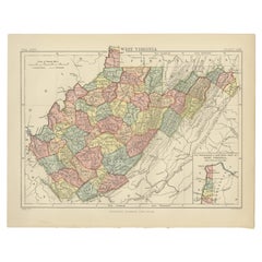
Antique Map of Virginia, with Inset Map of the Northern Part of West Viriginia
Located in Langweer, NL
Antique map titled 'West Virginia'. Original antique map of Virginia, United States. With inset map of the 'Panhandle' or northern part of West...
Category
Antique 19th Century Maps
Materials
Paper
$275 Sale Price
20% Off
Old Engraved Map of Hungary, European Balkan Countries, Greece and Crete, 1806
Located in Langweer, NL
Antique map titled 'Hongrie, Turquie Europe'.
Decorative map of Hungary, southeast European countries in the Balkan peninsula and Greece by Robert de Vaugondy, revised and publis...
Category
Antique 19th Century Maps
Materials
Paper
$428 Sale Price
20% Off
Original Antique Map of England with Hand Coloring
Located in Langweer, NL
Antique map titled 'Engand'. Original old map of England. Engraved by W. Milton. Published by John Mc. Gowan, circa 1829.
Category
Antique 19th Century Maps
Materials
Paper
$209 Sale Price
20% Off
Antique Map of the French Colony of Algeria by V. Levasseur, 1854
Located in Langweer, NL
Antique map titled 'Algérie, Colonie Francaise'. Shows the region divided into the administrative provinces of Oban, Alger, and Constantine. The map proper is surrounded by elaborate...
Category
Antique 19th Century Maps
Materials
Paper
$190 Sale Price
20% Off
Large Original Antique Map of Nevada, USA, 1894
Located in St Annes, Lancashire
Fabulous map of Nevada
Original color
By Rand, McNally & Co.
Published, 1894
Unframed
Free shipping.
Category
American Antique 19th Century Maps
Materials
Paper
Original Old Map Northeast India, incl Part of Himalayas and China, 1853
Located in Langweer, NL
Antique map titled 'India X'.
Old map of the the northeast region of India, including part of Himalayas and China. Great detail of landforms, rivers and water bodies, cities, towns...
Category
Antique 19th Century Maps
Materials
Paper
$180 Sale Price
20% Off
Antique Map of Central and Southern China by Kuyper, 1880
Located in Langweer, NL
Plate 53 : 'China, Midden en Zuid.' (China, Central and South). This lithographed map originates from: 'Wereld-atlas voor Kantoor en Huiskamer' (transl: World Atlas for the office an...
Category
Antique 19th Century Maps
Materials
Paper
$61 Sale Price
20% Off
Antique Map of France by Lapie, 1842
Located in Langweer, NL
Antique map titled 'Carte des Gaules'. Map of France. This map originates from 'Atlas universel de géographie ancienne et moderne (..)' by Pierre M. Lapie and Alexandre E. Lapie. Pie...
Category
Antique 19th Century Maps
Materials
Paper
$475 Sale Price
20% Off
Antique Map of South America by Johnston, 1861
Located in Langweer, NL
Antique map titled 'South America'.
Old map of South America, with an inset map of the Galapagos Isles. This map originates from 'The Royal Atlas of Modern Geography, Exhibiting, i...
Category
Antique 19th Century Maps
Materials
Paper
Antique Map of North America Including the West Indies
Located in Langweer, NL
Original antique map titled 'Nord-America'. Old map of North America and the West Indies. Also showing British Overseas Territories and Hudson Bay.
This map originates from Stiel...
Category
Antique 19th Century Maps
Materials
Paper
$551 Sale Price
20% Off
Antique Map of the United States by Balbi '1847'
Located in Langweer, NL
Antique map titled 'Etats-Unis'. Original antique map of the United States. This map originates from 'Abrégé de Géographie (..)' by Ad...
Category
Antique 19th Century Maps
Materials
Paper
$190 Sale Price
20% Off
Antique Map of Camden and Sonora, 1871
Located in Langweer, NL
Antique map titled 'Camden, Sonora'. Original antique map of villages and communities of Ohio. This map originates from 'Atlas of Preble County Ohio' by C.O. Titus. Published 1871.
Category
Antique 19th Century Maps
Materials
Paper
$237 Sale Price
20% Off
Antique Map of Washington County 'Ohio' by Titus, 1871
Located in Langweer, NL
Antique map titled 'Washington'. Original antique map of Washington, Ohio. This map originates from 'Atlas of Preble County Ohio' by C.O. Titus. Published, 1871.
Category
Antique 19th Century Maps
Materials
Paper
$223 Sale Price
24% Off
Antique Map of The Netherlands and Belgium by A & C, Black, 1870
Located in Langweer, NL
Antique map titled 'Holland & Belgium'. Original antique map of Map of The Netherlands and Belgium. This map originates from ‘Black's General Atlas of The World’. Published by A & C....
Category
Antique 19th Century Maps
Materials
Paper
$237 Sale Price
20% Off
Nicely Hand-Colored Print of a Belgium Army Regiment Riding Horses, 1833
Located in Langweer, NL
One nicely hand coloured print of an original serie of 23 plates, showing officers and soldiers on horses in beautiful army costumes holding spears. published in 1833. Rare.
From a serie of beautiful lithographed plates with Belgian military costumes after Madou and printed by Dero-Becker. Comes from a Belgian military costume album, dedicated to the Belgian King, and financed by subscribers, some 90 Belgian nobility and officers of the Belgian Army...
Category
Antique 19th Century Maps
Materials
Paper
$275 Sale Price
20% Off
19th Century Reprint of 16th Century Harbor Map of Copenhagen
Located in Haddonfield, NJ
This reprint of 1587 antique map of Copenhagen, Denmark retains its original mid-century mat and has been recently reframed in classic wood frame. The muted sepia colored map is a wo...
Category
Danish Baroque Antique 19th Century Maps
Materials
Wood, Paper
Antique Map of the Kingdoms of Spain and Portugal by Wyld '1845'
Located in Langweer, NL
Antique map titled 'Kingdoms of Spain and Portugal'. Original antique map of the Kingdoms of Spain and Portugal. This map originates from 'An Atlas of the World, Comprehending Separa...
Category
Antique 19th Century Maps
Materials
Paper
$190 Sale Price
20% Off
Antique Print of a Statue of a Boy by Knight, 1835
Located in Langweer, NL
Antique print titled 'Boy extracting a Thorn'. Old print of a statue of a boy, extracting a thorn. Made after a statue by Piranesi. This print originates from 'One Hundred and Fifty ...
Category
Antique 19th Century Maps
Materials
Paper
$64 Sale Price
20% Off
Hand Colored Antique Map of the department of Loir-et-Cher, France
Located in Langweer, NL
Antique map titled 'Dépt. de Loir et Cher'. Map of the French department Loir-et-Cher, France. This area is mainly known for its production of Selles-sur-Cher, a fine goats-milk chee...
Category
Antique 19th Century Maps
Materials
Paper
$323 Sale Price
20% Off
Small Original Antique Map of Switzerland and Surroundings, 1807
Located in Langweer, NL
Antique map titled 'Switzerland with its subjects & allies from the best authorities'.
Small map of Switzerland and surroundings. Originates from 'A general view of the world' by...
Category
Antique 19th Century Maps
Materials
Paper
$123 Sale Price
20% Off
Antique Map of the Europe Continent, 1880
Located in Langweer, NL
Antique map titled 'Europe'. Old map of the European continent. This map originates from 'Géographie Universelle Atlas-Migeon' by J. Migeon.
Artists an...
Category
Antique 19th Century Maps
Materials
Paper
$171 Sale Price
20% Off
Antique Engraved Map of South East Australia from a German Atlas, 1848
Located in Langweer, NL
Antique map Australia titled 'Süd-Ost Australien'.
Detailed map of South East Australia. Orginates from 'Stieler's Hand Atlas', published in Ge...
Category
Antique 19th Century Maps
Materials
Paper
$76 Sale Price
20% Off
Hand Colored Antique Map of the department of Hautes Alpes, France
Located in Langweer, NL
Antique map titled 'Dépt. des Hautes Alpes'. Map of the French department of Hautes Alpes, France. This area of France is known for its production of Cote...
Category
Antique 19th Century Maps
Materials
Paper
$323 Sale Price
20% Off
Map of Denmark, Norway & Iceland: Early 19th Century from the 1802 Tardieu Atlas
Located in Langweer, NL
Antique Map Description
Title: Royaume de Danemarck: Première Carte. Danemarck, Norwege et Islande
Publication Details:
- **Atlas Title:** Nouvel Atlas Universel de Géographie Anc...
Category
Antique 19th Century Maps
Materials
Paper
$456 Sale Price
20% Off
Antique Map of Persia and Afghanistan by Johnston, 1882
Located in Langweer, NL
Antique map titled 'Persia and Afghanistan'.
Old map of Persia and Afghanistan. This map originates from 'The Royal Atlas of Modern Geography, Exhibiting, in a Series of Entirely O...
Category
Antique 19th Century Maps
Materials
Paper
Antique 1844 J Calvin Smith JH Colton Midwest United States Survey Map 27"
By J.H. Colton
Located in Dayton, OH
Antique framed black and white map of seven Midwestern American states. Guide Through Ohio, Michigan, Indiana, Illinois, Missouri, Wisco...
Category
Antique 19th Century Maps
Materials
Paper
$940 Sale Price
20% Off
Map of England and Surrounding Regions: Early 19th Century - 1802 Tardieu Atlas
Located in Langweer, NL
Title: Isles Britanniques. Troisieme Carte, Angleterre
Publication Details:
- **Atlas Title:** Nouvel Atlas Universel de Géographie Ancienne et Moderne
- **Purpose:** For the Nouve...
Category
Antique 19th Century Maps
Materials
Paper
$361 Sale Price
20% Off
Black Sea in Antiquity: Pontus Euxinus Map, Published in 1880
Located in Langweer, NL
This map, titled "PONTUS EUXINUS," depicts the Black Sea region, historically known as the Pontus Euxinus. The Black Sea was central to ancient trade routes and cultural exchange, bo...
Category
Antique 19th Century Maps
Materials
Paper
$352 Sale Price
20% Off
Antique Chart of the Storm Centres of the United States, 1874
Located in Langweer, NL
Antique chart titled 'U.S. Signal Service chart showing the frequency of storm centres. Number of storm centres passing over each point deduced from the average of the two years Marc...
Category
American Antique 19th Century Maps
Materials
Paper
$380 Sale Price
20% Off
1859 Antique Arctic Vista: Greenland, Iceland and Faroe Islands, Blackie's Atlas
Located in Langweer, NL
The "1859 Antique Arctic Vista: Greenland, Iceland, and Faroe Islands" is an original antique map from 'The Imperial Atlas of Modern Geography', publishe...
Category
Antique 19th Century Maps
Materials
Paper
$166 Sale Price
20% Off
Guadeloupe and Dependencies: Mid-19th Century Map from France Pittoresque Series
Located in Langweer, NL
This map titled "Guadeloupe et Dépendances" is part of the France Pittoresque series and provides a detailed view of the island of Guadeloupe and its surrounding dependencies.
Features:
- The map shows the two main landmasses of Guadeloupe: Basse-Terre and Grande-Terre, separated by a narrow channel.
- Several smaller islands, including Marie-Galante, Les Saintes, and La Désirade, are also depicted.
- The main cities, towns, and geographical features are labeled, with emphasis on the island's mountain ranges and rivers, particularly on Basse-Terre.
- An inset at the bottom right provides a detailed plan of Pointe-à-Pitre, a major city and port on the island. The grid layout of the streets is clearly shown, reflecting urban planning of the time.
Artistic and Cartographic Details:
- The map uses clear linework to differentiate between the different islands and the sea, with significant natural features such as mountains and rivers carefully depicted.
- The map was drawn by Monin and engraved by Jacqueline and Barrière, whose names appear in the lower right corner.
- The scale in the lower left corner is measured in leagues, showing distances both by land and sea.
Historical Context:
- This map likely dates to the mid-19th century, a period when Guadeloupe was a key French colony in the Caribbean. Guadeloupe was known for its sugar and coffee plantations, which played a significant role in France's colonial economy.
- Maps like this were often used for administrative, military, and educational purposes to give a comprehensive view of France's overseas territories.
The map of Guadeloupe et Dépendances from the France Pittoresque series likely dates to the mid-19th century, around 1840 to 1860. This period corresponds to the height of French colonial influence in Guadeloupe, and the map's style, detailed urban planning, and cartographic techniques are consistent with maps produced in that era.
The specific publication date could be further narrowed down if the map was part of a known edition of the France Pittoresque atlas, but based on the cartographic style and historical context, 1840–1860 is a reasonable estimate.
Here are some relevant keywords people might use when searching for a map of Guadeloupe and its surrounding areas:
1. Guadeloupe map
2. Basse-Terre and Grande-Terre map
3. French Caribbean islands map...
Category
Antique 19th Century Maps
Materials
Paper
$114 Sale Price
20% Off
Hand Colored Antique Map of the Department of Aude, France
Located in Langweer, NL
Antique map titled 'Dépt. de l'Aude'. Map of the French department of Aude, France. This area of France is famous for its wide variety of vineyards and wine production. In the east a...
Category
Antique 19th Century Maps
Materials
Paper
$323 Sale Price
20% Off
Antique Map of China by A & C, Black, 1870
Located in Langweer, NL
Antique map titled 'China'. Original antique map of China. This map originates from ‘Black's General Atlas of The World’. Published by A & C. Black, 1870.
Category
Antique 19th Century Maps
Materials
Paper
$261 Sale Price
20% Off
Hand Colored Antique Map of the Department of Gard, France
Located in Langweer, NL
Antique map titled 'Départ. Du Gard'. Map of the French department of Gard, France. This area of France is known mainly for its red wine and production of Bleu des Causses, a soft an...
Category
Antique 19th Century Maps
Materials
Paper
$323 Sale Price
20% Off
Human Sacrifice in a Morai, Tahiti – Cook Voyage Engraving c.1795
Located in Langweer, NL
Menschelijke Offerhande in eene Morai of Otahiti verrigt – Human Sacrifice in Tahiti c.1795
This antique print depicts a dramatic and solemn scene of a human sacrifice performed in ...
Category
European Antique 19th Century Maps
Materials
Paper
$704 Sale Price
20% Off
Antique Map of England with Vignette of Stonehenge
Located in Langweer, NL
Antique map titled 'England'. Original antique map of England, with decorative vignette of stonehenge. Engraved by R. Scott. Published by Fulla...
Category
Antique 19th Century Maps
Materials
Paper
$171 Sale Price
20% Off
North African Coasts: Marmarica to Mauretania in Roman Times, Published in 1880
Located in Langweer, NL
The map with the title "MARMARICA, CYRENAICA, AFRICA, NUMIDIA, MAURETANIA secundum Italiam Poetarum" presents a historical geographical view of the northern coast of Africa, detailin...
Category
Antique 19th Century Maps
Materials
Paper
$352 Sale Price
20% Off
Scarce Antique Map of South America
Located in Langweer, NL
Antique map titled 'Carte de l'Amérique Méridionale'. Scarce map of South America, published in Paris in 1821. The map shows the continent in the ...
Category
Antique 19th Century Maps
Materials
Paper
$323 Sale Price
20% Off
Antique Map of New Brunswick, Nova Scotia and Surroundings by Johnson, 1872
Located in Langweer, NL
Antique map titled 'Johnson's Quebec, of the dominion of Canada (..)'. Original map of New Brunswick, Nova Scotia, Newfoundland and Prince Edward Island....
Category
Antique 19th Century Maps
Materials
Paper
$333 Sale Price
20% Off
Antique Map of Aube ‘France’ by V. Levasseur, 1854
Located in Langweer, NL
Antique map titled 'Dépt. de l'Aube'. Map of the French department of Aube, France. This area of France is known for its production of Chaource, a soft and salted cheese. Aube is par...
Category
Antique 19th Century Maps
Materials
Paper
$171 Sale Price
20% Off
Antique Map of Afghanistan and Surroundings, '1845'
Located in Langweer, NL
Antique map titled 'Map of Persia and Caubul'. Original antique map of Afghanistan and surroundings.
This map originates from 'An Atlas of the World, Comprehending Separate Maps of...
Category
Antique 19th Century Maps
Materials
Paper
$190 Sale Price
20% Off
Antique Costume Print of a Cabbage Cutter From Montafon in Austria, C.1880
Located in Langweer, NL
Antique costume print titled 'Krautschneider aus Montafun, Vorarlberg'. Old print of a cabbage cutter from Montafon. This print originates from 'Blätter...
Category
Antique 19th Century Maps
Materials
Paper
$104 Sale Price
20% Off
Old Original Hand-Colored Print of a Peasant of Little Russia, 1804
Located in Langweer, NL
Old print of a peasant of Little Russia.
This print originates from 'The Costume of the Hereditary States of the House of Austria' by William Miller....
Category
Antique 19th Century Maps
Materials
Paper
$266 Sale Price
20% Off
Hand Colored Antique Map of the department of Aube, France
Located in Langweer, NL
Antique map titled 'Dépt. de l'Aube'. Map of the French department of Aube, France. This area of France is known for its production of Chaource, a soft and salted cheese. Aube is par...
Category
Antique 19th Century Maps
Materials
Paper
$323 Sale Price
20% Off
Original Antique English County Map, Kent. J & C Walker, 1851
Located in St Annes, Lancashire
Great map of Kent
Original colour
By J & C Walker
Published by Longman, Rees, Orme, Brown & Co. 1851
Unframed.
Category
English Other Antique 19th Century Maps
Materials
Paper
Antique Map of South America by Wyld, '1845'
Located in Langweer, NL
Antique map titled 'South America'. Original antique map of South America. This map originates from 'An Atlas of the World, Comprehending ...
Category
Antique 19th Century Maps
Materials
Paper
$285 Sale Price
20% Off
Antique Map of Russia and Poland by Petri, 1852
Located in Langweer, NL
Antique map titled 'Europeesch Rusland en Polen'. Map of Russia in Europe and Poland. This map originates from 'School-Atlas van alle deelen der Aarde' by Otto Petri...
Category
Antique 19th Century Maps
Materials
Paper
$114 Sale Price
20% Off
Map of the Kingdom of Württemberg, Oberamt Tettnang in Germany, circa 1885
Located in Langweer, NL
Administrative Map of the Kingdom of Württemberg, Oberamt Tettnang, circa 1885
This detailed antique map titled "Handkarte von dem Königl. Württ. Oberamt Tettnang" was created by G....
Category
Antique 19th Century Maps
Materials
Paper
Original Antique Map of Switzerland, Engraved By Barlow, Dated 1807
Located in St Annes, Lancashire
Great map of Switzerland
Copper-plate engraving by Barlow
Published by Brightly & Kinnersly, Bungay, Suffolk.
Dated 1807
Unframed.
Category
English Antique 19th Century Maps
Materials
Paper
Antique Map of Bourbon/Reunion 'France' by V. Levasseur, 1854
Located in Langweer, NL
Antique map titled 'Ile de la Réunion'. Map of the French department of Ile. Bourbon or Reunion. Bourbon, or Reunion, is a volcanic island off the coast of Africa. It is one of Franc...
Category
Antique 19th Century Maps
Materials
Paper
$190 Sale Price
20% Off
Antique Map of the Moluccas by Stemfoort, 1885
Located in Langweer, NL
Antique map titled 'Kaart der Molukken'. Old map of the southern tip of the Moluccas, or Maluku Islands. With an inset map of part of Ambon Island and an inset map of New Guinea. Thi...
Category
Antique 19th Century Maps
Materials
Paper
$260 Sale Price
20% Off
Antique Map of Australasia, New Zealand, Polynesia & the Pacific Ocean, 1840
Located in Langweer, NL
Antique map titled 'The Pacific Ocean'.
This map depicts Australasia, New Zealand, Polynesia and islands in the Pacific Ocean including the Sandwich Islands.
Artists and Engravers: Published by the Society for the Diffusion of Useful Knowledge, 1840. Engraved by J. & C. Walker.
Condition:
Good, general age-related toning. Few tiny tears...
Category
Antique 19th Century Maps
Materials
Abalone, Paper
$209 Sale Price
20% Off
Antique Colored Belgium Map Flandria Gallica Flanders Henricus Hondius
Located in Dayton, OH
Antique hand colored map of Flanders, Belgium, engraved by Henricus Hondius.
Sans frame - 21.25” x 18”.
Category
Renaissance Antique 19th Century Maps
Materials
Paper
$280 Sale Price
20% Off
Antique Map of Southern Greece, 1892
Located in Langweer, NL
Antique map of Greece titled 'Griechenland. Südlicher Theil'. Old map of Southern Greece with inset maps of the Acropolis of Athens, the region of Athens, Thermopylae and Olympia. So...
Category
Antique 19th Century Maps
Materials
Paper
$80 Sale Price
20% Off
Antique Map of Gard ‘France’ by V. Levasseur, 1854
Located in Langweer, NL
Antique map titled 'Dépt. du Gard'. Map of the French department of Gard, France. This area of France is known mainly for its red wine and production of Bleu des Causses, a soft and ...
Category
Antique 19th Century Maps
Materials
Paper
$171 Sale Price
20% Off
