Mid-18th Century Maps
to
359
411
10
421
3
1
2,974
2,230
473
3
288
34
9
126
8
36
9
2
5
4
3
2
417
5
3
1
1
46
15
15
7
6
421
421
421
9
5
3
3
3
Period: Mid-18th Century
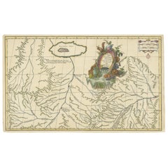
Original Antique Engrving of Chinese Tartary in the 18th Century, 1737
Located in Langweer, NL
The antique map titled " Ozieme feuille particuls de la Tartarie Chinoise, qui contient un pays dependant de la russie aucouchant de NIPTCHOU " translates to "Sixth sheet of parts of...
Category
Antique Mid-18th Century Maps
Materials
Paper
$415 Sale Price
20% Off
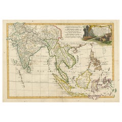
Antique Map of Southeast Asia with Decorative Allegorical Cartouche
Located in Langweer, NL
Antique map titled 'Les Indes Orientales et leur Archipel'. Old map of Southeast Asia, the Straits of Malaca, Philippines, Sumatra, Java, India etc., extending north to Canton and Ma...
Category
Antique Mid-18th Century Maps
Materials
Paper
$886 Sale Price
20% Off
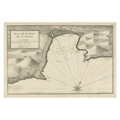
Large Antique Plan of St. Philiou Bay or Sant Feliu Catalonia Spain, circa 1746
Located in Langweer, NL
This antique map is a black and white harbor chart, specifically a port plan of St. Philiou, which is likely associated with Sant Feliu, Spain. This historical cartographic piece ori...
Category
Antique Mid-18th Century Maps
Materials
Paper
$509 Sale Price
20% Off
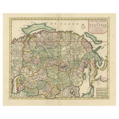
Antique Map of Northern Asia, with Russia, Korea and Northern Japan
Located in Langweer, NL
Antique map titled 'Nieuwe Kaart van Tartarie'. Map op Siberia and Chinese tartary. In the north Novaya Zemlya curls back to attach itself to the mainland by a narrow isthmus. In the...
Category
Antique Mid-18th Century Maps
Materials
Paper
$760 Sale Price
34% Off
Antique Map of both sides of the Central Rhine River, Germany
Located in Langweer, NL
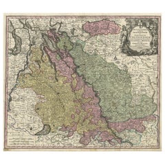
Antique map titled 'Mappa Geographica continens Archiepiscopatum et Electoratum Coloniensem (..)'. Decorative map of region on either side of the Central Rhine River, showing Dusseld...
Category
Antique Mid-18th Century Maps
Materials
Paper
$509 Sale Price
20% Off
Antique Map Centered on Turkestan
Located in Langweer, NL
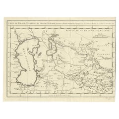
Antique map titled 'Carte de Karazm, Turkestan et Grande Bukarie'. Engraved map centered on Turkestan. Extends to include the Black and Caspian Seas, Uzbekistan, Tajikistan, Turkmeni...
Category
Antique Mid-18th Century Maps
Materials
Paper
$320 Sale Price
20% Off
Antique Map of Western Tartary, with Information from Kyrkov's Surveys
Located in Langweer, NL
Antique map titled 'Carte de la Tartarie Occidentale'. This map covers western Tartary with a focus on the region of present-day Mongolia. This map includes information from Kyrkov's...
Category
Antique Mid-18th Century Maps
Materials
Paper
$292 Sale Price
20% Off
Small Antique Map of England and Wales as It Was During the Heptarchy
Located in Langweer, NL
Antique map titled 'La Britannique dans sa Heptarchie Anglois Saxonique'. This little map shows England and Wales as it was during the Heptarchy, a phrase referring to the seven king...
Category
Antique Mid-18th Century Maps
Materials
Paper
$273 Sale Price
20% Off
Antique Plan of Plan of St. Julian's Harbour on the Coast of Patagonia
Located in Langweer, NL
Antique map titled 'Plan des Hafens St. Iulian auf der Küste von Patagonien'. Plan of St. Julian's Harbour on the Coast of Patagonia. This map originates from a German edition of 'Voyage around the World...
Category
Antique Mid-18th Century Maps
Materials
Paper
$273 Sale Price
20% Off
Antique Print of the Battle of Camaret in the Nine Years War, Near Brest, France
Located in Langweer, NL
Antique print titled 'Plan of the Attack of Camaret Bay, on the Coast of Bretagne, thro which lies the Harbour of Brest'. Striking plan showing the details of the battle at the mouth of Cameret Bay. Includes a battle plan...
Category
Antique Mid-18th Century Maps
Materials
Paper
$613 Sale Price
20% Off
Antique Print of the King of Barsalli & the Yamyamakunda Factory, Gambia, C1730
Located in Langweer, NL
Old Engraving with Title: Bumey Haman Seaka, King of Barsalli on the Gambia // plan of Yamyamakunda Factory on ye Gambia.
Artist/engraver/cartographer: ...
Category
Antique Mid-18th Century Maps
Materials
Paper
$226 Sale Price
20% Off
Captain Cook's Exploration of Tahiti 18th C. Hand-Colored Map by Bellin
Located in Alamo, CA
This beautiful 18th century hand-colored copper plate engraved map is entitled "Carte de l'Isle de Taiti, par le Lieutenant J. Cook" was created by Jacques Nicolas Bellin and publish...
Category
French Antique Mid-18th Century Maps
Materials
Paper
Original Antique Map of the Northwestern Part of Russia in Europe, 1753
Located in Langweer, NL
Antique map titled 'Partie septentrionale de la Russie Européenne'.
Detailed map of the Northwestern part of Russia, from the Gulf of Finland and Poland, to the western part of Asian Russia.
Artists and Engravers: Gilles Robert de Vaugondy (1688-1766) was the head of a leading family of geographers in eighteenth century France. Gilles got his start when he jointly inherited the shop of Pierre-Moullart Sanson, grandson of the famous geographer Nicholas Sanson. The inheritance included the business, its stock of plates, and a roller press...
Category
Antique Mid-18th Century Maps
Materials
Paper
$556 Sale Price
20% Off
Old Portrait of Henry Frederick, Prince of Wales, c.1750
Located in Langweer, NL
Antique portrait titled 'Henry, Prince of Wales, Son of K. James I'.
Old portrait of Henry Frederick. Henry Frederick, Prince of Wales (1594-1612) was the elder son of James VI and I, King of England and Scotland, and his wife, Anne of Denmark. Prince Henry was widely seen as a bright and promising heir to his father's thrones. However, at the age of 18, he predeceased his father when he died of typhoid fever. His younger brother Charles succeeded him as heir apparent to the English, Irish and Scottish thrones...
Category
Antique Mid-18th Century Maps
Materials
Paper
$339 Sale Price
20% Off
Old Map of Turkmenistan, Uzbekistan, Afghanistan, Tajikistan, Kyrgyzstan, 1757
Located in Langweer, NL
Antique map titled 'Kort over det Lille Bukarie og de naest graensende Lande. af Engelske Skribentere ved N. Bellin Ingenieur ved Marinen efter Söe Etaten'.
Map of present-day Turkmenistan, Uzbekistan, Afghanistan, Tajikistan, Kyrgyzstan including part of China. Originates from 'Almindelig histoirie over reiser til lands og bands (..)'. This 17 volume set is a translation of Collection of voyages and travels edited by Awnsham and John Churchill and Thomas Osborne...
Category
Antique Mid-18th Century Maps
Materials
Paper
$301 Sale Price
20% Off
Antique Map of Hangzhou, Capital of the Province of Zheijang, China, c.1750
Located in Langweer, NL
Antique map titled ‘Plan de la ville de Hang-Tcheou-Fou ou Hang-Chew-Fu Capitale de la Province de Che-Kiang’. This original print shows a map of the city of Hangzhou, capital of the...
Category
Antique Mid-18th Century Maps
Materials
Paper
$320 Sale Price
20% Off
Palace & Gardens of Shah Shuja, Prince of Rajmahal & Munger, India, 1757
Located in Langweer, NL
Antique print titled 'Paleis en Tuynen van Cha-Sousa Prins van Ragi Mohol - Grondtekening der Stad Mongheer‘.
This print depicts the palace and gardens of Shah Shuja, Prince of R...
Category
Antique Mid-18th Century Maps
Materials
Paper
$226 Sale Price
20% Off
Old Copper Engraving of the Siege of Syracuse, Sicily, Italy, Published, ca.1740
Located in Langweer, NL
Antique print titled 'Syracuse, Assiégée par les Atheniens'.
Old print of the siege of Syracuse, Sicily, Italy. Source unknown, to be determined.
The siege of Syracuse by the...
Category
Antique Mid-18th Century Maps
Materials
Paper
$264 Sale Price
20% Off
Antique Map of the Gulf of Bothnia, the Northernmost Arm of the Baltic, 1759
Located in Langweer, NL
Antique map titled 'Suite du Golphe de Bothnie'.
Original antique map of the Gulf of Bothnia, the northernmost arm of the Baltic Sea. It is situated between Finland's west coast ...
Category
Antique Mid-18th Century Maps
Materials
Paper
$226 Sale Price
20% Off
Map of the Russian Islands of Novaya Zemlya and Pechorskaya Guba, 1758
Located in Langweer, NL
Antique map titled 'Carte du detroit de Waeigats ou de Nassau.'
Map of the Russian islands of Novaya Zemlya (Nova Zembla) and Pechorskaya Guba, here Nouvelle Zemble and Grande Ba...
Category
Antique Mid-18th Century Maps
Materials
Paper
$245 Sale Price
20% Off
Old Original Map of the Philippines and Part of Indonesia 'Spice Islands', 1744
Located in Langweer, NL
Antique map titled 'Nieuwe Kaart van de Filippynsche, Ladrones, Moluccos of Specery Eilanden, als mede Celebes etc'.
Old map of the Philippines and part of Indonesia. Originates ...
Category
Antique Mid-18th Century Maps
Materials
Paper
$879 Sale Price
20% Off
Original Antique Plan of the Dutch Settlement at Chinsura-Hooghly, India, 1746
Located in Langweer, NL
Antique print, titled: 'Plan de la Loge Hollandoise d'Ougly'.
A plan of the Dutch settlement at Chinsura-Hooghly, India. This print originates from Prevost's 'Histoire Generale d...
Category
Antique Mid-18th Century Maps
Materials
Paper
$330 Sale Price
20% Off
Nicely Hand-Colored Antique Map of Part of India, the Ganges & Hindustan, 1755
Located in Langweer, NL
Antique map titled 'Carte de l'Inde en deca du Gange comprenant l' Indoustan (..)'
A map of part of India, the Ganges and Hindustan. From: Antoine Francois Prevost d'Exiles' (or ...
Category
Antique Mid-18th Century Maps
Materials
Paper
$603 Sale Price
20% Off
Decorative Original Antique Panoramic View of Atjeh on Sumatra, Indonesia, 1756
Located in Langweer, NL
Antique print titled 'Achem - Atsjien'.
Decorative panoramic view of Atjeh on Sumatra, Indonesia. On this engraving a pagode like building is visible in the background. In the fo...
Category
Antique Mid-18th Century Maps
Materials
Paper
$311 Sale Price
20% Off
Navigational Chart of Mexico's Coast, with Acapulco and Port Marquis, 1748
Located in Langweer, NL
Antique map titled 'The Form of cruising off Acapulca on the Coast of Mexico in the South Seas in the Year 1742. by His Majesty's Ships, Centurion, Gloucester, Tryall Prize, Carmila ...
Category
Antique Mid-18th Century Maps
Materials
Paper
$132 Sale Price
20% Off
Uncommon and Rare Map of the Caspian Sea by Order of the Czar, 1742
Located in Langweer, NL
Antique map, titled: 'Kaert van de Kaspische Zee volgens bevel van den Czaer (…).'
Uncommon map of Caspian Sea. Source unknown, to be determined.
Ar...
Category
Antique Mid-18th Century Maps
Materials
Paper
$688 Sale Price
20% Off
Decorative Hand-Colored Antique Map of Groningen in the Netherlands, ca.1730
Located in Langweer, NL
Antique print, titled: 'Groningae et Omlandiae Dominium vulgo de Provincie van Stadt en Lande (…) ' - This map shows Groningen, the Netherlands. Lower left scale sticks in the decora...
Category
Antique Mid-18th Century Maps
Materials
Paper
$1,179 Sale Price
20% Off
Beautiful Antique Map of the Province of Noord-Holland, the Netherlands, Ca.1730
Located in Langweer, NL
Antique map titled 'Kennemaria et Westfrisia vulgo et vernaculé Noord-Holland'.
Beautiful original antique map of the province of Noord-Holland, the Netherlands. Two large elaborat...
Category
Antique Mid-18th Century Maps
Materials
Paper
$1,368 Sale Price
20% Off
Map of the Circle of Franconia, Germany Bamberg, Wurtzburg and Nuremberg, 1757
Located in Langweer, NL
Antique map titled 'Cercle de Franconie (..)'.
Map of the Circle of Franconia, Germany. Centered on Bamberg, Wurtzburg and Nuremberg. This map originates from 'Atlas Universel (..)'.
Artists and Engravers: Gilles Robert de Vaugondy (1688 - 1766), also known as Le Sieur or Monsieur Robert, and his son, Didier Robert de Vaugondy (c.1723 - 1786), were leading mapmakers in France during the 18th century. In 1757, they published The Atlas Universel, one of the most important atlases of the 18th century. To produce the atlas, the Vaugondys integrated older sources with more modern surveyed maps...
Category
Antique Mid-18th Century Maps
Materials
Paper
$518 Sale Price
20% Off
Antique Plan of Fort Dauphin on Madagascar of the East Coast of Africa, 1756
Located in Langweer, NL
Antique map titled 'Plan du Fort Dauphin (..) -
Grondtekening van 't Fort Dauphin'. Plan of Fort Dauphin on the island of Madagascar of the east coast of Africa. This print origi...
Category
Antique Mid-18th Century Maps
Materials
Paper
$226 Sale Price
20% Off
Old Town View of the Fula Tribe and Its Cotton Plantations, Gambia, Africa, 1748
Located in Langweer, NL
Antique print titled 'Vue d'une Ville des Foulis et de ses Plantations - Gezigt van eene Stad der Fuli, en derzelver Planteryen'. View of a town of the Fula people and its cotton pla...
Category
Antique Mid-18th Century Maps
Materials
Paper
$132 Sale Price
20% Off
Shetland Islands Sea Chart – Antique Nautical Map by Ottens Brother c.1745
Located in Langweer, NL
Shetland Islands Sea Chart – Antique Nautical Map by Ottens Brothers, c.1740s
This striking antique nautical chart titled Nieuwe Paskaard van Hitland… presents the Shetland Islands ...
Category
Dutch Antique Mid-18th Century Maps
Materials
Paper
$1,179 Sale Price
20% Off
Rare Map of St. Louis on the Island of Hispaniola 'Santa Domingo', 1748
Located in Langweer, NL
Description: Antique map titled 'A New & Exact Planof the Harbour of Port Louis (..)'.
Scarce early plan of the Harbor of St. Louis on the Island of Hispaniola (Santa Domingo), showing the the harbor at the time it was taken by Admiral Knowles in March 1748. Charles Knowles (1704 – 1777) was an officer of the Royal Navy, who saw service during the War of Jenkins' Ear, the War of the Austrian Succession, and the Seven Years War. He also briefly served with the Imperial Russian Navy...
Category
Antique Mid-18th Century Maps
Materials
Paper
$330 Sale Price
20% Off
Antique Map of the Tunquin River and Bay by Van Schley 'c.1750'
Located in Langweer, NL
Antique map titled ‘Kaart van den Loop der Rivier van Tonkin van Cacho tot aan de Zee / Carte du Cours de la Riviere de Tunquin Depuis Cacho jusqu'à la Mer J. v. Schley direx.’ Detai...
Category
Antique Mid-18th Century Maps
Materials
Paper
$141 Sale Price
20% Off
Antique Map of Eastern Siberia by Bellin '1768'
Located in Langweer, NL
Antique map titled 'Suite de la Carte de la Siberie et le Pays de Kamtchatka'. Original antique map of the eastern portion of Siberia, centered on eastern Russia and the Mer d'Ochozk (Sea of Okhotsk) showing the Kamchatka Peninsula and I. de Beringe and I. Sagalin. The map shows the tracks of Russian ships...
Category
Antique Mid-18th Century Maps
Materials
Paper
$283 Sale Price
20% Off
Antique Map of the Arctic Ocean and Novaya Zemlya by Bellin '1759'
Located in Langweer, NL
Antique map titled 'Partie de la Mer Glaciale contenant la Nouvelle Zemle et le Pais des Samoiedes (..)'. Original antique map of the Arctic Ocean containing Novaya Zemlya and the co...
Category
Antique Mid-18th Century Maps
Materials
Paper
$330 Sale Price
20% Off
Antique Map of Coiba Island by Anson '1749'
Located in Langweer, NL
Antique map titled 'Plan van de Oost-Zyde van het Eiland Quibo'. Original antique map of the eastside of Coiba Island (Quibo), Panama, showing the shoreline around Port de Dames indi...
Category
Antique Mid-18th Century Maps
Materials
Paper
$235 Sale Price
20% Off
Original Antique Map of Northern Africa by Van Dùren (1749)
Located in Langweer, NL
This is a German antique map titled 'Neue Geographische Vorstellung der Mitternaechtlichen Küste von Africa'. Original antique engraving of Northern Africa extending from the Strait ...
Category
Antique Mid-18th Century Maps
Materials
Paper
$330 Sale Price
20% Off
Antique Map of Southeast Asia by Van Dùren, 1752
Located in Langweer, NL
Antique map titled 'Neue Vorstellung von Indien und China'. Original antique map of Southeast Asia. This map originates from 'Neue Sammlung der merkwürdigsten Reisegeschichten, inson...
Category
Antique Mid-18th Century Maps
Materials
Paper
$424 Sale Price
20% Off
Antique Map of Wuxi and Huzhou by Prévost '1746'
Located in Langweer, NL
Antique map titled 'Vusihyen. Hu Chew Fu'. Plans of Wuxi and Huzhou, China. Originates from Prévost's 'Histoire générale des voyages'.
Category
Antique Mid-18th Century Maps
Materials
Paper
$94 Sale Price
20% Off
Antique Map of Kamchatka by Bellin, '1757'
Located in Langweer, NL
Antique map titled 'Carte du Kamtchatka'. Antique map of the Kamchatka Peninsula. The map includes the island of Ouiakous Atch ou Anfinogen, Schoumctchou, and Sirinki ou Dilkon. Orig...
Category
Antique Mid-18th Century Maps
Materials
Paper
$264 Sale Price
20% Off
Antique Map of the North and East Coast of Asia by Vaugondy, circa 1750
Located in Langweer, NL
Antique map titled 'Nouvelle representation des Cotes Nord et Est de L'Asie.' Map the north and east coast of Asia, showing an oddly shaped Japan and inset maps of Kamchatka. Origina...
Category
Antique Mid-18th Century Maps
Antique Map of South America by G. Anson, 1749
Located in Langweer, NL
Antique map titled 'Kaart van het Zuidelykste Gedeelte van Zuider Amerika (..) - Carte de la Partie Meridionale de l'Amerique Meridionale (..)'. Detailed chart tracking the route of Capt. George Anson's ship The Centurion in 1745. The chart shows the tracks of Anson's ships around South America & Cape Horn to the Juan Fernandes Islands, with notes on currents and positions. This map originates from 'Reize rondsom de Werreld (..)' by George Anson, published 1749.
In 1740 Capt. George Anson (1697-1762) of the Royal Navy, was given command of a squadron of ships. As England was at war with France and Spain, Anson's task was to intercept and capture a Spanish treasure...
Category
Dutch Antique Mid-18th Century Maps
Materials
Paper
Antique Map Normandy 'France' by Homann Heirs, Published in c.1740
By Homann Heirs
Located in Langweer, NL
Antique map France titled 'Normannia Galliae celebris Provincia in terras suas Ballisiatus (..)'.
Decorative regional map of Normandy, France, circa ...
Category
German Antique Mid-18th Century Maps
Materials
Paper
$756 Sale Price
5% Off
Antique Plan of Duin en Berg 'the Netherlands' by H. de Leth circa 1732
Located in Langweer, NL
Antique plan titled 'Beschrijving Duin en Berg, de Lustplaets van den Heere Wilhem Hendrik Kerckrinck in Platten Gront'. Decorative cartouche with Dutch and French text. This plan or...
Category
Antique Mid-18th Century Maps
Materials
Paper
$452 Sale Price
20% Off
Antique Map of Gorée Island ‘Senegal’ by J.N. Bellin, 1764
Located in Langweer, NL
Nautical antique chart of Gorée Senegal including a letter key to the island's fortifications. Gorée is known as the location of the House of Slaves built by an Afro-French Métis fam...
Category
Antique Mid-18th Century Maps
Materials
Paper
$306 Sale Price
20% Off
Antique Map of Nova Zembla 'Russia' by J.N. Bellin, 1757
Located in Langweer, NL
Decorative map of Nova Zembla and environs in the Arctic Sea. Includes a large decorative title cartouche. One of the maps produced by Jacques-Nicolas Bellin for Prevost d'Exiles inf...
Category
Antique Mid-18th Century Maps
Materials
Paper
$259 Sale Price
20% Off
Antique Map of the Coast of Zanguebar and Madagascar 'Africa' by J. van Schley
Located in Langweer, NL
Decorative map of the area between the east coast of South Africa, the Seychelles, Mauritius and Madagascar. It was made by Jacob van der Schley for the Dutch edition of Histoire Gén...
Category
Antique Mid-18th Century Maps
Materials
Paper
$235 Sale Price
20% Off
Antique Map of the Mouth of the Yangtze River 'China' by J.N. Bellin, 1764
Located in Langweer, NL
This detailed regional map of China is a historical cartographic work from the mid-18th century and is attributed to Antoine-François Prévost, a prominent French cartographer and geo...
Category
Antique Mid-18th Century Maps
Materials
Paper
Antique Map of the Coast of Cape Verde by J. Van Der Schley, circa 1750
Located in Langweer, NL
An early map of what is now the coast of the capital city of Dakar, Senegal. What is now a dense, bustling city was at this time a uninhabited coast. Shows the overall contours of th...
Category
Antique Mid-18th Century Maps
Materials
Paper
$150 Sale Price
20% Off
Antique Print of the Bay of Sierra Leone by J. Van Der Schley, 1758
Located in Langweer, NL
Beautiful map and bird's-eye view of the Bay of Sierra Leone. While these maps by Van Schley after Bellin were initially made for 'Histoire Generale des Voyages' (Paris, 1746-1759), ...
Category
Antique Mid-18th Century Maps
Materials
Paper
$151 Sale Price
20% Off
Antique Print of the Bay of the Island of St. Vincent by Van Schley (1747)
Located in Langweer, NL
Antique print titled 'Oppervlakte van de Baaije van 't Eiland St. Vincent (..)'. View of the Bay of the Island of St. Vincent, one of the Capeverdian Islands. Originates from a Dutch...
Category
Antique Mid-18th Century Maps
Materials
Paper
$103 Sale Price
20% Off
Antique Map of the Tonkin River ‘Vietnam’ by J.N. Bellin, 1764
Located in Langweer, NL
One of the maps produced by Bellin for Prevost d'Exiles' influential travel book, ‘L'Histoire Generale des Voyages’. This map depicts part of Southeast Asia, most likely northern Vie...
Category
Antique Mid-18th Century Maps
Materials
Paper
$231 Sale Price
20% Off
Antique Map of Nova Zembla ‘Russia’ by J.N. Bellin, 1758
Located in Langweer, NL
An interesting map of Nova Zembla and surrounding areas. With details on the eastern tip of Nova Zembla of the place where the stranded Dutch sailors under Willem Barentsz spent the ...
Category
Antique Mid-18th Century Maps
Materials
Paper
$226 Sale Price
20% Off
Antique Map of Moscovy 'Russia' by E. Bowen, 1747
Located in Langweer, NL
Beautiful map of European Russia by the English cartographer Emmanuel Bowen. It depicts the European portion of Russia extending from the Gulf of Finland to the Ural Mountains. The m...
Category
Antique Mid-18th Century Maps
Materials
Paper
$301 Sale Price
20% Off
St. Christophe 'St. Kitts' Island: An 18th Century Hand-colored Map by Bellin
Located in Alamo, CA
Jacques Bellin's copper-plate map of the Caribbean island of Saint Kitts entitled "Carte De De l'Isle St. Christophe Pour servir á l'Histoire Genle. des V...
Category
French Antique Mid-18th Century Maps
Materials
Paper
French Framed Copper Engraved Hand Colored Map of Carolina & Georgia, Circa 1757
Located in Charleston, SC
French copper engraved hand colored map of Carolina & Georgia matted under glass with a painted frame, mid-18th century
Category
French Louis XV Antique Mid-18th Century Maps
Materials
Glass, Wood, Paint, Paper
West Africa Entitled "Guinea Propria": An 18th Century Hand Colored Homann Map
Located in Alamo, CA
This is a scarce richly hand colored copper plate engraved map of Africa entitled "Guinea Propria, nec non Nigritiae vel Terrae Nigrorum Maxima Pars" by Johann Baptist Homann (1664-1...
Category
German Antique Mid-18th Century Maps
Materials
Paper
South America: Hand-colored 18th Century Framed Map by Thomas Jefferys
Located in Alamo, CA
This detailed hand-colored map of South America by Thomas Jefferys was published in London in 1750. The map shows countries, early colonial possessions, towns, rivers, mountains, and...
Category
English Antique Mid-18th Century Maps
Materials
Paper
Colossal Terrestrian Globe Hand Painted, French, First Half of the 18th Century
Located in Saint-Ouen, FR
Colossal Terrestrian globe hand painted, French, first half of the 18th century.
Mounted in a 19th century pedestal wood.
Category
French Antique Mid-18th Century Maps
Materials
Beech
Recently Viewed
View AllMore Ways To Browse
Bavarian Porcelain Vases
Beer Tankard
Bjorn L
Black Cabinet With Flowers And Birds
Black Tansu Chest
Blue Morpho
Blue Opaline Crystal Vases
Bow Front Buffet
Boy And Girl Statues
Brass Donkey
Brass Hound
Bread Oven
Bronze Atlas Sculpture
Bronze Door Stop
Bronze Shakespeare Sculpture
Buddha Bell
Bull Terrier
Butlers Chest
