18th Century and Earlier Collectibles and Curiosities

to
2,704
3,890
557
4,482
216
93
41
35
29
14
10
7
4
2
2
2
1
1
1
6,828
13,526
2,736
3,516
4,723
3,084
511
298
603
745
486
909
908
906
659
594
3,383
600
526
139
127
1,372
278
268
225
187
4,482
4,482
4,482
58
21
14
13
12
Period: 18th Century and Earlier
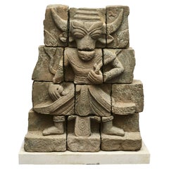
Hindi Sandstone Carving of Nandi / Nandikeshwara, 600-800 Years Old
Located in Kastrup, DK
Hindu sandstone carving depicting Nandi God in human form. 600-800 years old most likely older. An exceptional sculpture carved in sandstone from te...
Category

Burmese Other Antique 18th Century and Earlier Collectibles and Curiosities

Materials

Sandstone

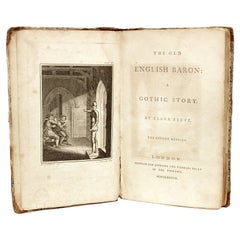
Clara REEVE. The Old English Baron: A Gothic Story. 1778 - 2ND ED (1ST ED THUS)
Located in Hillsborough, NJ
AUTHOR: REEVE, Clara. TITLE: The Old English Baron: A Gothic Story. PUBLISHER: London: For Edward and Charles Dilly, 1778. DESCRIPTION: SECOND EDITION (FIRST EDITION THUS). 1 vol...
Category

British Antique 18th Century and Earlier Collectibles and Curiosities

Materials

Leather

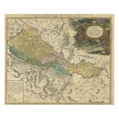
Detailed Antique Map of Slavonia, the Region in Eastern Croatia, ca.1745
Located in Langweer, NL
Antique map titled 'Tabula Geographica exhibens Regnum Sclavoniae.' Detailed map of Slavonia, the region in eastern Croatia. Map is dated shortly after the Peace of Belgrade sign...
Category

Antique 18th Century and Earlier Collectibles and Curiosities

Materials

Paper

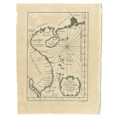
Antique Map of the Coast of China by Bellin, 1752
Located in Langweer, NL
Antique map titled 'Carte des Costes de Cochinchine, Tunquin et Partie de celles de Chine'. Detailed map of the region from the Cambodia River to Macao, along the coast of China. ...
Category

Antique 18th Century and Earlier Collectibles and Curiosities

Materials

Paper

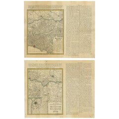
Set of Two Antique Maps of Northern Italy by Homann Heirs, 1754
Located in Langweer, NL
Set of two maps of northern Italy showing the position of troups during the war in April and March 1746. The area covered includes the course of the River Po between Valenza (north of Alexandria) and San Benedetto...
Category

Antique 18th Century and Earlier Collectibles and Curiosities

Materials

Paper

Original Very Old Hand-Colored Map of Limousin or Limoges, France, ca.1600
Located in Langweer, NL
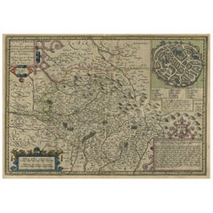
Antique map titled 'Totius Lemovici et Confinium (..).' - A handsome and detailed map of Limousin/Limoges, prepared by the well-known engraver, Petrus Kaerius. With an insert view ...
Category

Antique 18th Century and Earlier Collectibles and Curiosities

Materials

Paper

A General View of Jerusalem in the Early Part of the 18th Century" (circa 1752)
Located in Langweer, NL
The print is signed by the artist "S. Mynde sc." in the lower right corner. This suggests that the maker of the print is Samuel Mynde, a known engraver from the 18th century. His wor...
Category

Antique 18th Century and Earlier Collectibles and Curiosities

Materials

Paper

Boxwood Bilboquet Ball Game, treen, Late 18th Century
Located in Bilzen, BE
Bilboquet in turned boxwood, period, end of the 18th century. Dual use with point and ball. Beautiful patina of use. Total height 15 cm, ball diameter 4.8 cm.
Category

French Other Antique 18th Century and Earlier Collectibles and Curiosities

Materials

Wood

Rare 18th Century Waywiser By Jonathan Sissons
Located in Lincolnshire, GB
A super example of an early waywiser by Jonathan Sissons with a finely engraved center of the dial and a silvered readings dial, with the original hands. The oak and mahogany case ha...
Category

English Antique 18th Century and Earlier Collectibles and Curiosities

Materials

Silver, Brass

Map of Saint Helena Island: Early 18th-Century Copper Engraving by F. Bernard
Located in Langweer, NL
Map of Saint Helena Island: Early 18th-Century Copper Engraving by F. Bernard This rare and beautifully detailed copper engraving of Saint Helena Island dates from around 1722 and...
Category

Antique 18th Century and Earlier Collectibles and Curiosities

Materials

Paper

Circa 1800, Antique French Hand Carved Nutwood Putti Sculpture
Located in Lisse, NL
Lovely putti sculpture in typical Baroque Style. This beautiful and chubby putto sculpture was probably part of a larger Church ornament / sculpture o...
Category

French Baroque Antique 18th Century and Earlier Collectibles and Curiosities

Materials

Nutwood

Dutch 18th Century Copper Tobacco Box
Located in Delft, NL
A Dutch 18th century copper tobacco box A beautiful Dutch 18th century copper tobacco box with engraved on both sides and old Dutch text. The copper box is lined with tin on the ins...
Category

Dutch Antique 18th Century and Earlier Collectibles and Curiosities

Materials

Tin, Copper

Gothic Period Carved Stone Statue of Saint Nicholas
Located in Round Top, TX
A wonderful Gothic period hand carved stone statue of Saint Nicholas from the Avignon area of France. The now headless Saint Nicholas holds his staff an...
Category

French Antique 18th Century and Earlier Collectibles and Curiosities

Materials

Stone

Detailed Original Antique Plan of the City and Fort of Malacca, Malaysia, 1764
Located in Langweer, NL
Description: Antique map titled 'Plan de la Ville et Forteresse de Malaca'. Detailed plan of the city and fort of Malacca on the southern Malay Peninsula, commanding the strategic st...
Category

Antique 18th Century and Earlier Collectibles and Curiosities

Materials

Paper

Stunning Large Scale Antique Map of Martinique, Rare, Published 1758
Located in Langweer, NL
Antique map titled 'Carte Reduite de l'Isle de la Martinique Dressee au Depost des Cartes Plans et Journaux de la Marine.' Superb, large scale chart of th...
Category

Antique 18th Century and Earlier Collectibles and Curiosities

Materials

Paper

Admiral Viscount Bridport’s Gold and Hardstone Armorial Swivel Fob Seal
Located in Lymington, Hampshire
The openwork gold pendent mount supports a three sided faceted quartz, each side seal engraved respectively with the crest of Hood within the motto ‘Tria Juncta in Uno for the Order ...
Category

English Antique 18th Century and Earlier Collectibles and Curiosities

Materials

Quartz, Gold

Antique Map of the Northwestern Coast of Spain
Located in Langweer, NL
Antique map titled 'Gallaecia Regnum'. Original old map of the northwestern coast of Spain, extending from the Asturias de Oviedo region and Aviles in the Northeast to Bayona and the...
Category

Antique 18th Century and Earlier Collectibles and Curiosities

Materials

Paper

Large Map of Russian Discoveries in Siberia, Alaska & the Bering Strait, 1784
Located in Langweer, NL
1784 Russian Discoveries in Siberia, Alaska & the Bering Strait - Gerhard Friedrich Muller "Nouvelle Carte des Decouvertes Faites par des Vaisseaux Russiens Aux Cotes Inconnues de L'Amerique Septentrionale avec Les Pais Adiacents" is a seminal map by Gerhard Friedrich Muller, showcasing Russian discoveries in Siberia, Alaska, and the Bering Strait region. Originally published in 1754, this map served as a direct counter to Guillaume de L'Isle's speculative "fantasy" map of the same area, which prominently featured the fictitious Mer de l'Ouest (Sea of the West). This edition, published in 1784 by the Imperial Academy of Sciences in St. Petersburg, reflects the substantial geographic knowledge gained through Russian explorations, particularly the voyages of Vitus Bering. It accurately depicts the northern Pacific coasts, focusing on Siberia, the Aleutian Islands, and the Alaskan coast. The hand-coloring remains vibrant, emphasizing key geographic details, and a richly decorated rococo cartouche adorns the upper right, indicating the map's origins. This map is a significant artifact, illustrating the progression of cartographic accuracy and the influence of Russian expeditions in shaping the early knowledge of the North Pacific and Arctic regions. The 1784 edition of Gerhard Friedrich Muller's map features the routes of key Russian voyages that explored the North Pacific, specifically those related to the exploration of Siberia, Alaska, and the Bering Strait. These include: 1. Vitus Bering's Voyages (1728 and 1741) - The map shows routes of Vitus Bering, a Danish explorer in the Russian Navy, who led two important expeditions: - During his first Kamchatka Expedition (1728), Bering navigated through what is now known as the Bering Strait, proving that Siberia and Alaska were separated by a sea. - His second Kamchatka Expedition (1741) extended further eastward to Alaska. This journey greatly expanded European knowledge of the northern Pacific and confirmed Alaska as part of the North American continent. 2. Aleksei Chirikov's Route (1741) - As part of the second Kamchatka Expedition, Aleksei Chirikov, who was Bering's second-in-command, led a separate ship and reached the Alaskan coast, discovering the southeastern parts of Alaska and providing further detailed knowledge of the area. 3. Russian Navigators in the Aleutian Islands - The map also shows the exploration routes in and around the Aleutian Islands, which were instrumental for Russian fur...
Category

Antique 18th Century and Earlier Collectibles and Curiosities

Materials

Paper

Hand-Colored 17th-Century Map of Orléanais in France by Frederik De Wit c. 1688
Located in Langweer, NL
Title: Hand-Colored 17th-Century Map of Orléanais by Frederik De Wit c. 1688 Description: This beautifully crafted map, "Gouvernement General du Pays Orléanois," illustrates the Orl...
Category

Antique 18th Century and Earlier Collectibles and Curiosities

Materials

Paper

Detailed Original Old Map of the Southern Region of the Kingdom of Algiers 1773
Located in Langweer, NL
Antique map titled 'Kaart van het Zuidelyk Gedeelte van het Ryk Algiers'. Old map of the southern region of the Kingdom of Algiers, Algeria. Originates from the first Dutch edito...
Category

Antique 18th Century and Earlier Collectibles and Curiosities

Materials

Paper

Old Map Covering All of Southeast Asia from Persia to the Timor Island, 1712
Located in Langweer, NL
Description: Antique map titled 'A New Map of the East Indies'. Old map covering all of Southeast Asia from Persia to the Timor Island, inclusive of the modern day nations of India, ...
Category

Antique 18th Century and Earlier Collectibles and Curiosities

Materials

Paper

Ancient Sealing Wax Seal , 18th Century
Located in Roma, IT
Ancient Sealing Wax Seal. Italy, late 18th Century. Good condition with signs of age.
Category

Italian Antique 18th Century and Earlier Collectibles and Curiosities

Materials

Other

Fine Engraving Depicting an Officer's Mess in the Low Countries, 'Holland', 1754
Located in Langweer, NL
Title on Page (Dutch and French): CORPS DE GARDE van Hollandsche Officiers / Corps de Garde des Officiers Hollandois". Amst., 1754. Fine engraving depicting an officer's mess by J. Punt and P. Tanjé after a painting by C. Troost, with coat of arms engraved in lower margin and dedication to G. Braamcamp ("beminnaar der schilderkonst"). Waiting room with reading, smoking and card playing officers. Right, one of them studies a map of the Netherlands. On the wall a coat of arms with the Dutch lion. At the bottom of the margin the coat of arms and an assignment to Gerrit Braamcamp, who had the original painting in his collection. Cornelis Troost...
Category

Antique 18th Century and Earlier Collectibles and Curiosities

Materials

Paper

18th Century Polish Brass Hanukkah Lamp
Located in New York, NY
The backplate is cast and pierced with a central two-handled vase of flowers, flanked by fully formed birds with their heads turned outward. The side panels fitted with two servant lights, fronted by a row of eight oil fonts. Scholars theorize that these Polish Chanukah Lamps that bear two servant lights (as opposed to the singular servant light normally found on a Chanukah Lamp), served a purpose, having been used on one of the days that Chanukah fell on the Sabbath, as Sabbath Candlesticks. For another example, see page 296 of the book “Five Centuries of Hanukkah Lamps...
Category

Polish Antique 18th Century and Earlier Collectibles and Curiosities

Materials

Brass

17th Century Italian Rare Carved Walnut Antique Kneeler
Located in Casale Monferrato, IT
Rare antique Italian kneeler, Mid-17th Century Louis XIV. Made of solid walnut with relief decoration carved into the wood. In the part dedicated to the knees there is a compartment. Of great value all the hand forged iron part of the escutcheons and fantastic large antique keys...
Category

Italian Louis XIV Antique 18th Century and Earlier Collectibles and Curiosities

Materials

Walnut

Antique Print Depicting the Divorce Customs of the Jews, ca.1725
Located in Langweer, NL
Description: Antique religion print titled 'Gewoonten der Jooden wegens de brieven van Echtscheiding'. This print depicts divorce customs of the Jews. This print originates from ...
Category

Antique 18th Century and Earlier Collectibles and Curiosities

Materials

Paper

Remarkable Antique Print of a Horse Drawn Float with Religious Figures, 1775
Located in Langweer, NL
Antique print of a horse drawn float with religious figures. Double page with joined sheets and original folding lines. This print originates fro...
Category

Antique 18th Century and Earlier Collectibles and Curiosities

Materials

Paper

Antique Map of the Queen Charlotte Islands, Haida Gwaii
Located in Langweer, NL
Antique map titled 'Isles de la Reine Charlotte (..)'. Original old map of the Queen Charlotte Islands, based upon the explorations of James Cook, Juan Perez, and other contemporary European explorers. The map shows only partial coastal detail along the north end of the main island, and includes two insets of navigable bays and depth measurements. Now called Haida Gwaii, after the local native population, the islands situated off Canada’s coast, south of Vancouver played an important role in the late 18th and early 19th century maritime...
Category

Antique 18th Century and Earlier Collectibles and Curiosities

Materials

Paper

Detailed Antique Map of the Black Sea, Balkans and Asia Minor
Located in Langweer, NL
Antique map titled 'Nuova Carta del Europa Turchesca (..)'. This is an Italian version of Tirion's detailed map of the Black Sea, Balkans, and Asia Minor. It is embellished with a si...
Category

Antique 18th Century and Earlier Collectibles and Curiosities

Materials

Paper

Antique Map of the City of Batavia by Van der Aa 'c.1730'
Located in Langweer, NL
Antique map titled 'Plan de la Ville et du Chateau de Batavia en l'Isle de Iava - Ware affbeeldinge wegens het Casteel ende Stadt Batavia gelegen op groot Eylant Java'. Detailed plan...
Category

Antique 18th Century and Earlier Collectibles and Curiosities

Materials

Paper

Cartographic Treasures: A Journey Through the Gascogne and Guyenne Regions, 1680
Located in Langweer, NL
The antique map titled "Gouvernement de La Guienne & Gascogne" depicts the region of Gascogne and Guyenne, known for their wine production, in France. This map is a rare edition, u...
Category

Antique 18th Century and Earlier Collectibles and Curiosities

Materials

Paper

Antique Map of the Low Countries by Seutter, c.1745
Located in Langweer, NL
Antique map titled ‘XVII Provinciae Belgii sive Germaniae Inferioris (..)’. Detailed hand colored map of the Low Countries. Includes colored decorative cartouche, compass rose and co...
Category

Antique 18th Century and Earlier Collectibles and Curiosities

Materials

Paper

Antique Plan of the Siege of Grave by Guicciardini, c.1608
Located in Langweer, NL
Antique map titled 'Hic est situs oppidi Grauiae (..)'. Bird's eye view plan of Grave, The Netherlands, Holland. Showing the siege of Grave in the year 1602. Source unknown, to be de...
Category

Antique 18th Century and Earlier Collectibles and Curiosities

Materials

Paper

Old Antique Map of Borneo 'Kalimantan Indonesia, Sabah Malaysia & Brunei'
Located in Langweer, NL
Antique map titled 'Kaart van het Eyland Borneo'. Original antique map of the island of Borneo. Published 1724-1726 by Joannes van Braam and Gerard Onder de ...
Category

Antique 18th Century and Earlier Collectibles and Curiosities

Materials

Paper

Roman Clay Jar Handle Fragment
Located in Miami, FL
Roman clay fragment, this is the remains of the jar handle. This fragment was found in one of France's oldest ports, Fos-sur-Mer, not far from Arles whe...
Category

French Antique 18th Century and Earlier Collectibles and Curiosities

Materials

Clay

Detailed Antique Map of Hungary and Transylvania by Tirion, 1753
Located in Langweer, NL
Title: Nieuwe Kaart van’t Koninkryk Hongaryen en Zevenbergen by Isaak Tirion, 1753 – Antique Map of Hungary and Transylvania Description: This is an antique 1753 map titled *Nieuwe Kaart van’t Koninkryk Hongaryen en Zevenbergen*, created by the notable Dutch cartographer and publisher Isaak Tirion. The map showcases the Kingdom of Hungary and the region of Transylvania (referred to as "Zevenbergen") as they appeared in the mid-18th century. Tirion’s maps are well-known for their clarity, precision, and attention to geographic detail, making them highly sought after by collectors of antique maps. This map provides a detailed view of Hungary and Transylvania, including borders, towns, cities, rivers, and mountain ranges. It was created using the latest discoveries and updates of the time and reflects the political landscape of the region, which was part of the Habsburg Empire during a period of territorial changes and consolidations. The map’s borders are highlighted with color to distinguish different regions, and significant cities such as Buda, Pest, and Debrecen are clearly labeled. Isaak Tirion was one of the most prominent Dutch publishers of the 18th century, particularly known for his *Nieuwe en Beknopte Hand-Atlas* (New and Concise Hand Atlas) series, which included a wide range of maps of Europe and beyond. His works were appreciated for their cartographic accuracy and artistic quality. This map is a valuable piece for collectors interested in 18th-century European maps, particularly those that highlight Central Europe, Hungary, Transylvania, and the Habsburg Empire. It is a fine example of the craftsmanship of Isaak Tirion and offers insight into the historical geography of the region. Condition: Excellent for its age, with finely preserved hand-coloring and wide margins. Slight edge wear typical of maps from this period. Effective keywords that may help attract collectors or enthusiasts interested in historical maps of Hungary, Transylvania, and Central Europe: - Antique map of Hungary - Historical map of Transylvania - 18th-century map of Central Europe - Habsburg Empire map - Isaak Tirion map - Nieuwe Kaart van’t Koninkryk Hongaryen en Zevenbergen - Kingdom of Hungary map...
Category

Antique 18th Century and Earlier Collectibles and Curiosities

Materials

Paper

Engraving of Roman Punishments of Mass Crucifixion Outside the City Wall, 1690
Located in Langweer, NL
Antique print titled 'd'Aal-oude Kruis-straffen der Romeinen: hoedanige door Constantyn de Groot, uit eerbied voor het Kruis des Saligmakers, afgeschaft zyn'. Antique print of the ancient punishment by crucifixion which was abolished by Constantine the Great in deference to the cross of Jesus...
Category

Antique 18th Century and Earlier Collectibles and Curiosities

Materials

Paper

Antique Map of the Sunda Islands Sumatra, Java, Malay Peninsula & Borneo (1739)
Located in Langweer, NL
Antique map titled 'Nieuwe kaart van de Sundasche Eilanden als Borneo, Sumatra en Groot Iava & c'. Detailed map of the Sunda Islands, Southeast Asia, extending from the tip of Cambod...
Category

Antique 18th Century and Earlier Collectibles and Curiosities

Materials

Paper

Antique Map of Asia and the East Indies and Korea as a Peninsula, ca.1660
Located in Langweer, NL
Antique map titled 'Asiae nova delineatio'. Decorative map of Asia and the East Indies. The map shows Korea as a peninsula. In China the Great Wall is depicted, as well as a long str...
Category

Antique 18th Century and Earlier Collectibles and Curiosities

Materials

Paper

Antique Print of Alexandria in Egypt, 1698
Located in Langweer, NL
Antique print with two views of Alexandria, Egypt. This print originates from 'Reizen van Cornelis de Bruyn, door de vermaardste deelen van Klein Asia, de eylanden Scio, Rhodus, Cypr...
Category

Dutch Antique 18th Century and Earlier Collectibles and Curiosities

Materials

Paper

Antique Map of Senegal, West Africa
Located in Langweer, NL
Original antique map titled 'Carta del Senegal'. Antique map of Senegal, West Africa. This map originates from 'Compendio della storia generale dei viaggi (..)'. Published by De la Harpe...
Category

Antique 18th Century and Earlier Collectibles and Curiosities

Materials

Paper

Old Map of the Great Lakes and Upper Mississippi Valley, Northern America, c1780
Located in Langweer, NL
Antique map titled 'Partie Occidentale du Canada'. A fine example of Rigobert Bonne and Guilleme Raynal's 1780 map of the Great Lakes and upper Mississippi Valley. A map of c...
Category

Antique 18th Century and Earlier Collectibles and Curiosities

Materials

Paper

Historical Map of Northern Europe and Russia - Engraved for I. Harrison, 1788
Located in Langweer, NL
Historical Map of Northern Europe and Russia - Engraved for I. Harrison, 1788 This impressive historical map titled A New Map of Europe Containing Denmark, Norway, Sweden and Russ...
Category

Antique 18th Century and Earlier Collectibles and Curiosities

Materials

Paper

Print of the Solemn Celebration Sapan Giacche in Pegu, Burma 'Myanmar', 1725
Located in Langweer, NL
Antique print, titled: 'Fete Solennelle de Pegu appelee Sapan Giacche' This plate shows the Solemn celebration called Sapan Giacche in Pegu or Bago, the capital of the Bago Regio...
Category

Antique 18th Century and Earlier Collectibles and Curiosities

Materials

Paper

Iridescent Ammonite wall plate
Located in London, GB
Ammonites are perhaps the most widely known fossil. These creatures lived in the seas between 240 - 65 million years ago, when they became extinct along with the dinosaurs. This lar...
Category

British Antique 18th Century and Earlier Collectibles and Curiosities

Antique Dutch Map of the Twelve Tribes of Israel – After Ezekiel, circa 1730
Located in Langweer, NL
Antique Dutch Map of the Twelve Tribes of Israel – After Ezekiel, circa 1730 This uncommon early 18th-century Dutch map is titled "Ontwerp en Erfdeeling van’t Land Kanaan, volgens h...
Category

Dutch Antique 18th Century and Earlier Collectibles and Curiosities

Materials

Paper

Original Antique Map of Southern India and Ceylon 'Present-Day Sri Lanka'
Located in Langweer, NL
Antique map titled 'Suite de la Carte de l'Indoustan (..) - Vervolg van de Kaart van Hindoestan (..)'. Original antique map of Southern India and Ceylon (present-day Sri Lanka). This...
Category

Antique 18th Century and Earlier Collectibles and Curiosities

Materials

Paper

Old Map of Ancient Assyria Divided into Syria, Mesopotamia, Babylonia & Assyria
Located in Langweer, NL
This map, "Assyria vetus diuisa in Syriam, Messopotamiam, Babyloniam, et Assyriam", by Pierre Mortier, is a late 17th-century depiction of the historical Middle East. Title: Ancie...
Category

Antique 18th Century and Earlier Collectibles and Curiosities

Materials

Paper

Antique Print of a Section of Stratton Park, Hampshire, England, c.1770
Located in Langweer, NL
Antique print titled 'Section of Stratton Park'. Section of Stratton Park, Hampshire. This print originates from 'Vitruvius Britannicus' by Colen Campbell. Artists and Engravers:...
Category

Antique 18th Century and Earlier Collectibles and Curiosities

Materials

Paper

Antique Map of the Arabian Desert by Cellarius, 1731
Located in Langweer, NL
Antique map titled 'Arabia Petraea et Deserta.' Arabian desert with present day Israel, Jordania, Iraq. With decorative cartouche showing dromedaries. T...
Category

Antique 18th Century and Earlier Collectibles and Curiosities

Materials

Paper

Historical Map of the Duchy of Lauenburg by Johann Baptist Homann - Circa 1720
Located in Langweer, NL
Historical Map of the Duchy of Lauenburg by Johann Baptist Homann - Circa 1720 This splendid historical map titled Ducatus Lauemburgicus is a highly detailed and beautifully engra...
Category

Antique 18th Century and Earlier Collectibles and Curiosities

Materials

Paper

Antique Map of Ambon Island in the Moluccas, Indonesia, c.1760
Located in Langweer, NL
Antique map Ambon titled 'Carte Particuliere de l 'Isle Amboine'. Old map showing Ambon, in the Moluccas Islands, better known as the Spice Islands. Ambon was the headquarters of the...
Category

Antique 18th Century and Earlier Collectibles and Curiosities

Materials

Paper

Antique Map of Spain by Covens & Mortier, c.1740
Located in Langweer, NL
Antique map Spain titled 'L?Espagne dressée sur la Description qui en a eté faite par Rodrigo Mendez Sylva (..)'. Beautiful map of Spain with decorat...
Category

Antique 18th Century and Earlier Collectibles and Curiosities

Materials

Paper

1601 Miniature Map of Southeast Asia & Nova Guinea by Ortelius, Vrients Edition
Located in Langweer, NL
This miniature map of the East Indies and Nova Guinea was created by Abraham Ortelius and published in 1601 as part of the "Epitome" by Giovanni Battista Vrients. It is a finely hand...
Category

Antique 18th Century and Earlier Collectibles and Curiosities

Materials

Paper

Antique Map of the Province of Gelderland, the Netherlands, c.1690
Located in Langweer, NL
Antique map titled 'Ducatus Geldriae novissima descriptio'. Map of Gelderland, The Netherlands. Shows many cities (like Arnhem, Nijmegen, Eindhoven, Zutphen, Zwolle, etc), roads, riv...
Category

Antique 18th Century and Earlier Collectibles and Curiosities

Materials

Paper

Antique Map of the City of Verdun by Merian, c.1650
Located in Langweer, NL
Antique map titled 'Verdun'. Orginal antique map of Verdun, a small city in the Meuse department in Grand Est in northeastern France. This map originates from 'Topographia Germaniae'...
Category

Antique 18th Century and Earlier Collectibles and Curiosities

Materials

Paper

Antique Map of the Region of Cologne and Liege by Scherer, 1699
Located in Langweer, NL
Antique map titled 'Archpiescopatus Coloniensis (..) Episcopatus Leodiensis (..).' Detailed uncommon map of the Archbishopric of Cologne and the Bishopric of Liege/Luik. Source unkno...
Category

Antique 18th Century and Earlier Collectibles and Curiosities

Materials

Paper

Antique Map of Martinique, Showing Roads, Houses, Sugar Plantations, etc. c.1750
Located in Langweer, NL
Antique map titled 'Carte de l'Isle de la Martinique'. Detailed map of Martinique. Shows hilly terrain, forests, roads, houses, and even the sugar plantations. The island was to ...
Category

Antique 18th Century and Earlier Collectibles and Curiosities

Materials

Paper

Antique Map of Southern Asia with India, the Maldives, Ceylon and Arabia, c.1700
Located in Langweer, NL
Stunning Old Map of Asia. Description: Two-sheet map of Asia, joined. The left part of this antique map is titled 'Partie occidentale d'une partie d'Asie ou sont les Isles de Zoco...
Category

Antique 18th Century and Earlier Collectibles and Curiosities

Materials

Paper

Antique Plan of Emden in Germany by Guicciardini, 1612
Located in Langweer, NL
Antique map Emden titled 'Civitas Embda, eo modo situata cum essit controversia inter ipsam et suum Comitem anno'. Small plan of the city of Emden, Germany, Also depicted is part of ...
Category

Antique 18th Century and Earlier Collectibles and Curiosities

Materials

Paper

Read More

Medal-Worthy Memorabilia from Epic Past Olympic Games

Get into the games! These items celebrate the events, athletes, host countries and sporting spirit.

Ahoy! You’ve Never Seen a Collection of Sailor Art and Kitsch Quite Like This

French trendsetter and serial collector Daniel Rozensztroch tells us about his obsession with objects related to seafaring men.

Pamela Shamshiri Shares the Secrets behind Her First-Ever Book and Its Effortlessly Cool Interiors

The sought-after designer worked with the team at Hoffman Creative to produce a monograph that beautifully showcases some of Studio Shamshiri's most inspiring projects.

Moroccan Artworks and Objects Take Center Stage in an Extraordinary Villa in Tangier

Italian writer and collector Umberto Pasti opens the doors to his remarkable cave of wonders in North Africa.

Montecito Has Drawn Royalty and Celebrities, and These Homes Are Proof of Its Allure

Hollywood A-listers, ex-pat aristocrats and art collectors and style setters of all stripes appreciate the allure of the coastal California hamlet — much on our minds after recent winter floods.

Whaam! Blam! Pow! — a New Book on Pop Art Packs a Punch

Publishing house Assouline and writer Julie Belcove have teamed up to trace the history of the genre, from Roy Lichtenstein, Andy Warhol and Yayoi Kusama to Mickalene Thomas and Jeff Koons.

What Makes a Gem-Encrusted Chess Set Worth $4 Million?

The world’s most opulent chess set, weighing in at 513 carats, is literally fit for a king and queen.

Tauba Auerbach’s Geometric Pop-Up Book Is Mighty Rare, Thanks to a Hurricane

This sculptural art book has an epic backstory of its own.
Recently Viewed

View All