18th Century and Earlier Collectibles and Curiosities

to
2,714
3,888
557
4,477
215
93
41
35
30
13
10
7
4
2
2
2
1
1
1
6,813
13,507
2,734
3,523
4,710
3,079
513
300
604
745
482
909
903
901
659
595
3,385
601
521
138
126
1,346
271
265
222
182
4,477
4,477
4,477
59
21
14
13
12
Period: 18th Century and Earlier
18th Century Dutch Copper Tobacco Box
Located in Delft, NL
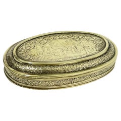
18th century Dutch copper tobacco box 18th century copper tobacco box in oval shape with rims. Engraved with Biblical scenes and Dutch text. Text is: "...
Category

Dutch Antique 18th Century and Earlier Collectibles and Curiosities

Materials

Copper

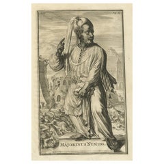
Antique Engraving of Majorinus, Bishop of Carthage of the Donatist Sect, 1701
Located in Langweer, NL
Antique print, titled: 'Majorinus Numida' Majorinus was a bishop of Carthage in dispute with Ceacilianus. He favored the so-called Donatist sect. Het died ca. 329 AD. The background to the controversy was the wave of persecutions of Christians by the Roman Emperor Diocletian. At that time some Church leaders - unwilling to endure torture or death and become martyrs - had been ready to take such acts as worshipping the gods of the old pantheon, considered idols by Christians, or surrendering church books and property to the imperial authorities. Such people became known as 'traditors' ("surrenderers"). One of these "traditors", named Caecilian, had returned to the fold of the Church once the persecutions ended, and was consecrated Bishop of Carthage and Primate of North Africa. Those of the faithful who refused to accept the authority of such a spiritual leader raised Majorinus as a rival bishop; however, Majorinus died shortly after being consecrated, and it fell to Donatus to take his place and continue the struggle. This rare print originates from: 'Historie der Kerken en Ketteren van den beginne des Nieuwen Testaments tot aan het Jaar onses Heeren 1688. Onzydig in 't Hoogduytsch beschreeven, door den Hoog-geleerden Heer Godfried Arnold, Voor deezen Hoog-Leeraar in de Historien tot Giesen. In het Neederduyts vertaald. Vercierd met verscheyde Koopere Plaaten door den Heer Romeyn de Hooghe.' (transl.: History of Churches and Heretics from the start of the New Testament until the year of our lord 1688 ...), by Godfried Arnold, Dutch edition published by Sebastiaan Petzold, Amsterdam 1701. This edition contains portraits of heretic figures, etched by the reknown Romeyn de Hooghe. Artists and Engravers: Made by 'Romeyn de Hooghe' after an anonymous artist. Gottfried Arnold (pseud. Christophorus Irenaeus) was an important representative of the so-called radical Pietism, publicist, church historian and chants writer (so he was believed to have written the well-known Church song 'O Durchbrecher aller Bande'). Arnold studied theology in Wittenberg. From the Lutheran Orthodoxy he converted, through writings of Spener, to Pietism, associating later into a circle around the court preacher Sprögel, who was influenced by Jakok Böhm. Many medieval mystics were later re-issued by him. In addition he was clearly influenced by Grotius and the early enlightenment. His quest for the 'true' Christianity rightly brought him in the early Church. So he arranged an edition containing the sermons of the desert father Macarius. Arnold was a skilled patristicus, although he did not escape from the creation of an ideal image of the Christian life in the early Church, in his view a flowering time which ended with the reign of Constantine. His first study of the early Church ('Die erste Liebe der Gemeinen Jesu Christi') provided him a professor position in Gießen, a post which he soon left, disappointed by what he called the 'Ruhmsachtige Vernunftwesen des akademischen Lebens'. He continued as an individual scientist and he published books and poems. His main work is 'Unparteiischen Kirchen- und Ketzerhistorie' (1699-1700), of which this is the Dutch translation. He adapts in this study the reformatory decay theory, where the censure lies no longer with Constantine, but the post-Apostolic time. The decay is temporarily lifted with the Reformation, but occurres again soon, so that even the contemporary institutional Protestantism lies under the fire of his criticism. On the other hand he favours the 'Church of the spirit' that existed in all times (invisible) and is characterised by avoiding the world and asceticism. Not the orthodoxy, but the subjectivity of religious man...
Category

Dutch Antique 18th Century and Earlier Collectibles and Curiosities

Materials

Paper

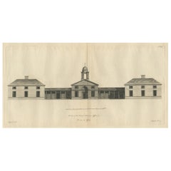
Antique Print of the Office of the Earl of Abercorn in Ireland or Scotland, 1770
Located in Langweer, NL
Antique print titled 'Elevation of the Earl of Abercorn's Offices (..)'. Old engraving of the office of the Earl of Abercorn. James Hamilton, 8th Earl of Abercorn PC (Ire) (22 Oc...
Category

Antique 18th Century and Earlier Collectibles and Curiosities

Materials

Paper

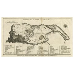
Detailed Map of the Island of Gorée off of the Coast of Dakar, Senegal, 1747
Located in Langweer, NL
Antique plan titled 'Plan de l'Isle de Goree The island of Gorée lies off the coast of Senegal, opposite Dakar. From the 15th to the 19th century, it was the largest slave-tradin...
Category

Antique 18th Century and Earlier Collectibles and Curiosities

Materials

Paper

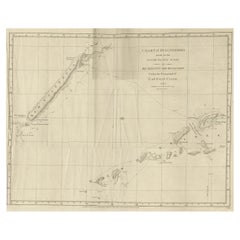
Rare Engraving of New Caledonia & New Hebrides from Capt. Cook's Travels, 1777
Located in Langweer, NL
Antique map titled 'Chart of Discoveries made in the South Pacific Ocean'. Rare engraving from the official British Admiralty sanctioned edition of the accounts of Cook’s second voyage. All other later copies made of this image by other publishers were unauthorised, usually smaller and inferior in quality. Made after Cook's discovery of the island group on 4 September 1774, which he named New Caledonia...
Category

Antique 18th Century and Earlier Collectibles and Curiosities

Materials

Paper

Original Antique Map of the Coast of Part of Greece, with Athens and Thebes
Located in Langweer, NL
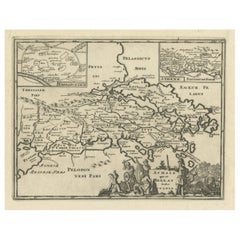
Original antique map titled 'Achaia quae et Hellas hodie Livadia'. Detailed map of the coast of part of Greece. With inset maps of Athens and Thebes. This map originates from 'Philippi Cluveri Introductionis in universam geographiam (..)' by P. Clüver. Published 1729. Philipp Clüver was an Early Modern German geographer and historian. Cluver's Geography was one of the most enduring works of the 17th & 18th Centuries, issued by several different publishers with many different sets of maps...
Category

Antique 18th Century and Earlier Collectibles and Curiosities

Materials

Paper

Antique Print of a Timeline of the Biblical History, 1732
Located in Langweer, NL
Antique print titled 'Chaine de l'Histoire Sacrée (..)'. Old print with two timelines, one of the Biblical history and another of the worldly governments. This print orginates from '...
Category

Antique 18th Century and Earlier Collectibles and Curiosities

Materials

Paper

Antique Map of Lower Saxony in Germany, c.1740
Located in Langweer, NL
Antique map titled 'Nieuwe Kaart van de Neder Saxise Kreits (..).' Attractive detailed map showing Lower Saxony, Germany, including Mekelenburg, Lauwenburg, Holstein, Bremen, Verden ...
Category

Antique 18th Century and Earlier Collectibles and Curiosities

Materials

Paper

Antique Map of Greece by J. Jansson, circa 1653
Located in Langweer, NL
This is an authentic antique map of the Greece by Jan Jansson. The map was published in Amsterdam, circa 1653. This striking 17th century map of Greece was based on “Totius Graeciae ...
Category

Antique 18th Century and Earlier Collectibles and Curiosities

Materials

Paper

Antique Map of the German Empire with decorative Title Cartouche
Located in Langweer, NL
Antique map titled 'Germania, Non ea tantum quae Rheno, Vistula, Danubio, mariqz Germanico Veteribus claudebatur; Sed tota illa continens quae hodie communiter Germanica lingua utitu...
Category

Antique 18th Century and Earlier Collectibles and Curiosities

Materials

Paper

Ancient Sealing Wax Seal , 18th Century
Located in Roma, IT
Ancient Sealing Wax Seal. Italy, late 18th Century. Good condition with signs of age.
Category

Italian Antique 18th Century and Earlier Collectibles and Curiosities

Materials

Other

La femme demasquée ou l'amour peint selon l'usage nouveau – Quesnot de La Chênée
Located in Middletown, NY
Quesnot de La Chênée, Jean-Jacques La femme démasquée ou l'amour peint selon l'usage nouveau la Haye (The Hague): Jacob van Ellinckhuysen, 1698. First Edition. 12mo, 5 x 2 3/4 inc...
Category

French Antique 18th Century and Earlier Collectibles and Curiosities

Materials

Gold Leaf

Original Antique Map of Martinique Island In The West Indies by Bonne, circa1780
Located in Langweer, NL
Antique map titled 'Carte de l'Isle de la Martinique Colonie Francoise dans les Isles Antilles'. Detailed map of the French Island of Martinique. Many towns and harbours, anchor pl...
Category

Antique 18th Century and Earlier Collectibles and Curiosities

Materials

Paper

Detailed Map of Dutch Rivers, with the Rhine, Maas, de Merwe en de Lek, C.1750
Located in Langweer, NL
Antique map titled 'Kaart van den Loop der Rivieren de Rhyn, de Maas, de Waal, de Merwe en de Lek, door de Provincien van Gelderland, Holland en Utrecht'. ...
Category

Antique 18th Century and Earlier Collectibles and Curiosities

Materials

Paper

The 17th Century Map of Northern Dithmarschen and Its Towns in Germany
Located in Langweer, NL
This is a detailed colored copperplate engraving depicting northern Dithmarschen, accompanied by town plans of Weßlingburen (now Wesselburen), Lunden, and Heyde (now Heide) at the to...
Category

Antique 18th Century and Earlier Collectibles and Curiosities

Materials

Paper

Antique Print of the Bold Hall in Warwickshire in England, 1714
Located in Langweer, NL
Antique print titled 'The Elevation of Nen Bold-Hall in Warwickshire (..)'. View of the Bold Hall in Warwickshire, England. This print originates from 'Vitruvius Britannicus' by Co...
Category

English Antique 18th Century and Earlier Collectibles and Curiosities

Materials

Paper

Original Hand-Colored Antique Map of Ancient Germany, circa 1630
Located in Langweer, NL
Antique map titled 'Germaniae Veteris typus'. Very attractive map of ancient Germany. Published by G. Blaeu after A. Ortelius, circa 1630. Willem Jans...
Category

Antique 18th Century and Earlier Collectibles and Curiosities

Materials

Paper

Antique Map of the Region of Rethelois by Janssonius, 1657
Located in Langweer, NL
Antique map of France titled 'Dioecese de Rheims et le Païs de Rethel'. Detailed map, centered on the River Ayne and the River Velle and sowing Reims, Chalons, Sedan, Charleville, as...
Category

Antique 18th Century and Earlier Collectibles and Curiosities

Materials

Paper

Antique Map of Northeastern Spain by Mercator, 1634
Located in Langweer, NL
Antique map titled 'Biscaia, Guipiscoa, Navarra et Asturias de Santillana'. Charming map of Northeastern Spain with the areas of Pamplona and Valladolid. This map originates from 'At...
Category

Antique 18th Century and Earlier Collectibles and Curiosities

Materials

Paper

Original Old Map with Many Details Around Manilla in the Philippine Islands
Located in Langweer, NL
Original antique map titled 'Carte du Canal des Iles Philippines (..) - Kaart van het Kanaal in de Filippynsche Eilanden (..)'. Striking and highly detailed chart of the Islands of the Philippines. Shows Islands, bays, reefs, soundings tracks of the Manila Galleon route, etc. Published 1724-1726 by Joannes van Braam...
Category

Antique 18th Century and Earlier Collectibles and Curiosities

Materials

Paper

Antique Map of the City of Grave by Blaeu, 1649
Located in Langweer, NL
Antique map titled 'Grave'. Original antique map of the city of Grave, the Netherlands. Published by J. Blaeu, 1649. Artists and Engravers: Joan Blaeu (23 September 1596 - 28 May...
Category

Antique 18th Century and Earlier Collectibles and Curiosities

Materials

Paper

Antique Print with Coastal Views of Asia by Cook, c.1784
Located in Langweer, NL
Antique print titled 'Views of the Coast of Asia (..)'. Antique print depicting various coastal views of Asia including Kamchatka. Originates from an edition of Cook's Voyages. A...
Category

Antique 18th Century and Earlier Collectibles and Curiosities

Materials

Paper

Antique Colourful Map of the Island of Java and Madura, Indonesia, C.1760
Located in Langweer, NL
Antique map titled 'Nouvelle Carte de l'Isle de Java'. Chart of the island of Java, depicting soundings around the coast, all principal harbors, rivers and elevations, bays and p...
Category

Antique 18th Century and Earlier Collectibles and Curiosities

Materials

Paper

Antique Map of Macedonia by the Famous Mapmaker Blaeu, c.1650
Located in Langweer, NL
Antique map titled 'Macedonia, Epirus et Achaia'. Ornated with a nice allegoric cartouche, one ship and a milage scale. Macedonia is shown in the centre of the map. With many detai...
Category

Antique 18th Century and Earlier Collectibles and Curiosities

Materials

Paper

Uncoulored Original Antique Map of Western Africa, 1749
Located in Langweer, NL
Interesting detailed German antique map titled 'Neue Vorstellung der Abendlaendischen Küsten von Africa (..)'. Original antique map of Western Africa. This map originates from 'Neue ...
Category

Antique 18th Century and Earlier Collectibles and Curiosities

Materials

Paper

Antique Map of Banten Bay, Java, Indonesia, c.1725
Located in Langweer, NL
A small early 18th century map of Banten Bay showing the islands of Pulo Dua and Pulo Batto together with soundings within the Bay and profiles of hills on the islands published by C...
Category

Antique 18th Century and Earlier Collectibles and Curiosities

Materials

Paper

Duchy of Brunswick-Lüneburg, 1595: A Renaissance Cartographic Masterpiece
Located in Langweer, NL
Title: "Braunschweig and Lüneburg Duchies: Authentic Depiction by Abraham Ortelius" This is an exquisite example of Abraham Ortelius’s cartographic craftsmanship: an original antiqu...
Category

Antique 18th Century and Earlier Collectibles and Curiosities

Materials

Paper

Antique Map of Madagascar by Mariette 'c.1670'
Located in Langweer, NL
Antique map titled 'Isle Dauphine communement nommée par les Europeens Madagascar, et St. Laurens (..)'. Original large-scale antique map of Madagascar...
Category

Antique 18th Century and Earlier Collectibles and Curiosities

Materials

Paper

Antique Map of the Namur Region 'France' by F. de Wit, circa 1680
Located in Langweer, NL
Antique map titled 'Comitatus Namurci Tabula in Lucem Edita'. Large map of the Namur region, France. Published by F. de Wit, circa 1680.
Category

Antique 18th Century and Earlier Collectibles and Curiosities

Materials

Paper

Antique Map of the Region of Hauts-de-France by Hondius, circa 1630
Located in Langweer, NL
Antique map titled 'Description du Gouvernement de la Cappelle'. Old map of the region of Hauts-de-France including the cities of Vervins, Marle, Cappelle and others. This map origin...
Category

Antique 18th Century and Earlier Collectibles and Curiosities

Materials

Paper

Scarce Antique Map of the Island of Java, Indonesia
Located in Langweer, NL
Title: "Kaart van 't Eyland Groot Java: Antique Map of Java, Indonesia" Description: This antique map, titled "Kaart van 't Eyland Groot Java," offers a rare and valuable depiction ...
Category

Antique 18th Century and Earlier Collectibles and Curiosities

Materials

Paper

Antique Map of the Islands Near Batavia, Capital of the Dutch East Indies, 1682
Located in Langweer, NL
Antique map titled 'Caerte van de Eylanden voor Batavia.' Map of the islands near Batavia, Indonesia. With scale, compass rose, cartouche and ships on the sea. Sheet with engraving...
Category

Antique 18th Century and Earlier Collectibles and Curiosities

Materials

Paper

17th Century Topographical Map, French Champagne Region, Epernay, Iohan Peeters
Located in New York, NY
Fine topographical 17th century map by Iohan Peeters of the towns of Epernay and Lametz in the Champagne Region of North Eastern France. Fabulous period engraving for a Wine Cellar,...
Category

Dutch Antique 18th Century and Earlier Collectibles and Curiosities

Materials

Paper

Original Hand-Colored Antique Map of Africa by Elwe '1792'
Located in Langweer, NL
Antique map titled 'l'Afrique Divisée en ses Empires, Royaumes, et Etats'. Decorative large map of Africa. The cartography is typical for the 17th century with the Nile originating i...
Category

Antique 18th Century and Earlier Collectibles and Curiosities

Materials

Paper

Antique Map of the Gulf of Bengal by J.N. Bellin, circa 1760
Located in Langweer, NL
Beautiful chart of the Gulf of Bengal. The map extends from Malabar to Sumatra and today Phuket area in Thailand. Including Pegu, Ceylon, and the Andaman and Nicobar Islands. Numerou...
Category

Antique 18th Century and Earlier Collectibles and Curiosities

Materials

Paper

Very Old Antique Map of the Persian Empire by Magini, c.1597
Located in Langweer, NL
Antique map titled 'Persiae Regnum sive Sophorum Imperium'. Old map of the Persian Empire. This map originates from 'Geografia cioe Descrittione Universale della Terra' by G.A. Magin...
Category

Antique 18th Century and Earlier Collectibles and Curiosities

Materials

Paper

Original Antique Map of Brasil, Published in the 16th Century, 1561
Located in Langweer, NL
This important Ruscelli map of Brazil, from his work La Geografia di Claudio Tolomeo Alessandrino, is one of the earliest obtainable modern maps of the re...
Category

Antique 18th Century and Earlier Collectibles and Curiosities

Materials

Paper

Rare Antique Map of Leeuwarden, Friesland, The Netherlands, by P. Bast, 1603
By P. Bast
Located in Langweer, NL
Very rare plan of Leeuwarden, Friesland, The Netherlands. With several cartouches and coat of arms. With a legend and compass rose at bottom right. Made by 'Pieter Bast' after the su...
Category

Antique 18th Century and Earlier Collectibles and Curiosities

Materials

Paper

Antique Map of the Bay and Rocks of Petatlan by Anson, 1749
Located in Langweer, NL
Antique map titled 'Baye et Rochers de Petaplan (..) - De Baay en de Rotsen van Petaplan (..)'. Original antique map of the bay and rocks of Petatlan, Mexico. This map originates fro...
Category

Antique 18th Century and Earlier Collectibles and Curiosities

Materials

Paper

18th Century Italian Baroque Gilded Ewer Repoussé Copper Liturgical Pitcher
Located in Milano, MI
A stunning Italian gilt copper ewer dating back to 18th century with a circular body featuring a quadripartite decoration defined by the repoussé of a double vertical ribbed frame that frames tableaux decorated with floral scrolls; the background of these sections is finely dotted by chisel tool to underline a very pleasant relief to the embossed parts thanks to the burnishing. An excellent and unique hand-made pitcher, selected in a private collection of Northern Italy. This rare golden jug was created to serve wine during the Eucharistic celebration, the Christian liturgical practice. it is an Italian work of art that dates back to 1700, with a wonderful fire gilding, for collectors. In good age related condition regardless of a small dent in the middle part of the body, consistent with the eighteenth-century dating. The cast handle takes up the motif of the volutes present on the body of the ewer. The spout is closed by a hinged lid with a small floral knob, with minimal deformations near the hinge compromising its perfect closure. In the upper part, there are welding signs...
Category

Italian Baroque Antique 18th Century and Earlier Collectibles and Curiosities

Materials

Copper

Antique Map of the Dutch Province of Gelderland with Zutphen as Capital, C.1650
Located in Langweer, NL
Antique map titled 'Ducatus Gelriae pars Tertia quae est comitatus Zutphaniensis'. Old map of the province of Gelderland, the Netherlands. The city of Zutphen can be found in the mid...
Category

Antique 18th Century and Earlier Collectibles and Curiosities

Materials

Paper

Antique Map of the City of Haarlem by Tirion, 1742
Located in Langweer, NL
Antique map titled 'Grondtekening van Haarlem (..)'. Original antique map of the city of Haarlem, the Netherlands. Published by I. Tirion, 1742. Artists and Engravers: Isaak Tirio...
Category

Antique 18th Century and Earlier Collectibles and Curiosities

Materials

Paper

Rare Antique Map of Persia, Incl the Caspian Sea and the Arabian Peninsula, 1726
Located in Langweer, NL
Rare untitled antique map of Persia. It covers from the Gulf of Suez eastward to Ahmedabad (Amadabad) in modern day western India. This map, centered on Persia, includes the Caspian Sea and part of the Arabian Peninsula...
Category

Antique 18th Century and Earlier Collectibles and Curiosities

Materials

Paper

Antique Map of Greece by Seutter or Lotter, 'c.1740'
Located in Langweer, NL
Antique map titled 'Graecia pars Septentrionalis'. Original antique map of Greece, uncommon. Signed cum Gratia et Privil. S.R.I. Vicariatus (..)'. Published by Seutter or Lotter, cir...
Category

Antique 18th Century and Earlier Collectibles and Curiosities

Materials

Paper

Scarce Map of the Mediterranean and Parts of Europe, Africa & Middle East, 1725
Located in Langweer, NL
Antique map titled: Byzondere afbeelding der landschappen, van de Apostelen bevaren en doorwandelt, om het Evangelium J.C. te prediken. Scarce map of the Mediterranean and contigu...
Category

Antique 18th Century and Earlier Collectibles and Curiosities

Materials

Paper

Original Antique Engraving of the Eastern Hemisphere, c.1700
Located in Langweer, NL
Antique map titled 'Proiectio Optica Aequinoctia lis Hemishaerii Orientalis' - Map of the Eastern Hemisphere with Africa, Europe, Asia and Nova Hollandia...
Category

Antique 18th Century and Earlier Collectibles and Curiosities

Materials

Paper

Antique Map of the Region of Berre-l'Étang, France
Located in Langweer, NL
Antique map titled 'Carte des etangs de Berre de Martigue et environs'. Original map of the region of Berre-l'Étang, France. This map originates from 'Le Petit Atlas Maritime (..)' b...
Category

Antique 18th Century and Earlier Collectibles and Curiosities

Materials

Paper

Antique Map of Banten Bay on Java Island, Indonesia, c.1720
Located in Langweer, NL
Antique map titled 'La Rade de Bantam'. A small early 18th century black and white map of Banten Bay (or Bantam Bay), located near the northwest co...
Category

Antique 18th Century and Earlier Collectibles and Curiosities

Materials

Paper

Antique County Map, Cambridgeshire, English, Framed Cartography, Robert Morden
Located in Hele, Devon, GB
This is an antique county map of Cambridgeshire. An English, framed atlas engraving of cartographic interest By Robert Morden, dating to the late 17th century and later. Superb lit...
Category

British Other Antique 18th Century and Earlier Collectibles and Curiosities

Materials

Glass, Wood, Paper

Old Antque Pirint of the New Dutch Church of Batavia 'Jakarta, Indonesia', 1744
Located in Langweer, NL
Antique print titled 'Ein Aufzug und Durchschnitt der Neuerbauten Holländischen Kirche in Batavia nach den Maastaab aufegzogen'. Old print with a cross-section of the new Dutch church of Batavia (Jakarta). This print originates from from 'Allerneuester Geographische- und Topographischer Schau-platz, von Africa und Ost-Indien'. Artists and engravers: Johann Wolfgang Heydt, a German artist who worked for the Dutch East India...
Category

Antique 18th Century and Earlier Collectibles and Curiosities

Materials

Paper

Antique Print of a Funeral on Ceylon 'Sri Lanka' is Asia, 1672
Located in Langweer, NL
Untitled print of the death of the prince heir, and his burial. Two prints, one with a long burial train including numerous horses, carrying the coffin, covered with cloth. The other...
Category

Antique 18th Century and Earlier Collectibles and Curiosities

Materials

Paper

Map of the Southeastern Part of the Banda Islands, Incl Northern Australia, 1726
Located in Langweer, NL
Antique map titled 'Kaart van de Zuyd-Ooster Eylanden van Banda.' Map of the southeastern part of the Banda islands. This map originates from 'Oud en Nieuw Oost-Indiën' by Franço...
Category

Antique 18th Century and Earlier Collectibles and Curiosities

Materials

Paper

Original Antique Map of Syria Phoenice by Van Dùren '1749'
Located in Langweer, NL
Interesting Antique map published in Germany titled 'Neue Vorstellung von Phoenice und Syrien (..)' This map is engraved with a lot of details. It is an original antique map of Syria...
Category

Antique 18th Century and Earlier Collectibles and Curiosities

Materials

Paper

Antique Map of part of India, the Ganges and Hindustan
Located in Langweer, NL
Antique map titled 'Carte de l'Indoustan'. Original antique map of part of India, the Ganges and Hindustan. This map originates from 'Histoire Generale Des Voyages' by Antoine Franco...
Category

Antique 18th Century and Earlier Collectibles and Curiosities

Materials

Paper

Antique Map of the British Isles by Covens & Mortier, 1730
Located in Langweer, NL
Covens and Mortier's attractive double-page engraved map of the British Isles, based on the 1702 De L'Isle map. The map features a large car...
Category

Antique 18th Century and Earlier Collectibles and Curiosities

Materials

Paper

View of the Exchange and the Warehouses at Petersburg in Russia, ca.1790
Located in Langweer, NL
Description: antique print titled 'A view of the Exchange and the Warehouses at Petersburg in Russia / Vüe de la Bourse & du Magazin de Marchandises a Petersburg Russe'. Beautiful engraving of the Stock and Warehouses of St. Petersburg, Russia. Artists and Engravers: Robert Sayer...
Category

Antique 18th Century and Earlier Collectibles and Curiosities

Materials

Paper

Old Print of Fort James on Kunta Kinteh Island on the Gambia River, Africa, 1746
Located in Langweer, NL
Antique print titled 'Plan de l’lle James sur la Gambra en 1732, Vue de Fort James du côte du Nord-Est, Vue de Fort James du côte de N.N. Ouest'. Old print of Kunta Kinteh Island on the Gambia...
Category

Antique 18th Century and Earlier Collectibles and Curiosities

Materials

Paper

Antique Map of Europe with Elaborate Title Cartouche, c.1750
Located in Langweer, NL
Antique map of Europe titled 'Europa Secundum legitimas Projectionis Stereographicae regulas et juxta recentissimas observationes aeque ac relationes… - L'Europe, dessinee suivant le...
Category

Antique 18th Century and Earlier Collectibles and Curiosities

Materials

Paper

Antique Map of the Malacca and Bangka Strait by De Mannevillette '1775'
Located in Langweer, NL
Antique map titled 'Carte de la Partie Comprise entre la Sortie du Detroit de Malac Le Detroit de Banca et L’Isle Borneo'. Chart of the Strait of Malacca and Bangka Strait. It shows ...
Category

Antique 18th Century and Earlier Collectibles and Curiosities

Materials

Paper

Rare Attractive Antique Map of Asia, India, Sri Lanka, Maldives, 1599
Located in Langweer, NL
Original Antique map of Asia, India, Ceylon (Sri Lanka), Maldives by Rosaccio / Ruscelli in attractive coloring. Title: Calecut Nuova Tavola Year: 1599 Relief shown pictorially. ...
Category

European Antique 18th Century and Earlier Collectibles and Curiosities

Materials

Paper

Read More

Medal-Worthy Memorabilia from Epic Past Olympic Games

Get into the games! These items celebrate the events, athletes, host countries and sporting spirit.

Ahoy! You’ve Never Seen a Collection of Sailor Art and Kitsch Quite Like This

French trendsetter and serial collector Daniel Rozensztroch tells us about his obsession with objects related to seafaring men.

Pamela Shamshiri Shares the Secrets behind Her First-Ever Book and Its Effortlessly Cool Interiors

The sought-after designer worked with the team at Hoffman Creative to produce a monograph that beautifully showcases some of Studio Shamshiri's most inspiring projects.

Moroccan Artworks and Objects Take Center Stage in an Extraordinary Villa in Tangier

Italian writer and collector Umberto Pasti opens the doors to his remarkable cave of wonders in North Africa.

Montecito Has Drawn Royalty and Celebrities, and These Homes Are Proof of Its Allure

Hollywood A-listers, ex-pat aristocrats and art collectors and style setters of all stripes appreciate the allure of the coastal California hamlet — much on our minds after recent winter floods.

Whaam! Blam! Pow! — a New Book on Pop Art Packs a Punch

Publishing house Assouline and writer Julie Belcove have teamed up to trace the history of the genre, from Roy Lichtenstein, Andy Warhol and Yayoi Kusama to Mickalene Thomas and Jeff Koons.

What Makes a Gem-Encrusted Chess Set Worth $4 Million?

The world’s most opulent chess set, weighing in at 513 carats, is literally fit for a king and queen.

Tauba Auerbach’s Geometric Pop-Up Book Is Mighty Rare, Thanks to a Hurricane

This sculptural art book has an epic backstory of its own.
Recently Viewed

View All