18th Century and Earlier Collectibles and Curiosities

to
2,720
3,856
553
4,441
216
93
41
35
30
14
10
5
4
2
2
2
1
1
1
6,814
13,476
2,733
3,520
4,692
3,077
513
301
604
744
480
903
895
900
659
592
3,350
601
522
136
127
1,304
265
232
222
182
4,441
4,441
4,441
59
21
14
13
12
Period: 18th Century and Earlier
Old Map of the Dutch Provinces of Friesland and Groningen, The Netherlands, 1604
Located in Langweer, NL
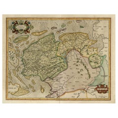
Antique print, titled: 'Frisiae Occidentalis.' Handsome map of the Dutch Provinces of Friesland and Groningen. Embellished with strapwork title-car...
Category

Antique 18th Century and Earlier Collectibles and Curiosities

Materials

Paper

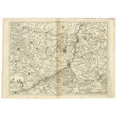
Antique Map of the Region of Liege by Coronelli, 1690
Located in Langweer, NL
Antique map titled 'Vescovato di Liege (..)'. Map of the Belgium area centered on Liege and the course of Meuse/Maas River. Also depicts the cities of Maastricht, Namur and Tienen. O...
Category

Antique 18th Century and Earlier Collectibles and Curiosities

Materials

Paper

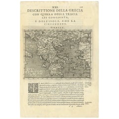
Rare Original 16th Century Antique Map of Greece, 1598
Located in Langweer, NL
Beautiful and rare antique map of Greece with Albania, Mecedonia, Romania, Dalmatia and the peninsula of Salento to the Golf of Taranto. Also clearly shown the islands of the Aegaian...
Category

Antique 18th Century and Earlier Collectibles and Curiosities

Materials

Paper

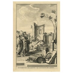
Antique Print Showing Remnants of Constantine I the Great's Baths, Rome, 1704
Located in Langweer, NL
Antique print, titled: 'De Overblyfzels der Badstoven van Konstantyn den Grooten' - This original old antique print shows the remnants of Constantine I the Great's baths in Rome, Ita...
Category

Antique 18th Century and Earlier Collectibles and Curiosities

Materials

Paper

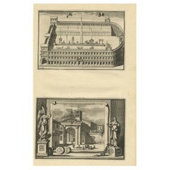
Circus Flaminius (..), Anonymous, 1704
Located in Langweer, NL
Antique print, titled: 'Circus Flaminius (?)' - This original old antique print shows a reconstruction of Circus Flaminius, a large, circular area in ancient Rome, located in the sou...
Category

Antique 18th Century and Earlier Collectibles and Curiosities

Materials

Paper

Pl. 1 Antique Print of Pavillon La Bouëxière by Le Rouge, c.1785
Located in Langweer, NL
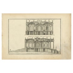
Antique print titled 'Pavillon de Labossiere (..)'. Copper engraving of pavillon La Bouëxière. This print originates from 'Jardins Anglo-Chinois à la Mode' by Georg Louis le Rouge. A...
Category

Antique 18th Century and Earlier Collectibles and Curiosities

Materials

Paper

Antique Map of the Arabian Desert by Cellarius, 1731
Located in Langweer, NL
Antique map titled 'Arabia Petraea et Deserta.' Arabian desert with present day Israel, Jordania, Iraq. With decorative cartouche showing dromedaries. T...
Category

Antique 18th Century and Earlier Collectibles and Curiosities

Materials

Paper

Inside View of Magdalen Chapel – Engraving of Medieval Gothic Interior, 1790
Located in Langweer, NL
Inside View of Magdalen Chapel – Engraving of Medieval Gothic Interior, 1790 This atmospheric antique engraving captures the interior of the Magdalen Chapel near Winchester, as view...
Category

English Antique 18th Century and Earlier Collectibles and Curiosities

Materials

Paper

The Holy Sepulchre '..', Basire, 1795
Located in Langweer, NL
Antique print titled 'The Holy Sepulchre at Northwold in the County of Norfolk'. Antique print depicting the Holy Sepulchre, Northwold. Artists and Engr...
Category

Antique 18th Century and Earlier Collectibles and Curiosities

Materials

Paper

Antique Map of Gabon, Angola and the Congo Region in Africa c.1680
Located in Langweer, NL
Antique map titled 'Royaume de Congo'. Map of Gabon, the Congo and Angola from Cape Lopez and Sao Tomé to approximately the border with present-day Namibia. The map is fully engrav...
Category

Antique 18th Century and Earlier Collectibles and Curiosities

Materials

Paper

Antique Print of the Neptune Fountain of Versailles, Paris, France, 1776
Located in Langweer, NL
Antique print titled 'Partie Centrale du Bassin de Neptune a Versailles'. Copper engraving showing parts of the Neptune fountain of Versailles, France...
Category

Antique 18th Century and Earlier Collectibles and Curiosities

Materials

Paper

Antique Religion Print Showing Rituals & Ceremonies for the Death of a Pope 1724
Located in Langweer, NL
Antique religion print depicting rituals and ceremonies for the death of the Pope. Originates from 'Ceremonies et coutumes Religieuses...' , by A. Moubach. Artists and Engrave...
Category

Antique 18th Century and Earlier Collectibles and Curiosities

Materials

Paper

Antique Map of Tartary and Northeast Asia by Bellin, circa 1750
Located in Langweer, NL
Antique map titled 'Carte de la Tartarie Occidentale'. Map of Tartary and northeast Asia, from Lake Baykal, Partie du Siberia in the north, Pays des Kalkas at the center, as well as ...
Category

European Antique 18th Century and Earlier Collectibles and Curiosities

Materials

Paper

Antique Bird's-Eye Plan of Tutecoryn (Tuticorin or Thoothukudi), India, 1672
Located in Langweer, NL
Antique map, titled: 'Tutecoryn.' Bird's-eye plan of map of Tutecoryn (Tuticorin or Thoothukudi), India. This map originates from 'Naauwkeurige Beschryvinge van Malabar en Choroman...
Category

Antique 18th Century and Earlier Collectibles and Curiosities

Materials

Paper

Antique Map of the Seven United Provinces of Holland by Seutter, 1727
Located in Langweer, NL
Antique map titled ‘Belgium Foederatum Auctius Et Emendatius‘. Important antique map of the Seven United Provinces of Holland with inset views of the East Indies, the province of Lim...
Category

Antique 18th Century and Earlier Collectibles and Curiosities

Materials

Paper

Antique Map of the Danube River by Homann, c.1720
Located in Langweer, NL
Antique map titled 'Danubii Fluminis (..)'. Regional map of the Donau river, Shows the Danube river from Belgrade in Serbia, along the border between Roma...
Category

Antique 18th Century and Earlier Collectibles and Curiosities

Materials

Paper

Antique Print of the Massacre in Naarden, The Netherlands, 1679
Located in Langweer, NL
Antique print titled 'De Moordt der Spanjaerden te Naerden geschiedt den eersten van December in den Jaare 1572'. Old print of the massacre by the Spaniards in Naarden, the Netherlands, 1 december 1572. This print originates from 'Oorsprongk, begin, en vervolgh der Nederlandsche oorlogen' by Pieter Christiaansz. Bor. Artists and Engravers: Jan Luyken...
Category

Antique 18th Century and Earlier Collectibles and Curiosities

Materials

Paper

Antique Map of the Region of Lyon by Janssonius, 1657
Located in Langweer, NL
Antique map of France titled 'La Principaute de Dombes'. Detailed map of the area above Lyon. This map originates from 'Atlas Novus, Sive Theatrum Orbis Orbis Terrarum: In quo Gallia...
Category

Antique 18th Century and Earlier Collectibles and Curiosities

Materials

Paper

Antique Map of Ambelau and Buru Island, Maluku or Moluccas in Indonesia, 1726
Located in Langweer, NL
Antique map titled 'Boero - Amblauw (..).' Detailed map of the Island Ambelau and Buru, Maluku Islands, Indonesia, by Francois Valentyn. With an inset of the lake on the Buru mountai...
Category

Antique 18th Century and Earlier Collectibles and Curiosities

Materials

Paper

Antique Map of the County of Hainaut by Jaillot, 1692
Located in Langweer, NL
Antique map titled 'Le Comté de Haynaut divisé en Chateliensis, Balliages, Prevoste's (..)'. Large map of the county of Hainaut (France) with its most important cities, Mons (Bergen)...
Category

Antique 18th Century and Earlier Collectibles and Curiosities

Materials

Paper

Antique Map of the Alsace region and Nova Zembla by Scherer, c.1700
Located in Langweer, NL
Antique map titled 'Chorographia Alsatiae.' Map of the Alsace region and Nova Zembla, printed for Scherer's 'Atlas Novus' (1702-1710). Scherer's 'Atlas Novus' forms an important mile...
Category

Antique 18th Century and Earlier Collectibles and Curiosities

Materials

Paper

Antique Map of the Buton Strait by Philippe, 1787
Located in Langweer, NL
Antique map titled 'Carte du Détroit de Bouton'. Map of the Buton Strait between Paula Buton and Celebes, Indonesia. This map originates from 'World atlas for the study of geography ...
Category

Antique 18th Century and Earlier Collectibles and Curiosities

Materials

Paper

Old Original Print of an Islamic Emir on a Horse, 1727
Located in Langweer, NL
Antique print titled 'Emir Chef des descendans de Mahomet'. Old print of an Islamic Emir on a horse. This print originates from 'Ceremonies et coutumes Religieuses (..)'. Art...
Category

Antique 18th Century and Earlier Collectibles and Curiosities

Materials

Paper

Great Antique Bird's-Eye View Plan of Brielle by Blaeu in The Netherlands, 1649
Located in Langweer, NL
Antique print, titled: 'Briela.' Bird's-eye view plan of Brielle in The Netherlands. With key to locations and coats of arms. Text in Dutch on verso. This plan originates from the famous city Atlas: 'Toneel der Steeden' published by Joan Blaeu...
Category

Antique 18th Century and Earlier Collectibles and Curiosities

Materials

Paper

Antique Map of the Coast of Africa and the Cape Verde Islands, ca.1680
Located in Langweer, NL
Antique map Africa titled 'Isles du Cap Verd Coste et Pays des Negres'. Antique map of the coast of Africa and the Cape Verde islands. Artis...
Category

Antique 18th Century and Earlier Collectibles and Curiosities

Materials

Paper

Old Antique Map of the Banda Islands (Southeast), Indonesia & Northern Australia
Located in Langweer, NL
Original antique map titled 'Kaart van de Zuyd-Ooster Eylanden van Banda'. Important map of the seas and islands surrounding the Banda Islands, Indonesia, extending south to northern Australia, east to Papua New Guinea and north to Ceram. Published 1724-1726 by Joannes van Braam...
Category

Antique 18th Century and Earlier Collectibles and Curiosities

Materials

Paper

Antique Print of the Stowe House in Stowe, Buckinghamshire, England, c.1785
Located in Langweer, NL
Antique print titled 'Plan actuel du Chateau de Stowe'. Copper engraving showing a plan and elements of the Stowe House. Stowe House is a grade I l...
Category

Antique 18th Century and Earlier Collectibles and Curiosities

Materials

Paper

Old Map of Indian Ocean & Sumatra, Java, Borneo, India, Arabia, Africa, c.1783
Located in Langweer, NL
Antique map titled 'Carte des Declinaisons et Inclinaisons de L'Aiguille Aimantée redigée d'après la table des observations Magnetiques faites par les Voyageurs depuis l'Année 1775'....
Category

Antique 18th Century and Earlier Collectibles and Curiosities

Materials

Paper

Original Old Map of South East England Incl London, Oxford, Cambridge, Etc, 1633
Located in Langweer, NL
Antique map titled 'Warwicum, Northhamtonia, Huntingdonia, Cantabrigia, Suffolcia, Oxonium, Buckinghamia, Befordia, Harfordia, Essexia, Berceria, Middlesexia, Southhatonia, Surria, Catiu & Southsexia'. Old map of south east England. Includes London, Salisbury, Oxford, Cambridge, Leicester and Norwich and the Isle of Wight. Originates from the 1633 German edition of the Mercator-Hondius Atlas Major, published by Henricus Hondius and Jan Jansson under the title: 'Atlas: das ist Abbildung der gantzen Welt, mit allen darin begriffenen Laendern und Provintzen: sonderlich von Teutschland, Franckreich, Niderland, Ost und West Indien: mit Beschreibung der selben.' Artists and engravers: Gerard Mercator (1512 - 1594) originally a student of philosophy was one of the most renowned cosmographers and geographers of the 16th century, as well as an accomplished scientific instrument maker. He is most famous for introducing Mercators Projection, a system which allowed navigators to plot the same constant compass bearing on a flat map.
Category

Antique 18th Century and Earlier Collectibles and Curiosities

Materials

Paper

Antique Print of the Convent of Buddhist Monks in Myanmar or Siam, Asia, c.1730
Located in Langweer, NL
Antique print titled 'Couvent de Talapoins - Pierres en forme de Mitre - Parasols d'Honneur'. This plate shows a convent of the Buddhist Talapoins, mitre schaped stones found next to...
Category

Antique 18th Century and Earlier Collectibles and Curiosities

Materials

Paper

Antique Map of Scandinavia by T. Jefferys, circa 1750
Located in Langweer, NL
Antique map titled 'Sweden, Denmark, Norway & Finland'. An original mid-18th century copper engraved antique map of Scandinavia by Thomas Jefferys....
Category

Antique 18th Century and Earlier Collectibles and Curiosities

Materials

Paper

Antique Map of The Bay of D'Estaing located on the Russian island Sakhalin, 1798
Located in Langweer, NL
Antique map titled 'Plan of La Baie d'Estaing'. This map shows the bay of D'Estaing located on the Russian island of Sakhalin. La Perouse was selected b...
Category

Antique 18th Century and Earlier Collectibles and Curiosities

Materials

Paper

Antique Map of Germany of German in Roman Times, c.1660
Located in Langweer, NL
Antique map Germany titled 'Germaniae Veteris Typus'. Antique map probably by Blaeu or based on an earlier state by W. Blaeu. Minor differences shown in the cartouches. Top left ha...
Category

Antique 18th Century and Earlier Collectibles and Curiosities

Materials

Paper

Detailed Regional Antique Map of Northwestern France and Catholic Belgium, 1648
Located in Langweer, NL
Antique map titled 'Picardie et les Pays Bas Catholiques (..)'. Detailed regional map of Northwestern France and Catholic Belgium, from an early edition of Sanson's Atlas. Art...
Category

Antique 18th Century and Earlier Collectibles and Curiosities

Materials

Paper

Antique Map of France by Janssonius, c.1650
Located in Langweer, NL
Antique map titled 'Gallia Vetus'. Beautiful map of France based on Caesar's De Bello Gallico. In the columns to the left and right important tribes and people are described. Art...
Category

Antique 18th Century and Earlier Collectibles and Curiosities

Materials

Paper

Antique Map of Kyoto located in The Kansai Region on the Island of Honshu, c1740
Located in Langweer, NL
Antique map titled 'Plan de la Ville de Meaco'. Detailed plan of Kyoto, located in the Kansai region on the island of Honshu, Japan. This map most likely originates from an edition of 'Histoire et description generale du Japon' by P.F.X. de Charlevoix. Artists and Engravers: Jacques-Nicolas Bellin (1703-1772) was among the most important mapmakers of the eighteenth century. In 1721, at age 18, he was appointed hydrographer (chief cartographer) to the French Navy. In August 1741, he became the first Ingénieur de la Marine of the Depot des cartes...
Category

Antique 18th Century and Earlier Collectibles and Curiosities

Materials

Paper

Encoloured Engraving of Cliff Kaloiero or Caloiero Island, Panaia, Greece, 1688
Located in Langweer, NL
Antique print Greece titled 'De Klip van Kaloiero'. Old print of the Island Kaloiero or Panaia, Greece. This print originates from 'Nauwkeurige Be...
Category

Antique 18th Century and Earlier Collectibles and Curiosities

Materials

Paper

Antique Map of the World with California as an Island, 1788
Located in Langweer, NL
Description: Antique map titled 'De wareld in een ronde gedaante van de Noord Pool te zien - De Wareld verbeeld in de gedaante van een hard'. This interesting composition contains three world maps on the sheet. At left is a northern projection showing all the landmasses. At right is a cordiform projection (heart-shaped). At top is a map of the world as known to the ancients. Both the polar and cordiform projections show California as an island...
Category

Antique 18th Century and Earlier Collectibles and Curiosities

Materials

Paper

Antique Map of the Limoges Region in France, c.1690
Located in Langweer, NL
Antique map titled 'Le Diocèse de Limoges'. Large map of the Limoges region, France. The map is dedicated to the bishop of Limoges, Antoine de Charpin. Artists and Engravers:...
Category

Antique 18th Century and Earlier Collectibles and Curiosities

Materials

Paper

Original Antique Print of the 'Korenbeurs' in Amsterdam, the Netherlands, 1787
Located in Langweer, NL
Antique print titled 'De Nieuwe Koornbeurs, in 1786'. Original antique print of the 'Korenbeurs' in Amsterdam, the Netherlands. The Korenbeurs ("grain bourse") was a 17th-century commodity market in Amsterdam where grain was traded. The building stood on the banks of the Amstel, on the western side (Nieuwezijde) of the Damrak. It was directly south of the Oude Brug bridge, on a spot now occupied by the former stock and commodity exchange Beurs van Berlage...
Category

Antique 18th Century and Earlier Collectibles and Curiosities

Materials

Paper

Antique Map of Juan Fernandez Island by Anson, c.1740
Located in Langweer, NL
Antique map titled 'Plan de la Côte du N.E. de l 'Ile de Juan Fernandes'. Map of the northeast coast of the island of Juan Fernandez with Cumberland Bay, South America. In 1740 Ans...
Category

Antique 18th Century and Earlier Collectibles and Curiosities

Materials

Paper

Rare Map of North Africa Depicting Numidia, Libia and Morocco, Published C.1740
Located in Langweer, NL
Antique map Africa titled 'Mauretania, Numidia, Gaetulia & c.'. Rare map of North Africa depicting Numidia, Libia and Morocco. Artists and E...
Category

Antique 18th Century and Earlier Collectibles and Curiosities

Materials

Paper

Old Map of the Rhine & German Cities Incl Düsseldorf, Bonn, Köln, Etc., c.1730
Located in Langweer, NL
Antique map Germany titled 'Mappa Geographica continens Archiepiscopatum et Electoratum Coloniensem (..)'. This antique map depicts the Rhine r...
Category

Antique 18th Century and Earlier Collectibles and Curiosities

Materials

Paper

Old Sea Charts of Tourane Bay & the Con Dao Islands 'Pulo Condor', Vietnam, 1780
Located in Langweer, NL
Description: Two maps on one sheet titled 'Carte d'une partie de la Cote de Cochinchine [and] Plan de l'Isle Condor'. Sea charts of the coast of Vietnam around the Tourane Bay an...
Category

Antique 18th Century and Earlier Collectibles and Curiosities

Materials

Paper

Rare Early Plate of a Woman from Venice, Italy in 16th Century Costume, 1577
Located in Langweer, NL
Antique print, titled: 'CXXII. Veneta Mulier' This rare early plate shows a woman from Venice, Italy in 16th century costume. From: 'Habitus praecipuorum populorum tam virorum qu...
Category

Antique 18th Century and Earlier Collectibles and Curiosities

Materials

Paper

Detailed Antique Map of Portugal, Published for the 'Gentleman's Magazine', 1758
Located in Langweer, NL
Antique map Portugal titled 'A Map of the Kingdom of Portugal'. Detailed map of Portugal, published for the 'Gentleman's Magazine'. Artist...
Category

Antique 18th Century and Earlier Collectibles and Curiosities

Materials

Paper

Original Antique Map of the Bay and Rocks of Petatlan, Mexico, 1749
Located in Langweer, NL
Antique map titled 'Baye et Rochers de Petaplan (..) - De Baay en de Rotsen van Petaplan (..)'. Original antique map of the bay and rocks of Petatlan, Mexico. This map originates...
Category

Antique 18th Century and Earlier Collectibles and Curiosities

Materials

Paper

Original and Colourful Map of Northern India with Surrounding Regions, 1783
Located in Langweer, NL
Antique map titled 'Indes'. A map of Northern India with surrounding regions. From Lattre's 'Atlas moderne ou collection de cartes sur toutes les parties du globe terrestre...
Category

Antique 18th Century and Earlier Collectibles and Curiosities

Materials

Paper

Antique Map of the Malabar Coast by Baldaeus, 1744
Located in Langweer, NL
Antique map titled 'Descriptio Nova Imperii Malabar (..).' Nice map of the Malabar Coast. This map was published in 'The True and Exact Description of th...
Category

Antique 18th Century and Earlier Collectibles and Curiosities

Materials

Paper

Antique Map of the German Empire by Le Rouge, 1743
Located in Langweer, NL
Antique map Germany titled 'L'Empire d'Allemagne dedie a Monseigneur Amelot (..)'. Antique map of the German Empire, with outline coloring. Art...
Category

Antique 18th Century and Earlier Collectibles and Curiosities

Materials

Paper

Old Print with a View of the Dutch Church in Batavia 'Jakarta, Indonesia', 1738
Located in Langweer, NL
Antique print titled 'Ein Perspectivischer Aufzug der neu erbauten Holländischen Kirch zu Batavia, welche von Ao. 1733. bis 1736. mit grossen Kosten der Ed;en Ost-Indischen Compagnie...
Category

Antique 18th Century and Earlier Collectibles and Curiosities

Materials

Paper

Antique Map of India and Southeast Asia by Sanson '1654'
Located in Langweer, NL
Antique map titled 'Partie Meridionale de l'Inde'. Early map of India and Southeast Asia. The map shows most of modern India, Bangladesh and Burma, the whole of Sri Lanka, Thailand, ...
Category

Antique 18th Century and Earlier Collectibles and Curiosities

Materials

Paper

Antique Map of the Harbour of Tongatabu by Cook, C.1783
Located in Langweer, NL
Antique map titled 'Sketch of Tongataboo Harbour (..)'. Antique map of the harbour of Tongatabu, one of the Tonga Islands. Originates from an edition of Cook's Voyages. Artists an...
Category

Antique 18th Century and Earlier Collectibles and Curiosities

Materials

Paper

Old Dutch Map of the City of Carthage and the Bay of Carthage, 1773
Located in Langweer, NL
Antique print titled 'Kaart van de Legging van het Oude Karthago'. Old map of the city of Carthage and the Bay of Carthage. It was the center or capital city of the ancient Carthagin...
Category

Antique 18th Century and Earlier Collectibles and Curiosities

Materials

Paper

Beautiful Decorative Antique Map of the City of Dordrecht, the Netherlands, 1581
Located in Langweer, NL
Antique map titled 'Dordrecht'. Map of the city of Dordrecht, the Netherlands. Bird's-eye plan view of the city, with many ships and two coats of arms in upper corners. This map ...
Category

Antique 18th Century and Earlier Collectibles and Curiosities

Materials

Paper

Early Bird's-Eye View of Rio Di Janeiro and Guanabara Bay, Brazil, 1702
Located in Langweer, NL
Antique print titled 'Rio Janeiro'. Bird's-eye view of Rio di Janeiro and Guanabara Bay, Brazil. From the French edition (translation by Renneville) of Commelin's 'Recueil des Vo...
Category

Antique 18th Century and Earlier Collectibles and Curiosities

Materials

Paper

Arrival of the English King Charles II from Delft in The Hague, Holland, 1660
Located in Langweer, NL
Antique engraving with the title Arrival of the English King Charles II from Delft in The Hague, 25 May 1660. Episode during his tour through and departure from the Netherlands. Arrival at the Vijverberg and Het Groene Zoodje, salute shots are fired at the Hofvijver. In the air the fame and putti with the arms of the English king, Holland and The Hague. On the left part of the signs of the zodiac. Marked at the top: Page. 34. In the top the Arms of the King with the text: Honi soit qui mal y pense. This a maxim in the Anglo-Norman language, a dialect of Old Norman French spoken by the medieval ruling class in England, meaning "shamed be whoever thinks ill of it", usually translated as "shame on anyone who thinks evil of it" It has been used as the motto of the British chivalric Order of the Garter. In current French usage, the phrase may be used ironically to insinuate the presence of a hidden agenda or a conflict of interest. Makers (mentioned on the engraving): Pieter Philippe after a design of: Jacob...
Category

Antique 18th Century and Earlier Collectibles and Curiosities

Materials

Paper

Antique Map of the Russian Empire in Europe, ca.1780
Located in Langweer, NL
Description: Antique map titled 'Bowles's New Pocket Map of the Russian Empire in Europe, Comprehending the West Part of the Empire in Asia' Large and detai...
Category

Antique 18th Century and Earlier Collectibles and Curiosities

Materials

Paper

Original Old Bird's-eye View plan of Sneek, Friesland, The Netherlands, 1649
Located in Langweer, NL
Antique map titled: 'Sneeck.' Bird's-eye view plan of Sneek, Friesland, The Netherlands. Text in Latin on verso. This plan originates from the famous city Atlas: 'Toneel der Steeden'...
Category

Antique 18th Century and Earlier Collectibles and Curiosities

Materials

Paper

Antique Plan of the Harbour of Taloo by Cook, c.1781
Located in Langweer, NL
Antique map titled 'Sketch of the Harbours on the North Side of Eimeo (..)'. Plan of the harbour of Taloo in the Island of Moorea, one of the Society Islands, French Polynesia. Origi...
Category

Antique 18th Century and Earlier Collectibles and Curiosities

Materials

Paper

Read More

Medal-Worthy Memorabilia from Epic Past Olympic Games

Get into the games! These items celebrate the events, athletes, host countries and sporting spirit.

Ahoy! You’ve Never Seen a Collection of Sailor Art and Kitsch Quite Like This

French trendsetter and serial collector Daniel Rozensztroch tells us about his obsession with objects related to seafaring men.

Pamela Shamshiri Shares the Secrets behind Her First-Ever Book and Its Effortlessly Cool Interiors

The sought-after designer worked with the team at Hoffman Creative to produce a monograph that beautifully showcases some of Studio Shamshiri's most inspiring projects.

Moroccan Artworks and Objects Take Center Stage in an Extraordinary Villa in Tangier

Italian writer and collector Umberto Pasti opens the doors to his remarkable cave of wonders in North Africa.

Montecito Has Drawn Royalty and Celebrities, and These Homes Are Proof of Its Allure

Hollywood A-listers, ex-pat aristocrats and art collectors and style setters of all stripes appreciate the allure of the coastal California hamlet — much on our minds after recent winter floods.

Whaam! Blam! Pow! — a New Book on Pop Art Packs a Punch

Publishing house Assouline and writer Julie Belcove have teamed up to trace the history of the genre, from Roy Lichtenstein, Andy Warhol and Yayoi Kusama to Mickalene Thomas and Jeff Koons.

What Makes a Gem-Encrusted Chess Set Worth $4 Million?

The world’s most opulent chess set, weighing in at 513 carats, is literally fit for a king and queen.

Tauba Auerbach’s Geometric Pop-Up Book Is Mighty Rare, Thanks to a Hurricane

This sculptural art book has an epic backstory of its own.
Recently Viewed

View All