18th Century Collectibles and Curiosities

to
1,828
2,490
325
2,835
114
92
40
34
27
13
7
5
1
1
1
1
1
4,472
6,847
13,505
2,754
3,504
4,713
3,085
509
298
601
740
482
904
912
902
656
596
2,216
380
284
94
82
846
212
194
142
133
2,835
2,835
2,835
21
14
13
12
11
Period: 18th Century
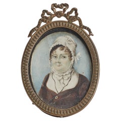
Ovale miniature painted on ivory, England end of XVIII century.
Located in Milan, IT
Oval miniature with brass gilt frame, painted watercolour on ivory, depicting a bust of a woman wearing a cap. England end of XVIII century. (SHIP TO EU ONLY)
Category

English Antique 18th Century Collectibles and Curiosities

Materials

Brass

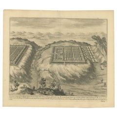
Antique Print of Caesar's Camp, A Roman Battle Print, c.1753
Located in Langweer, NL
Antique battle map of Caesar's Camp. With detailed legend explaining the various elements of the print. This print most likely originates from an edition of 'The Commentaries of Caesar, Translated into English. To Which is Prefixed a Discourse Concerning The Roman Art of War...
Category

Antique 18th Century Collectibles and Curiosities

Materials

Paper

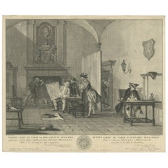
Fine Engraving of the 2nd Corps de Garde in the Low Countries 'Holland', 1760
Located in Langweer, NL
Title on page (Dutch and French): TWEEDE CORPS DE GARDE van Hollandsche Officiers / Second Corps de Garde d'Officiers Hollandois". Amst., P. Fouquet, 1760. An interior with several Dutch officers. On the right a man is sitting at a writing table, on the left a man is working on fire from the fireplace, in the middle three gentlemen are looking at a map. Above the chimney a coat of arms and above it a portrait of a man in profile, surrounded by a laurel wreath. Fine engraved print depicting an officer's mess by J. Houbraken after a painting by C. Troost, with coat of arms engraved in lower margin and dedication to D. Muilman. Cornelis Troost...
Category

Antique 18th Century Collectibles and Curiosities

Materials

Paper

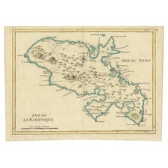
Martinique Map by Rigobert Bonne – French Antique Map, c.1768
Located in Langweer, NL
Map of Martinique by Rigobert Bonne, circa 1768 This is a detailed antique map of Martinique titled “Isle de la Martinique,” engraved by Rigobert Bonne around 1768 for the Atlas Encyclopédique. Bonne, a renowned French hydrographer and successor to Bellin, is celebrated for his scientifically precise and elegantly engraved maps. The map shows Martinique with its mountainous interior, rivers, and settlements labelled, including Fort Royal, Fort St. Pierre, Le Marin, and Le Prêcheur. Coastal features, bays, and capes are marked, along with anchorages important for maritime navigation in the 18th century. The depiction includes relief shown pictorially, characteristic of Bonne’s cartographic style, enhancing both geographic understanding and aesthetic appeal. This copperplate engraving retains original hand colouring outlining the coastlines in delicate blue and brown tones, typical for the period. It served as a key reference for scholars, navigators, and colonial administrators during France’s colonial presence in the Caribbean. Condition: Good condition overall. A strong impression with bright, original hand-colour outlines. General age toning, faint offsetting, and a vertical fold as issued in the atlas. Margins ample all around for framing. Framing suggestions: This historic Caribbean map...
Category

French Antique 18th Century Collectibles and Curiosities

Materials

Paper

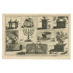
Antique Print of the Sacred Vessels Tabernacle & Temple of Ezekiel, 1717
Located in Langweer, NL
Antique religious print titled 'De Tabernakel, en Tempel van Ezechiel, met de verdere Heiligdommen en H. Gereedtschappen'. Original antique print of the Sacred Vessels, the Tabernacl...
Category

Antique 18th Century Collectibles and Curiosities

Materials

Paper

1758 Bellin Map of Guadeloupe and Marie-Galante – Caribbean Islands
Located in Langweer, NL
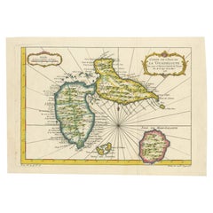
Thank you for noting the correct date on the map. Here is your **updated plain text catalog listing**: --- **Title (under 80 characters):** 1758 Bellin Map of Guadeloupe and Marie-Galante – Caribbean Islands **Description:** Original antique map titled *Carte de l’Isle de la Guadeloupe* by Jacques Nicolas Bellin, engraved for the *Histoire Générale des Voyages*, published in Paris in 1758. This finely engraved copperplate map depicts the French Caribbean island of Guadeloupe, showing its distinctive butterfly-shaped division into Basse-Terre and Grande-Terre. The surrounding smaller islands include Marie-Galante (bottom right) and Les Saintes. The map details numerous place names, parishes, rivers, bays, mountains, and anchorages. A decorative rococo title cartouche graces the upper right corner, complemented by a scale bar cartouche in the upper left. Jacques Nicolas Bellin (1703-1772) served as Hydrographer to the King and was one of the most prominent French cartographers of the 18th century, producing maps noted for their accuracy, elegance, and clarity. This map was created for the influential *Histoire Générale des Voyages* by Abbé Prévost. Condition report: Excellent condition. Strong and clean impression on fine laid paper with wide margins. Original hand coloring in outline and wash, highlighting coastlines and cartouches. Minor age toning at edges; verso blank. Framing suggestion: Frame with a classic gold or dark wood moulding and a neutral cream archival mat to emphasize the fine engraving and delicate color washes. Museum glass is recommended to preserve this 18th-century Caribbean map...
Category

French Antique 18th Century Collectibles and Curiosities

Materials

Paper

Antique Print of the House of Roger Hudson by Campbell, 1725
Located in Langweer, NL
Antique print titled 'The Elevation of Roger Hudson Esqr. his house at Sunbury (..)'. Old engraving of the house of Roger Hudson in Sunbury. This print originates from 'Vitruvius Bri...
Category

Antique 18th Century Collectibles and Curiosities

Materials

Paper

Antique Map of India, the East Indies and the Philippines
Located in Langweer, NL
Antique map titled 'Les Indes Orientales et leur Archipel'. Original antique map of India, the East Indies and the Philippines. Source unknown, to be determined. Published circa 1760.
Category

Antique 18th Century Collectibles and Curiosities

Materials

Paper

Map of India and Ceylon with Inset of Calcutta and the Ganges, by Bonne, 1780
Located in Langweer, NL
The map on offer is an antique copperplate engraving of India and Ceylon (Sri Lanka), created by Rigobert Bonne (1727-1794), a prominent French cartographer. Here is a breakdown of t...
Category

Antique 18th Century Collectibles and Curiosities

Materials

Paper

Antique Roman Battle Print of Ptolemy's Camp by Duncan, c.1753
Located in Langweer, NL
Antique battle map showing Ptolemy's Camp. With detailed legend explaining the various elements of the print. This print most likely originates fro...
Category

Antique 18th Century Collectibles and Curiosities

Materials

Paper

Antique Map of Tartary and Northeast Asia, c.1750
Located in Langweer, NL
Antique map titled 'Carte de la tartarie occidentale'. An interesting map of Tartary and northeast Asia, from Lake Baykal, Partie du Siberia in the north, Pays des Kalkas at the cent...
Category

Antique 18th Century Collectibles and Curiosities

Materials

Paper

Antique Map of Eastern Seram, Part of the Maluku Island in East Indonesia, 1726
Located in Langweer, NL
Antique map titled 'De Landvoogdy van Amboina met de elf onderhoorige Eylanden.' Detailed map of the eastern part of Seram in Indonesia, part of the Maluku islands. Map of the southe...
Category

Antique 18th Century Collectibles and Curiosities

Materials

Paper

Antique Map of Spain and Portugal by Bowles, c.1780
Located in Langweer, NL
"Antique map titled 'Bowles's New Pocket Map of the Kingdom of Spain and Portugal according to De Lisle'. Large and detailed map of Spain and Portugal. Artists and Engravers: Made by 'Thomas & Carington Bowles' after an anonymous artist. Thomas Bowles, born around 1712, was map publisher and seller in London...
Category

Antique 18th Century Collectibles and Curiosities

Materials

Paper

HOUSE OF LORDS. Remembrances for Order. 1712 - WITH THE GILT ARMS OF QUEEN ANNE
Located in Hillsborough, NJ
AUTHOR: HOUSE OF LORDS. TITLE: Remembrances for Order and decency to be kept in the Upper house of Parliament by the Lords, when His Majesty is not there. PUBLISHER: London, May 7...
Category

English Antique 18th Century Collectibles and Curiosities

Materials

Leather

Antique Map of Ukraine, Bulgaria, Romania, Servia by N. Visscher, circa 1700
Located in Langweer, NL
Antique map titled 'Exactissima Tabula qua tam Danubii Fluvii Pars Inferior, a Belgrado Urbe usq ad ejus ostia, et minores in eum influentes, Fluvii quam Regiones adjacentes, ut Tran...
Category

Dutch Antique 18th Century Collectibles and Curiosities

Materials

Paper

Antique Map of Champagne France by Johann Baptist Homann circa 1710 Hand-Colored
Located in Langweer, NL
Antique Map of Champagne France by Johann Baptist Homann circa 1710 Hand-Colored This richly detailed antique map titled Tabula Geographica Campani...
Category

Antique 18th Century Collectibles and Curiosities

Materials

Paper

View of the City Banten or Bantam Near the Western End of Java, Indonesia, c1725
Located in Langweer, NL
Antique print titled 'La Ville de Bantam capitale du Roiaume de meme nom'. A bird's eye view of the city Banten or Bantam near the western end of Java in Indonesia. Several tall ...
Category

Antique 18th Century Collectibles and Curiosities

Materials

Paper

Antique Print of a Cave in Saint-leu-taverny in France C.1785
Located in Langweer, NL
Antique print titled 'Vüe dessinée dans l'intérieur de la Grotte de St. Leu Taverni'. Copper engraving showing a cave in Saint-Leu-Taverny. This print originates from 'Jardins Anglo-...
Category

Antique 18th Century Collectibles and Curiosities

Materials

Paper

Detailed Antique Map of the Black Sea, Balkans and Asia Minor
Located in Langweer, NL
Antique map titled 'Nuova Carta del Europa Turchesca (..)'. This is an Italian version of Tirion's detailed map of the Black Sea, Balkans, and Asia Minor. It is embellished with a si...
Category

Antique 18th Century Collectibles and Curiosities

Materials

Paper

Detailed Antique Map of Slavonia, the Region in Eastern Croatia, ca.1745
Located in Langweer, NL
Antique map titled 'Tabula Geographica exhibens Regnum Sclavoniae.' Detailed map of Slavonia, the region in eastern Croatia. Map is dated shortly after the Peace of Belgrade sign...
Category

Antique 18th Century Collectibles and Curiosities

Materials

Paper

Antique Map of the South Part of Great Britain by Tirion, c.1750
Located in Langweer, NL
Antique map titled 'Nieuwe Kaart van 'T Zuider Gedeelte van Groot Britannie behelzende Het Koningryk Engeland (..).' Attractive map showing the south part of Great Britain; the K...
Category

Antique 18th Century Collectibles and Curiosities

Materials

Paper

Detailed 1720s Map – Siege of Douay and Lines of Circumvallation, France
Located in Langweer, NL
Detailed 1720s Map – Siege of Douay and Lines of Circumvallation, France This engraved map shows the detailed fortifications and surrounding region of Douay (Douai) in northern Fran...
Category

French Antique 18th Century Collectibles and Curiosities

Materials

Paper

Antique Map of the Queen Charlotte Islands, Haida Gwaii
Located in Langweer, NL
Antique map titled 'Isles de la Reine Charlotte (..)'. Original old map of the Queen Charlotte Islands, based upon the explorations of James Cook, Juan Perez, and other contemporary European explorers. The map shows only partial coastal detail along the north end of the main island, and includes two insets of navigable bays and depth measurements. Now called Haida Gwaii, after the local native population, the islands situated off Canada’s coast, south of Vancouver played an important role in the late 18th and early 19th century maritime...
Category

Antique 18th Century Collectibles and Curiosities

Materials

Paper

Batavia Market Scenes & Government House – Antique Prints VOC Period, c.1780
Located in Langweer, NL
Batavia Views – Government House and Market Scenes, circa 1780 This is an original late 18th-century engraving featuring two detailed views of Batavia (now Jakarta, Indonesia) under...
Category

Dutch Antique 18th Century Collectibles and Curiosities

Materials

Paper

Outstanding Antique George III Quality Oak Inlaid Hanging Corner Cabinet Out
Located in Suffolk, GB
Outstanding antique George III quality oak inlaid hanging corner cabinet having an attractive stepped and dental moulded cornice above a quality oak crossbanded moulded door with an ...
Category

European George III Antique 18th Century Collectibles and Curiosities

Materials

Other

Original Antique Map of the Bay and the Island of Arguin, Mauritania, 1747
Located in Langweer, NL
Antique map titled ’Plan de la Baye et Isle d'Arguim (..) - Oppervlakte van de Baai en 't Eiland van Arguin (..)'. Original antique map of the bay and the island of Arguin. This ...
Category

Antique 18th Century Collectibles and Curiosities

Materials

Paper

Detailed Original Old Map of the Southern Region of the Kingdom of Algiers 1773
Located in Langweer, NL
Antique map titled 'Kaart van het Zuidelyk Gedeelte van het Ryk Algiers'. Old map of the southern region of the Kingdom of Algiers, Algeria. Originates from the first Dutch edito...
Category

Antique 18th Century Collectibles and Curiosities

Materials

Paper

Detailed Original Antique Plan of the City and Fort of Malacca, Malaysia, 1764
Located in Langweer, NL
Description: Antique map titled 'Plan de la Ville et Forteresse de Malaca'. Detailed plan of the city and fort of Malacca on the southern Malay Peninsula, commanding the strategic st...
Category

Antique 18th Century Collectibles and Curiosities

Materials

Paper

West View of Cowdray House – Historic Sussex Estate Engraving, 1796
Located in Langweer, NL
West View of Cowdray House – Antique Engraving of Viscount Montague’s Estate, 1796 This detailed antique engraving captures the west-facing elevation of Cowdray House, the celebrate...
Category

English Antique 18th Century Collectibles and Curiosities

Materials

Paper

A Stunning 1744 Bowen Map: South East Germany & Queen of Hungary’s Dominions
Located in Langweer, NL
Title: A New and Correct Map of the South East part of Germany, 1744 This map by Emanuel Bowen, dating to around 1744, beautifully captures the southeastern part of Germany. The det...
Category

Antique 18th Century Collectibles and Curiosities

Materials

Paper

Stunning Large Scale Antique Map of Martinique, Rare, Published 1758
Located in Langweer, NL
Antique map titled 'Carte Reduite de l'Isle de la Martinique Dressee au Depost des Cartes Plans et Journaux de la Marine.' Superb, large scale chart of th...
Category

Antique 18th Century Collectibles and Curiosities

Materials

Paper

Engraving Print from the Panckoucke Encyclopédie Nautical Subject 1782-1832
Located in Milan, IT
Print by engraving on copper plate from the Panckoucke Encyclopédie méthodique, end of the 18th century,volume Marine Planches (more than 1,500 figures dealing with all subjects on the marina: planes, construction, carpentry, tree trunks, armaments of maneuvers, ropes, sails, artillery, ship maneuvers and combat tactics). This is the plate no. n. 24, pag. 69 fig. 341 ; with frame cm 38.3 x 31.5. Ship ropes are depicted. The Print has the "Benard direxit...
Category

French Antique 18th Century Collectibles and Curiosities

Materials

Paper

Antique Map of North Europe and East Asia by Vaugondy, circa 1750
Located in Langweer, NL
Antique map titled 'Carte des parties nord et est de L'Asie'. Map of the Northern parts and East Asia. Five maps on one sheet, showing California, Alaska and Syberia, Korea and Japan...
Category

Antique 18th Century Collectibles and Curiosities

Old Map Covering All of Southeast Asia from Persia to the Timor Island, 1712
Located in Langweer, NL
Description: Antique map titled 'A New Map of the East Indies'. Old map covering all of Southeast Asia from Persia to the Timor Island, inclusive of the modern day nations of India, ...
Category

Antique 18th Century Collectibles and Curiosities

Materials

Paper

Antique Map of England and Ireland by Lattre, 1789
Located in Langweer, NL
Antique map titled 'Les Royaumes d'Angleterre d'Ecosse et d'Irlande'. Original antique map of England and Ireland. Originates from 'Petit Atlas ...
Category

Antique 18th Century Collectibles and Curiosities

Materials

Paper

Fine Engraving Depicting an Officer's Mess in the Low Countries, 'Holland', 1754
Located in Langweer, NL
Title on Page (Dutch and French): CORPS DE GARDE van Hollandsche Officiers / Corps de Garde des Officiers Hollandois". Amst., 1754. Fine engraving depicting an officer's mess by J. Punt and P. Tanjé after a painting by C. Troost, with coat of arms engraved in lower margin and dedication to G. Braamcamp ("beminnaar der schilderkonst"). Waiting room with reading, smoking and card playing officers. Right, one of them studies a map of the Netherlands. On the wall a coat of arms with the Dutch lion. At the bottom of the margin the coat of arms and an assignment to Gerrit Braamcamp, who had the original painting in his collection. Cornelis Troost...
Category

Antique 18th Century Collectibles and Curiosities

Materials

Paper

Old Antique Map of Borneo 'Kalimantan Indonesia, Sabah Malaysia & Brunei'
Located in Langweer, NL
Antique map titled 'Kaart van het Eyland Borneo'. Original antique map of the island of Borneo. Published 1724-1726 by Joannes van Braam and Gerard Onder de ...
Category

Antique 18th Century Collectibles and Curiosities

Materials

Paper

Set of Two Antique Maps of Northern Italy by Homann Heirs, 1754
Located in Langweer, NL
Set of two maps of northern Italy showing the position of troups during the war in April and March 1746. The area covered includes the course of the River Po between Valenza (north of Alexandria) and San Benedetto...
Category

Antique 18th Century Collectibles and Curiosities

Materials

Paper

Antique Map of Senegal, West Africa
Located in Langweer, NL
Original antique map titled 'Carta del Senegal'. Antique map of Senegal, West Africa. This map originates from 'Compendio della storia generale dei viaggi (..)'. Published by De la Harpe...
Category

Antique 18th Century Collectibles and Curiosities

Materials

Paper

Remarkable Antique Print of a Horse Drawn Float with Religious Figures, 1775
Located in Langweer, NL
Antique print of a horse drawn float with religious figures. Double page with joined sheets and original folding lines. This print originates fro...
Category

Antique 18th Century Collectibles and Curiosities

Materials

Paper

Antique Print Depicting the Divorce Customs of the Jews, ca.1725
Located in Langweer, NL
Description: Antique religion print titled 'Gewoonten der Jooden wegens de brieven van Echtscheiding'. This print depicts divorce customs of the Jews. This print originates from ...
Category

Antique 18th Century Collectibles and Curiosities

Materials

Paper

Homann Heirs Map of France – Antique Hand-Colored, circa 1745
Located in Langweer, NL
Antique map titled 'Gallia Postarum geographice designata in qua Cursus Postarum Secundum Statum (..)'. Unusual postal map of France, with coat of arms. Very detailed map showing all...
Category

German Antique 18th Century Collectibles and Curiosities

Materials

Paper

Antique Map of the Low Countries by Seutter, c.1745
Located in Langweer, NL
Antique map titled ‘XVII Provinciae Belgii sive Germaniae Inferioris (..)’. Detailed hand colored map of the Low Countries. Includes colored decorative cartouche, compass rose and co...
Category

Antique 18th Century Collectibles and Curiosities

Materials

Paper

Original Antique Map of Southern India and Ceylon 'Present-Day Sri Lanka'
Located in Langweer, NL
Antique map titled 'Suite de la Carte de l'Indoustan (..) - Vervolg van de Kaart van Hindoestan (..)'. Original antique map of Southern India and Ceylon (present-day Sri Lanka). This...
Category

Antique 18th Century Collectibles and Curiosities

Materials

Paper

Antique Map of the City of Batavia by Van der Aa 'c.1730'
Located in Langweer, NL
Antique map titled 'Plan de la Ville et du Chateau de Batavia en l'Isle de Iava - Ware affbeeldinge wegens het Casteel ende Stadt Batavia gelegen op groot Eylant Java'. Detailed plan...
Category

Antique 18th Century Collectibles and Curiosities

Materials

Paper

Rare 18th-Century Hand-Colored Map of Southeast Asia and the East Indies, 1748
Located in Langweer, NL
1748 Homann Map of Southeast Asia and East Indies by Homann Heirs This original 1748 map, published by the renowned Homann Heirs, depicts Southeast Asia, the East Indies, and adjace...
Category

Antique 18th Century Collectibles and Curiosities

Materials

Paper

Antique Map of the Province of Zuid-Holland by Keizer & De Lat, 1788
Located in Langweer, NL
Antique map titled 'La Sud Hollande (..)'. Uncommon antique map of the province of Zuid-Holland, the Netherlands. This map originates from 'Nieuwe Natuur- Geschied- en Handelkundige ...
Category

Antique 18th Century Collectibles and Curiosities

Materials

Paper

Emperor Vespian Besieging and Conquering Iotapata 'Yodfat', 1725
Located in Langweer, NL
Antique print titled 'Vespasiaan belegert en verovert Iotapata'. Emperor Vespian besieging and conquering Iotapata (Yodfat). This print originates from 'Het algemeen groot historisch, oordeelkundig, chronologisch, geografisch, en letterlyk naam- en woord-boek, van den gantschen H. Bijbel (..)' by A. Calmet. The Siege of Yodfat (Hebrew: ????????, also Jotapata, Iotapata, Yodefat) was a 47-day siege by Roman forces of the Jewish town of Yodfat which took place in 67 CE, during the Great Revolt. Led by Roman General Vespasian and his son Titus, both future emperors, the siege ended with the sacking of the town, the deaths of most of its inhabitants and the enslavement of the rest. It was the second bloodiest battle of the revolt, surpassed only by the Siege of Jerusalem...
Category

Antique 18th Century Collectibles and Curiosities

Materials

Paper

Print of the Solemn Celebration Sapan Giacche in Pegu, Burma 'Myanmar', 1725
Located in Langweer, NL
Antique print, titled: 'Fete Solennelle de Pegu appelee Sapan Giacche' This plate shows the Solemn celebration called Sapan Giacche in Pegu or Bago, the capital of the Bago Regio...
Category

Antique 18th Century Collectibles and Curiosities

Materials

Paper

Antique Map of the Arabian Desert by Cellarius, 1731
Located in Langweer, NL
Antique map titled 'Arabia Petraea et Deserta.' Arabian desert with present day Israel, Jordania, Iraq. With decorative cartouche showing dromedaries. T...
Category

Antique 18th Century Collectibles and Curiosities

Materials

Paper

Antique Map of Spain by Covens & Mortier, c.1740
Located in Langweer, NL
Antique map Spain titled 'L?Espagne dressée sur la Description qui en a eté faite par Rodrigo Mendez Sylva (..)'. Beautiful map of Spain with decorat...
Category

Antique 18th Century Collectibles and Curiosities

Materials

Paper

Map of Constantinople, Bosphorus, the Coasts of Greece and the Archipelago, 1785
Located in Langweer, NL
This is a large 1785 map titled "Carte de la Ville de Constantinople et du Bosphore de Thrace", which includes detailed maps of Constantinople (modern-day Is...
Category

French Antique 18th Century Collectibles and Curiosities

Materials

Paper

18th Century Rare Dutch Mother of Pearl Pin Booklet with a Silver Back and Lock
Located in Delft, NL
18th century rare Dutch mother of pearl pin booklet with a silver back and lock A mother of pearl pin booklet with a silver back and lock. On ...
Category

Dutch Antique 18th Century Collectibles and Curiosities

Materials

Silver

Old Map of the East Coast of Honshu with an Inset, Japan, c.1785
Located in Langweer, NL
Antique map titled ‘Part of Japan or Nippon'. View of the Coast of Japan when we first saw it: The Hill a bearing West 3 miles distant. London Published by Allexer Hogg at the Kings Arms...
Category

Antique 18th Century Collectibles and Curiosities

Materials

Paper

Antique Map of Ambon Island in the Moluccas, Indonesia, c.1760
Located in Langweer, NL
Antique map Ambon titled 'Carte Particuliere de l 'Isle Amboine'. Old map showing Ambon, in the Moluccas Islands, better known as the Spice Islands. Ambon was the headquarters of the...
Category

Antique 18th Century Collectibles and Curiosities

Materials

Paper

Antique Map of the Gironde, part of the Dordogne and the Garonne, France
Located in Langweer, NL
Antique map titled 'Cours de la riviere de Gironde et parties de la Dordogne et de la Garonne depuis Bourdeaux jusqu'au banc de Bey'. Original old map of the Gironde, part of the Dor...
Category

Antique 18th Century Collectibles and Curiosities

Materials

Paper

Antique Map of Martinique, Showing Roads, Houses, Sugar Plantations, etc. c.1750
Located in Langweer, NL
Antique map titled 'Carte de l'Isle de la Martinique'. Detailed map of Martinique. Shows hilly terrain, forests, roads, houses, and even the sugar plantations. The island was to ...
Category

Antique 18th Century Collectibles and Curiosities

Materials

Paper

Antique Map of Southern Asia with India, the Maldives, Ceylon and Arabia, c.1700
Located in Langweer, NL
Stunning Old Map of Asia. Description: Two-sheet map of Asia, joined. The left part of this antique map is titled 'Partie occidentale d'une partie d'Asie ou sont les Isles de Zoco...
Category

Antique 18th Century Collectibles and Curiosities

Materials

Paper

Antique Print with Views of Sir Charles Saunders Island and Other Islands, 1774
Located in Langweer, NL
Explore the captivating world of the 18th century with this exquisite antique print titled 'Isles de Sir Charles Saunder Latitude (...)'. I A journey through time as you delve into t...
Category

Antique 18th Century Collectibles and Curiosities

Materials

Paper

Original Antique Map of Hungary and Transylvania 'Modern Day Romania', C.1710
Located in Langweer, NL
Antique map titled 'Hungary and Transilvania'. Original antique map of Hungary and Transylvania (modern day Romania), centered on Budapest. Artists and Engravers: Herman Moll ...
Category

Antique 18th Century Collectibles and Curiosities

Materials

Paper

Read More

Medal-Worthy Memorabilia from Epic Past Olympic Games

Get into the games! These items celebrate the events, athletes, host countries and sporting spirit.

Ahoy! You’ve Never Seen a Collection of Sailor Art and Kitsch Quite Like This

French trendsetter and serial collector Daniel Rozensztroch tells us about his obsession with objects related to seafaring men.

Pamela Shamshiri Shares the Secrets behind Her First-Ever Book and Its Effortlessly Cool Interiors

The sought-after designer worked with the team at Hoffman Creative to produce a monograph that beautifully showcases some of Studio Shamshiri's most inspiring projects.

Moroccan Artworks and Objects Take Center Stage in an Extraordinary Villa in Tangier

Italian writer and collector Umberto Pasti opens the doors to his remarkable cave of wonders in North Africa.

Montecito Has Drawn Royalty and Celebrities, and These Homes Are Proof of Its Allure

Hollywood A-listers, ex-pat aristocrats and art collectors and style setters of all stripes appreciate the allure of the coastal California hamlet — much on our minds after recent winter floods.

Whaam! Blam! Pow! — a New Book on Pop Art Packs a Punch

Publishing house Assouline and writer Julie Belcove have teamed up to trace the history of the genre, from Roy Lichtenstein, Andy Warhol and Yayoi Kusama to Mickalene Thomas and Jeff Koons.

What Makes a Gem-Encrusted Chess Set Worth $4 Million?

The world’s most opulent chess set, weighing in at 513 carats, is literally fit for a king and queen.

Tauba Auerbach’s Geometric Pop-Up Book Is Mighty Rare, Thanks to a Hurricane

This sculptural art book has an epic backstory of its own.
Recently Viewed

View All