Mid-17th Century Collectibles and Curiosities

to
239
290
17
307
6
2
4,431
6,784
13,459
2,726
3,520
4,677
3,077
512
300
606
745
480
898
888
899
659
595
280
13
12
7
7
44
12
8
7
6
307
307
307
28
1
1
Period: Mid-17th Century
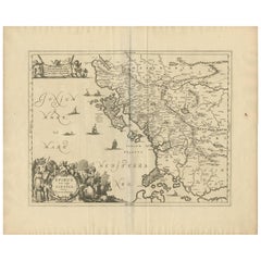
Antique Map of Epirus 'Albania, Greece' by J. Janssonius, circa 1650
Located in Langweer, NL
This map covers the northwestern coast of Greece and part of present-day Albania. The map was drawn by Johannes Wilhelm Laurenberg, a mathematician and historian who produced several...
Category

Antique Mid-17th Century Collectibles and Curiosities

Materials

Paper

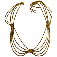
Christian Dior Signed 1960s Snake Chain Gold-Tone Metal Graceful Swag Belt
Located in Philadelphia, PA
From Christian Dior, France, a 1960s Era belt made of five gold-tone snake chains bound at three intervals with soldered rectangular stations. The chains hang in a graceful swag. The Christian Dior stamped...
Category

French Mid-Century Modern Antique Mid-17th Century Collectibles and Curiosities

Materials

Metal

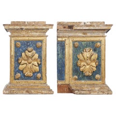
17th Century Italian Baroque Architectural Bases Carved Giltwood Elements Pair
Located in Milano, MI
17th Century Italian Baroque Architectural Bases Pair of Carved and Giltwood Elements featuring blue painting details, a pair of antique decorativ...
Category

European Baroque Antique Mid-17th Century Collectibles and Curiosities

Materials

Wood, Giltwood

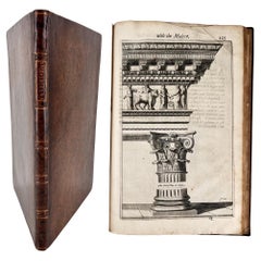
A Parallel of Antient Architecture with Modern by John EVELYN
Located in Middletown, NY
Evelyn, John translator; Fréart, Roland de Chambray A Parallel of Antient Architecture with Modern,; In a Collection of Ten Principal Authors who have Written upon the Five Orders, P...
Category

English Antique Mid-17th Century Collectibles and Curiosities

Materials

Gold Leaf

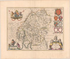
1645 Blaeu Map of Westmorland, Northern England – Hand Colored, Decorative
Located in Langweer, NL
This map, "Westmoria Comitatus; Anglice Westmorland", was created by the esteemed Dutch cartographer Willem Blaeu and was published around 1645 in 'Le Theatre du Monde ou Nouvel Atlas'. It provides a detailed look at Westmorland, a historic county in northern England, based on John Speed’s earlier map. The map features numerous place names, parks, and estates, including Brigster Park, Colnhead Park, Crosbye, and Midleton, along with a detailed depiction of Windermere (spelled Wynandermere) and the surrounding regions. Additional Features: - Hand-colored map, with vibrant and detailed colors that bring out the topographical and decorative features. - Includes intricate cartouches, such as the royal coat of arms, a decorative title cartouche topped with putti (cherubic figures), and six coats of arms (two left blank). - Depicts the region’s rich landscape, including the rolling hills and mountainous terrain of northern England. - French text on the verso, indicative of the publication period from 1645-1648, part of Blaeu’s highly sought-after atlases. - Map shows precise details of small towns, estates, and parks, such as Brigster Park, Colnhead Park, Crosbye, and Wynandermere (now Windermere Lake). This map would be of particular interest to collectors of English county maps, antique maps of northern England, 17th-century cartography, and the decorative works of Willem Blaeu. Blaeu's maps are renowned for their accuracy, artistic beauty, and historical significance. Keywords: Willem Blaeu, Westmorland map, northern England, 17th-century map, antique map, English county map, John Speed, Windermere, decorative cartography, hand-colored map, rare map, antique cartography...
Category

Antique Mid-17th Century Collectibles and Curiosities

Materials

Paper

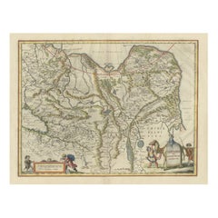
Old Genuine Antique Map of Tartary in the Russian Far East
Located in Langweer, NL
Original antique map titled 'Tartaria sive Magni Chami Imperium'. This great map of Tartary covers all of eastern Asia between the Caspian Sea and northern China and Manchuria. Being...
Category

Antique Mid-17th Century Collectibles and Curiosities

Materials

Paper

1640 Map of North Africa Nova Barbariae Descriptio or The Barbarian Coast
Located in Langweer, NL
1640 Antique Map of North Africa 'Nova Barbariae Descriptio' by Johannes Janssonius This antique map titled Nova Barbariae Descriptio*, published by Johannes Janssonius around 1640,...
Category

Antique Mid-17th Century Collectibles and Curiosities

Materials

Paper

Antique Map of the Province of Navarre with the City of Pamplona, Spain
Located in Langweer, NL
Antique map titled 'Royaume de Navarre (..)'. Decorative map of the province Navarre (Spanish: Navarra) in Northern Spain centered on the city of Pamplona. Published by N. Sanson, 16...
Category

Antique Mid-17th Century Collectibles and Curiosities

Materials

Paper

Map of Blaisois by Janssonius, 1633, Decorative Antique Map of Loire Valley
Located in Langweer, NL
Map of Blaisois by Janssonius, 1633, Decorative Antique Map of Loire Valley This finely detailed and colorfully embellished map titled 'Description du Blaisois' was published in 163...
Category

Antique Mid-17th Century Collectibles and Curiosities

Materials

Paper

Beautiful Rare Antique Map of the Holy Land, 1648
Located in Langweer, NL
Antique map Holy Land titled 'Perigrinatie ofte Veertich-Iarige Reyse, der kinderen Israels uyt Egipten, door de Roode-Zee; mitsgaders de Woestyne tot int Beloofde Landt Canaan, : met groote vlyt uyt verscheryden auctoren by een gestelt, uyt de H. Schrift gecorigeert, ende int licht gegeven'. Beautiful and rare antique map of the Holy Land...
Category

Antique Mid-17th Century Collectibles and Curiosities

Materials

Paper

Large Map of Castile's Southern Realms - Granada, Andalusia, and Murcia, 1652
Located in Langweer, NL
This antique map, titled 'Les Etats de la Couronne de Castille', represents the southern regions of the Crown of Castile, specifically the territories of Andalusia, Granada, and Murc...
Category

Antique Mid-17th Century Collectibles and Curiosities

Materials

Paper

Original Map of the Rhine River in the Holy Roman Empire by Janssonius, c.1645
Located in Langweer, NL
This striking original antique map, titled "Rhenus Fluviorum Europae celeberrimus," showcases the historic Rhine River region, a vital artery of European trade, culture, and history....
Category

Dutch Antique Mid-17th Century Collectibles and Curiosities

Materials

Paper

Original Antique Print of the Chinese City of Kinnungam with its Ramparts, 1665
Located in Langweer, NL
Antique print, titled: 'Kinnungam' View of the Chinese city of Kinnungam with its ramparts. Also depicted are ships and a pagoda can be seen as well. ...
Category

Antique Mid-17th Century Collectibles and Curiosities

Materials

Paper

Antique Bird's-Eye View of Hangzhou (China) by Matthäus Merian, 1638
Located in Langweer, NL
This is an exquisite antique bird's-eye view map of Hangzhou, historically referred to as "Xuntien or Quinzay," from the first edition of Matthäus Merian's publication in 1638. This ...
Category

Antique Mid-17th Century Collectibles and Curiosities

Materials

Paper

17th-Century Map of Sri Lanka (Ceylon) by Mercator & van den Keere, 1630
Located in Langweer, NL
This captivating 17th-century map titled "Zeilan ou Ceilon Isle" (Ceylon/Sri Lanka) was engraved by Petrus Kaerius (van den Keere) and published in Mercator's "Atlas Minor," edited b...
Category

Antique Mid-17th Century Collectibles and Curiosities

Materials

Paper

Authentic 1644 Janssonius Map of the Champagne Region (Campania) in France
Located in Langweer, NL
"1644 Janssonius Map of Champagne, France" This meticulously detailed original antique map, engraved in 1644, is a work by the esteemed cartographer Johannes Janssonius. It depicts the historic province of Champagne, situated in the northeastern part of France. The map is notable for its high level of detail, with meticulously drawn boundaries, city markers, and river courses. It features a beautifully rendered cartouche adorned with the provincial coat of arms, flanked by classical figures, indicative of the region's cultural significance. In the lower left corner, a pair of cherubs are engaged in surveying, symbolizing the scientific endeavor of cartography. The elaborate compass rose and the scale bar further complement the map's utility and artistic merit. Champagne is renowned globally for its viticultural heritage, being the birthplace of the eponymous Champagne sparkling wine. The region's unique terroir, with its chalky soil and cool climate, is ideal for the production of the grapes used in champagne-making. The historical significance of Champagne extends beyond winemaking; it has been the site of pivotal battles and royal coronations, which shaped the course of French and European history. This map is not only a navigational tool but also a snapshot of a region rich in history and tradition, an artifact that embodies the geographical and cultural prestige of Champagne. This description provides a detailed visual and contextual presentation of the map, suitable for a catalog entry, emphasizing both its artistic features and the historical and cultural importance of the Champagne region. THE WINE AREAS: The Champagne region, known primarily for its production of the sparkling wine that bears its name, encompasses several important cities and sites of historical and cultural significance: 1. **Reims**: Often considered the unofficial capital of the Champagne region, Reims is renowned for its grand cathedral, Notre-Dame de Reims, where French kings were historically crowned...
Category

Antique Mid-17th Century Collectibles and Curiosities

Materials

Paper

CAMDEN - The Historie of the Life & Death of Mary Stuart - SECOND EDITION - 1636
Located in Hillsborough, NJ
AUTHOR: CAMDEN, William. TITLE: The Historie of the Life and Death of Mary Stuart Queene of Scotland. PUBLISHER: London: by John Haviland, and are to be sold by William Sheares, 1...
Category

British Antique Mid-17th Century Collectibles and Curiosities

Materials

Leather

Antique Map of Venezuela by Montanus, 1671
Located in Langweer, NL
Antique map titled 'Venezuela cum parte Australi Novae Andalusiae'. The map extends from Coquibocoa to the Orinoque River, centered on Bariquicemento and Cape de Curiacao. Large cart...
Category

English Antique Mid-17th Century Collectibles and Curiosities

Materials

Paper

Original 17th-Century Antique Map of Nanjing Province, China – by Blaeu
Located in Langweer, NL
Title: 17th-Century Antique Map of Nanjing Province, China – "Nanking sive Kiangnan" by Blaeu, with Decorative Details Description: This captivating 17th-century map of Nanjing Pr...
Category

Antique Mid-17th Century Collectibles and Curiosities

Materials

Paper

1667 Melchior Tavernier Map of the Patriarchate of Constantinople – Black Sea
Located in Langweer, NL
This 1667 map titled "Patriarchatus Constantinopolitani Geographica Descriptio" was crafted by renowned French cartographer Melchior Tavernier, who was a prominent map engraver during the 17th century. This rare and historically significant map focuses on the territories under the ecclesiastical jurisdiction of the Patriarchate of Constantinople, one of the most important centers of the Eastern Orthodox Church. It covers regions around the Black Sea (Pontus Euxinus), parts of Greece, and adjacent areas in Asia Minor and the Balkans, which were historically vital during the Byzantine and Ottoman Empires. The map is filled with ancient place names, making it a valuable resource for both historical and cartographic enthusiasts. Key Features: - Antique ecclesiastical map illustrating the influence of the Orthodox Patriarchate of Constantinople in the 17th century. - Features beautifully detailed ancient coastlines, rivers, and terrains, providing a comprehensive geographical view of the region. - Rich with historic place names - like Byzantium, Nicomedia, Nicaea, Cyzicus, Bithynia, Pontus, Macedonia, and Thrace - that date back to the classical era, offering insights into the ancient geography of the eastern Mediterranean. - A finely engraved strapwork cartouche in the lower right corner with Baroque-style decoration, featuring two putti (cherubic figures) – a hallmark of 17th-century map art. - The map extends to include the Mediterranean Sea (Mare Mediterraneum) to the south and the Black Sea to the north, highlighting its ecclesiastical and geopolitical significance. - Original hand coloring may still be present, enhancing the decorative appeal for collectors of antique maps. This rare map offers a unique perspective on the religious influence and historical geography of the Eastern Mediterranean during the late 17th century. It would appeal to collectors interested in: - **Byzantine history** - **Ottoman Empire** - **Eastern Orthodox Church** - **Antique cartography...
Category

French Antique Mid-17th Century Collectibles and Curiosities

Materials

Paper

Antique Map of the Frankfurt Region by Johannes Janssonius, Hand-Colored, C.1650
Located in Langweer, NL
Antique Map of the Frankfurt Region by Johannes Janssonius circa 1650 Hand-Colored This rare and beautifully detailed antique map titled Territorium Francofurtense depicts the reg...
Category

Antique Mid-17th Century Collectibles and Curiosities

Materials

Paper

Ariosto 'Lodovico', Orlando Furioso, the First English Language Edition, 1634
Located in Hillsborough, NJ
Author: Ariosto (Lodovico). Title: Orlando Furioso In English Heroical Verse. By Sir John Harington of Bathe, Knight. Now thirdly revised and amend...
Category

British Antique Mid-17th Century Collectibles and Curiosities

Materials

Leather

Italian Parchment Map of the City of Pisa Dated, 1640
By Matthäus Merian the Elder
Located in Florence, Tuscany
An antique map of the Tuscan city of Pisa engraved for The 'Itinerarium Italiæ Nov-antiquæ' by Matthäus Merian the Elder and printed in 1640....
Category

Italian Antique Mid-17th Century Collectibles and Curiosities

Materials

Paper

Striking Antique View of Kozhikode, also known as Calicut, in Kerala, India
Located in Langweer, NL
Antique print titled 'Calechut'. Wonderful, miniature copper engraving depicting Arion riding on a very cheerful looking sea monster in the important tradi...
Category

Antique Mid-17th Century Collectibles and Curiosities

Materials

Paper

An Original Antique Mid-17th Century Blaeu Map of Styria in Southeastern Austria
Located in Langweer, NL
This is an antique map of Styria (referred to as “Stiria” or “Steyrmarck”), published by the renowned Dutch cartographer Willem Janszoon Blaeu (often simply “Blaeu”). The first editi...
Category

Antique Mid-17th Century Collectibles and Curiosities

Materials

Paper

16 x 18th Century Venetian Marionette Puppets from Commedia dell’arte Theatre
Located in London, GB
Antique Venetian Marionettes, Antique Puppets, Venice Carnival Antiques, Masked Ball Antiques, Venetian Mask, Commedia dell'art Theatre Marionettes. Co...
Category

Italian Baroque Antique Mid-17th Century Collectibles and Curiosities

Materials

Metal

Original Antique Map of the Northern Part of Scotland, circa 1640
Located in Langweer, NL
The antique map, titled 'Scotiae pars septentrionalis,' depicts the northern part of Scotland. Crafted by Hondius around 1640, this map is a historical treasure showcasing the geogra...
Category

Antique Mid-17th Century Collectibles and Curiosities

Materials

Paper

Antique Map of the Holy Land, with vignette of the Garden of Eden
Located in Langweer, NL
Antique map titled 'Hondius his Map of Paradise'. Beautiful map of the region bounded by the Holy Land. Syria, Mesopotamia, Chaldea and part of Arabia. W...
Category

Antique Mid-17th Century Collectibles and Curiosities

Materials

Paper

Antique Map of Northern Germany, Including Schleswig-Holstein and Hamburg
Located in Langweer, NL
Antique map titled 'Basse Partie de la Basse Saxe ou sont les Duchés de Sleswick, Holsace, Meckelenbourg et Lauvenbourg (..)'. Original old map of northern Germany, including Schlesw...
Category

Antique Mid-17th Century Collectibles and Curiosities

Materials

Paper

Mapping the Heart of France: Willem Blaeu's 17th Century Île-de-France, ca.1650
Located in Langweer, NL
This original antique map titled "Le Gouvernement de l'Isle de France" represents the Île-de-France region, which historically was one of the provinces of France and contained the ci...
Category

Antique Mid-17th Century Collectibles and Curiosities

Materials

Paper

Antique Map of Central Sweden by J. Blaeu, 1662
Located in Langweer, NL
A striking, rare map with a cartouche dedicated to Gabriel Bengtsson Oxenstierna. Published by J. Bleau, Amsterdam, 1662. Contemporary coloring.
Category

Antique Mid-17th Century Collectibles and Curiosities

Materials

Paper

1663 Blaeu's Engraved Map of Frankfurt with Decorative Coats of Arms
Located in Langweer, NL
This map, titled "Novam Hanc Territorii Francofurtensis Tabulam," is an exquisite hand-colored engraved map from around 1663, created by the renowned cartographers J. and C. Blaeu of...
Category

Antique Mid-17th Century Collectibles and Curiosities

Materials

Paper

Silver Reformation Commemorative Medal 1630, 100th Anniversary Augsburg
Located in Bilzen, BE
"Silver Reformation Commemorative Medal 1630, 100th Anniversary Of The Augsburg Confession" Silver Reformation Commemorative Medal 1630 — Johann the Steadfast — 100th Anniversary of ...
Category

German Baroque Antique Mid-17th Century Collectibles and Curiosities

Materials

Silver

Antique Map of Persia with Dedication Cartouche
Located in Langweer, NL
Antique map titled 'Persia sive Sophorum Regnum'. Original old map of Persia. The map extends from the Eastern Mediteranian to Tacalistan and the Indus River and the Dalanguer Mounta...
Category

Antique Mid-17th Century Collectibles and Curiosities

Materials

Paper

Rare and Early Map of the Seventeen Provinces, Published in circa 1640
Located in Langweer, NL
Antique map titled 'Carte Generale des Dixsept Provinces des Pais Bas'. Rare and Early map of the Seventeen Provinces. The Seventeen Provinces were the Imperial states of the Habsbur...
Category

Antique Mid-17th Century Collectibles and Curiosities

Materials

Paper

17th Century Italian Ballot Voting Urn Carved Blue and Red Painted Wood
Located in Milano, MI
Antique Italian ballot urn shaped wooden box, carved and painted, coming from Tuscany, Monte San Savino near Arezzo in Central Italy. This ballot urn is an excellent example of a 17th century wooden voting box...
Category

Italian Baroque Antique Mid-17th Century Collectibles and Curiosities

Materials

Pine

Original Antique Engraving of a Sea Chart of the Western Mediterranean, ca.1650
Located in Langweer, NL
Antique map titled 'Pascaerte van 't westlyckste deel vande Middelandsche-Zee (..)'. Sea chart of the Western Mediterranean. The map extends from the Straits of Gibralter to Italy ...
Category

Antique Mid-17th Century Collectibles and Curiosities

Materials

Paper

Two Original Japanese Engravings on One Sheet, Soldiers & a Priest, 1669
Located in Langweer, NL
One sheet with two engravings: One print is titled: 'Siccabonsii, Japansche Papen. [verso: Japanese soldiers].' An image of a Japanese priest. In one hand hee holds a long rope with a thick knot in it. In the other he holds aloft a copper gong...
Category

Antique Mid-17th Century Collectibles and Curiosities

Materials

Paper

Stunning Bird's-Eye View Plan of Hasselt by Blaeu in The Netherlands, 1649
Located in Langweer, NL
Antique print, titled: 'Hasselt.' Bird's-eye view plan of Hasselt in The Netherlands. With key to locations and coats of arms. Text in Dutch on verso. This plan originates from the famous city Atlas: 'Toneel der Steeden' published by Joan Blaeu...
Category

Antique Mid-17th Century Collectibles and Curiosities

Materials

Paper

Antique Map of the Region of Touraine by Janssonius 'circa 1650'
Located in Langweer, NL
Antique map of France titled 'Touraine - Turonensis Ducatus'. Decorative map of the Touraine region, France. It shows the cities of Tours, Amboise and others. Published by J. Jansson...
Category

Antique Mid-17th Century Collectibles and Curiosities

Materials

Paper

Original Antique Engraving of the Mighty Imperial Osaka Castle in Japan, 1669
Located in Langweer, NL
Antique print, titled: 'Afbeeldinge vant Maghtich Keyserlyck Casteel Osacca geleegen int groot Ryck Jappan besuyden de Stadt Osacce inde provinsie Qioo.' - ('Image of the Mighty Imperial Castle Osaka'). A bird's eye view of Osaka Castle, Japan. Arnoldus Montanus' "Gedenkwaerdige Gesantschappen der Oost-Indische Maatschappy in 't Vereenigde Nederland aan de Kaisaren van Japan […]. Amsterdam: Jacob Meurs, 1669. Artists and Engravers: Made by an anonymous engraver after 'Arnoldus Montanus'. Condition: Very good, given age. Original middle fold, as issued. Some faint browning of the margin edges. A few small spots in the margins (from paper making...
Category

Antique Mid-17th Century Collectibles and Curiosities

Materials

Paper

Antique Print Showing the Arms of the Japanese Emperor, 1669
Located in Langweer, NL
Description: Antique print, titled: 'Japansche wapenen van den Kaisar.' - ('The Arms of the Japanese Emperor'). The image shows several official Imp...
Category

Antique Mid-17th Century Collectibles and Curiosities

Materials

Paper

17th Century Italian Rare Carved Walnut Antique Kneeler
Located in Casale Monferrato, IT
Rare antique Italian kneeler, Mid-17th Century Louis XIV. Made of solid walnut with relief decoration carved into the wood. In the part dedicated to the knees there is a compartment. Of great value all the hand forged iron part of the escutcheons and fantastic large antique keys...
Category

Italian Louis XIV Antique Mid-17th Century Collectibles and Curiosities

Materials

Walnut

Antique Map of Prussia by Blaeu, circa 1635
Located in Langweer, NL
Antique map titled 'Prussiae Nova Tabula'. Rare early edition of Blaeu's map of Prussia, embellished with a gorgeous large format cartouche, compass ros...
Category

Antique Mid-17th Century Collectibles and Curiosities

Materials

Paper

17th Century Dutch Bronze pharmacy Mortar, dated 1632
Located in Bilzen, BE
17th century Dutch bronze mortar, dated 1632 and with border text "lof God van al anno 1632". Height 12.5 cm, Diameter 14 cm
Category

Dutch Renaissance Antique Mid-17th Century Collectibles and Curiosities

Materials

Bronze

Paris 1960s Era Gold-Tone Metal and Bakelite Jeweled Medallion Handmade Belt
Located in Philadelphia, PA
From Paris, France, a 1960s Era belt made of gold-tone metal rectangular links with applied medallions, and bakelite 'jewels'. Unusual and impactful! Heavy and very well made. Ass...
Category

French Mid-Century Modern Antique Mid-17th Century Collectibles and Curiosities

Materials

Metal

ANTIQUE CIRCA 1640 ORIGINAL HEAVILY WORN ENGLISH SHIP's ANCHOR FROM PENZANCE
Located in West Sussex, Pulborough
Royal House Antiques Royal House Antiques is delighted to offer for sale this absolutely stunning and totally original, folded iron Ships Anchor dati...
Category

English Charles II Antique Mid-17th Century Collectibles and Curiosities

Materials

Iron

German 18th Century Silver Hanukkah Lamp by Herfurth
Located in London, GB
German 18th century silver Hanukkah lamp by Herfurth German, c. 1760 Height 17.5cm, width 23cm, depth 7cm This exceptional German Hanukkah lamp was produced in the 18th century ...
Category

German Antique Mid-17th Century Collectibles and Curiosities

Materials

Silver

Original Antique Map of Trier and Luxembourg by Joan Blaeu, Amsterdam circa 1640
Located in Langweer, NL
Map of Trier and Luxembourg by Joan Blaeu, Amsterdam circa 1640 This beautifully engraved and hand-colored map titled Trevirensis Archiepiscopatus, et Lutzenburgi Ducatus depicts th...
Category

Dutch Antique Mid-17th Century Collectibles and Curiosities

Materials

Paper

Map of Comitatus Marchia et Ravensberg: Historical Counties in Germany, c.1660
Located in Langweer, NL
Antique map titled 'Comitatus Marchia et Ravensberg'. This map depicts two historical counties of the Holy Roman Empire: Marks and Ravensberg. Major cities, towns, mountains, and riv...
Category

Antique Mid-17th Century Collectibles and Curiosities

Materials

Paper

Antique Map of the of the Course of the Albis River 'or Elbe River'
Located in Langweer, NL
Antique map titled 'Albis Fluvius Germaniae celebris A Fontiubus Ad Ostia, Cum Fluminibus ab utroque latere in illum fluenibus descriptus'. Detailed map of the course of the Albis Ri...
Category

Antique Mid-17th Century Collectibles and Curiosities

Materials

Paper

1658 Large Map of the Holy Land by Jansson – Twelve Tribes of Israel in 6 Sheets
Located in Langweer, NL
Holy Land Divided Among the Twelve Tribes – Six-Part Map by Jan Jansson and Georgius Hornius, circa 1658 This rare and impressive six-sheet engraved map of the Holy Land was publish...
Category

Dutch Antique Mid-17th Century Collectibles and Curiosities

Materials

Paper

17th Century Italian Faience Madonna with Child Relief Wall Plaque
Located in Milano, MI
A fashinating 17th century Italian Virgin with Child, an hand-made rectangular shaped relief devotional plaque in polychrome glazed terracotta depicting a Madonna with Child, dating ...
Category

Italian Renaissance Antique Mid-17th Century Collectibles and Curiosities

Materials

Terracotta

French 17th Century Stone Blasson
Located in Round Top, TX
An exquisite 17th century Blasson of a Pelican nurturing its young - representing the Eucharist. Wonderfully carved from Burgundy Stone. A stunning piece.
Category

French Antique Mid-17th Century Collectibles and Curiosities

Materials

Stone

Original Old Map of Northeastern Greece & Northwestern Turkey, Published in 1661
Located in Langweer, NL
This small map was engraved by Petrus Kaerius and is based on Ortelius' map of the same title. It covers the ancient region of Thrace, present-day European Turkey and part of Greece....
Category

Antique Mid-17th Century Collectibles and Curiosities

Materials

Paper

Antique Map of the Region of Aiguillon by Janssonius, 1657
Located in Langweer, NL
Antique map 'Le Duche d'Aiguillon'. Decorative map of the Aiguillon region, France. Located at the confluence of the Lot and Garonne rivers. The map is based on the cartography of Pi...
Category

Antique Mid-17th Century Collectibles and Curiosities

Materials

Paper

17th Century Spanish Wooden Crucifix Figure Sculpture
Located in Marbella, ES
17th century Spanish wooden crucifix figure sculpture.
Category

Spanish Antique Mid-17th Century Collectibles and Curiosities

Materials

Wood

HABINGTON, William. The Historie Of Edward The Fourth - FIRST EDITION - 1640
Located in Hillsborough, NJ
AUTHOR: HABINGTON, William. TITLE: The Historie Of Edward The Fourth, King Of England. PUBLISHER: London: by Tho. Cotes, for William Cooke, 1640. DESCRIPTION: FIRST EDITION. 1 vo...
Category

American Antique Mid-17th Century Collectibles and Curiosities

Materials

Leather

1600s-1700s Eastern Ball Headed Club
Located in Coeur d'Alene, ID
Eastern ball headed club of walnut burl with panther effigy over ball. High polished use. Scalloped handle at base. Original drops missing. The panthe...
Category

American Native American Antique Mid-17th Century Collectibles and Curiosities

Materials

Wood

Antique Map of Peru in South America by Blaeu, circa 1645
Located in Langweer, NL
Antique map titled 'Peru'. Original antique map of Peru. With cartouche, compass rose, ships and two sea-monsters. Published by W. Blaeu, circa 1645.
Category

Antique Mid-17th Century Collectibles and Curiosities

Materials

Paper

Read More

Medal-Worthy Memorabilia from Epic Past Olympic Games

Get into the games! These items celebrate the events, athletes, host countries and sporting spirit.

Ahoy! You’ve Never Seen a Collection of Sailor Art and Kitsch Quite Like This

French trendsetter and serial collector Daniel Rozensztroch tells us about his obsession with objects related to seafaring men.

Pamela Shamshiri Shares the Secrets behind Her First-Ever Book and Its Effortlessly Cool Interiors

The sought-after designer worked with the team at Hoffman Creative to produce a monograph that beautifully showcases some of Studio Shamshiri's most inspiring projects.

Moroccan Artworks and Objects Take Center Stage in an Extraordinary Villa in Tangier

Italian writer and collector Umberto Pasti opens the doors to his remarkable cave of wonders in North Africa.

Montecito Has Drawn Royalty and Celebrities, and These Homes Are Proof of Its Allure

Hollywood A-listers, ex-pat aristocrats and art collectors and style setters of all stripes appreciate the allure of the coastal California hamlet — much on our minds after recent winter floods.

Whaam! Blam! Pow! — a New Book on Pop Art Packs a Punch

Publishing house Assouline and writer Julie Belcove have teamed up to trace the history of the genre, from Roy Lichtenstein, Andy Warhol and Yayoi Kusama to Mickalene Thomas and Jeff Koons.

What Makes a Gem-Encrusted Chess Set Worth $4 Million?

The world’s most opulent chess set, weighing in at 513 carats, is literally fit for a king and queen.

Tauba Auerbach’s Geometric Pop-Up Book Is Mighty Rare, Thanks to a Hurricane

This sculptural art book has an epic backstory of its own.
Recently Viewed

View All