18th Century and Earlier More Furniture and Collectibles

to
2,948
4,030
1,132
5,201
277
155
135
83
59
55
52
27
11
5
3
3
2
2
2
1
1
10,402
31,470
15,173
6,678
13,593
6,633
931
576
1,132
1,384
1,029
2,839
2,899
2,598
1,214
797
3,350
930
674
477
278
1,776
382
359
341
245
5,201
5,201
5,201
63
24
16
14
13
Period: 18th Century and Earlier
Wall rack, Czechoslovakia, 1960.
Located in Madrid, ES
Rack – wall shelf made of Formica and oak, with different accessories.
Category

Czech Mid-Century Modern Antique 18th Century and Earlier More Furniture and Collectibles

Materials

Formica, Oak

French Censer / incense burner / Church clock / perfume burner - Bronze - 17th
Located in Beuzevillette, FR
Very beautiful baluster censer decorated with gadroons from the Louis XIV period. This censer / incense burner / church clock / perfume burner in openwo...
Category

French Louis XIV Antique 18th Century and Earlier More Furniture and Collectibles

Materials

Bronze

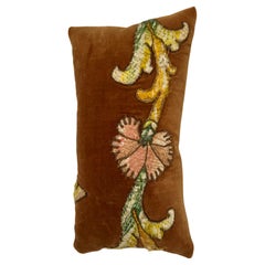
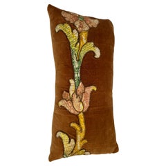
17th Century Flemish Tapestry Pillow 2083p
Located in Los Angeles, US
17th Century Flemish Tapestry Pillow beautiful and vibrant color and design
Category

Belgian Antique 18th Century and Earlier More Furniture and Collectibles

Materials

Wool

Antique Map of the Region of Oldenburg, Germany
Located in Langweer, NL
Antique map titled 'Oldenburg Comitatus'. Detailed old map of Oldenburg, Germany. The map also shows Bremen and the Jade Bight. Published by W. Blaeu, circa 1640. Willem Jansz. Blaeu...
Category

Antique 18th Century and Earlier More Furniture and Collectibles

Materials

Paper

Very Decorative Original Antique Map of the World, Published in France in c.1780
Located in Langweer, NL
Antique map titled 'L'Ancien Monde Et Le Nouveau en Deux Hemispheres' - Double hemisphere map of the World, showing the contemporary geographical...
Category

Antique 18th Century and Earlier More Furniture and Collectibles

Materials

Paper

Map of Languedoc-Roussillon and Provence in France and Piedmont in Italy, c1680
Located in Langweer, NL
Title: Antique map titled 'La basse Partie du Gouvernement de Languedoc, environne des Frontiers des Gouverns de Provence, de Dauphine de Lyonnais et de Guienne et Gascogne ; Les Fro...
Category

Antique 18th Century and Earlier More Furniture and Collectibles

Materials

Paper

Antique Decorative French Map of Java, Indonesia, 1718
Located in Langweer, NL
Antique map of Java titled 'Carte de l'Ile de Java: Partie Occidentale, Partie Orientale, Dressee tout Nouvellement (..)'. Decorative large format map...
Category

Antique 18th Century and Earlier More Furniture and Collectibles

Materials

Paper

Georgian 18th Century Childs High Chair
Located in Bedfordshire, GB
A Charming Late 18th Century Georgian, Mahogany, Hepplewhite Period Childs High Chairs, Having Camel Back With Elegant Pierced Splat, Scrolling Arms, Removable Safety Bar And Adjustable Foot Rest Over Detachable Mahogany Table Stand Raised On Square Legs. This remarkable little 18th century childs high chair, which also doubles as a childs chair and table...
Category

English Hepplewhite Antique 18th Century and Earlier More Furniture and Collectibles

Materials

Mahogany

Original Engraved Map of Saint Lucia in the West Indies by Bellin, 1758
Located in Langweer, NL
The "Carte de L’Isle de Sainte Lucie" by Jacques Nicolas Bellin, a prominent figure as the Royal Hydrographer and engineer of the French Navy, is a remarkable antique map showcasing ...
Category

Antique 18th Century and Earlier More Furniture and Collectibles

Materials

Paper

Map of the West African coast from the North of Mauretania to Guinee, 1788
Located in Langweer, NL
Antique map titled 'Particular Map of the Western Coast of Africa, from Cape Blanco to Cape de Verga, and of the Course of the Rivers Senega and Gambia.' Map of the African coast...
Category

Antique 18th Century and Earlier More Furniture and Collectibles

Materials

Paper

Antique Bird's Eye View of Scheveningen Near The Hague, the Netherlands, 1730
Located in Langweer, NL
Antique print titled 'Afbeeldinge van Schevelinge in den Jaare 1729'. Bird's eye view of Scheveningen near The Hague / Den Haag, the Netherlands. This print originates from 'Beschr...
Category

Antique 18th Century and Earlier More Furniture and Collectibles

Materials

Paper

18th Century Hand Colored Map of Spain and Portugal by Visscher
Located in Alamo, CA
This is an early 18th century map of Spain and Portugal, with attractive original hand-coloring, entitled "Hispaniae et Portugalliae Regna per Nicolaum Visscher cum Privilegio Ordinu...
Category

Dutch Antique 18th Century and Earlier More Furniture and Collectibles

Materials

Paper

American William and Mary Style Oak Cradle
Located in Queens, NY
American Country (Wm. & Mary style-17/18th Cent) oak paneled cradle with hooded front section with finials.
Category

American William and Mary Antique 18th Century and Earlier More Furniture and Collectibles

Materials

Oak

Map of the Provence in Southern France, Original Old Engraving by De Wit c. 1688
Located in Langweer, NL
Title: Provence Map - Hand-Colored 17th-Century Engraving by Frederik De Wit c. 1688 Description: This captivating map, "Gouvernement de Provence," depicts the Provence region of so...
Category

Antique 18th Century and Earlier More Furniture and Collectibles

Materials

Paper

Antique Map of the Eastern Part of the World by Tirion, 1755
Located in Langweer, NL
Antique map titled 'Nieuwe Kaart van het Oostelykste Deel der Weereld, dienende tot Aanwyzing van de Scheepstogten der Nederlanderen naar Oostindië'. Australia (Nieuw Holland) shown ...
Category

Dutch Antique 18th Century and Earlier More Furniture and Collectibles

Materials

Paper

Genuine Antique Engraved Map of Helvetia or Switzerland, 1729
Located in Langweer, NL
Decorative early 18th century engraved map of Switzerland. Title: Helvetia Conterminarumq terra rum antiqua. Translated from Latin: Switzerland is an ancient land Description: Switzerland, antique copperplate engraved map with hand coloring and a decorative title cartouche. Two figures greatly enhances visual appeal. Author: Phillip Cluver, or Philip Cluverius, Philipp Clüver, Latinized as Philippus Cluverius studied law in Leiden and settled over there in 1615. We only sell Guaranteed Absolutely Original authentic Maps and Prints. A Certificate of Authenticity ( COA ) will be supplied on request. We ship our antique maps and prints...
Category

Antique 18th Century and Earlier More Furniture and Collectibles

Materials

Paper

Antique Apothecary Mortar & Pestle, English, Bronze, Chemist Shop Aid, Georgian
Located in Hele, Devon, GB
This is an antique apothecary mortar and pestle. An English, bronze chemist's shop aid, dating to the Georgian period, circa 1800. Quality Georgian apothecary aid with superb finis...
Category

British Georgian Antique 18th Century and Earlier More Furniture and Collectibles

Materials

Bronze

Antique Map of Epirus 'Albania, Greece' by J. Janssonius, circa 1650
Located in Langweer, NL
This map covers the northwestern coast of Greece and part of present-day Albania. The map was drawn by Johannes Wilhelm Laurenberg, a mathematician and historian who produced several...
Category

Antique 18th Century and Earlier More Furniture and Collectibles

Materials

Paper

18th Century Giltwood and Polychrome Painted Putti / Cherub
Located in Hastings, GB
Hand carved winged Italian Baroque Putti, water gilded over applied gesso, the face and head polychrome painted. Small hanging hook to the back of the head. Width 23 cm x Height 1...
Category

Italian Baroque Antique 18th Century and Earlier More Furniture and Collectibles

Materials

Gesso, Wood

Antique Bust of a Spanish Knight, Hand Carved with Original Gesso and Paint
Located in Oxfordshire, GB
Wooden bust of a knight. A wonderful armored knight carved from lime wood. The knight is well carved with the face (with moustache) looking out of the ...
Category

Spanish Baroque Antique 18th Century and Earlier More Furniture and Collectibles

Materials

Pine

18th Century Italian Baroque Gilded Ewer Repoussé Copper Liturgical Pitcher
Located in Milano, MI
A stunning Italian gilt copper ewer dating back to 18th century with a circular body featuring a quadripartite decoration defined by the repoussé of a double vertical ribbed frame that frames tableaux decorated with floral scrolls; the background of these sections is finely dotted by chisel tool to underline a very pleasant relief to the embossed parts thanks to the burnishing. An excellent and unique hand-made pitcher, selected in a private collection of Northern Italy. This rare golden jug was created to serve wine during the Eucharistic celebration, the Christian liturgical practice. it is an Italian work of art that dates back to 1700, with a wonderful fire gilding, for collectors. In good age related condition regardless of a small dent in the middle part of the body, consistent with the eighteenth-century dating. The cast handle takes up the motif of the volutes present on the body of the ewer. The spout is closed by a hinged lid with a small floral knob, with minimal deformations near the hinge compromising its perfect closure. In the upper part, there are welding signs...
Category

Italian Baroque Antique 18th Century and Earlier More Furniture and Collectibles

Materials

Copper

Antique Map of Guyenne, Gascony and Béarn, France
Located in Langweer, NL
Antique map titled 'Guyenne et Gascogne et Bearn'. Original old map of Guyenne (or Guienne), Gascony and Béarn, France. This map originates from 'Le Petit Atlas Maritime Recueil De C...
Category

Antique 18th Century and Earlier More Furniture and Collectibles

Materials

Paper

Original 17th-Century Antique Map of Fujian (Fokien) Province, China – by Blaeu
Located in Langweer, NL
17th-Century Antique Map of Fujian Province, China – "Fokien" by Blaeu, with Decorative Cartouches Description: This stunning 17th-century map of Fujian Province, historically ref...
Category

Antique 18th Century and Earlier More Furniture and Collectibles

Materials

Paper

Original Antique 17th-Century Map of Shanxi (Xansi) Province, China – by Blaeu
Located in Langweer, NL
Antique 17th-Century Map of Shanxi Province, China – "Xansi" by Blaeu, with Artistic Cartouches Description: This beautifully engraved map of Shanxi Province, historically referred to as "Xansi," was created by Johannes Blaeu in 1655 as part of his renowned *Novus Atlas Sinensis*. This atlas was the first comprehensive Western collection focused on Chinese geography, produced with the guidance of Jesuit missionary Martino Martini. Blaeu’s attention to detail and artistic flair are evident in this representation of Shanxi, highlighting mountains, rivers, cities, towns, and key geographic features. The Great Wall of China, an iconic landmark, is also depicted. The map includes decorative cartouches that enhance its aesthetic appeal. The upper-left corner features the map's title framed in an ornate design, while the lower-right corner showcases a seated figure in traditional Chinese attire alongside a small globe, symbolizing the merging of European cartographic expertise and Chinese knowledge. Each city and geographic feature is labeled in Latin, making it a fascinating historical artifact of cross-cultural exploration. This map was crafted using the copperplate engraving technique, prized for its ability to produce fine, precise details. It is further embellished with hand-coloring, which brings the landscape and decorative elements to life. Blaeu’s maps are highly regarded for their accuracy, artistry, and historical significance, making this piece a valuable collectible. Shanxi Province, historically referred to as "Xansi," is renowned for its historical significance, natural landscapes, and rich cultural heritage. The region has been a crucial center of Chinese history and culture for centuries. Its name, meaning "West of the Mountains," refers to its location west of the Taihang Mountains. Shanxi has long been known for its coal resources, which have made it an important economic hub in modern times. Important places in Shanxi include Pingyao, a UNESCO World Heritage Site known for its well-preserved ancient city walls and traditional Chinese architecture. The Yungang Grottoes, near Datong, are another UNESCO site, famous for their intricate Buddhist carvings and statues. Mount Wutai, one of China’s Four Sacred Buddhist Mountains, is a significant religious site that attracts pilgrims and tourists alike. Taiyuan, the provincial capital, is known for its historical sites, including the Jinci Temple. Shanxi is also known for its role in the early development of Chinese banking, particularly during the Ming and Qing Dynasties. Keywords include antique map of Shanxi, Xansi map, Pingyao, Yungang Grottoes, Mount Wutai, 17th-century China map...
Category

Antique 18th Century and Earlier More Furniture and Collectibles

Materials

Paper

Antique Map of South East Asia, Australia and the Indian Ocean, 1726
Located in Langweer, NL
Antique map titled 'Tabula Indiae Orientalis'. Beautiful detailed map of Australia, Southeast Asia and the Indian Ocean. The map features a fine depiction of the outlines of the western two-thirds of Australia, based on the discoveries of explorers working for the Dutch East India Company (the VOC). These include Willem Jansz's discoveries in the Gulf of Carpentaria in 1606; the encounters of Dirk...
Category

Dutch Antique 18th Century and Earlier More Furniture and Collectibles

Materials

Paper

17th-Century Map of the Latin Patriarchate of Jerusalem by Melchior Tavernier
Located in Langweer, NL
Title: 17th-Century Map of the Latin Patriarchate of Jerusalem by Melchior Tavernier Description: This rare 17th-century map by Melchior Tavernier illustrates the geographical ext...
Category

Antique 18th Century and Earlier More Furniture and Collectibles

Materials

Paper

Antique Map of India and the Gulf of Bengal by Mallet, c.1686
Located in Langweer, NL
Antique map titled ?Partie Orientale de la Terre Ferme de l'Inde Moderne. Small map of India and the Gulf of Bengal. This map originates from a German edition of 'Description de l' Univers'. Artists and Engravers: Alain Manesson Mallet (1630-1706) was a French cartographer and engineer. He started his career as a soldier in the army of Louis XIV, became a Sergeant-Major in the artillery and an Inspector of Fortifications. He also served under the King of Portugal, before returning to France, and his appointment to the court of Louis XIV. His military engineering and mathematical background led to his position teaching mathematics at court. His 'Description de L'Universe' contains a wide variety of information, including star maps...
Category

Antique 18th Century and Earlier More Furniture and Collectibles

Materials

Paper

Chippendale Period Mahogany Hanging Wall Shelves
Located in Lymington, Hampshire
A fine set of 18th century open fret work hanging wall shelves. This set of wall shelves have been made in the fashionable Chinese openfret fretwo...
Category

English Antique 18th Century and Earlier More Furniture and Collectibles

Materials

Mahogany

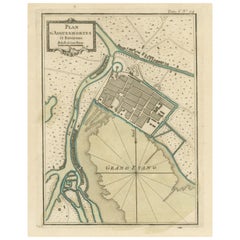
Antique Map of the Port of Zihuatanejo in Mexico, c.1740
Located in Langweer, NL
Antique map titled 'Plan du Port de Chequetan ou Seguataneo'. Map of the Mexican port of Zihuatanejo. This area was originally named Cihuatlán in Aztec, which means 'Place of Women,'...
Category

Antique 18th Century and Earlier More Furniture and Collectibles

Materials

Paper

18th Century Georgian Mahogany Bottle Holder on Stand
Located in Long Island City, NY
The bottle holder with a carrying handle. The stand on turned and fluted legs.
Category

Irish George III Antique 18th Century and Earlier More Furniture and Collectibles

Materials

Mahogany

1585 Mercator Map of Ireland, Entitled "Irlandiae Regnvm, " Hand Colored Ric0006
Located in Norton, MA
1585 Mercator map of Ireland, entitled "Irlandiae Regnvm." Hand Colored Description: Published in Amsterdam by Mercator/Hondius ca. 1585. Artists and Engravers: 1585 Mercator map of Ireland, entitled "Irlandiae Regnvm." Copperplate engraving on verge type hand laid paper with watermark. Description: Published in Amsterdam by Mercator/Hondius ca. 1585.Artists and Engravers: Mercator was born in Rupelmonde in Flanders and studied in Louvain under Gemma Frisius, Dutch writer, astronomer and mathematician. The excellence of his work brought him the patronage of Charles V, but in spite of his favor with the Emperor he was caught up in the persecution of Lutheran protestants and charged with heresy, fortunately without serious consequences. No doubt the fear of further persecution influenced his move in 1552 to Duisburg, where he continued the production of maps, globes and instruments. Mercator's sons and grandsons, were all cartographers and made their contributions in various ways to his atlas. Rumold, in particular, was responsible for the complete edition in 1595. The map plates...
Category

Dutch Antique 18th Century and Earlier More Furniture and Collectibles

Materials

Paper

Old Print of Standia, a Greek Island 'Heraklion, Crete, Greece, Balkans', 1688
Located in Langweer, NL
Antique print Greece titled 'Het Eilant Standia'. Old print of the island Standia, near Crete, Greece. This print originates from 'Nauwkeurige Bes...
Category

Antique 18th Century and Earlier More Furniture and Collectibles

Materials

Paper

Rare 17th-Century Map of Dauphiné in Southeastern France by F. De Wit, ca.1688
Located in Langweer, NL
Title: Rare Hand-Colored 17th-Century Map of Dauphiné by Frederik De Wit c. 1688 Description: This captivating 17th-century map of Dauphiné, titled "Nova et Accurata Delphinatus Vul...
Category

Antique 18th Century and Earlier More Furniture and Collectibles

Materials

Paper

17th-Century Antique Map of Jiangxi (Kiangsi) Province, China – by Blaeu
Located in Langweer, NL
Title: 17th-Century Antique Map of Jiangxi Province, China – "Kiangsi" by Blaeu, Detailed and Vibrantly Colored Description: This detailed 17th-century map of Jiangxi Province, historically referred to as "Kiangsi," was created by Johannes Blaeu and published in 1655 as part of the *Novus Atlas Sinensis*. Jiangxi, located in southeastern China, is known for its cultural heritage, scenic landscapes, and significant contributions to Chinese history. The map meticulously charts Jiangxi’s geography, including mountain ranges, rivers, and cities, with place names rendered in Latin. Poyang Lake, one of the largest freshwater lakes in China, is prominently depicted, emphasizing the region’s ecological and economic importance. The map also highlights key cities such as Nanchang, the provincial capital, which has long been a cultural and political center, and Jingdezhen, globally famous as the center of Chinese porcelain production. The decorative cartouche in the lower-right corner features traditional Chinese figures, adding cultural depth to the map. Blaeu’s craftsmanship is evident in the precise copperplate engraving and the vibrant hand-coloring, which enhances the boundaries and natural features, making this map both a functional document and a work of art. Condition: Nearly excellent. Sharp impression with vivid hand-coloring. Wide margins with minor age-toning appropriate for its age. Framing Tips: Use a neutral double mat and an ornate gilt or dark wood frame to highlight the map’s historical and artistic value. UV-protective glass is recommended to preserve the hand-coloring and intricate details. Jiangxi, historically referred to as "Kiangsi," is famous for its rich cultural history, stunning landscapes, and economic contributions. It has been a key region for porcelain production, with Jingdezhen renowned as the "Porcelain Capital" of the world. Poyang Lake, featured prominently on the map, is vital for fishing, transportation, and its ecological significance. The province’s location along the Gan River has historically made it an important transportation corridor. Nanchang, the provincial capital, is noted for its historical landmarks and political significance in modern Chinese history. Keywords include: antique map of Jiangxi, Kiangsi map, Poyang Lake, Jingdezhen porcelain, 17th-century China map...
Category

Antique 18th Century and Earlier More Furniture and Collectibles

Materials

Paper

Old Ptolemaic Map of the Region Between the Persian Gulf and Caspian Sea, 1598
Located in Langweer, NL
"Tabula Asiae V", Ptolemy/Ruscelli Subject: Persia - Iran Period: 1598 (published) Publication: Geografia di Claudio Tolomeo Allessadrino… Claudius Ptolemy was a mathematician, ast...
Category

Antique 18th Century and Earlier More Furniture and Collectibles

Materials

Paper

Les Pavillons: French Pavilions of the Eighteenth Century (Book)
Located in North Yorkshire, GB
by Cyril Connolly and Jerome Zerbe A first edition copy from 1962 of this fascinating book which is beautifully illustrated with photographs taken by Jerome Zerbe and also with an i...
Category

Antique 18th Century and Earlier More Furniture and Collectibles

Materials

Paper

Antique Map of the Coast of Guinea and the Cape Verde Islands
Located in Langweer, NL
Antique map titled 'Carte de la Guinée (..)'. This map was originally part of a 2 sheet larger map of Eastern Africa, showing the Cape Verde Islands and Senegal. This map originates ...
Category

Antique 18th Century and Earlier More Furniture and Collectibles

Materials

Paper

Antique Book, Compendium of Farriery, English, Georgian, Equestrian, London 1796
Located in Hele, Devon, GB
This is a delicate antique book, Compendium of Farriery. An English language, Georgian guide to equestrian care, published in London, 1796. Full title: Taplin Improved; or a Compend...
Category

British Georgian Antique 18th Century and Earlier More Furniture and Collectibles

Materials

Paper

Antique Map of the Mongol Empire, 1767
Located in Langweer, NL
Antique map titled 'The Moguls Empire divided into its principal governments'. Old map of India, Bangladesh, and parts of eastern China. Artists and Engravers: Published in the G...
Category

Antique 18th Century and Earlier More Furniture and Collectibles

Materials

Paper

1690 Frederick de Wit Sea Chart of Hudson Bay, Baffin Bay and Greenland
Located in Langweer, NL
Title: c. 1690 Frederick de Wit Sea Chart of Hudson Bay, Baffin Bay, and Greenland - Engraved by Romeyn de Hooghe This striking sea chart by Frederick de Wit, titled "Septemtrionali...
Category

Antique 18th Century and Earlier More Furniture and Collectibles

Materials

Paper

18th Century Pair of Italian Polychrome Coffers
Located in Marbella, ES
18th century pair of Italian polychrome coffers, hand painted in green and typical Italian period ochre color vegetable and ornamental motifs. Featured in "Arredo Domestico", a c...
Category

Italian Antique 18th Century and Earlier More Furniture and Collectibles

Materials

Wood

Limburg Cityscape 1580: Historical Copper Engraving by Braun and Hogenberg
Located in Langweer, NL
Title: Limburgum Oppidum Galliae Belgicae, vulgo Lympurch, gallicè, Lembor Dr. Type: Print (Copper Engraving) Circa 1580 Technique: Colored Copper Engraving Medium: Handmade Paper S...
Category

Antique 18th Century and Earlier More Furniture and Collectibles

Materials

Paper

Peace Depicting the Crucifixion in Dark Patina Bronze 18th Century
Located in Milan, IT
18th Century. Peace depicting the Crucifixion Dark patina bronze, 21 x 14.5 cm The bronze examined is an ancient peace (in Latin osculum pacis or table pacis), the object of th...
Category

Italian Antique 18th Century and Earlier More Furniture and Collectibles

Materials

Bronze

Antique Engravings of Mauritius and Indonesia, incl de Banda Islands, c.1730
Located in Langweer, NL
Title on page: "Ins. de Cerno a. Nostatibus Mauritius Nominata [on sheet with] Gunnanappi Labetacq [and] Civitas Gammelamme [and] Rex Tubatus", Le Clerc, Jean This sheet includes fo...
Category

Antique 18th Century and Earlier More Furniture and Collectibles

Materials

Paper

Antique Map of the City of Groningen Made After Harrewijn, C.1750
Located in Langweer, NL
Antique map titled 'Groeningue'. Old map of the city of Groningen, the Netherlands. Source unknown, to be determined. Artists and Engravers: Most likely made after J. Harrewijn. ...
Category

Antique 18th Century and Earlier More Furniture and Collectibles

Materials

Paper

Fabulous Original Antique two-sheet Map of the Caspian Sea, ca.1723
Located in Langweer, NL
Carte Marine de la Mer Caspiene... [and] Coste de Perse sur la Mer Caspiene et Partie de Celles de Tartarie", Delisle, Guillaume (2 maps) Subject: Caspian Sea ...
Category

Antique 18th Century and Earlier More Furniture and Collectibles

Materials

Paper

Antique Extremely Rare Judaica Tzedakah Synagoge Charity Box 16th Century
Located in Doha, QA
This 16th century Tzedakah Charity Box is an incredibly rare and unique museum quality piece. It’s made out of walnut wood and has an original 16th century silk material all over it from outside as well as in the inside, bronze plug in the front and the Star of David with two lions from the left and right side of the Star. There are also two round bronze handles to lift the box from both sides. The Tzedakah Box...
Category

Spanish Gothic Antique 18th Century and Earlier More Furniture and Collectibles

Materials

Metal

William Caxton, an Original Leaf from the Polycronicon 'Polychronicon', 1482
Located in Hillsborough, NJ
Author: Caxton, William - Higden, Ranulf (Ranulphus). Title: Polycronicon. (Polychronicon). Publisher: [Westminster]: William Caxton, 1482. De...
Category

British Antique 18th Century and Earlier More Furniture and Collectibles

Materials

Paper

Jacques Callot "Misères Et Malheurs De La Guerre" Collection of Engraving 17th
Located in Beuzevillette, FR
“Les Misères Et Les Malheurs De La Guerre” (“The misfortunes of war”) more commonly called “the great miseries of war” (“The great miseries of war”) is a major work by the 17th centu...
Category

French Louis XIII Antique 18th Century and Earlier More Furniture and Collectibles

Materials

Paper

1767 D’Anville Map of the Holy Land: Ancient Divisions and Biblical Geography
Located in Langweer, NL
Ancient Map of Palestine or the Holy Land by D'Anville (1767) This detailed map, created by the renowned French cartographer Jean Baptiste Bourguignon d'Anville in 1767, depicts the...
Category

Antique 18th Century and Earlier More Furniture and Collectibles

Materials

Paper

1705 Golfe de Mexico and Florida Framed Map
Located in Stamford, CT
Framed map of Mexico & Florida circa 1705, Paris. Small map with Mexico and the Gulf Coast. Inset text indicating Panama, Acapulco, Mexico City and the Mississippi. Extends North to ...
Category

French Spanish Colonial Antique 18th Century and Earlier More Furniture and Collectibles

Materials

Glass, Wood, Paper

Road Map Britannia 1675/6 No 5 Road London to Barwick, London Stilton Grey Frame
Located in BUNGAY, SUFFOLK
John Ogilby (British 1600-1676) cosmographer and geographick printer to Charles II. A road map from Britannia, 1675/6. No 5, The road from London to Barwick: London to Stilton In a grey painted and gilded frame. In a remarkable life John Ogilby pursued, several careers, each ending in misfortune, and yet he always emerged undeterred, to carry on. His modern reputation is based on his final career, started in his sixty-sixth year, as a publisher of maps and geographical accounts. Ogilby was born outside Dundee, in 1600, the son of a Scottish gentleman. While he was still a child, the family moved to London. When the elder Ogilby was imprisoned for debt, the young John invested his savings in a lottery, won a minor prize, and settled his father's debts. Unfortunately, not enough money was left to secure John a good apprenticeship; instead, he was apprenticed to a dance master. Ogilby was soon dancing in masques at court but, one day, while executing a particularly ambitious leap, he landed badly. The accident left him with a permanent limp, and ended his dancing career. However, he had come to the attention of Thomas Wentworth, later Earl of Strafford, Charles I's most senior minister. Ever one to exploit his contacts, Ogilby became a dance instructor in Strafford's household. When Strafford was sent to Ireland, Ogilby accompanied him as Deputy-Master of the Kings Revels, and then Master of Revels. In Dublin, he built the New Theatre, in St. Werburgh Street, which prospered at first, but the Irish Rebellion, in 1641, cost Ogilby his fortune, which he estimated at £2,000, and almost his life. After brief service as a soldier, he returned to England, survived shipwreck on the way, and arrived back penniless. On his return, Ogilby turned his attention to the Latin classics, as a translator and publisher. His first faltering attempt, in 1649, was a translation of the works of Virgil, but after his marriage to a wealthy widow the same year, his publishing activities received a considerable boost. One means by which Ogilby financed these volumes was by subscription, securing advance payments from his patrons, in return for including their name and coats-of-arms on the plates of illustrations. Another approach was to secure a patron, preferably in the court circle. Ogilby's first patron was Strafford, who found out too late that all leading ministers are dispensable when Charles I assented to his execution in 1641. As he re-established himself, Ogilby sought a new patron, the King himself. In 1661, Ogilby was approached to write poetry for Charles II's coronation procession; he later published 'The Relation of His Majesties Entertainment Passing Through the City of London', and a much enlarged edition the following year, which included a Fine set of plates depicting the procession. Royal favour was bestowed in 1674 when John Ogilby received the title of 'His Majesty's Cosmographer and Geographick Printer' with a salary of £13.6s.8d per annum. In 1665, Ogilby left London to avoid the Plague then ravaging the capital. The following year, in the Great Fire of London, Ogilby claimed that he lost his entire stock of books valued at some £3,000, as well as his shop and house, leaving him worth just £5. As he sought to restore his fortunes, Ogilby was already looking in new directions. The initial opportunity he seized on was the reconstruction of London's burnt-out centre. He secured appointment as a "sworn viewer", whose duty was to establish the property boundaries as they existed before the Fire. Ogilby was assisted in the project by his step-grandson, William Morgan, and by a number of professional surveyors. The result was an outstanding plan of London, on a scale of 100 feet to an inch, on 20 sheets, although it was not printed until after Ogilby's death. Ogilby then turned his attention to publishing geographical descriptions of the wider-world. In 1667, he issued 'An Embassy from the East India Company of the United Provinces to the Grand Tartar Cham, Emperor of China.' Buoyed by the response to this volume, Ogilby conceived an ambitious project, a multi-volume description of the world. The volumes were joint collaborations, in conjunction with the Dutch publisher Jacob van Meurs. 'Africa', published in 1670, was the least original of the three, both in terms of the text, maps and illustrations. In a similar vein, he issued the 'Atlas Japannensis' (1670), the 'Atlas Chinensis' (1671), and 'Asia' (1673). In 1671, Ogilby published the 'America', translated from Arnold Montanus' Dutch text. The 'America' is certainly the most original, and most important, of Ogilby's various geographical volumes, and its influence and popularity was immediate. With its completion, Ogilby turned to a project nearer his heart, the description of Britain. Ogilby originally intended to devote one volume to Britain, but as the project evolved, he became more ambitious, as revealed in a prospectus issued in about 1672: "This having oblig'd our Author to take new Measures ... to compleat within the space of two Years a Work ... considering the Actual survey of the Kingdom, the Delineation and Dimensuration of the Roads, the Prospects and Ground plots of Cities, with other Ornamentals ... into six fair volumes. The Four first comprehending the historical and geographical description of England, with the County-Maps truly and actually survey'd. ... The fifth containing an Ichnographical and Historical Description of all the Principal Road-ways in England and Wales, in two hundred copper sculptures, after a new and exquisite method. The sixth containing a New and Accurate Description of the famous City of London, with the perfect Ichnography thereof ..." In the proposals, Ogilby emphasised the scale of the undertaking; no-one before him had attempted such a vast project. He estimated the total costs would be £20,000, a staggering amount. The cost of the complete set of six volumes was to be £34. At that time, Wenceslas Hollar...
Category

British Charles II Antique 18th Century and Earlier More Furniture and Collectibles

Materials

Paper

Antique Map of the Artois Region of France by Ortelius, 'circa 1590'
Located in Langweer, NL
Antique map titled 'Artesia'. Original antique map of the Artois region, France. Published by A. Ortelius, circa 1590.
Category

Antique 18th Century and Earlier More Furniture and Collectibles

Materials

Paper

Original 17th-Century Antique Map of Henan (Honan) Province, China – by Blaeu
Located in Langweer, NL
17th-Century Antique Map of Henan Province, China – "Honan" by Blaeu, with Detailed Cartography and Artistic Cartouches Description: This exceptional 17th-century map of Henan Province, historically referred to as "Honan," was created by Johannes Blaeu and published in 1655 as part of the *Novus Atlas Sinensis*. Henan, located in central China, is known as the cradle of Chinese...
Category

Antique 18th Century and Earlier More Furniture and Collectibles

Materials

Paper

Old Print of William Cavendish, First Duke of Newcastle, on Horseback, ca.1740
Located in Langweer, NL
Antique print titled 'Apres l'homme le Cheval (..)'. Antique print depicting William Cavendish, first Duke of Newcastle, on horseback on an inscr...
Category

Antique 18th Century and Earlier More Furniture and Collectibles

Materials

Paper

1773 John Blair Map of the Ancient Holy Land: Tribes, Journeys, and Empires
Located in Langweer, NL
Title: 1773 John Blair Map of the Ancient Holy Land: Tribes, Journeys, and Empires This exceptional map by John Blair, published in London in 1773, offers a richly detailed view o...
Category

Antique 18th Century and Earlier More Furniture and Collectibles

Materials

Paper

Antique Map of the Congo, Gabon and Angola by N. Sanson, circa 1700
Located in Langweer, NL
Attractive map of Gabon, the Congo and Angola from Cape Lopez and Sao Tomé to approximately the border with present-day Namibia. The map is fully engraved with mountains, rivers, for...
Category

Antique 18th Century and Earlier More Furniture and Collectibles

Materials

Paper

Original Antique Map of Northern India
Located in Langweer, NL
Antique map titled 'Carte de l'Indoustan (..) - Kaart van Hindoestan (..)'. Original antique map of northern India. This map originates from 'His...
Category

Antique 18th Century and Earlier More Furniture and Collectibles

Materials

Paper

Read More

Medal-Worthy Memorabilia from Epic Past Olympic Games

Get into the games! These items celebrate the events, athletes, host countries and sporting spirit.

Ahoy! You’ve Never Seen a Collection of Sailor Art and Kitsch Quite Like This

French trendsetter and serial collector Daniel Rozensztroch tells us about his obsession with objects related to seafaring men.

39 Incredible Swimming Pools

It's hard to resist the allure of a beautiful pool. So, go ahead and daydream about whiling away your summer in paradise.

Pamela Shamshiri Shares the Secrets behind Her First-Ever Book and Its Effortlessly Cool Interiors

The sought-after designer worked with the team at Hoffman Creative to produce a monograph that beautifully showcases some of Studio Shamshiri's most inspiring projects.

Moroccan Artworks and Objects Take Center Stage in an Extraordinary Villa in Tangier

Italian writer and collector Umberto Pasti opens the doors to his remarkable cave of wonders in North Africa.

Montecito Has Drawn Royalty and Celebrities, and These Homes Are Proof of Its Allure

Hollywood A-listers, ex-pat aristocrats and art collectors and style setters of all stripes appreciate the allure of the coastal California hamlet — much on our minds after recent winter floods.

Whaam! Blam! Pow! — a New Book on Pop Art Packs a Punch

Publishing house Assouline and writer Julie Belcove have teamed up to trace the history of the genre, from Roy Lichtenstein, Andy Warhol and Yayoi Kusama to Mickalene Thomas and Jeff Koons.

The Sparkling Legacy of Tiffany & Co. Explained, One Jewel at a Time

A gorgeous new book celebrates — and memorializes — the iconic jeweler’s rich heritage.

Recently Viewed

View All