18th Century and Earlier More Furniture and Collectibles

to
2,900
4,129
1,110
5,286
299
154
137
81
58
53
50
26
16
5
3
3
2
2
2
2
1
10,615
31,733
15,223
6,678
13,767
6,696
929
566
1,131
1,401
1,051
2,872
2,941
2,586
1,202
819
3,362
951
711
501
284
1,944
418
370
369
264
5,286
5,286
5,286
59
21
14
13
12
Period: 18th Century and Earlier
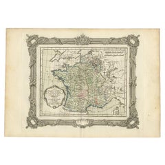
Antique Map of France at the Beginning of the 17th Century by Zannoni, 1765
Located in Langweer, NL
Antique map France titled 'Carte pour servir à intelligence de l'Histoire de France (..)'. Beautiful old map of France. This map originates from 'At...
Category

Antique 18th Century and Earlier More Furniture and Collectibles

Materials

Paper

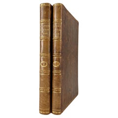
Gilpin, Wm: Observations... on Great Britain, and High-Lands of Scotland, 2 vols
Located in Middletown, NY
This is Gilpin's third in his series of works tracing picturesque beauty in British natural landscapes. In it he portrays the landscapes of Scottish Highlands, and describes them lyrically in his text. Prefacing the list of Prints at the end of the second volume, the author says "With regards to the prints, which adorn these volumes, I can only say..... that few of them pretend to be 'exact portraits.' They in general 'only characterize the countries,' through which the reader is carried." The illustrations, based on Gilpin's sketches, were etched by his nephew William Sawrey Gilpin using the newly invented aquatint process. This volume also includes a technical discourse about drawing and the mixing of colors, including a chart (vol. 1, p. 131-134) William Gilpin (1724 – 1804) was an English artist, Church of England cleric, schoolmaster and author. He is best known as a travel writer and as one of those who originated the idea of the picturesque. Gilpin's tour journals circulated in manuscript to friends such as the poet William Mason and a wider circle including Thomas Gray...
Category

English Antique 18th Century and Earlier More Furniture and Collectibles

Materials

Leather, Paper

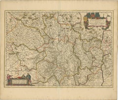
Rare Hand-Colored Map of Lyonnais Region in France by Frederik De Wit c. 1688
Located in Langweer, NL
Title: Rare Hand-Colored Map of Lyonnais Region by Frederik De Wit c. 1688 Description: This beautifully detailed map, "Gouvernement General du Lyonnois," showcases the Lyonnais reg...
Category

Antique 18th Century and Earlier More Furniture and Collectibles

Materials

Paper

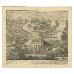
Antique Roman Battle Print of the Greater and Lesser Camp by Duncan, c.1753
Located in Langweer, NL
Antique battle map showing the greater and lesser camp. With detailed legend explaining the various elements of the print. This print most likely originates from an edition of 'The C...
Category

Antique 18th Century and Earlier More Furniture and Collectibles

Materials

Paper

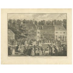
Antique Print of the Baptism of Christians by Bernaerts, 1736
Located in Langweer, NL
Antique print titled 'Le Baptême de Rhinsbourg'. This print depicts the baptism of Christians in Katwijk-Rijnsburg in The Netherlands. Engraved by B. Bernaerts.
Category

Dutch Antique 18th Century and Earlier More Furniture and Collectibles

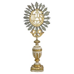
18th Century Processional Gilt Iron IHS Cross Mounted on a Baroque Altar Vase
Located in Hastings, GB
A rare and exceptional 18th century gilt iron processional cross with IHS to the centre, mounted on a magnificent painted gesso, carved wooden altar vase dating to the baroque period...
Category

Italian Baroque Antique 18th Century and Earlier More Furniture and Collectibles

Materials

Iron

Original Engraving of Japanese Musicians Playing Native Music Instruments, 1669
Located in Langweer, NL
Antique print, titled: 'Japansche kamerspeelders.' - ('Japanese musicians'). Four chamber musicians are playing on native instruments outside. Arnol...
Category

Antique 18th Century and Earlier More Furniture and Collectibles

Materials

Paper

Circa 1659 Blaeu Family Map: Glogau and the Odra River Valley, Silesia
Located in Langweer, NL
Circa 1659 Blaeu Family Map: Glogau and the Odra River Valley, Silesia This hand-colored map from circa 1659 by the Blaeu Family, titled "Ducatus Silesiae Glogani Vera Delineatio," provides a detailed view of the Odra River valley in western Poland, centered around the city of Glogau. The map, based on the work of Silesian cartographer Jonas Scultetus, is oriented with north to the left. It intricately details forests, rivers, lakes, and numerous small villages. A large decorative title cartouche features an ornate coat of arms and a key to the map's symbols. The bottom right includes a finely crafted scale of miles cartouche, adorned with calipers and a pair of falcons. Published between 1659 and 1672, the map has Spanish text on the verso. Measuring 19.9 inches wide by 16.4 inches high, it is in good condition with full contemporary color on a bright sheet, a watermark of the god Atlas, some marginal soiling, and a few short tears along the edges. Keywords: - Blaeu Family map - Silesia historical map - Glogau map - Odra River valley - 17th-century Poland map - Jonas Scultetus - Decorative cartouches - Historical cartography - Antique maps of Poland...
Category

Antique 18th Century and Earlier More Furniture and Collectibles

Materials

Paper

Georgian 18th Century Childs High Chair
Located in Bedfordshire, GB
A Charming Late 18th Century Georgian, Mahogany, Hepplewhite Period Childs High Chairs, Having Camel Back With Elegant Pierced Splat, Scrolling Arms, Removable Safety Bar And Adjustable Foot Rest Over Detachable Mahogany Table Stand Raised On Square Legs. This remarkable little 18th century childs high chair, which also doubles as a childs chair and table...
Category

English Hepplewhite Antique 18th Century and Earlier More Furniture and Collectibles

Materials

Mahogany

Antique Map of the Bay of Bantam, c.1720
Located in Langweer, NL
Rare, untitled miniature map of the Bay of Bantam with various Islands including Pulo Dua and Pulo Batto. This map originates from a small travelogue and may originate from an editio...
Category

Antique 18th Century and Earlier More Furniture and Collectibles

Materials

Paper

Antique Map of Southern Germany by F. de Wit, circa 1680
Located in Langweer, NL
This antique map depicts a portion of southern Germany that included the historic regions of Bavaria, the Palatinate, Prussia-Brandenburg, the Rhineland and Saxony. Regensberg, Freis...
Category

Antique 18th Century and Earlier More Furniture and Collectibles

Materials

Paper

Old Handcolored Antique Map of Pays De Caux in Normandy, France, ca.1640
Located in Langweer, NL
Antique map titled 'Le Pais de Caux'. Old map of Pays de Caux, France. Pays de Caux is an area in Normandy occupying the greater part of the French département of Seine Maritime ...
Category

Antique 18th Century and Earlier More Furniture and Collectibles

Materials

Paper

Original Antique Map of Egypt by Van Dùren '1749'
Located in Langweer, NL
Decorative German antique engraving with titled 'Neue Vorstellung von Aegypten (..)'. It concerns a rare original antique map of Egypt. This map o...
Category

Antique 18th Century and Earlier More Furniture and Collectibles

Materials

Paper

Antique Map of the Franconia Region by Scherer, 1699
Located in Langweer, NL
Antique map titled 'Franconia multa numerat loca deiparae sacra in quibus magna recipit à dei matre beneficia.' Detailed uncommon map of the Franconia region in Germany. Source unkno...
Category

Antique 18th Century and Earlier More Furniture and Collectibles

Materials

Paper

Copper-Engraved Map Showing the Algerian Coast of North Africa, Published 1683
Located in Langweer, NL
Antique map titled 'Partie de Barbarie, ou est le Royaume d'Alger (..)'. Copper-engraved map showing the Algerian coast of North Africa. Published 1683. Artists and Engravers:...
Category

Antique 18th Century and Earlier More Furniture and Collectibles

Materials

Paper

1692 Engraved Map: Detailed Mogul Empire, India to Afghanistan, Hand-Colored
Located in Langweer, NL
1692 Map of the Mogul Empire by Jacques Peeters This finely engraved map, published in 1692 by Jacques Peeters, showcases the Mogul Empire region, covering areas from northern India...
Category

Antique 18th Century and Earlier More Furniture and Collectibles

Materials

Paper

Bird's-Eye View of Blâmont in Lorraine by Braun and Hogenberg, 1597
Located in Langweer, NL
Title: Bird's-Eye View of Blâmont in Lorraine by Braun and Hogenberg, 1597 This copperplate engraving, published in 1597 by Braun and Hogenberg, depicts a bird's-eye view of the t...
Category

Antique 18th Century and Earlier More Furniture and Collectibles

Materials

Paper

Antique Print with a View of Amsterdam from the IJ Dock by H. Schouten
Located in Langweer, NL
This rare authentic old antique print / plate originates from: 'Nieuwe atlas, van de voornaamste gebouwen en gezigten der stad Amsterdam, met derzelver beknopte beschryvingen.' (tran...
Category

Antique 18th Century and Earlier More Furniture and Collectibles

Materials

Paper

18th Century Gold French Gilded Wood Barometer, Antique Parisian Thermometer
Located in West Palm Beach, FL
A rare antique finely worked French barometer with lyre shaped crest thermometer above a large hexagonal framed barometer. The Parisian décor piece is m...
Category

French Empire Antique 18th Century and Earlier More Furniture and Collectibles

Materials

Giltwood

17th-Century Antique Map of Jiangxi (Kiangsi) Province, China – by Blaeu
Located in Langweer, NL
Title: 17th-Century Antique Map of Jiangxi Province, China – "Kiangsi" by Blaeu, Detailed and Vibrantly Colored Description: This detailed 17th-century map of Jiangxi Province, historically referred to as "Kiangsi," was created by Johannes Blaeu and published in 1655 as part of the *Novus Atlas Sinensis*. Jiangxi, located in southeastern China, is known for its cultural heritage, scenic landscapes, and significant contributions to Chinese history. The map meticulously charts Jiangxi’s geography, including mountain ranges, rivers, and cities, with place names rendered in Latin. Poyang Lake, one of the largest freshwater lakes in China, is prominently depicted, emphasizing the region’s ecological and economic importance. The map also highlights key cities such as Nanchang, the provincial capital, which has long been a cultural and political center, and Jingdezhen, globally famous as the center of Chinese porcelain production. The decorative cartouche in the lower-right corner features traditional Chinese figures, adding cultural depth to the map. Blaeu’s craftsmanship is evident in the precise copperplate engraving and the vibrant hand-coloring, which enhances the boundaries and natural features, making this map both a functional document and a work of art. Condition: Nearly excellent. Sharp impression with vivid hand-coloring. Wide margins with minor age-toning appropriate for its age. Framing Tips: Use a neutral double mat and an ornate gilt or dark wood frame to highlight the map’s historical and artistic value. UV-protective glass is recommended to preserve the hand-coloring and intricate details. Jiangxi, historically referred to as "Kiangsi," is famous for its rich cultural history, stunning landscapes, and economic contributions. It has been a key region for porcelain production, with Jingdezhen renowned as the "Porcelain Capital" of the world. Poyang Lake, featured prominently on the map, is vital for fishing, transportation, and its ecological significance. The province’s location along the Gan River has historically made it an important transportation corridor. Nanchang, the provincial capital, is noted for its historical landmarks and political significance in modern Chinese history. Keywords include: antique map of Jiangxi, Kiangsi map, Poyang Lake, Jingdezhen porcelain, 17th-century China map...
Category

Antique 18th Century and Earlier More Furniture and Collectibles

Materials

Paper

Antique Architectural Print of Pavilions for English Gardens by Le Rouge, 1776
Located in Langweer, NL
Antique print titled 'Pavillons Grottes pour les Jardins Anglais'. Copper engraving showing pavilions for English gardens. This print originates from 'J...
Category

Antique 18th Century and Earlier More Furniture and Collectibles

Materials

Paper

Pl. 2 Antique Print of Vauxhall Gardens by Le Rouge, c.1785
Located in Langweer, NL
Antique print titled 'Vue d'une partie du Voxhal de Londres'. Copper engraving of Vauxhall gardens, London. This print originates from 'Jardins Anglo-Chinois à la Mode' by Georg Loui...
Category

Antique 18th Century and Earlier More Furniture and Collectibles

Materials

Paper

Gaucho Spurs – Hand-forged Iron And Silver Inlay – Argentina, 18th Century
Located in Bilzen, BE
Gaucho Spurs – Hand-forged Iron And Silver Inlay – Argentina, 18th Century" Antique 18th-Century Gaucho Spurs – Hand-Forged Iron with Silver Inlay (Argentina, c.1750–1800) Descriptio...
Category

Argentine Other Antique 18th Century and Earlier More Furniture and Collectibles

Materials

Silver, Iron

The 1649 Haderschleben Map of Western Jutland and North Sea Islands
Located in Langweer, NL
This is a beautiful example of an antique map, titled "Westertheil des Amptes Haderschleben Zusambt Rieben und dem Loehmcloster Anno 1649." It's a hand-colored copper etching by Matt...
Category

Antique 18th Century and Earlier More Furniture and Collectibles

Materials

Paper

Original Antique Map of Turkey, Asia Minor and Cyprus
Located in Langweer, NL
Antique map titled 'Natoliae sive Asia Minor'. Original old map of Turkey, Asia Minor and Cyprus. Includes a decorative cartouches, sailing ship, sea mon...
Category

Antique 18th Century and Earlier More Furniture and Collectibles

Materials

Paper

Original 17th-Century Antique Map of Fujian (Fokien) Province, China – by Blaeu
Located in Langweer, NL
17th-Century Antique Map of Fujian Province, China – "Fokien" by Blaeu, with Decorative Cartouches Description: This stunning 17th-century map of Fujian Province, historically ref...
Category

Antique 18th Century and Earlier More Furniture and Collectibles

Materials

Paper

Old Map of the Eastern Region of the Kingdom of Algiers, Algeria, 1773
Located in Langweer, NL
Antique map titled 'Kaart van het Oostelyke Deel van het Ryk van Algiers'. Old map of the eastern region of the Kingdom of Algiers, Algeria. Originates from the first Dutch edito...
Category

Antique 18th Century and Earlier More Furniture and Collectibles

Materials

Paper

Very Rare Antique Print of the Kings Celebrations in Pegu, Myanmar, 1682
Located in Langweer, NL
Plate: 'Konings feesten tot Pegu.' (Kings celebrations in Pegu.) On this plate: 1. The King. 2. And the Queen, sprinkling water on each other. 3. Their children. 4. Officers. 5. ...
Category

Antique 18th Century and Earlier More Furniture and Collectibles

Materials

Paper

Antique Map of Java 'Indonesia' by Chatelain, 1719
Located in Langweer, NL
Antique map titled 'Carte de l'Ile de Java: Partie Occidentale, Partie Orientale, Dressee tout Nouvellement Sur Les Memoires Les Plus Exacts (..)'. This beautiful map of Java exists ...
Category

Antique 18th Century and Earlier More Furniture and Collectibles

Materials

Paper

Antique Map of the City of Copenhagen in Denmark c.1720
Located in Langweer, NL
Antique map titled 'Copenhagen'. Original antique map of the city of Copenhagen, Denmark. This map originates from 'Unterschiedliche dieser Zeit Beruffene Laender, Gegenden, Staedte ...
Category

Danish Antique 18th Century and Earlier More Furniture and Collectibles

Materials

Paper

Rare Hand-Colored Map of Champagne and Brie, France, by Frederik De Wit c. 1688
Located in Langweer, NL
Title: Rare Hand-Colored Map of Champagne and Brie by Frederik De Wit c. 1688 Description: This exquisite 17th-century map, "Champagne et Brie," beau...
Category

Antique 18th Century and Earlier More Furniture and Collectibles

Materials

Paper

Original Antique Engraving of Algiers in Algeria, 1773
Located in Langweer, NL
Antique print titled 'Algiers'. Old print with a view of Algiers, Algeria. With Dutch legend. Originates from the first Dutch editon of an interesting travel account of Northern Afri...
Category

Antique 18th Century and Earlier More Furniture and Collectibles

Materials

Paper

1748 Homann Heirs Double Map of the East Indies and Southeast Asia
Located in Langweer, NL
Title: 1774 Homann Heirs Double Map of the East Indies and Southeast Asia Description: This stunning 1774 double map by the Homann Heirs showcases the East Indies and Southeast ...
Category

Antique 18th Century and Earlier More Furniture and Collectibles

Materials

Paper

Old Ptolemaic Map of the Region Between the Persian Gulf and Caspian Sea, 1598
Located in Langweer, NL
"Tabula Asiae V", Ptolemy/Ruscelli Subject: Persia - Iran Period: 1598 (published) Publication: Geografia di Claudio Tolomeo Allessadrino… Claudius Ptolemy was a mathematician, ast...
Category

Antique 18th Century and Earlier More Furniture and Collectibles

Materials

Paper

Antique Map of the Island of Psara by Dapper, 1688
Located in Langweer, NL
Antique map titled 'Sara.' Map of Psara ( Psyra or Ipsera) Island (North East Aegean Islands), Greece. This map originates from 'Nauwkeurige Beschrijving der eilanden in de Archipel ...
Category

Antique 18th Century and Earlier More Furniture and Collectibles

Materials

Paper

Alnmått (Cubit measure) in Birch with a Noble Crown. Gustavian, dated 1783
Located in Knivsta, SE
Rare Alnmått (Cubit measure) made in Birch with a Noble Crown. From the Gustavian period of the late 1700s, roughly corresponding to the Louis XVI period in France, made in Sweden an...
Category

Swedish Gustavian Antique 18th Century and Earlier More Furniture and Collectibles

Materials

Brass

Antique Print of Graves Near the City of Nanjing in China, 1665
Located in Langweer, NL
Antique print titled 'Graf-Steden'. Old print depicting graves near the city of Nanjing, China. This print originates from 'Het gezantschap der Nee^rlandtsche Oost-Indische Compagnie...
Category

Antique 18th Century and Earlier More Furniture and Collectibles

Materials

Paper

Antique Print of Phineus, Son of Poseidon or Phoenix, 1733
Located in Langweer, NL
Antique print titled 'Phinée délivré des Harpyes (..)'. This print depicts Phineus delivered from the Harpies by Calais & Zethes. Phineas was said to be a son of Poseidon, or of Phoenix, and had the gift of prophecy. Zeus, angry that Phineas revealed too much of the plans of the gods, punished him by blinding him and setting him on an island with a buffet of food. However, he could eat none of it because the harpies, vicious, winged women, stole the food out of his hands right before he could eat. This continued until the arrival of Jason and the Argonauts...
Category

Antique 18th Century and Earlier More Furniture and Collectibles

Materials

Paper

17th Century Cartographic Marvel: A Detailed Engraving of Guangzhou (Kanton)
Located in Langweer, NL
This engraving of Guangzhou ("Kanton") is from a French edition of Olfert Dapper's work. The French edition titled "Description de l’Empire de la Chine" was published in 1674. It is ...
Category

Antique 18th Century and Earlier More Furniture and Collectibles

Materials

Paper

Antique Plan of Ancient Syracuse, Plan of ancient Syracuse, Sicily, Italy
Located in Langweer, NL
Antique print titled 'Plan de l'Ancienne Ville de Syracuse'. Plan of ancient Syracuse, Sicily, Italy. This print originates from 'Histoire Universelle (..)'. Artists and Engravers...
Category

Antique 18th Century and Earlier More Furniture and Collectibles

Materials

Paper

Antique Engravings of Mauritius and Indonesia, incl de Banda Islands, c.1730
Located in Langweer, NL
Title on page: "Ins. de Cerno a. Nostatibus Mauritius Nominata [on sheet with] Gunnanappi Labetacq [and] Civitas Gammelamme [and] Rex Tubatus", Le Clerc, Jean This sheet includes fo...
Category

Antique 18th Century and Earlier More Furniture and Collectibles

Materials

Paper

Gothic Period Carved Stone Statue of Saint Nicholas
Located in Round Top, TX
A wonderful Gothic period hand carved stone statue of Saint Nicholas from the Avignon area of France. The now headless Saint Nicholas holds his staff an...
Category

French Antique 18th Century and Earlier More Furniture and Collectibles

Materials

Stone

Old Map of The Kurile Islands, from Hokkaido, Japan to Kamchatka, Russia, c.1750
Located in Langweer, NL
Antique map titled 'Carte des Iles Kouriles'. Original antique map of the Kuril Islands. The Kuril Islands or Kurile Islands are a volcanic archipelago that stretches approximate...
Category

Antique 18th Century and Earlier More Furniture and Collectibles

Materials

Paper

Roman Clay Jar Handle Fragment
Located in Miami, FL
Roman clay fragment, this is the remains of the jar handle. This fragment was found in one of France's oldest ports, Fos-sur-Mer, not far from Arles whe...
Category

French Antique 18th Century and Earlier More Furniture and Collectibles

Materials

Clay

Antique Architecture Print of a Composite Portico by Neufforge, c.1770
Located in Langweer, NL
Antique print titled 'Plan et Elevation d'un Portique Composite (..)'. Old print showing the design of a Composite portico. This print originates from 'Recueil Élémentaire d?Architec...
Category

Antique 18th Century and Earlier More Furniture and Collectibles

Materials

Paper

Detailed Decorative Antique Map of the Coast of Malabar and Coromandel, India
Located in Langweer, NL
Antique map titled 'Carte des Côtes de Malabar et de Coromandel'. Finely engraved map of the southern part of India, first issued in 1723 by acclaimed French mapmaker Guillaume De L’Isle. It focuses on trade routes within India, as well as the Coromandel and Malabar Coasts...
Category

Antique 18th Century and Earlier More Furniture and Collectibles

Materials

Paper

Scarce Antique Map of the Middle East, Surrounded by Latin Text, 1624
Located in Langweer, NL
Antique map titled 'Lumen Historium per Orientem (..).' Scarce map of the Middle East, surrounded by Latin text. The two insets show Israel and an oval world map. This map (from the last edition of Ortelius Theatri Orbis Terrarum Parergon, 1624) was engraved by Franciscus Hareio. Later, this map was copied by Hornius for his World Atlas (1653). Artists and Engravers: Franciscus Haraeus (Latinised form of Franciscus Verhaer; also known as Frans Verhaer), (Utrecht 1555? - Leuven, 11 January 1631), was a Dutch theologian, historian, and cartographer. He is best known for his history (from a Catholic point of view) of the Dutch Revolt...
Category

Antique 18th Century and Earlier More Furniture and Collectibles

Materials

Paper

Original Antique Map showing Southern India, Northern Sri Lanka & Malabar, 1652
Located in Langweer, NL
Antique map titled 'Presqu'Isle de l'Inde deca le Gange (..)'. Old map showing the southern part of India, including the northern part of Sri Lanka. With inset map of Southern India (Malabar). This map covers the subcontinent from the Bay of Bengal and the Gulf of Cambay to Ceylon. The Mogul Empire can be found in the north. Further south...
Category

Antique 18th Century and Earlier More Furniture and Collectibles

Materials

Paper

Antique Print of a Bathroom Design for Hotel De Jansen in Paris, France, c.1785
Located in Langweer, NL
Antique print titled 'Projets d'une Salle de Bains'. Copper engraving showing the design of a bathroom. This print originates from 'Jardins Anglo-Chinois à la Mode' by Georg Louis le...
Category

Antique 18th Century and Earlier More Furniture and Collectibles

Materials

Paper

Rare Part of a Poem of the Battle of Ptolemy against Alexander the Great, 1721
Located in Langweer, NL
Antique print titled 'Mr. A. Alewyns dichtkundige uitbreiding over den Veldslag van Ptolomeus tegens Alexander (..)'. Antique print depicting the Battle of Ptolemy against Alexander the Great. This print originates from 't Groot waerelds tafereel, waar in de heilige en waereldsche geschiedenissen en veranderingen zedert de schepping des waerelds'. Artists and Engravers: Published by J...
Category

Antique 18th Century and Earlier More Furniture and Collectibles

Materials

Paper

1726 Valentyn's Map of Bali and Lombok, Original Engraving
Located in Langweer, NL
This antique map is a detailed 18th-century chart of the island of Bali, one of the many islands of Indonesia, with an inset of the neighboring island Lombok, attributed to François ...
Category

Antique 18th Century and Earlier More Furniture and Collectibles

Materials

Paper

Two Charts of The English Channel, Each Adorned with Nice Compass Roses, ca.1700
Located in Langweer, NL
Antique map titled 'Hydrographia Canalis Marini Inter Angliam et Galiiam de Fluentis.' Sheet with with two charts of the English Channel, each adorned with beautiful compass rose...
Category

Antique 18th Century and Earlier More Furniture and Collectibles

Materials

Paper

Antique Map of the Kingdom of Tunisia, Africa, 1773
Located in Langweer, NL
Antique map titled 'Kaart van het Koningryk van Tunis'. Old map of the Kingdom of Tunisia. Originates from the first Dutch editon of an interesting travel account of Northern Africa ...
Category

Antique 18th Century and Earlier More Furniture and Collectibles

Materials

Paper

Antique Map of Greece, Turkey and surroundings with original coloring
Located in Langweer, NL
Antique map titled 'Nieuwe Kaart van Europisch Turkyen na de alderlaatste ontdekking in t licht gebracht'. Antique map of Greece with Crete and Cyprus, Turkey and the Black Sea. Publ...
Category

Antique 18th Century and Earlier More Furniture and Collectibles

Materials

Paper

Antique Map of the Netherlands and Belgium by Homann, circa 1710
Located in Langweer, NL
Antique map titled 'Tabula Generalis Totius Belgii Provinciae XVII. Infer. Germaniae (..)'. Map of the Benelux countries by Johann Baptist Homann. Shows the area between the Seine es...
Category

German Antique 18th Century and Earlier More Furniture and Collectibles

Materials

Paper

Antique Map of Manchuria and the Northeast Portion of Tartary
Located in Langweer, NL
Antique map titled 'Carte de la Tartarie Orientale (..)'. Detailed map of Manchuria and the Northeast portion of Tartary, including Sagallan Anga Hata--Isle de la Bouche...
Category

Antique 18th Century and Earlier More Furniture and Collectibles

Materials

Paper

Antique Map of the Rethelois or Rethel Region in France by Janssonius, ca.1650
Located in Langweer, NL
Antique map of France titled 'Dioecese de Rheims et le Païs de Rethel'. Detailed map, centered on the River Ayne and the River Velle and sowing Reims, Chalons, Rethel, Sedan, Cha...
Category

Antique 18th Century and Earlier More Furniture and Collectibles

Materials

Paper

Antique Map of Batavia 'Jakarta, Indonesia' by Montanus, 1679
Located in Langweer, NL
Fine early plan of Batavia (Jakarta), published by Arnoldus Montanus. This map has a vignette at the bottom showing Jakarta from the sea with the volcanoes Mount Gede, Mount Pangrnago and Mount Salak in the background. The plan is based on the earlier, much larger map of Batavia published by Clement de Jonghe...
Category

Unknown Antique 18th Century and Earlier More Furniture and Collectibles

Materials

Paper

Antique Print of the City of Kancheu in China, 1668
Located in Langweer, NL
Antique print China titled 'Kancheu'. Old print depicting a view on the Chinese city of Kancheu with its ramparts. This print originates from the L...
Category

Antique 18th Century and Earlier More Furniture and Collectibles

Materials

Paper

Antique Map of Friesland Also Know as the Peacock Map, C.1580
Located in Langweer, NL
Antique map titled ?Frisia Occidentalis?. Original antique map of the province of Friesland, the Netherlands. Includes a fascinating inset of ancient Friesland with a peacock and myt...
Category

Antique 18th Century and Earlier More Furniture and Collectibles

Materials

Paper

Read More

Medal-Worthy Memorabilia from Epic Past Olympic Games

Get into the games! These items celebrate the events, athletes, host countries and sporting spirit.

Ahoy! You’ve Never Seen a Collection of Sailor Art and Kitsch Quite Like This

French trendsetter and serial collector Daniel Rozensztroch tells us about his obsession with objects related to seafaring men.

39 Incredible Swimming Pools

It's hard to resist the allure of a beautiful pool. So, go ahead and daydream about whiling away your summer in paradise.

Pamela Shamshiri Shares the Secrets behind Her First-Ever Book and Its Effortlessly Cool Interiors

The sought-after designer worked with the team at Hoffman Creative to produce a monograph that beautifully showcases some of Studio Shamshiri's most inspiring projects.

Moroccan Artworks and Objects Take Center Stage in an Extraordinary Villa in Tangier

Italian writer and collector Umberto Pasti opens the doors to his remarkable cave of wonders in North Africa.

Montecito Has Drawn Royalty and Celebrities, and These Homes Are Proof of Its Allure

Hollywood A-listers, ex-pat aristocrats and art collectors and style setters of all stripes appreciate the allure of the coastal California hamlet — much on our minds after recent winter floods.

Whaam! Blam! Pow! — a New Book on Pop Art Packs a Punch

Publishing house Assouline and writer Julie Belcove have teamed up to trace the history of the genre, from Roy Lichtenstein, Andy Warhol and Yayoi Kusama to Mickalene Thomas and Jeff Koons.

What Makes a Gem-Encrusted Chess Set Worth $4 Million?

The world’s most opulent chess set, weighing in at 513 carats, is literally fit for a king and queen.
Recently Viewed

View All