Netherlands - Collectibles and Curiosities

to
4,820
6,394
15,028
11,538
6,353
28
13
55
25
19
18
16
11
6
5
4
2
1
1
1
3,129
2,486
738
41
337
116
38
79
6
6
10
6
17
32
14
7
5
5,732
361
210
79
79
906
245
212
117
72
6,394
6,393
6,393
104
59
20
14
14
Item Ships From: Netherlands
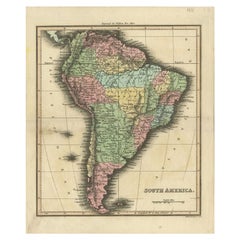
Antique Map of South America by Walker, 1816
By Thomas Kitchin
Located in Langweer, NL
Antique map titled 'South America'. Old map of South America. This map originates from 'Walker's Universal Atlas'. Artists and Engravers: Printed by Barnard and Farley. Artist: Pr...
Category

19th Century Antique Netherlands - Collectibles and Curiosities

Materials

Paper

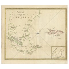
Antique Map of South America by J. Cook, 1775
Located in Langweer, NL
Antique map titled 'Kaart van het Zuidlyk Eind van Amerika'. Map of the sourthern part of South America, focusing on Cook's tracks around the Cape Horn and T...
Category

Mid-18th Century Antique Netherlands - Collectibles and Curiosities

Materials

Paper

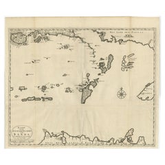
Original Antique Map Southeast of the Banda or Spice Islands, Indonesia, 1726
Located in Langweer, NL
Antique map titled 'Kaart van de Zuyd-Ooster Eylanden van Banda'. Map of the southeastern part of the Banda islands. This map originates from 'Oud en Nieuw Oost-Indiën' by F. Valen...
Category

1720s Antique Netherlands - Collectibles and Curiosities

Materials

Paper

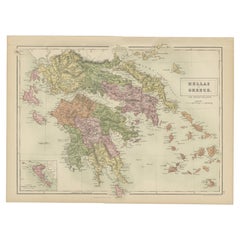
Antique Map of Greece and Ionian Islands by A & C. Black, 1870
Located in Langweer, NL
Antique map titled 'Hellas or Greece'. Original antique map of Greece and Ionian Islands with inset map of Corfu. This map originates from ‘Black's General Atlas of The World’. Publi...
Category

Late 19th Century Antique Netherlands - Collectibles and Curiosities

Materials

Paper

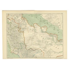
Antique Map of the East Coast of Sumatra , Indonesia, 1900
Located in Langweer, NL
Antique map of the East Coast of Sumatra. Also depicting the Strait of Malacca. This map originates from 'Atlas van Nederlandsch Oost- en West-Indië' by I. Dornseiffen. Artists and...
Category

20th Century Netherlands - Collectibles and Curiosities

Materials

Paper

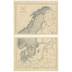
Antique Map of Sweden and Norway by Lowry, '1852'
Located in Langweer, NL
Antique map titled 'Sweden and Norway'. Two individual sheets of Sweden and Norway. This map originates from 'Lowry's Table Atlas constructed and engraved from the most recent Author...
Category

Mid-19th Century Antique Netherlands - Collectibles and Curiosities

Materials

Paper

Antique Map of Canada by Johnston '1909'
Located in Langweer, NL
Antique map titled 'Dominion of Canada'. Original antique map of Canada. This map originates from the ‘Royal Atlas of Modern Geography’. Publishe...
Category

Early 20th Century Netherlands - Collectibles and Curiosities

Materials

Paper

Antique Map of Western and Eastern Barbary in Africa, c.1744
Located in Langweer, NL
Antique map titled 'A New & Accurate Map of the Western Parts of Barbary' and 'A New & Accurate Map of the Eastern Parts of Barbary'. Decorative maps of North Africa and the Southern...
Category

18th Century Antique Netherlands - Collectibles and Curiosities

Materials

Paper

Antique Map of Asia Minor by Malte-Brun, 1847
Located in Langweer, NL
Antique map titled 'Asie Mineure Ancienne'. This is an original antique map of Asia Minor from Malte Brun's "" Atlas de Géographie Universelle"", revised by...
Category

19th Century Antique Netherlands - Collectibles and Curiosities

Materials

Paper

Old Map Focusing on the Wine Region of Metz, the Moselle Region of France, 1657
Located in Langweer, NL
Antique map of France titled 'Territorium Metense'. Old map focusing on the wine region surrounding Metz, in the Moselle region of France. This map originates from 'Atlas Novus, ...
Category

1650s Antique Netherlands - Collectibles and Curiosities

Materials

Paper

Map of Denmark, Norway & Iceland: Early 19th Century from the 1802 Tardieu Atlas
Located in Langweer, NL
Antique Map Description Title: Royaume de Danemarck: Première Carte. Danemarck, Norwege et Islande Publication Details: - **Atlas Title:** Nouvel Atlas Universel de Géographie Anc...
Category

Early 1800s Antique Netherlands - Collectibles and Curiosities

Materials

Paper

Beautiful Antique Map of the Moluccas or Spice Islands, Indonesia, ca.1650
Located in Langweer, NL
Antique map titled 'Insularum Moluccarum Nova Descriptio.' Beautiful map of the Moluccas. The famous Spice Islands, the cornerstone of the Dutc...
Category

1650s Antique Netherlands - Collectibles and Curiosities

Materials

Paper

Original Antique Map of the City of Stavoren, Friesland, The Netherlands, 1649
Located in Langweer, NL
Antique map titled 'Staveren'. Original antique map of the city of Stavoren, Friesland, The Netherlands. This map originates from 'Toonneel der Steden van de Vereenighde Nederlanden'...
Category

1640s Antique Netherlands - Collectibles and Curiosities

Materials

Paper

Antique Print of 'Madonna and Child with Angels' Made after Botticelli 'c.1890'
Located in Langweer, NL
Antique print titled 'Madonna and Child with Angels'. Original antique print on chine collé, made after the painting by Botticelli. Source unknown, to be determined. Published circa ...
Category

Late 19th Century Antique Netherlands - Collectibles and Curiosities

Materials

Paper

Rare Fish Print of the Norway Redfish 'Sebastes Viviparus' and the Sculpin, 1842
Located in Langweer, NL
Antique print, titled: 'Poissons Plate 9 - La Sebaste du Nord (Sebastes septentrionalis) - Le Cotte Scorpion (Cottus scorpius).' - This rare plate shows the Norway redfish (Sebastes ...
Category

1840s Antique Netherlands - Collectibles and Curiosities

Materials

Paper

Antique Map of Lower Egypt, Showing Port Said, Suez and Surroundings, 1922
Located in Langweer, NL
Antique map of Africa titled 'Lower Egypt '. Old map of Africa depicting Egypt, Port Said, Suez and surroundings. This map originates from 'The Times' atla...
Category

20th Century Netherlands - Collectibles and Curiosities

Materials

Paper

Detailed Map of Southern Holland, Incl the Hague, Rotterdam, Delft, Gouda, c1680
Located in Langweer, NL
Antique map titled 'Delflandia, Schielandia et circumjacentes Insulae ut Voorna, Overflackea, Goerea, Yselmonda et aliae.' Detailed map of Southern Holland, which includes the ci...
Category

1680s Antique Netherlands - Collectibles and Curiosities

Materials

Paper

Antique Map of Germany by Hederichs 'circa 1740'
Located in Langweer, NL
Antique map titled 'Germania'. Rare miniature map of Germany and surroundings. This map covers the entirety of those lands traditionally occupied by Germanic peoples, from the Blatic...
Category

Mid-18th Century Antique Netherlands - Collectibles and Curiosities

Materials

Paper

Antique Map of the City of Rotterdam by Guicciardini, C.1600
Located in Langweer, NL
Antique map titled 'Rotterdam'. Bird's eye view plan of Rotterdam in the province of Zuid-Holland, The Netherlands, Holland. This map originates from one of the editions of 'Discritt...
Category

17th Century Antique Netherlands - Collectibles and Curiosities

Materials

Paper

Antique Map of Upper Saxony in Germany by Tirion, circa 1740
By Isaak Tirion
Located in Langweer, NL
Antique map titled 'Nieuwe Kaart van de Opper Saxise Kreits (..).' Attractive detailed map showing Upper Saxony, Germany with Meissen, Thuringen, Anhalt, Brandenburg, Pommeren etc. S...
Category

18th Century Antique Netherlands - Collectibles and Curiosities

Materials

Paper

Antique Map of Eaton 'Ohio' by Titus, 1871
Located in Langweer, NL
Antique map titled 'Eaton'. Original antique map of Eaton, Ohio. This map originates from 'Atlas of Preble County Ohio' by C.O. Titus. Published 1871.
Category

Late 19th Century Antique Netherlands - Collectibles and Curiosities

Materials

Paper

Old Print of the Sand Dollar and Other Sea Urchins, c.1829
Located in Langweer, NL
Antique print titled '1. Echinus verticillatus 2. Echinoneus semilunaris (..)'. Old print of the sand dollar and other sea urchins. This print originates from 'Iconographie du rè...
Category

1820s Antique Netherlands - Collectibles and Curiosities

Materials

Paper

Original Antique Print of Ice Fishing, Published, circa 1900
Located in Langweer, NL
Antique print titled 'Hechtfang im Winter'. Original antique print of ice fishing. Published circa 1900. Artists and Engravers: Anonymous. Condition:...
Category

Early 1900s Antique Netherlands - Collectibles and Curiosities

Materials

Paper

Antique Map of Germany by Balbi '1847'
Located in Langweer, NL
Antique map titled 'Allemagne'. Original antique map of Germany. This map originates from 'Abrégé de Géographie (..)' by Adrien Balbi. Published...
Category

Mid-19th Century Antique Netherlands - Collectibles and Curiosities

Materials

Paper

Reference Book Chinese Art - Chinese Art Hardcover, 1961
Located in Amsterdam, Noord Holland
Bronzes, pottery, porcelain, ivories, jades, sculpture and paintings-all these mediums of the Chinese creative genius are presented in this volume in full color. Rarely has such a co...
Category

20th Century Netherlands - Collectibles and Curiosities

Materials

Paper

Antique Map of the United Kingdom and Ireland, circa 1825
Located in Langweer, NL
Antique map titled 'Insula Britannicae'. Old map of the United Kingdom and Ireland originating from 'Atlas der Oude Wereld'. Artists and Engravers: Published by C. Ph. Funke and W. v...
Category

19th Century Antique Netherlands - Collectibles and Curiosities

Materials

Paper

Antique Hand-Colored Print of the Common Hazel, 1758
Located in Langweer, NL
Antique print of the common hazel. Originates from 'Pomologia' by J. H. Knoop. Artists and Engravers: Published by Johann Hermann Knoop (c.1700-1769). Condition: Good, general ...
Category

18th Century Antique Netherlands - Collectibles and Curiosities

Materials

Paper

Antique Map of Africa with Mountain Ranges and other details
Located in Langweer, NL
Antique map titled 'Carte générale et Politique de l'Afrique'. Original antique map of Africa. Highlights numerous mountain ranges, lakes and rivers, regions, countries and places. P...
Category

Late 18th Century Antique Netherlands - Collectibles and Curiosities

Materials

Paper

Antique Print of 'Madonna Addolorata and Ecce Homo' Made after Luini 'c.1890'
Located in Langweer, NL
Antique print titled 'Madonna Addolorata and Ecce Homo'. Original antique print on chine collé, made after the painting by Luini. Source unknown, to be determined. Published circa 1890.
Category

Late 19th Century Antique Netherlands - Collectibles and Curiosities

Materials

Paper

Salmon Fly Fishing Reel cabinet coattail
Located in DE MEERN, UT
Dutch reel cabinet! On the waterfront, the place where fishermen meet, fish together, admire each other's fishing tackle, and drink a good glass of whiskey with each other. This cabi...
Category

2010s Dutch Arts and Crafts Netherlands - Collectibles and Curiosities

Materials

Platinum

Map of England and Surrounding Regions: Early 19th Century - 1802 Tardieu Atlas
Located in Langweer, NL
Title: Isles Britanniques. Troisieme Carte, Angleterre Publication Details: - **Atlas Title:** Nouvel Atlas Universel de Géographie Ancienne et Moderne - **Purpose:** For the Nouve...
Category

Early 1800s Antique Netherlands - Collectibles and Curiosities

Materials

Paper

Original Antique Engraved Map of the Russian Empire, 1778
Located in Langweer, NL
Description: Antique map titled 'A New and Correct Map of the Russian Empire'. Original antique map of the Russian Empire. This map originates from Moore's 'New and Complete Coll...
Category

1770s Antique Netherlands - Collectibles and Curiosities

Materials

Paper

Antique Engraving of the Islands Wanooa, Wateeoo, Mangeea, Toobouai, Cook, 1803
Located in Langweer, NL
Antique map South Pacific Islands, Polynesia. Originates from 'Reizen Rondom de Waereld door James Cook (..)'. Artists and Engravers: Translated by J.D. Pasteur. Published by Hon...
Category

19th Century Antique Netherlands - Collectibles and Curiosities

Materials

Paper

Detailed Antique Map of Southeast England, incl Warwickshire and Hampshire, 1690
Located in Langweer, NL
Antique map titled 'Orientalior districtus Regni Angliae (..)'. Detailed map of southeast England encompassing the country from Lincolnshire and the Wash south and including Warw...
Category

1690s Antique Netherlands - Collectibles and Curiosities

Materials

Paper

Pl. XXVIII Ecuries, Chabat, c.1900
Located in Langweer, NL
Antique print titled 'Ecuries (Boulevard Beauséjour) Mr. Pierre Chabat Architecte'. This print depicts the design of buildings in France. Originates from 'La Brique et La Terre Cuite...
Category

20th Century Netherlands - Collectibles and Curiosities

Materials

Paper

Antique Map of Great Britain and Ireland by Brion de la Tour, 1766
Located in Langweer, NL
Antique map titled 'Les Isles Britanniques (..).' Attractive map of Great Britain surrounded by an engraved border printed from a separate coppe...
Category

18th Century Antique Netherlands - Collectibles and Curiosities

Materials

Paper

Bird’s-Eye View Map of Gallipoli: Fortified Ionian Gem by Mattheus Merian, 1688
Located in Langweer, NL
Bird’s-Eye View Map of Gallipoli: Fortified Ionian Gem by Mattheus Merian Description: This exquisitely detailed map of Gallipoli, crafted by the renowned engraver Mattheus Merian,...
Category

1680s German Antique Netherlands - Collectibles and Curiosities

Materials

Paper

Antique Map of South East Asia, Australia and the Indian Ocean, 1726
By F. Valentijn
Located in Langweer, NL
Antique map titled 'Tabula Indiae Orientalis'. Beautiful detailed map of Australia, Southeast Asia and the Indian Ocean. The map features a fine depiction of the outlines of the western two-thirds of Australia, based on the discoveries of explorers working for the Dutch East India Company (the VOC). These include Willem Jansz's discoveries in the Gulf of Carpentaria in 1606; the encounters of Dirk...
Category

Mid-18th Century Dutch Antique Netherlands - Collectibles and Curiosities

Materials

Paper

Attractive Detailed Authentic Map Showing Bavaria, Germany and Austria, c.1740
Located in Langweer, NL
Antique map titled 'Nieuwe Kaart van de Beyersche en Oostenryksche Kreits (..).' Attractive detailed map showing Bavaria, Germany and Austria. Source unknown, to be determined. Ar...
Category

18th Century Antique Netherlands - Collectibles and Curiosities

Materials

Paper

Antique Map of Germany with the Empire of Austria by Wyld '1845'
Located in Langweer, NL
Antique map titled 'The Confederated States of Germany with the Empire of Austria, and The Kingdoms of Prussia and Poland'. Original antique map of ...
Category

Mid-19th Century Antique Netherlands - Collectibles and Curiosities

Materials

Paper

Cricket by W.G. Grace '1891'
Located in Langweer, NL
'Cricket' by W.G. Grace. Bristol/ London, J.W. Arrowsmith etc., 1891, VIII,489p., woodengr. frontisp., ills., orig. cl.
Category

Late 19th Century Antique Netherlands - Collectibles and Curiosities

Materials

Paper

Cricket by W.G. Grace '1891'
$190 Sale Price
20% Off
Antique Print of a Member of the Jesuati or Jesuates Order, Siena, 1845
Located in Langweer, NL
Antique print titled 'Religieux Jesuate'. Print of a member of the Jesuati Order. This print originates from 'Histoire et Costumes des Ordres Religieux'. The Jesuati (Jesuates) we...
Category

19th Century Antique Netherlands - Collectibles and Curiosities

Materials

Paper

Antique Map of Buru Island, Indonesia, c.1725
Located in Langweer, NL
Antique map titled 'Boero'. Original antique map of Buru island. With an inset of the lake on top of the inland mountain. This map originates from Valentyn's 'Oud en Nieuw Oost Indie...
Category

18th Century Antique Netherlands - Collectibles and Curiosities

Materials

Paper

Antique Religion Print of King David, Having Subdued Syria, C.1850
Located in Langweer, NL
Large antique print with two religious engravings. The upper image depicts King David, having subdued Syria. The lower image depicts King David watching Batsheba bathing. This print originates from a work illustrating the complete series of Vatican frescos painted...
Category

19th Century Antique Netherlands - Collectibles and Curiosities

Materials

Paper

Rare Map of the Philippines; Joseph Freewills Island & Mindanao South End, 1773
Located in Langweer, NL
Three charts on one sheet titled '1) A Dangerous Shoal 2) Joseph Freewills Island 3) The South End of Mindanao'. It shows Captain Carteret's voyage: Saint George's Channel to Min...
Category

1770s Antique Netherlands - Collectibles and Curiosities

Materials

Paper

Black Sea & Eastern Mediterranean Map: Eastern Roman Empire, Tardieu Atlas, 1802
Located in Langweer, NL
Antique Map with Title: "Partie Orientale de l'Empire Romain ou du Monde connu des Anciens" Publication Details: - **Atlas Title:** Nouvel Atlas Universel de Géographie Ancienne e...
Category

Early 1800s Antique Netherlands - Collectibles and Curiosities

Materials

Paper

PIERRE BOULEZ, Bronze relief medallion by H.G. Adam, 1967
Located in Delft, NL
PIERRE BOULEZ, Bronze relief medallion by H.G. Adam, 1967 Obverse: Portrait of the French composer. Reverse: signed by Henri Georges Adam (right be...
Category

20th Century French Netherlands - Collectibles and Curiosities

Materials

Bronze

Antique Map of Vienne 'France' by V. Levasseur, 1854
By Victor Levasseur
Located in Langweer, NL
Antique map titled 'Dépt. de la Vienne'. Decorative antique map of the French Department of Vienne, with its capital of Poitiers and small engraved vignette of the battle of Poitiers...
Category

Mid-19th Century Antique Netherlands - Collectibles and Curiosities

Materials

Paper

Original Antique Engraving of the Creation of the World According to Mozes, 1725
Located in Langweer, NL
Antique map titled 'De Schepping der Wereldt volgens de Beschryving van Mozes' - This plate shows the creation of the world according to Moses. The upper depiction shows the world wi...
Category

18th Century Antique Netherlands - Collectibles and Curiosities

Materials

Paper

Guadeloupe and Dependencies: Mid-19th Century Map from France Pittoresque Series
Located in Langweer, NL
This map titled "Guadeloupe et Dépendances" is part of the France Pittoresque series and provides a detailed view of the island of Guadeloupe and its surrounding dependencies. Features: - The map shows the two main landmasses of Guadeloupe: Basse-Terre and Grande-Terre, separated by a narrow channel. - Several smaller islands, including Marie-Galante, Les Saintes, and La Désirade, are also depicted. - The main cities, towns, and geographical features are labeled, with emphasis on the island's mountain ranges and rivers, particularly on Basse-Terre. - An inset at the bottom right provides a detailed plan of Pointe-à-Pitre, a major city and port on the island. The grid layout of the streets is clearly shown, reflecting urban planning of the time. Artistic and Cartographic Details: - The map uses clear linework to differentiate between the different islands and the sea, with significant natural features such as mountains and rivers carefully depicted. - The map was drawn by Monin and engraved by Jacqueline and Barrière, whose names appear in the lower right corner. - The scale in the lower left corner is measured in leagues, showing distances both by land and sea. Historical Context: - This map likely dates to the mid-19th century, a period when Guadeloupe was a key French colony in the Caribbean. Guadeloupe was known for its sugar and coffee plantations, which played a significant role in France's colonial economy. - Maps like this were often used for administrative, military, and educational purposes to give a comprehensive view of France's overseas territories. The map of Guadeloupe et Dépendances from the France Pittoresque series likely dates to the mid-19th century, around 1840 to 1860. This period corresponds to the height of French colonial influence in Guadeloupe, and the map's style, detailed urban planning, and cartographic techniques are consistent with maps produced in that era. The specific publication date could be further narrowed down if the map was part of a known edition of the France Pittoresque atlas, but based on the cartographic style and historical context, 1840–1860 is a reasonable estimate. Here are some relevant keywords people might use when searching for a map of Guadeloupe and its surrounding areas: 1. Guadeloupe map 2. Basse-Terre and Grande-Terre map 3. French Caribbean islands map...
Category

1850s Antique Netherlands - Collectibles and Curiosities

Materials

Paper

19th Century Agate spinner watch key and wax seal stamp
Located in Delft, NL
19th Century Agate spinner watch key and wax seal stamp A 19th Century pocket watch key with Agate. The center is hinged to enable the inlaid cut Aga...
Category

Early 19th Century European Antique Netherlands - Collectibles and Curiosities

Materials

Agate, Brass

Original Antique Map of England and Wales, with Decorative Cartouche
Located in Langweer, NL
Antique map titled 'England and Wales from the best Authorities'. Original antique map of England and Wales, with decorative cartouche. Engraved by T. Conder. Published circa 1790.
Category

Late 18th Century Antique Netherlands - Collectibles and Curiosities

Materials

Paper

Jaime Hayon Designer Toys — Set of 4 Unique Hand-Decorated “Onion” Figures
By Jaime Hayon
Located in Weesp, NL
An exceptionally rare collector’s set of four unique “Fuck the Human Race” vinyl figures, hand-decorated by acclaimed Spanish designer Jaime Hayon during the 2004 ToyCon in Hong Kong...
Category

Early 2000s Spanish Modern Netherlands - Collectibles and Curiosities

Materials

Plastic

Original Hand-Colored Antique County Map of Durham, England, 1804
Located in Langweer, NL
Antique county map of Durham first published c.1800. Villages, towns, and cities illustrated include Gateshead, South Shields, and Darlington. C...
Category

Early 1800s Antique Netherlands - Collectibles and Curiosities

Materials

Paper

Antique Map of Sweden and Norway by Johnston, 1882
Located in Langweer, NL
Antique map titled 'Sweden & Norway (Scandinavia)'. Old map of Sweden and Norway, with inset map of Stockholm. This map originates from 'The Royal Atlas ...
Category

19th Century Antique Netherlands - Collectibles and Curiosities

Materials

Paper

Antique Plan of the Siege of Grave by Guicciardini, c.1608
Located in Langweer, NL
Antique map titled 'Hic est situs oppidi Grauiae (..)'. Bird's eye view plan of Grave, The Netherlands, Holland. Showing the siege of Grave in the year 1602. Source unknown, to be de...
Category

17th Century Antique Netherlands - Collectibles and Curiosities

Materials

Paper

Large Scale Map of Greece with Inset Map of Macedonia, c.1786
Located in Langweer, NL
Antique map titled 'Graeciae Antiquae'. Large scale map of Greece, extends south to the island of Cythera. Inset map shows details of Macedonia. Publis...
Category

18th Century Antique Netherlands - Collectibles and Curiosities

Materials

Paper

Old Bird's Eye View of the European Trading Posts at Sabi, Benin, Africa, 1748
Located in Langweer, NL
Antique print titled 'Vue des comtoirs Europeins de Xavier ou Sabi (..) - Gezigt der Europese Faktooryen, te Xavier of Sabi (..)'. Bird's eye view of the European trading posts a...
Category

1740s Antique Netherlands - Collectibles and Curiosities

Materials

Paper

Pl. 494 Antique Print of Ship Structures by Archibald, c.1810
Located in Langweer, NL
Antique print titled 'Plate CCCCXCIV Ship-Building'. Old print depicting various ship building structures. This print originates from 'Encyclopedia Britannica'. Artists and Engravers...
Category

19th Century Antique Netherlands - Collectibles and Curiosities

Materials

Paper

Antique Map of Lower Silesia of The Famous Mapmaker Blaeu, c.1650
Located in Langweer, NL
Antique map titled 'Ducatus Silesiae Wolanus'. \ Antique map depicting lower Silesia with the cities of Wolow (Wohlau), Winsko (Winzig), Herrnstadt, Chobie (Koben), Lubin (Lüben), R...
Category

17th Century Antique Netherlands - Collectibles and Curiosities

Materials

Paper

Read More

Medal-Worthy Memorabilia from Epic Past Olympic Games

Get into the games! These items celebrate the events, athletes, host countries and sporting spirit.

Ahoy! You’ve Never Seen a Collection of Sailor Art and Kitsch Quite Like This

French trendsetter and serial collector Daniel Rozensztroch tells us about his obsession with objects related to seafaring men.

Pamela Shamshiri Shares the Secrets behind Her First-Ever Book and Its Effortlessly Cool Interiors

The sought-after designer worked with the team at Hoffman Creative to produce a monograph that beautifully showcases some of Studio Shamshiri's most inspiring projects.

Moroccan Artworks and Objects Take Center Stage in an Extraordinary Villa in Tangier

Italian writer and collector Umberto Pasti opens the doors to his remarkable cave of wonders in North Africa.

Montecito Has Drawn Royalty and Celebrities, and These Homes Are Proof of Its Allure

Hollywood A-listers, ex-pat aristocrats and art collectors and style setters of all stripes appreciate the allure of the coastal California hamlet — much on our minds after recent winter floods.

Whaam! Blam! Pow! — a New Book on Pop Art Packs a Punch

Publishing house Assouline and writer Julie Belcove have teamed up to trace the history of the genre, from Roy Lichtenstein, Andy Warhol and Yayoi Kusama to Mickalene Thomas and Jeff Koons.

What Makes a Gem-Encrusted Chess Set Worth $4 Million?

The world’s most opulent chess set, weighing in at 513 carats, is literally fit for a king and queen.

Tauba Auerbach’s Geometric Pop-Up Book Is Mighty Rare, Thanks to a Hurricane

This sculptural art book has an epic backstory of its own.
Recently Viewed

View All