Collectibles and Curiosities on Sale

to
5,466
1,382
6,859
43
41
356
168
91
80
68
50
41
40
35
26
24
17
15
10
8
7
5
4
2,707
2,345
1,807
84
540
705
284
112
30
79
124
70
150
129
89
64
29
4,942
1,195
604
283
237
1,287
501
453
279
261
6,943
6,939
6,939
104
55
21
18
13
Sale Items
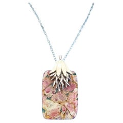
Vintage Pendant Necklace with Semiprecious Stone Pink, Tan, Cream, Mauve, Clear
Located in Warrenton, OR
Vintage Pendant Necklace with Semiprecious Stone Pink, Tan, Cream, Mauve, Clear, Silvertone This is a unique, beautiful pendant! On a silvertone chain. IMPORTANT INFORMATION FOLLOW...
Category

Mid-20th Century Unknown Mid-Century Modern Collectible Jewelry

Materials

Stone, Metal

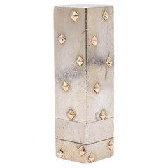
MARCIN PARIS 1930 By Frontin Lipstick Case Holder In Sterling & 18Kt Gold
Located in Miami, FL
A lipstick case designed by Frontin for Marcin Paris. This an antique lipstick case created in Paris France during the art-deco period, back in 1930....
Category

Vintage 1930s French Art Deco Historical Memorabilia

Materials

Gold, Silver, Sterling Silver

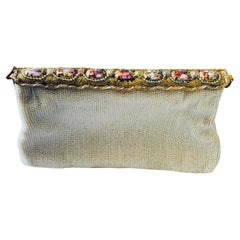
French Beaded Evening Handbag With Limoges Porcelain Cameos
Located in Guaynabo, PR
This is a French beaded evening’s handbag. It depicts a rectangular handbag body that has been hand stitched completely with tiny white pearly like bead glass. The work looks neatly done. At the upper top, there is a gold tone metal rectangular hinged lid/“door” with scalloped border adorned with gold and white glass beads that has been twisted and/or braided. Seven Limoges porcelain cameos...
Category

20th Century French Models and Miniatures

Materials

Metal

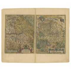
Map of the Region of Basel and Northern Switzerland by Ortelius, circa 1603
Located in Langweer, NL
Two original antique maps on one sheet titled 'Basiliensis Territorii Descriptio Nova [with] Circulus sive Liga Sueviae'. The first centers on Basel, Switzerland, located on the Rhine River...
Category

Antique Early 17th Century Maps

Materials

Paper

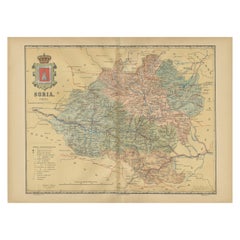
Map of Soria Province, 1901: Detailed Cartography of Northeastern Spain
Located in Langweer, NL
The map is a historical map of the province of Soria from 1901. A decorative coat of arms enhances the aesthetic of the map, signifying the historical and cultural significance of ...
Category

Antique Early 1900s Maps

Materials

Paper

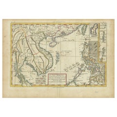
Bonne Map of Philippines, Formosa, Siam, Indochina & South China, 1780
Located in Langweer, NL
Bonne Map of Philippines, Formosa, Siam, Indochina & South China, 1780 Les Isles Philippines, celle de Formose, le Sud de la Chine, les Royaumes de Tunkin, de Cochinchine, de Cambog...
Category

Antique 1780s Maps

Materials

Paper

Decorative Original Antique Map of Valencia in Southern Spain, circa 1601
Located in Langweer, NL
This is an original antique map titled 'Valentiae Regni olim Contestanorum Si Ptolemaeo, Edentanorum Si Plinio Credimus Typus'. This is a historical map of the Kingdom of Valencia in...
Category

Antique Early 17th Century Maps

Materials

Paper

Ancient Cartography of the Indian Subcontinent, Published in 1880
Located in Langweer, NL
This map is titled "INDIA," and it provides a detailed view of the Indian subcontinent with various inset maps that offer additional historical and geographical context. The main ma...
Category

Antique 1880s Maps

Materials

Paper

DEYKIN & HARRISON 1930 Mechanical Cigarette Case Set In Solid .925 Sterling
By Deykin & Harrison
Located in Miami, FL
Mechanical cigarettes case set designed by Deykin & Harrison. This is a very interesting mechanical case, created in Birmingham England during the art deco period at the silversmith...
Category

Vintage 1930s English Art Deco Tobacco Accessories

Materials

Sterling Silver, Silver

A Tallis Map of British Guiana with Colonial Vignettes and Other Landmarks, 1851
Located in Langweer, NL
This Tallis map of British Guiana (now known as Guyana) is a richly decorated document, much like other maps from the esteemed cartographic publisher John Tallis & Company. The firm,...
Category

Antique 1850s Maps

Materials

Paper

Ancient Babylon with The Tower of Babel According to Herodotus & Kircherus, 1730
Located in Langweer, NL
Antique print titled 'Platte Grond van de Stad Babilon, volgens Herodotus en A. Kircherus'. This original antique print shows a view of ancient Babylon with the tower of Babel...
Category

Antique 1730s Maps

Materials

Paper

Antique Engraved Map of the Northern Part of Greece and the Aegean Sea, Ca.1730
Located in Langweer, NL
Title: "GRÆCIÆ PARS Septentrionalis". Hand Coloured Engraved map by G. Delisle of the northern part of the Aegean. In the top left corner a distance scale included. Condition...
Category

Antique 1730s Maps

Materials

Paper

1645 Blaeu Map of Westmorland, Northern England – Hand Colored, Decorative
Located in Langweer, NL
This map, "Westmoria Comitatus; Anglice Westmorland", was created by the esteemed Dutch cartographer Willem Blaeu and was published around 1645 in 'Le Theatre du Monde ou Nouvel Atlas'. It provides a detailed look at Westmorland, a historic county in northern England, based on John Speed’s earlier map. The map features numerous place names, parks, and estates, including Brigster Park, Colnhead Park, Crosbye, and Midleton, along with a detailed depiction of Windermere (spelled Wynandermere) and the surrounding regions. Additional Features: - Hand-colored map, with vibrant and detailed colors that bring out the topographical and decorative features. - Includes intricate cartouches, such as the royal coat of arms, a decorative title cartouche topped with putti (cherubic figures), and six coats of arms (two left blank). - Depicts the region’s rich landscape, including the rolling hills and mountainous terrain of northern England. - French text on the verso, indicative of the publication period from 1645-1648, part of Blaeu’s highly sought-after atlases. - Map shows precise details of small towns, estates, and parks, such as Brigster Park, Colnhead Park, Crosbye, and Wynandermere (now Windermere Lake). This map would be of particular interest to collectors of English county maps, antique maps of northern England, 17th-century cartography, and the decorative works of Willem Blaeu. Blaeu's maps are renowned for their accuracy, artistic beauty, and historical significance. Keywords: Willem Blaeu, Westmorland map, northern England, 17th-century map, antique map, English county map, John Speed, Windermere, decorative cartography, hand-colored map, rare map, antique cartography...
Category

Antique 1640s Dutch Maps

Materials

Paper

Original Antique Plan of the Fortress of Charedsch in Persia or Iran, ca.1780
Located in Langweer, NL
Antique map, titled: 'Plan de la Citadelle de la Ville de Charedsch.' Plan of the fortress of Charedsch, Iran / Persia. This original antique print originates from 'Reize naar Ar...
Category

Antique 1780s Maps

Materials

Paper

Early 20th Century Dutch Tin Charity Box
Located in New York, NY
Black, red, and gold painted tin charity box, The Netherlands, circa 1915. Used for collecting funds for the Jewish hospital. Decorated with Stars of ...
Category

Early 20th Century Dutch Decorative Boxes

Materials

Metal

Original Detailed Antique Map of Southern India and Most of Ceylon, 1744
Located in Langweer, NL
Antique map titled 'A Map of India on the west Side of the Ganges, comprehending the coasts of Malabar, Coromandel and the Island Ceylon'. Map of Southern India and most of Ceylo...
Category

Antique 1740s Maps

Materials

Paper

Antique German Shultz Marke Disk Player with Eight Disks C1890
Located in Big Flats, NY
***Reduced In-House Delivery Rates - Click on “Ask Seller” to Request a Quote*** Antique German Shultz Marke Disk Player With 8 Disks C1890 (10 3/8" x 19 1...
Category

Antique Late 19th Century Musical Instruments

Materials

Wood

Highly Detailed Antique Map of the Holy Land Showing 12 Tribes of Israel, c.1720
Located in Langweer, NL
Antique map titled 'Heylige Land verdeeld in de Twaalf Stammen Israels (..).' Highly detailed map of the Holy Land divided into 12 tribes of Israel...
Category

Antique 1720s Maps

Materials

Paper

Antique Map of Trincomalee and Tambalagam Bay, 1758
Located in Langweer, NL
Antique map titled 'Bay de Trinquemale'. Map of Trincomalee and Tambalagam Bay in Sri Lanka. While these maps by Van Schley after Bellin were initially made for 'Histoire Generale de...
Category

Antique 18th Century Maps

Materials

Paper

Early 19th Century Polish Silver Kiddus Goblet
Located in New York, NY
Handmade silver Kiddush goblet, Poland, circa 1820. Large upper portion engraved with curtain decoration, set on a knobbed stem with skirt decoration on a round stylized base. Clearl...
Category

Antique Early 19th Century Polish Religious Items

Materials

Silver

Old Map of the French Department of Ardèche, France
By Victor Levasseur
Located in Langweer, NL
Antique map titled 'Dépt. de l'Ardèche'. Map of the Department of Ardèche, France. This region is known for its fine wines, agriculture, distilled spirits, and cheese. The capital ci...
Category

Antique Mid-19th Century Maps

Materials

Paper

Rare and Interesting Small Antique Woodcut Map of the Mediterranean, 1568
Located in Langweer, NL
Very rare untitled antique woodcut map showing the region of the missionary journeys of Apostle Paul. It shows the Mediterranean with Greece, Asia Minor (Turkey), Northern Africa, So...
Category

Antique 16th Century Maps

Materials

Paper

PGA Golf Tournament Autographed Lithograph, Certified Sports Memorabilia
Located in Miami, FL
Autographed PGA Golf Tournament 1991 - Crooked Stick Golf Course that was held in Carmel, Indiana. Titled "The Cinderella Story". This lithograph is autographed by both the Legendary Golf Champion John Daly and pencil signed by the artist Donald Voorhees, Artist. Certified. The 1991 PGA Championship was the 73rd PGA Championship, held August 8–11 at Crooked Stick Golf Club in Carmel, Indiana, a suburb north of Indianapolis. John Daly won the first of his two major titles, three strokes ahead of runner-up Bruce Lietzke. Daly, age 25, was quite arguably the most unforeseen major champion in modern history. He was the ninth alternate who only qualified after several others pulled out of the tournament. Nick Price withdrew for the birth of his first child and Daly hired his caddy, Jeff "Squeaky" Medlin. Daly's outgoing personality and "grip it and rip it" style of play made him an instant fan favorite. The PGA Championship was his first tour victory. This wonderfully collectible lithograph would make a great gift. Donald Voorhees has been recognized from coast to coast for his outstanding contribution to art and is the recipient of over 100 awards from such prestigious organizations as the Hudson Valley Art Association, the Salmagundi Club of New York City and the New Jersey Water Color Society. He has been cited for his work by the State of New Jersey. The artist's works have been shown in museums throughout the country, including the Frye Museum, Seattle, Washington; the Edward Dean Museum, Cherry Valley, California; the Central Museum of Wyoming; and the Martello Museum, Key West, Florida. He has exhibited with the American Watercolor Society, Allied Artists, Knickerbocker Artists, New Jersey Water Color Society, Hudson Valley Art Association, Salgamundi Club, National Academy of Design, and the National Art Club. His works are owned by many banks, corporations and public institutions througout the country including Sun Oil, Gannett Publications, Citibank, Hertz, Pfizer Drug and Bethlehem Steel. Prints from his Americana Series hang in schools, government offices and the Freedom Foundation at Valley Forge. His painting "Beckoning Still" is in the collection of former President Reagan...
Category

Late 20th Century American Modern Sports Equipment and Memorabilia

Materials

Wood, Paper

Antique Map of the Bay of Bantam, c.1720
Located in Langweer, NL
Rare, untitled miniature map of the Bay of Bantam with various Islands including Pulo Dua and Pulo Batto. This map originates from a small travelogue and may originate from an editio...
Category

Antique 18th Century Maps

Materials

Paper

Antique Map of New Brunswick by W. G. Blackie, 1859
Located in Langweer, NL
Antique map titled 'New Brunswick, Nova Scotia, Prince Edward Island and Part of Canada east'. Original antique map of New Brunswick, Nova Scotia,...
Category

Antique Mid-19th Century Maps

Materials

Paper

1970s Steven Burr Buckled Leather California Hippie Hip Purse Bag
By Jack Boyd
Located in Hyattsville, MD
Steven Burr Buckle is 1.5 wide by 2 long. Strap to top of purse is 16 inches. Purse is 9 wide, 2.75 deep, and 7 inches high.
Category

Vintage 1970s American Mid-Century Modern Collectible Jewelry

Materials

Brass

1782 Map of the East Indies – India, Siam, Philippines, Java, Borneo, Ganges
Located in Langweer, NL
1782 Bayly Map of the East Indies – India, Siam, Philippines, Java, Borneo, Ganges This finely engraved and vibrantly hand-colored map titled 'A New Map of the East Indies' was dr...
Category

Antique 1780s Maps

Materials

Paper

Grand Tour Model of the Eiffel Tower, Now as a Lamp
Located in West Palm Beach, FL
Grand Tour model of the Eiffel Tower, now as a lamp, newly wired. The architectural model stands 30" high, 33" high to the top of the socket.
Category

Early 20th Century French Grand Tour Table Lamps

Materials

Wrought Iron

19th Century Sailboat Yacht Ships Ashtray Match Striker Manhattan Brass Co NYC
Located in Hyattsville, MD
A rare 19th Century Yachts Match-Striker Ashtray by the Manhattan Brass Company of New York City. Stamped M.B. Co. New York. The weight is 2 lbs 9...
Category

Antique 1880s American American Colonial Tobacco Accessories

Materials

Brass

Antique Map of the Netherlands and IJmuiden by Beekman & Schuiling, 1927
Located in Langweer, NL
Two maps on one sheet titled 'Nederland Landbouwkaart' and 'Nederland Groote Verkeerswegen'. With an inset map of the harbour of IJmuiden (The Netherlands). This map originates from ...
Category

20th Century Maps

Materials

Paper

Late 19th Century Russian Silver Torah Pointer
Located in New York, NY
Handmade silver Torah pointer, Russian Empire, circa 1896. The handle is made with a knob shape interval engraved with floral ornaments. The Hebrew name Zisel Dresler with the Jewish year 5673 is engraved on the lower part of the pointer. The reading end is shaped as a hand with a pointing index finger. Original chain is connected to suspension loop at the top of upper section of the pointer. Marked with Russian silver hallmarks...
Category

Antique 1890s Russian Religious Items

Materials

Silver

Brass Aspara Bell Sculpture
Located in New York, NY
A brass Aspara bell sculpture piece, circa 20th century, Asia.
Category

20th Century Asian Religious Items

Materials

Brass

Brass Aspara Bell Sculpture
$300 Sale Price
36% Off
Antique Map of Hindustan, or India
Located in Langweer, NL
Antique map titled 'Hindoostan, or India'. Original antique map of India (Hindustan) and Sri Lanka (Ceylon). Engraved by Russell. Published by Nuttall, Fisher & Co, 1814.
Category

Antique Early 19th Century Maps

Materials

Paper

Antique Map of Saxony and Westphalia by Scherer, 1699
Located in Langweer, NL
Antique map titled 'Saxonia et Westphalia varijs in locis sacris erga dei matre est officiosa & ipsa vicissim erga utramq. Munifica.' Detailed uncommon map of Saxony and Westphalia i...
Category

Antique 17th Century Maps

Materials

Paper

Vintage Mother Grimm Jointed Plush Teddy Bear 20thC
Located in Big Flats, NY
Vintage Mother Grimm Jointed Plush Teddy Bear 20thC Measures- None listed 22"h x 13"w x 11 1/2"d
Category

20th Century Toys and Dolls

Materials

Faux Fur

Antique Print of a Monk of the Alexians, 1845
Located in Langweer, NL
Antique print titled 'Alexien'. Print of a Monk of the Alexians. This print originates from 'Histoire et Costumes des Ordres Religieux'. Artists and Engravers: Author: Abbé Tiron....
Category

Antique 19th Century Prints

Materials

Paper

Antique Metal Japanese Tsuba Tosogu with Scholars Travelling in Landscape
Located in Amsterdam, Noord Holland
Nicely made Tsuba. The piece is unmarked. Dating to the Edo period Provenance: Collected in the 1920’s. Thence by decent A Tsuba is a Japanese sword mountings are the various housi...
Category

Antique 19th Century Edo Arms, Armor and Weapons

Materials

Bronze

Antique Print of the Dutch VOC Bombing Palembang, Sumatra (Indonesia), ca.1700
By Pieter Van Der Aa
Located in Langweer, NL
Antique print titled 'La Ville de Palimbang dans L’Ile de Sumatra.' A very decorative, impressive engraving of Palembang in Sumatra. Two views on one sheet. In the upper part the ove...
Category

Antique Early 18th Century Prints

Materials

Paper

Antique Map of Spain & Portugal 'Iberian Peninsula', Decorative Cartouche, c1755
Located in Langweer, NL
Antique map titled 'Spain and Portugal'. Small, detailed antique map of Spain and Portugal (Iberian Peninsula). Decorative title cartouche. Artists and Engravers: Thomas Jeff...
Category

Antique 1750s Maps

Materials

Paper

Kay Bojesen Painted Wooden Puzzle, 1950s
By Kay Bojesen
Located in Esbjerg, DK
Bought from the collection of Danish Design Museum in Randers Denmark (now closed) this large puzzle designed by Kay Bojesen reigns among his rarest designs. ...
Category

Vintage 1950s Dutch Mid-Century Modern Toys and Dolls

Materials

Beech

Old Map of Anatolia, part of modern-day Turkey, Armenia and Syria, 1745
Located in Langweer, NL
Title: "Kaartje van Natolie en Syrie opgesteld door de Hr. Lucas en de Hr. Guil de L'Isle en andere auteuren" The title "Kaartje van Natolie en Syrie opgesteld door de Hr. Lucas en...
Category

Antique 1740s Maps

Materials

Paper

A Glass & Tin Moroccan Charity Container, Fez 1920
Located in New York, NY
Antique glass and tin Moroccan Bikur Cholim charity container from Fez, circa 1920, is a fascinating artifact blending both cultural and historical sig...
Category

Vintage 1920s Religious Items

Materials

Tin

1950s Italian Angel Skin Coral Eight Strand Necklace 18kt Gold hand Carved Lock
Located in Haarlem, NL
Glamorous 1950s Midcentury statement piece choker necklace which features eight strands of light orange pink coral beads. This colour is also know as Angel Skin. The 4 strands of 4mm...
Category

Mid-20th Century Italian Collectible Jewelry

Materials

Gold

1667 Melchior Tavernier Map of the Patriarchate of Constantinople – Black Sea
Located in Langweer, NL
This 1667 map titled "Patriarchatus Constantinopolitani Geographica Descriptio" was crafted by renowned French cartographer Melchior Tavernier, who was a prominent map engraver during the 17th century. This rare and historically significant map focuses on the territories under the ecclesiastical jurisdiction of the Patriarchate of Constantinople, one of the most important centers of the Eastern Orthodox Church. It covers regions around the Black Sea (Pontus Euxinus), parts of Greece, and adjacent areas in Asia Minor and the Balkans, which were historically vital during the Byzantine and Ottoman Empires. The map is filled with ancient place names, making it a valuable resource for both historical and cartographic enthusiasts. Key Features: - Antique ecclesiastical map illustrating the influence of the Orthodox Patriarchate of Constantinople in the 17th century. - Features beautifully detailed ancient coastlines, rivers, and terrains, providing a comprehensive geographical view of the region. - Rich with historic place names - like Byzantium, Nicomedia, Nicaea, Cyzicus, Bithynia, Pontus, Macedonia, and Thrace - that date back to the classical era, offering insights into the ancient geography of the eastern Mediterranean. - A finely engraved strapwork cartouche in the lower right corner with Baroque-style decoration, featuring two putti (cherubic figures) – a hallmark of 17th-century map art. - The map extends to include the Mediterranean Sea (Mare Mediterraneum) to the south and the Black Sea to the north, highlighting its ecclesiastical and geopolitical significance. - Original hand coloring may still be present, enhancing the decorative appeal for collectors of antique maps. This rare map offers a unique perspective on the religious influence and historical geography of the Eastern Mediterranean during the late 17th century. It would appeal to collectors interested in: - **Byzantine history** - **Ottoman Empire** - **Eastern Orthodox Church** - **Antique cartography...
Category

Antique 1660s French Maps

Materials

Paper

Attractive Detailed Map of the Empire of the Great Mogul, Incl India, 1731
Located in Langweer, NL
Antique map titled 'Nieuwe Kaart van t Keyzer Ryk Grooten Mogol.' Attractive detailed map of the Empire of the Great Mogul, which included India, Sri Lanka, Pakistan and Banglade...
Category

Antique 1730s Maps

Materials

Paper

Optical View Depicting the Siege of Barcelona, Spain, ca.1765
Located in Langweer, NL
Antique print Barcelona titled 'Aggressio et Circumunitio in via cooperta'. Optical view depicting the siege of Barcelona (Spain) which took place between 25 July 1713 and 11 September 1714. With Latin, French, Italian and German caption. Artists and Engravers: Georg Balthasar Probst (1732 - 1801) was a German artist, engraver and publisher in Augsburg. The Siege of Barcelona (Catalan: Setge de Barcelona) was a battle at the end of the War of Spanish Succession, which pitted Archduke Charles of Austria (backed by Great Britain and the Netherlands, i.e. the Grand Alliance) against Philip V of Spain, backed by France in a contest for the Spanish crown. The surrender of the pro-Archduke forces to the Franco-Spanish army in 1714 was not only the end of the war, but also a phase in the centralization of various monarchies on the European continent which had been going on for two centuries. With the War of the Spanish Succession completed, Spain evolved from a personal union of different states to a centralized kingdom. The defenders of the city were buried in a cemetery, now a plaça (Catalan: square) called Fossar de les Moreres, where Catalans gather every 11 September, known as the National Day of Catalonia or la Diada. The former market hall Mercat del Born covers archaeological ruins which were part of the La Ribera district of Barcelona that was demolished after the defeat of Catalonia in 1714. The alleged abandonment of the Catalans defenders of Barcelona was one of the criticisms made by his opponents during the British Parliament...
Category

Antique 1760s Prints

Materials

Paper

Vintage Red Long Amber Necklace, 1960
Located in Oirlo, LI
Do you also want to wear something nice and especially something that others don't have, this might be something for you. These beads have a beautiful red color. This is an amber ...
Category

Vintage 1960s Baltic Collectible Jewelry

Materials

Multi-gemstone

1584 Ortelius Map of Switzerland: A Cartographic Reversal
Located in Langweer, NL
This is a fine example of Ortelius' map of Switzerland from his *Theatrum Orbis Terrarum*, recognized as the first modern atlas of the world. The map is oriented with south at the top, which reverses the typical north-up orientation seen in most modern maps. It highlights significant geographical features such as Lake Geneva (Lemanus Lacus) to the right of the map and the Rhine river entering Switzerland near the center. The *Theatrum Orbis Terrarum*, first published in 1570 by Abraham Ortelius in Antwerp, was groundbreaking as it compiled uniform maps with supporting text in a single volume, marking a departure from earlier collections of maps that were custom-assembled on demand. This atlas included a wealth of sixteenth-century cartographic knowledge, reflecting the extensive global explorations occurring after the discovery of America...
Category

Antique 16th Century Maps

Materials

Paper

Early 20th Century Argentinian Silver and Gold Torah Crown
Located in New York, NY
Silver and gold Torah crown, Buenos Aires, Argentina, 1925. On silver base decorated with a small gold Stars of David. The lower ribs decorated with applie...
Category

Vintage 1920s Argentine Religious Items

Materials

Silver, Gold

Map of Spain & Portugal Incl. the islands of Ibiza, Minorque & Majorque, 1780
Located in Langweer, NL
Antique map titled 'Les Royaumes d'Espagne et de Portugal.' Map of Spain and Portugal. Includes the islands of Ibiza, Minorque, and Majorque. Shows towns, rivers, some topographi...
Category

Antique 1780s Maps

Materials

Paper

Teledyne Ryan Firebee II Drone Contractor's Desk Model
Located in San Diego, CA
A very cool and extremely rare Teledyne Ryan Firebee II contractor's desk model, circa 1970s. The piece is in very good condition and super high quality. It is made of wood and mount...
Category

Late 20th Century American Models and Miniatures

Materials

Stainless Steel

Antique Print of Liège / Luik in Belgium by Braun & Hogenberg, 1575
Located in Langweer, NL
Antique print titled 'Leodium'. View of Liège / Luik, Belgium with surrounding hills and the city wall. With text explaining the origins of Liège, a cartouche expressing thanks to th...
Category

Antique 16th Century Prints

Materials

Paper

Old Print of the Town Hall of Batavia 'Jakarta' in the Dutch East Indies, 1770
Located in Langweer, NL
Antique optical print titled 'Prospect des Rathhauses in Batavia (..)'. View of the town hall of Batavia, Indonesia. This is an optical print, also cal...
Category

Antique 18th Century Prints

Materials

Paper

Vintage Danish Gold Ring with Pink Sapphire by Hermann Siersbol
By Hermann Siersbol
Located in Esbjerg, DK
14-carat ladies ring with pink sapphire cut in Baguette. It was made by the Danish silver and goldsmith Hermann Siersbol and dates from the late 1960s or early 1970s. It is hallmarked 585 for 14-carat gold and has the initials HS hand engraved to the inside. The ring weights 8 grams and measures 15/55 on a standard Swiss ring...
Category

Vintage 1960s Danish Mid-Century Modern Collectible Jewelry

Materials

Gold

1616 Bertius Map of Sumatra, Singapore and the Straits of Malacca
Located in Langweer, NL
Title: "1616 Bertius Map of Sumatra and the Straits of Malacca" Description: This is an exquisite 1616 original antique map by Petrus Bertius, titled "Sumatra Insula," showcasing Su...
Category

Antique Early 17th Century Maps

Materials

Paper

Rare Original Miniature Map of Papua New Guinea and the Salomon Islands, 1600
Located in Langweer, NL
Very handsome original old coloured copper engraving of Papua and the Solomon Island. Title of the map 'Descriptio Novae Guneae et Inss. Salom. On the reverse text in Latin. Ve...
Category

Antique Early 1600s Maps

Materials

Paper

JERRICAN Paris 1946 Licensed By Clodion Petrol-Can Pocket Lighter
By Clodion France
Located in Miami, FL
Jerrican petrol pocket lighter. This is a very unusual novelty Jerrican petrol pocket lighter created in Paris France and licensed by the brand of Clodion. The pocket lighter has be...
Category

Vintage 1940s French Mid-Century Modern Tobacco Accessories

Materials

Brass, Zinc

Antique Bird's Eye View of Scheveningen Near The Hague, the Netherlands, 1730
Located in Langweer, NL
Antique print titled 'Afbeeldinge van Schevelinge in den Jaare 1729'. Bird's eye view of Scheveningen near The Hague / Den Haag, the Netherlands. This print originates from 'Beschr...
Category

Antique 1730s Maps

Materials

Paper

Hibernia Regnum Map by Carel Allard, 1700: Hand-Colored Provinces of Ireland
Located in Langweer, NL
This is a historical map of Ireland created by Carel Allard around 1700, titled "Hibernia Regnum in Quatuor Provincias Ultoniam, Connaciam, Lageniam, et Momoniam". The map is hand-colored and engraved. It includes two large decorative cartouches. The map is part of an atlas by Carel Allard, an Amsterdam-based cartographer. Here are the detailed points about the map: Maker: Carel Allard - a prominent Dutch cartographer and publisher from Amsterdam. Atlas: Source Atlas - Likely part of an atlas published by Carel Allard, but specific title of the atlas isn't mentioned. Interesting Features 1. Decorative Cartouches: The map features two large, ornate cartouches. One in the upper left depicts a classical figure and British Royal arms...
Category

Antique Early 1700s Maps

Materials

Paper

Antique Engraved Map of Hungary and Transylvania or Romania, c.1710
Located in Langweer, NL
Antique map titled 'Hungary and Transilvania'. Original antique map of Hungary and Transylvania (modern day Romania), centered on Budapest. Artists and ...
Category

Antique 18th Century Maps

Materials

Paper

Read More

Medal-Worthy Memorabilia from Epic Past Olympic Games

Get into the games! These items celebrate the events, athletes, host countries and sporting spirit.

Ahoy! You’ve Never Seen a Collection of Sailor Art and Kitsch Quite Like This

French trendsetter and serial collector Daniel Rozensztroch tells us about his obsession with objects related to seafaring men.

Pamela Shamshiri Shares the Secrets behind Her First-Ever Book and Its Effortlessly Cool Interiors

The sought-after designer worked with the team at Hoffman Creative to produce a monograph that beautifully showcases some of Studio Shamshiri's most inspiring projects.

Moroccan Artworks and Objects Take Center Stage in an Extraordinary Villa in Tangier

Italian writer and collector Umberto Pasti opens the doors to his remarkable cave of wonders in North Africa.

Montecito Has Drawn Royalty and Celebrities, and These Homes Are Proof of Its Allure

Hollywood A-listers, ex-pat aristocrats and art collectors and style setters of all stripes appreciate the allure of the coastal California hamlet — much on our minds after recent winter floods.

Whaam! Blam! Pow! — a New Book on Pop Art Packs a Punch

Publishing house Assouline and writer Julie Belcove have teamed up to trace the history of the genre, from Roy Lichtenstein, Andy Warhol and Yayoi Kusama to Mickalene Thomas and Jeff Koons.

What Makes a Gem-Encrusted Chess Set Worth $4 Million?

The world’s most opulent chess set, weighing in at 513 carats, is literally fit for a king and queen.

Tauba Auerbach’s Geometric Pop-Up Book Is Mighty Rare, Thanks to a Hurricane

This sculptural art book has an epic backstory of its own.
Recently Viewed

View All