Collectibles and Curiosities on Sale

to
5,750
1,407
7,123
74
52
446
181
174
93
82
52
46
40
37
27
24
17
15
10
8
7
5
4
2,720
2,366
2,037
126
569
833
346
123
39
87
139
85
236
142
116
73
49
4,997
1,293
672
299
250
1,500
517
467
286
284
7,249
7,223
7,244
104
56
21
21
18
Sale Items
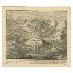
Antique Roman Battle Print of the Greater and Lesser Camp by Duncan, c.1753
Located in Langweer, NL
Antique battle map showing the greater and lesser camp. With detailed legend explaining the various elements of the print. This print most likely originates from an edition of 'The C...
Category

Antique 18th Century Prints

Materials

Paper

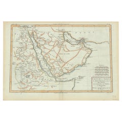
Old Map of the Arabian Peninsula with Parts of Egypt, Sudan, Eritrea & Ethiopia
Located in Langweer, NL
"Carte de l'Arabie, du Golfe Persique, et de la Mer Rouge, avec l'Egypte, la Nubie et l'Abissinie", Bonne, Rigobert Subject: Arabia Period: 1780 (circa) Publication: Atlas de Toutes...
Category

Antique 1780s Maps

Materials

Paper

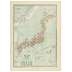
Antique Map of Japan, the Kurile Islands and Liu Kiu Islands, 1886
Located in Langweer, NL
The map is an exquisite piece, showcasing Japan's vibrant geography. Engraved by J. Bartholomew and published by George Philip & Son in London & Liverpool, it presents a detailed and...
Category

Antique Late 19th Century Maps

Materials

Paper

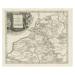
Original Antique Map of the Ancient Netherlands and Belgium, c.1750
Located in Langweer, NL
Description: Antique map titled 'Naauwkeurige Kaart van het Oude Nederland (..)'. Original antique map of the Netherlands and Belgium. This map originates from 'Vaderlandsche his...
Category

Antique 1750s Maps

Materials

Paper

Original Exhibition Catalog – Esculturas by María Simón, Sala Gaspar, 1979
Located in Barcelona, ES
Original Exhibition Catalog – Esculturas by María Simón, Sala Gaspar, 1979 Artist: María Simón Exhibition: Esculturas – Sala Gaspar, Barcelona Year: 1979 Language: Texts in Spani...
Category

Vintage 1970s Spanish Mid-Century Modern Books

Materials

Paper

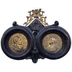
Italian 18th Century Gilt Bronze Reliefs Christ and Virgin Mary after Girardon
Located in Milano, MI
Pair of Gilt bronze reliefs of early 18th century, after François Girardon (1628-1715) The original model for these two profiles of the Virgin and Christ dates from 1691. These works...
Category

Antique Early 18th Century Italian Louis XIV Religious Items

Materials

Bronze

Old Handcolored Antique Map of Pays De Caux in Normandy, France, ca.1640
Located in Langweer, NL
Antique map titled 'Le Pais de Caux'. Old map of Pays de Caux, France. Pays de Caux is an area in Normandy occupying the greater part of the French département of Seine Maritime ...
Category

Antique 1640s Maps

Materials

Paper

Antique Map of the Bay of Bantam, c.1720
Located in Langweer, NL
Rare, untitled miniature map of the Bay of Bantam with various Islands including Pulo Dua and Pulo Batto. This map originates from a small travelogue and may originate from an editio...
Category

Antique 18th Century Maps

Materials

Paper

1720 Johann Baptist Homann Map of the Austrian Circle and Surrounding Regions
Located in Langweer, NL
"1720 Johann Baptist Homann Map of the Austrian Circle and Surrounding Regions" Description of the Map: This map, crafted by the renowned cartographer Johann Baptist Homann around...
Category

Antique 1720s Maps

Materials

Paper

French Gold Bubble Pendant Watch w/ Skeleton View by Avril w/ 14K Gold Chain
Located in Van Nuys, CA
This exquisite gold Avril Bubble Pendant Watch features a clear glass dome that showcases its intricate inner workings. The Saturn-like rings around the face ...
Category

Vintage 1950s French Collectible Jewelry

Materials

Gold

Copper-Engraved Map Showing the Algerian Coast of North Africa, Published 1683
Located in Langweer, NL
Antique map titled 'Partie de Barbarie, ou est le Royaume d'Alger (..)'. Copper-engraved map showing the Algerian coast of North Africa. Published 1683. Artists and Engravers:...
Category

Antique 1680s Maps

Materials

Paper

Physical & Political Map of Switzerland: Late 18th Century - Mentelle Atlas
Located in Langweer, NL
Antique Map with Title: 'Carte Physique et Politique de la Suisse' **Publication Details:** - **Atlas Title:** Nouvel Atlas Universel de Géographie Ancienne et Moderne - **Purpose:...
Category

Antique 1790s Maps

Materials

Paper

Antique Map of the Franconia Region by Scherer, 1699
Located in Langweer, NL
Antique map titled 'Franconia multa numerat loca deiparae sacra in quibus magna recipit à dei matre beneficia.' Detailed uncommon map of the Franconia region in Germany. Source unkno...
Category

Antique 17th Century Maps

Materials

Paper

Circa 1659 Johannes Blaeu Map: Ducatus Silesiae Ligniciensis, Legnica Region
Located in Langweer, NL
Circa 1659 Johannes Blaeu Map: Ducatus Silesiae Ligniciensis, Legnica Region This hand-colored map from circa 1659 by Johannes Blaeu, titled "Ducatus Silesiae Ligniciensis," depicts the region centered around Legnica (Lignitz) in southwestern Poland. It extends to include the cities of Lublin, Jawor, and Lwówek Śląski. The map features decorative elements such as a title cartouche adorned with a putto, garlands of fruit, and birds, and a distance scale cartouche that includes a hunter with his dogs. This map is dedicated to Georgius Rodulfus, the Duke of Silesia, by Ionas Scultetus, reflecting the map's historical context and noble patronage. It includes Spanish text on the verso, indicating publication between 1659 and 1672. Measuring 20.9 inches wide by 16.3 inches high, the map is in excellent condition with a sharp impression, full contemporary color, and a large watermark of the god Atlas. Minor details include a bit of printer's ink residue at the right and slight marginal soiling. Keywords: - Johannes Blaeu map - Silesia historical map - Legnica (Lignitz) map - 17th-century Poland map...
Category

Antique 1650s Maps

Materials

Paper

Old Map of the French Department of Ardèche, France
By Victor Levasseur
Located in Langweer, NL
Antique map titled 'Dépt. de l'Ardèche'. Map of the Department of Ardèche, France. This region is known for its fine wines, agriculture, distilled spirits, and cheese. The capital ci...
Category

Antique Mid-19th Century Maps

Materials

Paper

Antique Map of North America from an Old Dutch School Atlas, 1852
Located in Langweer, NL
Antique map titled 'Noord-Amerika'. Map of North America. This map originates from 'School-Atlas van alle deelen der Aarde' by Otto Petri. Artists and Engra...
Category

Antique 19th Century Maps

Materials

Paper

Antique Map of France in Ancient Roman Times, 1880
Located in Langweer, NL
Antique map titled 'Gaule indépendante et Romaine'. Old map of Gaul or France in ancient Roman times. The map covers from the southern part of England (Britannia) to the north of S...
Category

Antique 19th Century Maps

Materials

Paper

Antique Map of The United States Southern Section by A & C. Black, 1870
Located in Langweer, NL
Antique map titled 'United States Southern Section'. Original antique map of Map of The United States Southern Section. This map originates from ‘Black's General Atlas of The World’....
Category

Antique Late 19th Century Maps

Materials

Paper

18th Century Italian Antique Oil on Canvas Painting Saint Francesco Saverio
Located in Casale Monferrato, IT
Beautiful antique Italian oil painting on canvas. Excellent pictorial quality great attention to detail. Italian school of the 18th century. Not signed. A beautiful religious painting Saint Francesco...
Category

Antique 1750s Italian Paintings

Materials

Canvas

Original Antique Map of the Maluku Islands or Moluccas, Indonesia
Located in Langweer, NL
Antique map titled 'Carte Particuliere des Isles Moluques'. This map depicts the islands of Herij, Ternate, Tidor, Pottebackers, Timor, Machian and Bachian. The Moluccan islands were...
Category

Antique Mid-18th Century Maps

Materials

Paper

Map of Denmark Proper & Jutland: Early 19th Century from the 1802 Tardieu Atlas
Located in Langweer, NL
Antique Map with Title: "Royaume de Danemarck: Deuxieme Carte. Danemarck Propre, le Jutland et les Isles" Publication Details: - **Atlas Title:** Nouvel Atlas Universel de Géograp...
Category

Antique Early 1800s Maps

Materials

Paper

Antique Architectural Print of Pavilions for English Gardens by Le Rouge, 1776
Located in Langweer, NL
Antique print titled 'Pavillons Grottes pour les Jardins Anglais'. Copper engraving showing pavilions for English gardens. This print originates from 'J...
Category

Antique 18th Century Prints

Materials

Paper

Old Map of the Eastern Region of the Kingdom of Algiers, Algeria, 1773
Located in Langweer, NL
Antique map titled 'Kaart van het Oostelyke Deel van het Ryk van Algiers'. Old map of the eastern region of the Kingdom of Algiers, Algeria. Originates from the first Dutch edito...
Category

Antique 1770s Maps

Materials

Paper

Rare Engraving of Mount Sinai with St. Catherine's Monastery and Bedouins, 1680
Located in Langweer, NL
Rare antique print titled ‘Bergh Sinai of Sint Catryn’. This engraving shows Mount Sinai (also known as Mount Horeb) with St. Catherine's Monastery at the foot of the mountains a...
Category

Antique 1680s Religious Items

Materials

Paper

Map of Western Australia & Swan River, insets of Perth, Aboriginals, Sheep, 1851
Located in Langweer, NL
Antique map titled 'Western Australia, Swan River'. Map of Western Australia and Swan River, surrounded by illustrations of Perth, Aborigines and sheep shea...
Category

Antique 1850s Maps

Materials

Paper

19th Century Italian Hand Carved Coral and Gold Bacchante Bacchus Cameo Pendant
Located in Haarlem, NL
19th Century Italian hand carved coral and gold Bacchante / Bacchus pendant. Made from 9 Kt gold and natural, untreated hand carved blood coral from S...
Category

Antique Mid-19th Century Italian Collectible Jewelry

Materials

Coral, Gold

Antique Map of Italy with Hand-Colored Borders, 1852
Located in Langweer, NL
Antique map titled 'Italië'. Map of Italy. This map originates from 'School-Atlas van alle deelen der Aarde' by Otto Petri. Artists and Engravers: Published by A. Baedeker (Otto Petr...
Category

Antique 19th Century Maps

Materials

Paper

19th c. I. Hick Carpentry Molding Plane
Located in San Francisco, CA
ABOUT Antique wooden carpentry plane used to make trim and moldings. Stamped "I. Hick' on the side. Shown with life size hand mold for scale. CREATOR Unknown. DATE OF MANU...
Category

Antique 19th Century Industrial Scientific Instruments

Materials

Walnut

Very Rare Antique Print of the Kings Celebrations in Pegu, Myanmar, 1682
Located in Langweer, NL
Plate: 'Konings feesten tot Pegu.' (Kings celebrations in Pegu.) On this plate: 1. The King. 2. And the Queen, sprinkling water on each other. 3. Their children. 4. Officers. 5. ...
Category

Antique 1680s Prints

Materials

Paper

Antique Miniature Map of Ceylon 'Sri Lanka' and the Maldives by Bertius, 1618
Located in Langweer, NL
Antique map titled 'Descriptio Zeilan, et Maldivarum Inss'. Rare, original antique miniature map of Ceylon/Sri Lanka and the Maldives. This map originate...
Category

Antique Early 17th Century Maps

Materials

Paper

Pair WWII Bomber Airplane Wheels c.1940
Located in San Francisco, CA
ABOUT Pair of World War II bomber airplane wheels with red enameled, cast aluminum rims and balloon tires. CREATOR U.S. Airforce, United States. DATE OF MANUFACTURE c.1940...
Category

Early 20th Century Industrial Aviation Objects

Materials

Aluminum, Steel

Pair WWII Bomber Airplane Wheels c.1940
$1,695 Sale Price / set
32% Off
Antique Map of Russia in Europe by Lowry, 1852
Located in Langweer, NL
Antique map titled 'Russia in Europe'. Original map of Russia in Europe. This map originates from 'Lowry's Table Atlas constructed and engraved from the most recent Authorities' by J...
Category

Antique Mid-19th Century Maps

Materials

Paper

Antique Map of Romania and Bulgaria Centered on the Danube River
Located in Langweer, NL
Antique map titled 'Vetus descriptio Daciarum nec non Moesiarum'. Impressive map of the area of Romania and Bulgaria centered on the Danube River. The map is based on Ortelius' map o...
Category

Antique Mid-17th Century Maps

Materials

Paper

Mid-20th Century Israeli Brass Hanukkah Lamp
Located in New York, NY
Cast brass made in Israel, circa 1950. Hebrew word "Hanukkah" written across oil jug between two flames. Cast with green patina overlay with gilded accents. Marked on the bottom "M...
Category

Mid-20th Century Israeli Historical Memorabilia

Materials

Brass

Antique Engravings of Mauritius and Indonesia, incl de Banda Islands, c.1730
Located in Langweer, NL
Title on page: "Ins. de Cerno a. Nostatibus Mauritius Nominata [on sheet with] Gunnanappi Labetacq [and] Civitas Gammelamme [and] Rex Tubatus", Le Clerc, Jean This sheet includes fo...
Category

Antique 1730s Maps

Materials

Paper

Antique Map of the Island of Psara by Dapper, 1688
Located in Langweer, NL
Antique map titled 'Sara.' Map of Psara ( Psyra or Ipsera) Island (North East Aegean Islands), Greece. This map originates from 'Nauwkeurige Beschrijving der eilanden in de Archipel ...
Category

Antique 17th Century Maps

Materials

Paper

Antique Map of Friesland, Province in The Netherlands, 1864
Located in Langweer, NL
Antique map titled 'De Provincie Friesland'. Map of the province of Friesland, the Netherlands. This map originates from 'F. C. Brugsma's Atlas van het Koninkrijk der Nederlanden (.....
Category

Antique 19th Century Maps

Materials

Paper

Original Antique Engraving of Algiers in Algeria, 1773
Located in Langweer, NL
Antique print titled 'Algiers'. Old print with a view of Algiers, Algeria. With Dutch legend. Originates from the first Dutch editon of an interesting travel account of Northern Afri...
Category

Antique 18th Century Prints

Materials

Paper

Antique Hand-Colored Print of a Greek Monk in Poland and a Slavonic Monk, c.1845
Located in Langweer, NL
Description: antique print titled 'Moine Grec en Pologne et Moine Esclavon'. Print of a Greek Monk. This print originates from 'Histoire et Costumes des...
Category

Antique 1840s Prints

Materials

Paper

Antique Map of Batavia 'Jakarta, Indonesia' by Montanus, 1679
Located in Langweer, NL
Fine early plan of Batavia (Jakarta), published by Arnoldus Montanus. This map has a vignette at the bottom showing Jakarta from the sea with the volcanoes Mount Gede, Mount Pangrnago and Mount Salak in the background. The plan is based on the earlier, much larger map of Batavia published by Clement de Jonghe...
Category

Antique Late 17th Century Unknown Maps

Materials

Paper

Antique Map of the Netherlands and Belgium by Homann, circa 1710
By Johann Baptist Homann
Located in Langweer, NL
Antique map titled 'Tabula Generalis Totius Belgii Provinciae XVII. Infer. Germaniae (..)'. Map of the Benelux countries by Johann Baptist Homann. Shows the area between the Seine es...
Category

Antique Early 18th Century German Maps

Materials

Paper

Antique Print of Graves Near the City of Nanjing in China, 1665
Located in Langweer, NL
Antique print titled 'Graf-Steden'. Old print depicting graves near the city of Nanjing, China. This print originates from 'Het gezantschap der Nee^rlandtsche Oost-Indische Compagnie...
Category

Antique 17th Century Prints

Materials

Paper

Antique Map of Vermont
Located in Langweer, NL
Antique map titled 'Vermont'. Original antique map of Vermont, United States. This print originates from 'Encyclopaedia Britannica', Ninth Edition. Publ...
Category

Antique Late 19th Century Maps

Materials

Paper

Antique Map of Vermont
$275 Sale Price
20% Off
Original Antique Map of Turkey, Asia Minor and Cyprus
By Gerard Mercator
Located in Langweer, NL
Antique map titled 'Natoliae sive Asia Minor'. Original old map of Turkey, Asia Minor and Cyprus. Includes a decorative cartouches, sailing ship, sea mon...
Category

Antique Early 17th Century Maps

Materials

Paper

Antique Print of Phineus, Son of Poseidon or Phoenix, 1733
Located in Langweer, NL
Antique print titled 'Phinée délivré des Harpyes (..)'. This print depicts Phineus delivered from the Harpies by Calais & Zethes. Phineas was said to be a son of Poseidon, or of Phoenix, and had the gift of prophecy. Zeus, angry that Phineas revealed too much of the plans of the gods, punished him by blinding him and setting him on an island with a buffet of food. However, he could eat none of it because the harpies, vicious, winged women, stole the food out of his hands right before he could eat. This continued until the arrival of Jason and the Argonauts...
Category

Antique 18th Century Prints

Materials

Paper

Mid-20th Century Lacquered Wooden Architectural Construction Set, Spain
Located in Barcelona, ES
This rare mid-20th-century architectural construction set, crafted in Spain, is a nostalgic piece that showcases the charm of traditional wooden toys. The set features lacquered wood...
Category

Vintage 1950s Spanish Mid-Century Modern Toys and Dolls

Materials

Wood

Old Map of The Kurile Islands, from Hokkaido, Japan to Kamchatka, Russia, c.1750
Located in Langweer, NL
Antique map titled 'Carte des Iles Kouriles'. Original antique map of the Kuril Islands. The Kuril Islands or Kurile Islands are a volcanic archipelago that stretches approximate...
Category

Antique 1750s Maps

Materials

Paper

Scarce Antique Map of the Middle East, Surrounded by Latin Text, 1624
Located in Langweer, NL
Antique map titled 'Lumen Historium per Orientem (..).' Scarce map of the Middle East, surrounded by Latin text. The two insets show Israel and an oval world map. This map (from the last edition of Ortelius Theatri Orbis Terrarum Parergon, 1624) was engraved by Franciscus Hareio. Later, this map was copied by Hornius for his World Atlas (1653). Artists and Engravers: Franciscus Haraeus (Latinised form of Franciscus Verhaer; also known as Frans Verhaer), (Utrecht 1555? - Leuven, 11 January 1631), was a Dutch theologian, historian, and cartographer. He is best known for his history (from a Catholic point of view) of the Dutch Revolt...
Category

Antique 1620s Maps

Materials

Paper

16th Century Spanish Carved & Polychrome Painted Saint Anne with the Infant Mary
Located in Miami, FL
This sculpture represents Santa Ana (Saint Anne) with the infant Mary. Verge.    
Category

Antique 16th Century European Baroque Religious Items

Materials

Wood

Original Antique Map showing Southern India, Northern Sri Lanka & Malabar, 1652
Located in Langweer, NL
Antique map titled 'Presqu'Isle de l'Inde deca le Gange (..)'. Old map showing the southern part of India, including the northern part of Sri Lanka. With inset map of Southern India (Malabar). This map covers the subcontinent from the Bay of Bengal and the Gulf of Cambay to Ceylon. The Mogul Empire can be found in the north. Further south...
Category

Antique 1650s Maps

Materials

Paper

Antique Print of a Bathroom Design for Hotel De Jansen in Paris, France, c.1785
Located in Langweer, NL
Antique print titled 'Projets d'une Salle de Bains'. Copper engraving showing the design of a bathroom. This print originates from 'Jardins Anglo-Chinois à la Mode' by Georg Louis le...
Category

Antique 18th Century Prints

Materials

Paper

Antique Map of the Bahia Todos Santos 'Brazil' by Tirion, circa 1750
Located in Langweer, NL
Antique map titled 'Kaart Van De Aller-Heiligen Baay Waar aan de Hoofdstad legt van Brazil.', Detailed map of the Bahia Todos Santos in Brazil, with a lar...
Category

Antique Mid-18th Century Maps

Materials

Paper

Antique Print of a Swiss Guard for the Pope in The Vatican, 1850
Located in Langweer, NL
Description: Antique costume print titled 'Sergent Suisse de la Garde du Pape'. Old print depicting a Swiss sergeant of the Pope's guard. This print originates from 'Costumes Mod...
Category

Antique 1850s Prints

Materials

Paper

Elegant Carved Bald Eagle on Wood Base Pipe Holder / Stand / Rest by Dunhill
By Dunhill
Located in San Diego, CA
Elegant carved bald eagle on wood base pipe holder / stand / rest by Dunhill, circa 1950s. The eagle has amazing carved detail and I believe is made of wood (if not wood, it is some ...
Category

20th Century Italian Tobacco Accessories

Materials

Wood

Antique Map of Herefordshire 'England' by R. Morden, 1708
Located in Langweer, NL
This antique County map of Herefordshire by Robert Morden was first published in 1701 in a work entitled 'The New Description and State of England'...
Category

Antique Early 18th Century Maps

Materials

Paper

Rare Part of a Poem of the Battle of Ptolemy against Alexander the Great, 1721
Located in Langweer, NL
Antique print titled 'Mr. A. Alewyns dichtkundige uitbreiding over den Veldslag van Ptolomeus tegens Alexander (..)'. Antique print depicting the Battle of Ptolemy against Alexander the Great. This print originates from 't Groot waerelds tafereel, waar in de heilige en waereldsche geschiedenissen en veranderingen zedert de schepping des waerelds'. Artists and Engravers: Published by J...
Category

Antique 1720s Prints

Materials

Paper

Two Charts of The English Channel, Each Adorned with Nice Compass Roses, ca.1700
Located in Langweer, NL
Antique map titled 'Hydrographia Canalis Marini Inter Angliam et Galiiam de Fluentis.' Sheet with with two charts of the English Channel, each adorned with beautiful compass rose...
Category

Antique Early 1700s Maps

Materials

Paper

Detailed Decorative Antique Map of the Coast of Malabar and Coromandel, India
Located in Langweer, NL
Antique map titled 'Carte des Côtes de Malabar et de Coromandel'. Finely engraved map of the southern part of India, first issued in 1723 by acclaimed French mapmaker Guillaume De L’Isle. It focuses on trade routes within India, as well as the Coromandel and Malabar Coasts...
Category

Antique Mid-18th Century Maps

Materials

Paper

Old Ptolemaic Map of the Region Between the Persian Gulf and Caspian Sea, 1598
Located in Langweer, NL
"Tabula Asiae V", Ptolemy/Ruscelli Subject: Persia - Iran Period: 1598 (published) Publication: Geografia di Claudio Tolomeo Allessadrino… Claudius Ptolemy was a mathematician, ast...
Category

Antique 16th Century Maps

Materials

Paper

Antique Map of the Palaeontology of the British Isles by Johnston '1850'
Located in Langweer, NL
Antique map titled 'Palaeontological Map of the British Islands'. Original antique map showing the palaeontology of the British Isles. This map originates from 'The Physical Atlas of...
Category

Antique Mid-19th Century Maps

Materials

Paper

Read More

Medal-Worthy Memorabilia from Epic Past Olympic Games

Get into the games! These items celebrate the events, athletes, host countries and sporting spirit.

Ahoy! You’ve Never Seen a Collection of Sailor Art and Kitsch Quite Like This

French trendsetter and serial collector Daniel Rozensztroch tells us about his obsession with objects related to seafaring men.

Pamela Shamshiri Shares the Secrets behind Her First-Ever Book and Its Effortlessly Cool Interiors

The sought-after designer worked with the team at Hoffman Creative to produce a monograph that beautifully showcases some of Studio Shamshiri's most inspiring projects.

Moroccan Artworks and Objects Take Center Stage in an Extraordinary Villa in Tangier

Italian writer and collector Umberto Pasti opens the doors to his remarkable cave of wonders in North Africa.

Montecito Has Drawn Royalty and Celebrities, and These Homes Are Proof of Its Allure

Hollywood A-listers, ex-pat aristocrats and art collectors and style setters of all stripes appreciate the allure of the coastal California hamlet — much on our minds after recent winter floods.

Whaam! Blam! Pow! — a New Book on Pop Art Packs a Punch

Publishing house Assouline and writer Julie Belcove have teamed up to trace the history of the genre, from Roy Lichtenstein, Andy Warhol and Yayoi Kusama to Mickalene Thomas and Jeff Koons.

What Makes a Gem-Encrusted Chess Set Worth $4 Million?

The world’s most opulent chess set, weighing in at 513 carats, is literally fit for a king and queen.

Tauba Auerbach’s Geometric Pop-Up Book Is Mighty Rare, Thanks to a Hurricane

This sculptural art book has an epic backstory of its own.
Recently Viewed

View All